My daughter began attending Mohawk College in the upper city on the mountain in Hamilton in January. Shortly after she began I discovered that there are several sets of steps from the lower city to the upper city. As someone who has climbed the CN Tower for the past nine years I was intrigued. Also, after driving up James, Claremont and Becket accesses and hearing about a cyclist killed on the Claremont access, and knowing that Hamilton is making an effort to be more bicycle friendly, I was curious as to whether or not there was a safe, and not crazy difficult, way to cycle up the mountain.
I was picking up Megan for the weekend in the mid-afternoon, and had nothing planned for the morning, so I headed out three hours early with my bike in the back of the van with plans to find staircases and climb them, find a bike friendly way to get up the mountain (for a future trip) and explore a new bike path I discovered on Google maps at the east end of the upper city on Mountain Brow Boulevard.
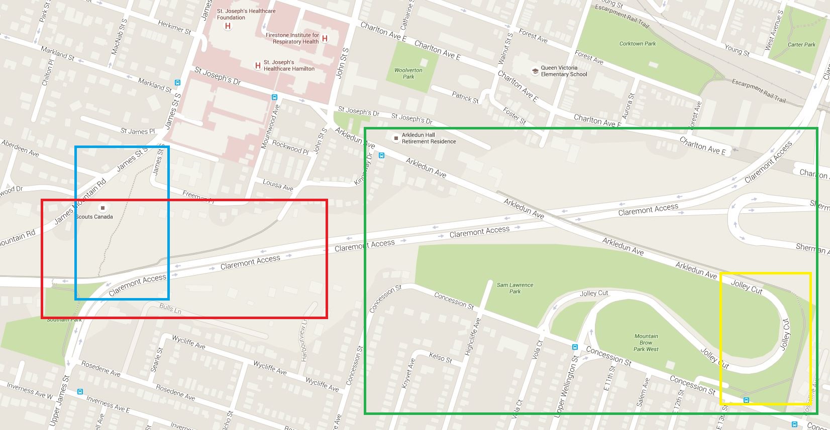
Studying Google maps before I left home I came up with a plan to find the James Staircase to begin, then drive up the Jolly Cut, where I could see on Streetview that there was a narrow painted bike lane and then head to Mountown Brow.
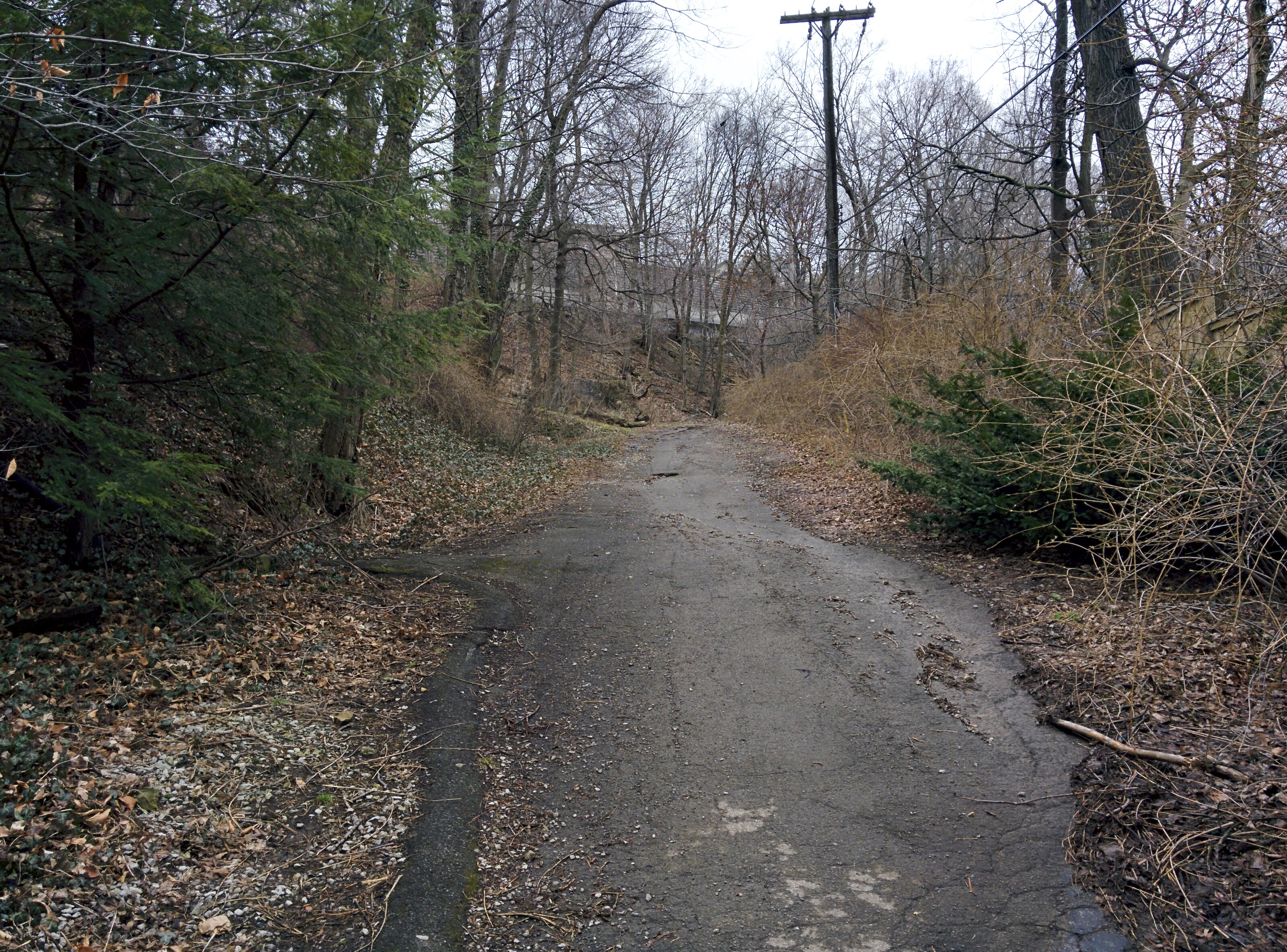
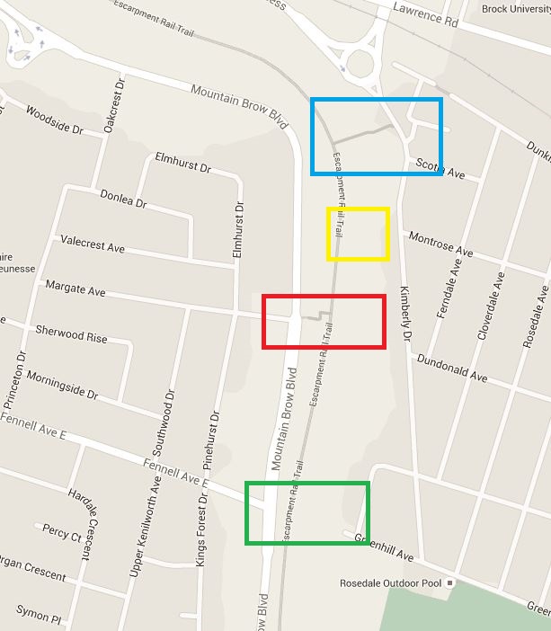
I parked on Freeman Place and walked to the end of John Street South and followed the gray path in the red box on the map below.
I discovered a wide dirt path through the trees, not the stairs I was expecting. I decided to follow it anyway.
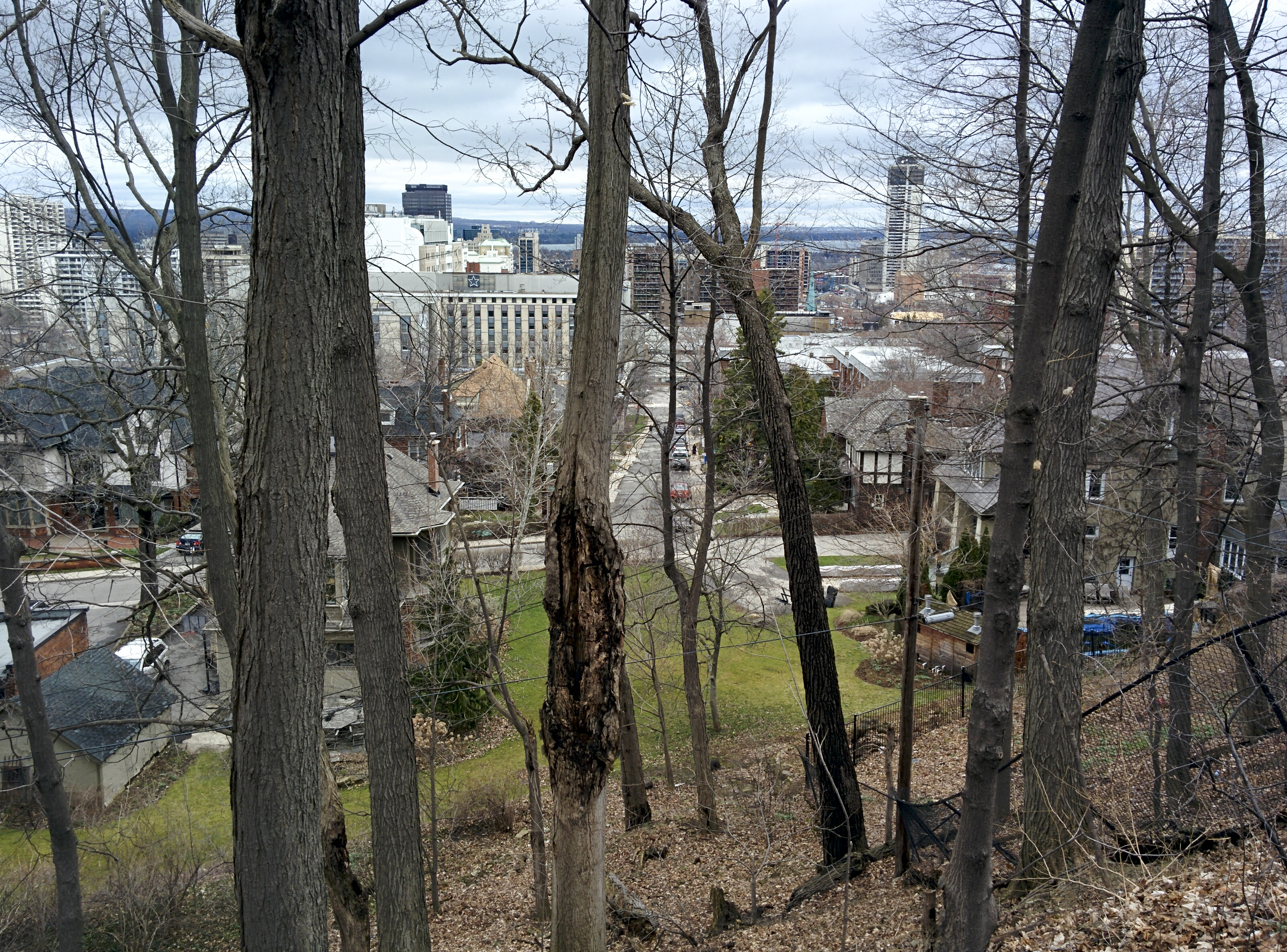
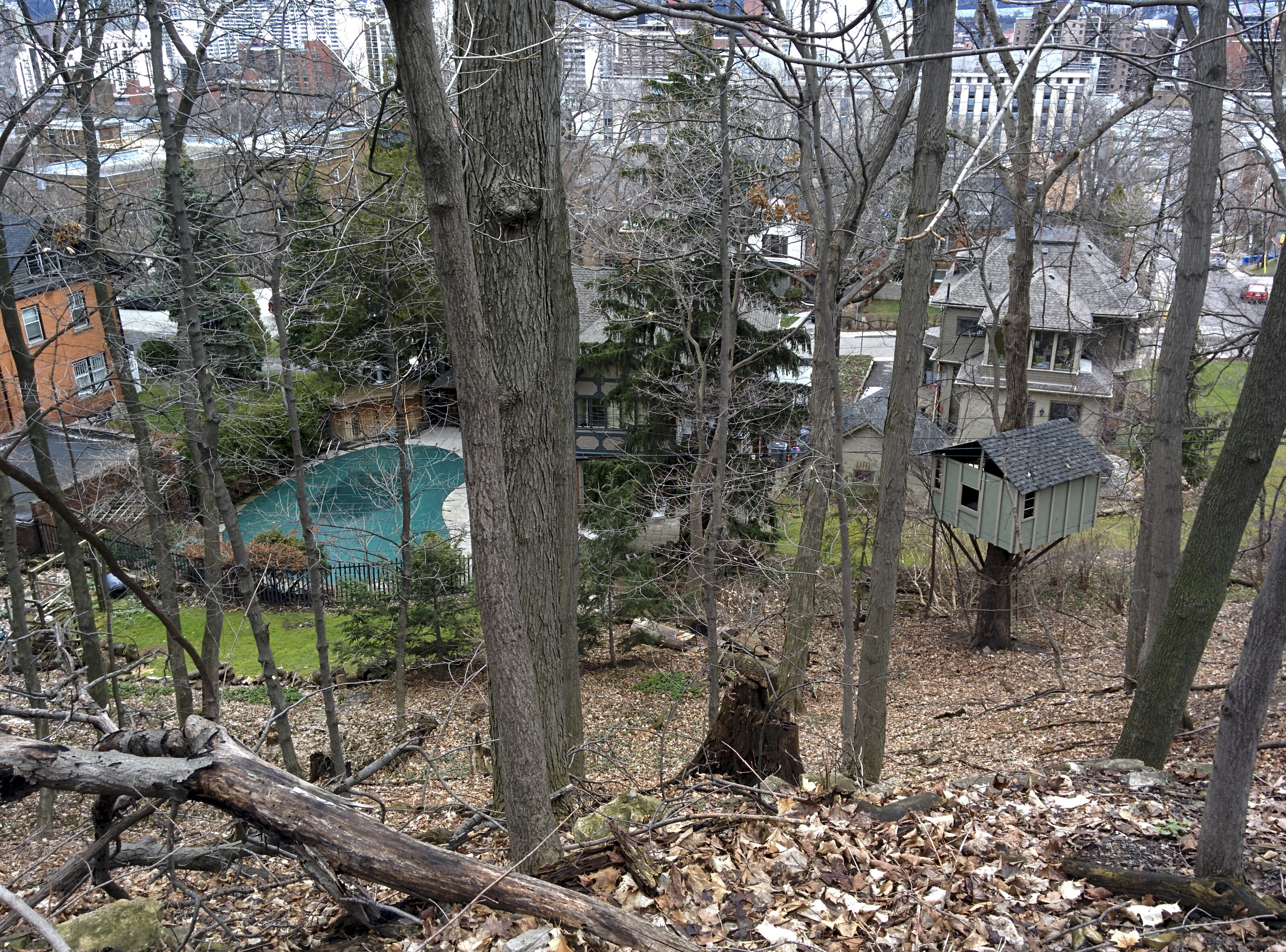
It went up behind some lovely old homes, one of which had a great treehouse in the backyard, with views of downtown and the harbour through the trees.
I eventually came to some steps and when I climbed them, found myself at the edge of the Claremont Access and on the Bruce Trail.
I continued to walk along the edge of the Access and eventually came to the sidewalk, which led me to the top of the stairs and Southam Park, after crossing the ramp to West 5th Street.
It was a useful diversion from finding the stairs immediately, as it would be a fairly easy, short route to push a bike up this pathway. I outlined the staircase in blue on the map above.
Interestingly, on a Jane’s walk today, Shawn Micallef said he liked exploring somewhat randomly and then returning home and researching what he had seen on the internet. Tonight when I was making the map above, I discovered that there is a sidewalk, a small staircase and pathway around the east end of the Jolly Cut that one could follow on foot or if one had a light enough bike to carry on the stairs. That is outlined in yellow on the map above. I will have to check that out on my next trip.
After descending the staircase I went back to my van and drove up the Jolly Cut (outlined in green) and over to Mountain Brow.
What a fabulous job Hamilton has done on the bike path along Mountain Brow Boulevard. The path is 4m wide, lighted with solar powered lights and well marked. There is a small parking lot near the east end of the street between Nova and Ellsworth Drives and several bumpouts for on street parking of about 8-10 cars every so often along the length of the path which is about 2.5km. I got out my bike to explore. This residential road with houses on one side and the escarpment on the other used to be two lanes in each direction. It is now a much nicer single lane in each direction with the wide bike path along the escarpment making for a much more desirable, and useful for all, streetscape.
Part way down the mountain the is a flat area with a paved rail trail (Hamilton Brantford) which I will definitely be exploring on another day.
The views were terrific even on this overcast day.
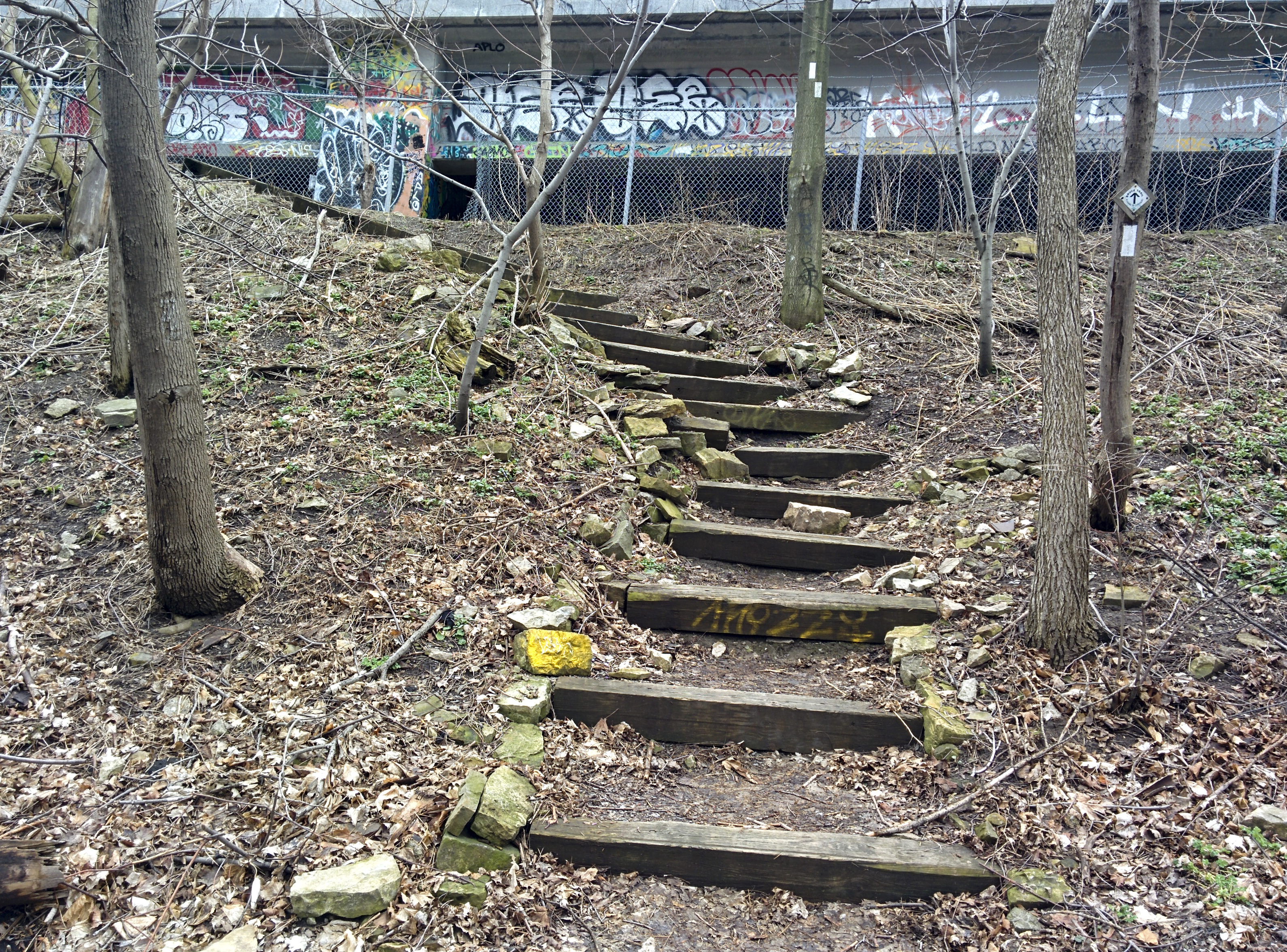
In short order I discovered Uli’s stairs (marked in green – above the Rail Trail and yellow, below), built by hand by a retired local resident in 2005. The city discourages their use and has installed a metal staircase (Kimberly stairs) 300 metres west (marked in red – above the Rail Trail and blue, below).
I cycled the length of the trail and then returned to my car, moved it to one of the bumpouts for on street parking and climbed down the Kimberly Stairs to the rail trail. I walked west to the lower set of Uli’s stairs and then back east to climb the upper set of Uli’s stairs. I didn’t discover the location of the lower Kimberly stairs until I returned home and studied the map further. I will climb those another day.
Uli’s Stairs:
Kimberly Stairs:
The city has even put in a water fountain at the top of the Kimberly stairs, something rarely seen outside any more. The stairs have bike rails, but there is a ramp access to the rail trail at the east end of Mountain Brow Boulevard and Mohawk Road East.
I then returned to my van, drove to McDonald’s for a latte and picked up Megan. Megan then showed me the top of the Dundurn stairs (red box below) which she has recently started using and together we discovered the top of the Chedoke stairs (blue box below), but by this time I was starving so we left those for another day.
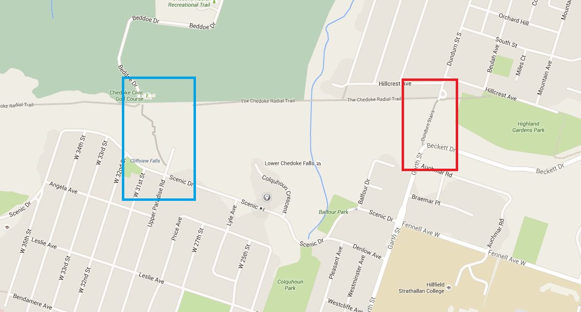
This is the top of the Chedoke stairs, the stairs and the view to McMaster. These stairs also have a bike rail. The drive to McMaster from Megan’s house near Mohawk on the mountain is 6.7km, but the walk, via the Dundurn stairs is 5.2km.
Discover more from Lisa Stokes
Subscribe to get the latest posts sent to your email.