
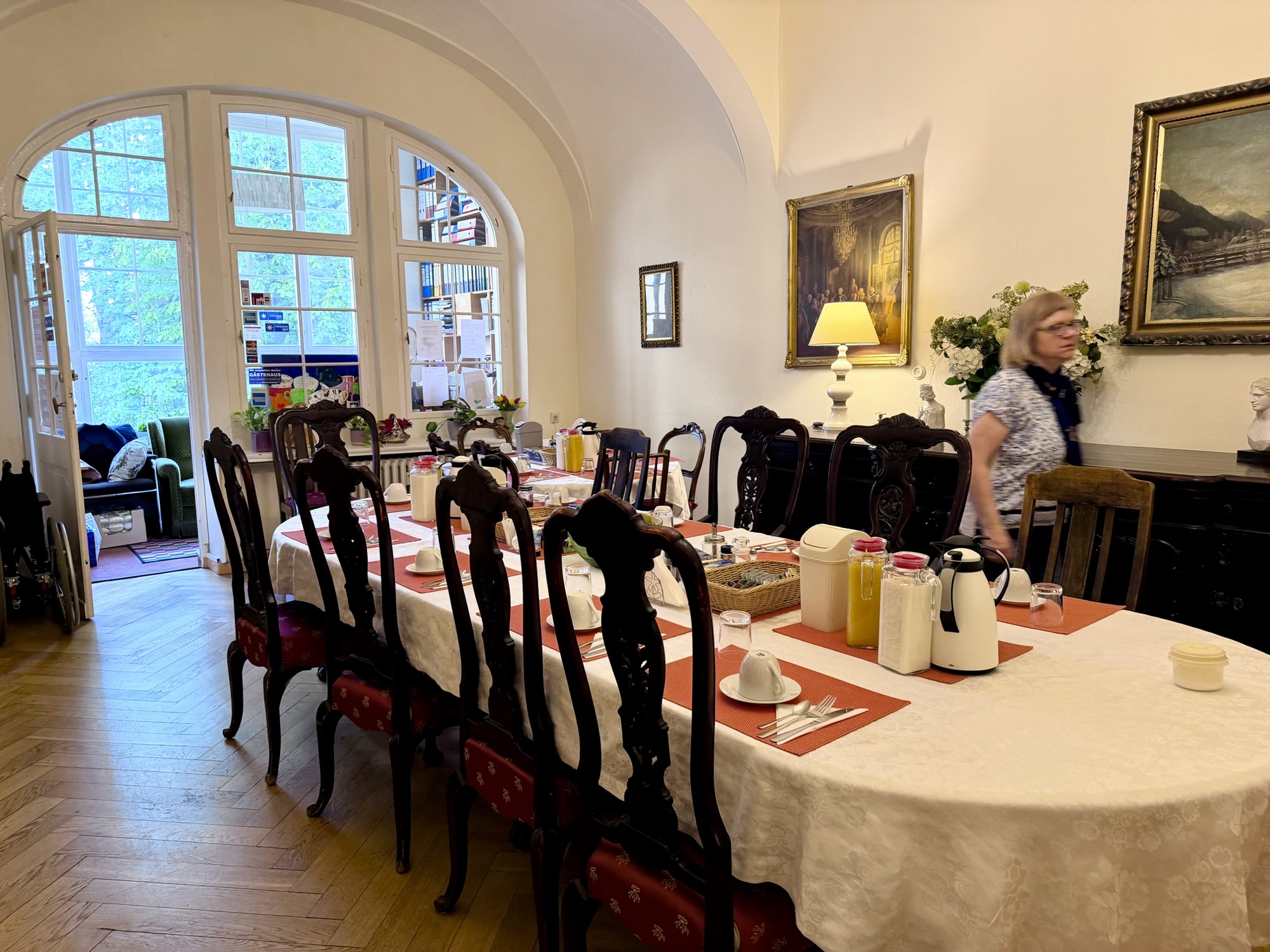
Our small guest house, Hotel-Pension Waizenegger included a good breakfast. It was quite reasonable at $190 each for three nights and three breakfasts. We had a sink and shower in the room. The toilet was in the hallway shared by all the guests.
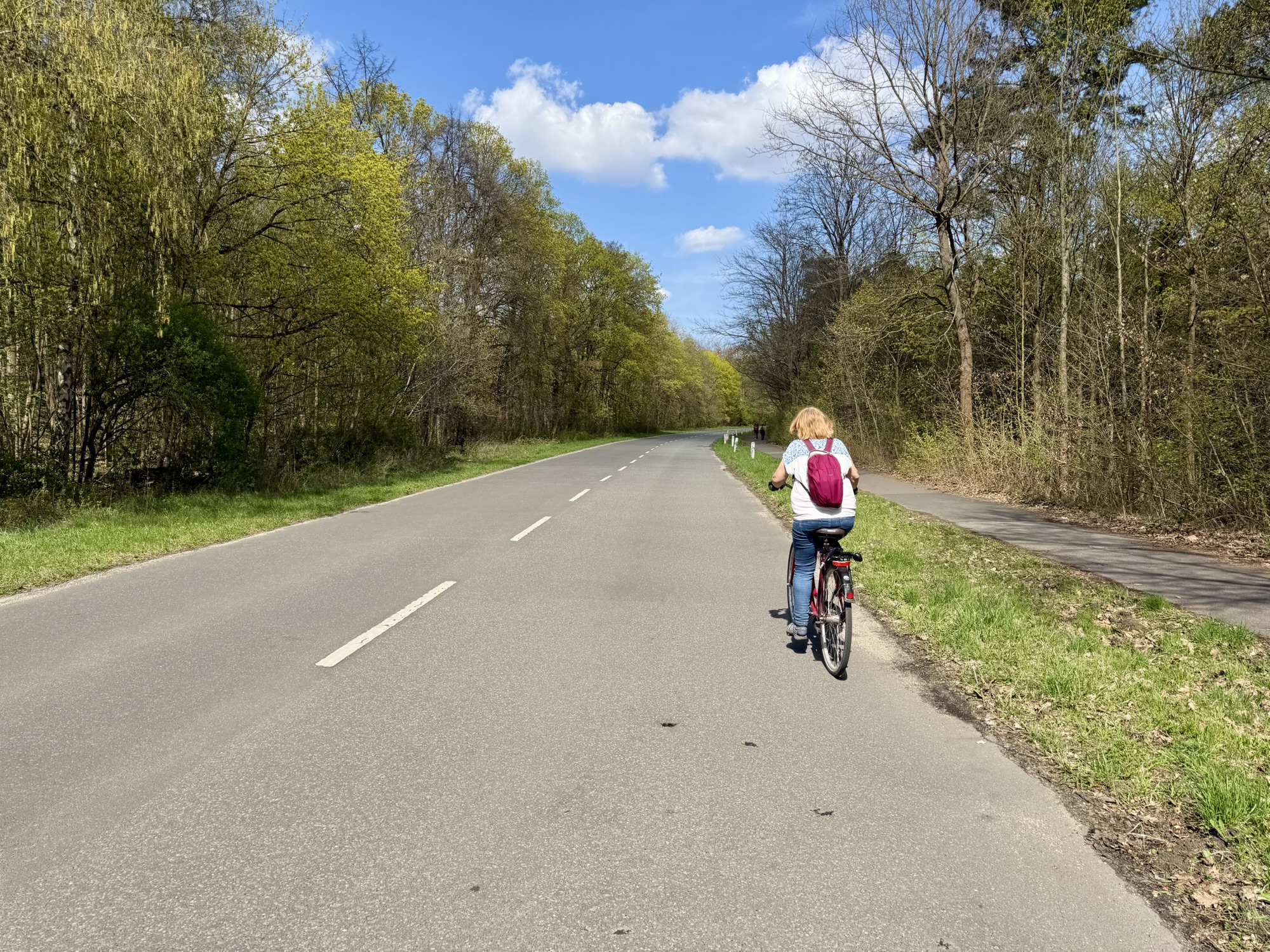
Our destinations for the day included Teufelsberg, Charlottenburg Palace, Tiergarten, and Potsdamer Platz. I created a route Ride with GPS to guide us, entering the places that we wanted to go, but allowing Ride with GPS to determine the route between them.
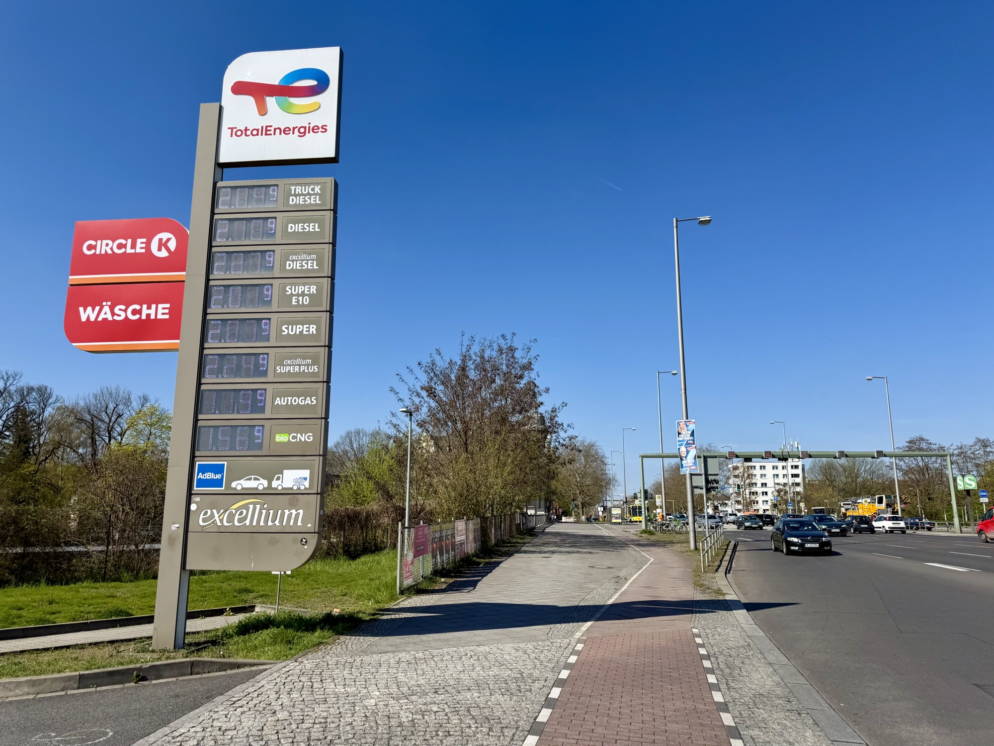
Gas prices were over €2 per liter. The exchange rate is about 1.6 which means that they are paying over double what we pay for gas.
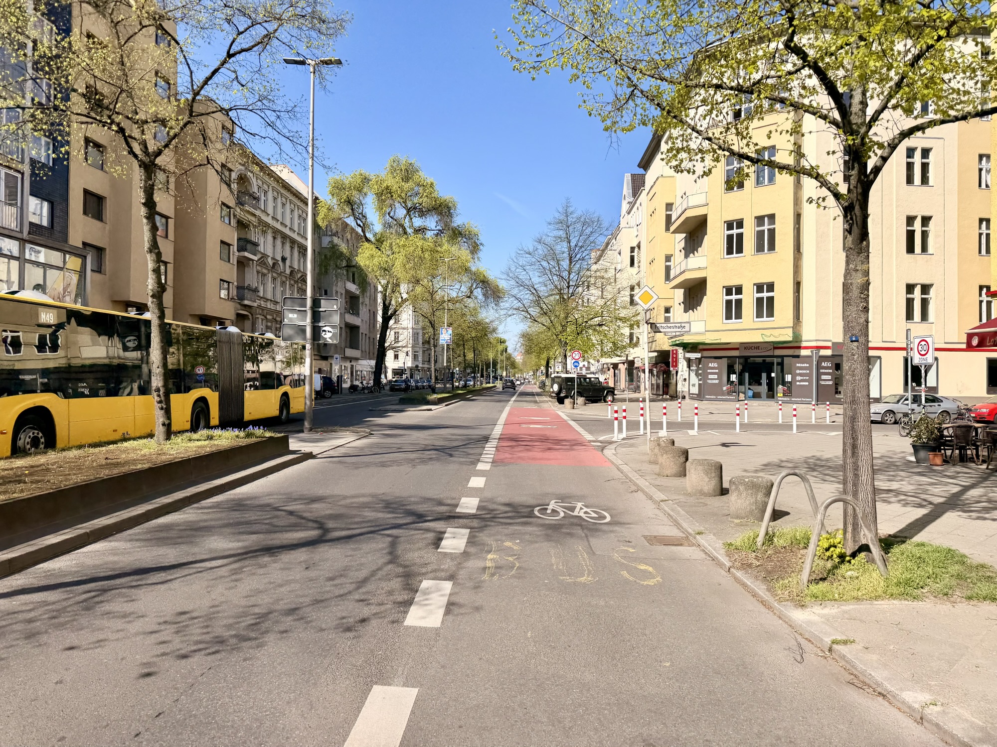
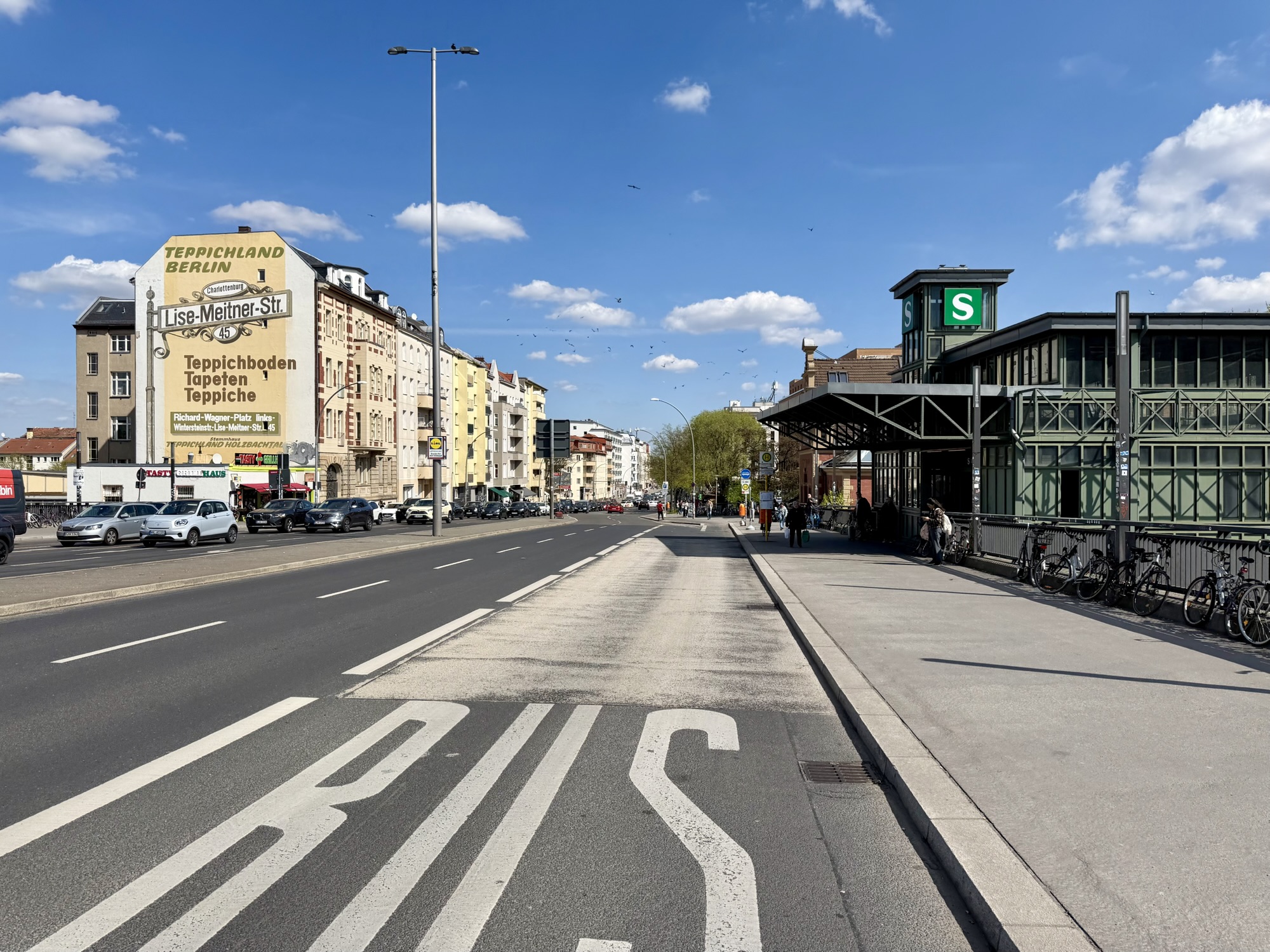
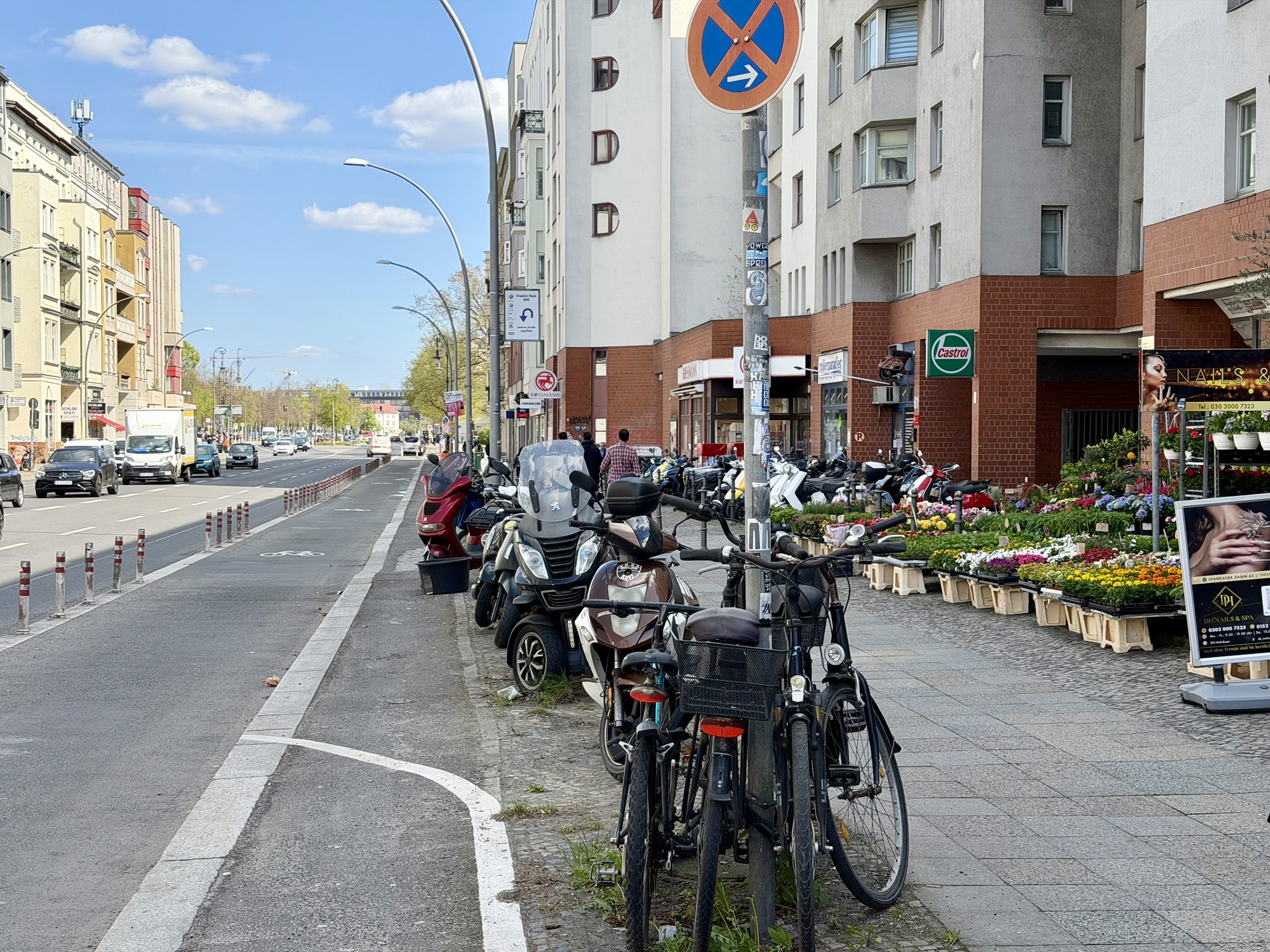
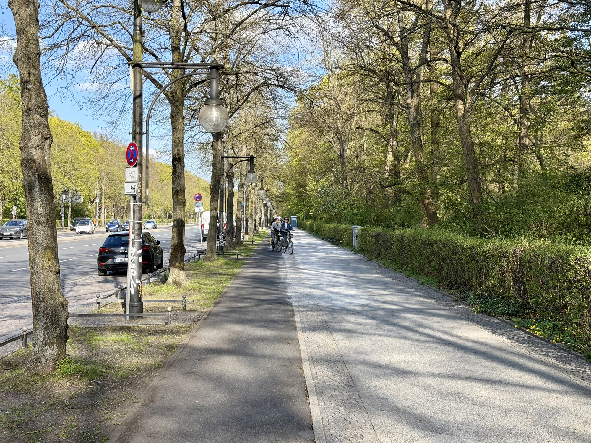
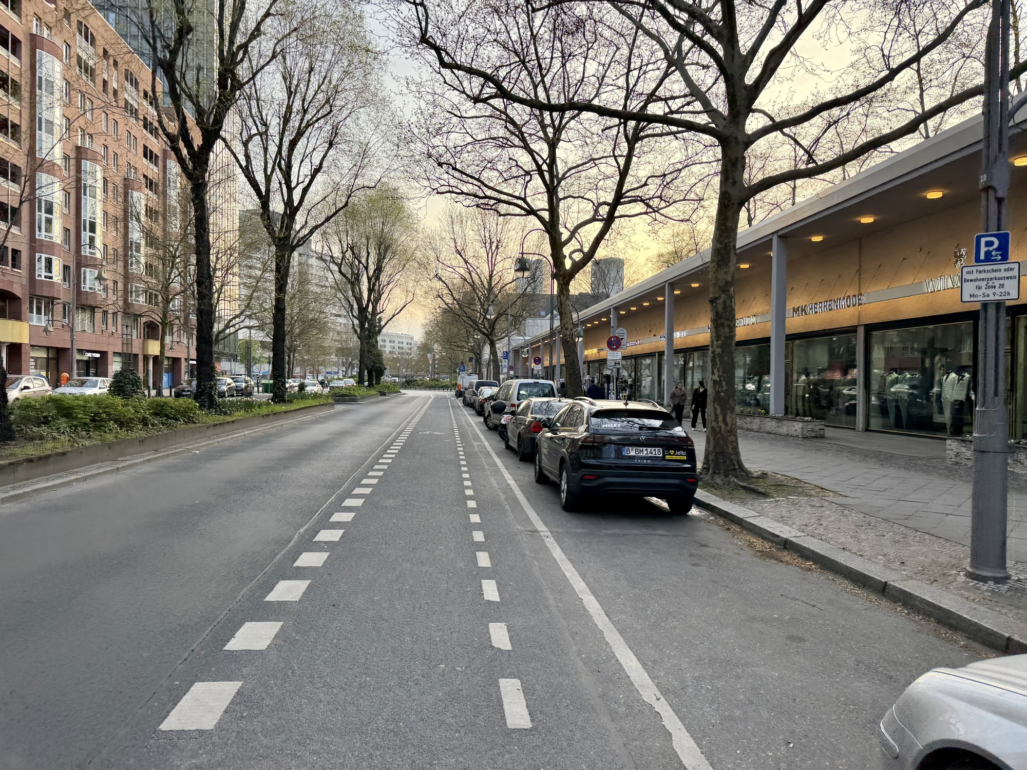
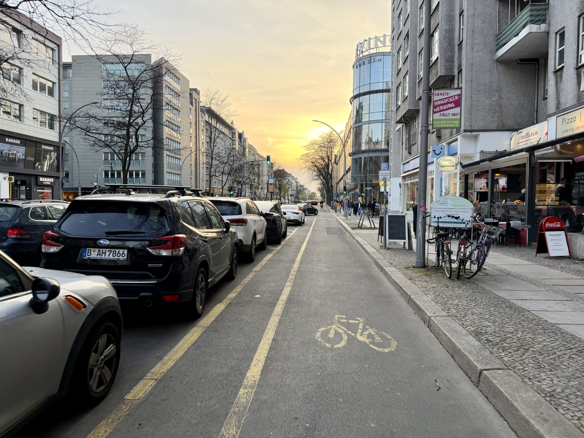
We encountered several other types of cycling infrastructure today. Including curb lanes shared with a bus, a bollard protected lane, raised cycle tracks, a painted lane in the dooring zone, and a parking protected painted bike lane.
Recently a Brampton councillor criticized Brampton cycling infrastructure for not being the same across the city. I explained to him that that was the case even in world class cycling cities. As standards change, infrastructure recommendations change, and newer infrastructure is often different and better than older. However, budget, as well as location constraints, mean that there will always be more than one facility type.
In the slideshow above, there are pictures of six different types of cycling infrastructure we encountered in Berlin in one day. Even though it was only the second day I had ever spent in the city I managed to figure out what to do. Surely drivers could do so as well, if they cared to.
As I was writing the blog, I wondered what the cycling mode share is in Berlin. I was surprised and impressed to learn that it is about 19% of all daily trips in the city despite the fact that in many places, there is no cycling infrastructure. In Brampton, the cycling mode share is at best 1%. It got me thinking what makes a cycling city?
I think there are many of things that make a cycling city and safe cycling infrastructure is only one of those things.
Here’s a list in no particular order.
- Cycling infrastructure, preferably protected from motor vehicle traffic
- Speed limits. 75% of Berlin roads have a speed limit of 30 kph or less meaning that many people are willing to cycle even when there is no cycling infrastructure
- Transitioning road space away from cars to protected bike lanes and away from parking
- A good public transit system, which integrates well with cycling
- Bike share. These bikes are usually very visible to drivers and help normalize cycling.
- Safe places to park bikes
- Integrating cycling education into the school system
- Cost of gasoline
Carlton Reid wrote a book called Bike Boom in which he argued that cycling infrastructure alone is not sufficient to drive significant cycling mode share in cases where it is easy to drive. He gives the examples of Stevenage, UK, and Columbia, Maryland. In both cases l cycling infrastructure was separated from motor vehicles and formed a network, however, the roads were built to be large enough to make driving easy so most people chose to drive rather than using the separated cycling networks. Many cities in the Netherlands have made driving more difficult as they have built cycling infrastructure, and this has resulted in significant numbers of people choosing cycling over driving. 
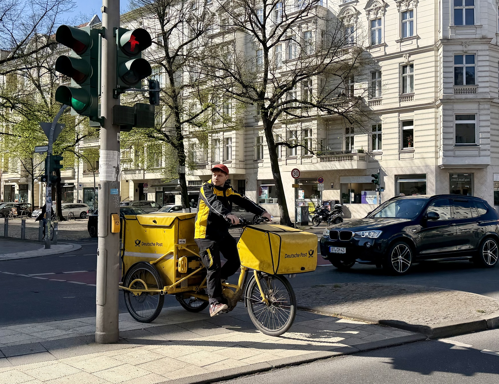
There are bicycle mail delivery vehicles in Berlin as there were in the Netherlands.
I often forget how to spell place names that end in -berg and -burg. As I wrote this blog post today, I googled the difference. Berg means mountain or hill, and burg means fortified castle or town. Thus, Teufelsberg is spelled with an E because it’s on a hill, and Charlottenburg is spelled with a U because it’s a palace.
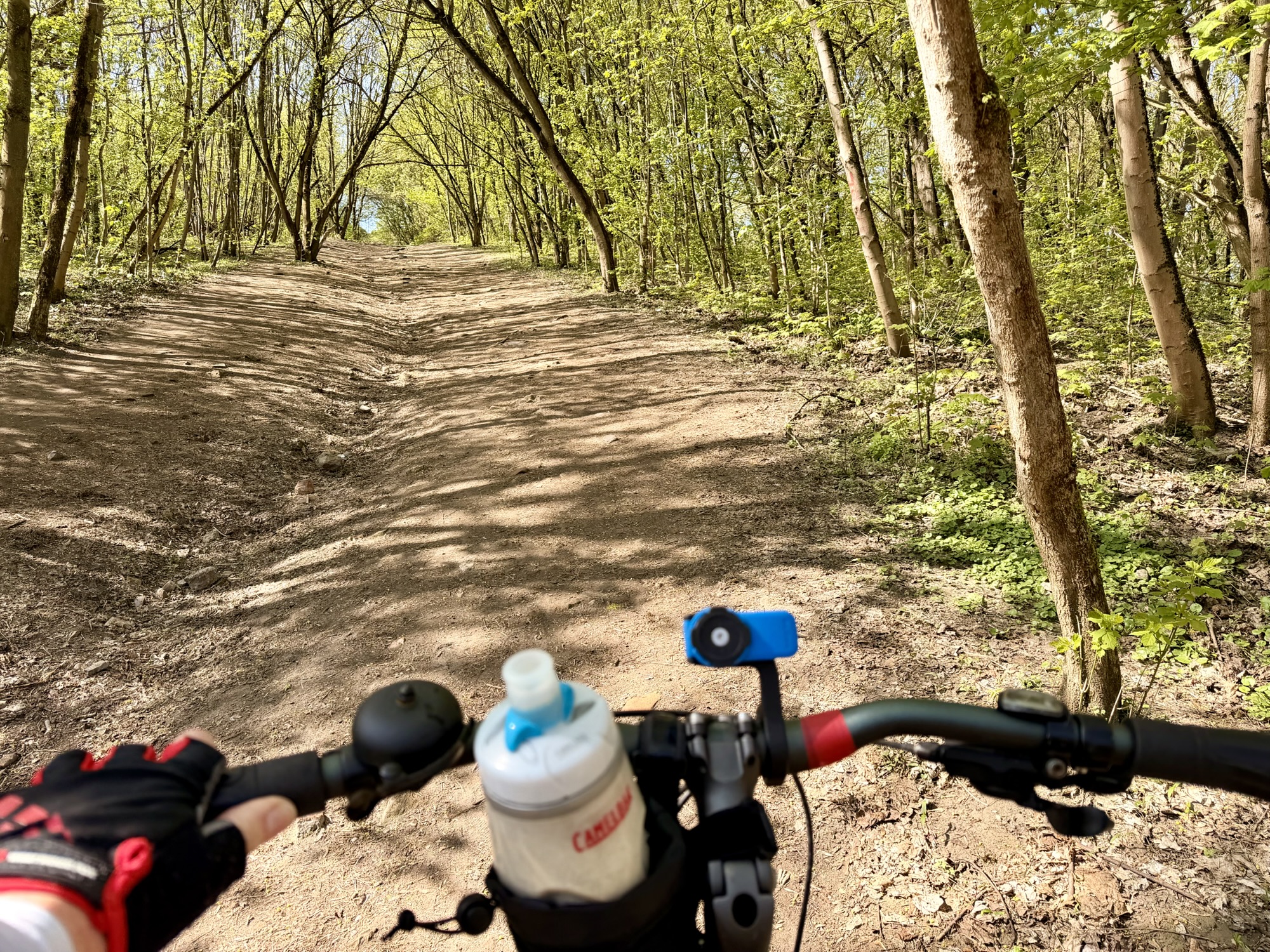
The route was fairly straightforward and we were fairly close to Teufelsberg when it indicated we should turn into a park. Then suddenly we were faced with a hike-a-bike situation. We had to push our bikes through the woods up grades as steep as 17%. I knew that it wasn’t possible to drive a car to Teufelsberg, but this seemed ridiculous.
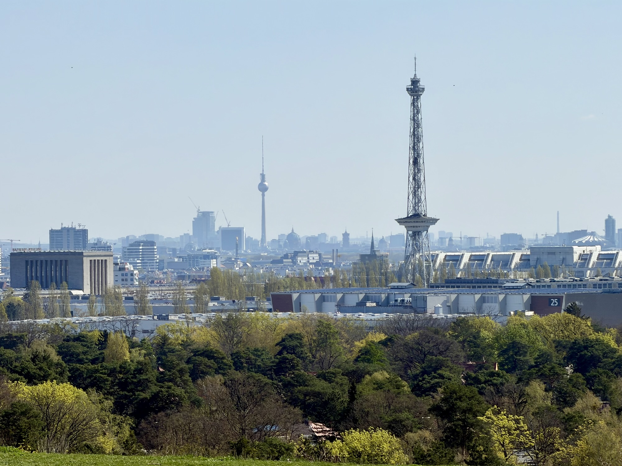
We emerged from the woods to see our destination. Unfortunately, it was on the next hill over. We stopped to catch our breath, take in the views of Berlin, and consult the map to determine whether or not to continue following the route we were on.
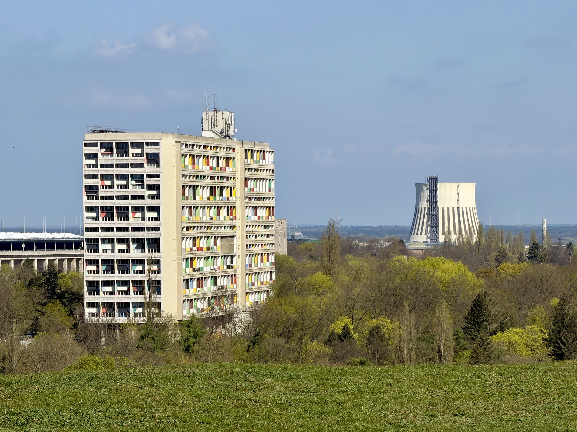
In this picture, the Olympic stadium is on the left, Corbusier’s Unité d’Habitation of Berlin is center left. The architectural style is brutalism. It was built on with on-site prefab cast concrete panels and poured ceiling slabs. A combined heat and power plant is on the right.
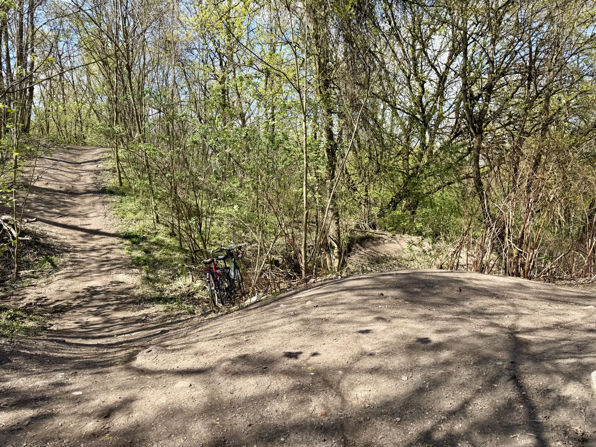
We slowly and carefully descended a steep desire line path, that coincided with the Ride with GPS route. Then crossed a small area of flat ground, and were back in woods again. At the next steep incline, we decided to lock up our bikes and walk without them the rest of the way. Can you spot the bikes in the picture below?
Allied bombing raids followed by street by street fighting in the battle of Berlin in 1945 reduced huge areas of the city to rubble. It is estimated that around 75,000,000 m³ of debris filled the streets. Much of the work of clearing fell to the Trümmerfrauen or “rubble women” because so many men were dead or prisoners of war. They salvaged usable bricks, and loaded debris onto carts and makeshift narrow gauge railways, or Trümmerbahnen. Landfills within the city quickly filled up. One of the sites chosen outside the city was the Grunewald Forest. Between 1950 and 1972 an estimated 26,000,000 m³ of rubble were deposited in the forest forming the highest elevation in West Berlin, of approximately 120 m above sea level.
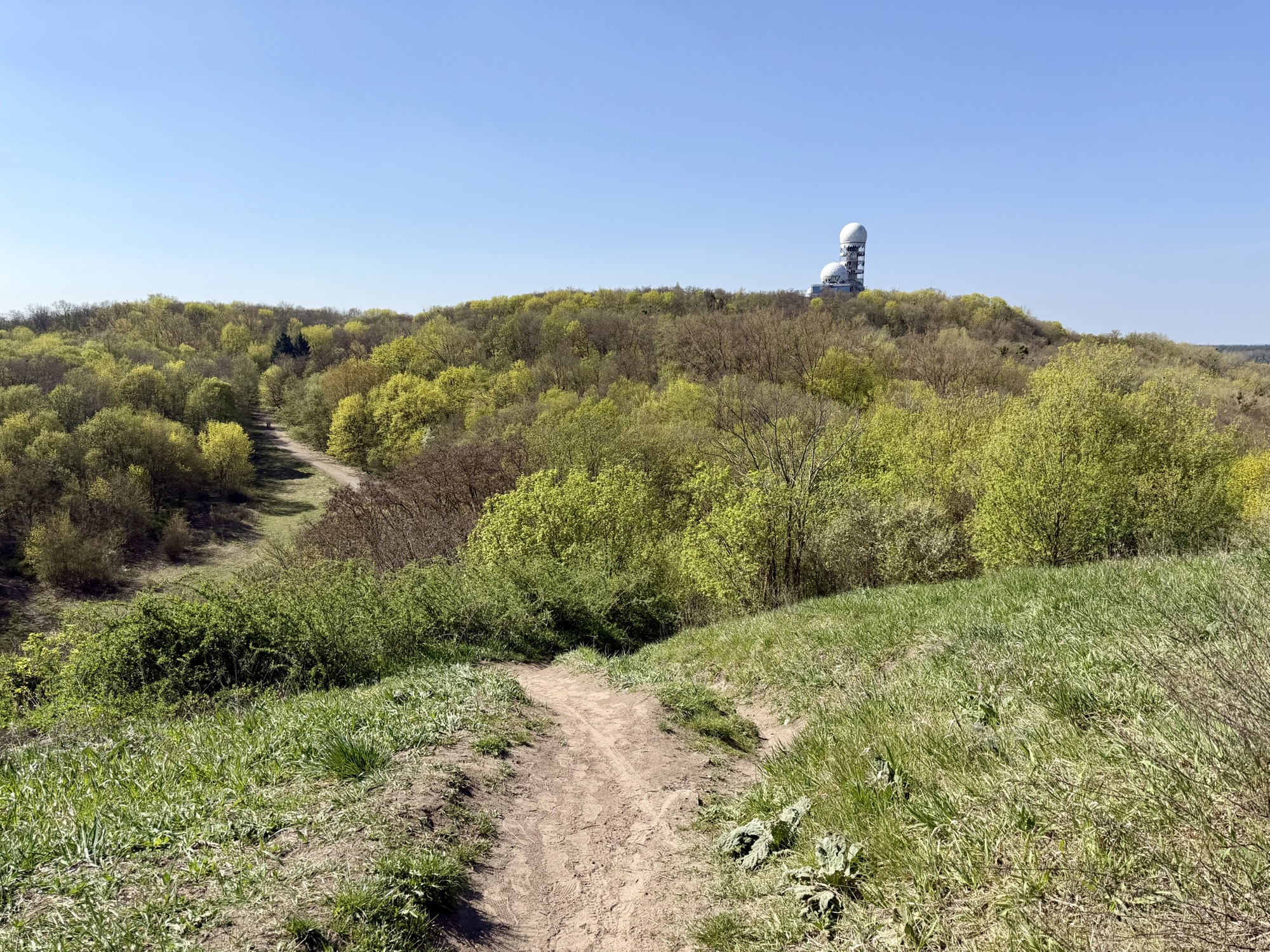
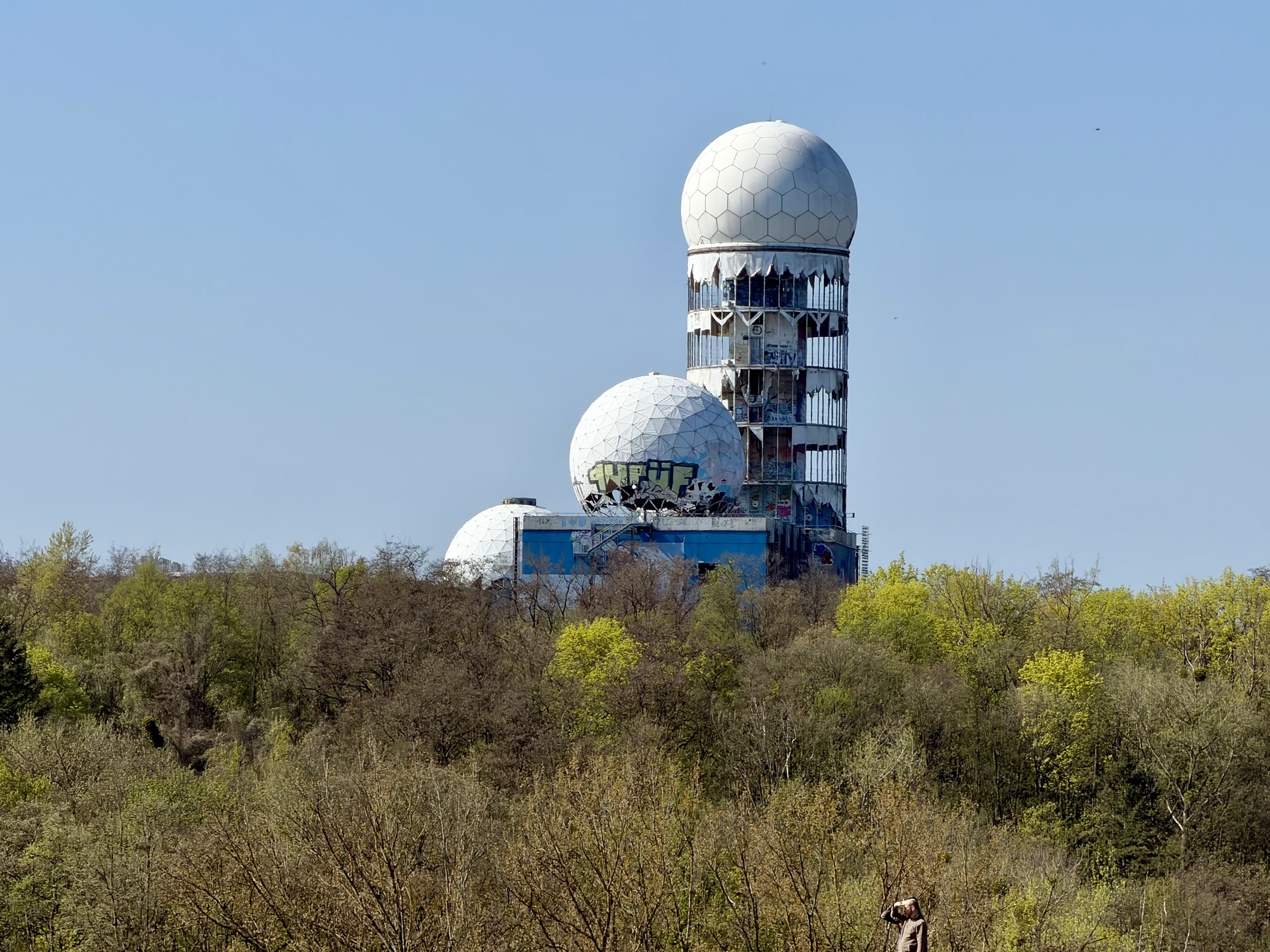
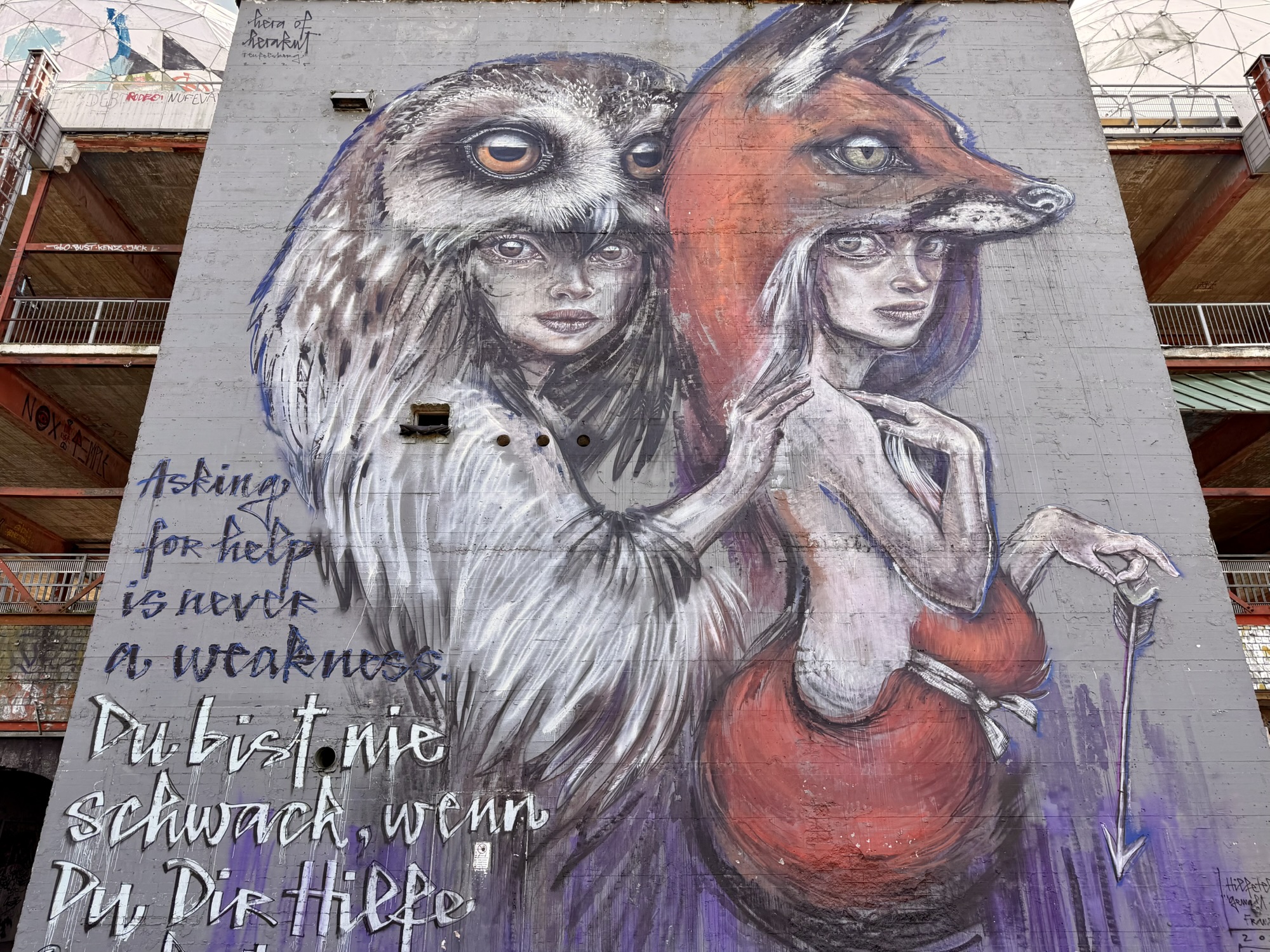
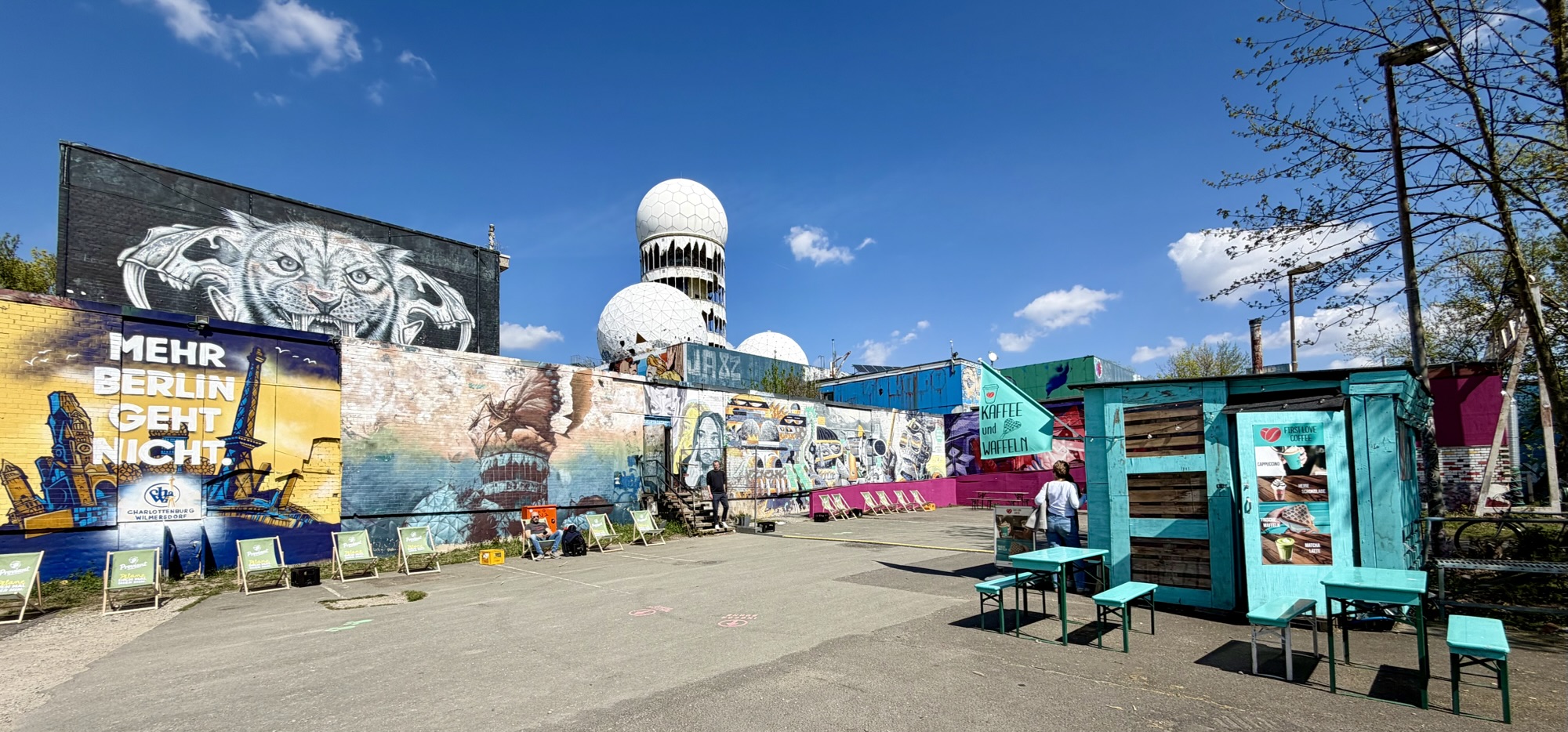
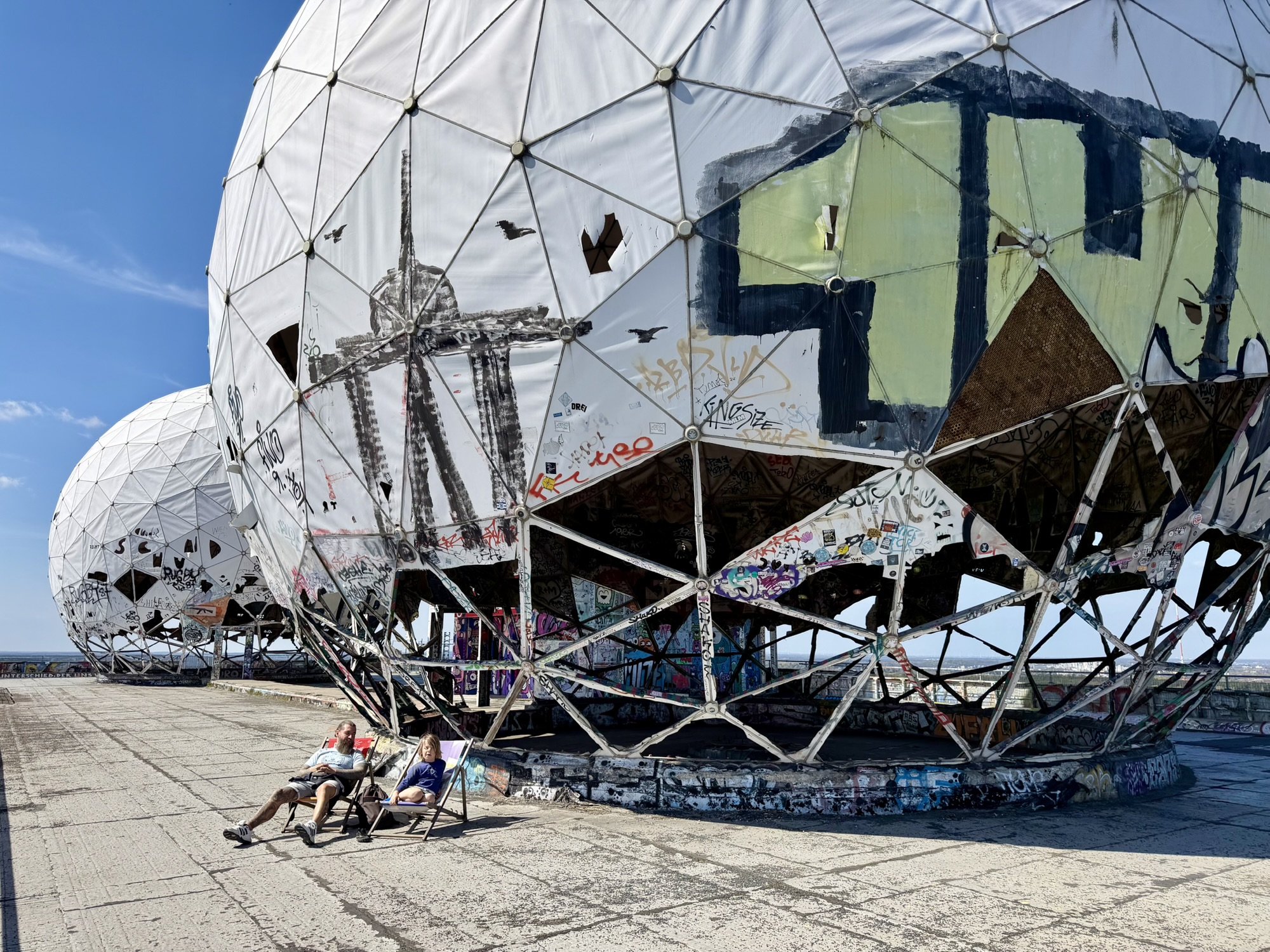
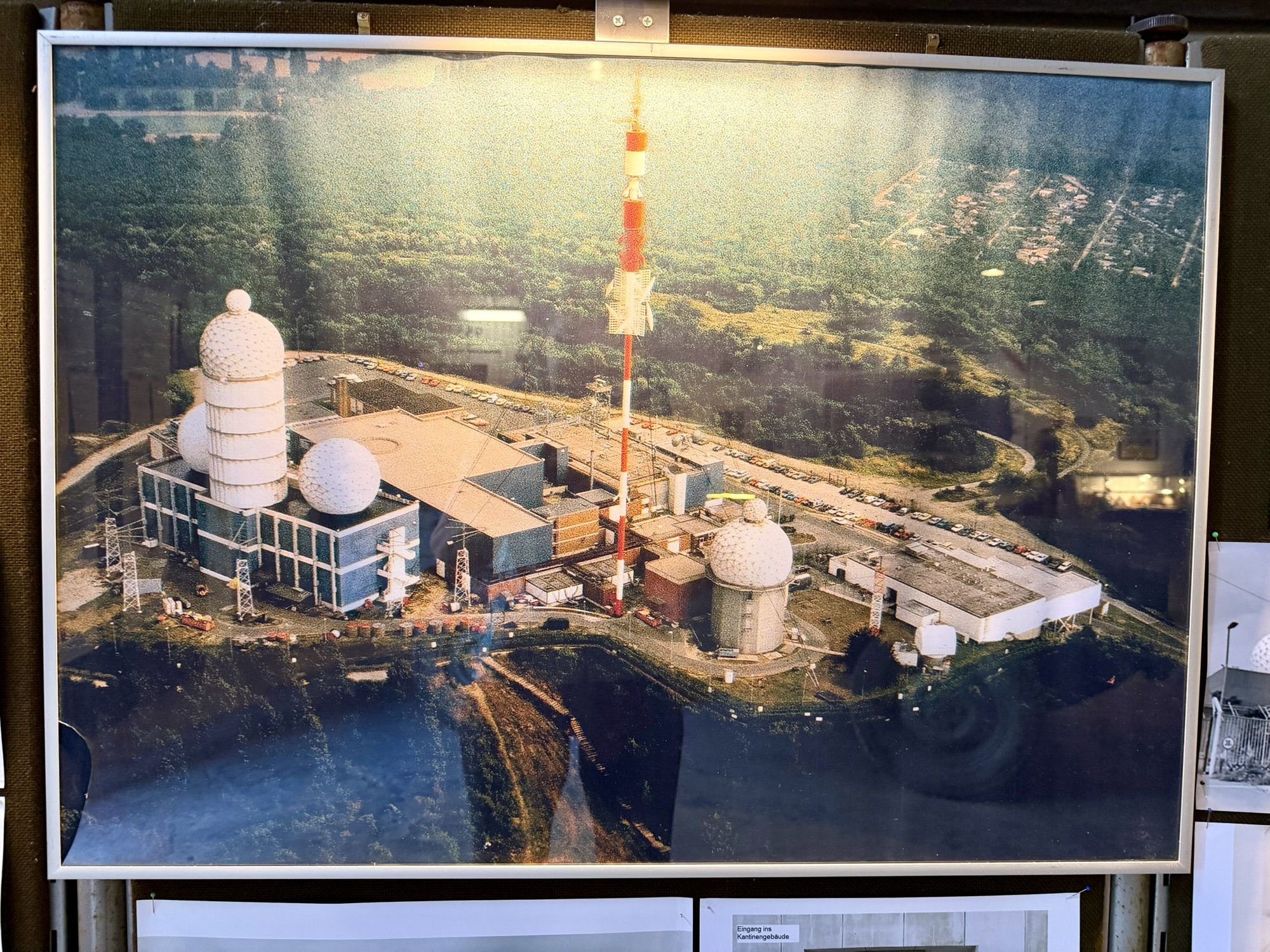
Teufelsberg – the ‘Devil’s Mountain’ – named after nearby Teufelssee, or “ Devil’s Lake“, was a listening post, operated jointly by the Americans and British intelligence agencies. It became one of the west’s most crucial intelligence gathering facilities during the Cold War. A cluster of geodesic domes covered in fiberglass protected the large sensitive dish antennas and other electronic equipment inside from the weather. They also concealed the exact nature and orientation from prying eyes.
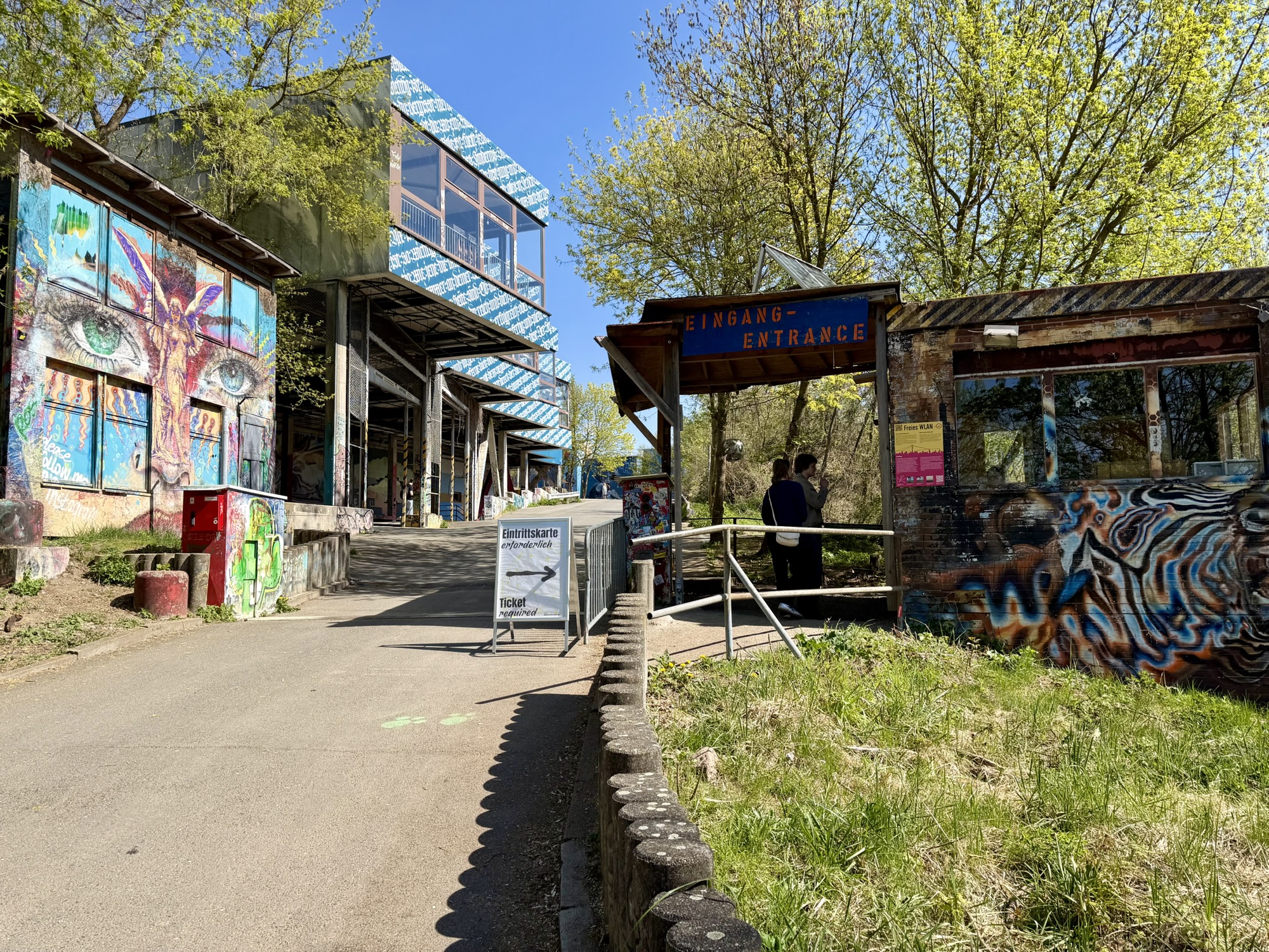
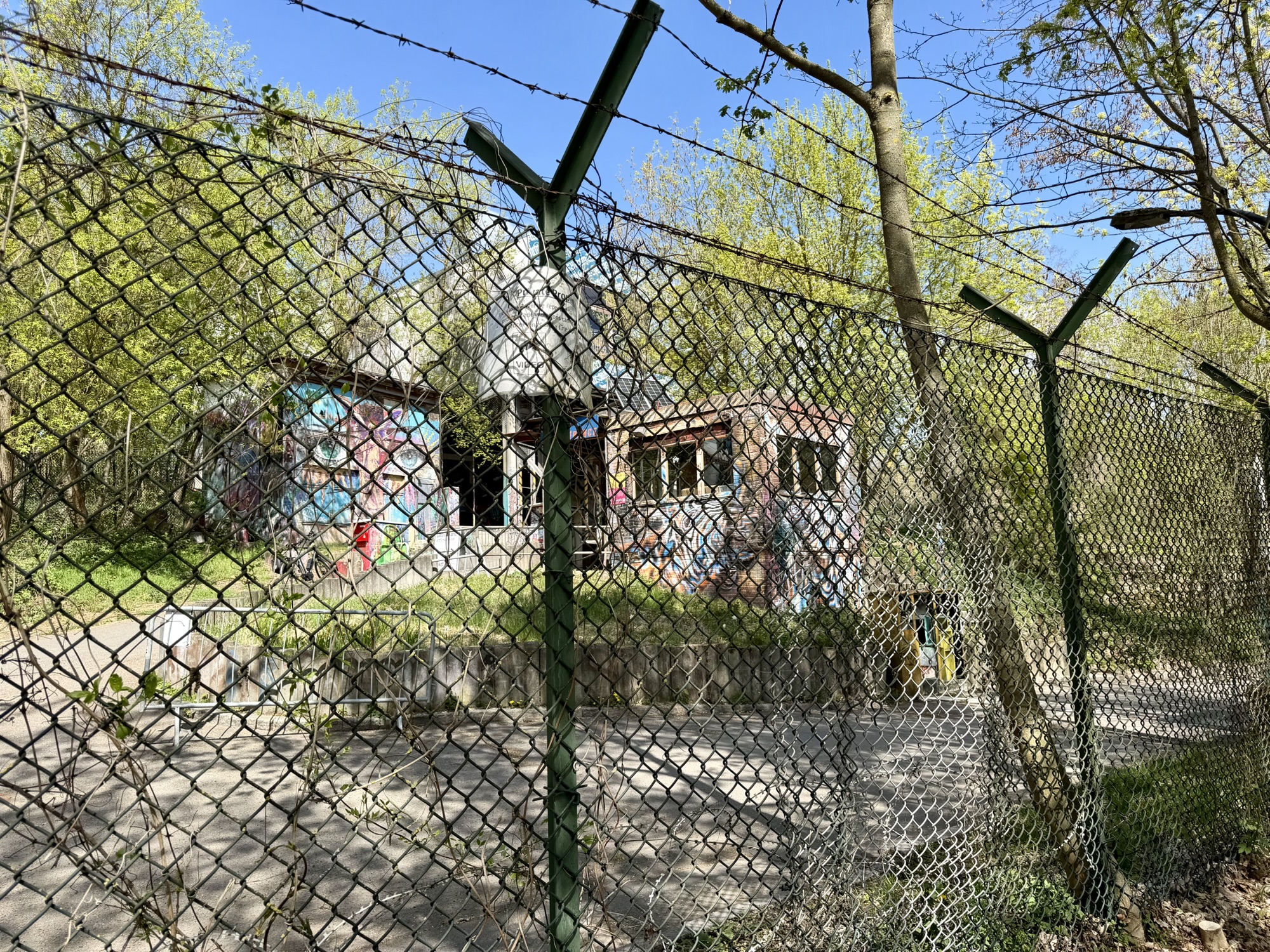
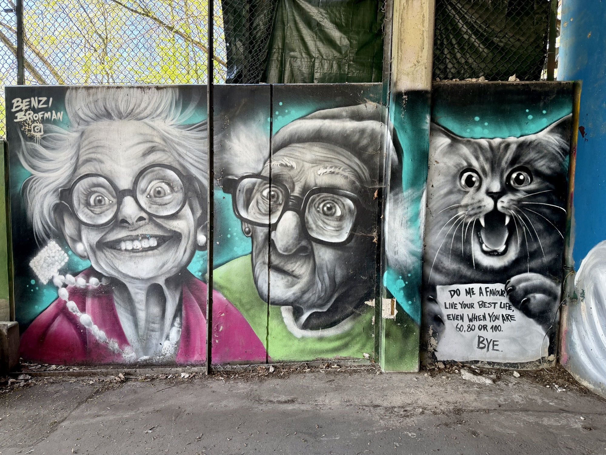
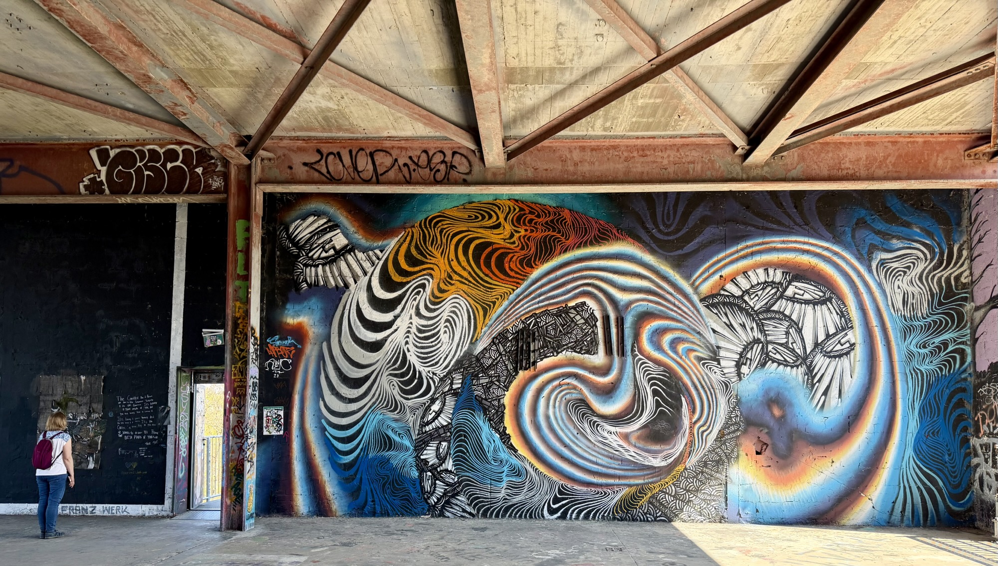
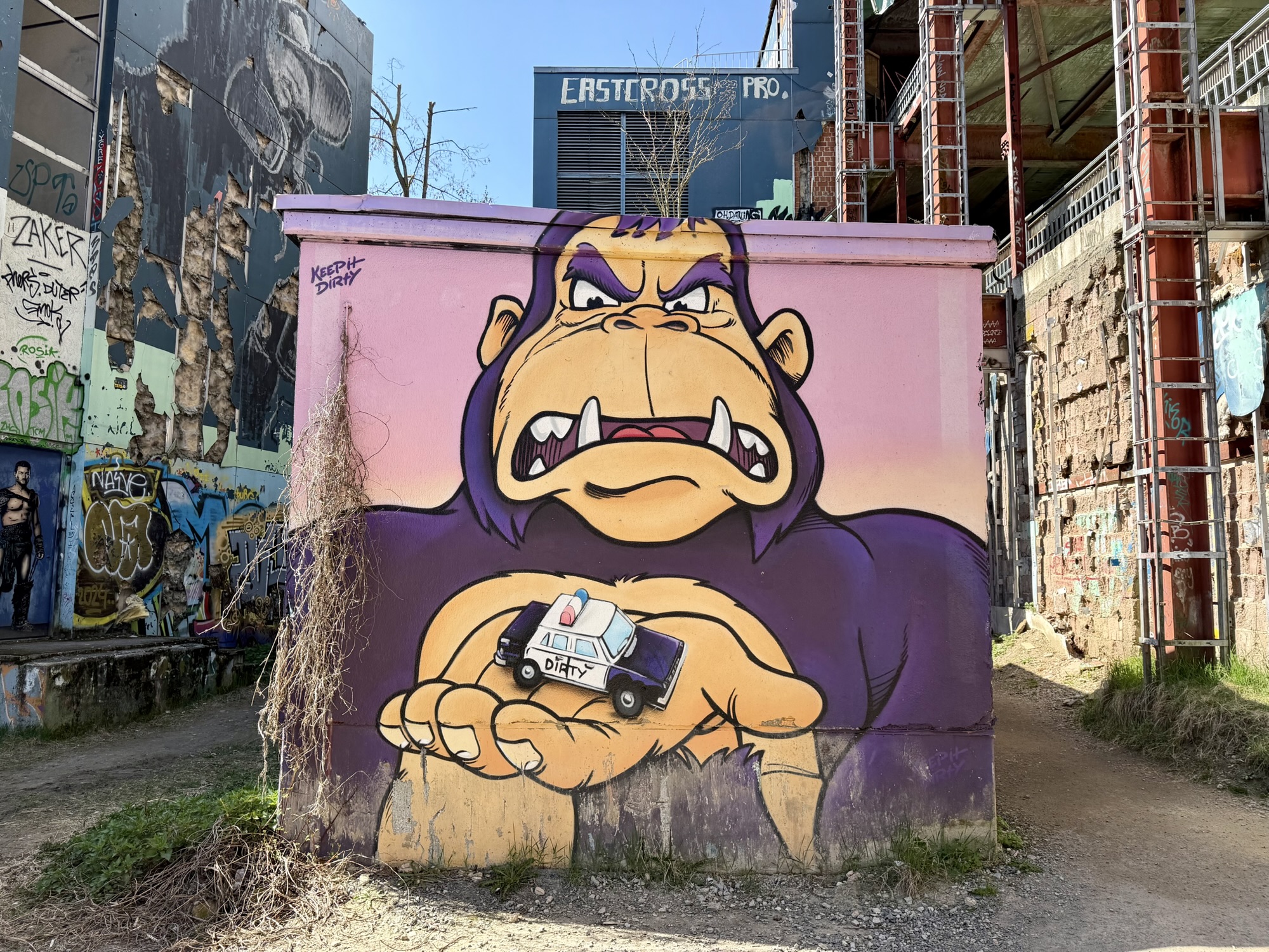
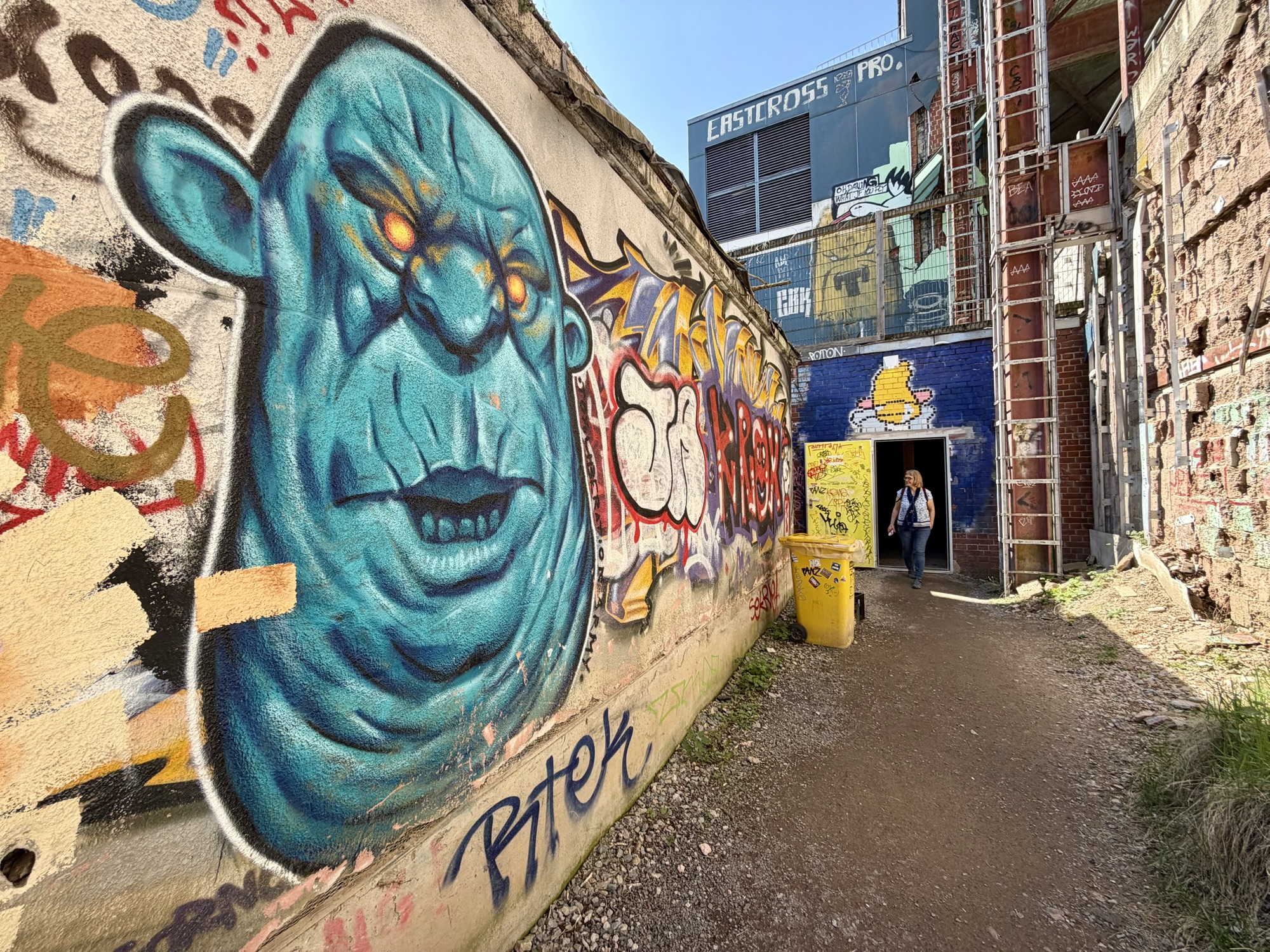
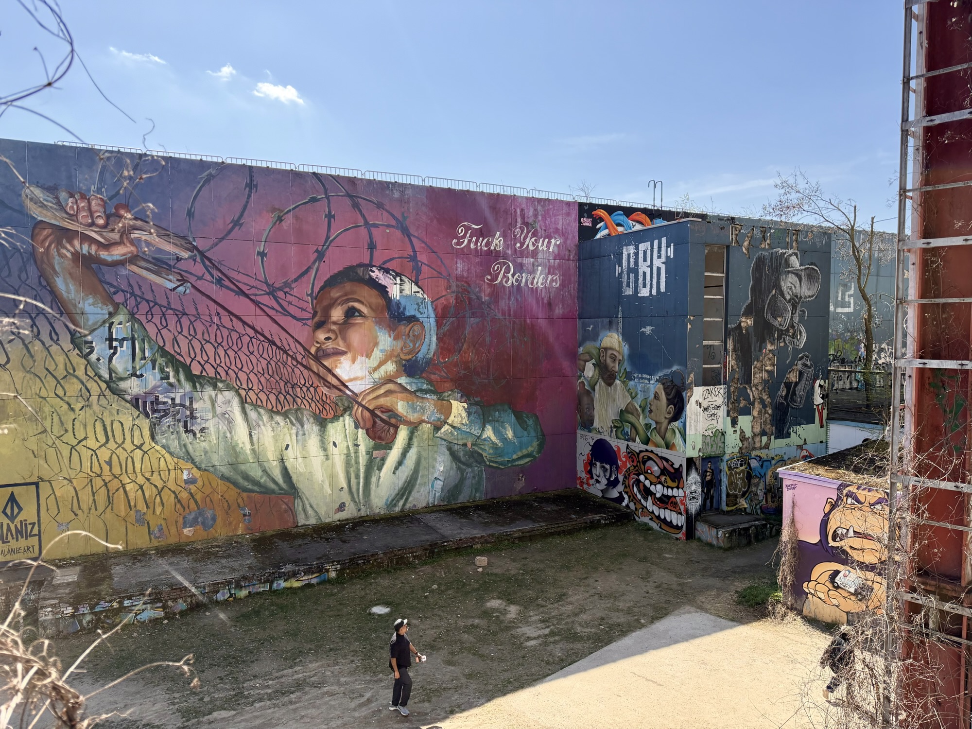
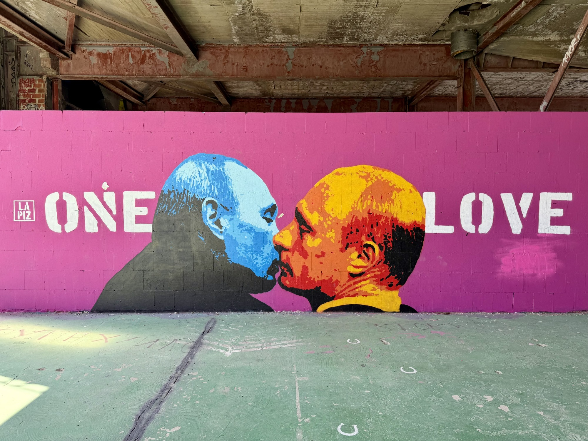
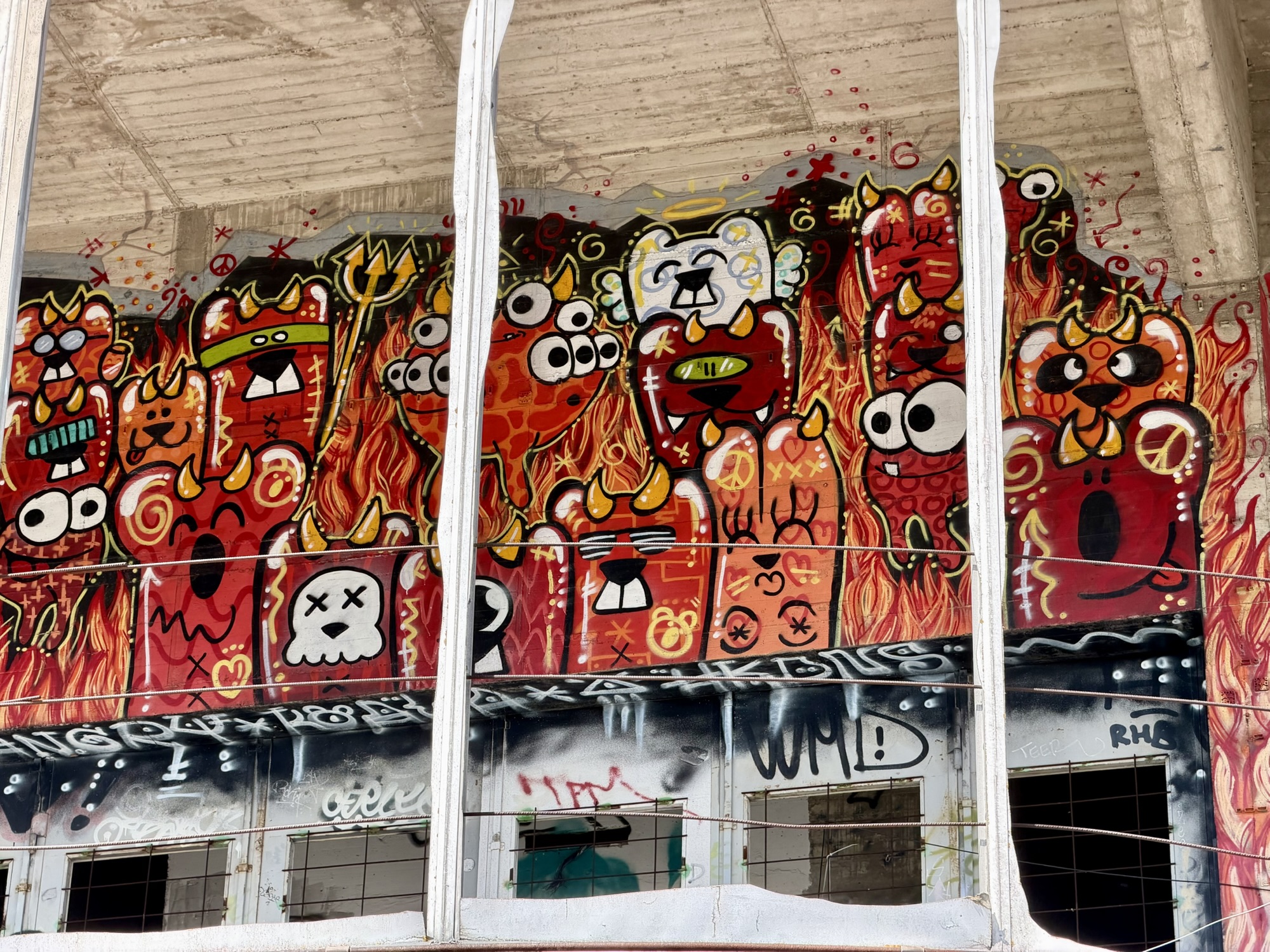
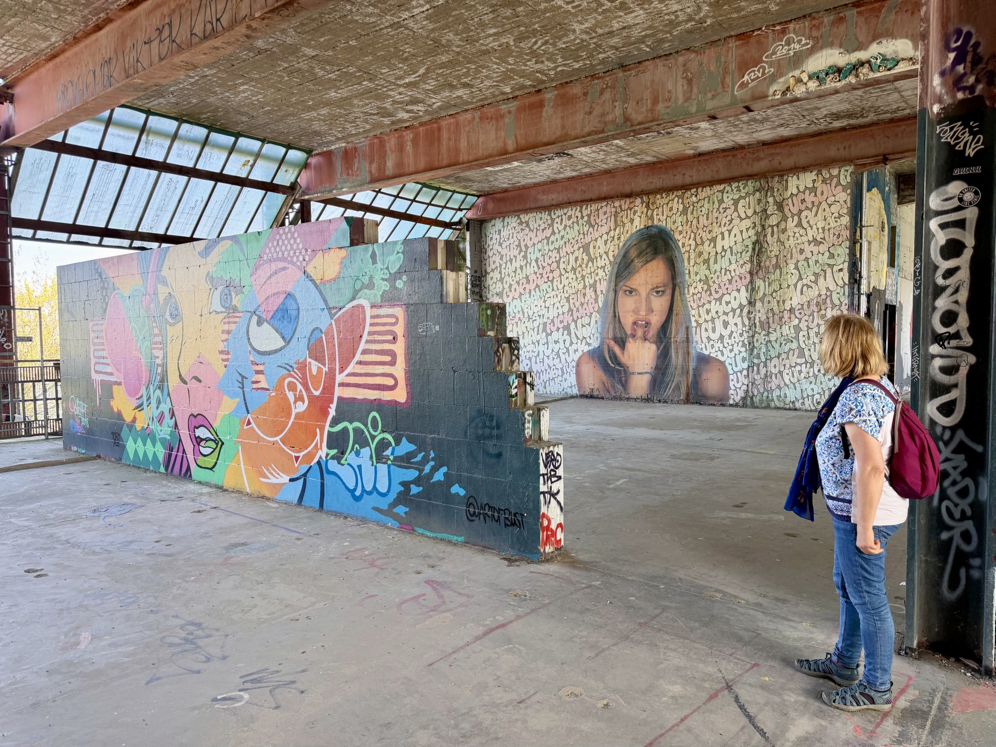
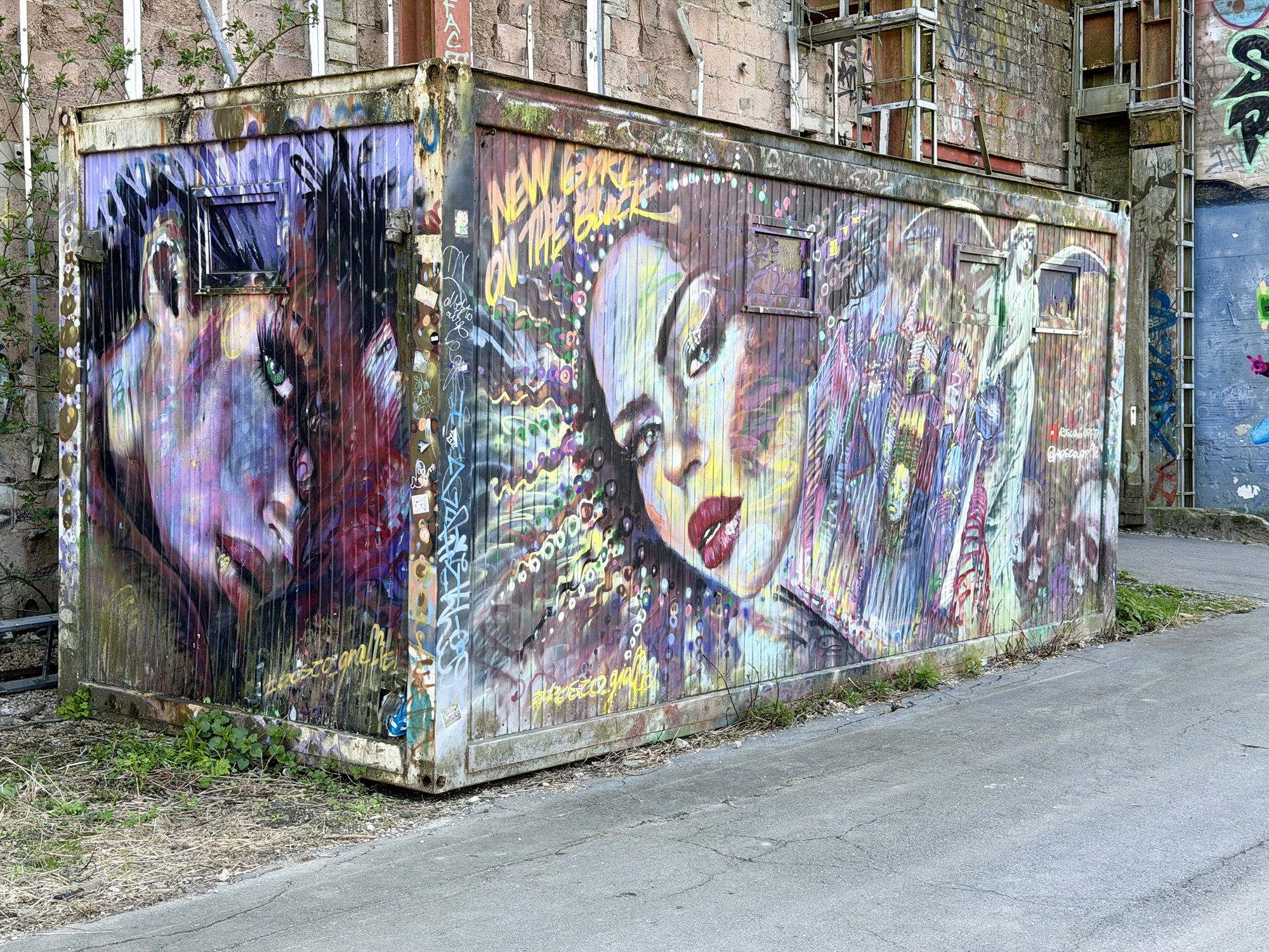
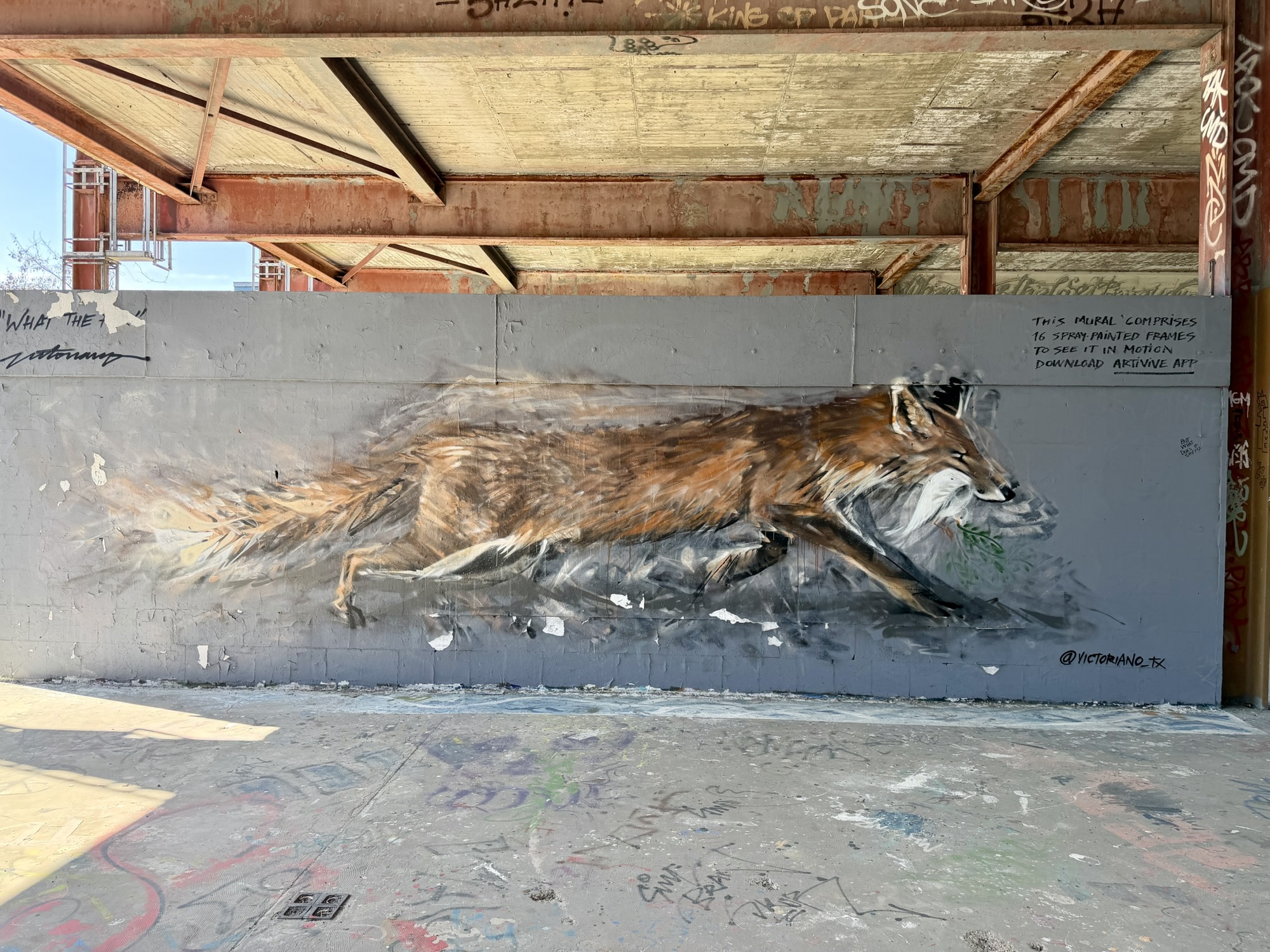
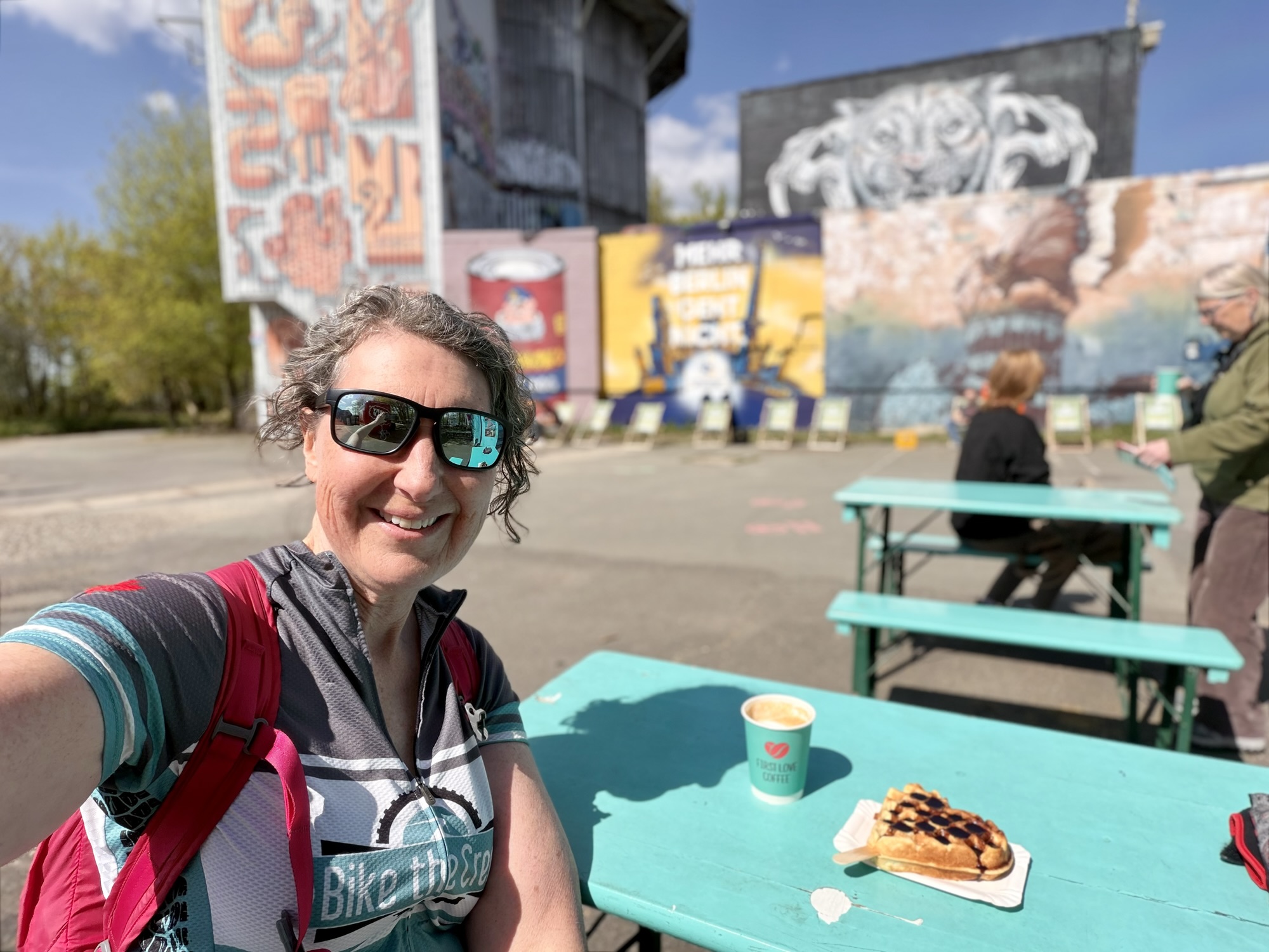
Hundreds of technicians, linguists, and analysts worked around the clock, listening for useful information. After the fall of the Berlin wall in 1989 and reunification of Germany in 1990 the listening operations wound down and equipment was removed or destroyed. By 1992 the site was handed back to German authorities. Over the years, there were suggestions for what to do with the site that included luxury apartments, hotel, conference center, or even a spy museum. None of that happened. The area is now operated as a gallery for street art. It is one of Europe’s largest open air street art galleries. It has over 400 unique works, including massive multistory murals.
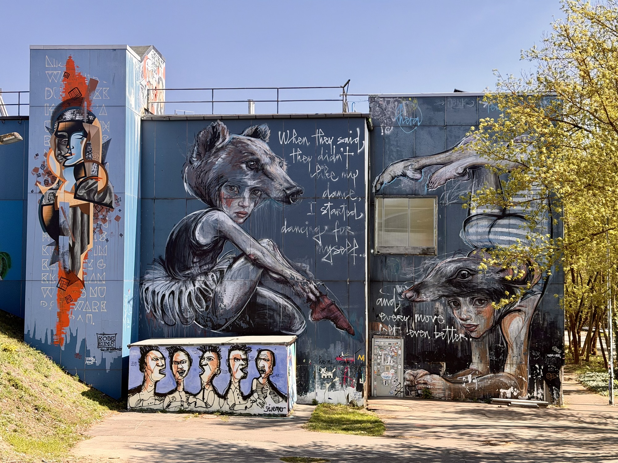
This mural was painted in such a way that when viewed through an app downloaded to a phone from a QR code, the fox would run. This is a still image below, and then a screen cap of the fox running on my phone screen.
We spent two hours exploring the murals and climbing up inside the structure supporting the geodesic domes.
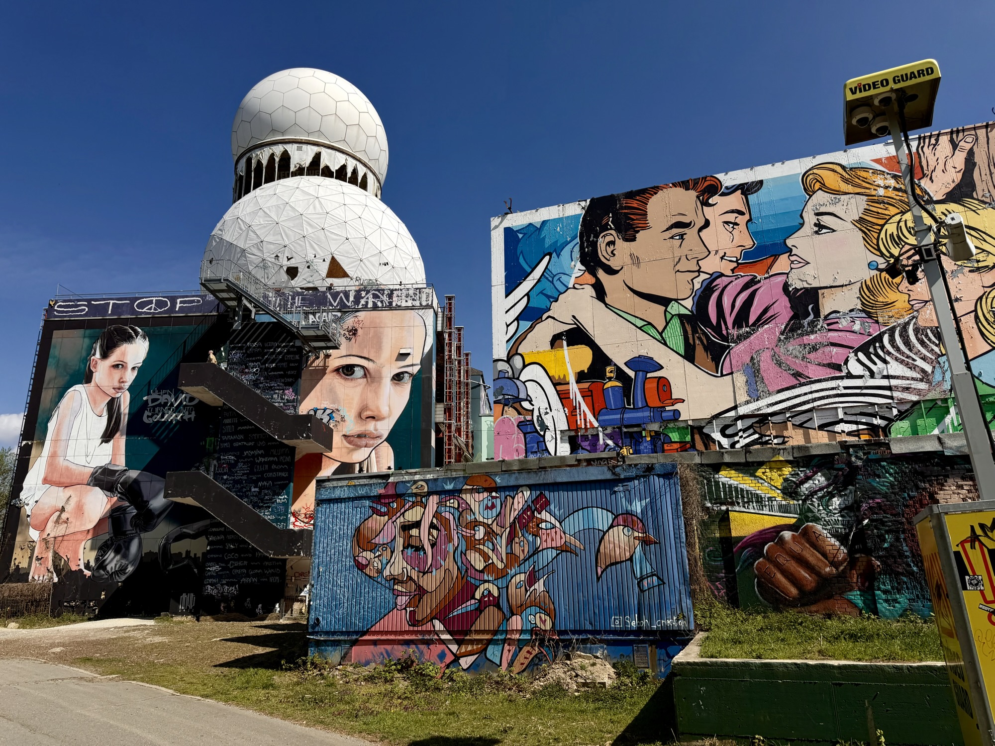
This is the view inside one of the geodesic domes.
This is the view from the rooftop supporting the geodesic domes.
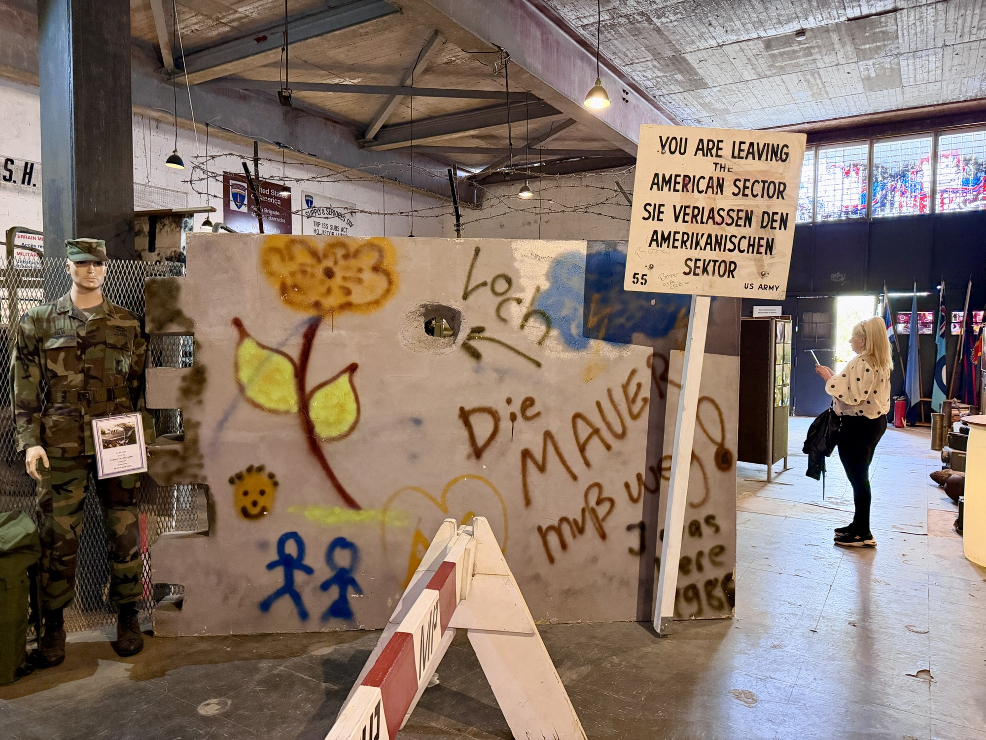
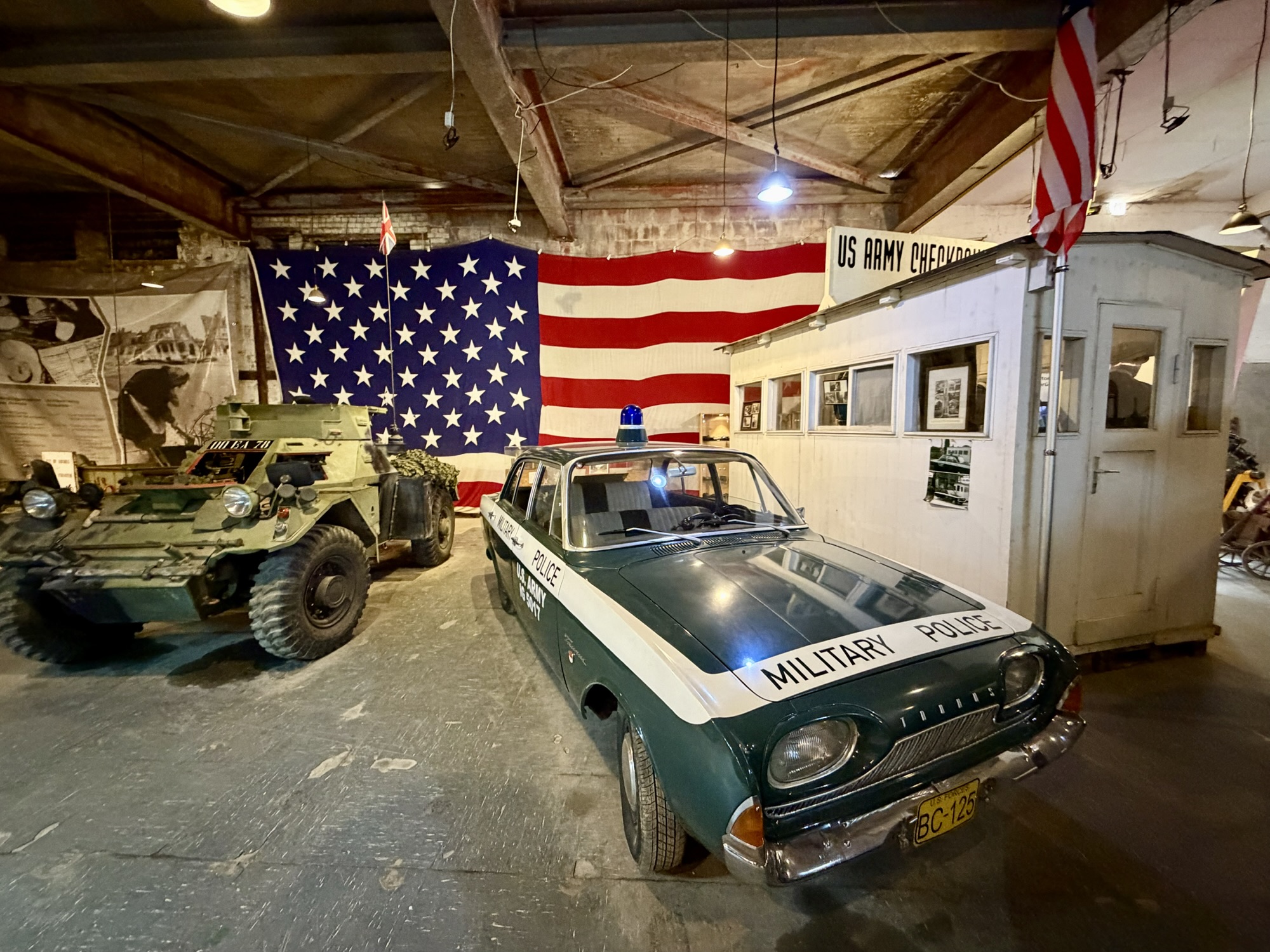
We also explored an exhibit entitled Declassified – The Secret of Teufelsberg which explain the history of the site. And the Museum “Alliierte in Berlin” – Experience History Up Close – which focuses on post World War II occupation from 1945 to 1994.
We had a snack before we left. While having the snack, I studied the map and determined that once we got back to the bikes, we should follow a short desire line which would take us to a road that we could use to descend.
It was a delightful descent, with the steepest section at about 6%. Had we come up this way we would have been able to ride the whole way. I’m not really sure why Ride with GPS recommend going through the forest. Google Maps did, too, as well as videos on the official Instagram account. Lesson learned: check the elevation profile when letting Ride with GPS generate your route. However, it was a fascinating visit, and is all part of the adventure.
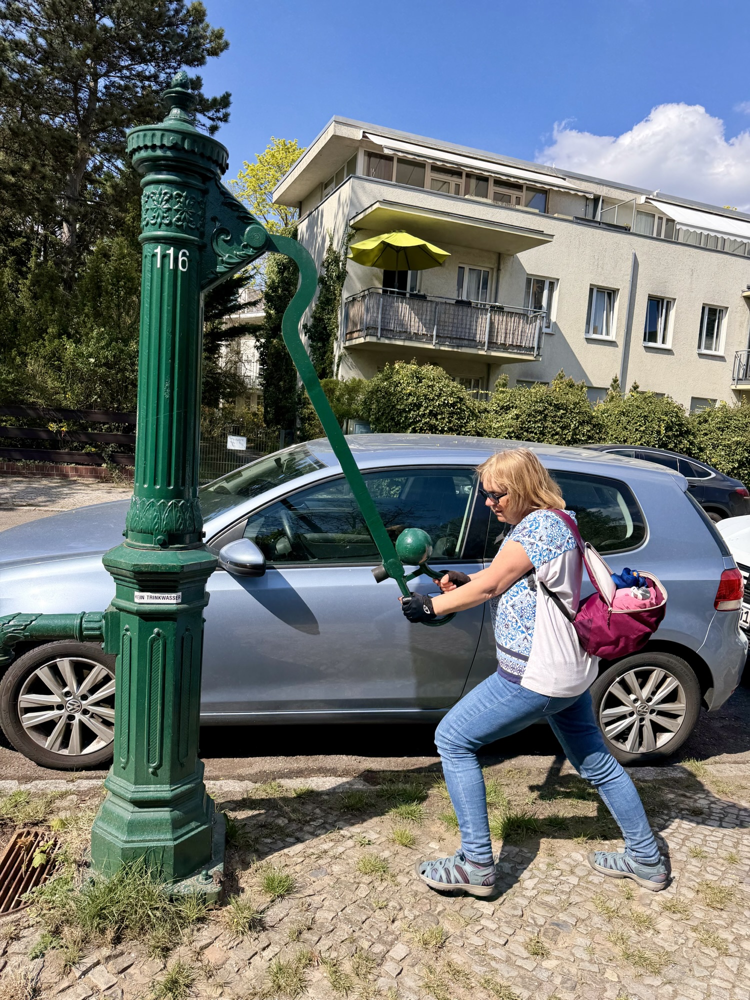
These green cast-iron water pumps are a distinct feature of the city’s streetscape. They were initially installed in the 1800s as watering spots for carriage horses. Today these pumps serve as emergency infrastructure, providing drinkable naturally filtered ground water to the public in the event of a citywide water utility failure. There used to be 6000. The infrastructure was very important after the bombing in the second world war, which damaged the water network. There are still over 2000 in Berlin, of which about 1600 are functional.
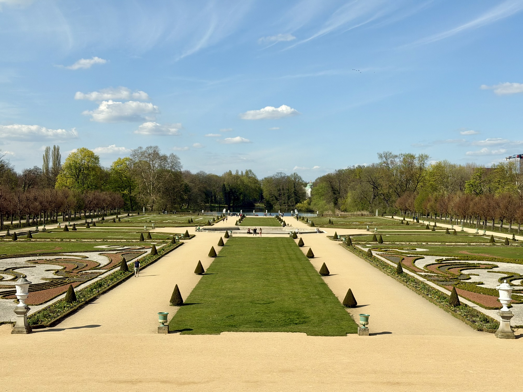
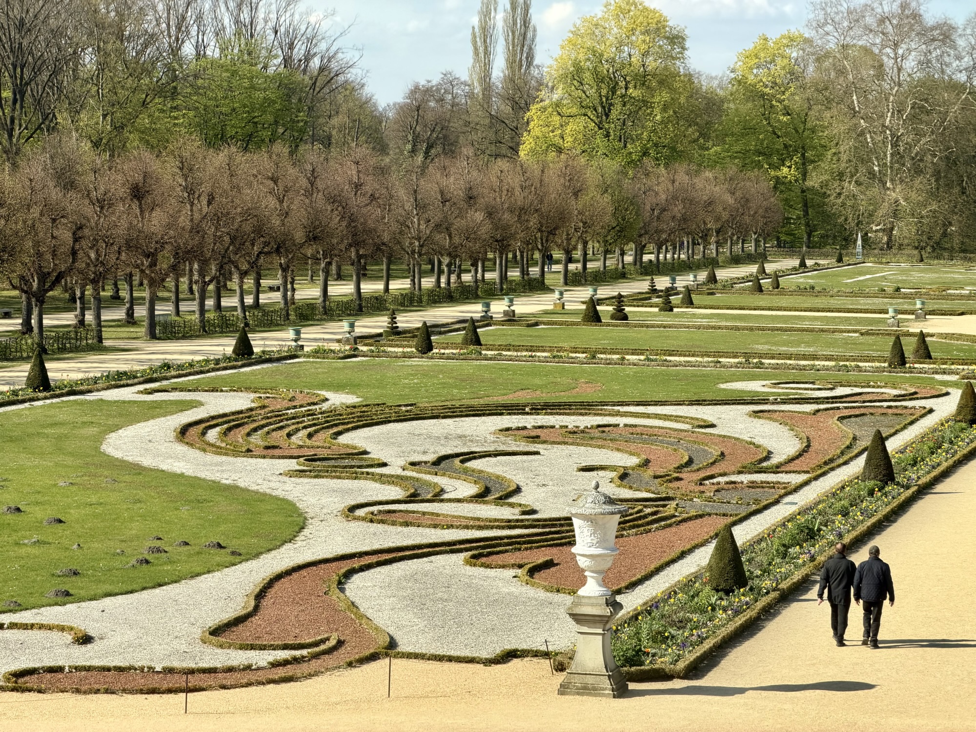
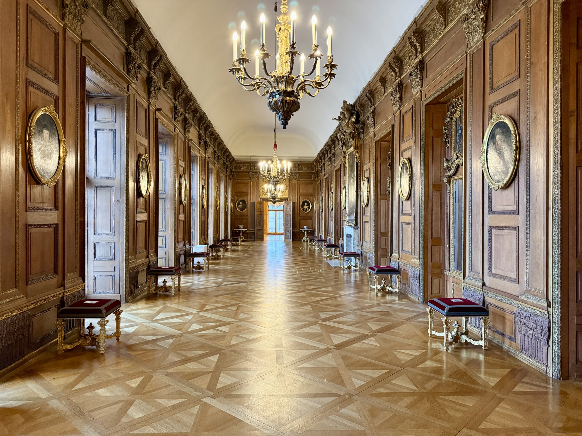
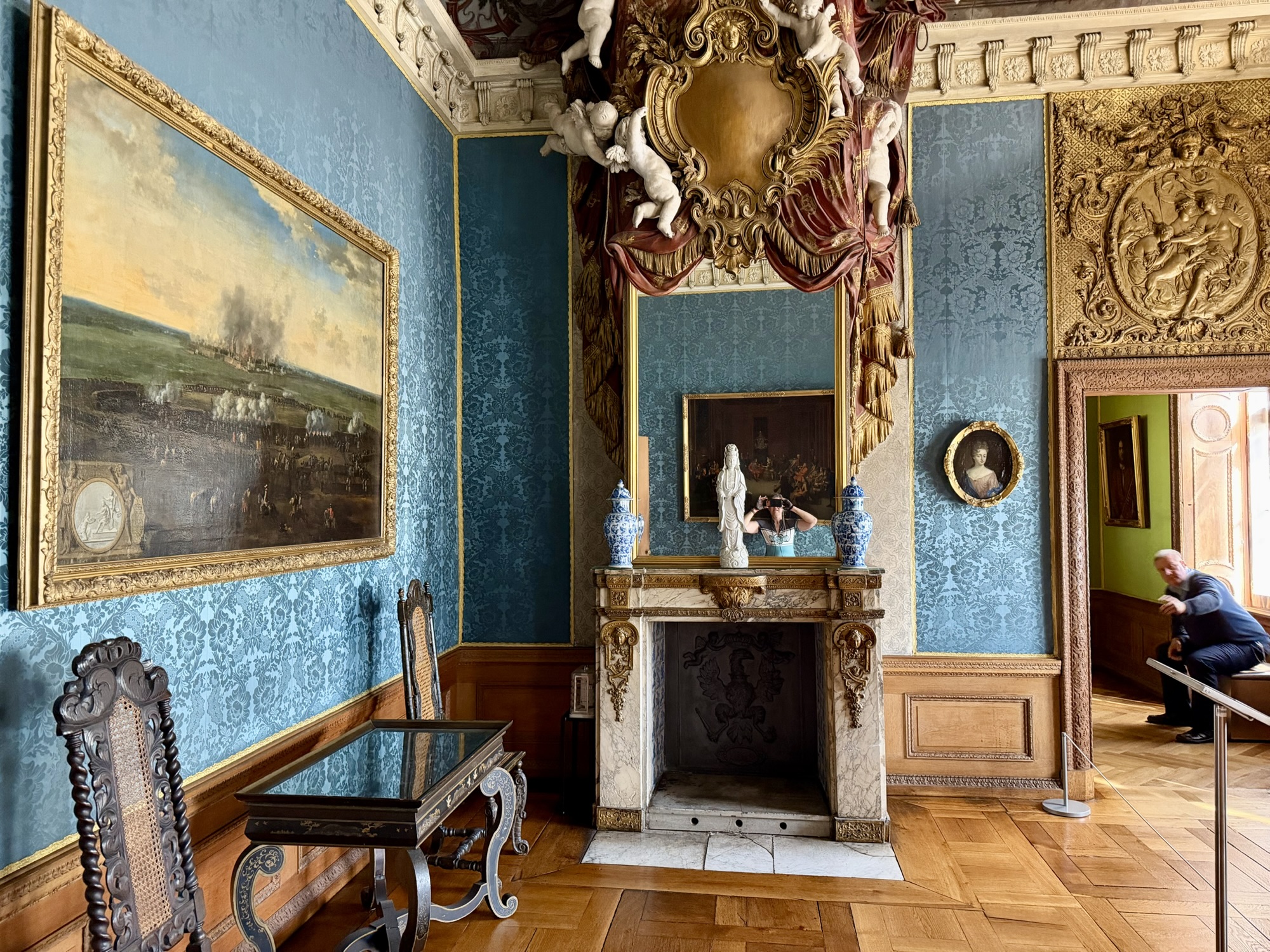
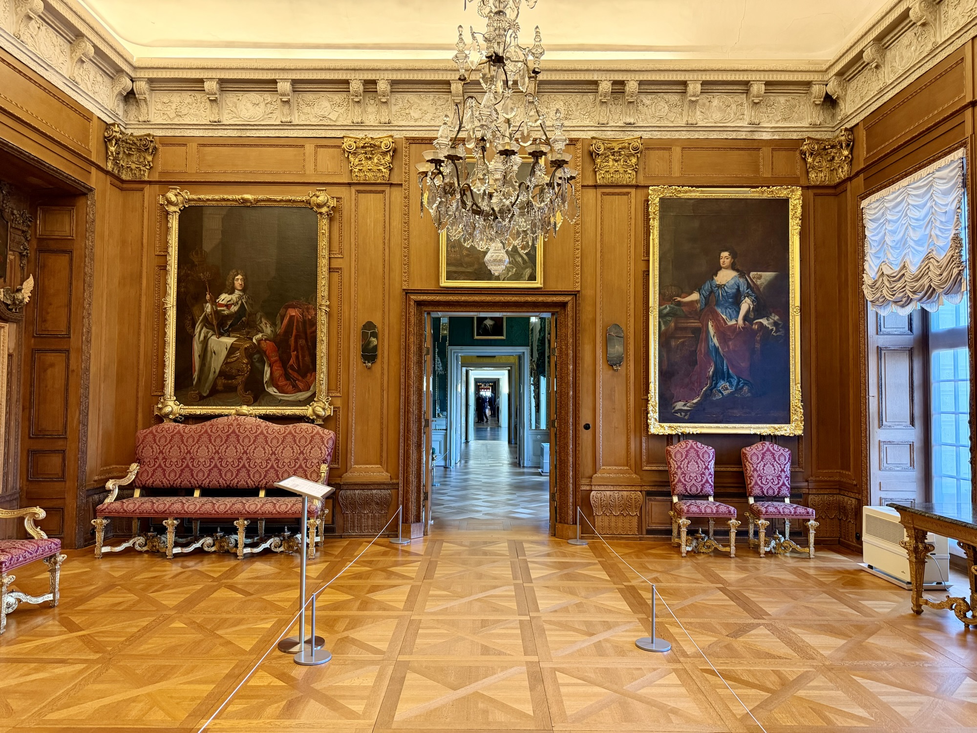
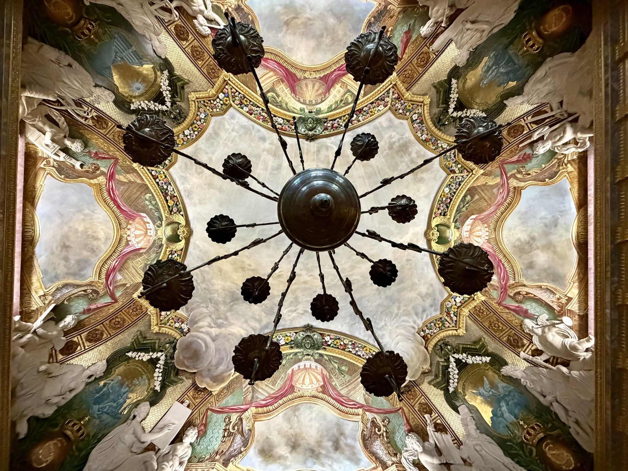
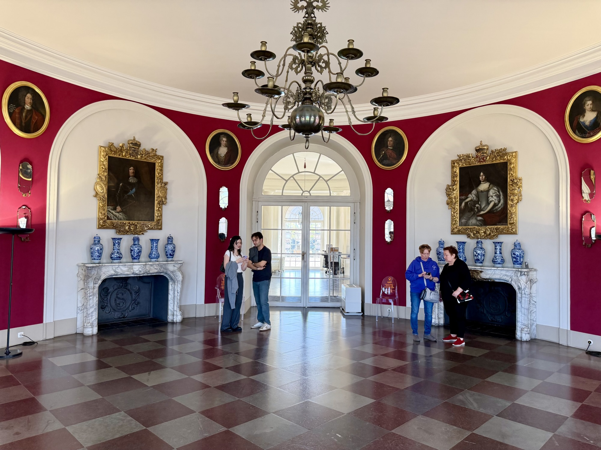
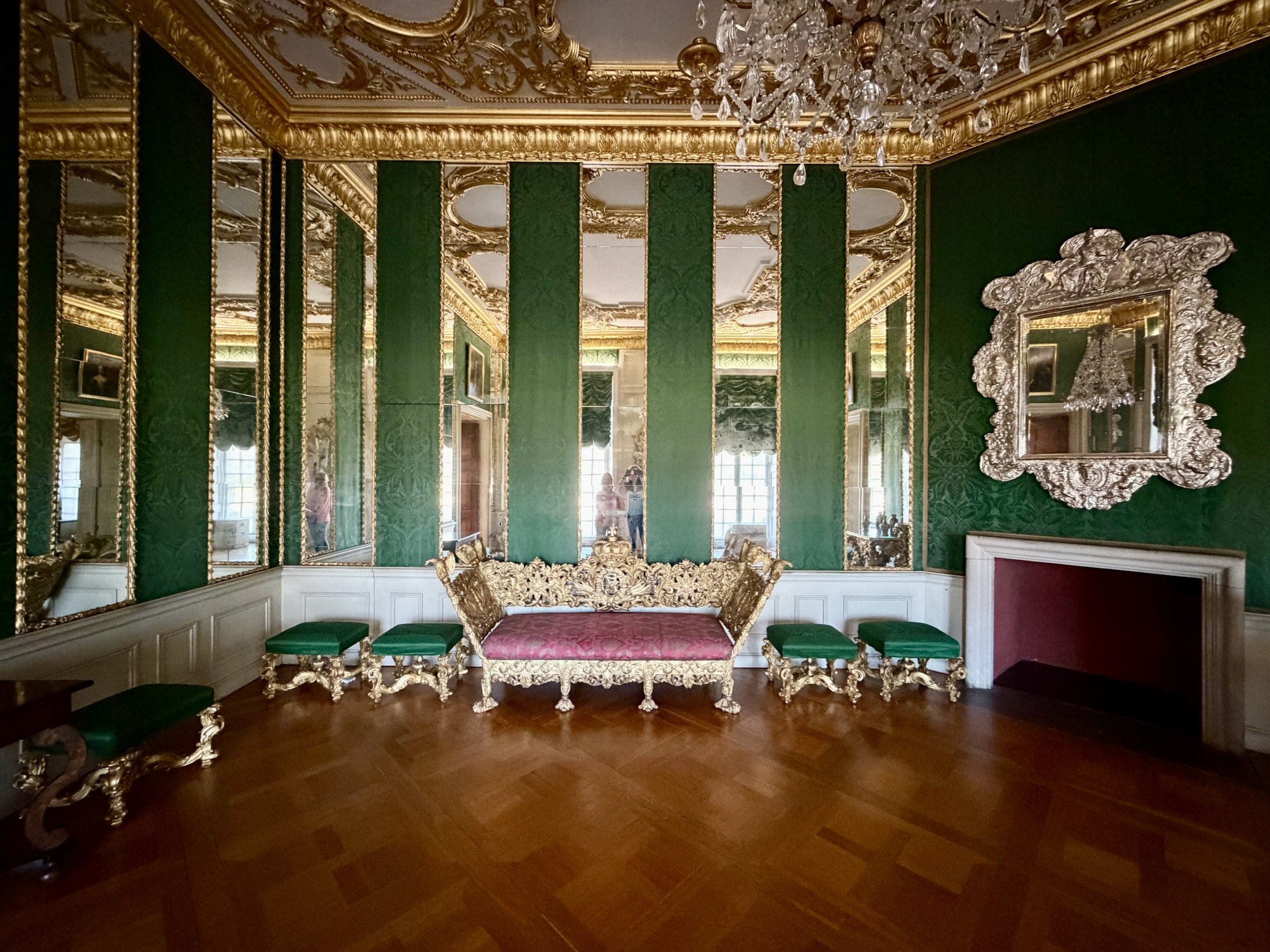
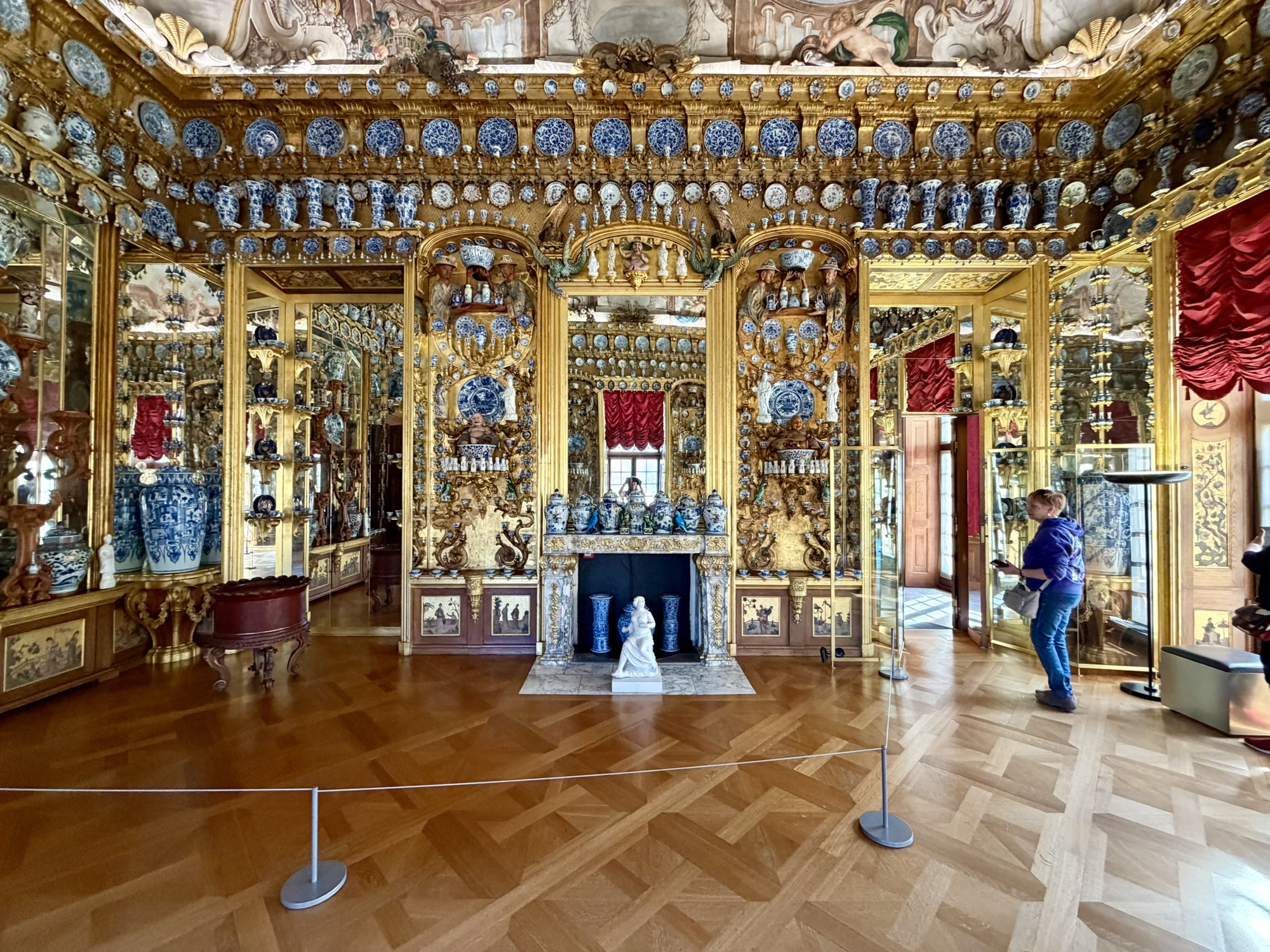
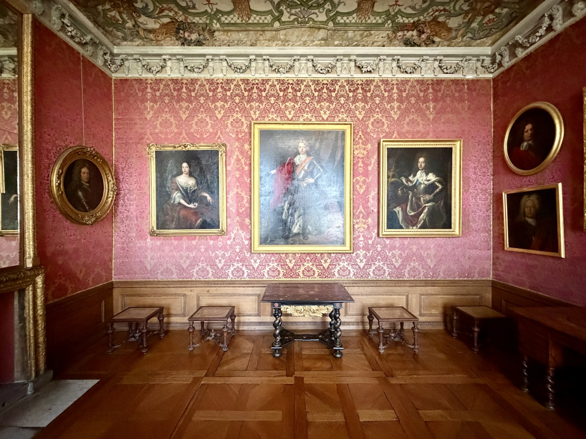
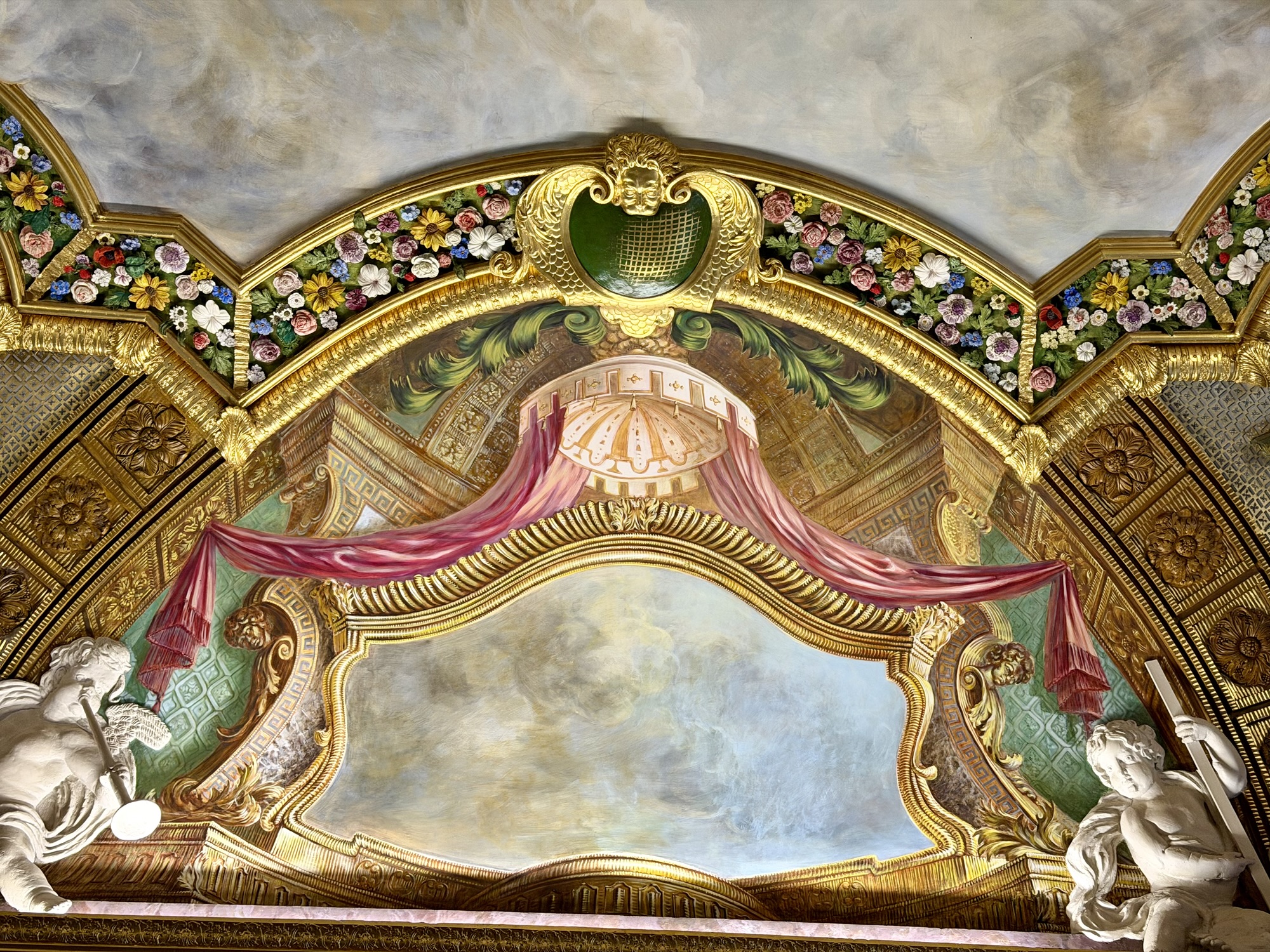
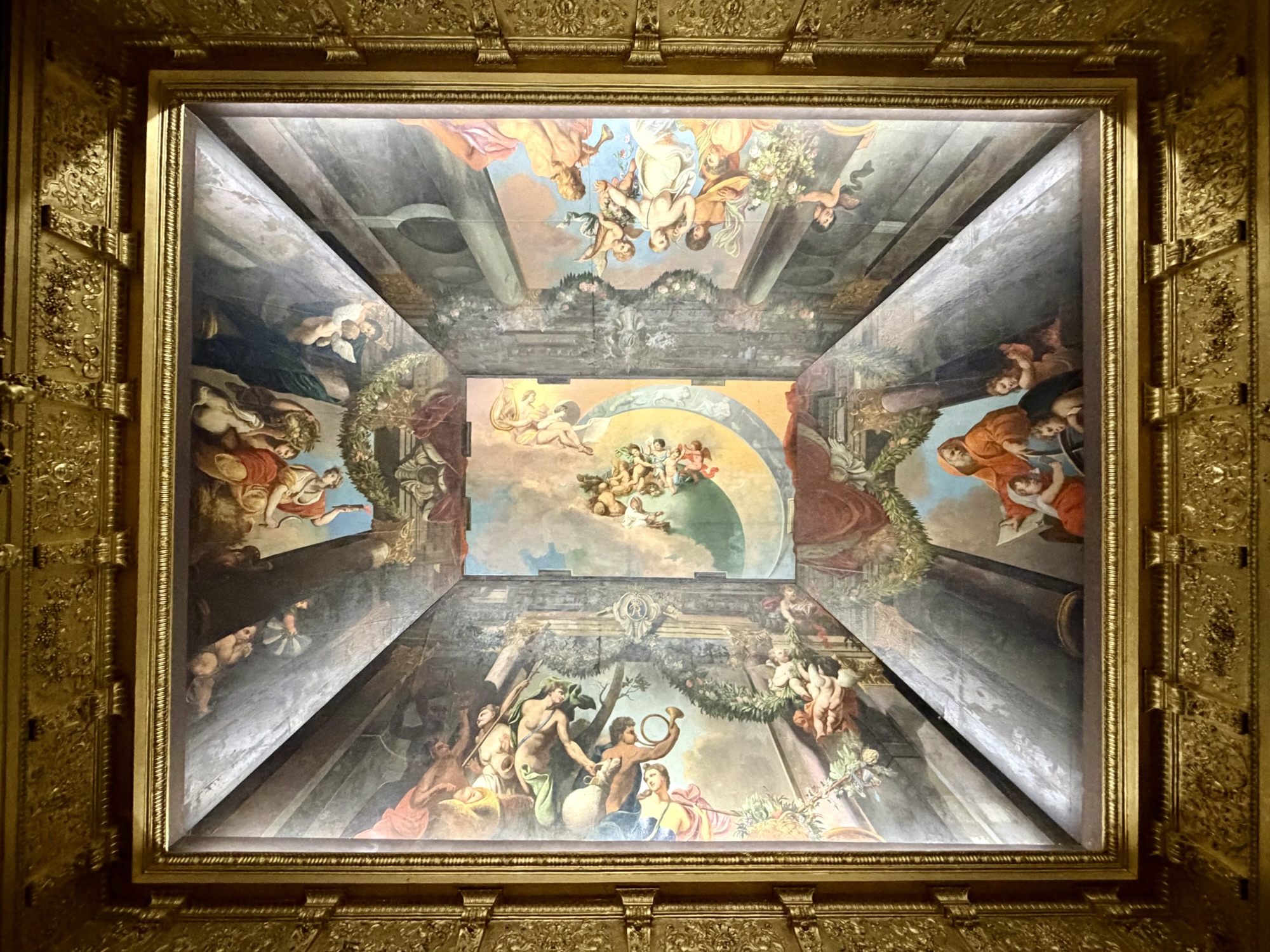
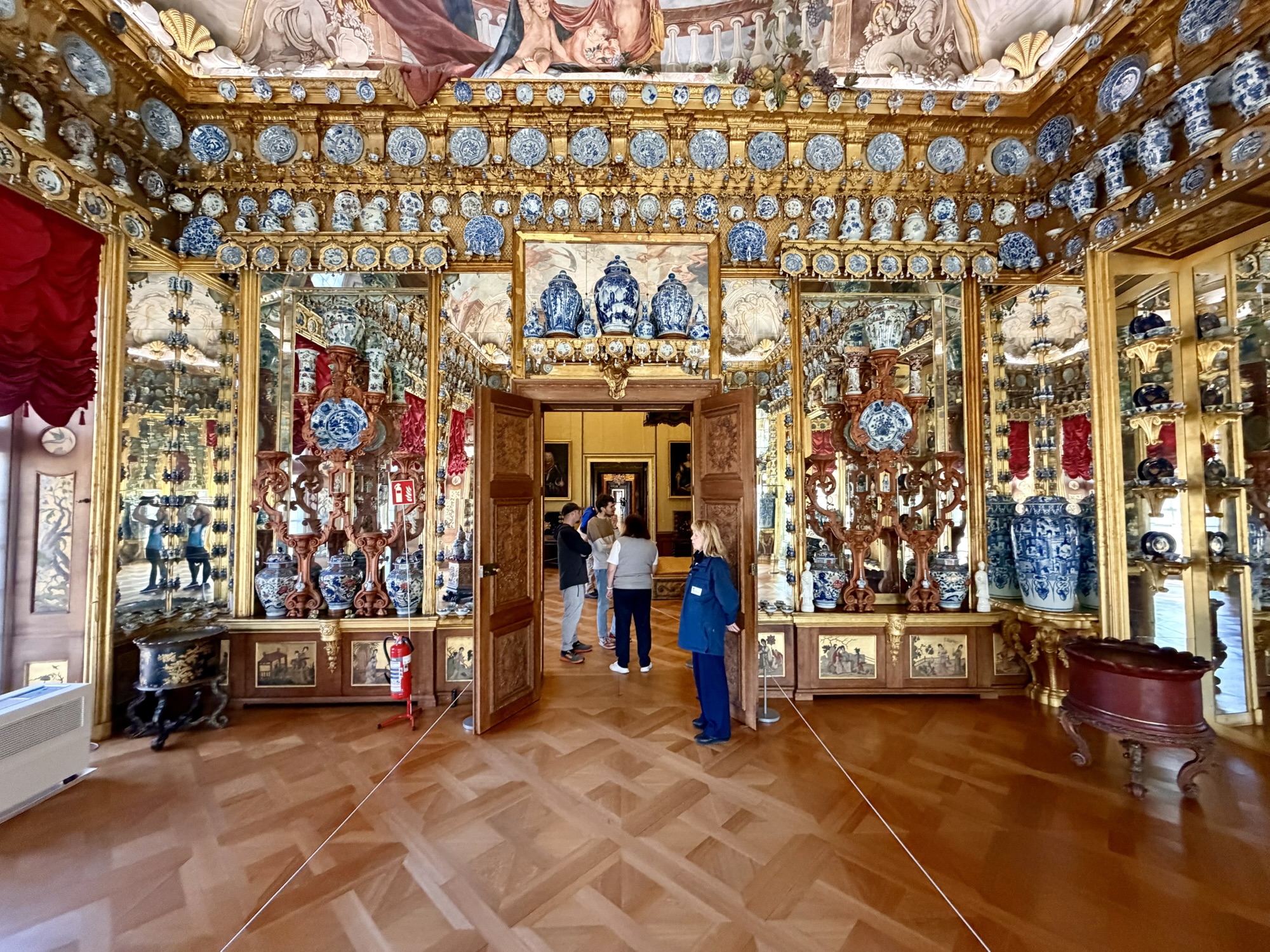
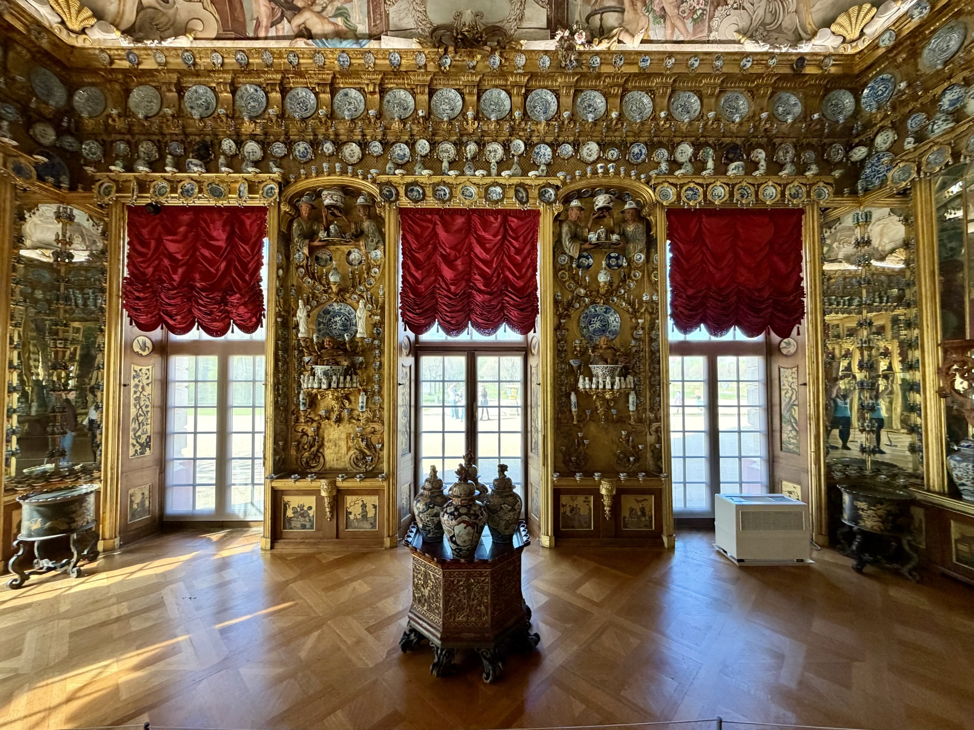
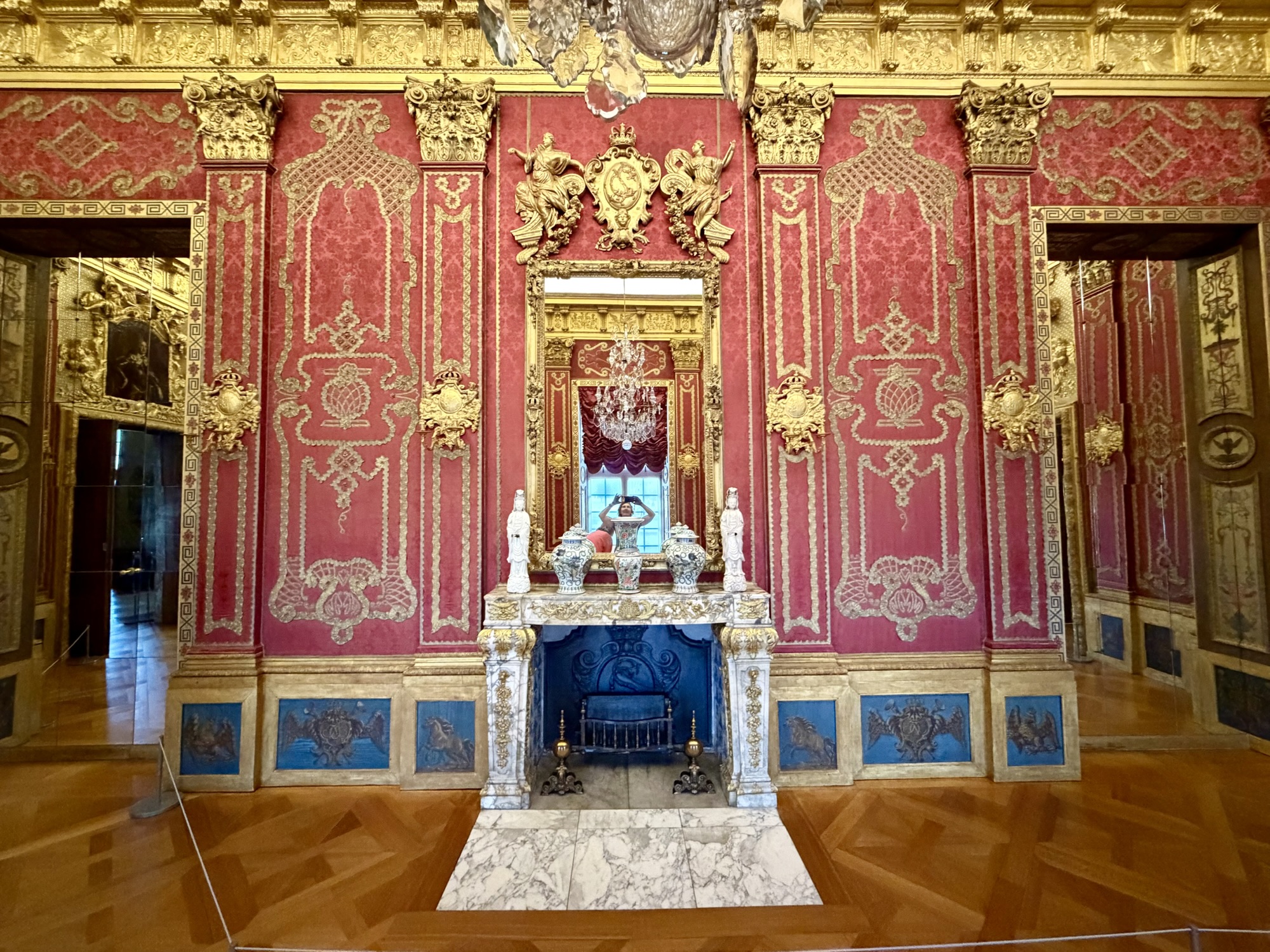
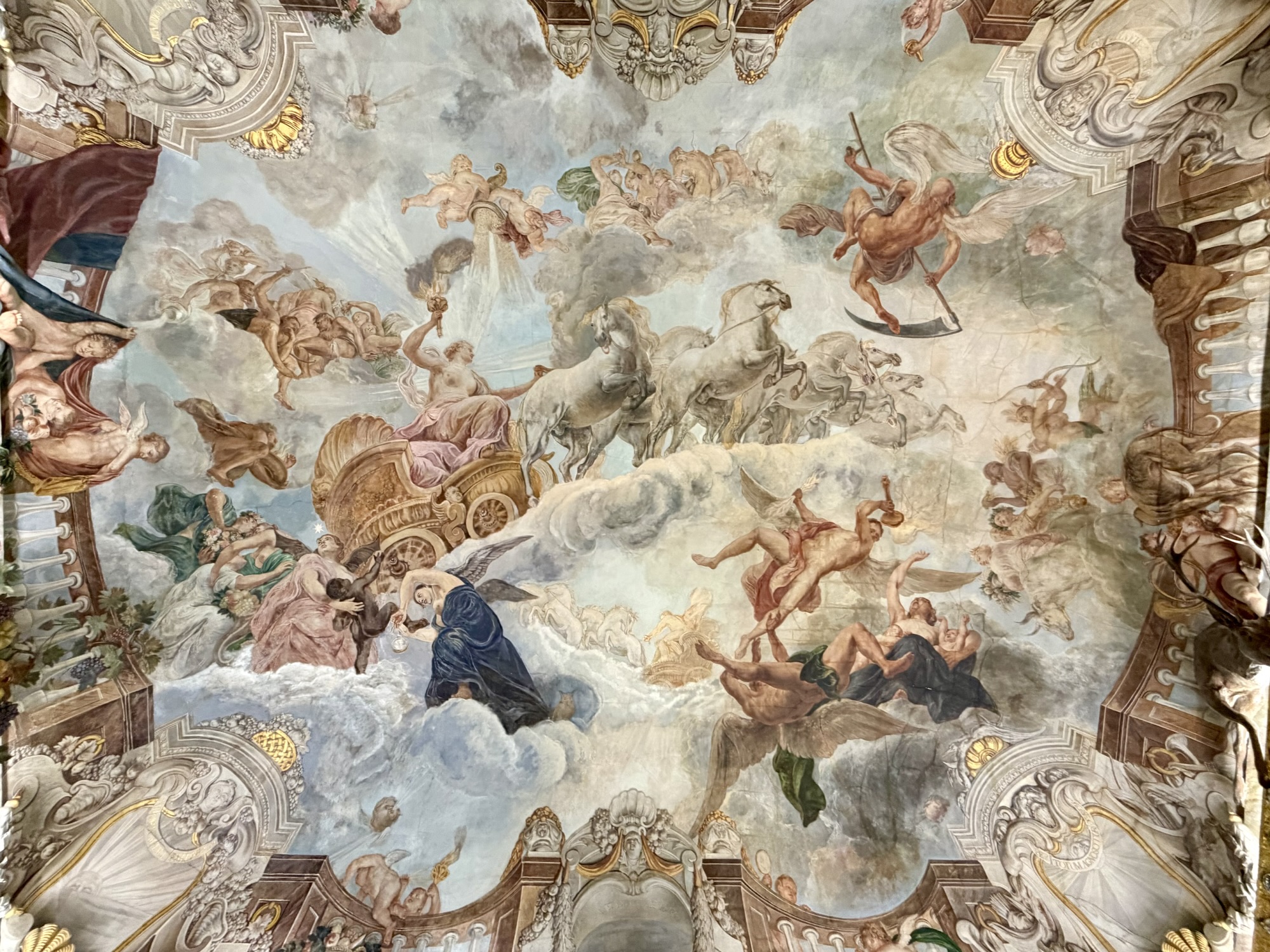
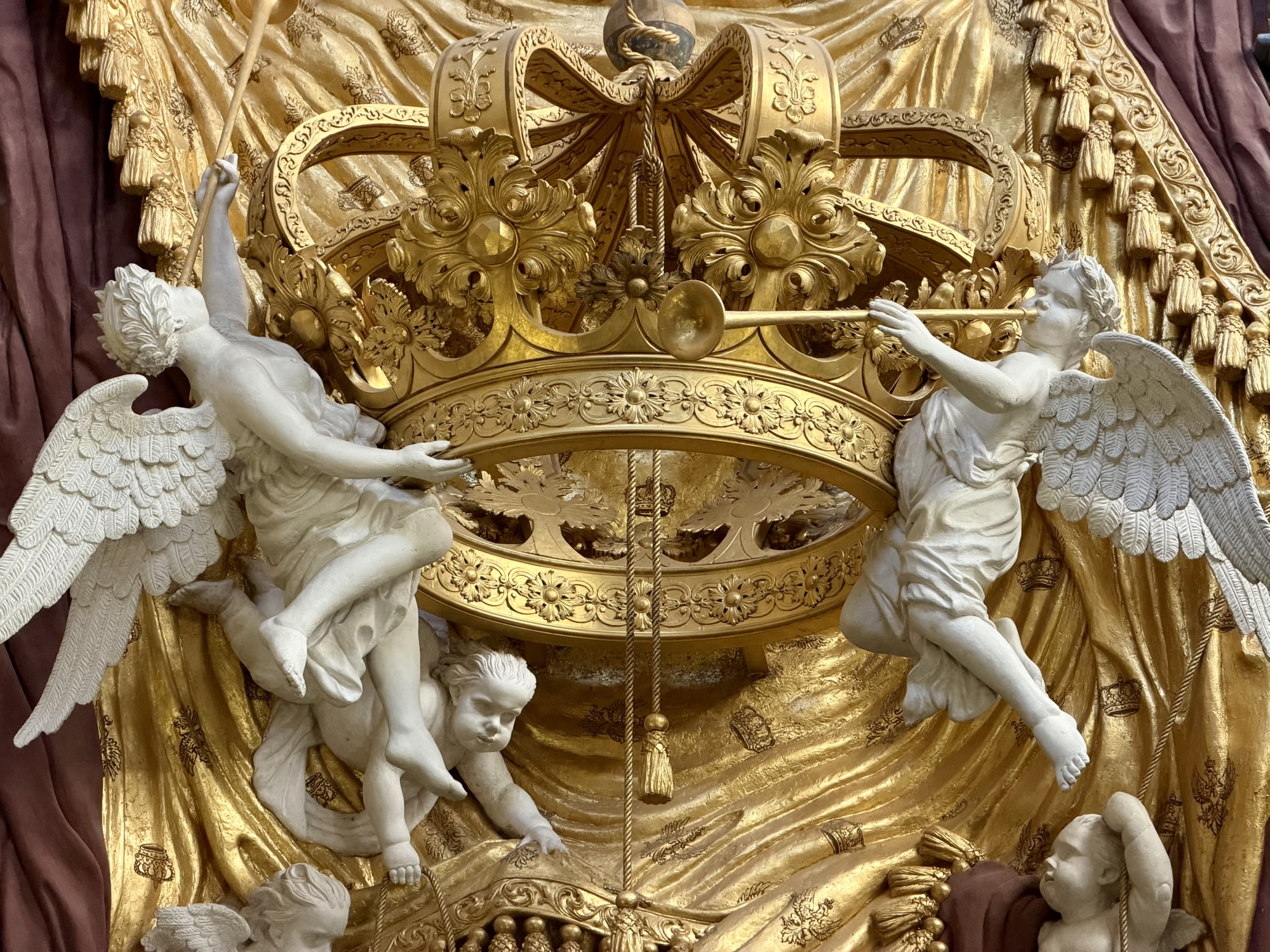
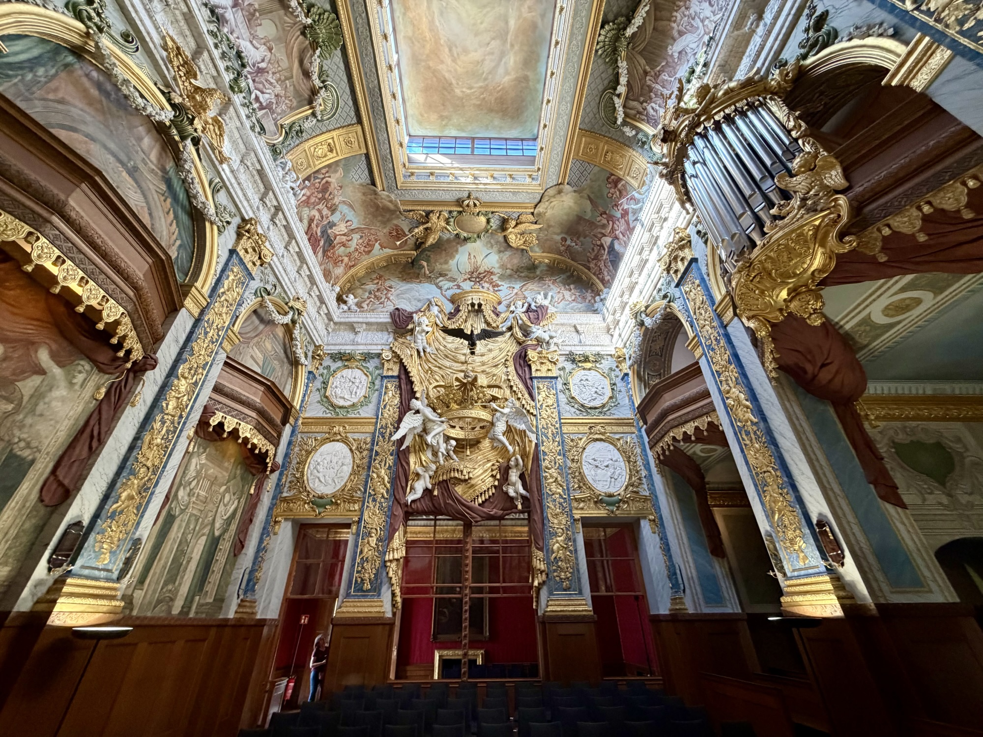
Charlottenburg Palace (Schloss Charlottenburg) is Berlin’s largest royal palace. It was built in the late 17th century as a summer residence for Queen Sophie Charlotte. The architecture is baroque and rococo. It features lavish state apartments, and extensive gardens, and historical art collections.
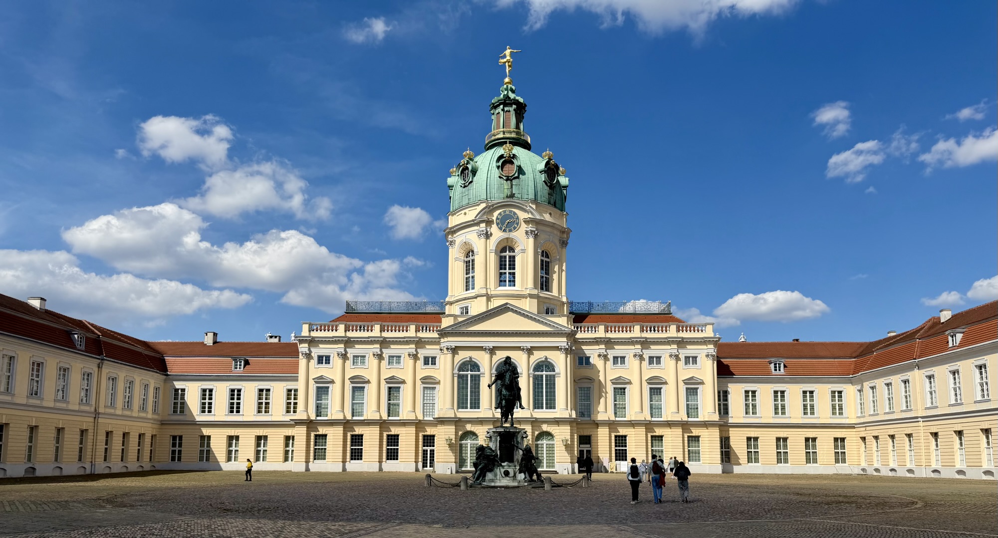
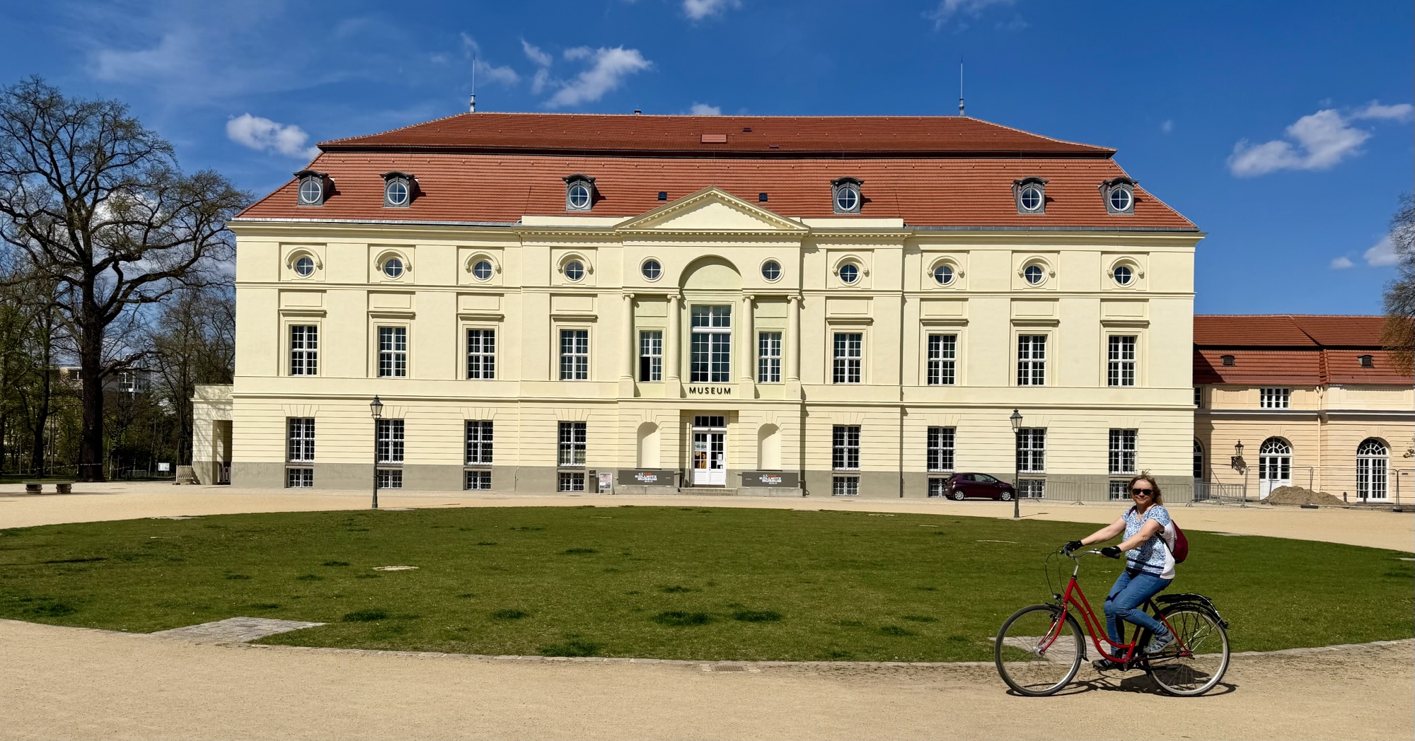
We toured the old palace, the original core of which was built in 1695. The palace was nearly destroyed by bombing during World War II, but has been meticulously restored to its former glory.
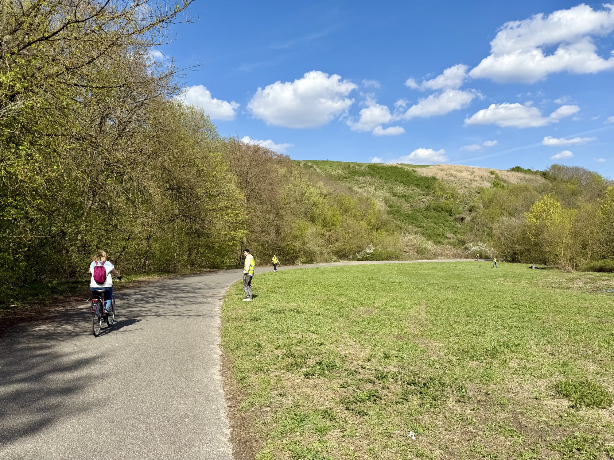
Next, we rode through the Tiergarten. It is Berlin’s largest (519 acres) and most famous inner-city park. It was originally a 16th century royal hunting ground. It now serves as a public recreation area and historic monument.
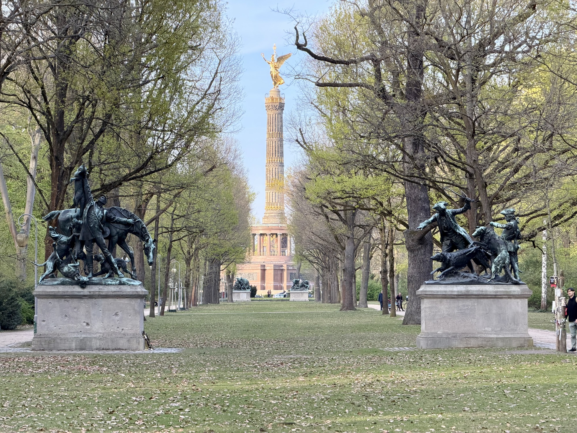
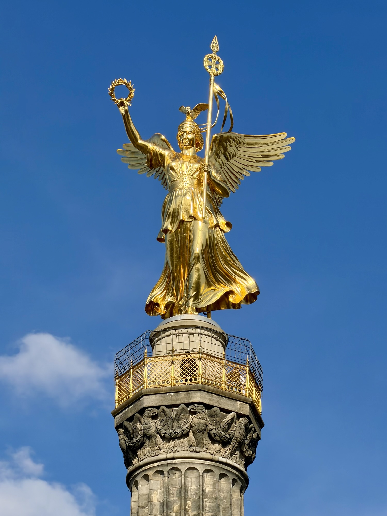
The Berlin victory column (Siegessäule) is a 67 m tall monument in the centre of the Tiergarten Park. It was built between 1864 and celebrates Russia‘s military victories over Denmark, Austria, and France. It is topped by a golden bronze statue of the goddess Victoria. Visitors can climb a winding staircase of 285 steps to reach an open air viewing platform, which features panoramic 360° views of the city. We didn’t take the time to do so as the plan for tomorrow is to visit the nearby Reichstag Dome which also offers open air panoramic views.
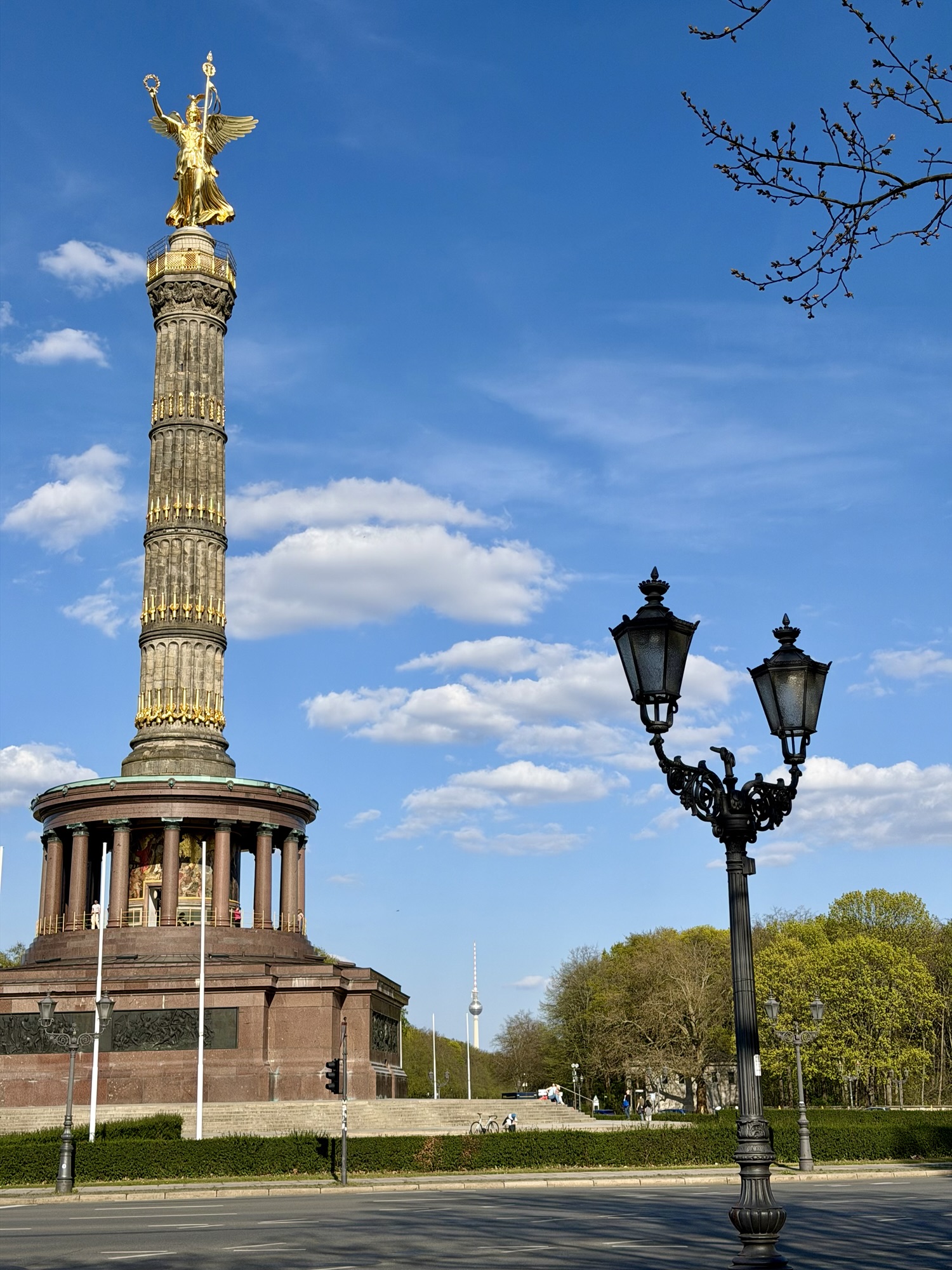
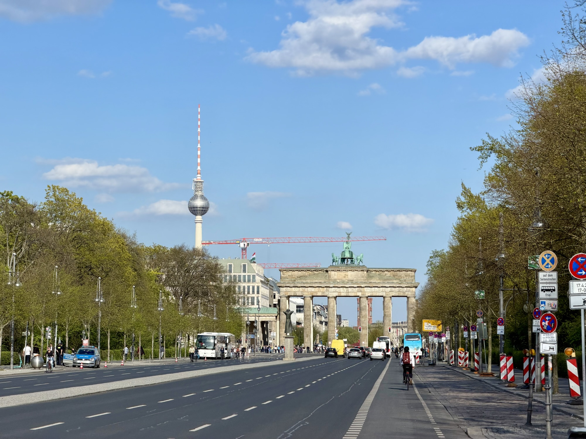
In addition to the many recreational trails through the park, there are raised cycle tracks along the streets around the park. Here you can see the Brandonburg Gate and Berlin Tower.
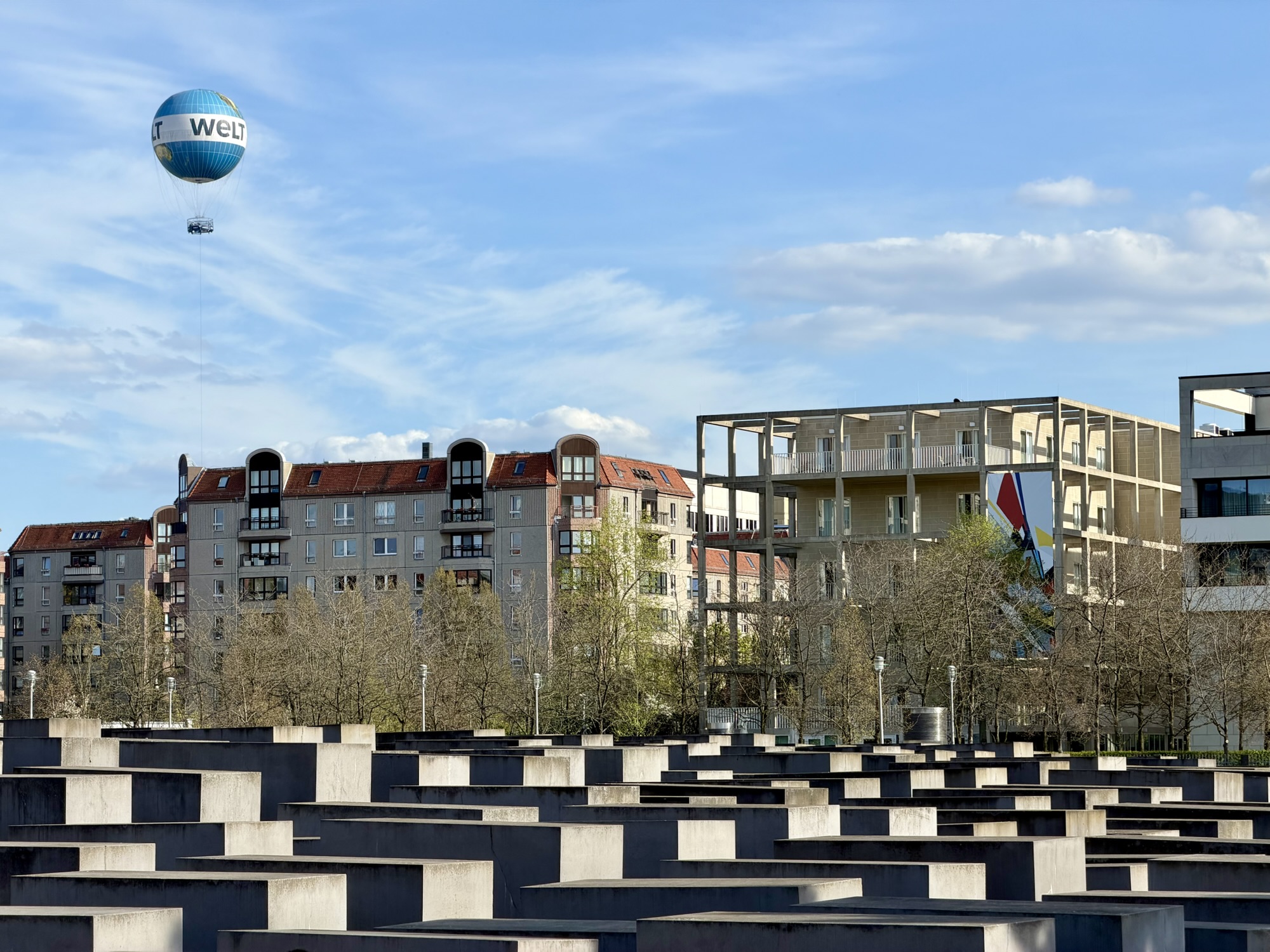
Very close to the park and Brandenburg Gate is the Memorial to the Murdered Jews of Europe, commonly called the Holocaust Memorial. It is a monument commemorating the up to 6 million Jewish victims of the holocaust. It was designed by Peter Eisenman and features a sprawling disoriented maze of 2711 concrete slabs (stelae) varying Heights that cover a 4.7 acre undulating site.
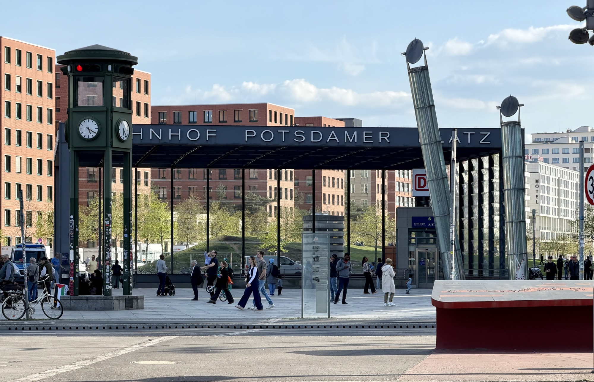
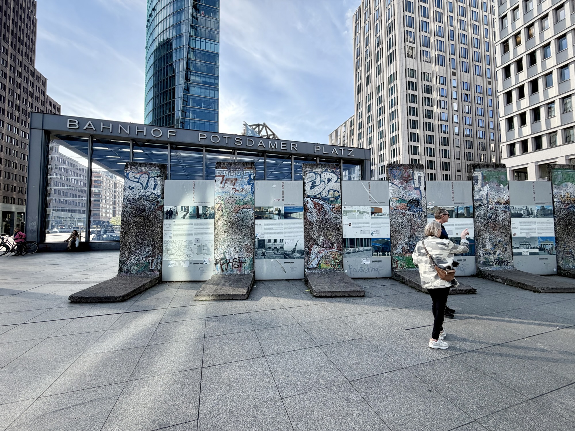
Next, we headed to Potsdamer Platz, which was in East Berlin. Sections of the Berlin Wall have been preserved outside of the modern redeveloped Potsdamer Platz railway and s–Bahn station.
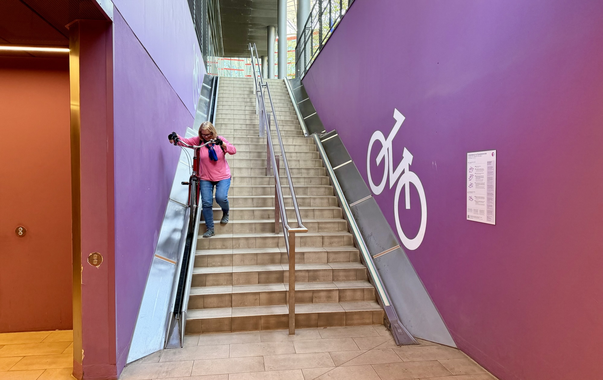
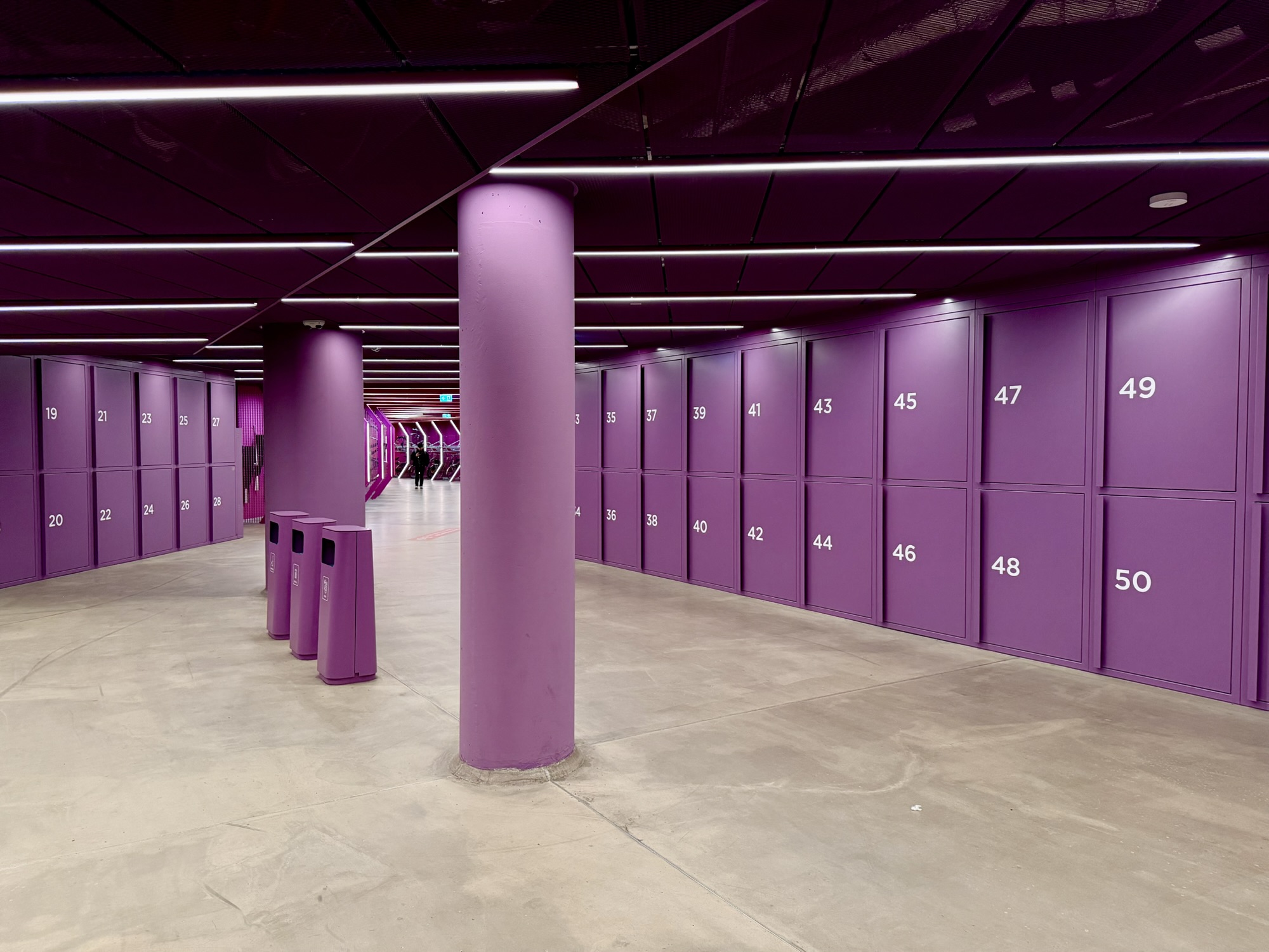
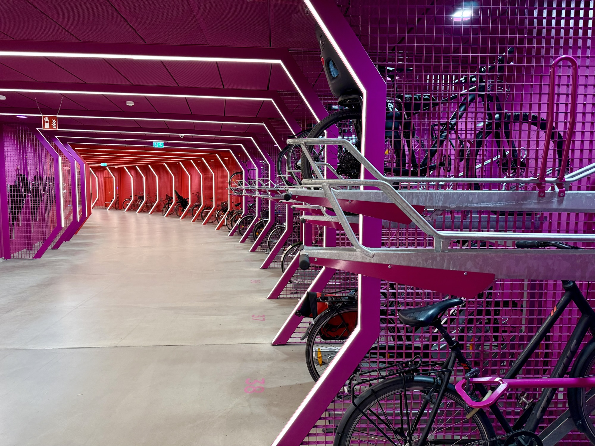
I had recently seen on social media a new underground bike parking station in Berlin, and that’s where we headed next. It is under Potsdamer Platz. The bike trough had bristles that slowed the descent of your bike, and a drain at the bottom to catch water from the tires on wet days.
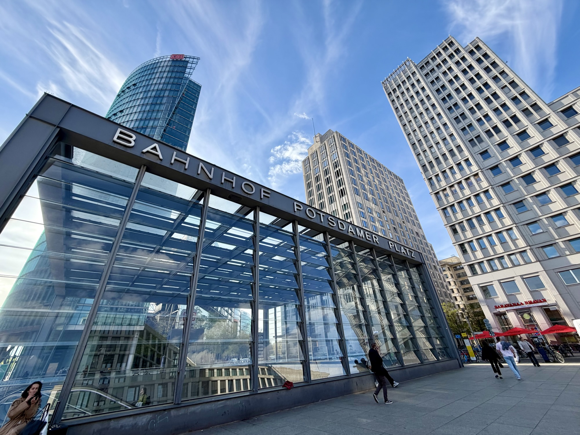
The entryway is in The Centre at Potsdamer Platz, known as the Sony Centre until 2023. It is a glass and steel open air complex with a spectacular tent like roof covering a central plaza filled with restaurants, offices, apartments, and entertainment venues.
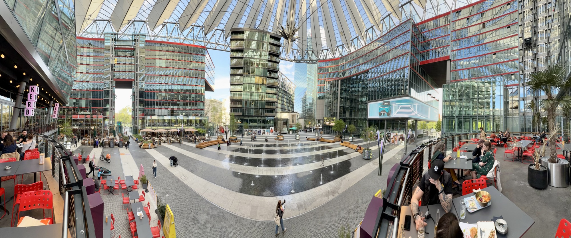
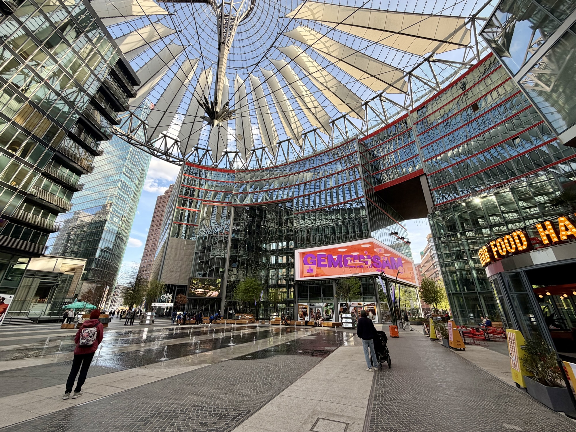
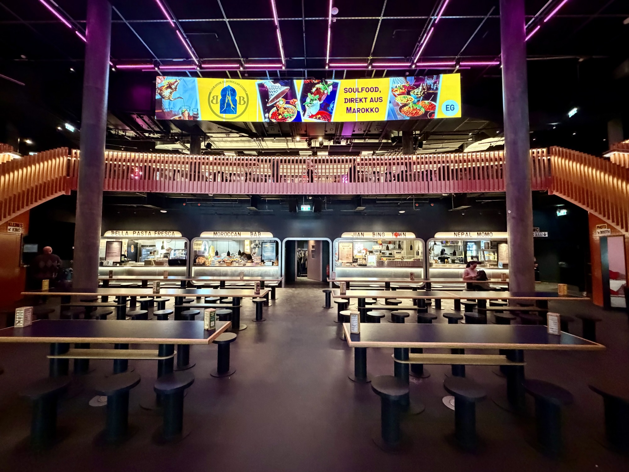
We decided to eat dinner here having not had a proper lunch, but just the coffee and waffle at Tuefelsberg, and some fruit and nuts we had with us before going into Charlottenburg.
Alina‘s daughter asked her to visit The Rosa Luxembourg (1871 to 1919) memorial. She was “a prominent advocate of democratic socialist thought and action in Europe. She opposed the butchery of the 1914–1918 World War with all her strength. She and Karl Liebknecht were the most important supporters of internationalist and anti-militarist positions within the Social Democratic Party (SPD). She was a passionate and convincing critic of capitalism, and it was from this critique that she drew the strength for revolutionary action. She welcomed the Russian Revolution full of hope, but as a revolutionary democrat remained critical and alert, and had the foresight to condemn the dictatorial policies of the Bolsheviks.”
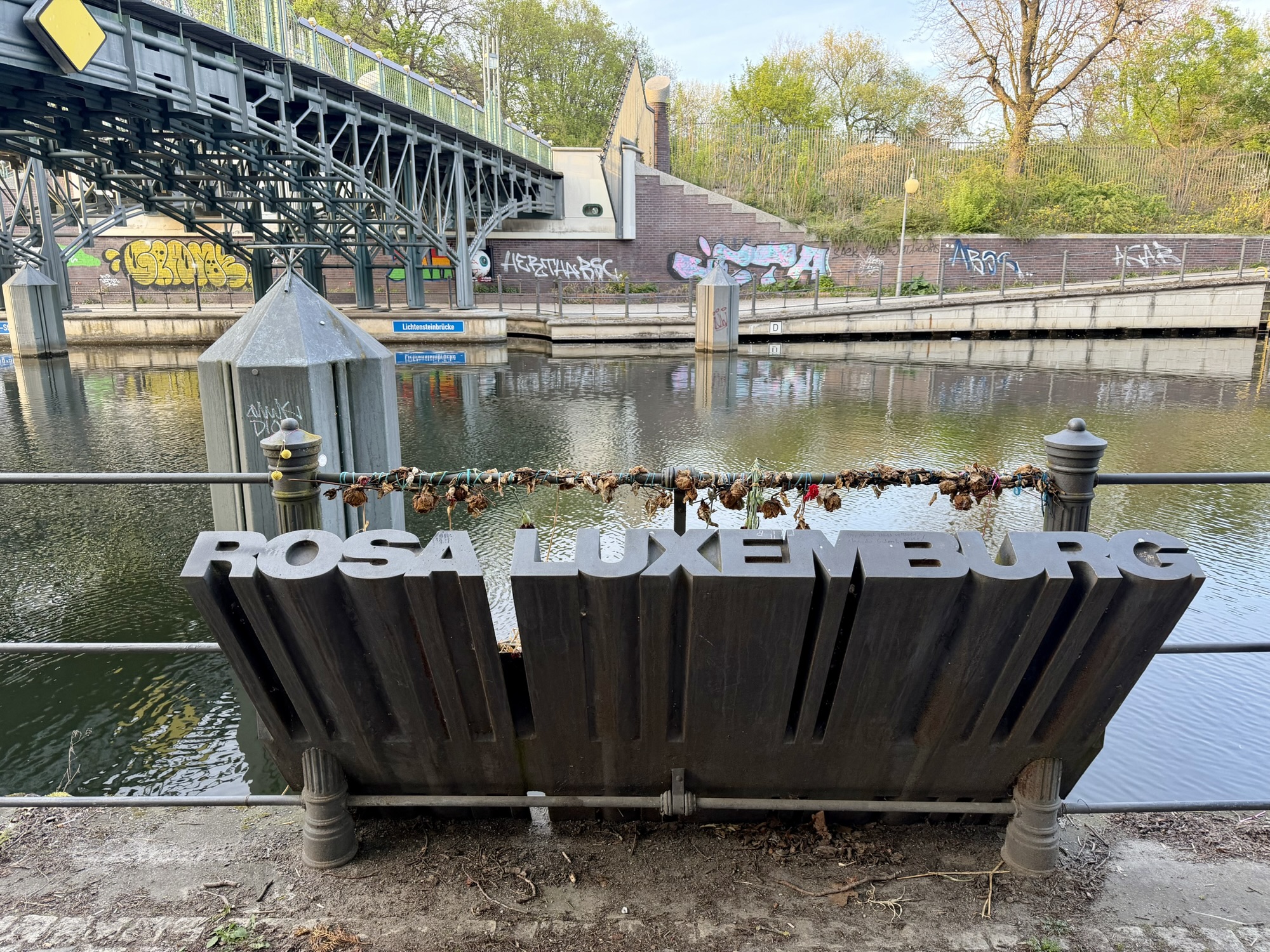
Rosa was an academic who earned a doctorate at a time when hardly any women attended university. She was also active in politics. “Rosa Luxemburg was a martyr of the German Revolution of November 1918. She was killed by uniformed murderers on 15 January 1919 — members of the same milieu that would later openly support the handover of power to the Nazis.” The memorial has been placed where her body was thrown into the Landwehr Canal.
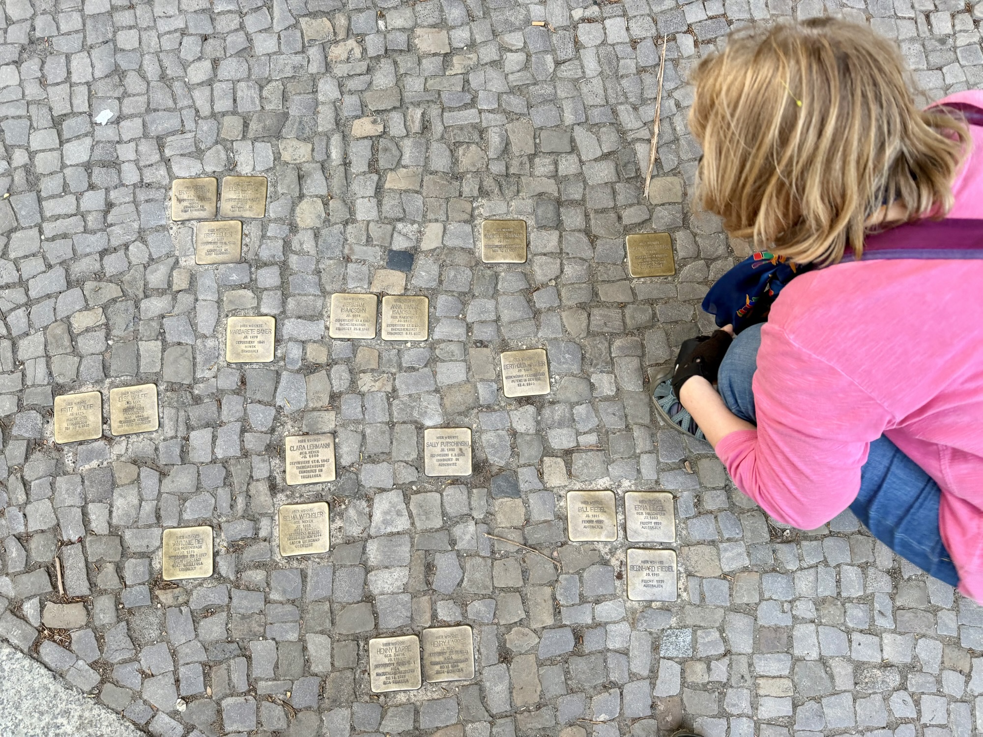
It was starting to get dark as we returned to the guest house. Outside of the building housing the guest house were these small brass capped plaques embedded in the cobblestones. They are known as Stilpersteine (stumbling stones). They were initiated by artist Gunter Demnig, and are placed directly outside the last known freely chosen residence or workplace of someone targeted by the Nazis.
We were locking our bikes up in the courtyard when a resident pointed out that there is a bike room where we should park and that the guest house should have told us this.
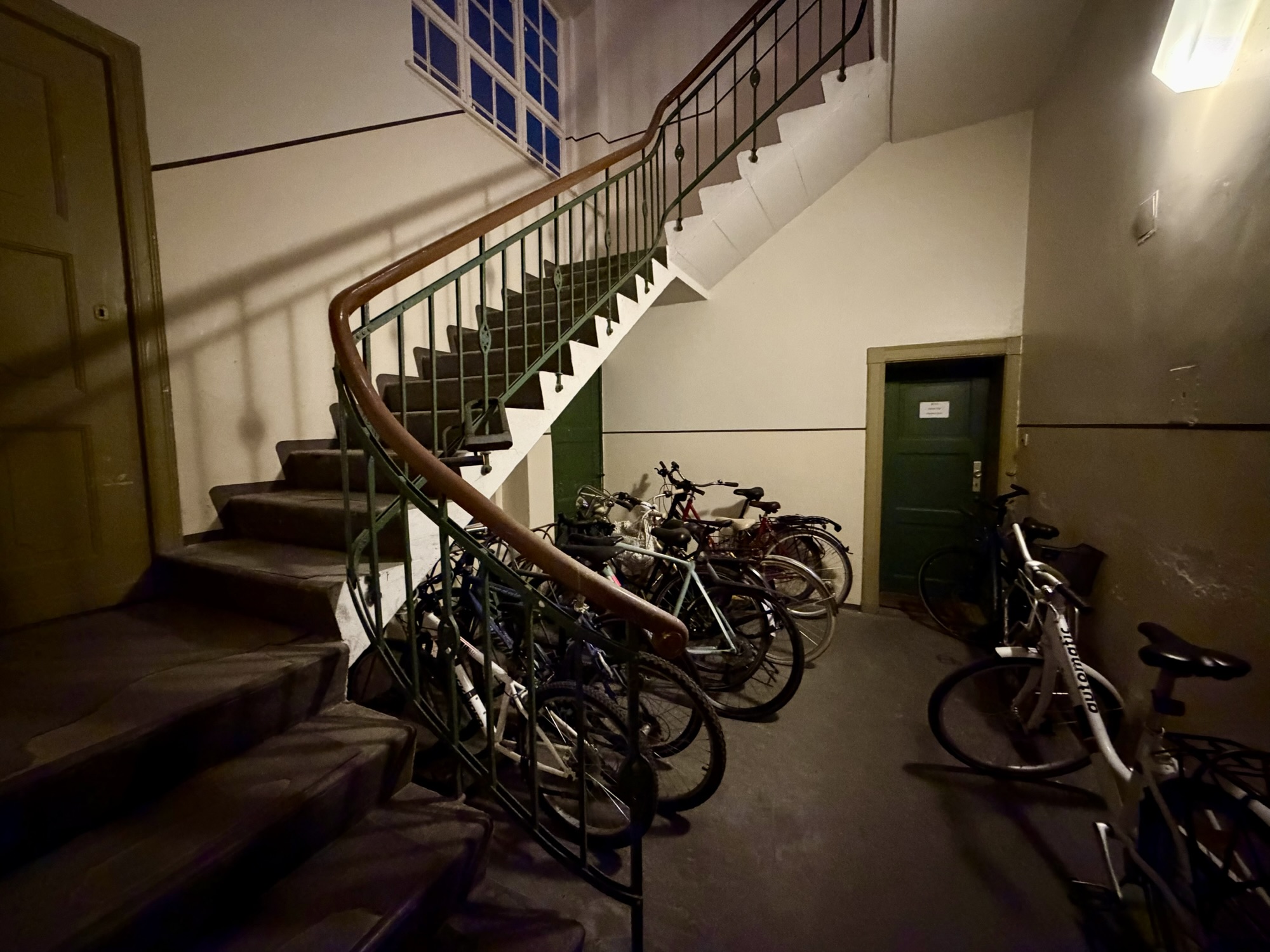
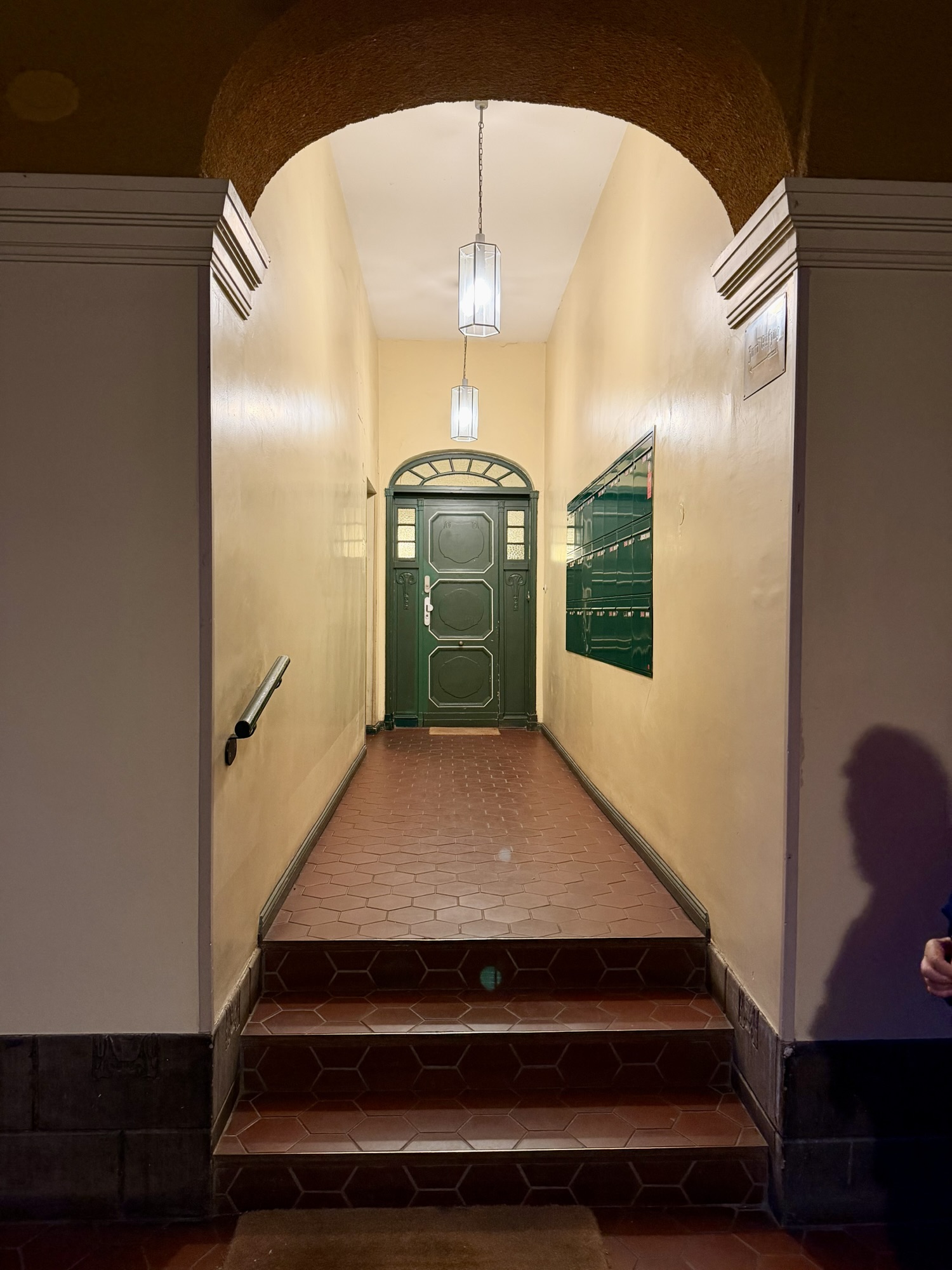
The elevator to our guest house was three steps up from the street level. It was still better than carrying my suitcase up two long flights of stairs, but not very useful for someone using a mobility device.
Discover more from Lisa Stokes
Subscribe to get the latest posts sent to your email.
One thought on “Europe 2026 – Day 20 – Berlin”