Riding UP

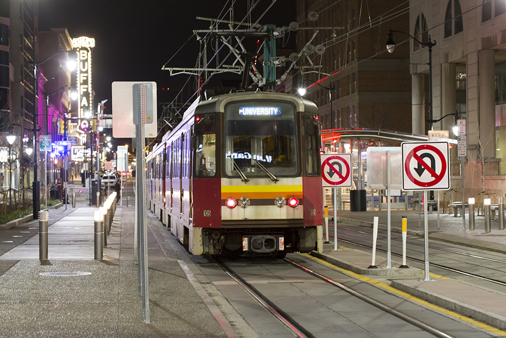
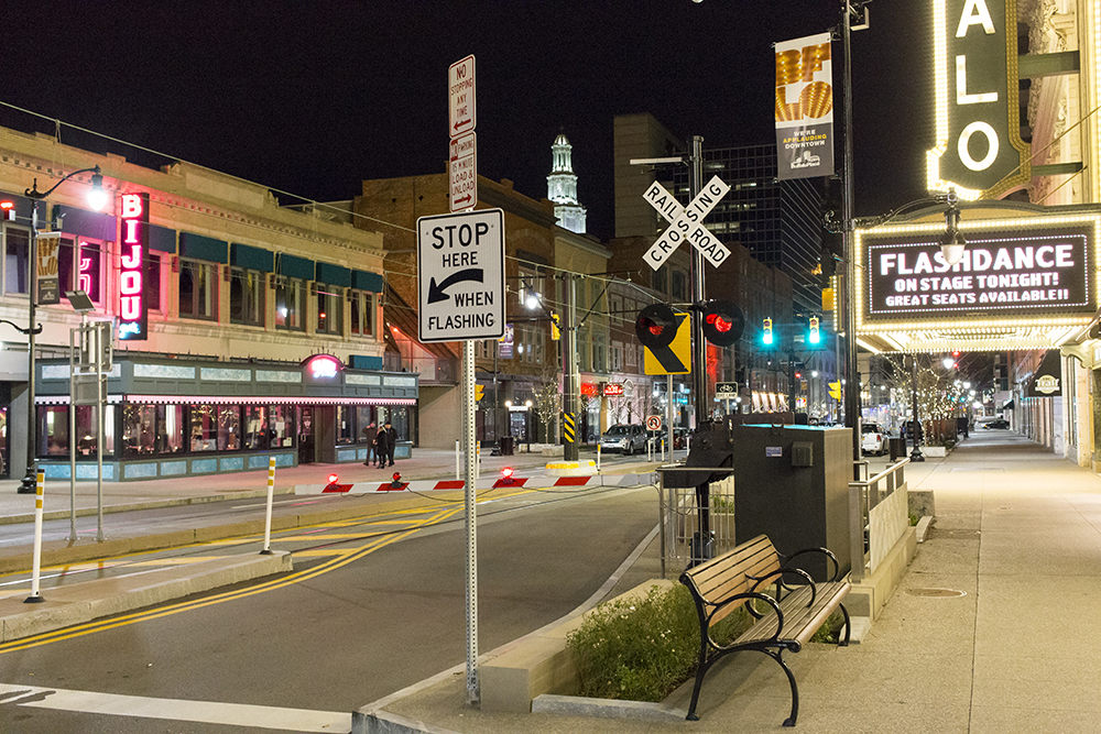
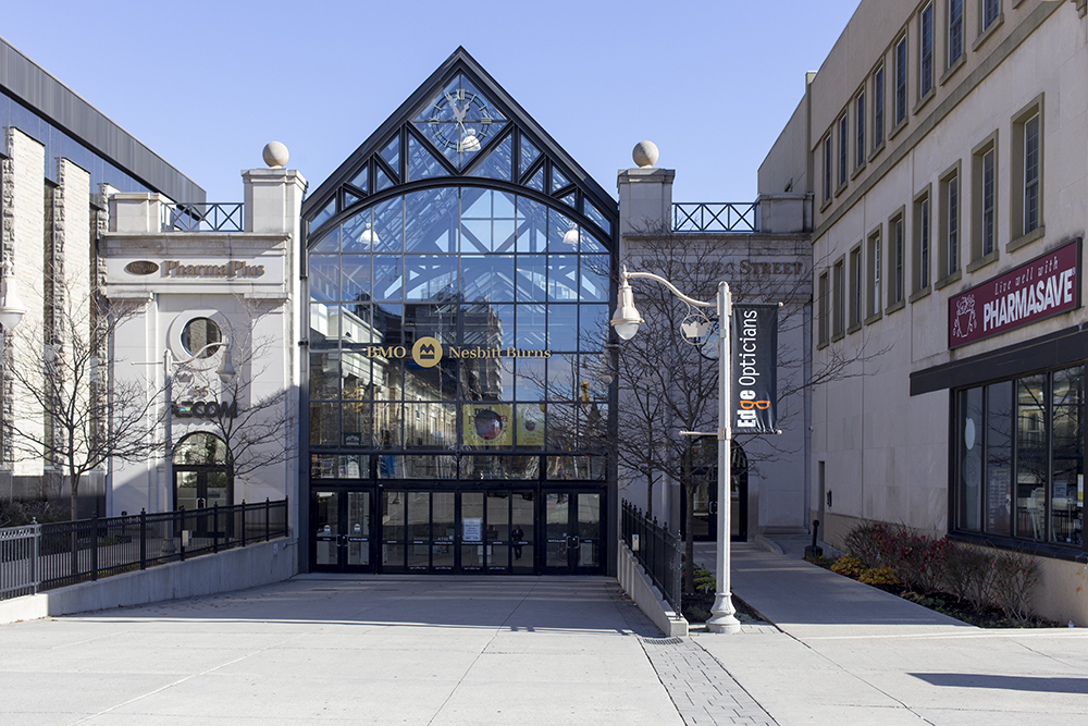
Metrolinx, the provincial agency responsible for regional transit in the Greater Toronto Hamilton Area, opened the Union Pearson Express (UP Express) last July amid much criticism based on the price of the service ($27.50 cash/$19  with Presto Card, one way) and skepticism over the ridership projections of 5000 people per day.  The train travels from Terminal One at Pearson Airport on a 6km long dedicated spur before joining up with the tracks used by the Kitchener GO train.  It stops at Weston Station and Bloor Station before arriving at its own special station on the Skywalk just west of Union Station 23 minutes later.

Unfortunately, the skepticism proved to be well founded as UP struggled to attract only about half the projected riders.  While it provides a more reliable trip time than a taxi, at the current cost it is really only attractive to the single traveller.

In order to showcase the train to a wider audience, Metrolinx decided to offer free travel over the Family Day long weekend.  It would not make sense for my family to use the train as we live in the suburbs north of the airport.  However, having become interested in public transit since being involved in the Hurontario-Main LRT debacle, I was interested in trying out UP. We have also never used the continuous loop cableway train (LINK) from the long term parking at the airport to the terminals.

IMG_3609 editsmall

I decided to have a family day out.  With Megan home from college for the weekend all six of us were able to go.

We drove to the long term parking, parked in the surface lot and walked a couple minutes to the LINK station.  Next time I would park in the multistory lot with a bridge connecting to the station.

IMG_3611 editsmall

The station was bright and clean with glass walls separating the waiting area from the track. Once the train entered the station, it lined up its doors with sliding glass doors in the glass wall and both sets of doors opened to allow boarding.

IMG_3383 editsmallIMG_3382 editsmall

When the train arrived and we entered it I was surprised to see how small each car is with a bench seat at each end and standing/luggage room in the middle.

IMG_3392 editsmall

LINK stops at Terminal 3 first, then continues on to Terminal 1 where the UP station is located. It only took a few minutes and let us out right in front of the entrance for UP.

IMG_3398 editsmallIMG_3399 editsmall

The UP station also has glass walls separating the platform from the tracks. There was no lineup to board and within a few minutes we were seated in comfortable seats with seat back trays, “in-flight” magazines and free wifi.  There was staff on the train to greet us and people cleaning the train.  Michael commented that he has never seen anyone cleaning on a GO train.  It was spotless.

IMG_20160214_105355 edit

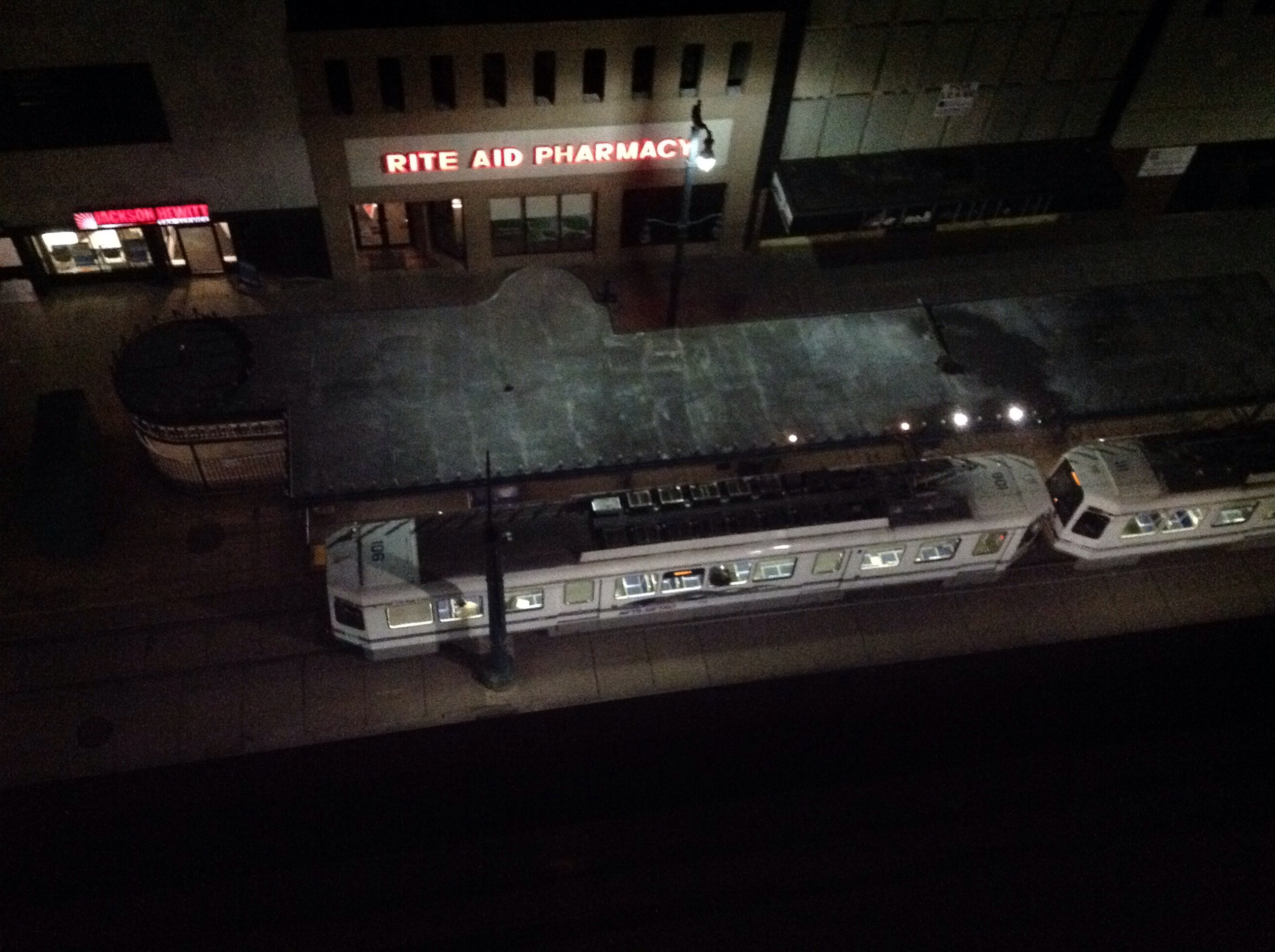
Here we are looking down on the LINK track from UP.

IMG_3402 editsmall

The train was quieter and faster than the GO train and 23 minutes later we arrived at Union Station. However, we had left home at 10:10, so the door to door trip took 70 minutes, at least 20 minutes longer than it would have taken us to drive downtown on a Sunday morning.

The station was relatively quiet when we disembarked.  There was a backdrop inviting us to take a picture and tweet with the hashtag #ImOnUP for a chance to win a prize. And guess what? I won a prize – a $50 Balzac Coffee gift box.

We planned to have lunch at Marche in Brookfield Place, but it was still early so we explored Union Station and the PATH system first.

I love this view from the bridge over York Street.

As we walked under this sign, Michael quipped, “It’s telling us to go via the subway”.

IMG_3439 editsmall

The Great Hall is being renovated.

IMG_3441 editsmall

A relatively new addition to the PATH system, a bridge over Simcoe Street.

IMG_3455 editsmall
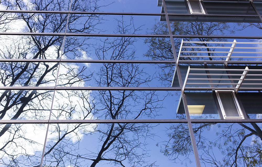
Back onto the Skywalk looking east toward the UP station.

IMG_3467 editsmallThere was one little gap where we had to go outside to get from Union Station to the Royal Bank tower entrance. I read about an outdoor area being glassed over in the future.  I’m not sure if this is the area.

IMG_3472 editsmallIMG_3514 editsmall

I love the Allan Lambert Galleria in Brookfield Place. As you climb the stairs from the underground PATH system this is what you see.

IMG_3509 editsmall

Just as we were starting to get hungry we arrived at Marche.

IMG_3484 editsmallAs usual, the food was good.  It was the first time Megan and Owen had eaten at the Marche.

We managed to get our favourite table, way in back, where it isn’t too noisy.

After lunch we retraced our steps and were shocked to find a huge line-up for UP which continued to grow for the 40 minutes we waited for a train.

IMG_3528 editsmallMichael, Megan, Alun and Trystan elected to stand in line, while Owen and I walked about. I entertained myself taking pictures, introducing myself to Anne Marie Aikins, the spokesperson for Metrolinx, and tweeting the pictures I was taking.

Metrolinx employees were ensuring that anyone travelling to the airport for a flight were boarded first.  They were able to come up the left side of the ramp in the picture above. The trains were not filled  when leaving Union so that travellers waiting at Bloor or Weston would be able to board.

After another quiet and quick journey we arrived to crowds of hundreds waiting to board at Pearson.  Thankfully we had set out early enough not to encounter delays at both ends.

If I lived in a place where it made sense to use UP, I probably would.  Given that I do not, and we have no weekend or evening GO trains from Brampton, I hope that Metrolinx will consider lowering fares and offering a family rate so I can ride UP again.

Metrolinx offered the free fares for the weekend in the hope that it would bring out many people who would try it for free and pay in the future.  They were certainly successful in getting people to try it for free.  More than 10000 people rode on each of the three free days.  Whether or not that translates into future fare-paying customers remains to be seen.

Father Tobin Road Traffic Calming Endangers Cyclists

Father Tobin Road in northeast Brampton runs 3.5 km west-east from Dixie Road to Mountainash Road.  It has houses, parks, two elementary schools, a middle school and two high schools.  Unfortunately, as a 3.5km long, straight, overly wide road, it encourages drivers to use it to avoid busier arterial roads and to exceed the speed limit. One quarter of vehicles was deemed to be “cut-through” traffic in a vehicle study of this road.

Last summer Brampton decided to do traffic calming on the 1.4km section between Bramalea and Dixie where there are three schools.  The speed limit over the 3.5km varies from 40-50kph.  East of Fernforest, near the middle school, the speed limit is 40kph, with average measured speeds at 45.5kph, which might not seem too bad at first glance, however, the 85th percentile – the speed at which 85% of vehicles travel at or below – is 55.8kph, which means that 15% of vehicles are travelling at higher than 55.8kph in a 40kph school zone.

img_3281

Newton’s laws dictate that a doubling in vehicle speed results in a stopping distance four times as long and four times as much kinetic energy absorbed during an impact. Driver response times further increase stopping distances. As a result, a small increase in roadway traffic speeds results in a disproportionately large increase in pedestrian fatalities.


Source: https://www.sciencedirect.com/science/article/pii/S0386111214000235

Pedestrians or cyclists hit at speeds above 40kph are dramatically more likely to sustain severe injuries or die. Clearly, given this street has only homes and schools on it, the traffic situation was dangerous.

Brampton is embarking on traffic calming on Fernforest Drive this year, so I cycled along Father Tobin Road and Fernforest Drive this afternoon to see what was done last year so I can provide feedback at the Public Information Centre (PIC) for the Fernforest Drive traffic calming next week.
Options presented at the PIC for traffic calming on Father Tobin Road included a parking lane on one side or bicycle lanes on both sides.  Neither option was actually constructed.  The image below shows the evaluation criteria which includes lowering the 85th percentile to 45kph, which means that 15% of vehicles would still be travelling above 45kph.
img_3282
I began my ride at the east end where Father Tobin Road begins at Mountainash Road.  This is Shaw Public Elementary School and the road is far too wide along the entire length of Father Tobin Road, so I am curious why the traffic calming applied only to the western 1.4km.
IMG_20160108_141500 editsmall
This is an intimidating expanse of asphalt to cross at Torbram Road.
IMG_20160108_141730 editsmall
It is quite unusual to see a bridge built so wide in Brampton.  There is plenty of room for bike lanes here.
IMG_20160108_141842 editsmall
Another huge intersection at Sunny Meadow Boulevard.
IMG_20160108_142049 editsmall
Here is where the traffic calming begins, on the west side of Bramalea, in front of a high school.  Urban shoulders, on alternating sides, and some medians, using a brick surface in places, is what was actually implemented.  Parking is allowed on urban shoulders.  Cyclists may ride on the shoulder, but need to come out into the motor vehicle traffic to get around parked cars.  And in this implementation, with the urban shoulder alternating from side to side, the cyclist needs to regularly merge with traffic when the shoulder disappears.
IMG_20160108_142408 editsmall
Here the lane disappears
IMG_20160108_142539 editsmall
Here’s another section on the north side where the shoulder has appeared again.
IMG_20160108_142743 editsmall
This is a terrible implementation for cyclists.  The likelihood of a crash between a car and a cyclist has likely increased due to the increased numbers of merges.  Most cyclists in Brampton are inexperienced at riding confidently on the road and will likely ride on the shoulder until it just runs out rather than merging into the travel lane before the shoulder narrows.  This increased risk might be somewhat offset by the fact that cars should be travelling at a lower speed.
Next I headed to the north end of Fernforest Drive which runs from Countryside Drive in the north to Bovaird Drive at the south end.  However, the road continues south of Bovaird with a name change to MacKay Street and will continue north of Countryside with a name change to Russell Creek Drive.  Ferforest has no road markings except at intersections where sometimes there are right and left turn lanes.  MacKay Street has four lanes painted from Bovaird to Williams Parkway, where it ends at a middle school.
The traffic calming for Fernforest is for Bovaird to Sandalwood Parkway only.  There are only homes and schools on Fernforest, right up to Countryside, and on MacKay, so I would like to know why the traffic calming is limited to such a small section, just as it was on Father Tobin.
This is the north end of Fernforest.  There is a multiuse path on the boulevard on Countryside on the south side to which bike lanes on Fernforest could connect.
IMG_20160108_144028 editsmall
This is a section that is not going to be traffic calmed.  It is crazy wide.

IMG_20160108_145402 editsmall

As I passed this school the traffic was heavy with people picking up children in cars.  No children, up to and including a Grade 6 student, would be expected to walk more than 2km.  It was a windless, sunny, dry, not too cold, winter day.  No reason not to walk.  This behavior drives me crazy.IMG_20160108_145546 editsmall

Finally, here is MacKay, south of Bovaird.  A residential street, far too wide for local traffic, but not part of the upcoming traffic calming.
IMG_20160108_150353 editsmall
To summarize:
1.  I would like to know why these traffic calming projects are being carried out on only a portion of these streets
2.  The alternating-side urban shoulder potentially makes the traffic calmed street more dangerous for cyclists than the original design.
3.  I hope a better implementation will be constructed on Fernforest, for the entire length, and include MacKay Street.

Buffalo and Frank Lloyd Wright

Breakfast was included in our stay at the Hilton Garden Inn in a nice space on the second floor overlooking the LRT and Lafayette Square.  I wrote about our first day in Buffalo, here.

After breakfast we packed up and asked for the car to be retrieved.  While waiting I had a look down Main Street where we walked the previous evening.

IMG_2826 editsmallIMG_2825 editsmall

In the light of day, the area didn’t feel quite as welcoming, possibly due to the fact that it was almost completely deserted.

I took a few other pictures as we waited. It was a beautiful sunny, but cool, November morning.

There is a civil war monument in Lafayette Square and when you stand with your back to the monument you look straight down Court Street to City Hall.

The car arrived and I entered Rotary into the GPS, the address where the Fontana Boathouse  is situated.  As we headed off, I said to Alun that it felt like we were going in the wrong direction, but as I had never been to Buffalo before, and did not have a paper map on which I could get an overview of the route, we followed the directions.

We saw the Electric Tower, once the tallest building in Buffalo, as we drove in the previous evening, and walked by the M&T Bank building with the gold dome which faces the LRT.

IMG_2834 editsmall

IMG_2835 editsmall

We ended up at the University of Buffalo on Rotary Road, not on Rotary Row (which wasn’t in the GPS, but was the correct street name) which was, as I had felt, in the opposite direction of where we wanted to be.  I had to stop at a McDonalds to use the wifi to find Rotary Row.  I don’t mind getting lost as it affords an opportunity to see things I might not have otherwise seen like these beautiful windows and reflections on the campus.

Once we left the area of the hotel, we did see the more rundown, abandoned side of Buffalo.  We saw very few chain stores and restaurants (although there was a Timmies kitty-corner to the hotel) and later discovered Buffalo doesn’t even have a Walmart, which must be a fairly uncommon situation for a city of a quarter million people.

Eventually we found the Fontana Boathouse.  It was originally designed by Frank Lloyd Wright in 1905 for the University of Wisconsin, but was never built until its construction in 2007, in Buffalo, along the shore of the Black Rock Channel.  Unfortunately, it was locked up on a November Sunday morning so we were only able to view it from the outside where it was already showing some signs of neglect.

Next we headed to the Darwin Martin Complex and the reason for our visit.  I booked a two hour tour starting at noon.  The house is considered by leading Frank Lloyd Wright scholars as one of Wright’s finest achievements of the Prairie period and, indeed, of his entire career. The complex consists of the Barton House, built for Martin’s sister, The Main House, pergola, conservatory, stables and carriage house and gardener’s cottage.

IMG_2869 editsmall

Darwin Martin had a difficult childhood, with the death of his mother when he was six, and left home at age twelve and managed to obtain a job selling soap in New York City.  He moved to Buffalo a year later and was hired by the Larkin Company as an office clerk and eventually rose to become Corporate Secretary. In 1902 he needed to find an architect to build a new administrative building for Larkin.  His brother, living in Chicago at the time, recommended Frank Lloyd Wright, an architect he used on his own home, the William E. Martin house in Oak Park.

Martin had become quite wealthy by this time so in addition to hiring Wright to build the Larkin building (which no longer stands) he also asked Wright to design and build a home for him.  Wright found an acre lot in a Victorian neighbourhood.  Martin commissioned him to build a home for his sister, Delta Barton, on one corner of the property to audition the architect.  It is clearly a Frank Lloyd Wright home, but the details pale in comparison to the main, 15000 square foot home that Martin commissioned.  The Barton House was completed in 1903 on schedule and Martin was impressed enough to hire Wright despite the fact that it came in three times over budget.

IMG_2845 editsmall

Unfortunately pictures are not allowed inside.  We started in the Eleanor and Wilson Greatbatch Pavilion (Visitor’s Centre) designed by Toshiko Mori (former Chair of Architecture, Harvard),  and built in 2009.  It is a glass pavillion designed to be unobtrusive on the property and offer great views of the house and grounds.  It in inspired from design elements from Wright’s work. We were shown a slideshow about Darwin Martin.

IMG_2862 editsmallIMG_2864 editsmall

Next we moved on to the gardener’s cottage, built in 1909, which had even fewer details than the Barton House, and is a stucco finish on a wood frame, but is a home I could happily retire to. It has an addition on the back which had beautiful Wright-inspired doors.

IMG_2859 editsmallIMG_2860 editsmall

Finally, we came to Martin’s home.  The size and the details were overwhelming.  It was amazing to see in person the genius which I had only seen in books or on the internet in the past.  Martin designed every aspect, from floor plan, to window design to furniture design and layout. In order to have perfectly level eaves-troughs, Wright designed an eaves-trough in an eaves-trough with the inner one sloped to drain properly.  The mortar between the bricks was indented an inch parallel to the long side of the brick, but flush on the short side to accentuate the long low feel of the house and its connection to the earth.  The house used curtain wall construction, with the structural support coming from huge brick piers which were used to disguise duct work, separated large rooms into functional areas and contained built in shelving.  This allowed for “ribbons” of windows which were unusual at the time.  This is one of the best documented of Wright’s homes as the architect and client communicated by letter on all the details, often daily.  Wright also had a professional photographer capture the home when it was finished.  Wright’s famous “Tree of Life” window design is used extensively throughout the house.  Each window has 300-400 pieces of glass and was handmade.

The family moved into the house in 1907.  In 1926, Martin hired Wright to build a summer home, Graycliff, south of Buffalo.  We didn’t have enough time to visit Graycliff this weekend, but we will definitely return.

Martin was financially devastated by the depression and died of a brain hemorrhage in 1935.  His wife, Isabelle, was unable to sell the house and abandoned it in 1937.   Then began the “Period of Abandonment” which lasted 17 years.

Architect Sebastian J. Tauriello purchased the Martin House in 1954 (it had reverted to the city for back taxes in 1946).  The pergola, conservatory and carriage house were demolished and an apartment building was built.  The money this earned was used to rescue the main house.  In 1967, it was purchased by the State University of New York at Buffalo, for use as its president’s residence.

In 1992, the Martin House Restoration Corporation (MHRC) was established.  $42M US has been spent restoring the house to its 1907 “Year of Significance”, rebuilding the pergola, conservatory and carriage house, acquiring the Barton house and gardener’s cottage and building the visitors’ centre.  Only about half of the complex’s almost 400 windows survived the “Period of Abandonment”.  Each restored window costs $27K US.

Restoration is about 85% complete.  Next spring the MHRC will embark on a project to restore the grounds to Wright’s design which included one million plants.

We will definitely be returning to see the house completed, to see the gardens and to visit Graycliff.


November 21, 2015 – Buffalo and The LRT

I have long admired Frank Lloyd Wright and am familiar with his work from books.  Alun, my sixteen year old, is interested in architecture, so I suggested to him that we visit The Martin House in Buffalo.

We left just after lunch and had an uneventful drive, with less than ten minutes spent at the border crossing into the U.S.

Our first stop was The Fashion Outlets of Niagara Falls in Niagara Falls, New York.  We were there with Megan back in September when I took the two of them for their first cross border shopping trip.  I don’t really enjoy shopping, but I thought it would be a fun excuse to get away before Megan moved to London for college.

IMG_1731 editsmall

Alun found a couple cardigans to add to the two he purchased the last time we were there.

We then drove the rest of the way to Buffalo, where I had booked a room at the Hilton Garden Inn, as recommended by The Martin House website.  It was a nice hotel, right downtown, and by booking through The Martin House link we got a reduced rate.

It was after dark when we arrived, unloaded, arranged for the valet to park the van in a nearby garage and checked in.  We went up to our room on the ninth floor to find unmade beds.  I called the front desk and they arrived in short order with a new key for a made-up room down the hall.

We carried in our luggage and I flung open the curtain and looked out to discover an LRT in a transit plaza adjacent to the hotel.  “Oh my God, Buffalo has an LRT!”, I shouted.  “We must ride it!”.


Perhaps a little background is needed to explain my excitement.  In 2010, Brampton started running light Bus Rapid Transit on Main Street.  The Transportation Master Plan called for it to be converted to Light Rail Transit when ridership and funding warranted. In the intervening years, the Hurontario-Main LRT (HMLRT) was extensively planned, had public consultation and ample opportunity for City Council to have input on the route.

Having completed the planning phase, Metrolinx, a provincial agency responsible for The Big Move, building transportation infrastructure for the Great Toronto Hamilton Area, looked to Mississauga and Brampton Councils to approve the plan so they could move forward with contracting and construction (2018-2021) of the HMLRT.  Mississauga Council approved the plan, but Brampton Council rejected it 10-1 in September of 2014 due to concerns they had failed to address through all the years of planning.

In October, a new Council was elected with a new mayor, six new councillors and four returning councillors.  In April of this year, the Provincial budget provided full capital funding of $1.6B for HMLRT.  With a substantially new council and full funding rather than the usual split of one third funding provided by each level of government this was a game changer.  The Mayor indicated she supported the route as planned and that the decision would be brought back to Council.  It soon became clear that the old divisions still existed and that it would be a tough job to get Council approval.

I wrote a letter to the Brampton Guardian urging acceptance of the plan.  I made a deliberate decision in 2013 to get involved in cycling advocacy and started communicating with staff and my councillor and I joined the advocacy group BikeBrampton. I have also been appointed to the Brampton Cycling Advisory Committee of Council.  I wrote the letter regarding the LRT because it just made sense to me , but I didn’t expect to get involved in transit advocacy.  Shortly thereafter I was contacted by Fight Gridlock, an advocacy group that had been encouraging acceptance of HMLRT for over a year, and asked to send my letter to my councillor and to delegate the Planning & Infrastructure Committee when they debated whether or not to approve the HMLRT.

Thereafter followed an extensive correspondence with my councillor, who was against the LRT, and preparation to delegate.  You can see my delegation starting at 2:37:07.  There was one delegate against and seven for the LRT.  At the meeting of the previous council the opposite was the case: with Fight Gridlock for and seven others against.The committee decided to defer making a decision to a Special Council meeting held on the evening on July 8, so I spent the next three weeks working with other advocates and preparing to delegate again.
On July 8 the council chamber overflowed and additional seating was provided in the atrium. There were about 80 delegates with three quarters of them for the HMLRT.  You can see my presentation at 1:01:03. The meeting went until almost 2am and ended with a motion to defer for six weeks to allow for a facilitator to be hired to help Council reach a concerns us.  It was very disappointing. Councillors were entrenched in their opinions and seemed impervious to evidence.

Six weeks turned to twelve and my time continued to be taken up with the fight.  We advocated our councillors and fellow citizens through the media, email, videos, Facebook and Twitter.  The Minister of Transportation and head of Metrolinx held a townhall, a facilitator was hired at great expense and accomplished nothing.

On October 27 another Special Council meeting was held, this time at The Rose Theatre to accommodate the expected crush of delegates and observers.  No issue had ever captivated the population of Brampton the way this one did. There were about 60 delegates, again with three quarters in favour, that included the CEO of Coca Cola, the president of the Board of Trade, an MP and many others, all urging Council to vote in favour of the plan.  You can see my delegation  at 37:10.

It was all to no avail. At the end, in the wee hours of the morning, Council voted 6-5 to reject the plan. Through all this I had never seen or travelled on an LRT. I was also unaware that there was one in Buffalo, thus my excitement.

We ate at the Pan-American Grill & Brewery in The Hotel Lafayette.


Then we took a ride on the LRT.  About a third of the length is above ground with the remainder underground.  Unfortunately, most of the above ground stations were closed for the weekend.  The above ground section is a free fare zone, so we rode between two open stations and got off just before the tunnel.  It was the above ground section that interested me most, anyway.  Then we walked back. It was quite interesting because in a very short distance we were able to see three different street treatments.  The first section was a transit plaza with wide sidewalks, cycling and LRT with no private vehicles.

IMG_2715 editsmall

This section also had colourfully lit stations.

IMG_2716 editsmallIMG_2756 editsmall

A second section had narrower sidewalks, on street parking and shared right of way with a narrow painted Bike lanes.

IMG_2750 editsmallIMG_2746 editsmall

And finally, a quite ugly, tunnel entrance and then just a regular wide urban street with painted bike lanes and on-street parking on both sides.

IMG_2728 editsmallIMG_2733 editsmall

The first section was definitely the most inviting for pedestrians and the part of the street where I would be most likely to linger to shop or stop for a coffee or meal.

Although there seemed to be a fairly high vacancy rate, just like in Brampton’s downtown, the buildings were all in good repair (unlike Brampton) and changeable coloured lights were used on the buildings for the length of the street to give the area a unified inviting feel.

IMG_2726 editsmallIMG_2744 editsmall

As we ventured away from the LRT we encountered many beautiful old buildings, but fewer pedestrians.  Buffalo has a massive old City Hall and county buildings and courthouses all clustered around a roundabout with a monument to President Mc Kinley , who was assassinated in Buffalo, in the centre.


The City Court was built in the Brutalist architectural style and stood in stark contrast to City Hall and a newer glass courthouse.

I was surprised at the the size of the downtown and its buildings.  I recall, when I was a child, watching after-school shows on channels from Buffalo, which were often interrupted by breathless reports from Irv Weinstein about fires raging in Buffalo and Tonawanda. That and reports of tremendous snowfalls was about all I knew of Buffalo.

To our amusement we discovered they have fire alarms on the street corners downtown.

IMG_2719 editsmall

Upon returning to the hotel I learned that Buffalo had once been considered one of America’s leading cities and owed its prosperity to shipping.  However, upon the opening of the St. Lawrence Seaway, its fortunes declined and from the 1960s to the present it lost half of its population.  The population decline was well on its way by the time the LRT was built and continued thereafter.   It is also odd in that it runs on the surface downtown and in a tunnel in the suburbs. The tunnelling caused significant construction cost and time overruns.  Having said all that it still carries over 6M riders annually on its 10km run.

IMG_2808 editsmall

In the GTA there are constant complaints of congestion, but it is somewhat disconcerting walking around a city built for over half a million people that now contains only half of that. We kept joking that it felt like the zombie apocalypse had happened.

In my next post I will write about our second day, driving around Buffalo in the daylight and visiting the Darwin Martin complex.

November 8, 2015 – University of Guelph and the My Kitty Cafe

Owen discovered the existence of Cat Cafes a couple years ago while browsing on the internet.  He asked me if I would take him to one, however, at the time, the only ones I could find were in Montreal and New York city.  I told him we would go to one when there was one closer to home.  Since then there were one or two crowdfunding campaigns to open one in Toronto, but they were unsuccessful.

Last month, in my Facebook newsfeed, an article about a new cafe opening in Guelph popped up.  Guelph is just an hour away by car so we planned an outing for a couple weeks after the grand opening.  The cafe is called My Kitty Cafe and is located in the back of a variety and pet supply store on Wyndham Street North.  Just this weekend TOT, The Cat Cafe, opened in Toronto.  Owen and I will be heading out for another cat inspired adventure soon.

It was a beautiful autumn day so I planned a walk around the University of Guelph campus before heading to the cafe so we could get some fresh air and exercise.  Earlier this year I cycled in the Tour de Guelph, which started at the University, however, I didn’t really get a sense of how large it is until this visit.  I had also visited the Arboretum five years ago to enjoy the fall colours.  It is a huge campus with over 22K students.  It was Fall Preview Day for high school students so the campus was busy for a Saturday.

IMG_2652 editsmall

Guelph seems to be further along in encouraging cycling than Brampton is and the campus was a mecca for cyclists with wide walkways and sparsely travelled roads.  The bike racks and repairs stations were terrific.

IMG_2630 editsmall IMG_2633 editsmall

The university has a nice mix of old and new buildings.

IMG_2629 editsmall IMG_2632 editsmall IMG_2641 editsmall IMG_2644 editsmall

Most of the trees were bare, but there was still some nice colour around the conservatory.

IMG_2648 editsmall IMG_2647 editsmall

The campus is quite large.  We set out in one direction from the car, walked almost an hour out and back, and did not reach the far edge of the campus, past the barns and fields where the Veterinary Science classes are held.

After our campus tour we drove about five to ten minutes to downtown.  Guelph, with a population of 120K, has an extensive and thriving downtown, especially compared to Brampton’s downtown even though Brampton has a population of 560K.  The potential for flooding by the Etobicoke Creek has stunted downtown Brampton’s growth. Guelph has a much more significant river, The Speed River running through it, but apparently dams were built upriver that have helped to eliminate flooding.  They have a lot of nice parkland along the river and have located their stadium, the Sleeman Centre, right downtown.

IMG_1025 editsmall IMG_2686 editsmall

Here is a view looking toward the Church of our Lady Immaculate at the end of Macdonnel Street.

IMG_2653 editsmall

And here is a nice looking indoor mall on Wyndham Street North near the cafe.

IMG_2655 editsmall

Here is Owen arriving at the My Kitty Cafe.

IMG_2657 editsmall

The cafe is in the back of a variety and pet supply store.  You can order food and drink at the front and when it is ready you can eat it in the back with the cats.

IMG_2659 editsmall

Ready to go meet the cats.

IMG_2661 editsmall

There were four cats living in the cafe when we visited, although we only saw three. They were very friendly.

IMG_2668 editsmall

One might have been hiding out in the private area for the cats at the back.

IMG_2673 editsmall

Apparently 26 cats have been adopted through the cafe in the few weeks it has been open.  Two of the cats we saw were kittens and looked like siblings.

IMG_2669 editsmall IMG_2671 editsmall

There was a lot of upholstered furniture and a small bar at the back where one could eat if you preferred.  When I started eating while sitting in one of the upholstered chairs, one of the kittens was up on my lap in a flash trying to help herself.  There were lots of toys, tunnels, climbers and cat books available.  I had a chicken wrap and a coffee, Owen had packaged sushi and a hot chocolate.  We had a cookie and a cat themed cupcake for dessert. The food was reasonably priced, with a small selection.  However, it wasn’t a problem, because it was the cats that were the main attraction.

IMG_2677 editsmall

Owen saying goodbye to one of the cats.

IMG_2679 editsmall

I noticed that there is an art gallery nearby and I would have like to have explored downtown Guelph more, however, we had to get home to pick up Alun from a DECA competition so our stay was short.

We will definitely be heading back on another day.

Bike To School Week – May 26-29, 2015

I worked with Walk+Roll Peel and the principal at my children’s school in northeast Brampton to encourage participation in Bike Week.  The school has an enrollment of 760 students.  Bike Week was promoted to families in the school newsletter, advertised on the notice board outside the school on the Friday before Bike Week began and added to the morning announcements at the school.
IMG_0283 editsmall
Historically, 10-15 children have cycled to school in the spring with the most bikes I had ever counted in the bike racks being 27 on one particularly beautiful spring morning.

We began on Tuesday because I was busy on Monday at Bike to Work day leading a group downtown from northeast Brampton.

IMG_0285 editsmall
I had 60 bells from Walk+Roll Peel and screwdrivers.  I decided to actually install the bells on the bikes because often giveaways like these end up on dusty shelves in garages.  It also gave me a way to determine repeat versus new riders as we progressed through the week.   I thought 60 bells would be sufficient as that was more than double the most bikes I had ever seen at the school.  I was overwhelmed when 45 children arrived on bikes and had to enlist the help of a couple Grade 8 students to get all the bells installed.

IMG_0284 editsmall
I tweeted congratulations and pictures to the school and challenged them to do better on Wednesday.  I also acquired additional bells.  Each day I followed the same pattern and the children were amazing.  Each day more children rode their bikes to school.  By Friday, the racks were overflowing as there is comfortably room for about 55 bikes.

Tuesday 45 cyclists
Wednesday 53
Thursday 65
Friday 77

IMG_1378 editsmall IMG_0341 edit blog
Total individual cyclists over the week was 121 from a school population of 760.  It was much more successful than my most optimistic projections.

IMG_0345 banner blog
I continued to check the bike racks every few days and amazingly, the little bit of encouragement made a lasting change. Daily thereafter, until the end of the school year, there were 50-60 children riding.

When school started again this fall 30 -40 students rode their bikes each day without any additional encouragement as was provided during Bike to School week.  The number has slowly dwindled as the weather has become cooler, wetter and windier.  By this point in prior years there would have been no cyclists at all.  However, as of this morning, November 16, twelve students are still riding.
IMG_2687 editsmall
Imagine the change we can make if this type of effort is made at every school every year.

Tour De Mississauga 2015 (#tourdemississauga)

Today I rode in the Tour de Mississauga for the third year in a row.  Two years ago I rode the 60km route with Patti.  Last year I rode 100km for the first time, but Patti was jet-lagged from a recent trip to the UK so I made friends along the way.  This year Patti and I rode the 120km route.

I set three cycling goals for myself for 2015.  Today I achieved one of them by completing the 120km route.

I awoke at 5:20 so I could get ready and have breakfast before leaving home at 6:15.  It was still dark when I left the house with the sun rising as we assembled for our 7am start time.


IMG_1742 editsmallThere were probably about 200 cyclists riding the 120km route.

IMG_1746 editsmall

We received safety instructions and were off about 7:10.  One poor fellow ran into the rope holding down the inflatable starting arch as we set off.  Fortunately, he was startled, but unhurt.

Here we are waiting for the light at Rathburn Road and Duke of York Boulevard.

IMG_1748 editsmall IMG_1749 editsmall

My legs felt strong, but I was concerned about my neck and shoulders as these are the body parts that have given me pain as my rides have gotten longer this summer.

This year all the routes rode the new Mississauga Transitway.

IMG_1751 editsmall IMG_1753 editsmall

We got a great view of the beautiful blue sky and the Marilyn buildings as we approached Central Parkway from Bloor.

IMG_1754 editsmall

I brought some cut up oranges which we stopped to share after 30km on the Queensway.  Mississauga has built some new cyclist crossrides on the Queensway in anticipation of the recently passed legislation allowing cyclists to ride through intersections adjacent to the pedestrian crossing.

IMG_1757 editsmall

This path was at least 4m wide.  I think it is eventually planned to run the full width of Mississauga from Oakville to Toronto.

We stopped at the Tim Horton’s in Port Credit for chocolate milk and smile cookies after 45km.

IMG_1758 editsmall

There was a rest stop at 70km where I had some sesame crackers and we refilled our water bottles.  I laid down and stretched and rested my neck and shoulders.  A month ago I quit the MEC Burlington Century Ride at 77km due to neck and shoulder pain.  Since then I have had four massages and have been doing a lot of stretching and some strengthening.  While I still have a way to go, I was feeling better today.  My legs did not feel tired at all at this point.  If I can just get the neck and shoulders sorted out, I should be able to go even further in a day next year.

We stopped at Starbuck’s for a frappuccino at 93km.  At the end of Second Line, after descending from the bridge over the 401 we encountered this huge stop sign.  I wonder if a car ended up on the front lawn across the street some time in the past.

IMG_1765 editsmall

Just after 3pm we crossed the finish line.

IMG_1766 editsmall

We weren’t even the last of the 120km riders to finish, having left behind a couple of groups of young men less than half our age.  We did miss the BBQ, as we did on the Tour de Cambridge, Tour de Guelph and MEC Burlington Century rides earlier this year.  Perhaps we need to work on speed next year.  We didn’t really mind, though, as it gave us an excuse to go to Panera Bread for lunch – one of my favourite restaurants.

IMG_2752 editsmall

Ride statistics:

  • Length:  123.37 km
  • Ascents: 587 m
  • Riding Time: 6:13:14
  • Elapsed Time: 8:16:52
  • Average Speed: 19.8 kph
  • Top Speed: 37.8 kph

Sunday July 5 – Tour de Guelph

The day of the Tour de Guelph dawned cool, dry and sunny with heat forecast for later in the day.  This was to be the longest ride of my life at 111km.  It was advertised as a 100km long ride on the website where I signed up for the ride.  After registering and paying I looked more closely at the route and learned that it was actually 111km.  Patti was riding with me and her longest ride ever was back in 2008 when we rode the rail trail from Cataract to Elora and back for a total of 92km.  We were on hybrid bikes.  It took us all day and we were miserable for the final 20 km.93.06 kilometres

More recently, Patti rode about 75km on the day of Bike the Creek since she biked the creek to the creek, biked the creek and then biked the creek back home.

We studied the route and determined that we could take a shortcut near the end and cut off 20 km if we needed to do so.

I left home at 6:15am, picked up Patti in Mississauga and we were in Guelph by about 7:30.  As we got out of the car I spotted Kamil, with whom I rode Ride Don’t Hide a couple weeks earlier.  It was his birthday so he was riding the 50km to allow time to celebrate later in the day.  We didn’t run into him again.

There always seems to be a lot of waiting around at the start of these rides.  They encourage people to arrive an hour before the start times, which are staggered with the cyclists riding the longer distances going out first.  Our ride was scheduled to begin at 8am.  However, our experience has been that the speeches usually begin at the published start time and the registration lines are not usually too long so we aim to arrive in time to unload, register, go to the bathroom and head out.

IMG_1547 editsmall

This was the second annual Tour de Guelph and participants were fundraising for the local hospital.  398 people pre-registered and raised about $40K.

The ride started at the University of Guelph.  I had no idea what a large campus it is.  Once we got off the campus and out of the Guelph we headed down a lovely leafy road that led us to Eden Mills, which has a goal of being the first carbon neutral village in North America.  Every house we saw had solar panels.  It looked like a beautiful place to live.

IMG_1549 editsmall IMG_1550 editsmall

At the first rest stop, the volunteers were dressed like medical personal and had water, bananas oranges and granola bars to refresh us.

IMG_1553 editsmall

I am always torn when I am on these types of rides between maintaining my speed and stopping to take pictures.  I couldn’t resist stopping for this.  It appeared to be unoccupied and shared a property with a more conventional home.

IMG_1554 editsmall

As we neared the second rest stop I started feeling had been in the area before.  I saw a cemetery that look familiar.  Then I saw a covered bridge and realized I was in West Montrose.  Here are a couple pictures from the first time I was there back in 2007.  Cemetery Kissing Bridge

And here is one in the winter 2008, taken on my birthday.  A Time For ReflectionMy friend Gail picked me up and we went out for the day looking for photo opportunities.  It was a beautiful crisp winter day with fresh snowfall from the day before.  You can follow this link to see the pictures from that day.  We had a great lunch that day at the Elora Mill.

The bridge was built is 1881 and is the last of this type of bridge still standing in Ontario.

IMG_1557 editsmall

At the second stop we learned we were the last of the 100km riders and they packed up as we had our snack.  While we are able to ride 100km, we are not able to ride it as fast as many of the other riders.  It’s a bit disconcerting to have everyone packing up around you as you reach each rest stop.  The same thing happened to me on the Ride Don’t Hide and the Tour de Grand.  Here we are at the second rest stop – still smiling.

IMG_1559 editsmall

The worst hill of the day was just before we returned to the first rest stop and I gave in and pushed my bike up the top part of the hill.  Even though we had just decended a hill, I did not have enough momentum or energy to make it to the top.  From the top of the previous hill  we could see down and up to the sign indicating a t-junction.  That morning, someone had driven their car right through the junction into a field of corn, driven back towards the road, gotten trapped in the ditch and gone to sleep.  The police, who had been present because of the Tour de Guelph, apparently didn’t realize anything was amiss for hours and were in attendance when we came by.  Consensus was drunk driver.

We arrived back at the start at 2:30 to find we had missed the BBQ and everyone had packed up and gone home.  It was getting pretty hot and we were exhausted.  It was somewhat anticlimactic to arrive back to an empty campus.  We loaded up our bikes, did some stretching and headed to Panera Bread for lunch and Marble Slab for some well deserved ice cream.  I was annoyed to find there was a bug in the MapMyRide app and our elevation gain for the day showed as zero.  It had been a hillier ride than we had expected and I had wanted to verify that.    As I check back today for the ride stats I see the elevation data is now available.

Our average speed was much higher than when we did the Tour de Grand, (19.6 kpm) despite it being a much longer ride.  I encouraged Patti to draft behind me and it really seemed to help keep our speed up.

  • Length:  111.73 km
  • Ascents: 724 m
  • Riding Time: 5:10:18
  • Elapsed Time: 6:26:51
  • Average Speed: 21.6 kph
  • Top Speed: 55.2 kph

Sunday June 21 – Ride Don’t Hide

On March 8, I volunteered to help out at the BikeBrampton booth at the Toronto Bike Show which allowed me to get into the show for free.  Patti came with me.  We had a look around for a while and then gave David and Dayle a break and looked after the booth.  We had a couple of interesting visitors.

Nisha, from the Canadian Mental Health Association, came by to tell us about a ride the CMHA was organizing called Ride Don’t Hide on June 21st in Caledon to raise money for local mental health programs and initiatives.

From a CMHA media release, “The Ride Don’t Hide movement began in 2010 with Michael Schratter, a Vancouver school teacher living with bipolar disorder, who spent almost a year and a half cycling 40,000 km around the globe.  Armed with only his bike, a knapsack and the determination to realize his dream of raising awareness and empowering those who experience mental illness, his story inspired millions of people and raised $100,000 for CMHA.”

The second interesting visitor was Michael Merrall, the founder of Epic Tour Halton, the first Gran Fondo in the Toronto area.  Michael has also started the BikeChallenge, a community bike challenge to encourage cycling, community and fundraising.  It is in its third year in Halton Hills and Michael hopes to spread it across the country to 150 communities in 2017 for Canada’s 150th Birthday.  I hope that BikeBrampton or Brampton’s new Cycling Advisory Committee can bring it to Brampton next year.

Saturday June 20 was the second annual Bike The Creek.  I was unable to ride this year, even though I helped with a couple of the planning rides last fall.  On Saturday my father was married.IMG_0449 edit blog

Bike the Creek was a great success with double the cyclists participating compared to 2014.  Patti rode without me.  She biked the creek to the start of the ride, from which she biked the creek , after which she biked the creek to get home for a total of 75km.  Patti and I have been riding together since middle school, but until recently Patti didn’t do much riding on her own.  She used to think I was crazy for jumping on my bike and heading off on my own for the day.  However, I know that Patti, like me, has caught the cycling bug, because she is doing the same thing now.

To minimize my disappointment with missing Bike the Creek, I decided to cycle in Ride Don’t Hide.  Patti didn’t feel up to two long rides in two days so I went on my own.    Right up until 6am Sunday morning I was unsure whether or not I would go.  The weather forecast was for all-day rain, and even though I rode in the rain for 50km a week earlier on the Tour de Grand I didn’t really want to set out in the rain on my own.

I set the alarm for 6am and when I looked out the window it was dry and the forecast had changed to overcast, but no rain,  so I headed up to Inglewood.  I arrived just after 7am and registered.  It was $45 and included a nice technical t-shirt.  They had me fill out a waiver and sent me off to pick up my t-shirt.  It wasn’t until about half an hour later I realized they hadn’t asked me to pay and headed back to the registration table where they told me they had been looking for me.  Good thing I’m honest.

The day was misty, but brightening as I waited for the 8am start time for the 100km ride.  I had cycled 100km only once before – last fall in the Tour de Mississauga.  I decided to try, but knew I could cut it short if need be.  Pastries, coffee, water and bananas were provided at the beginning of the ride.

IMG_1492 editsmall

We finally lined up to set off just after 8:30.  Here are the riders in front of me.

IMG_1496 editsmall

And the riders behind me.  However, they didn’t stay behind me for long.  There is a very steep hill just south of Old Base Line Road on McLaughlin which quickly separated out the stronger and weaker riders.  I was one of the latter.

IMG_1498 editsmall

I chatted with a couple people as we rode south on McLaughlin, often sensing someone very close behind.  It was windy and I tried to stay behind a couple for a while to draft but lost them after we turned west on King Street, however, there was still someone close behind me.  I dropped back and we chatted for a bit.  His name was Kamil, a recent accounting grad from Wilfred Laurier University.  He had registered for the 50km route, but since he was ready early and the 100km route left late, he left at the same time.  We decided to ride together, sometimes side by side, often with me in front.  I must admit it stroked my ego to have someone half my age drafting behind me.  He was a little stronger on the hills, but I was stronger over the long haul.

We climbed the Escarpment on Mississauga Road to Charleston Sideroad and then came back down past the Caledon Ski Club (briefly climbing back up) into Belfountain for our first rest stop where we were told we were at the back of the pack.  After refilling our water bottles, grabbing a LaraBar and eating some orange I had brought along, we headed off.

IMG_1500 editsmall

I replaced my handlebars just before this ride.  I purchased my bike second hand and the handlebars weren’t quite right, but Scott at Cyclepath, who did a bike fitting for me, suggested trying them for a while.  The new bars were much better for my neck and shoulders, but strained my lower back for the first half of the ride.  It improved on the second half.  Oddly enough, my jaw was sore for the last half of the ride.  I must have been clenching my teeth.  I’ve never had that happen on a ride before.

Less than 10km after the first rest stop we passed very close to the starting point.  The sun had come out strongly and Kamil needed more sunscreen.  I didn’t need to stop, but we made a deal.  We would stay together and he would share his sunscreen.  It definitely help to have someone to talk to on a long ride for distraction from boredom and fatugue.   So back to the arena to sunscreen, use the bathroom and grab a cookie.  Why not?  I was burning tonnes of calories.

The next stop was in Caledon East where we caught up with some of the other 100km riders.  We set off along Old Church Road to The Gore Road and headed north climbing the Escarpment a second time.  Up to that point the signage had been very good.  Unfortunately, when we hit Highway 9 we realized we had gone about 7km too far, climbing more than we needed and going well out of our way.  We decided to proceed along Highway 9, an 80kph road, to Mountainview Road to get back on track.  We stopped at Tim Horton’s at Airport Road for lunch and to call in to say we would be back late.

I find that my appetite gets suppressed when I ride all day.  I wasn’t really hungry, but ate a bowl of chili anyway, as I actually had to push my bike a couple hundred metres up a hill on Highway 9.  Lunch revived me and off we went.

We descended the Escarpment on St. Andrew’s Sideroad, a twisty, exhilarating downhill ride, then headed straight back along Old Base Line to the start 9 (skipping part of the route going south on Kennedy).  We rode a few kilometres further than we would have, had we stayed on the planned route and rode more than 200m extra in ascents due to inadvertently climbing the Escarpment a second time – something I couldn’t do even once in April.

IMG_1502 editsmall

As we pulled into the arena driveway, Nisha was pulling out in a large van, with a car following her that nearly hit me.  Everything was packed up.  We had missed the BBQ and ours’ were the only two cars left in the parking lot.  Nisha jumped out, very apologetic about the near miss and that she hadn’t gotten the message that we were running late.  She gave us water and we chatted for a bit assuring her that all was well.  It was a great day for a ride.

As I turned off MapMyRide, I realized too late, that I was at 99.14 km.  Had I realized sooner, I would have done a lap around the parking lot to get to 100km.

The CMHA Peel surpassed their funding goal and raised $35,000 for mental health.  I hope to participate again next year.

Ride statistics:

  • Length:  99.14 km
  • Ascents: 855 m
  • Riding Time: 4:37:12
  • Elapsed Time: 6:05:56
  • Average Speed: 21.5 kph
  • Top Speed: 59.1 kph

Ride statistics (for Tour de Mississauga):

  • Length:  101.89 km
  • Ascents: 531 m
  • Riding Time: 4:39:14
  • Elapsed Time (approx): 5:45:00
  • Average Speed: 21.9 kph
  • Top Speed: 42.8 kph

I love numbers and I find it very motivating being able to use an app like MapMyRide to record my rides.  I am pretty pleased with how these two rides compare as I had trained longer for the Mississauga ride given that it was in September.