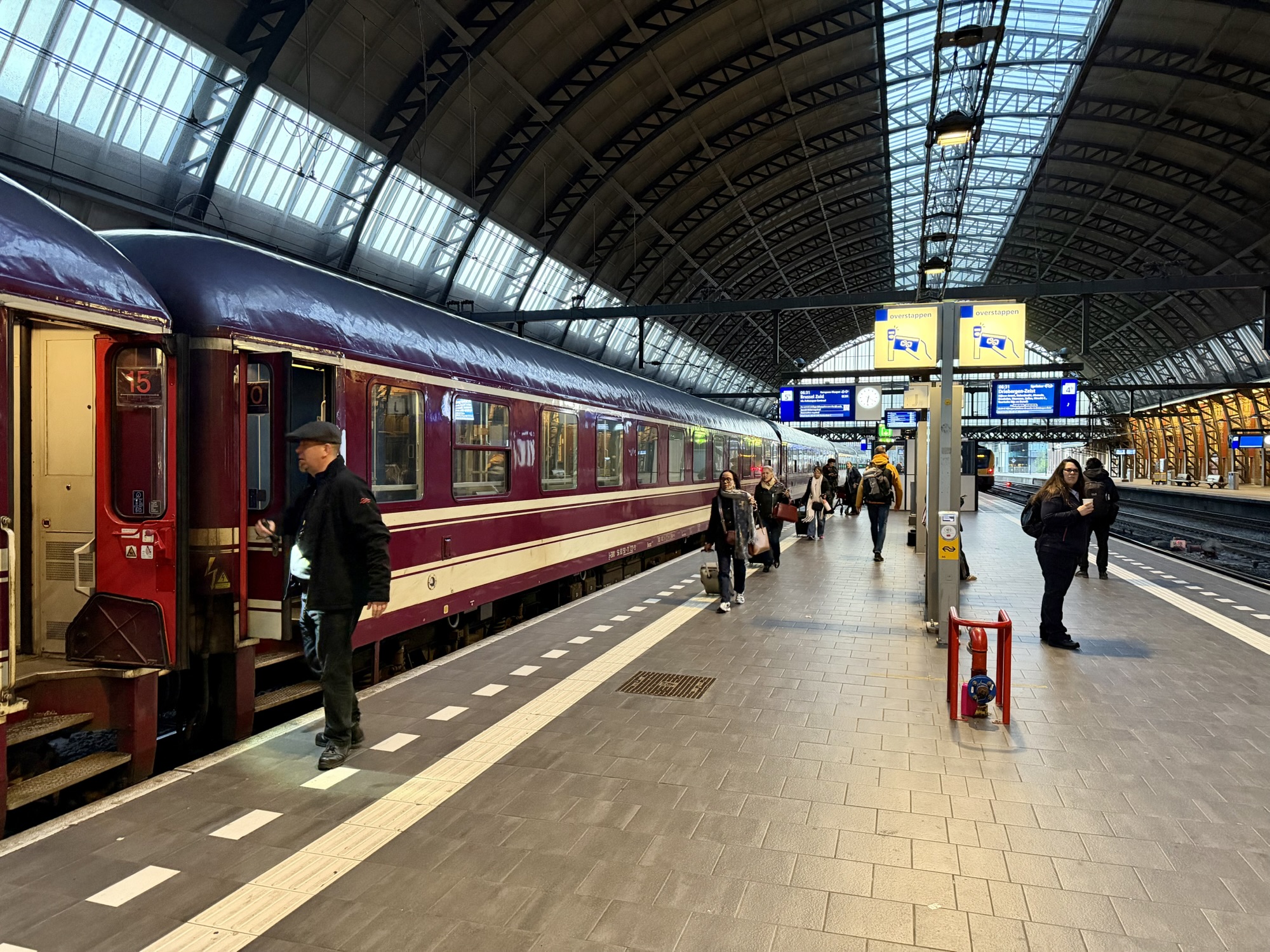
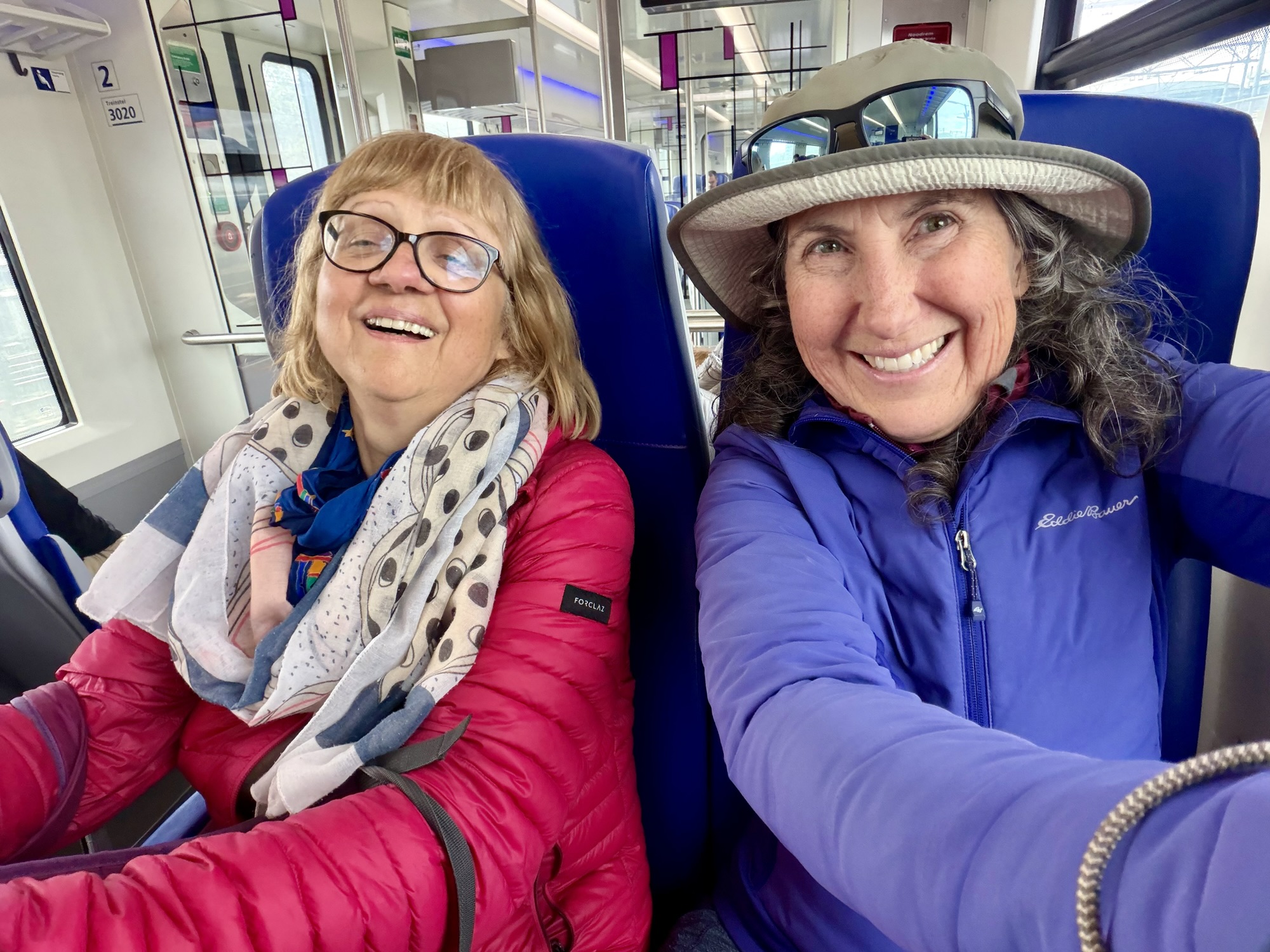
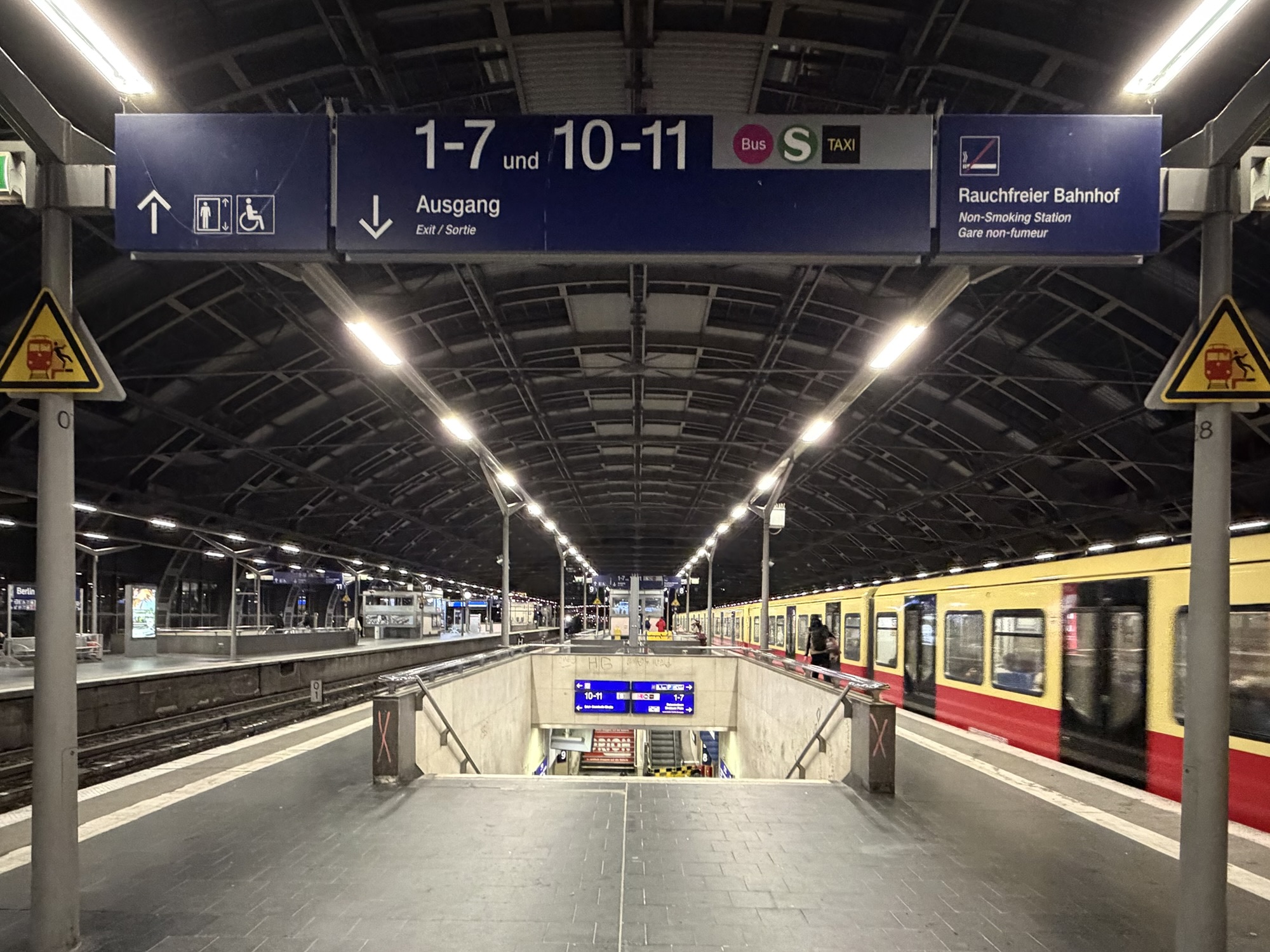
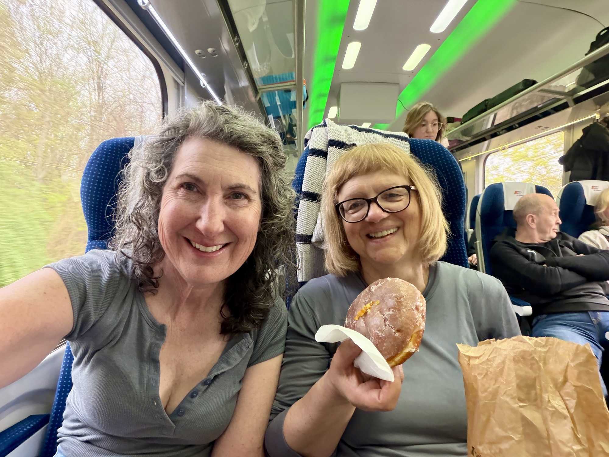
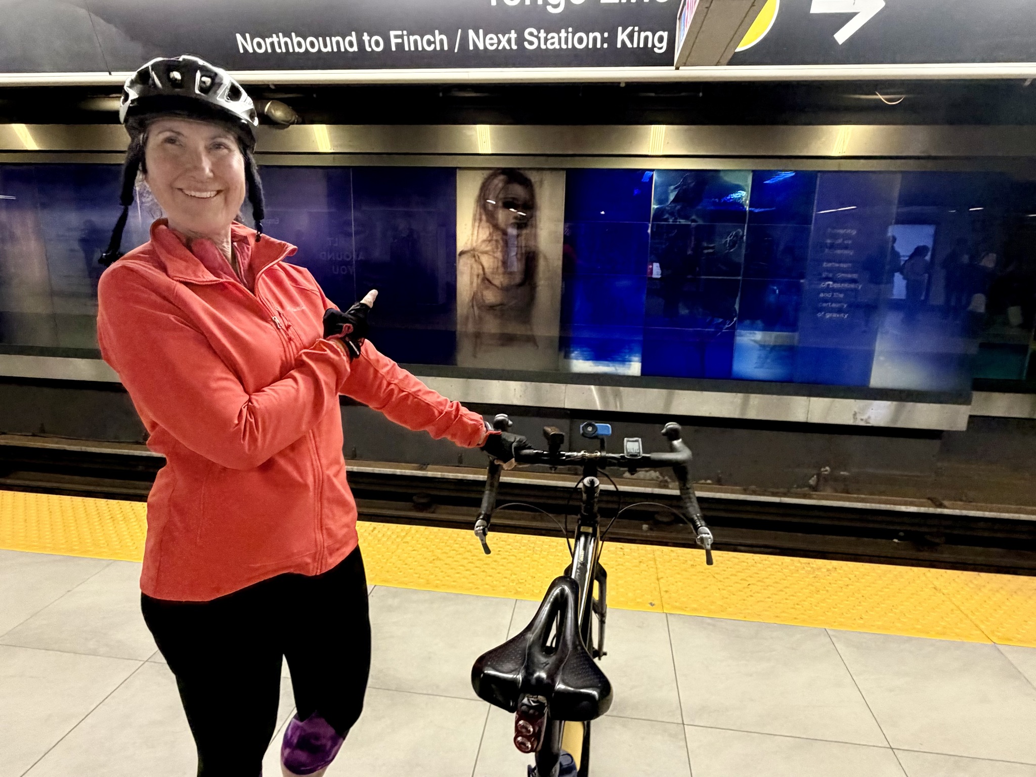
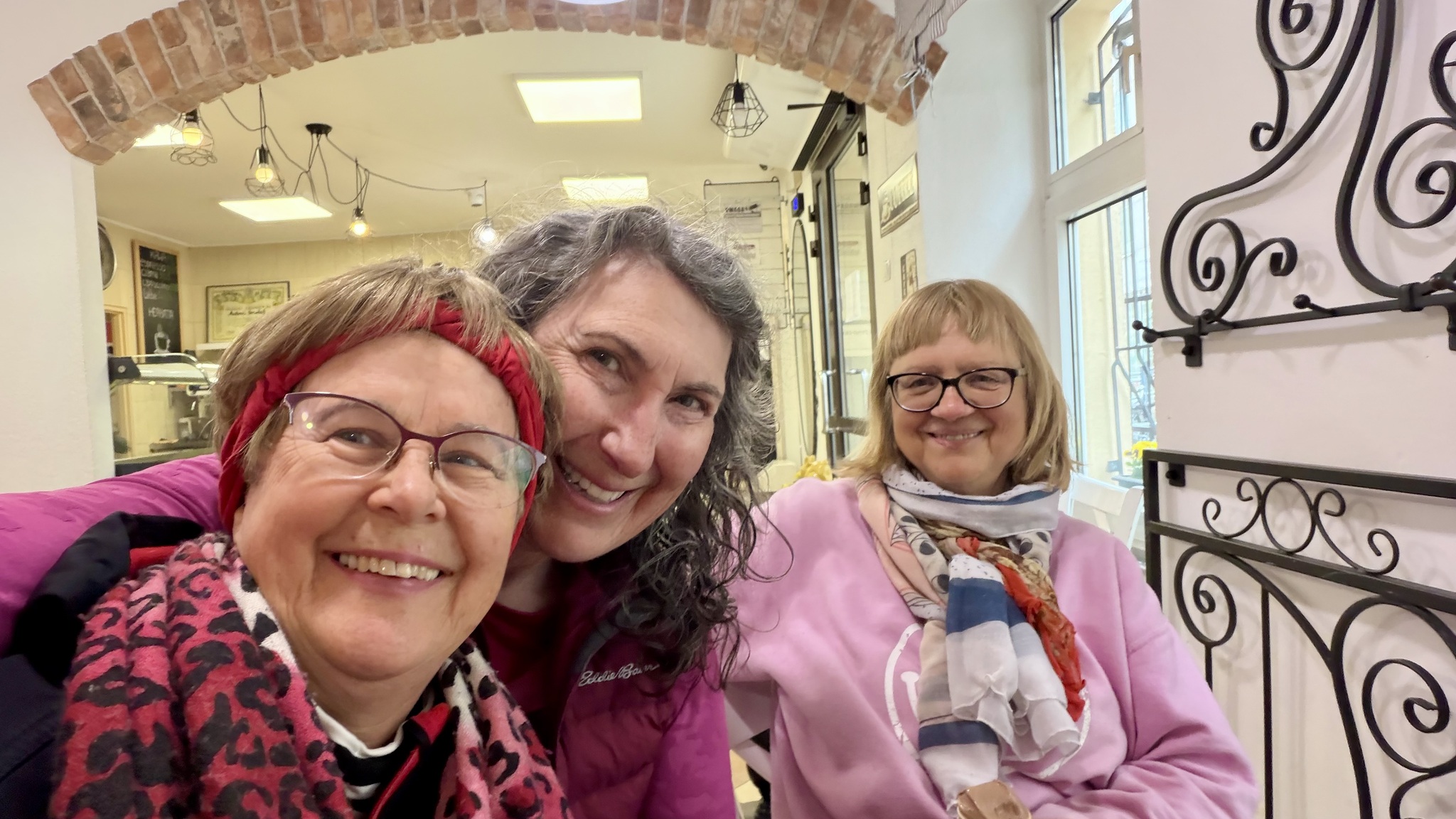
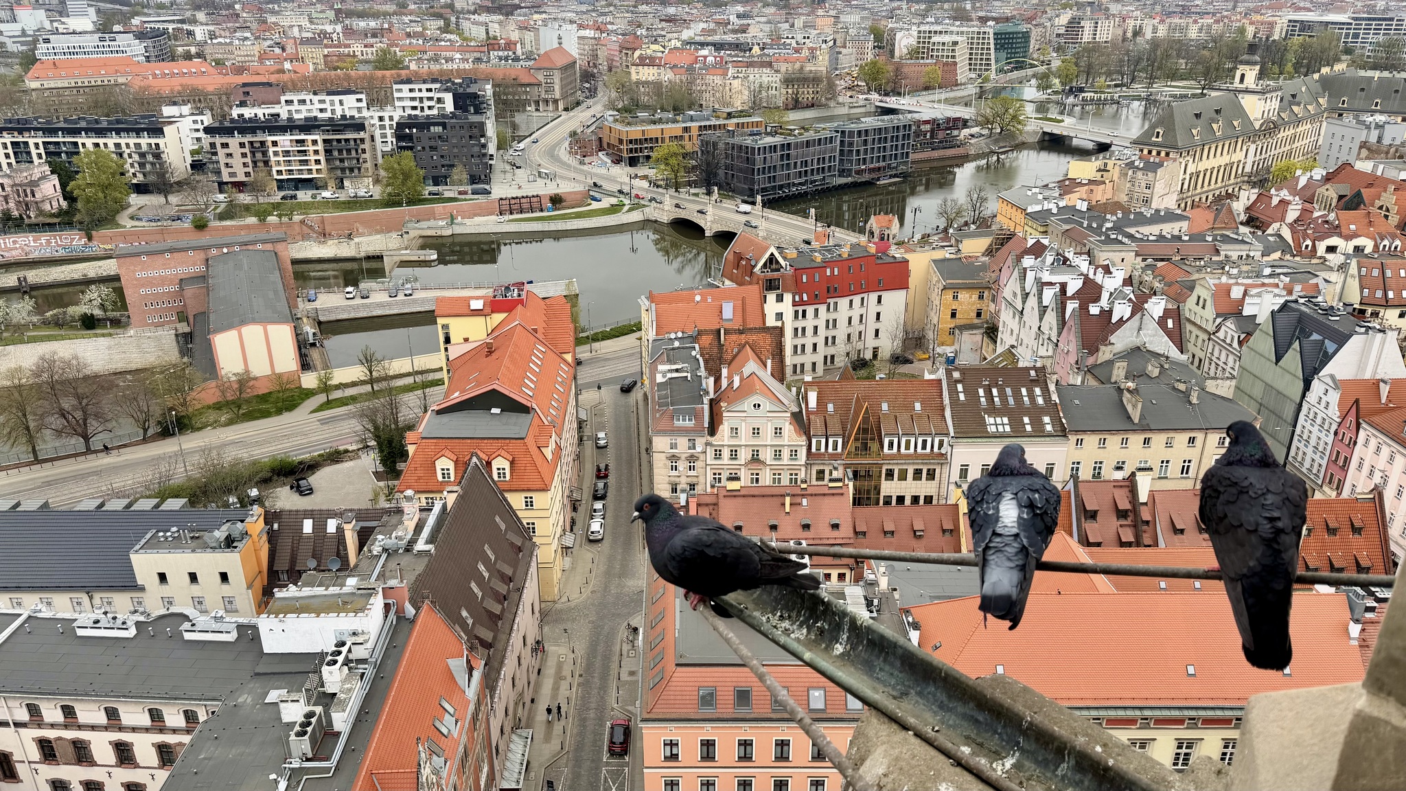
As predicted by the conductor when we boarded the train, even though it was an hour late leaving Berlin, we arrived in Amsterdam exactly on time. I set my alarm for 30 minutes before the arrival time so that I could use the bathroom and have everything organized to get off the train quickly.
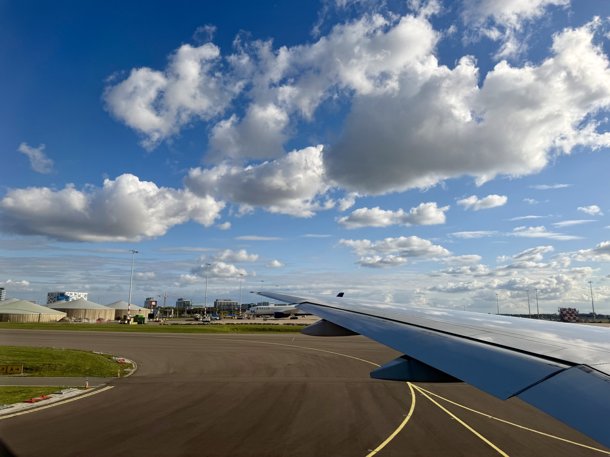
It was a beautiful morning as the train came into Amsterdam.
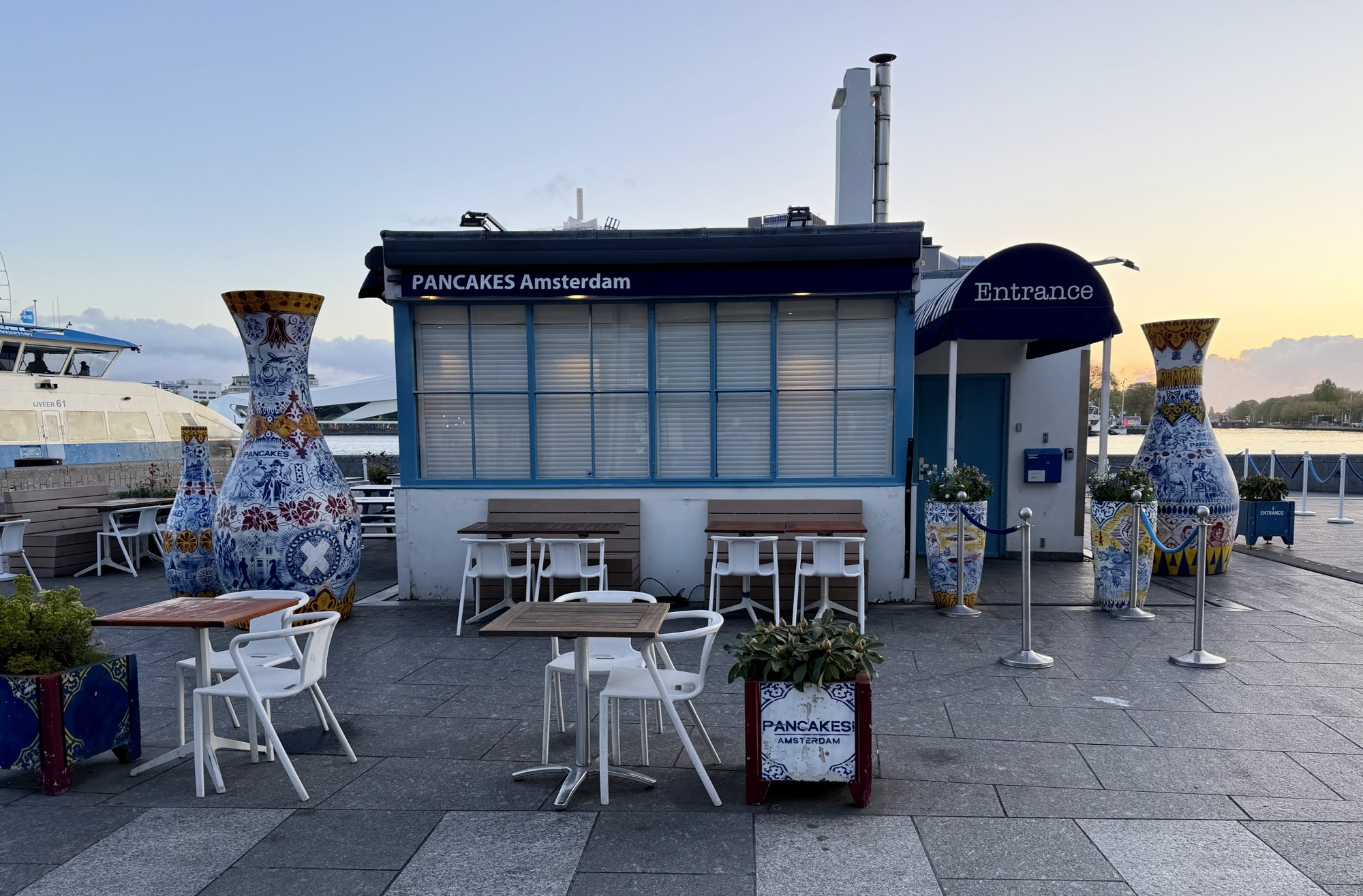
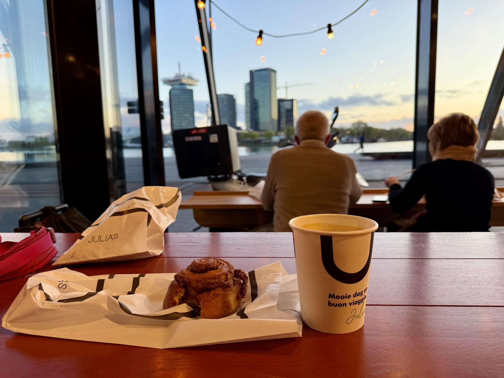
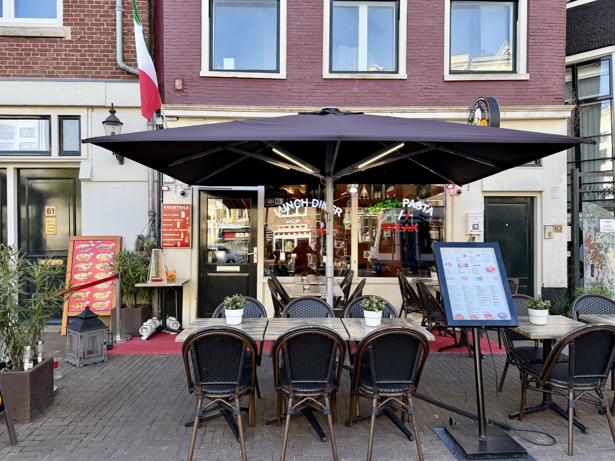
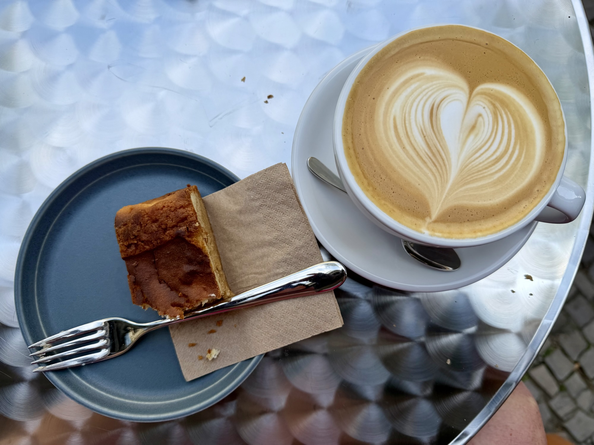
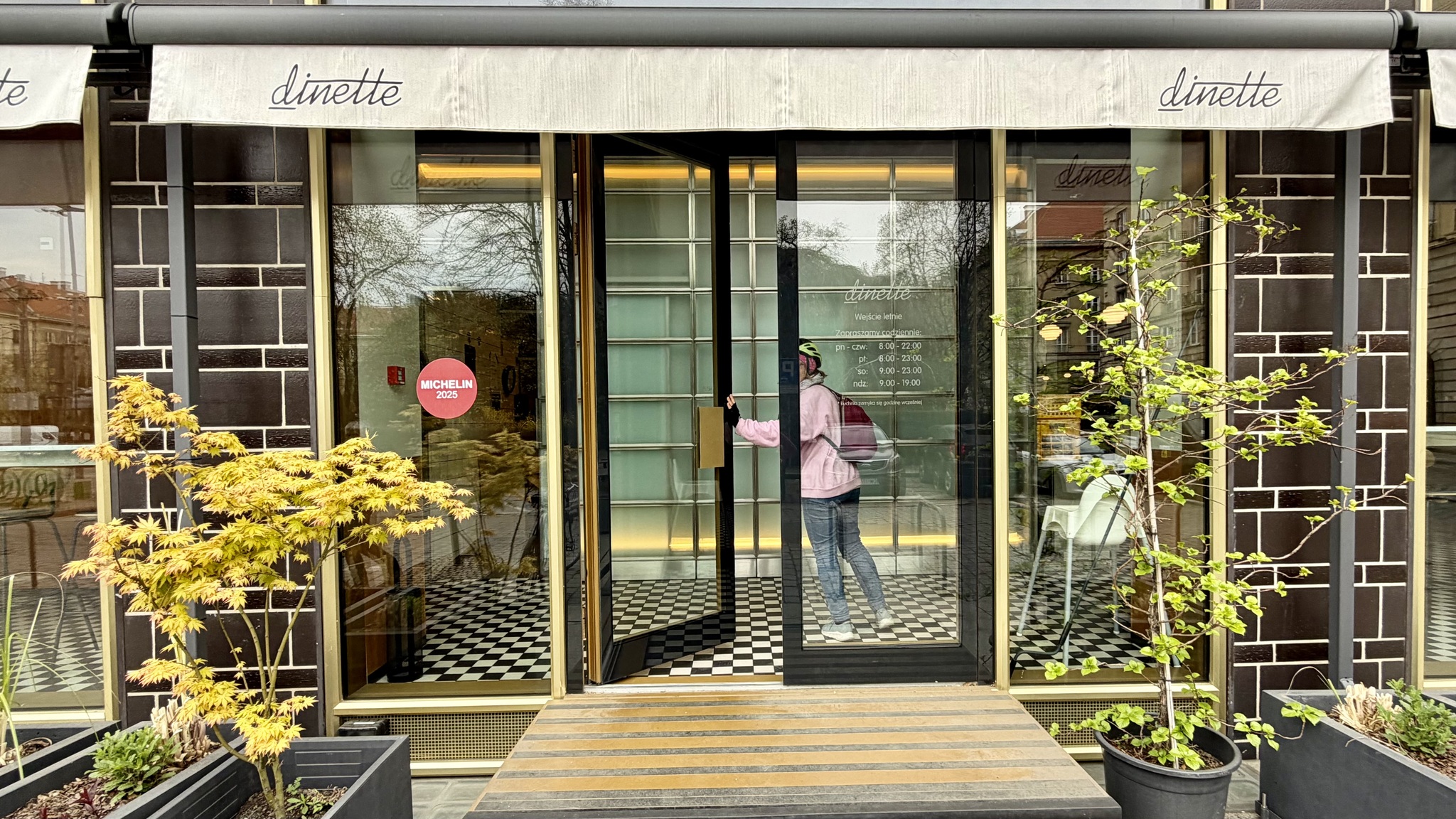
Each time we went back-and-forth across the IJ River on the free ferry we noticed this restaurant at the dock. We thought we would try it for breakfast this morning, but we were too early at just after 6:30 AM. So we walked back into the station and went to a coffee shop called Julia’s where we had some coffee and pastries.
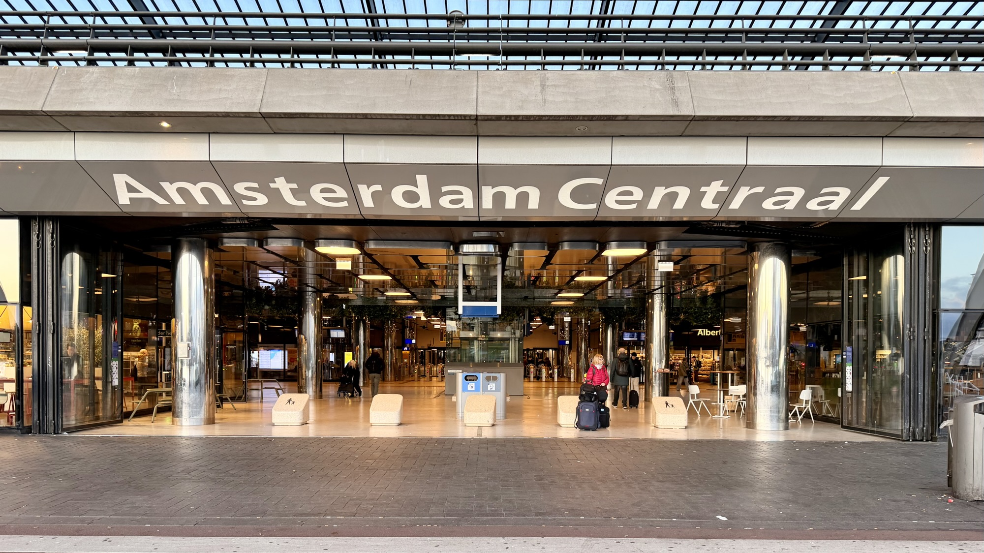
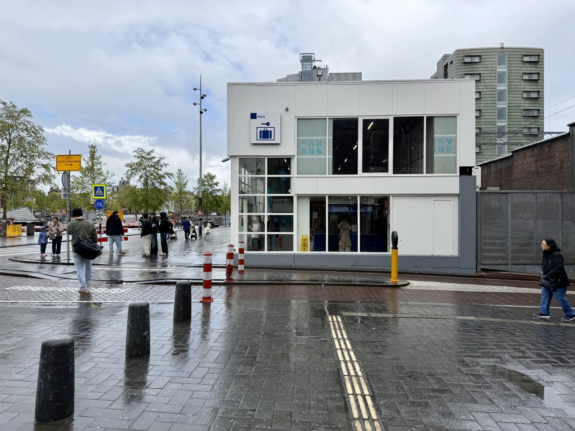
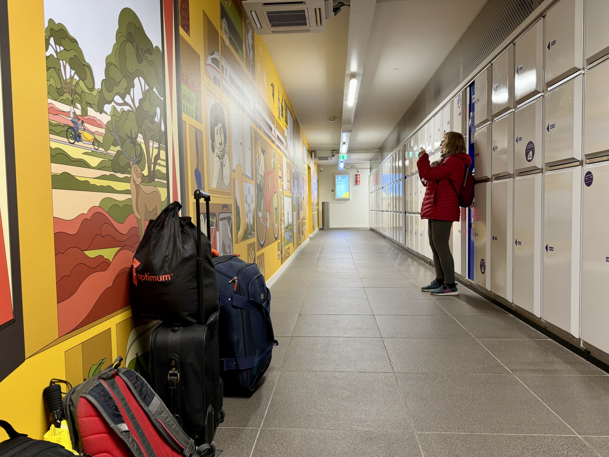
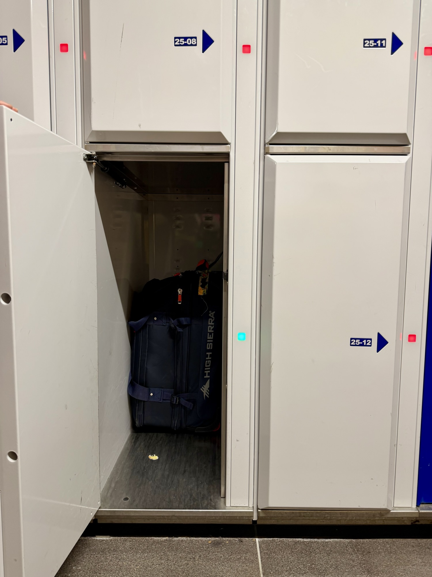
Next, we went to the luggage storage facility adjacent to the central station. I was shocked at how much it was to store our luggage. When Michael and I were in Prague, we left our luggage in the central station and it cost us under €4. In Amsterdam, for an extra large locker, which was big enough to store all of our luggage, it was €36 which we split two ways. It was a lot of money, but, it was better than lugging it around while we went sightseeing. There were signs in several places in the facility explaining that the price included unlocking ONLY ONCE. Alina put in her suitcase then in my sleep deprived state, after putting my stuff into the locker, I closed it without checking if Alina had stored everything that she wanted to. She had not. So I went to the front desk and pleaded my case, and the employee did come and unlock the locker for us to allow us to finish stowing our things. Rain was forecasted, but it hadn’t started yet, and our flight was not until nearly 6 PM.
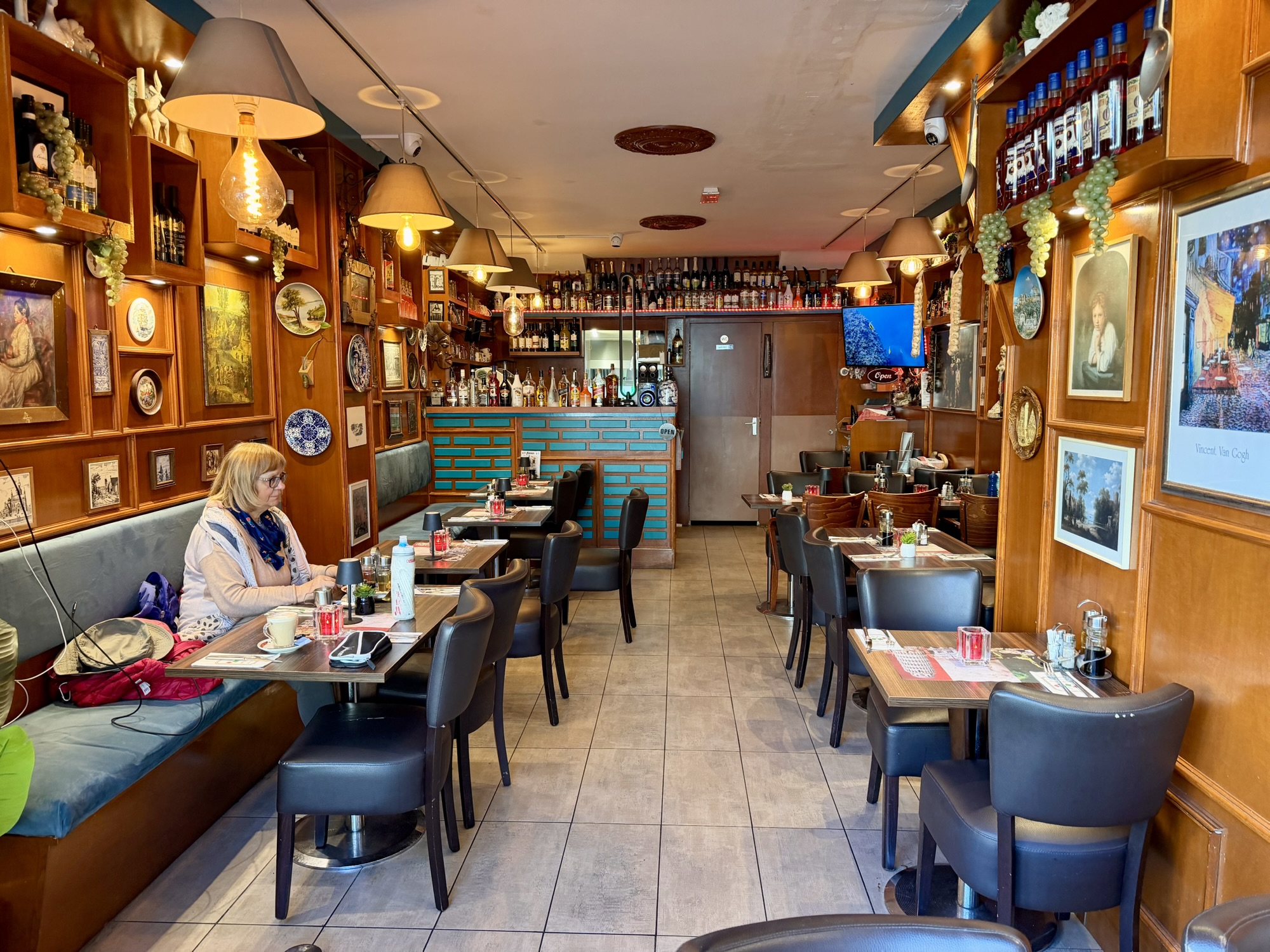
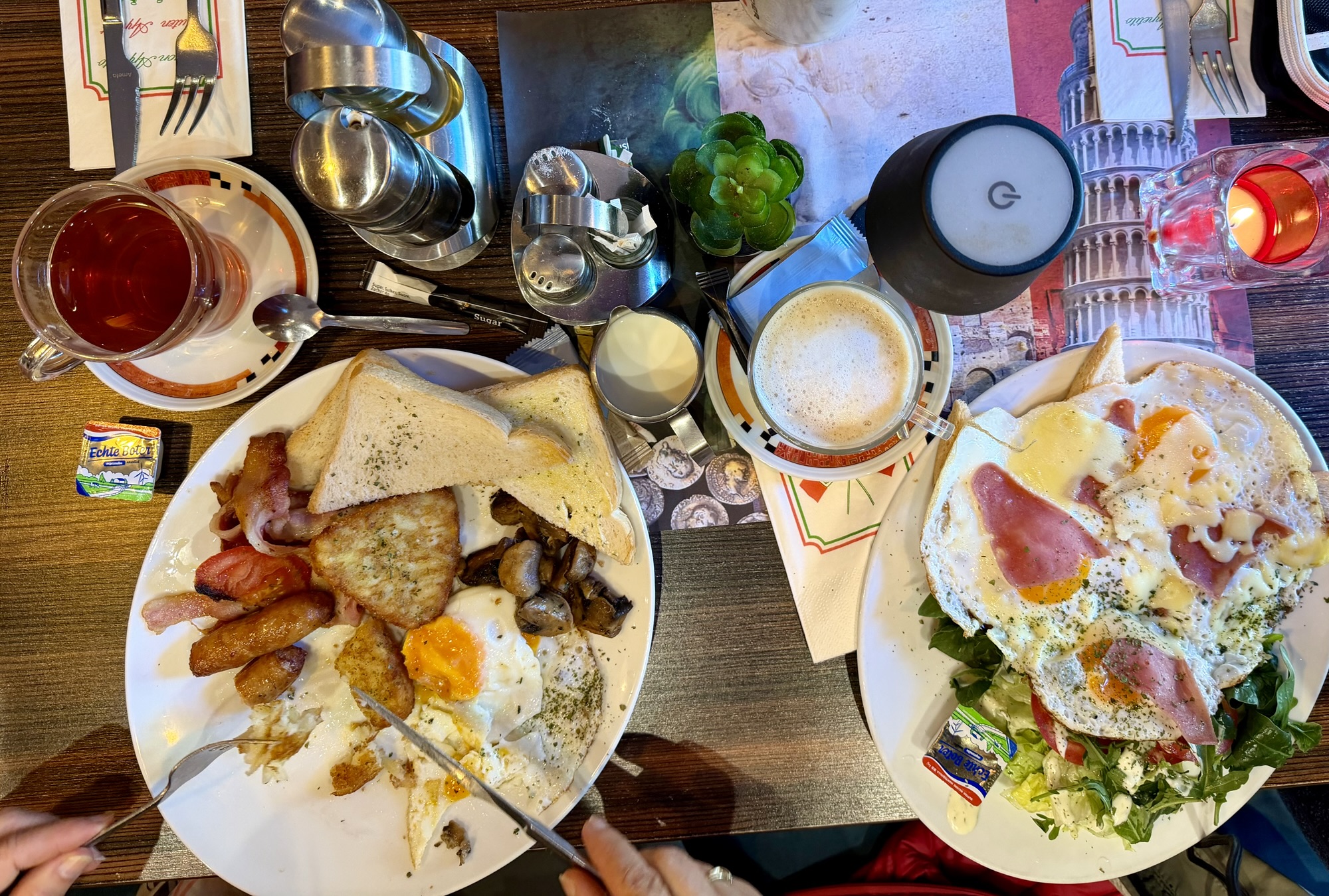
We decided it was time for a second breakfast. We found a reasonably priced restaurant north, not far from the station.
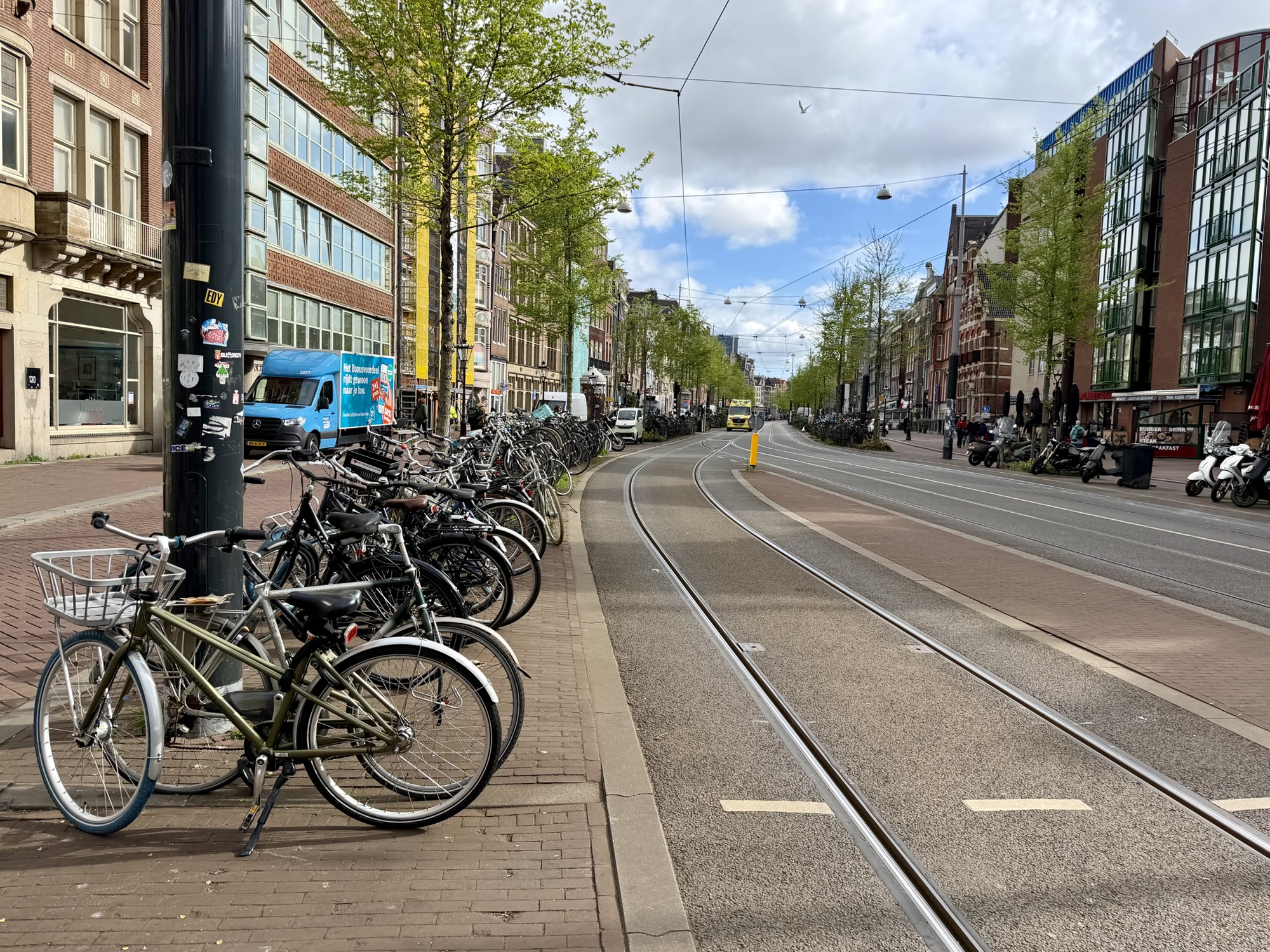
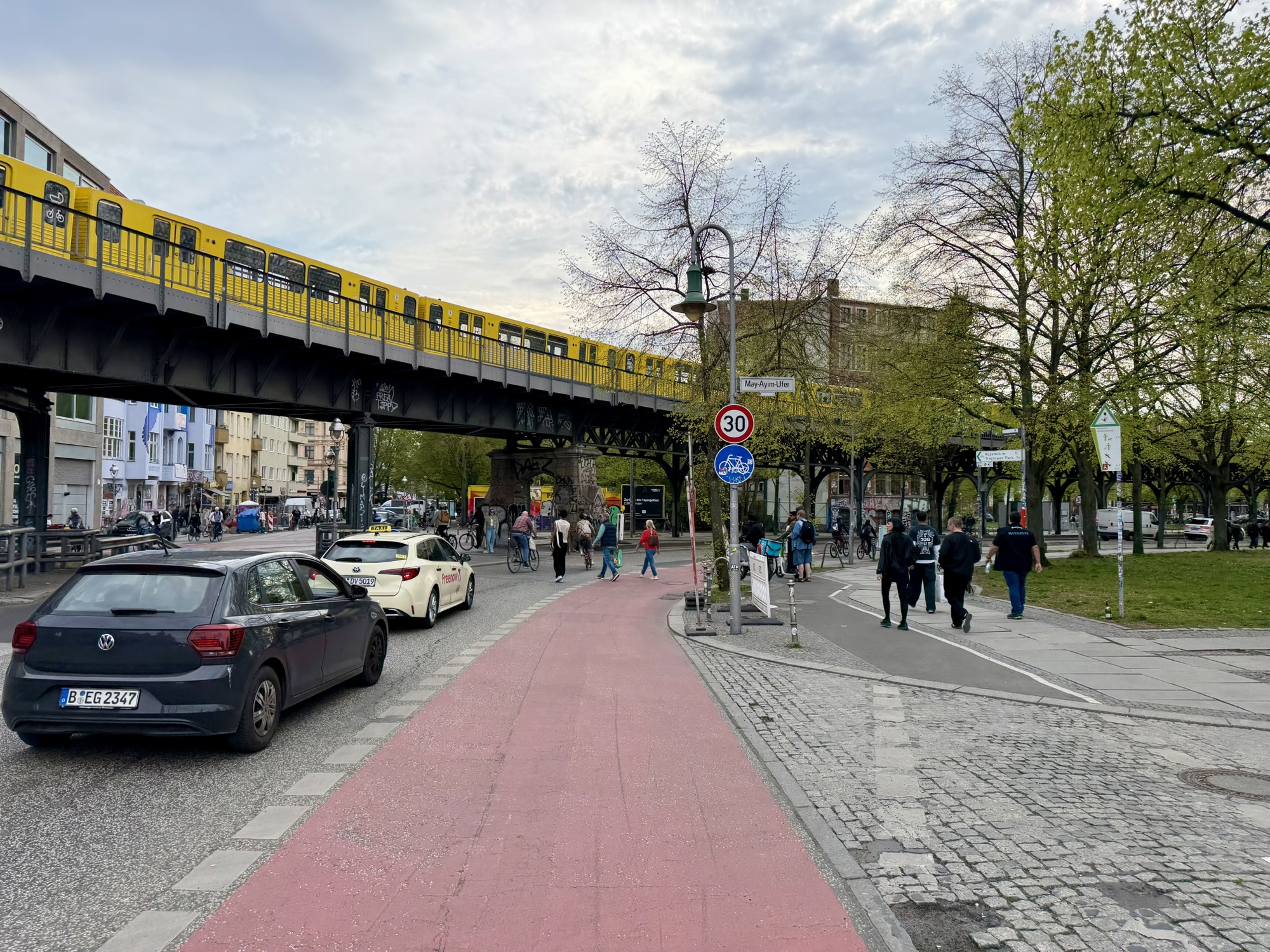
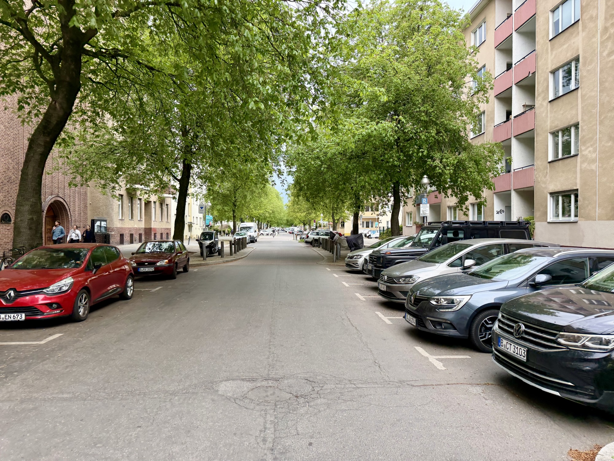
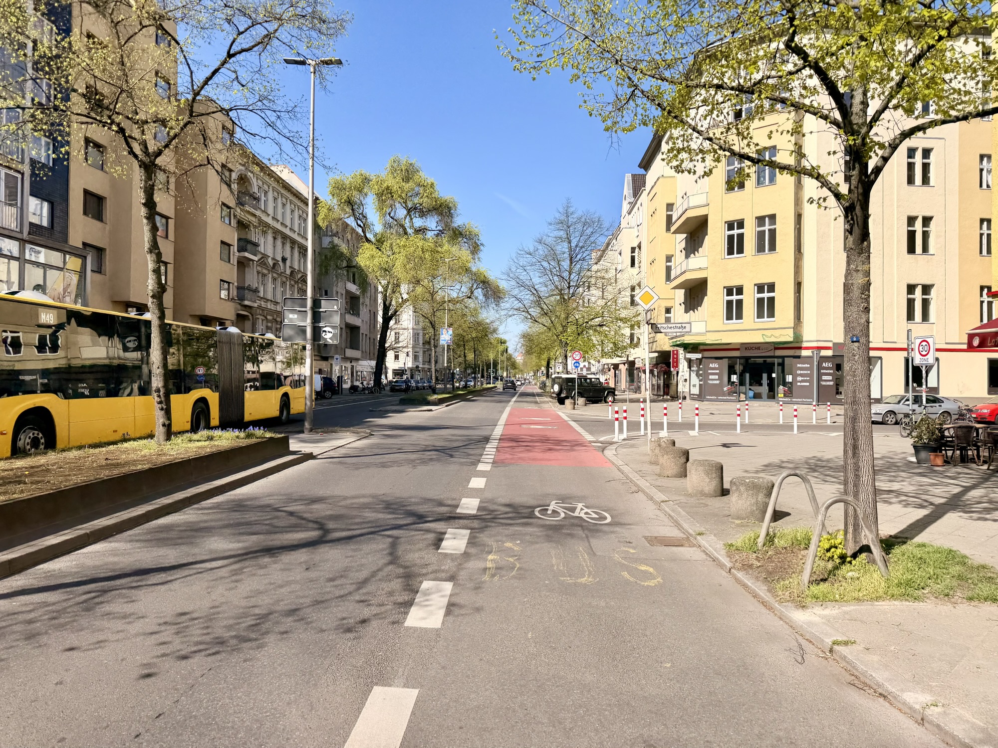
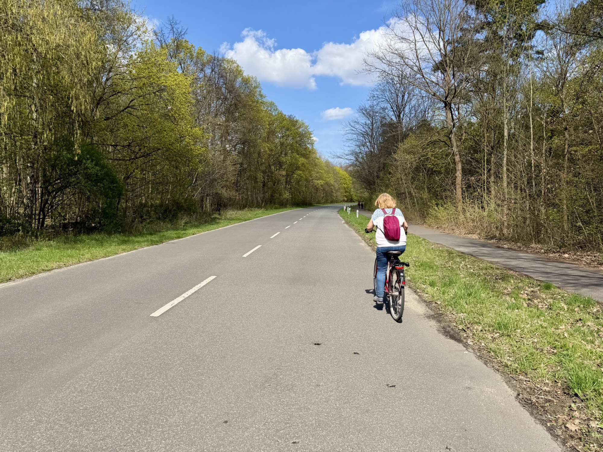
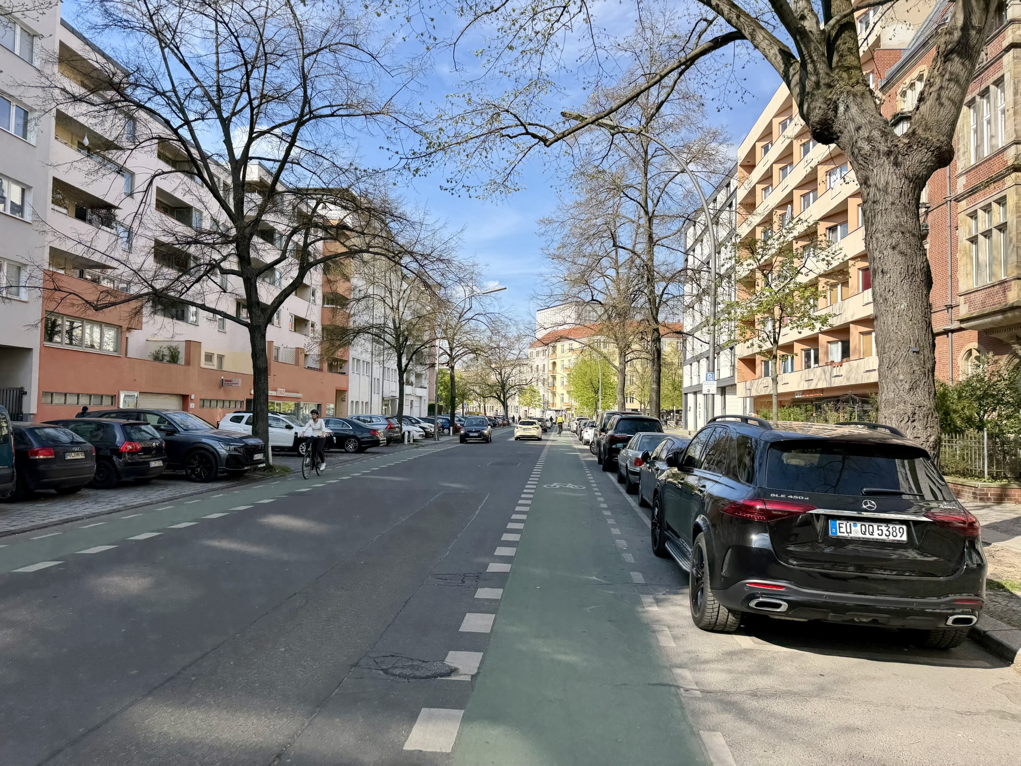
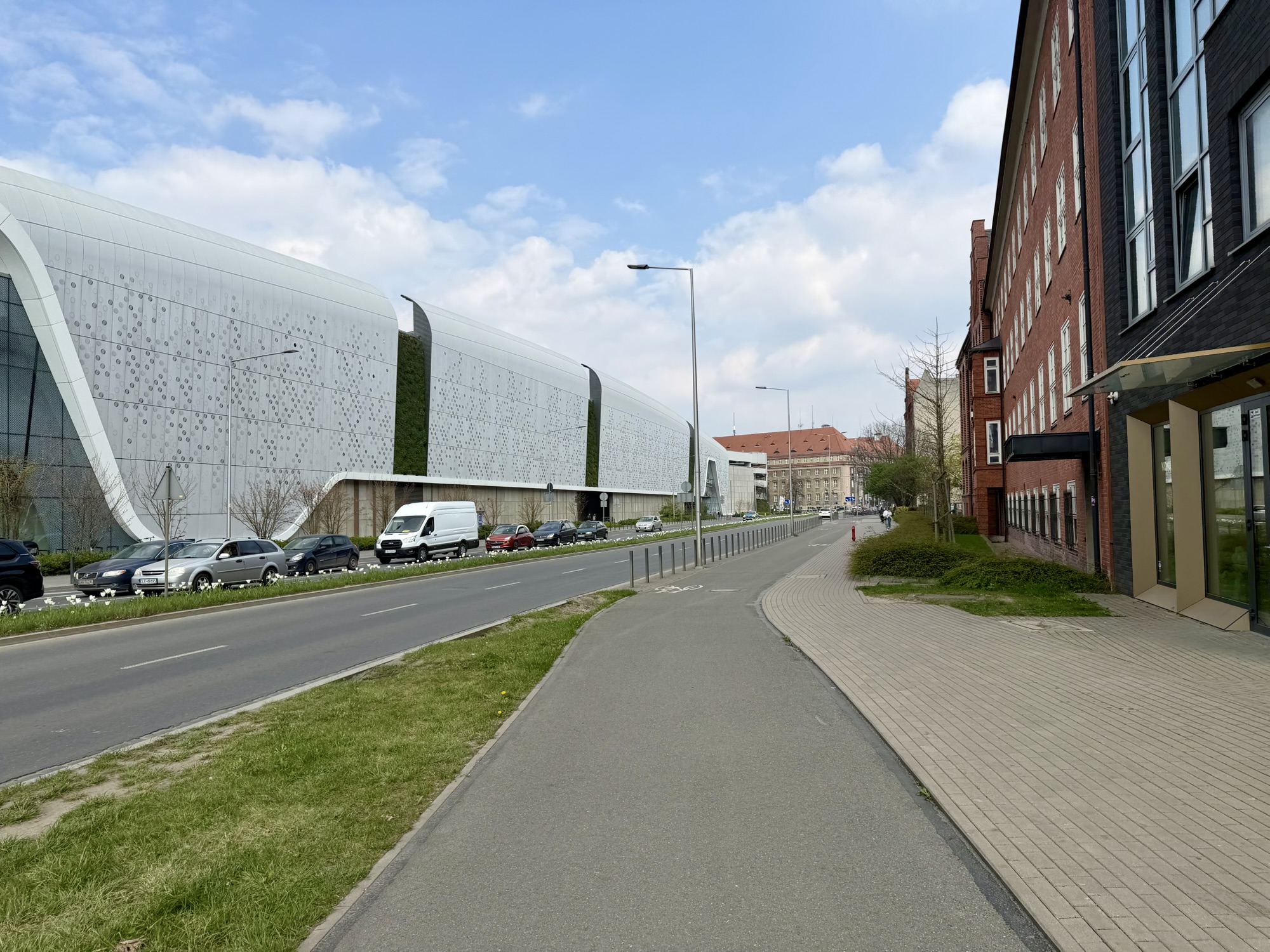
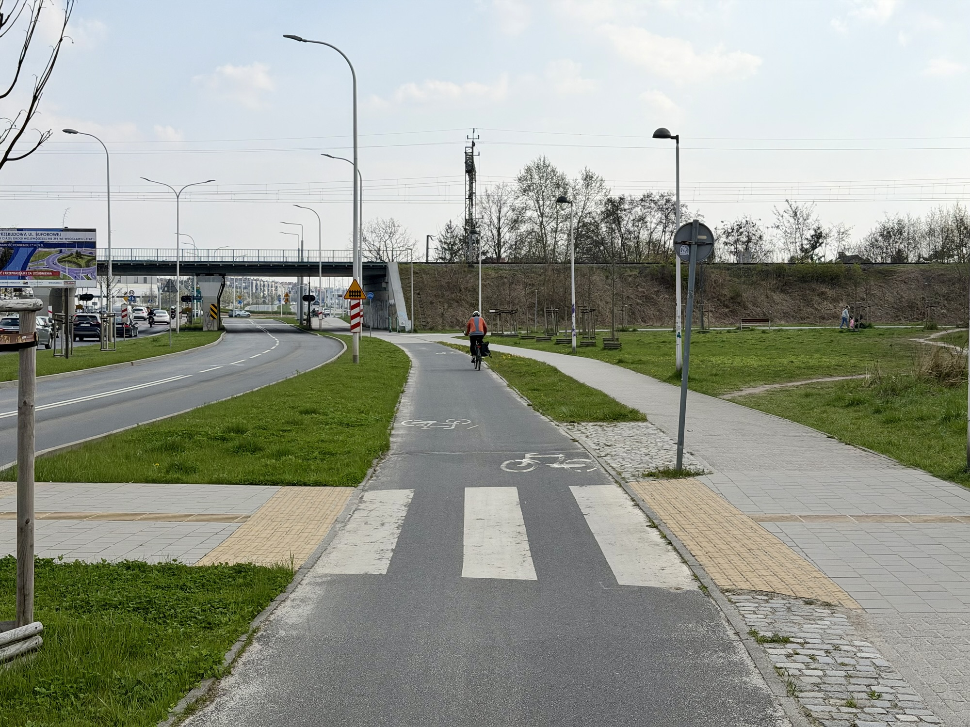
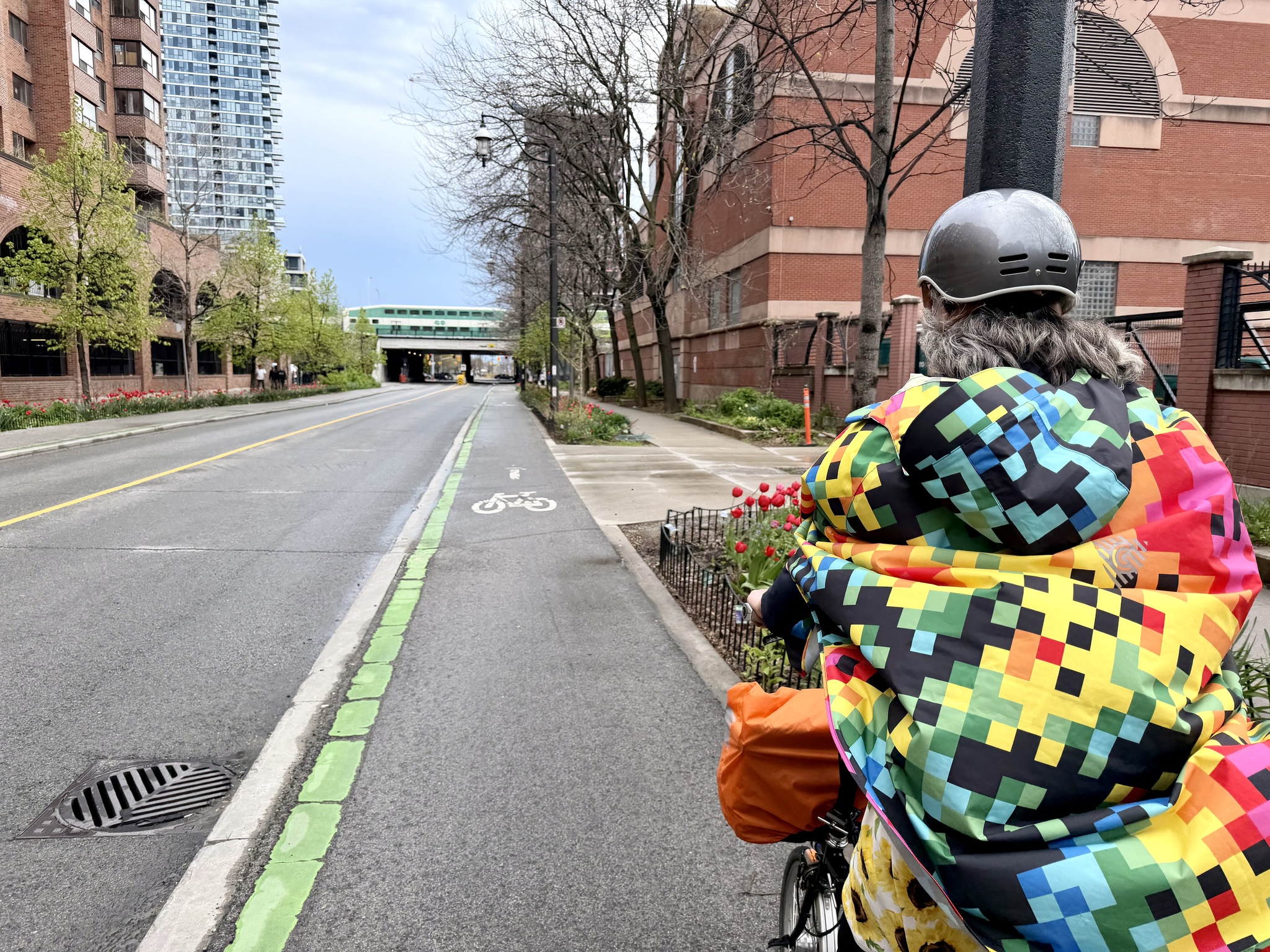
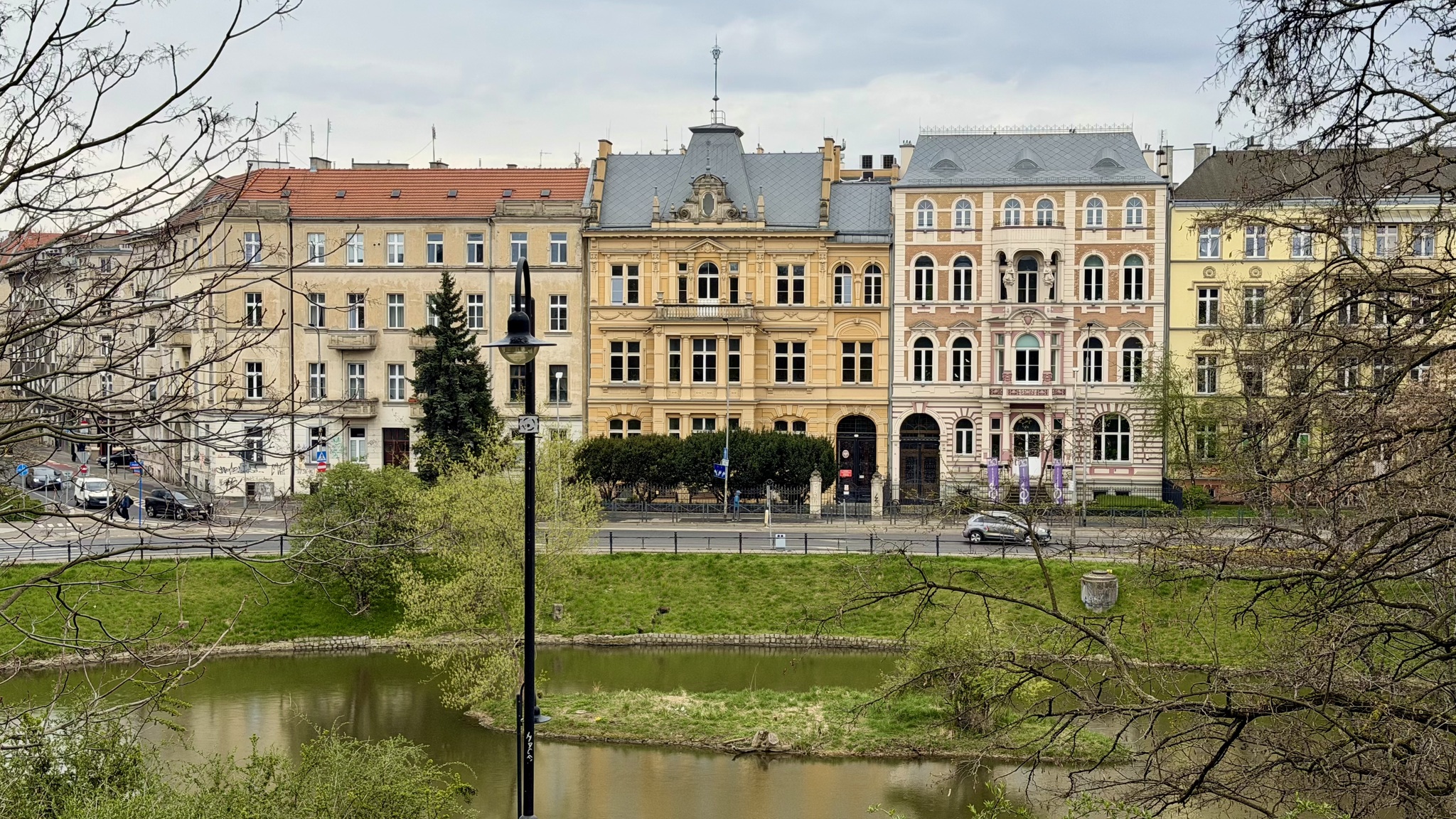
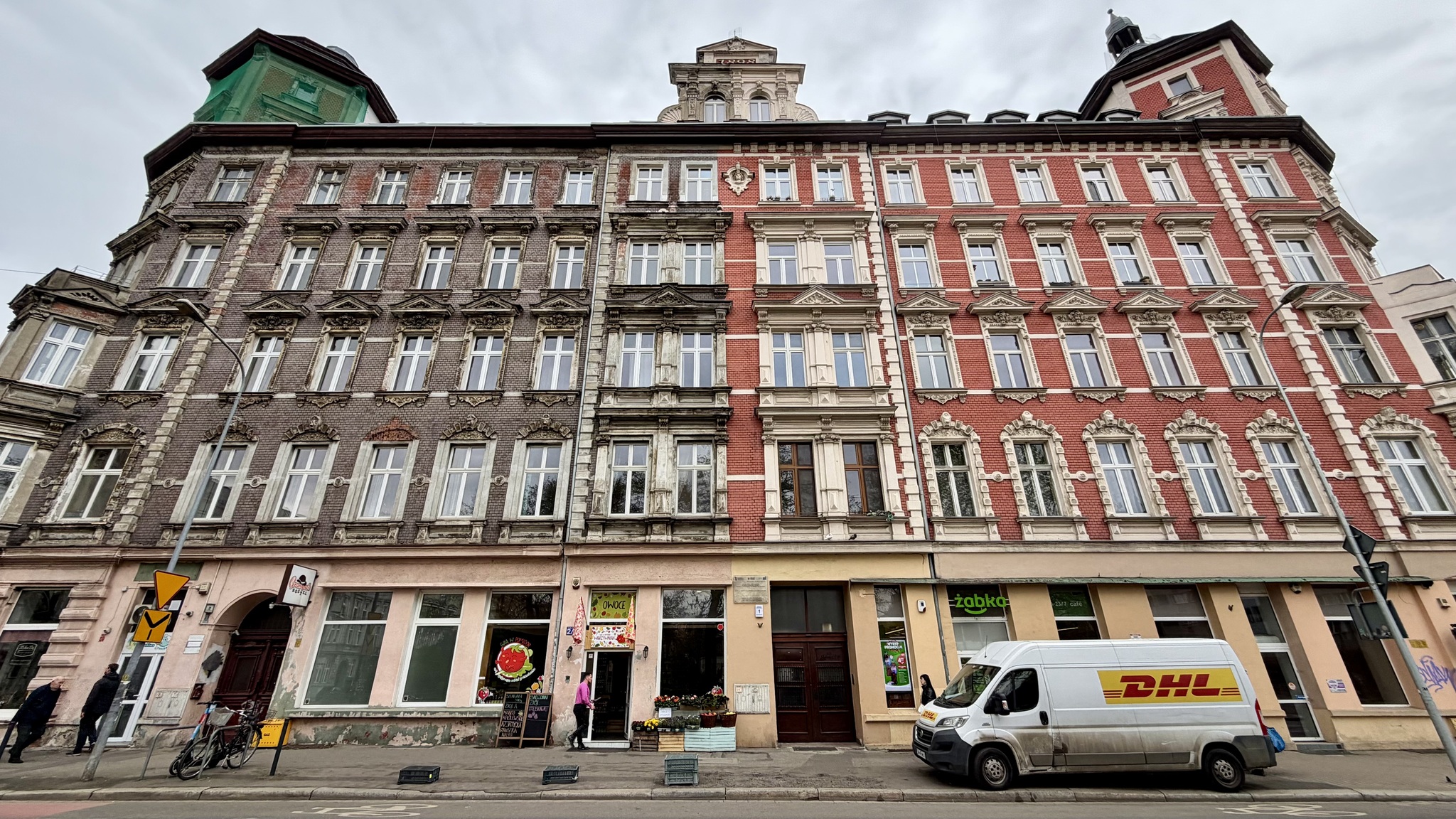
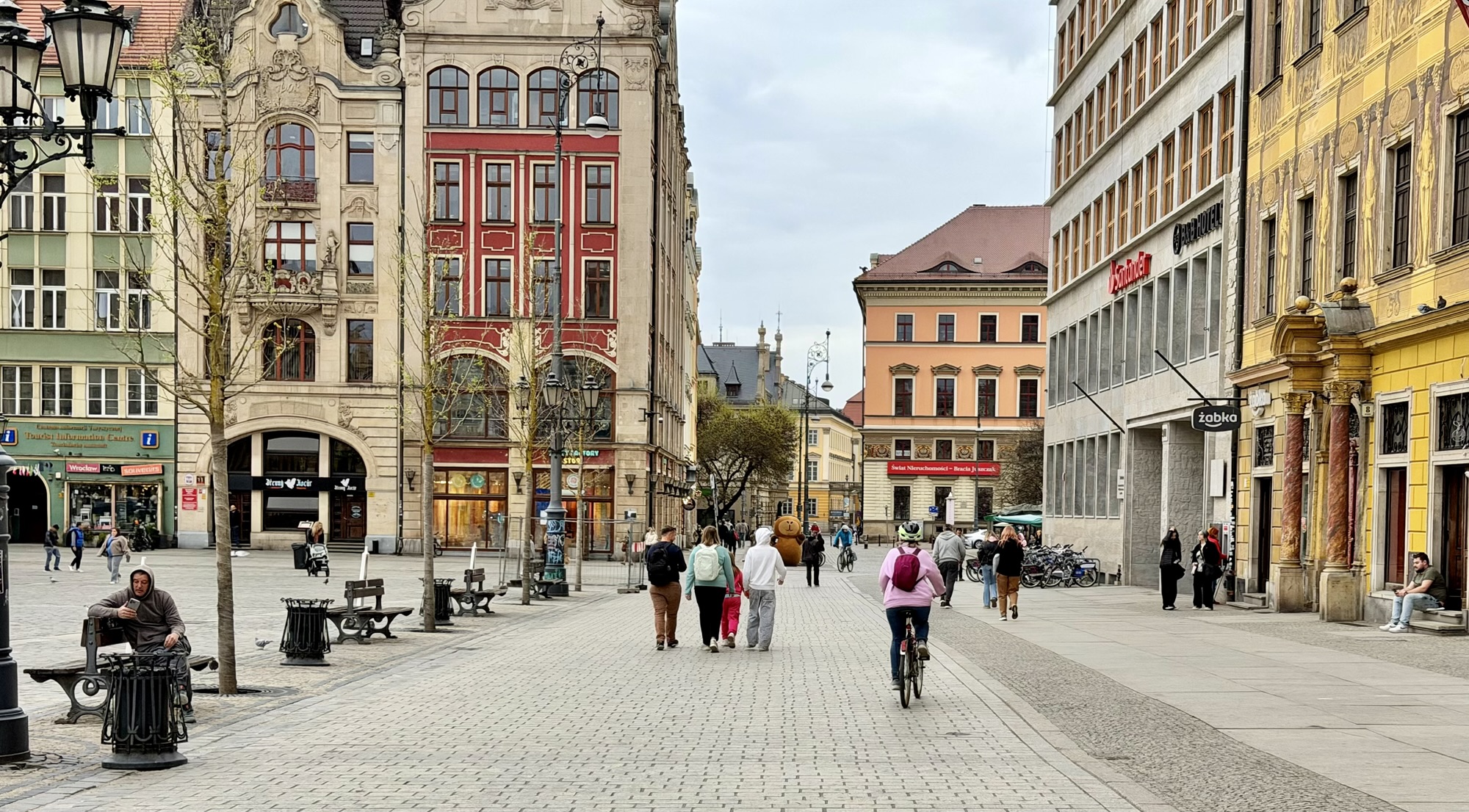
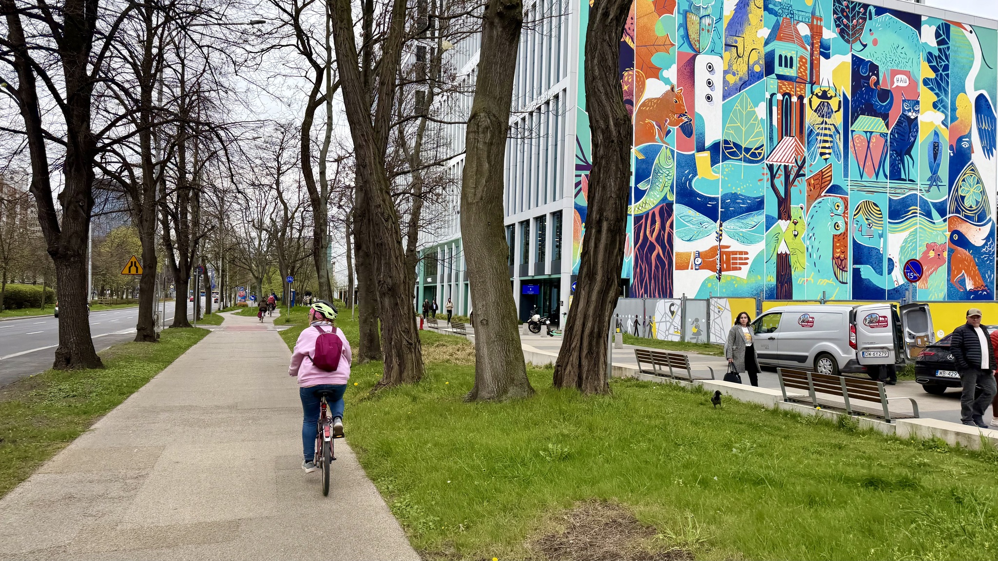
It was a Monday morning, but there was very little motor vehicle traffic. People mostly get around by streetcar, walking, and cycling.
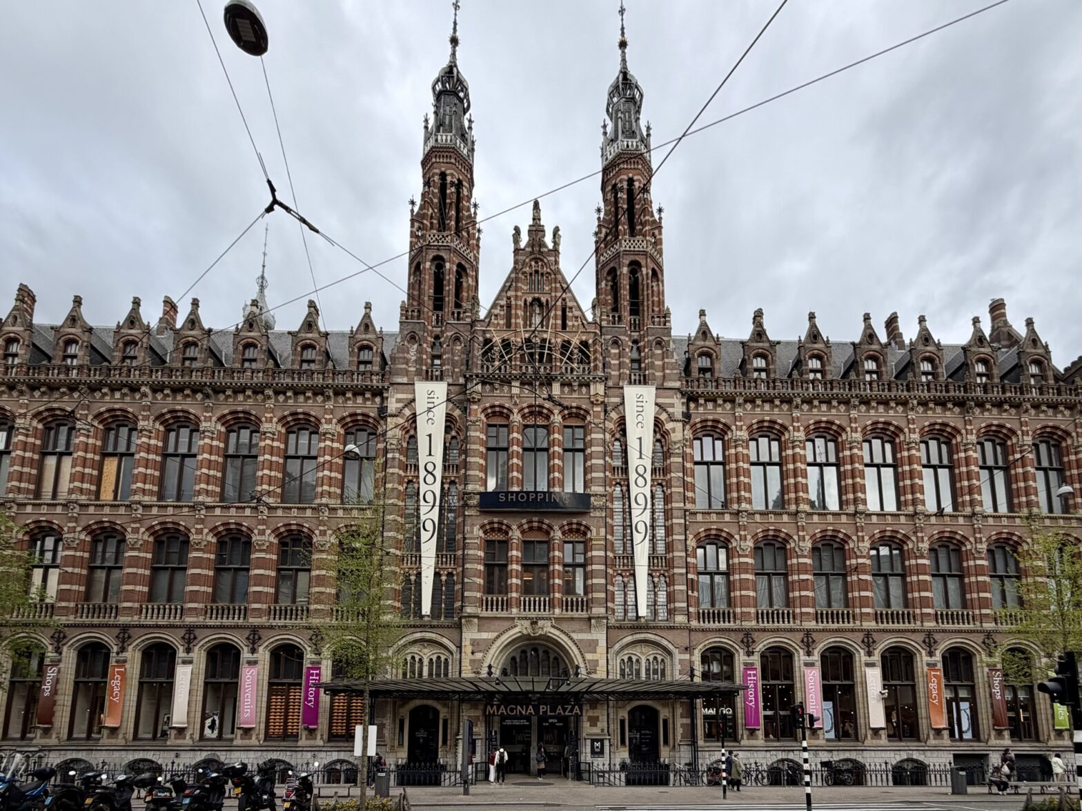
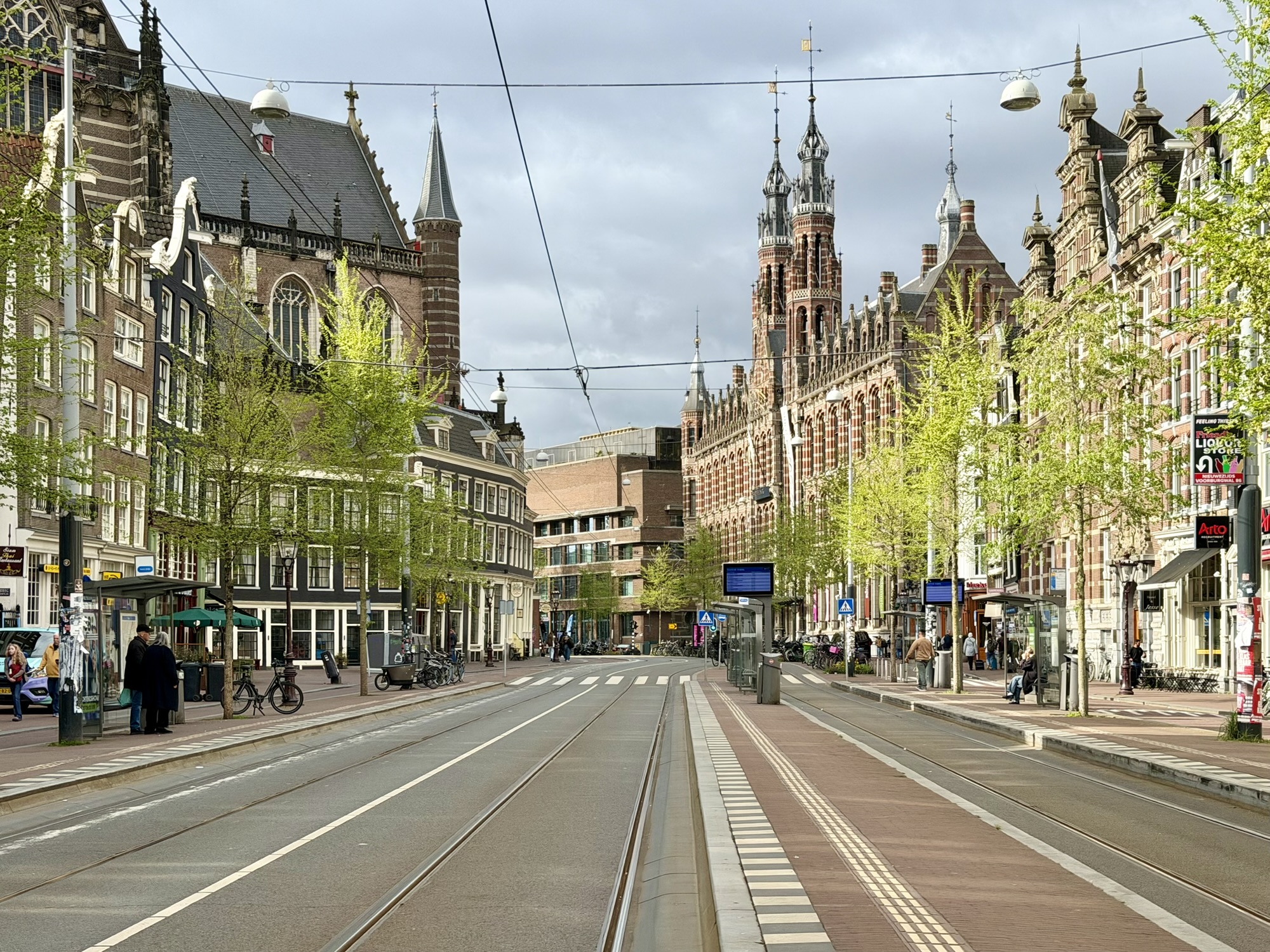
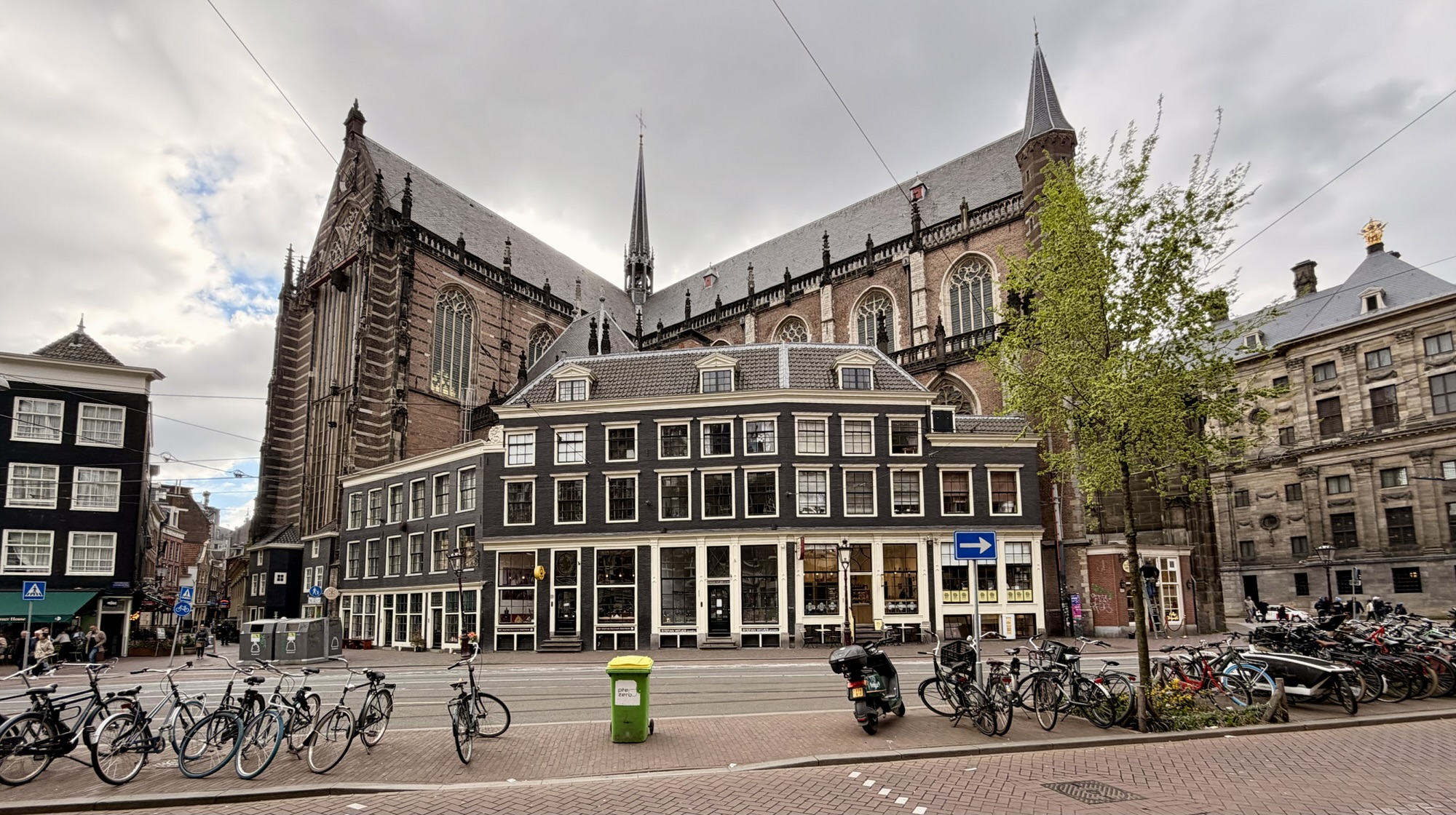
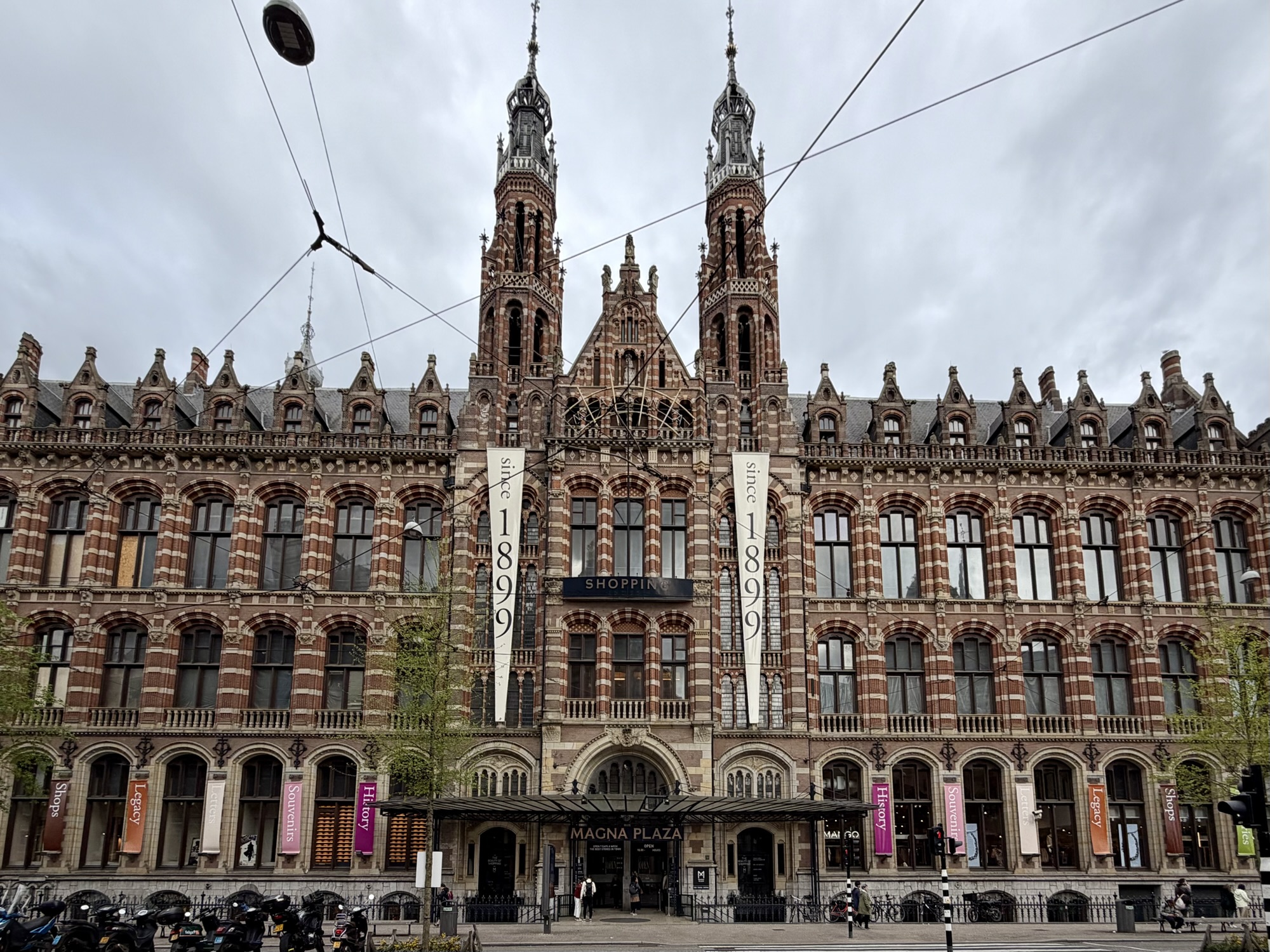
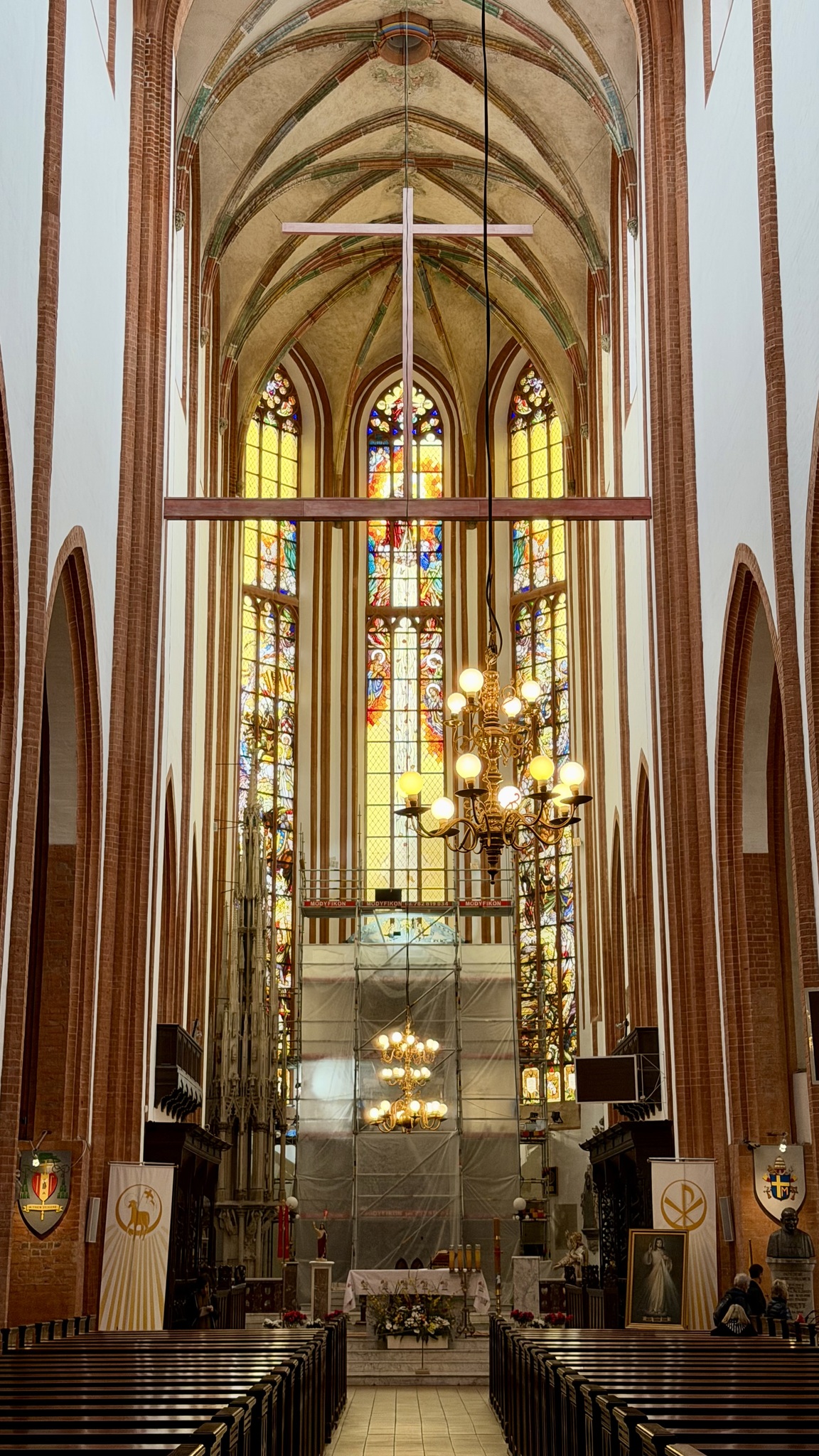
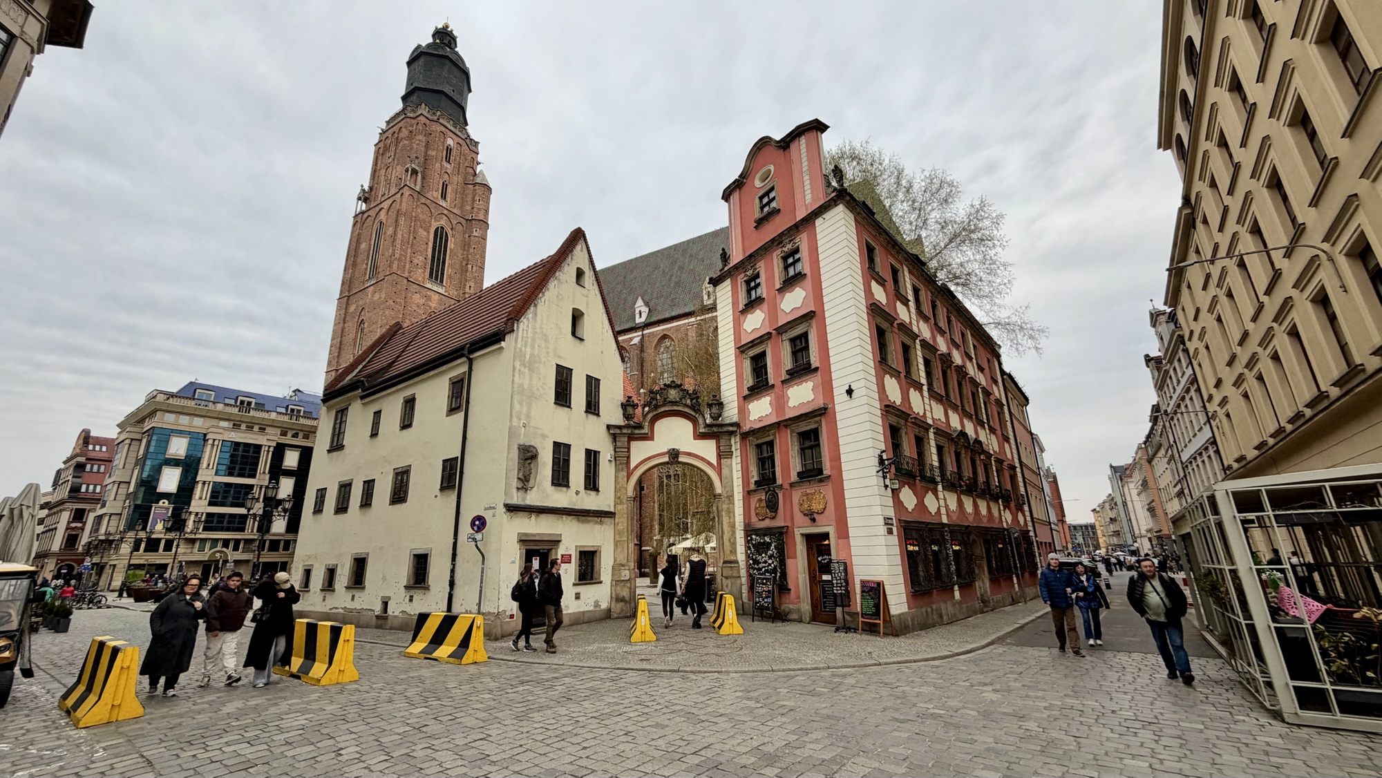
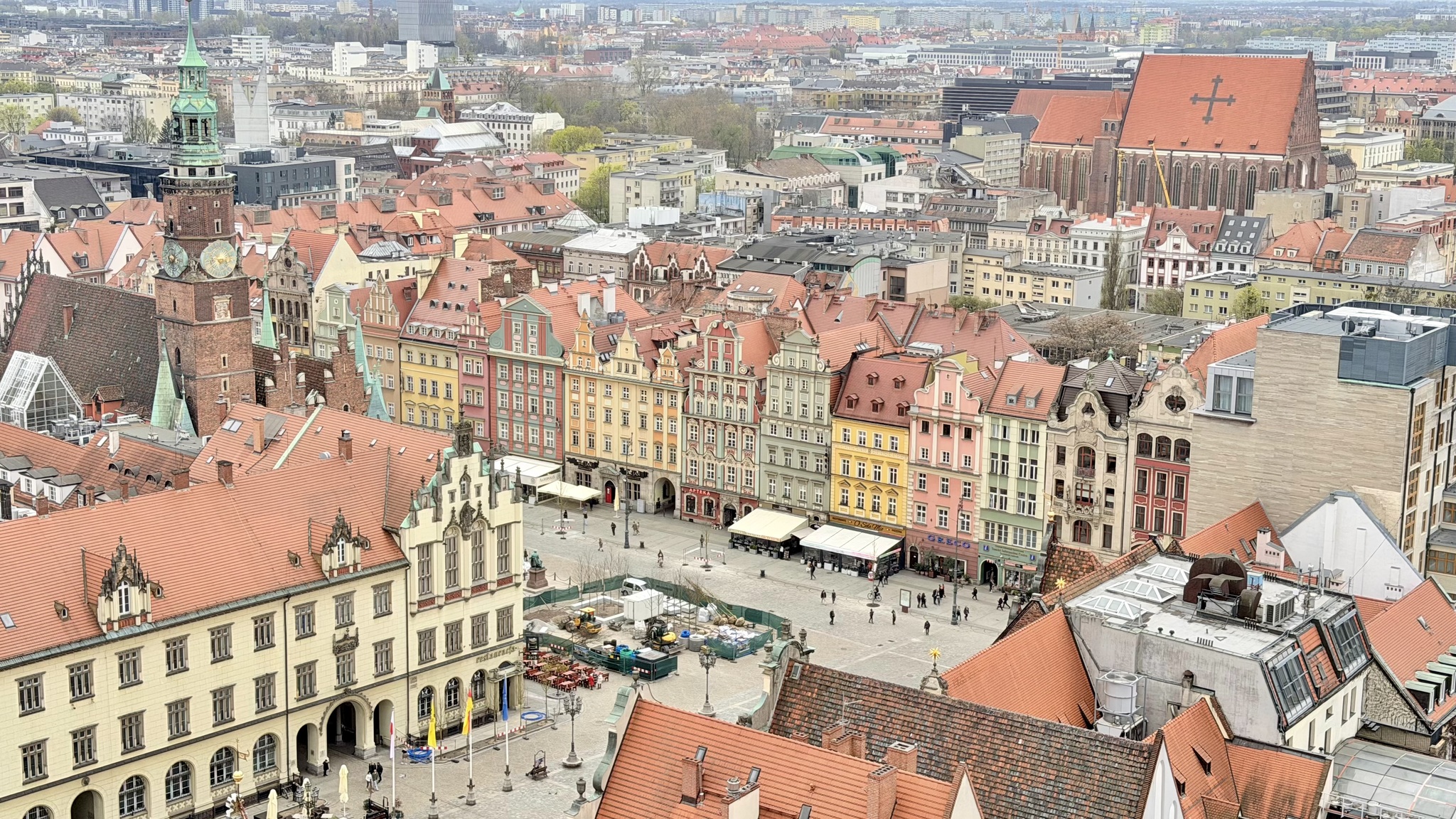
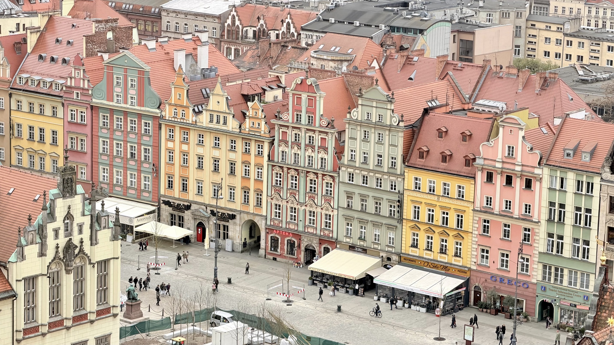
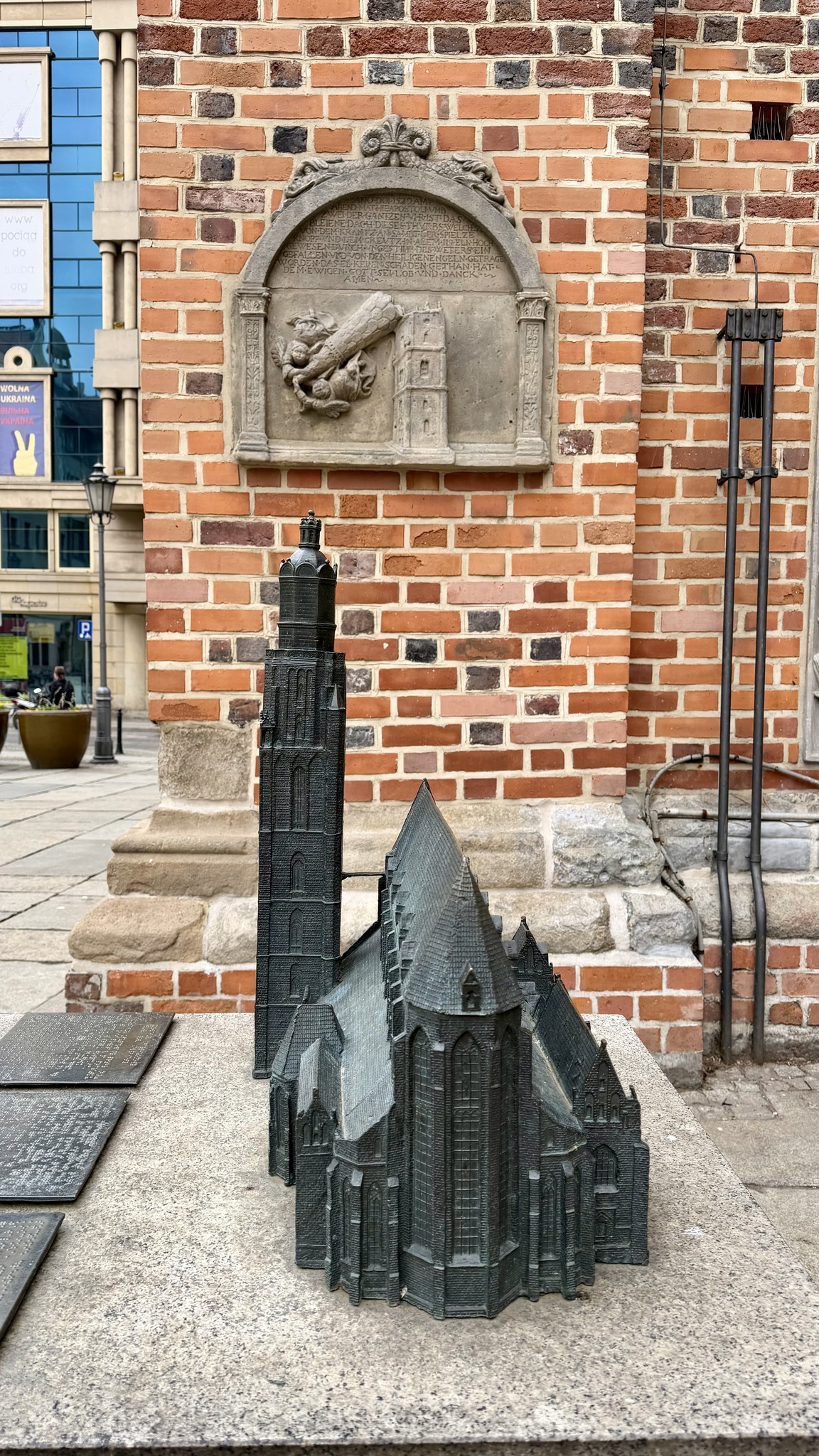
This 15th century church is known as De Nieuwe Kerk, or the new church. I find it interesting how they have built other building buildings right up against the church. We also saw this in Haarlem next to a church.
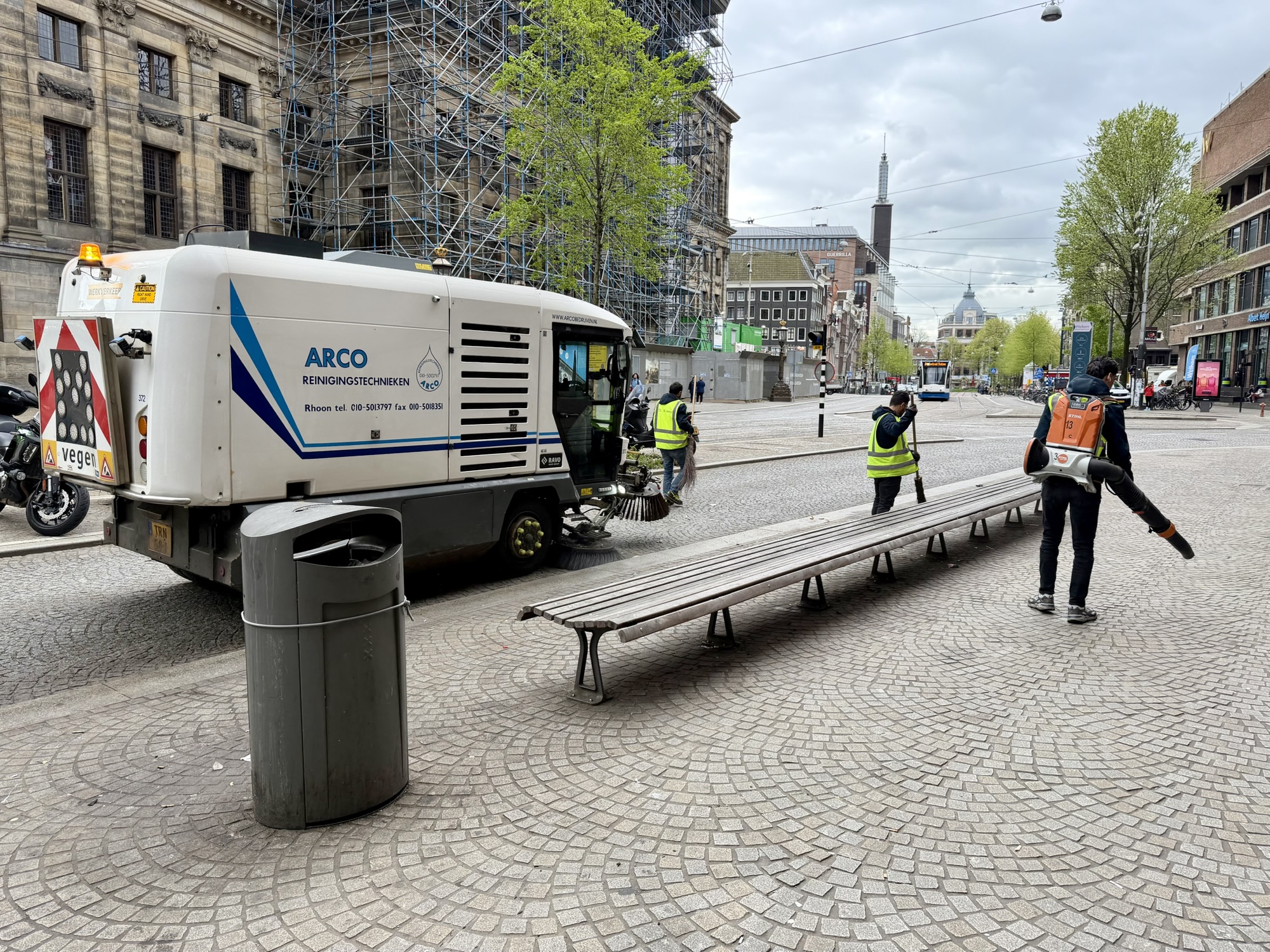
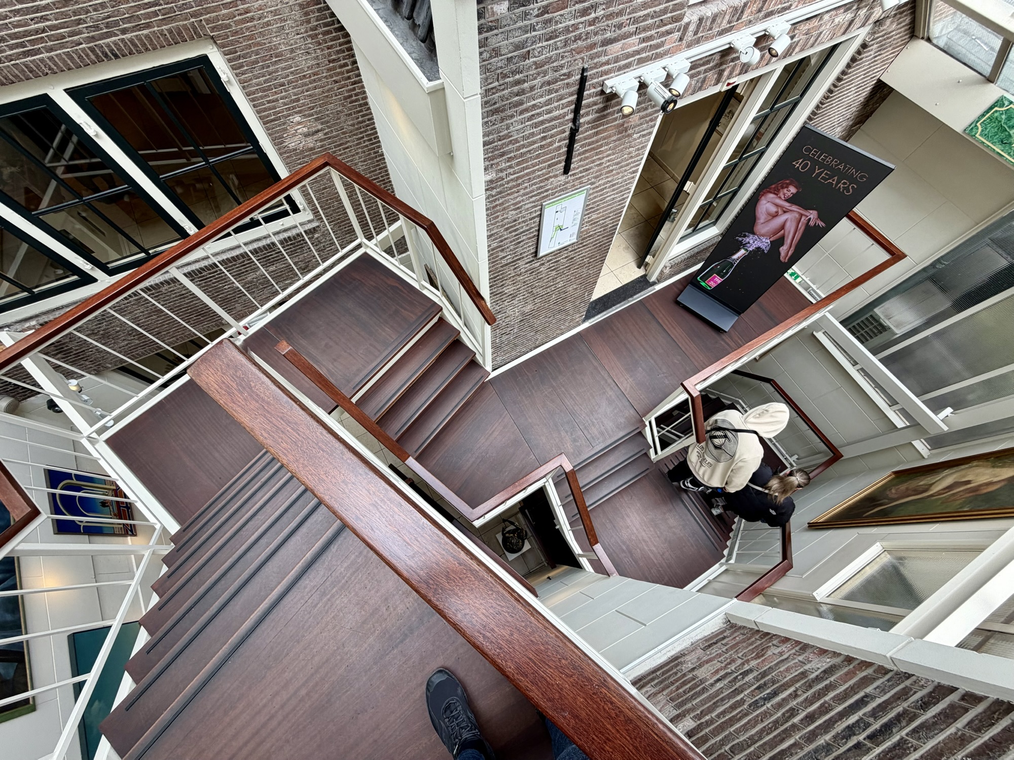
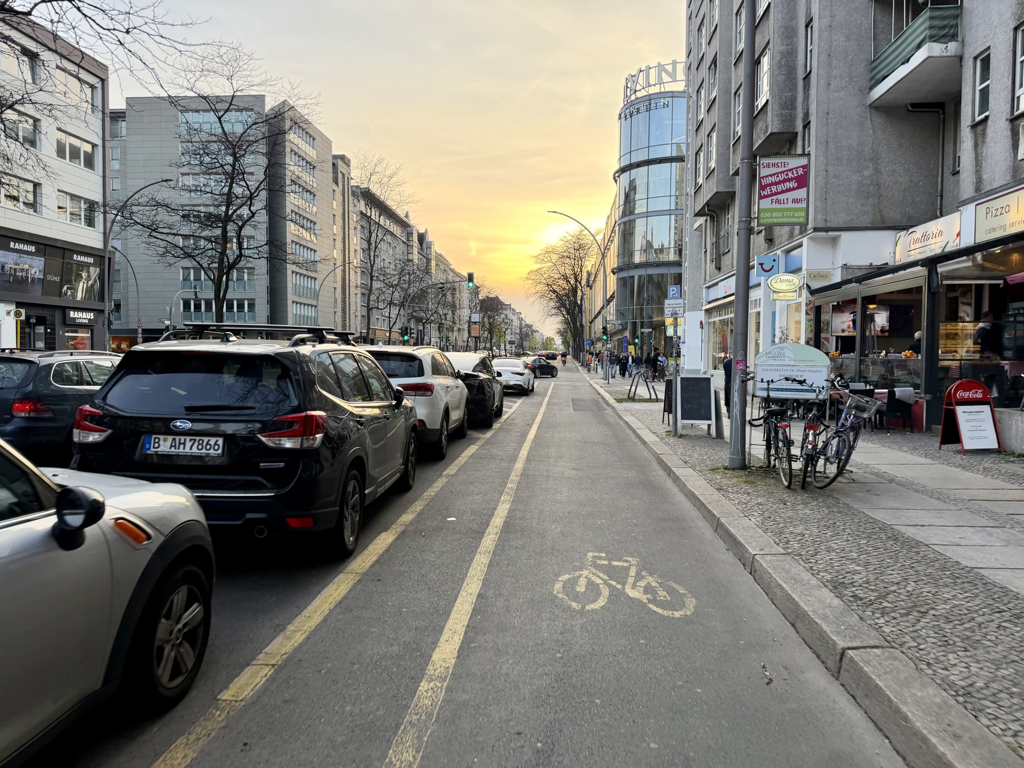
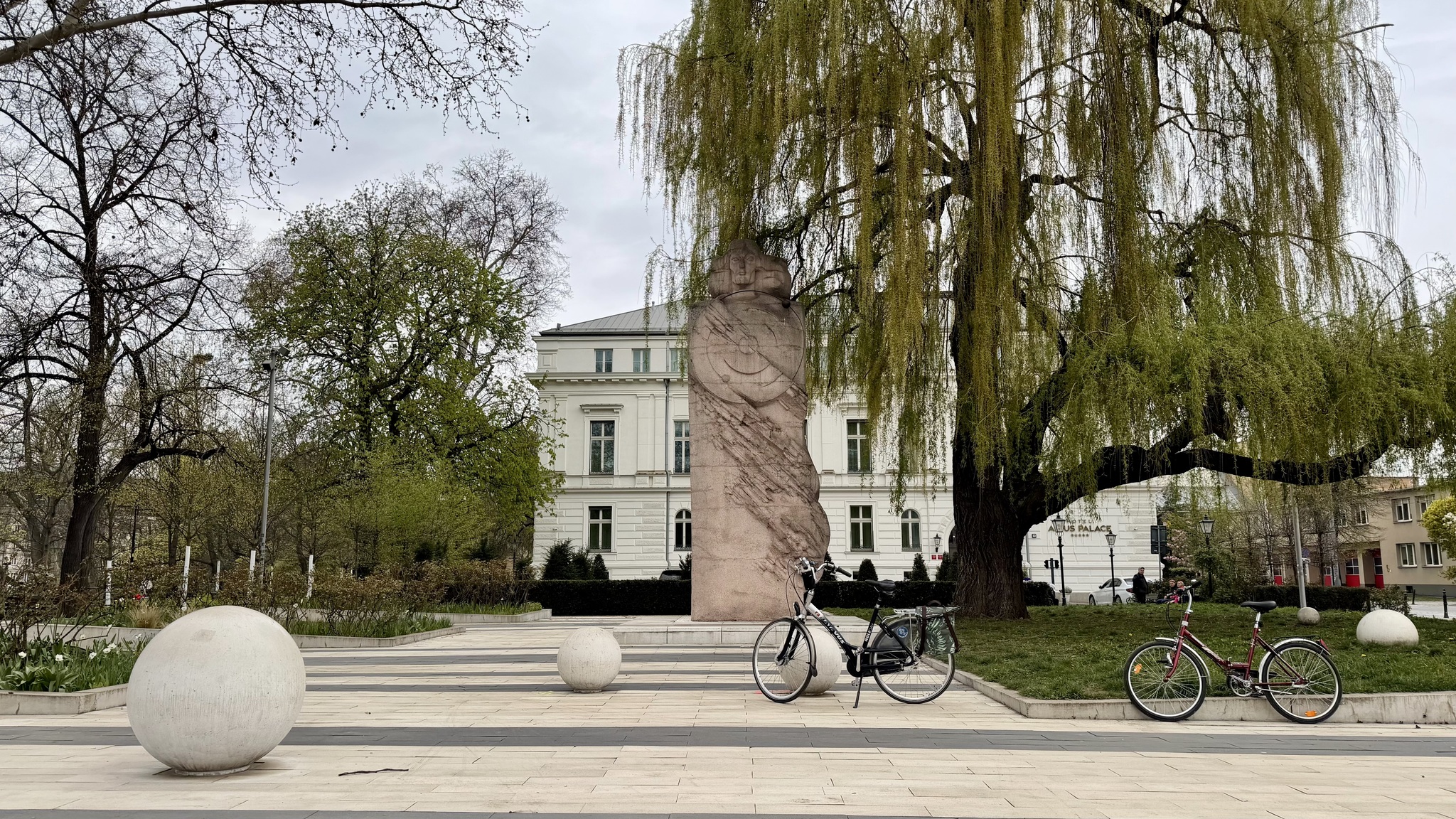
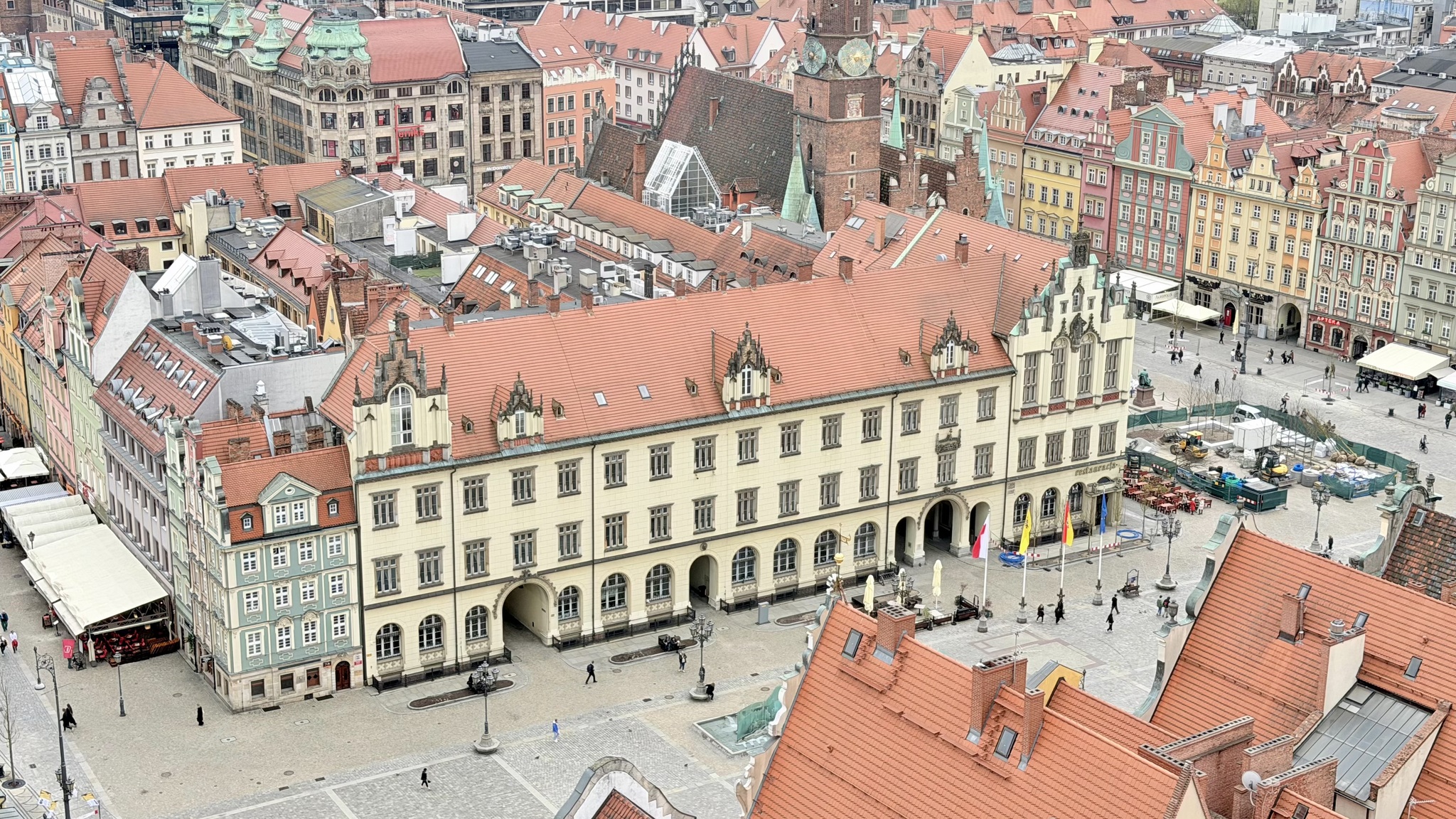
When we were in Amsterdam a couple weeks ago it was from Monday to Saturday morning. We were impressed that despite crowds of tourists the city was incredibly clean. There was no litter. However, this morning (a Monday) we did see litter perhaps from even bigger weekend crowds. But, workers were out sweeping and blowing litter into the path of street sweeping trucks. Amsterdam is a much cleaner city than Berlin where we saw a lot of litter day after day.
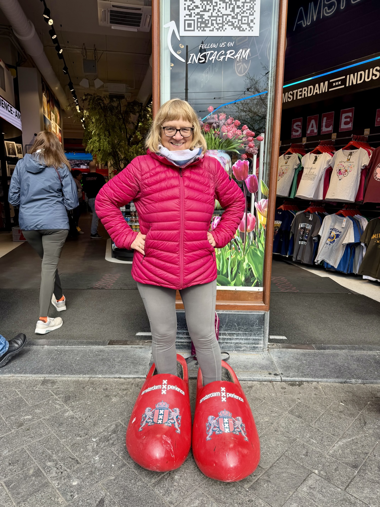
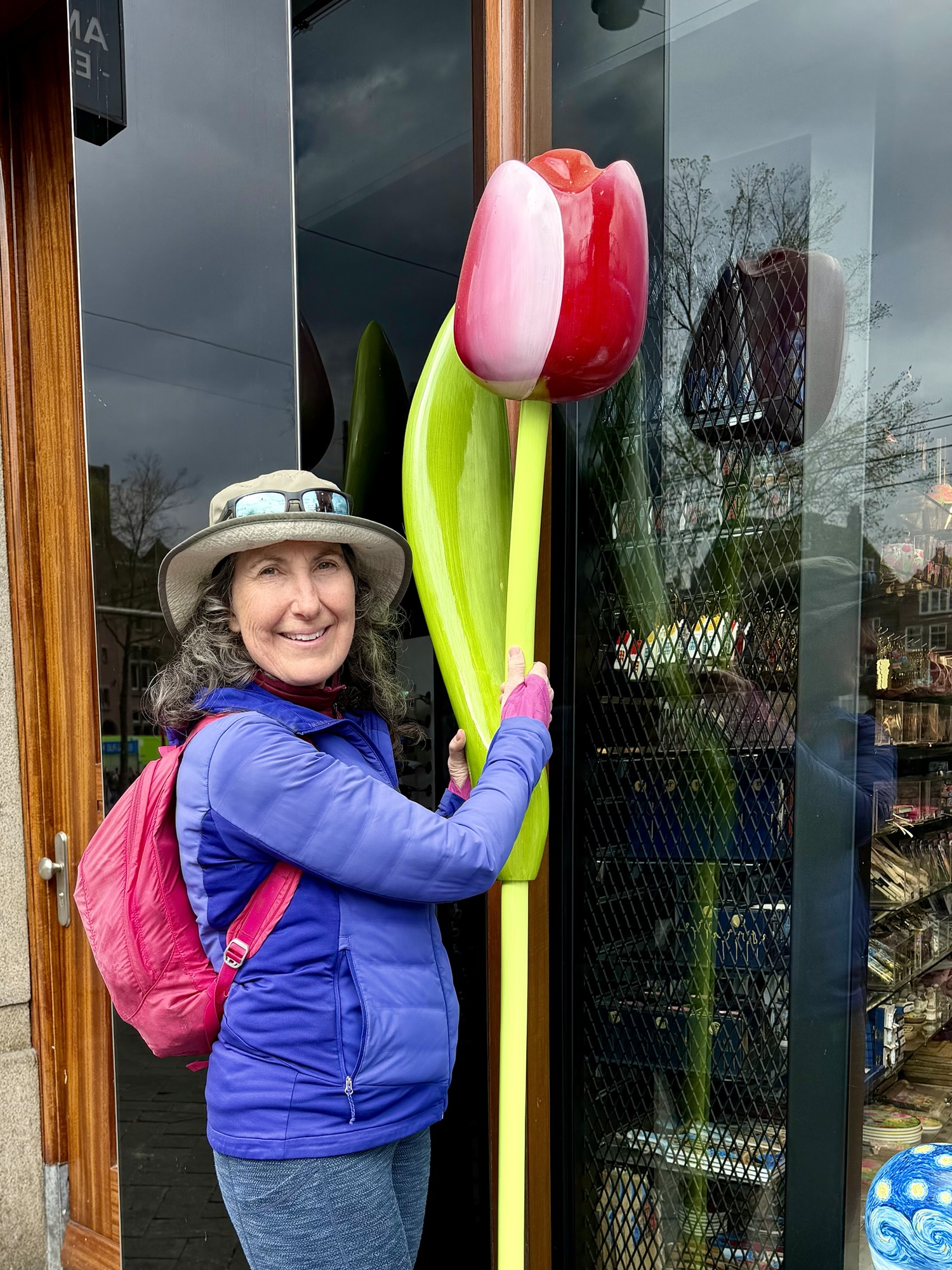
This gift shop had tulips and clogs for tourists to pose with.
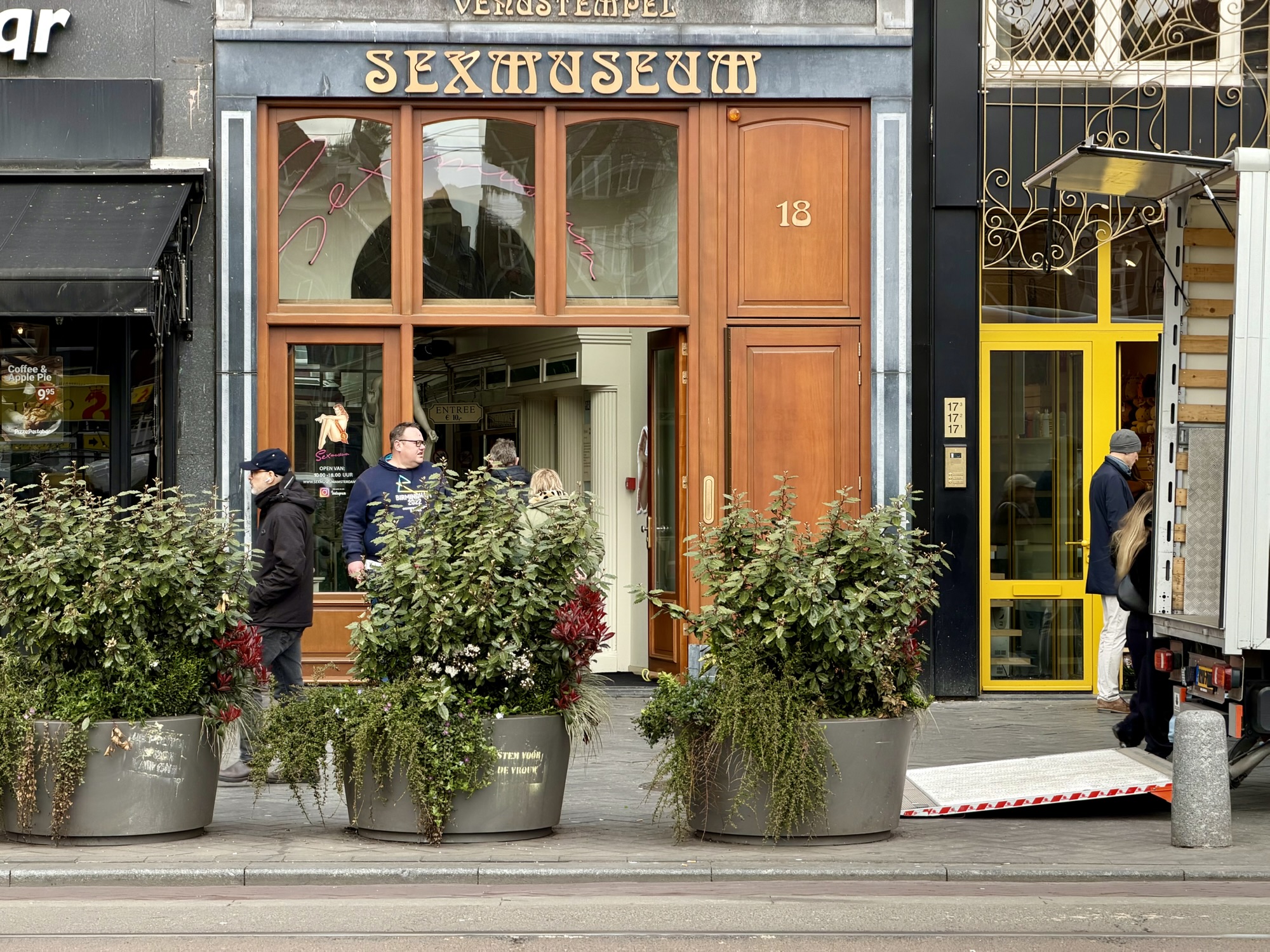
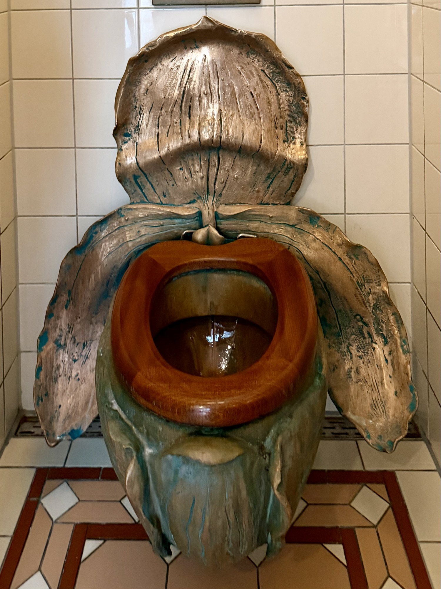
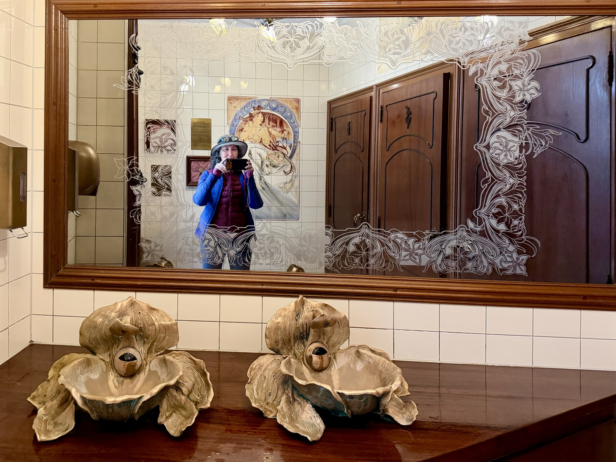
We decided to visit The Sex Museum, a small museum a few blocks from the central station. It was an interesting museum, the first of its kind in the world when it opened in the 1970s. I would recommend it.
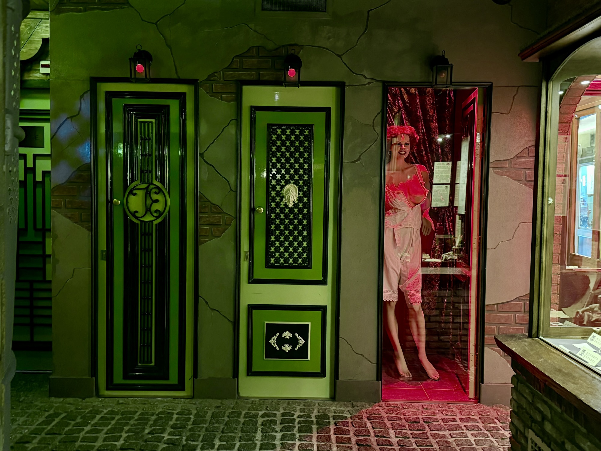
Most of the pictures that I took there are NSFW (not safe for work). The building layout was interesting. As were the all gender bathroom fixtures.
This video would begin playing when someone started to wash their hands. There is nudity in the latter half of the video below.
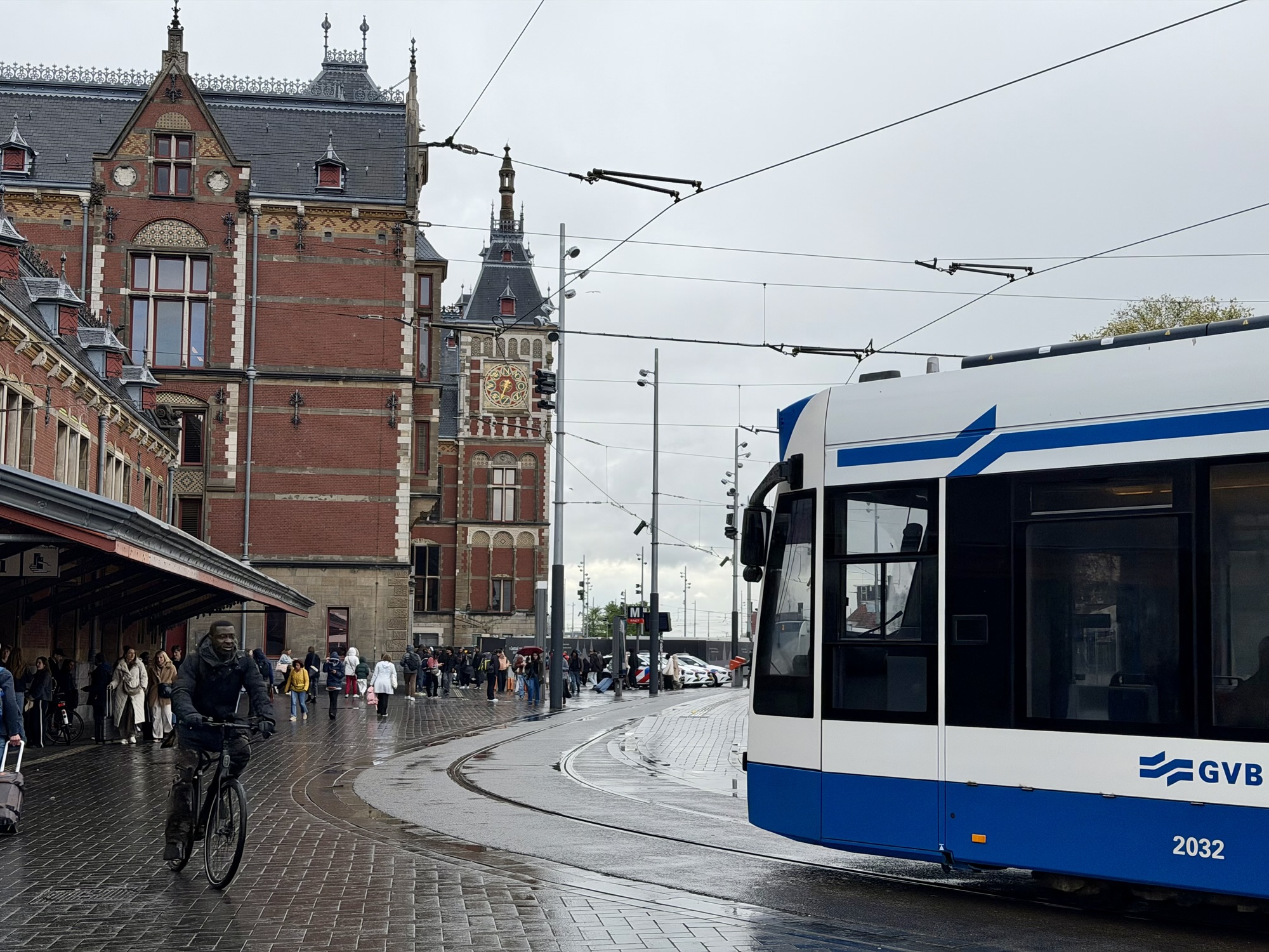
When we were finished there, it had started to rain so we decided to pick up our luggage and take the train to the airport. This time the train to the airport was uncrowded unlike nine days ago on a Saturday evening.
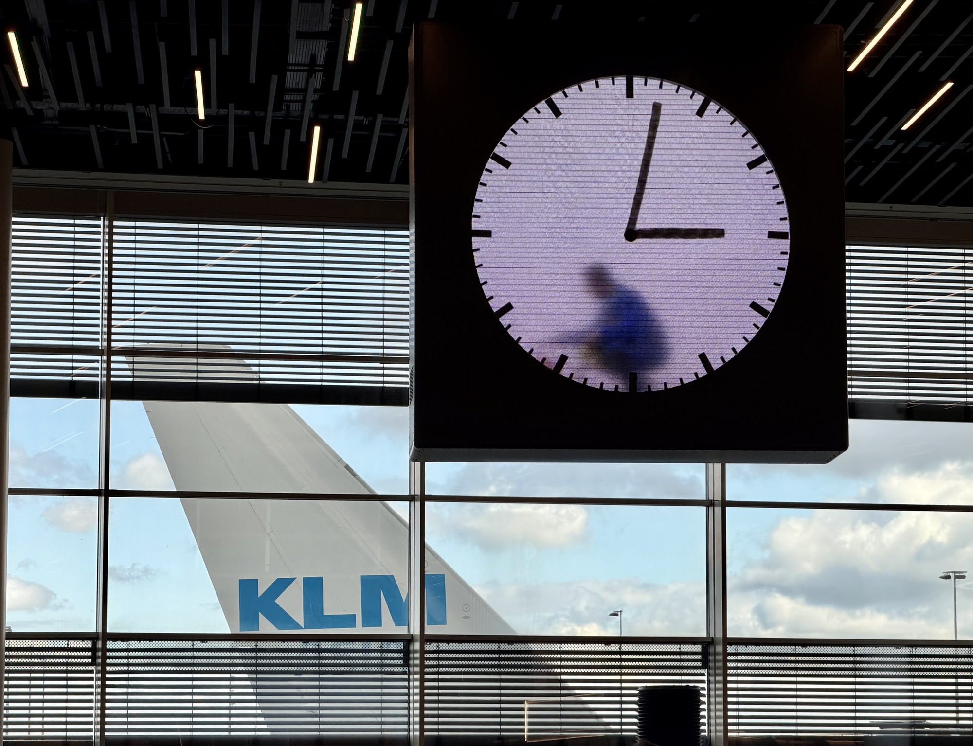
We were checked in and through security by 3 PM for our 5:50 PM flight. This clock in the departure area is a work of art called Clock Man by Maarten Baas. It is a seamless 12-hour continuous video recording of an actor (Tiago Sá da Costa) filmed wiping away the old time and drawing a new hand every minute.
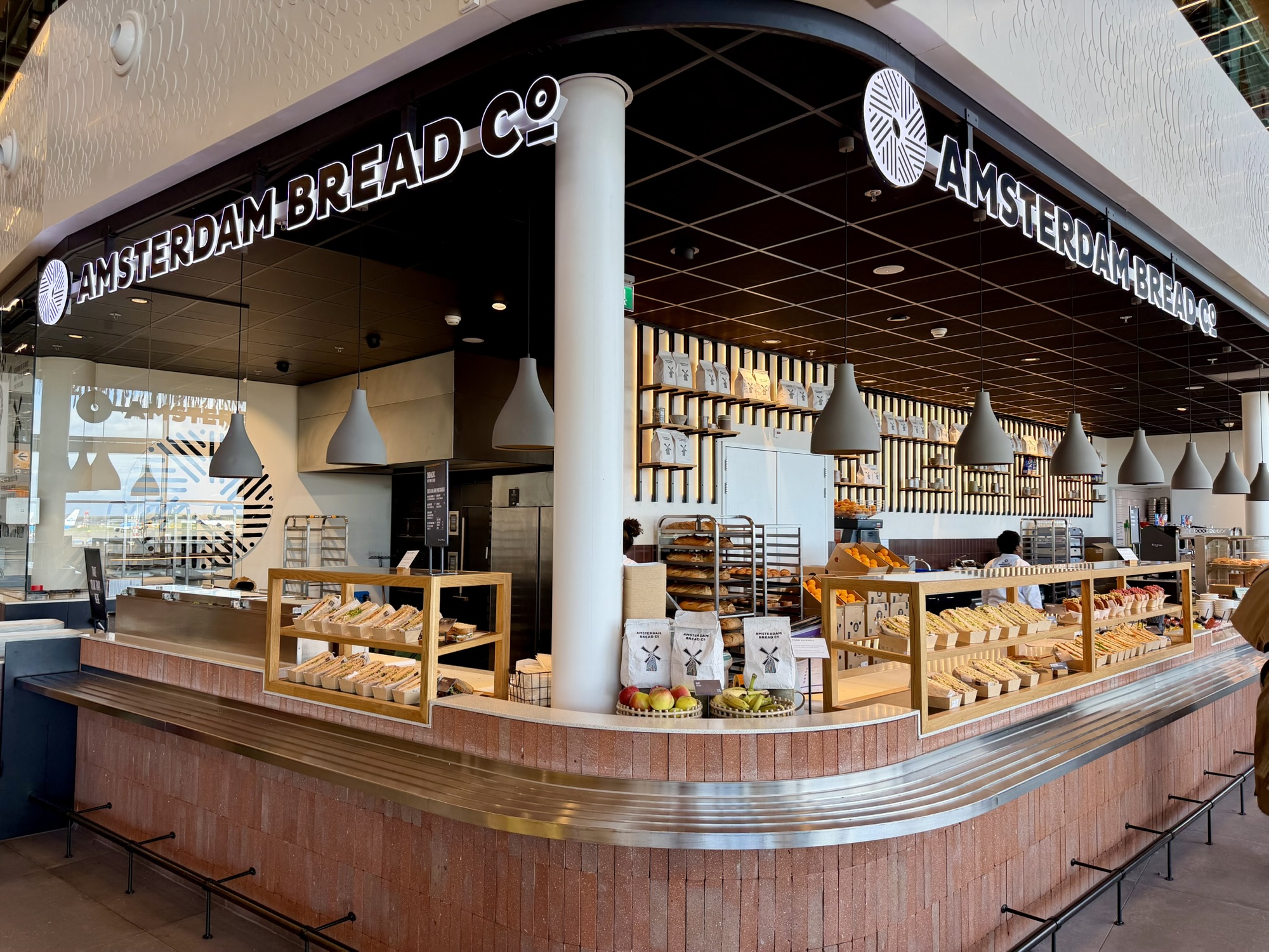
We found a reasonably priced place to buy lunch with very comfortable chairs adjacent to it.
The rain had stopped, and there was a beautiful sky by the time we took off.
The food served on the plane was reasonably good for airplane, food, and plentiful.
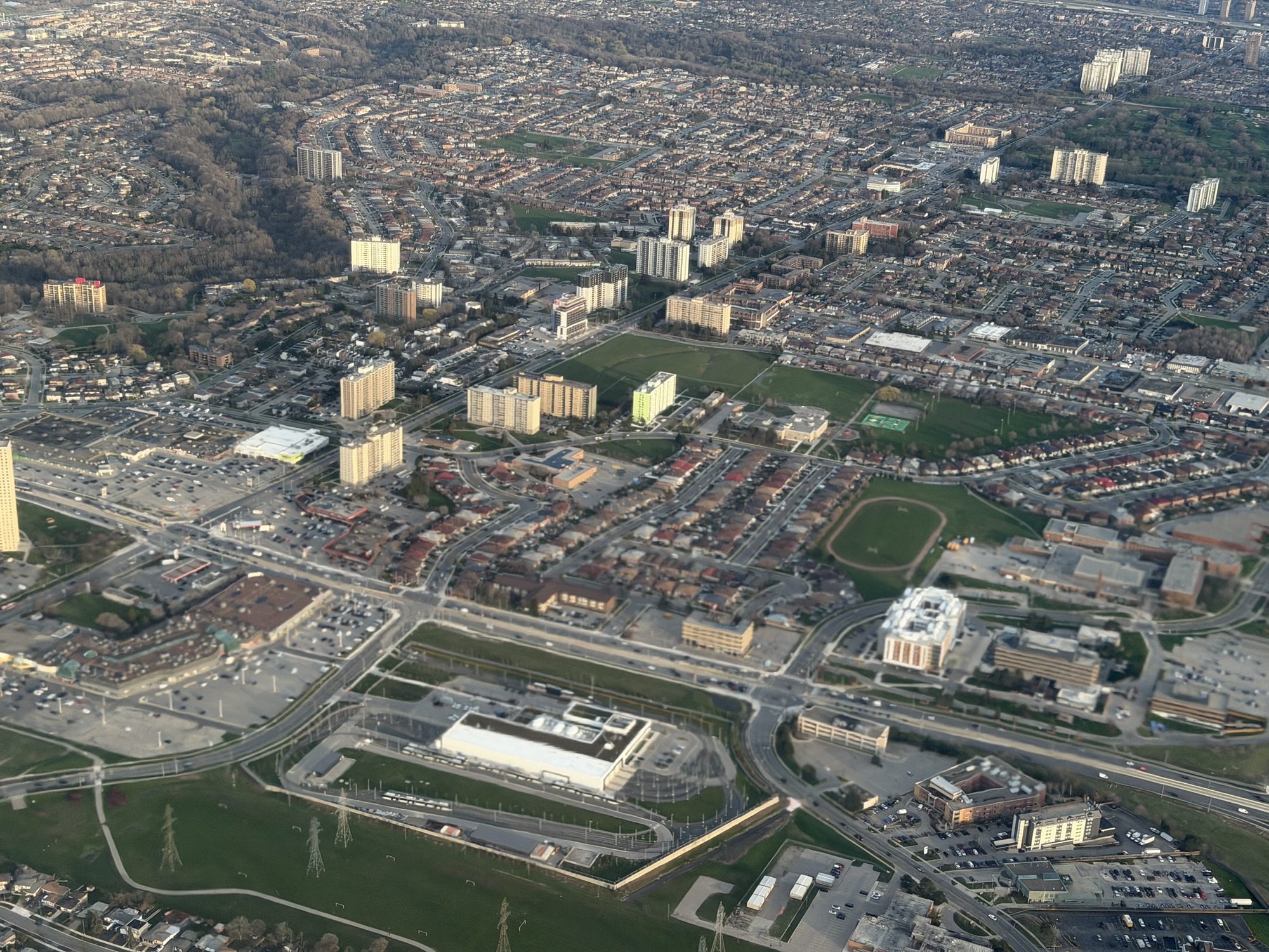
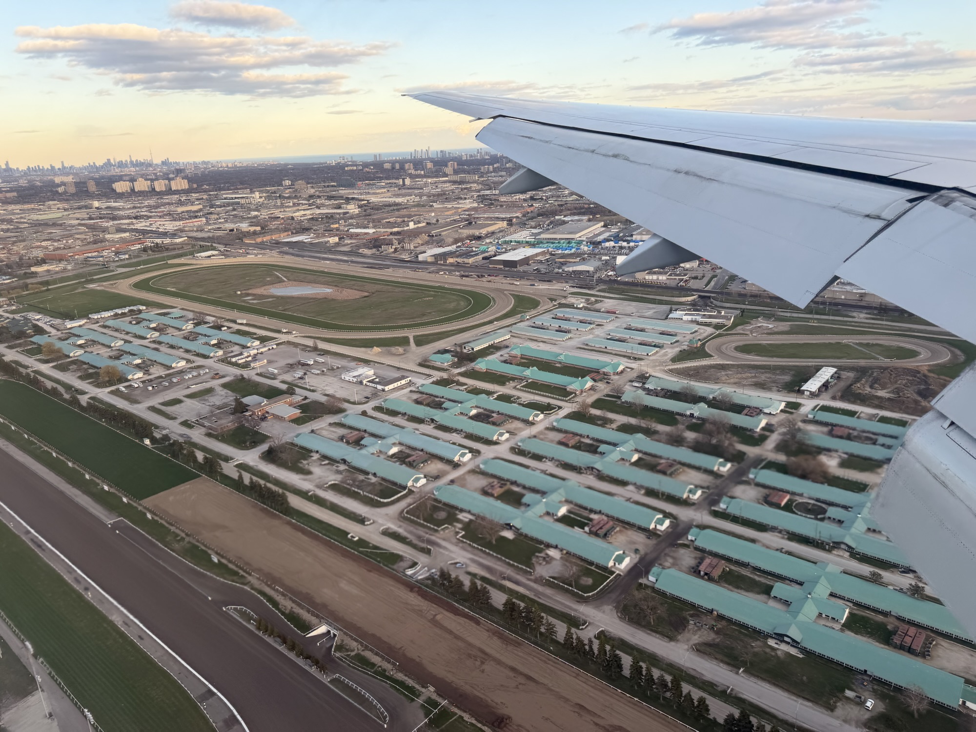
We had good views as we descended into Toronto. In the first picture, you can see the Finch hydro corridor trail in the bottom left corner. In the second, you can see the stables that Woodbine racetrack.
I texted Michael that we had landed and he and Alun started driving to pick us up. However, our van broke down before he got to the airport. He called CAA for a tow. Cindy came to the rescue and picked us up, even though she had just flown in five hours earlier. As she was driving us north on Torbram Road the tow truck was just dropping off our van and the guys at our garage so she picked them up and dropped us all at home. Thanks, Cindy. Fortunately, it was a small repair involving replacing the thermostat.
It was a wonderful trip with a wonderful friends. It was also good to be back home with family.
The weather forecast for today has been predicting the first substantial amount of rain of our whole trip. The weather has been almost perfect for weeks. We planned our day with indoor activities in case the forecast proved accurate. It is our last day in Berlin so we packed up our suitcases and checked out. However, we made arrangements to leave our luggage and have access to the property in the evening to pick it up before catching a sleeper train to Amsterdam.
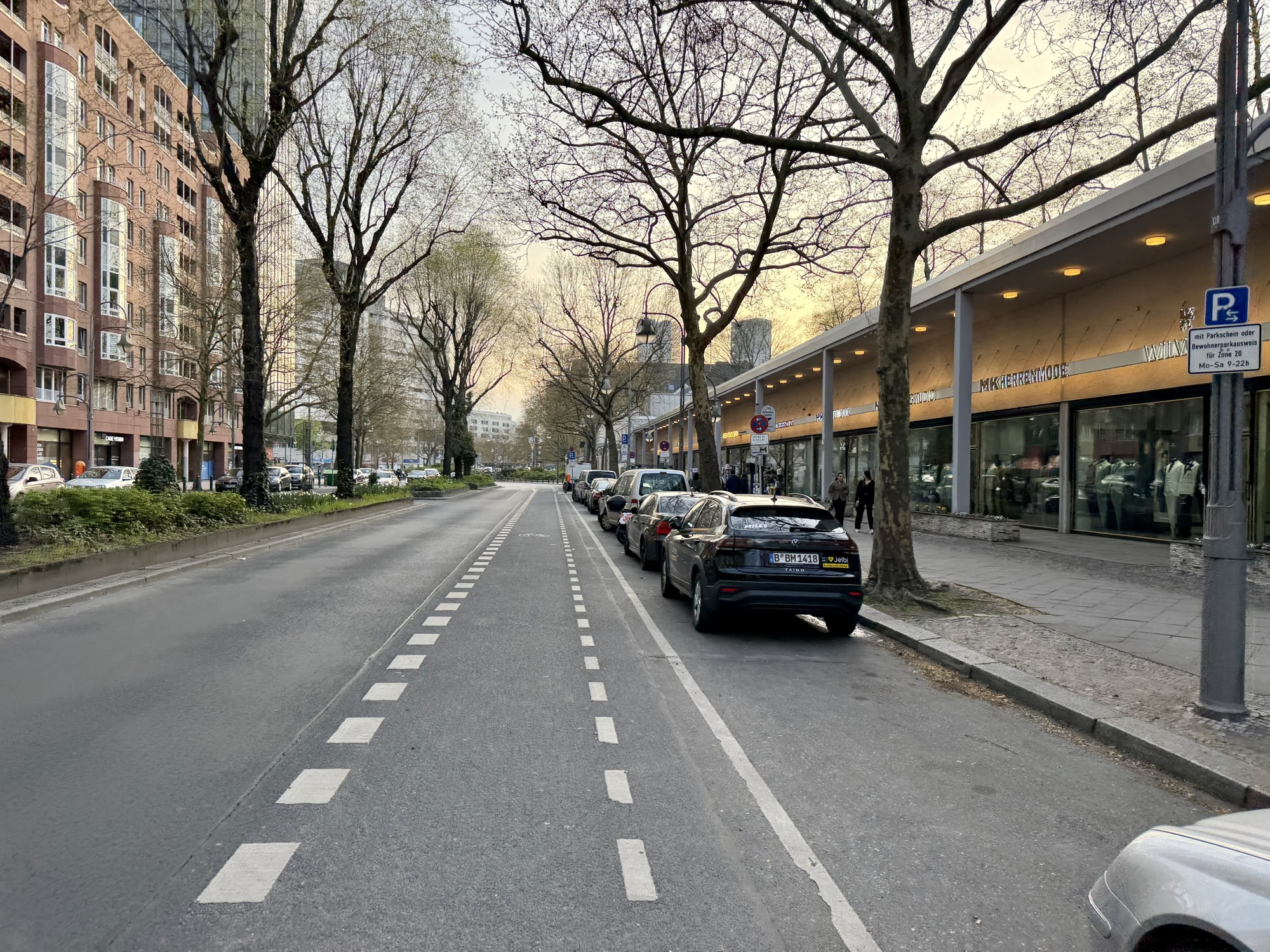
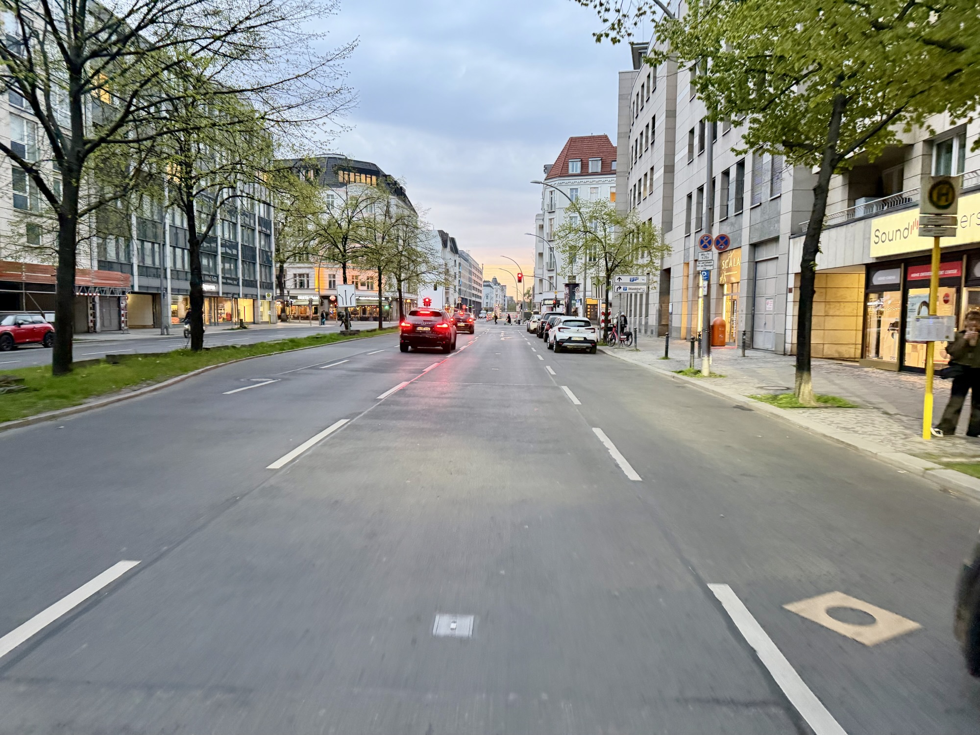
When we were ready it was overcast, but the forecasted rain had been pushed out to the afternoon. The streets were mostly empty of cars.
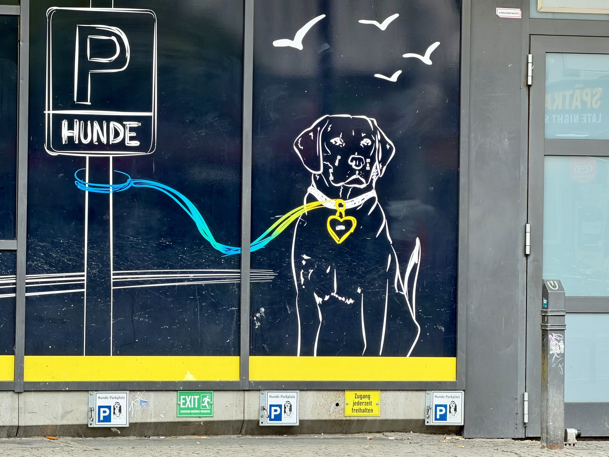
This store had dog parking.
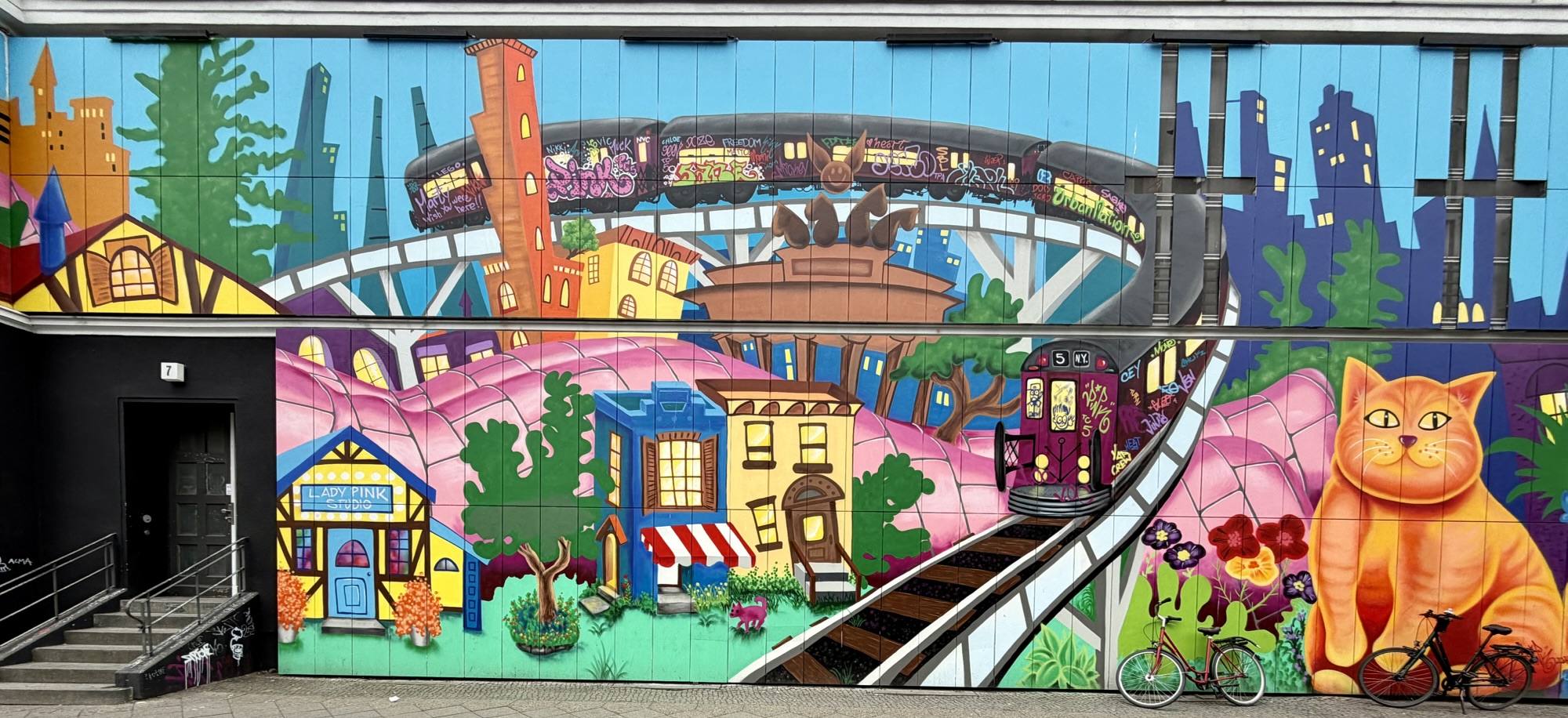
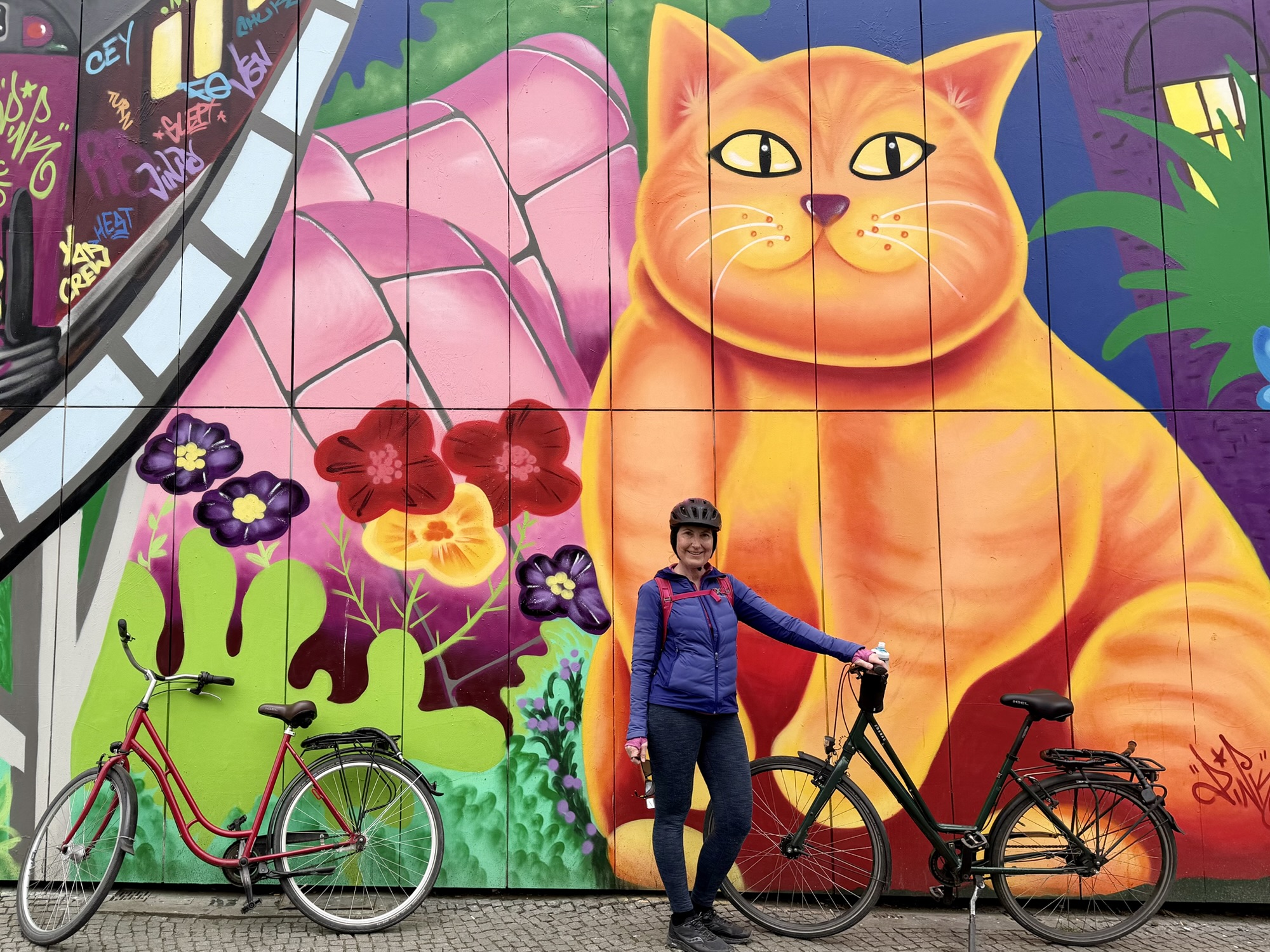
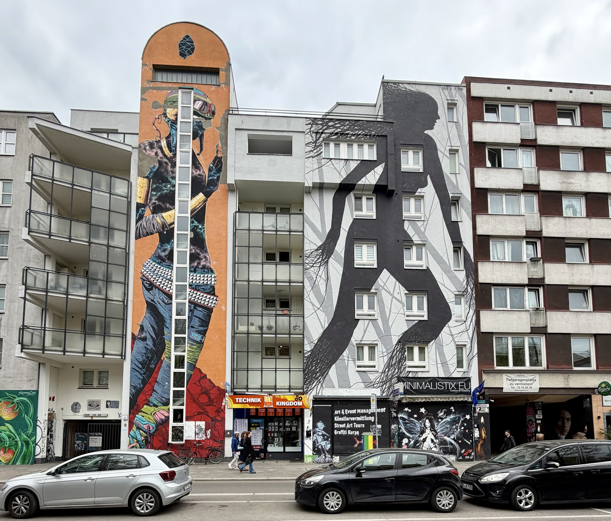
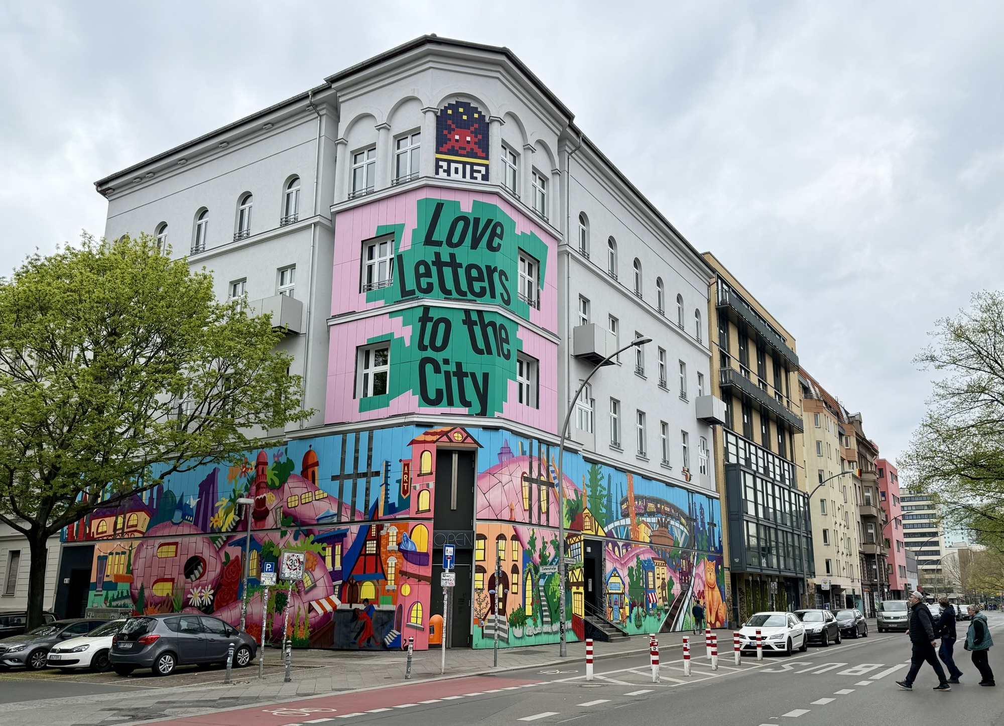
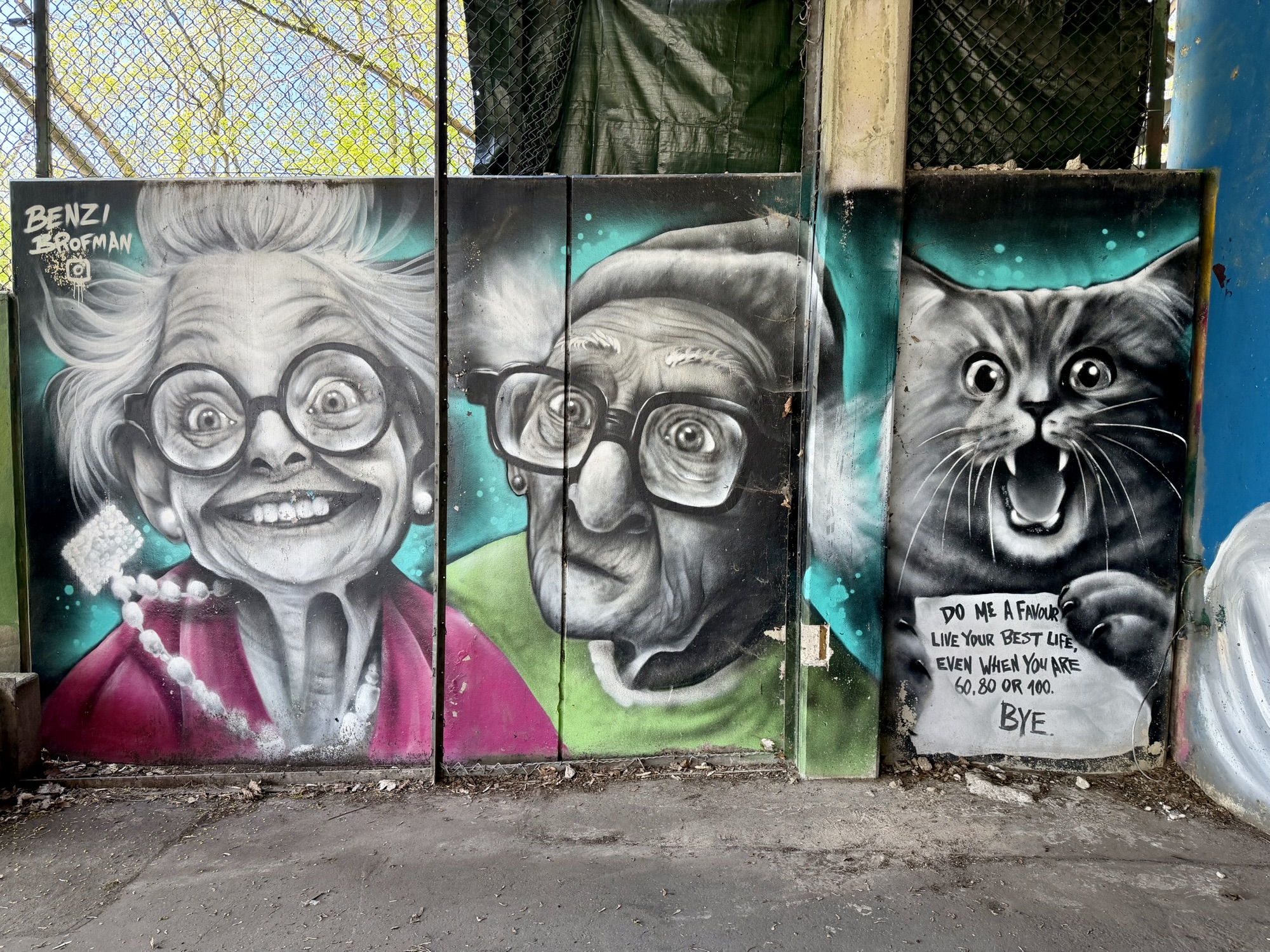
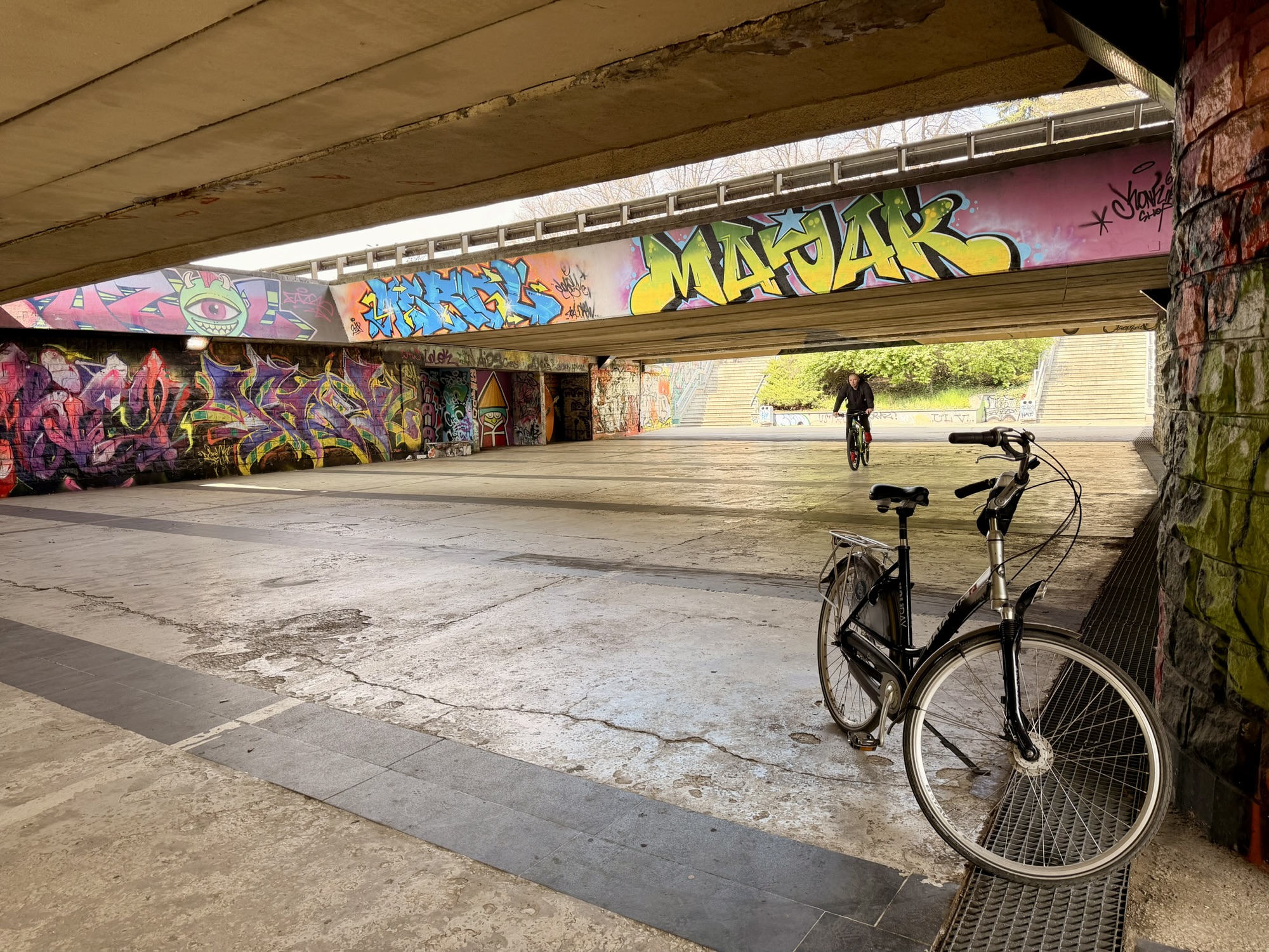
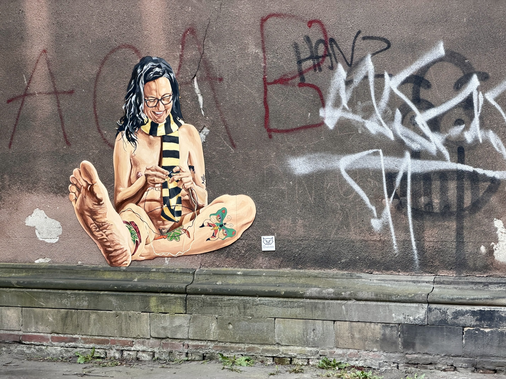
Berlin has a museum for urban contemporary art called Urban Nation. It wasn’t open yet for the day, but there were many beautiful murals along the street where the museum is located.
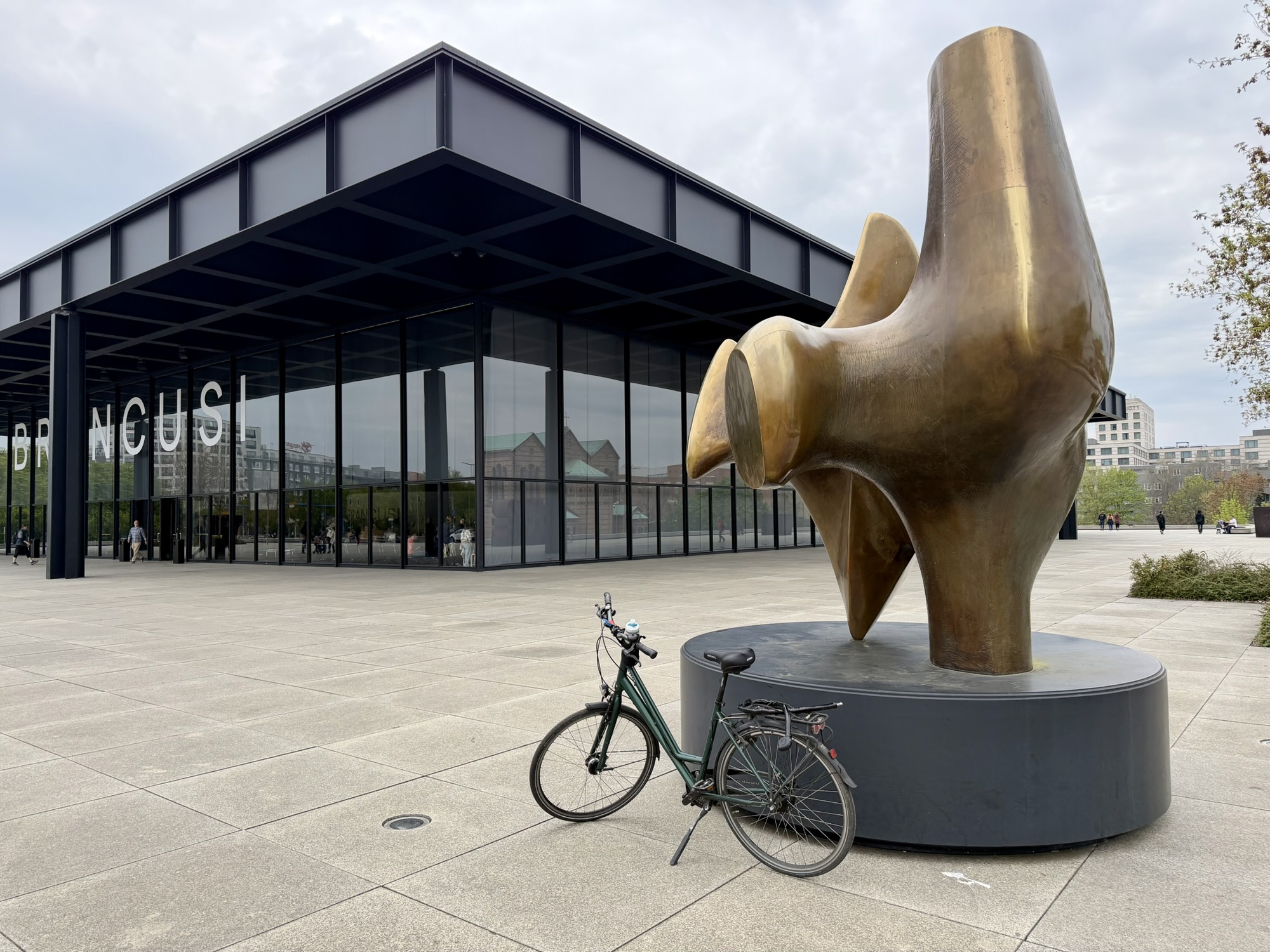
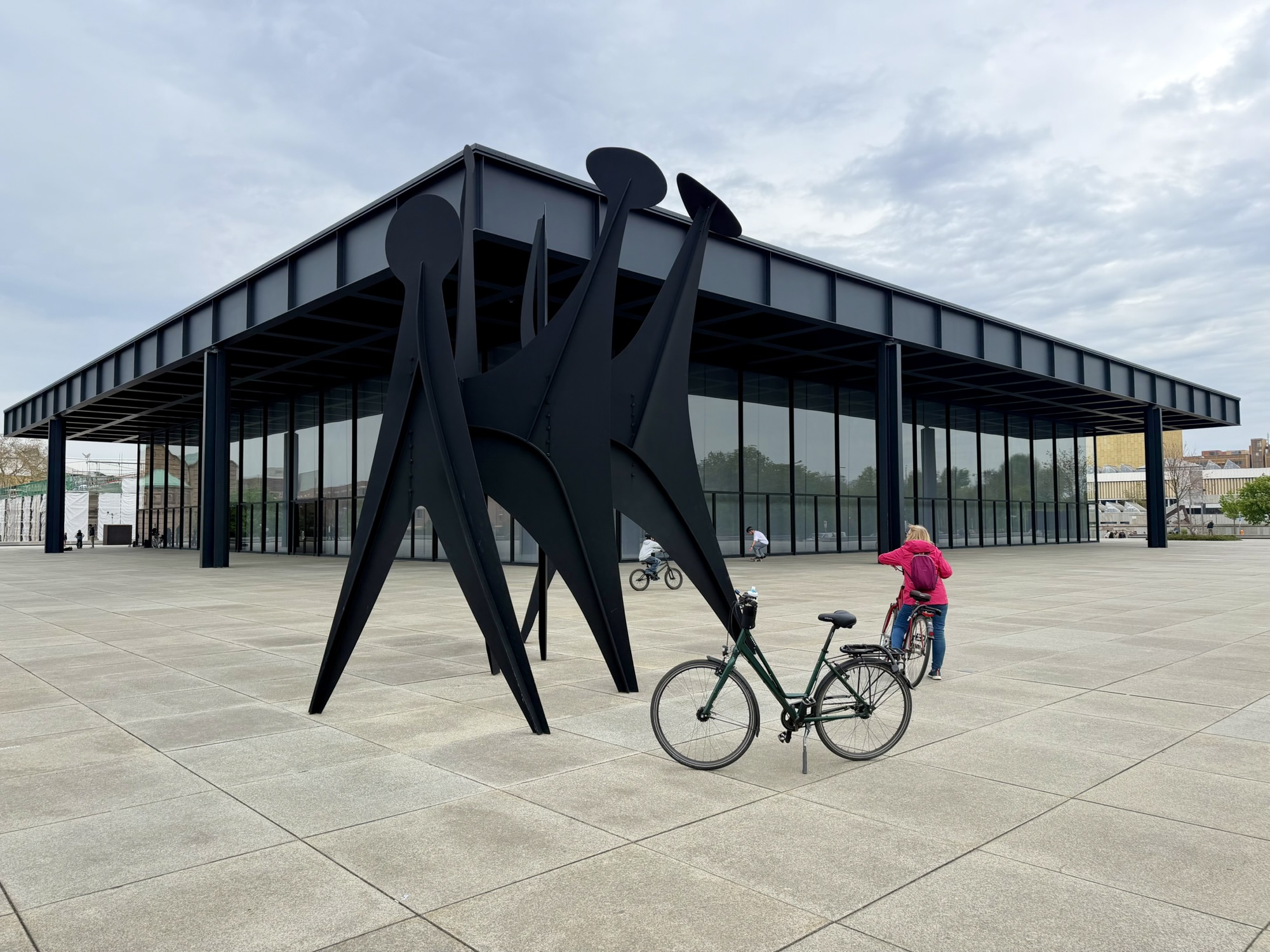
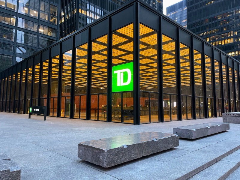
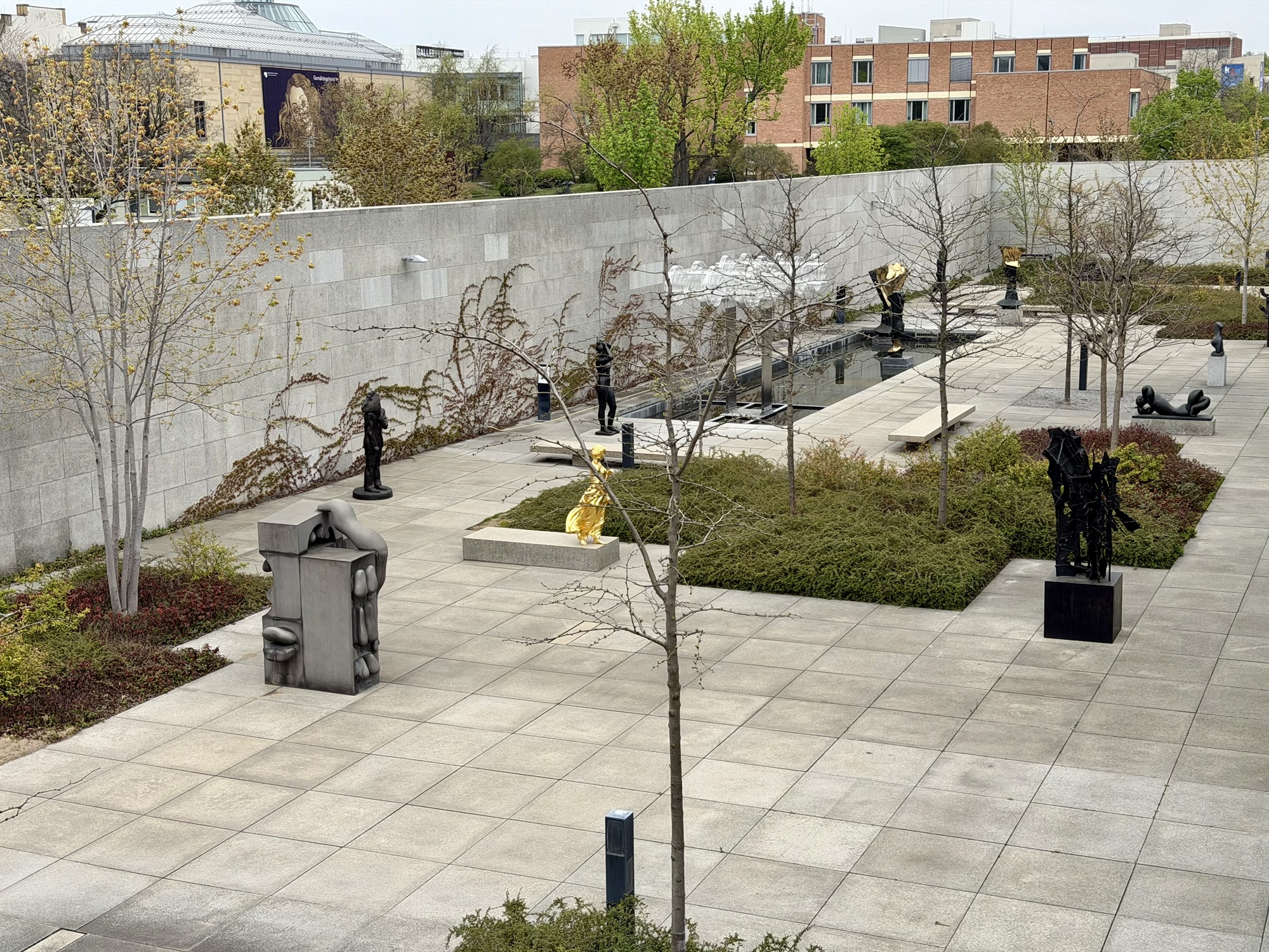
Our next stop was the New National Gallery. The architect was Ludwig Mies van der Rohe, a German and American architect. He is regarded as one of the pioneers of modern architecture. Special exhibits are displayed in the glass box portion of the gallery above ground. The glass and metal box is supported by only eight columns on the outside. There are no interior columns. People in Toronto would likely recognize this building as his work because of its similarity to part of the TD Centre in Toronto. There are Henry Moore and Alexander Calder sculptures outside the gallery.
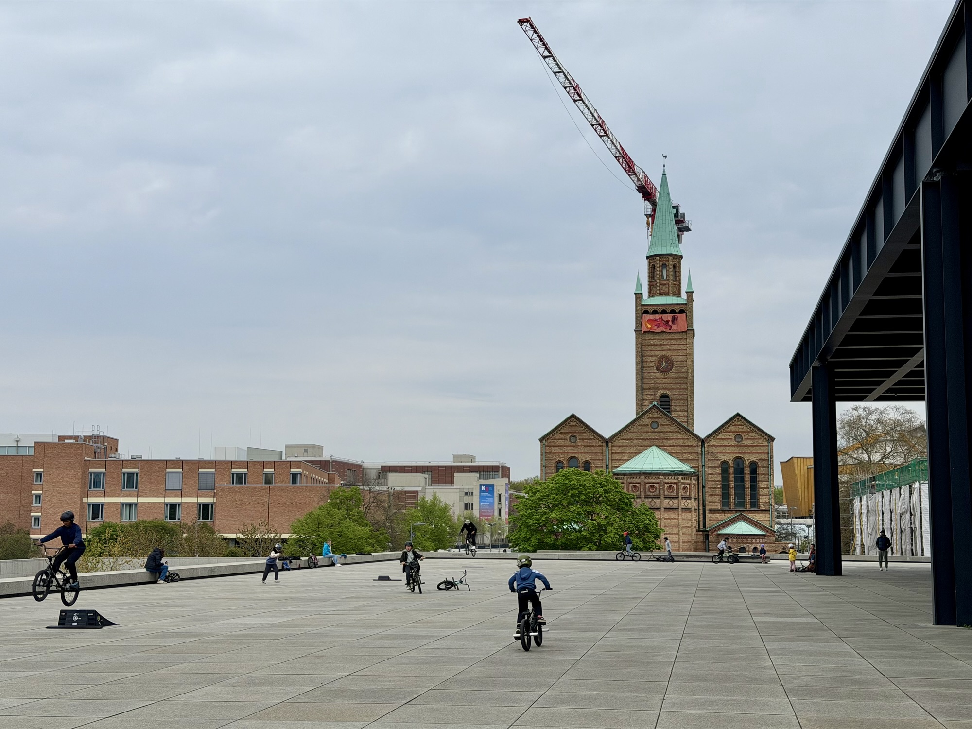
There were a lot of children on bikes playing on the large plaza around the museum. It seemed to be a tolerated behavior.
Below grade there was a sculpture garden, which is accessed from the below grade part of the gallery where the permanent collection is located.
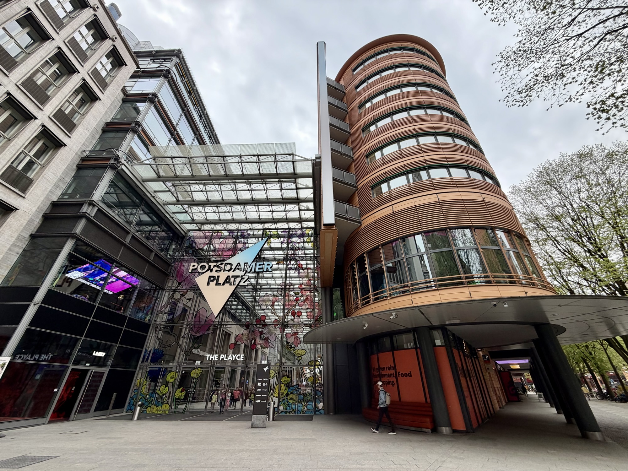
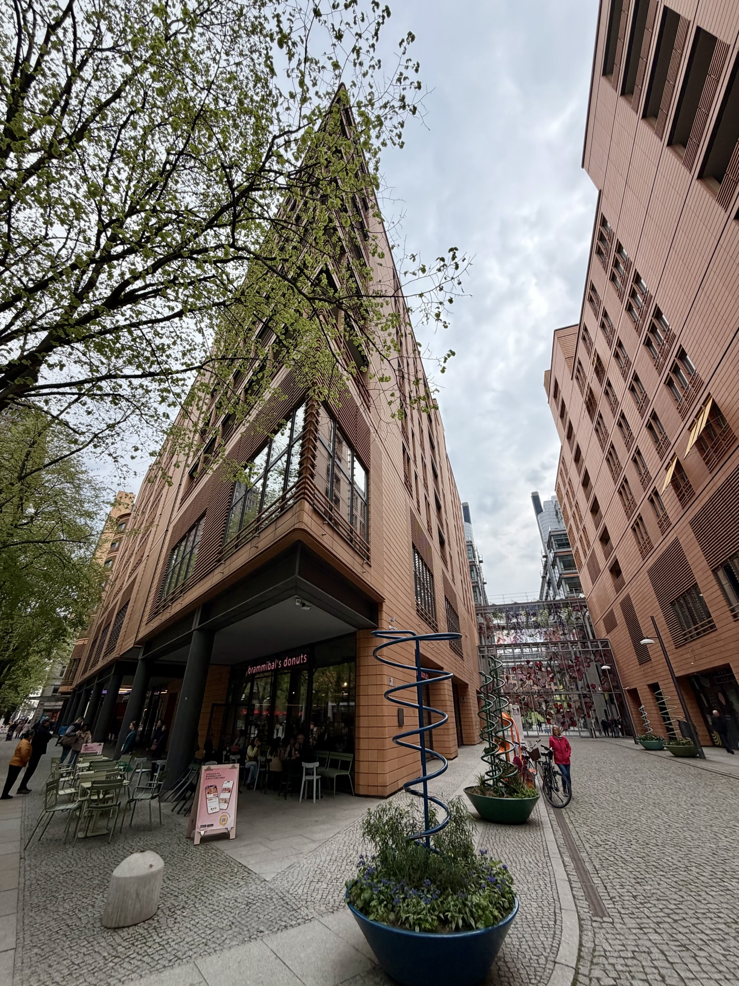
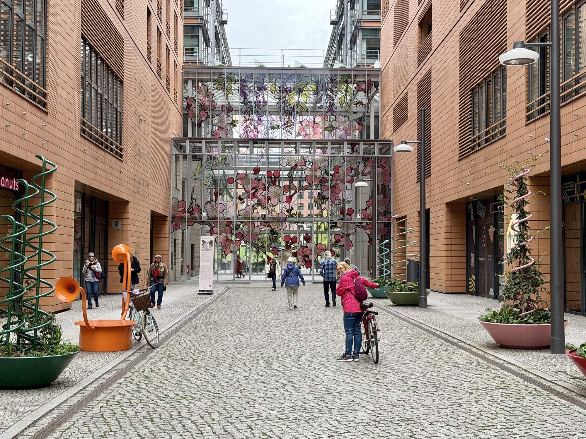
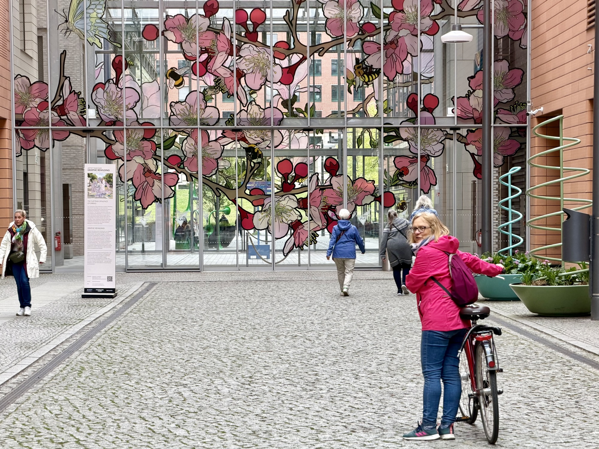
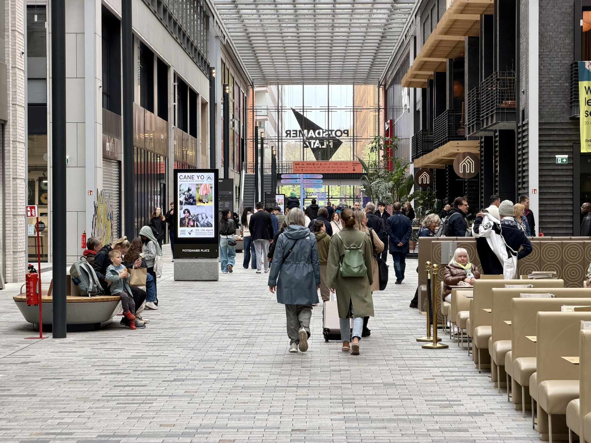
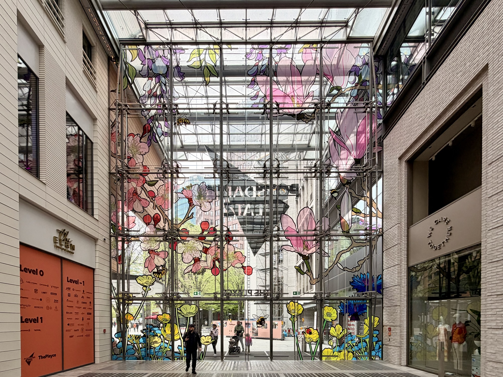
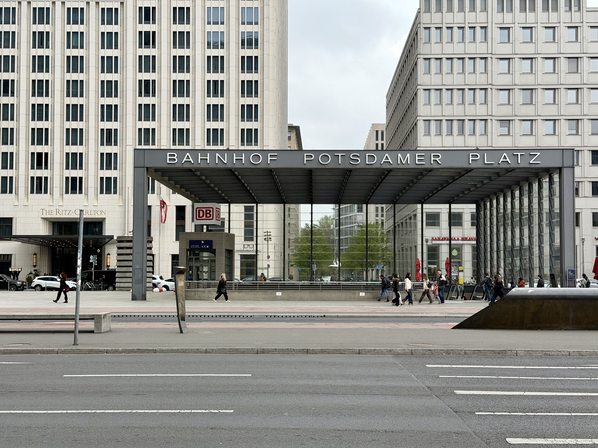
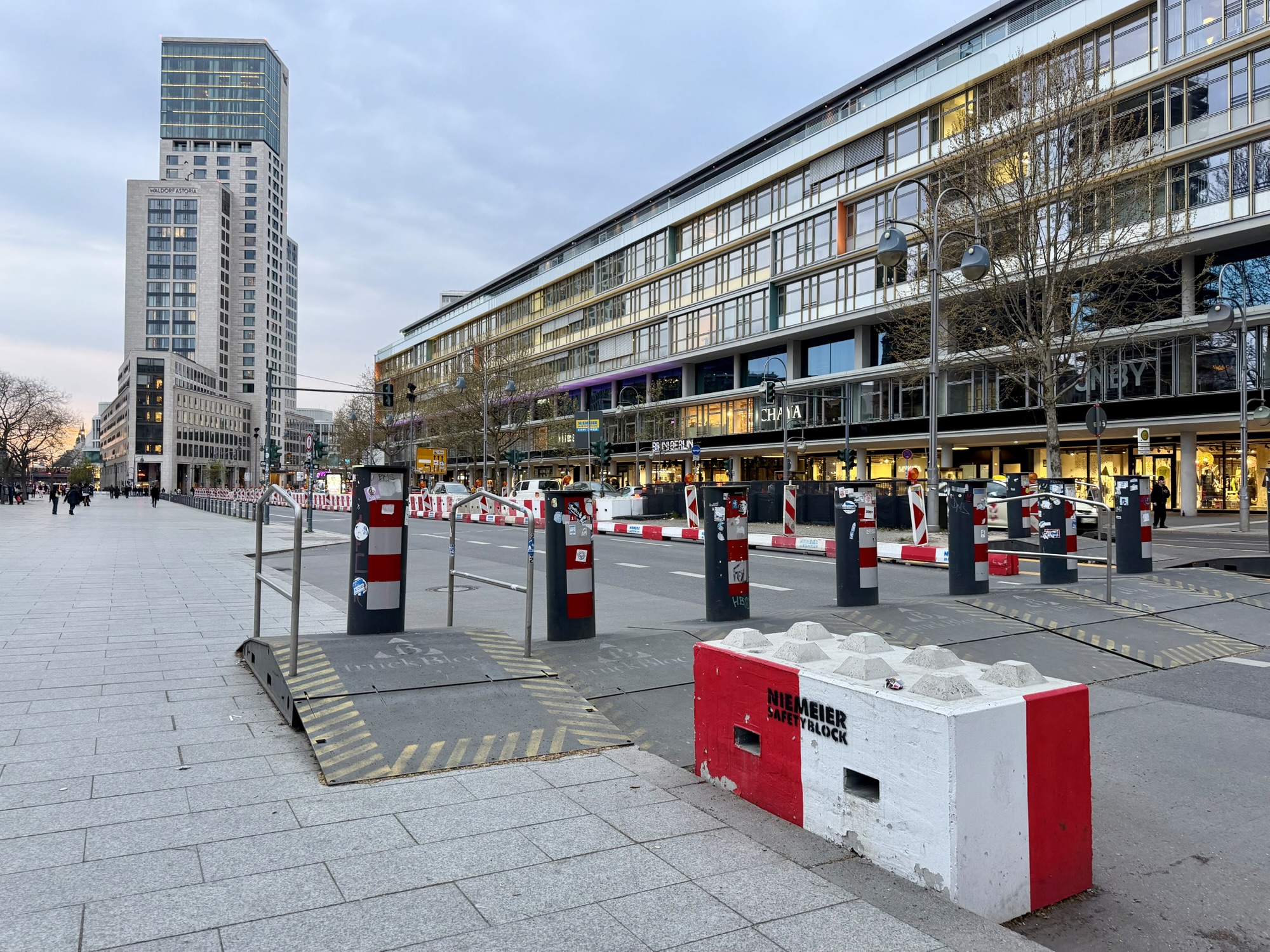
Because the weather was still dry we decided not to go in, but to continue exploring. Our next stop was Potsdamer Playce, a mall of 130 stores under a glass roof in Potsdamer Platz. Renzo Piano, an Italian architect, served as the master planner to reshape Potsdamer Platz between 1992 and 2000. He transformed a desolate, war torn, World War II wasteland previously divided by the Berlin Wall into a bustling, ultra modern urban centre. There are 19 individual buildings integrated with public green spaces and water features. The area was delightful, inside and out. The shopping mall had beautiful stained glass and was full of light. He is the architect of the new Provincial Law Courts at 11 Armoury St. in Toronto.
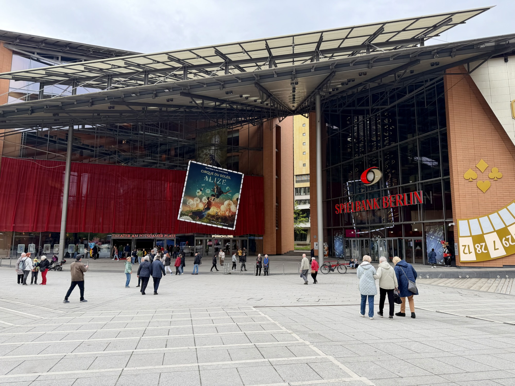
One of the buildings is a musical theater on the left, built for large scale stage productions, and casino on the right.
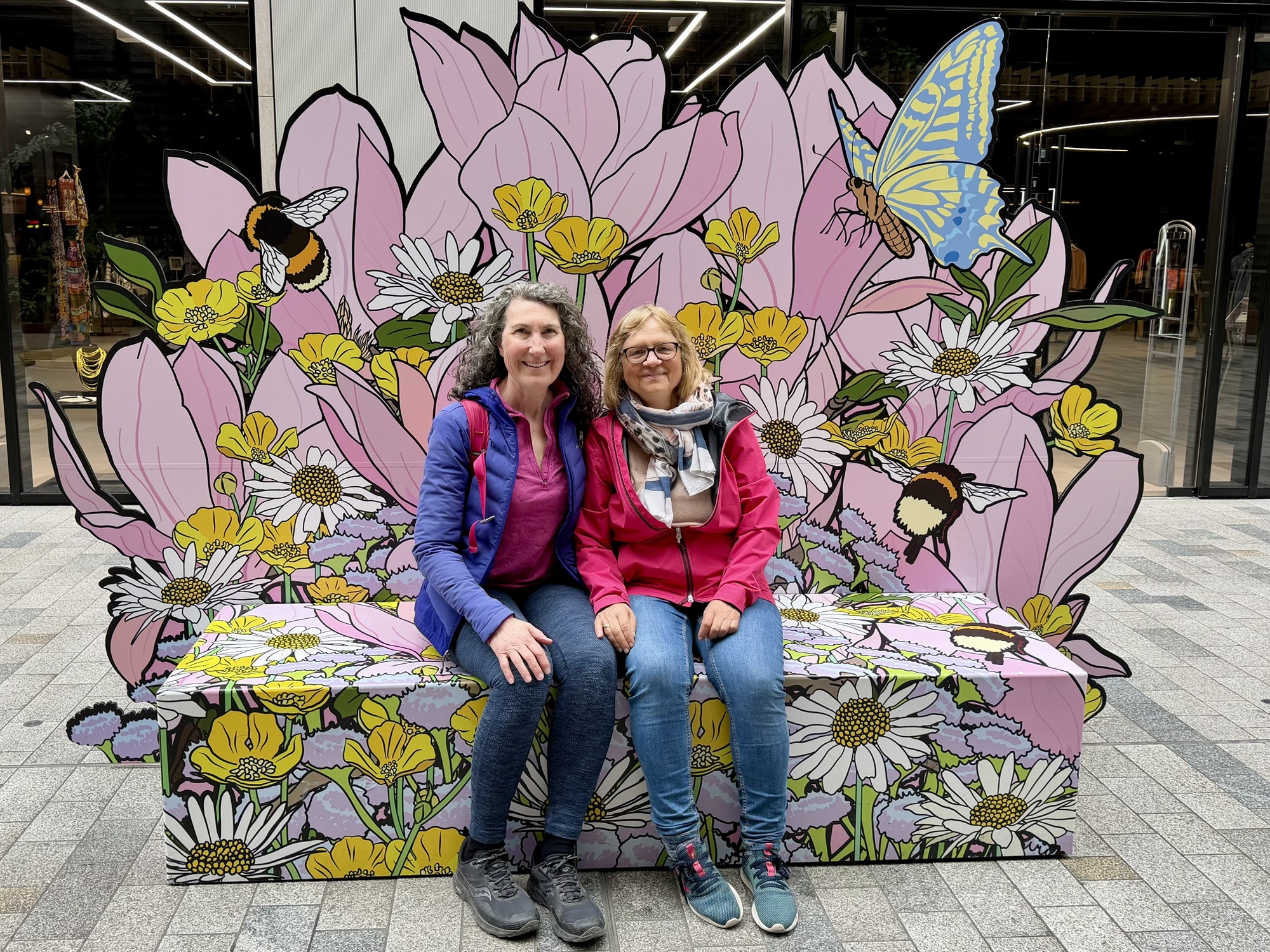
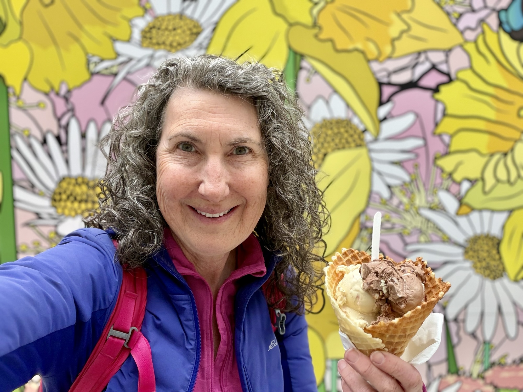
There were many of these benches around the area. We sat on one to have a snack. My gelato was absolutely delicious.
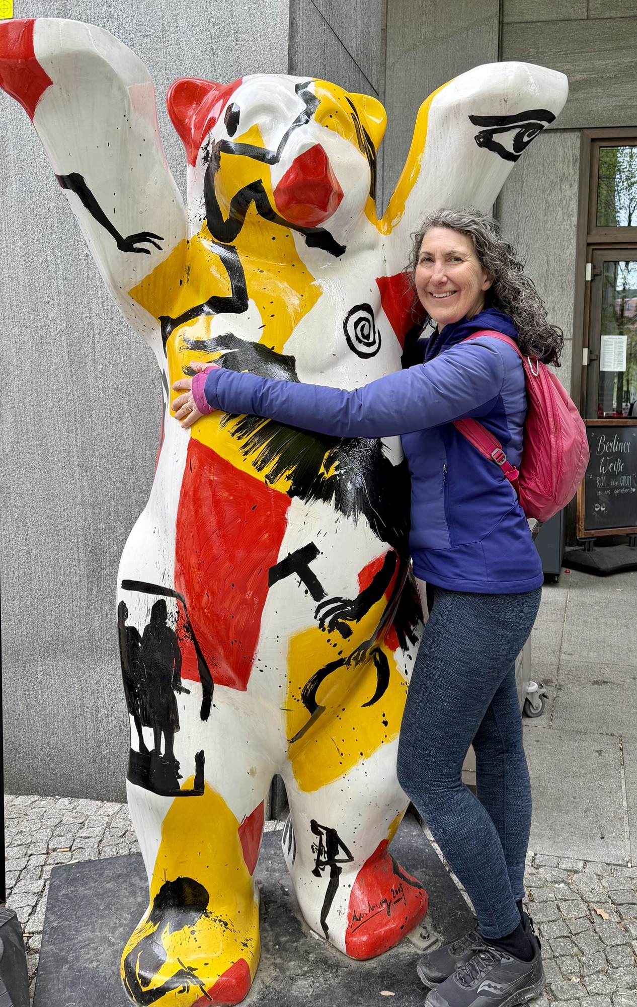
We saw these bears all over Berlin. They are called Buddy Bear Berlin. “The Buddy Bears are ambassadors of a cosmopolitan Berlin and promote peace intolerance around the globe”. The largest number of these bears are in Berlin, but there are almost 700 worldwide including one in Toronto at the German consulate.
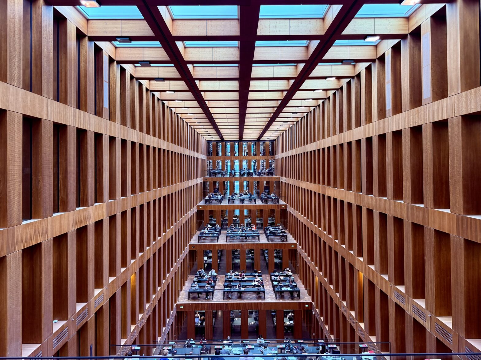
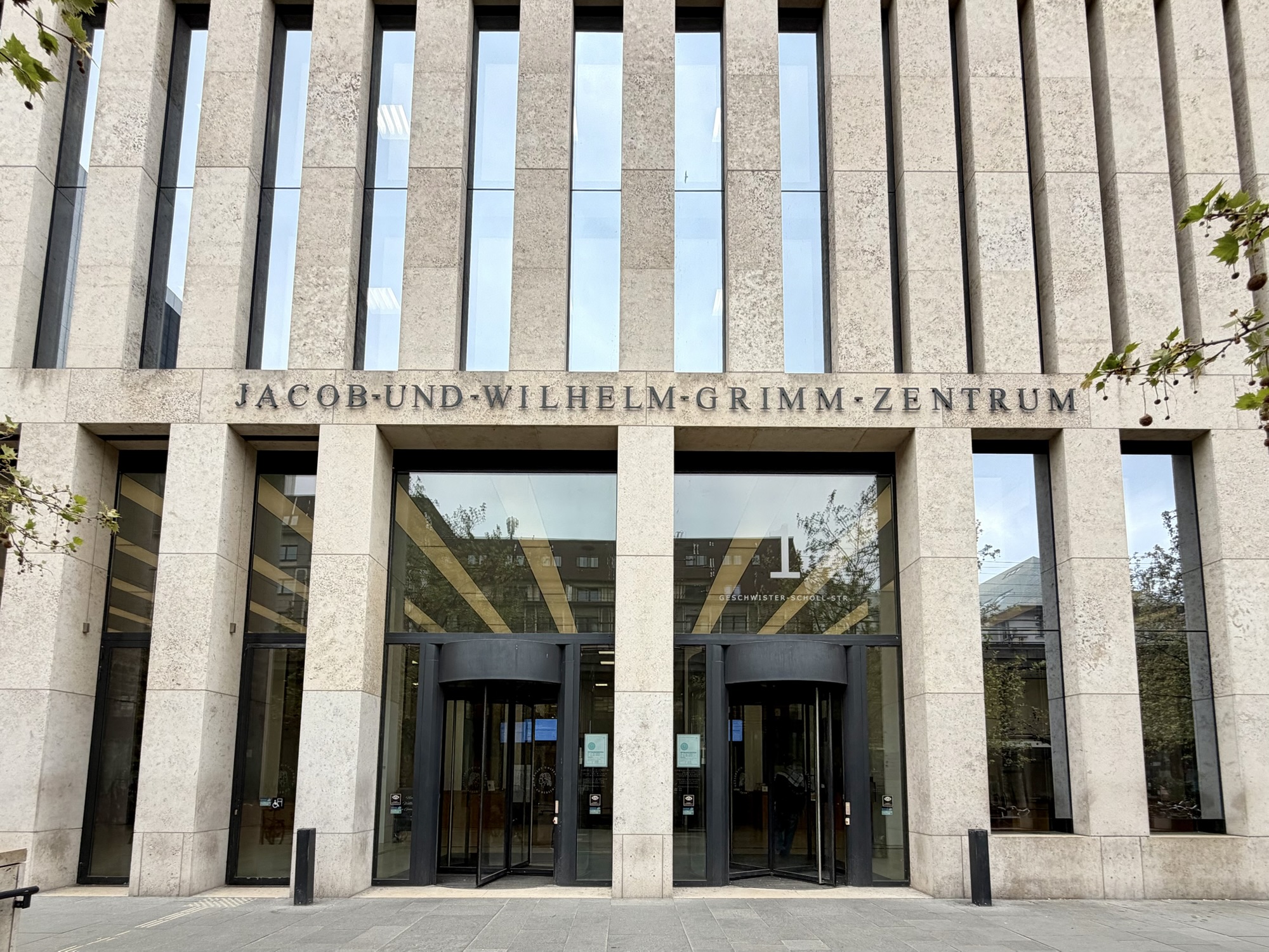
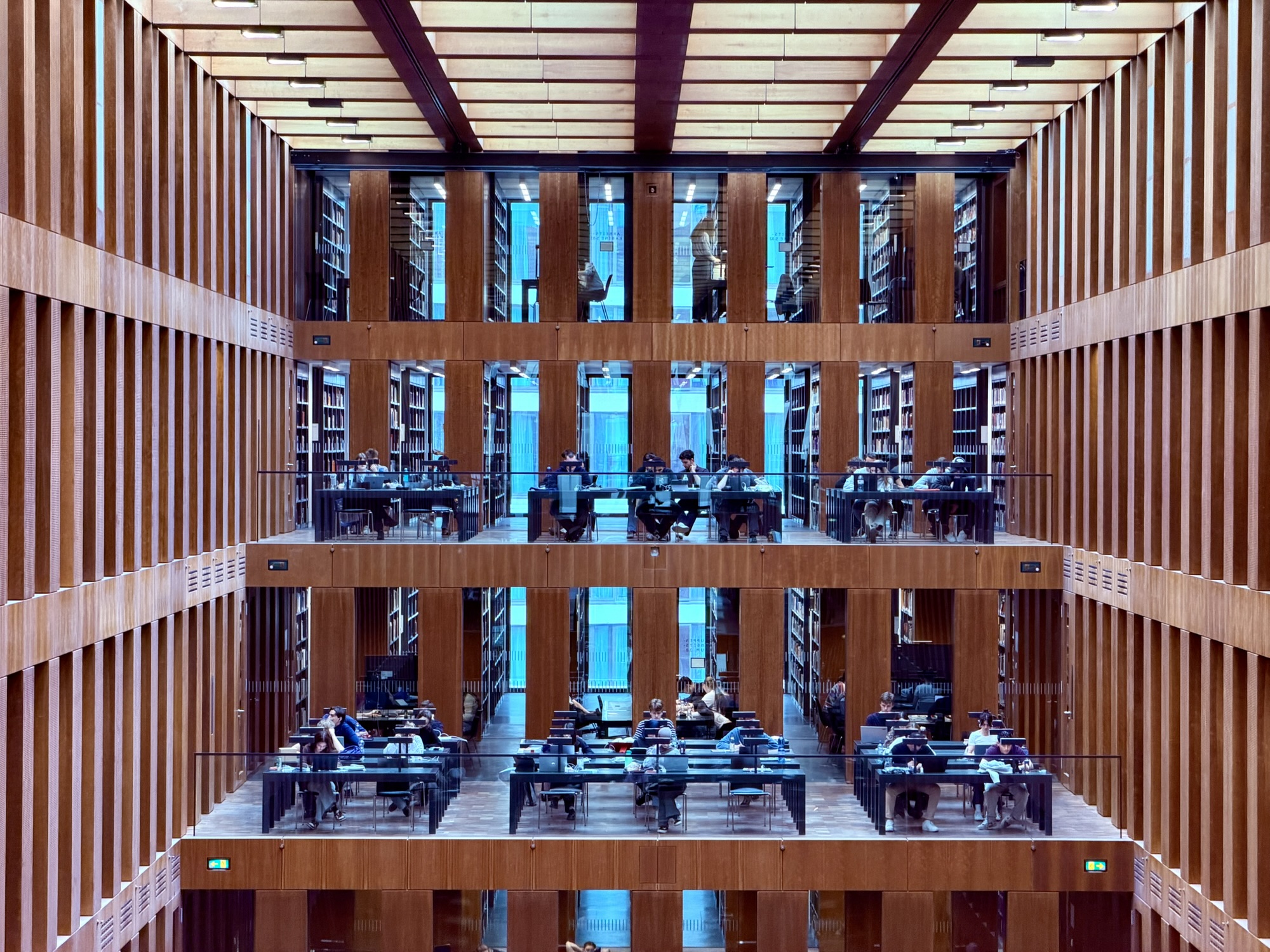
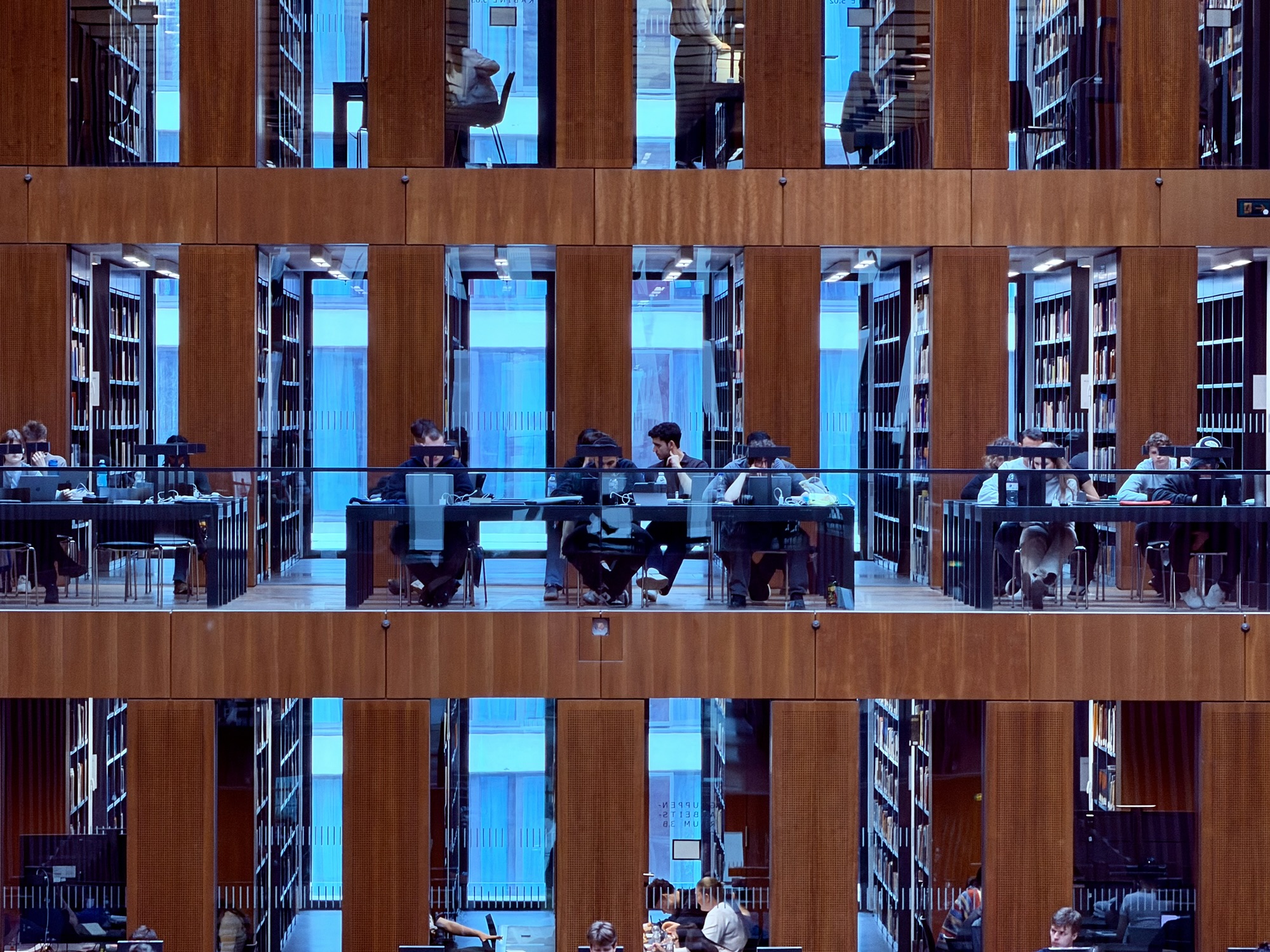
Our next stop was back to Humboldt University to visit the central library – the Jacob-und-Wilhelm-Grimm-Zentrum. The building was quite plain on the outside. It is named after the Brothers Grimm, best known for publishing Grimm’s Fairy Tales which compiled folklore that popularized classics like Cinderella, Snow, White, and Rapunzel.
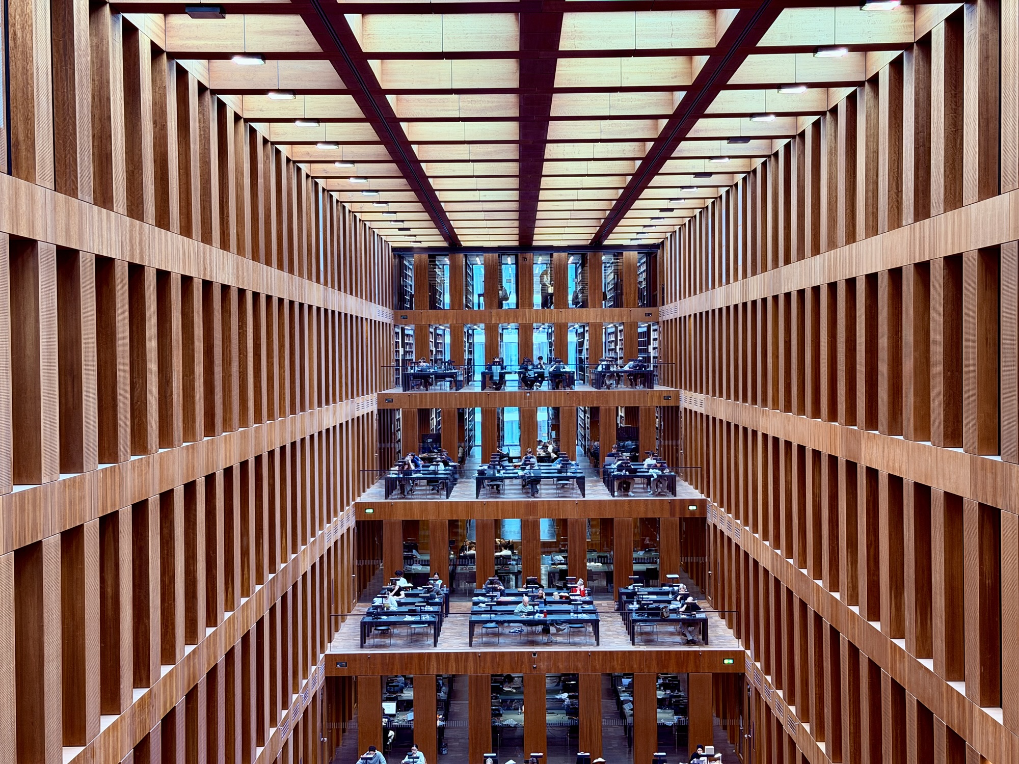
The study room in the centre of the book stacks was absolutely stunning and silent, despite the number of people using the room.
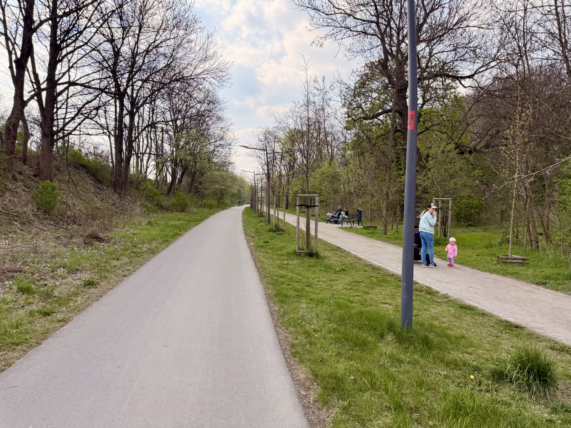
From there, we cycled back across Museum Island, again on a road with very little motor vehicle traffic.
This was the first time I noticed streetcars in the three days we have been here.
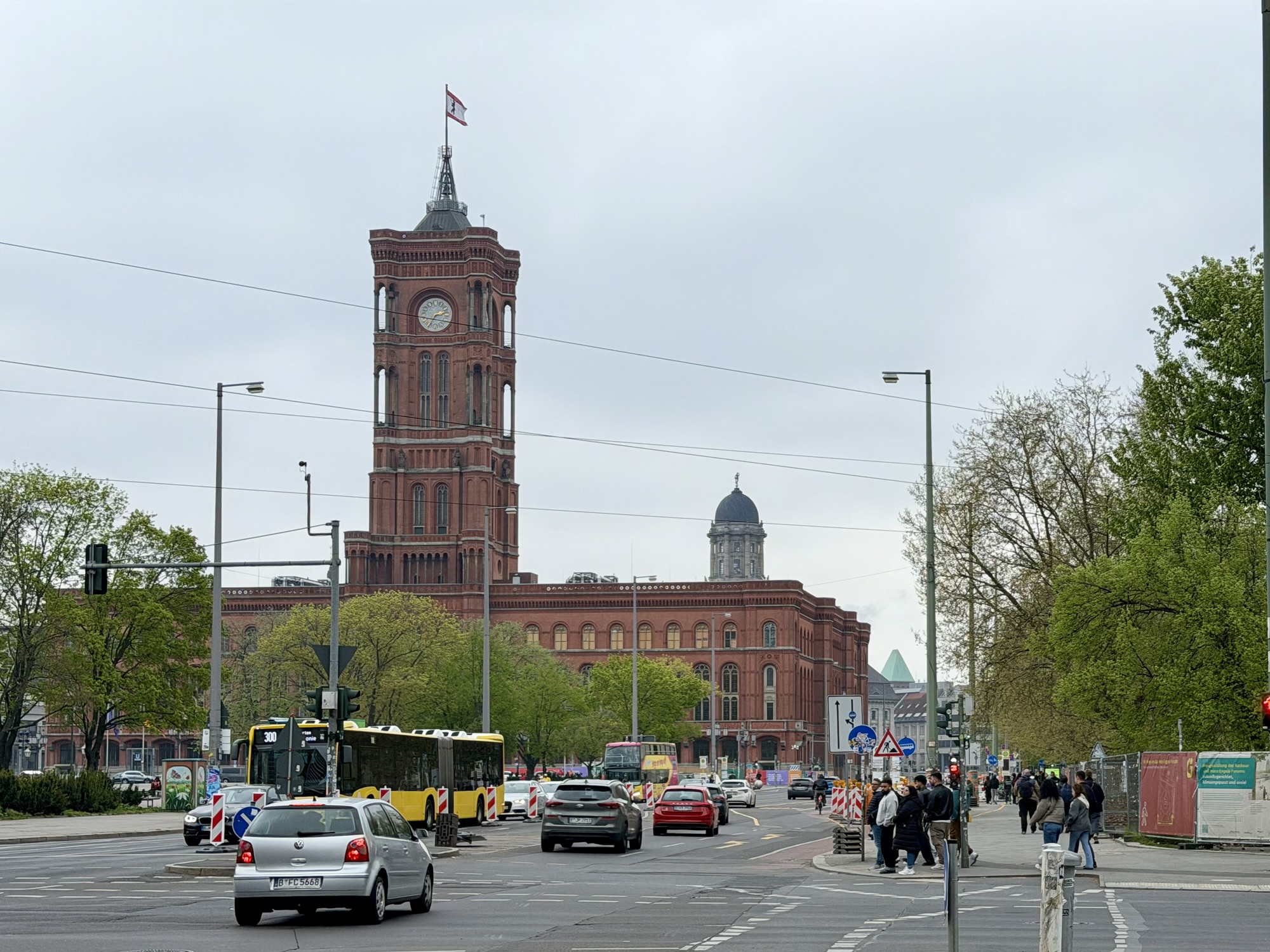
We passed Red City Hall, the seat of the Berlin municipal government, which was built between 1861 and 1869. It was heavily damaged by alleged bombing in World War II, but was rebuilt to the original plans between 1951 and 1956. During the Cold War, it was located in East Berlin and the moniker red referred not only to the brick color, but was used figuratively to designate the socialist government of East Berlin.
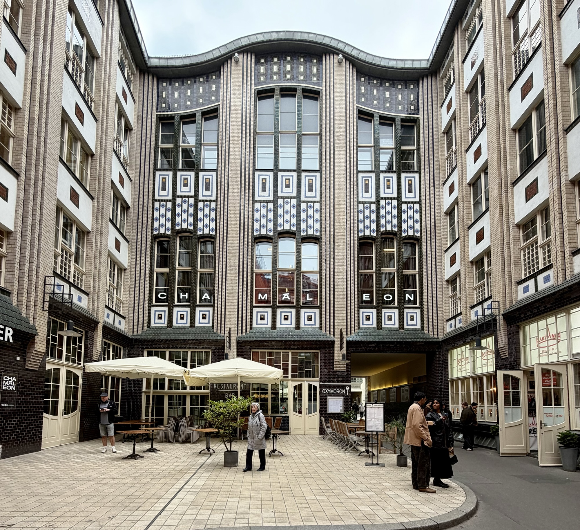
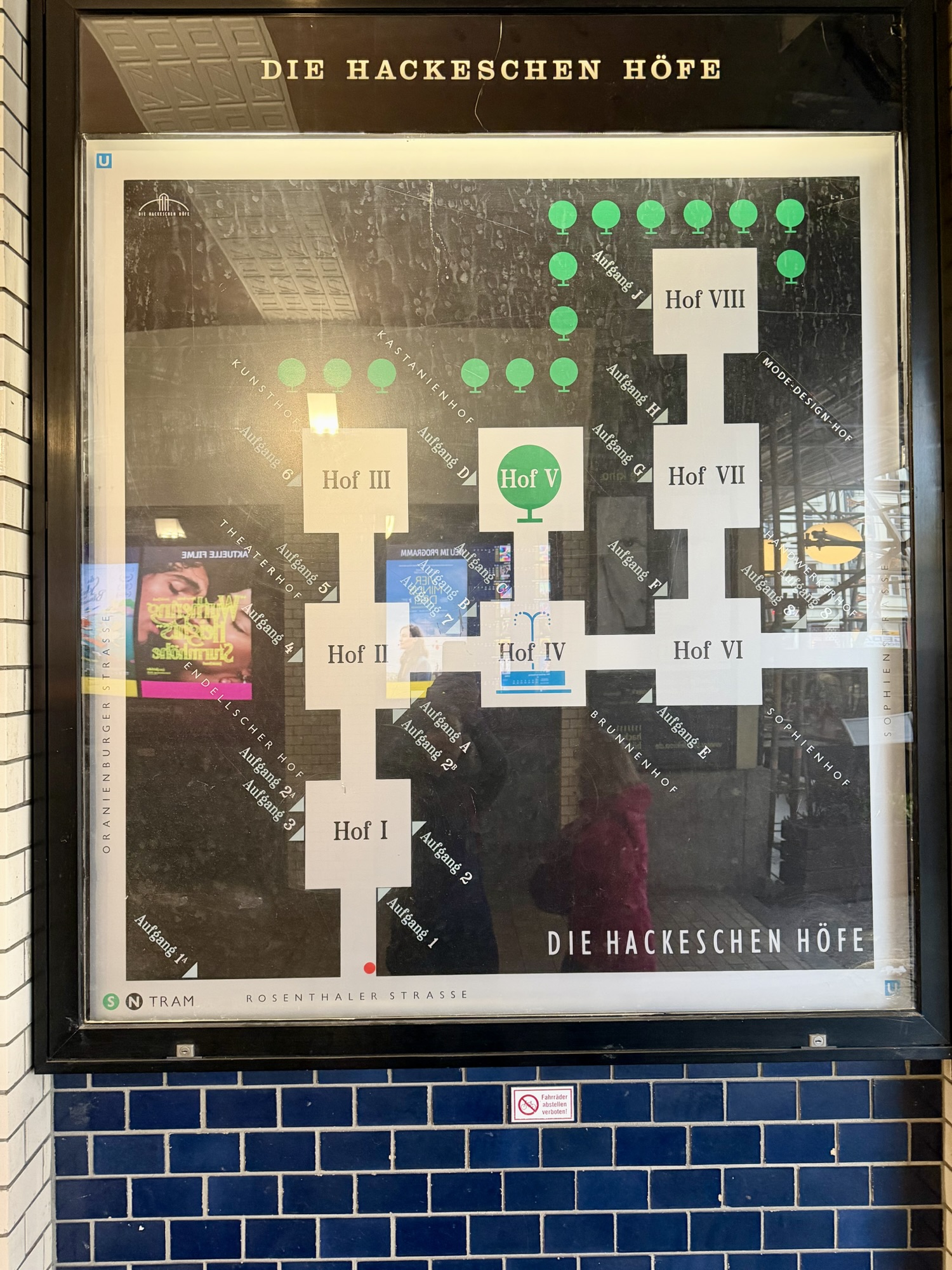
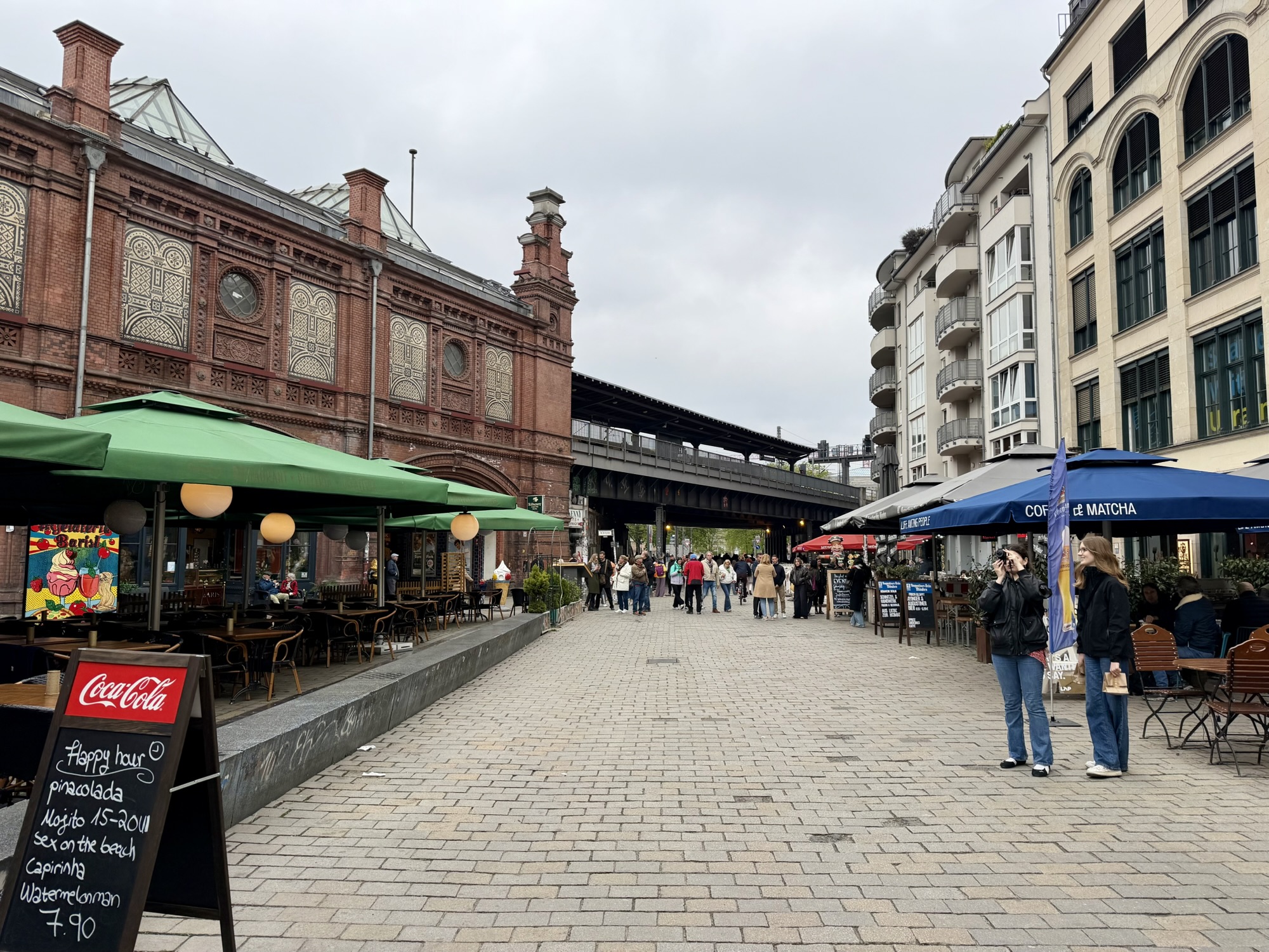
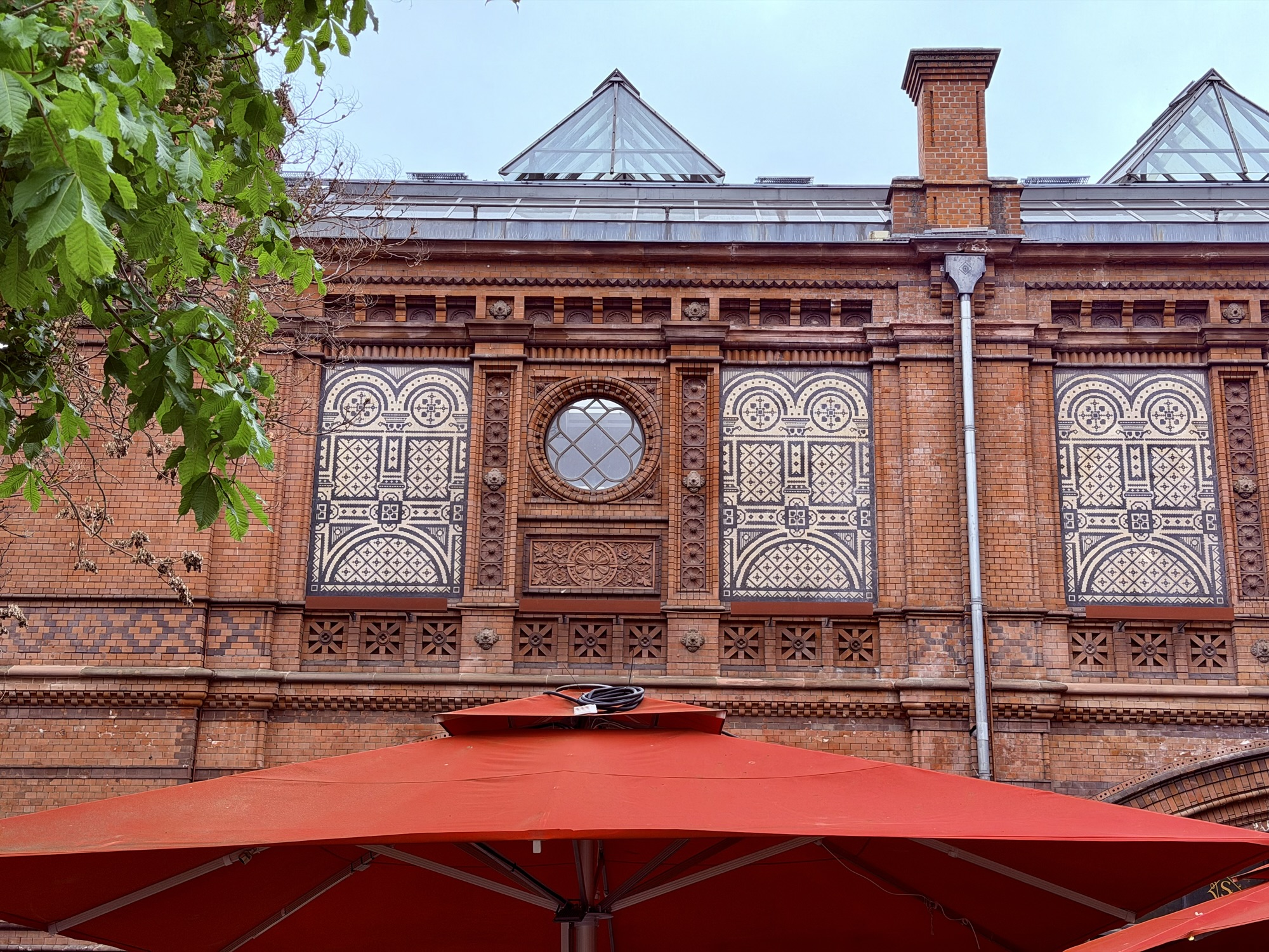
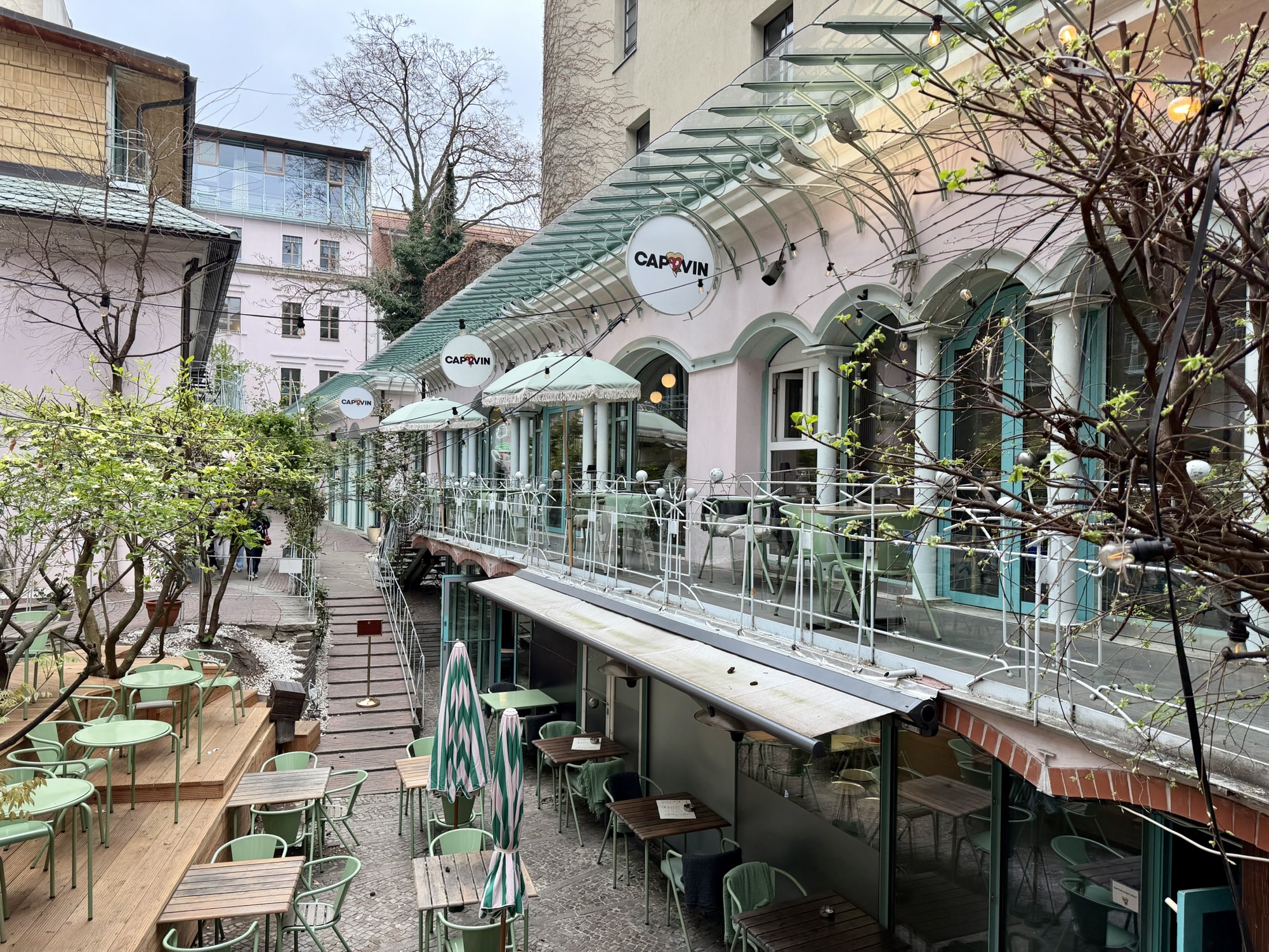
Our destination was The Hackesche Höfe, courtyard complex adjacent to the Hackesche Markt, and Hackesche Station in central Berlin. It consists of an interconnected courtyards. It was designed in the Art Nouveau style and was started in 1906. There are residential and retail spaces.
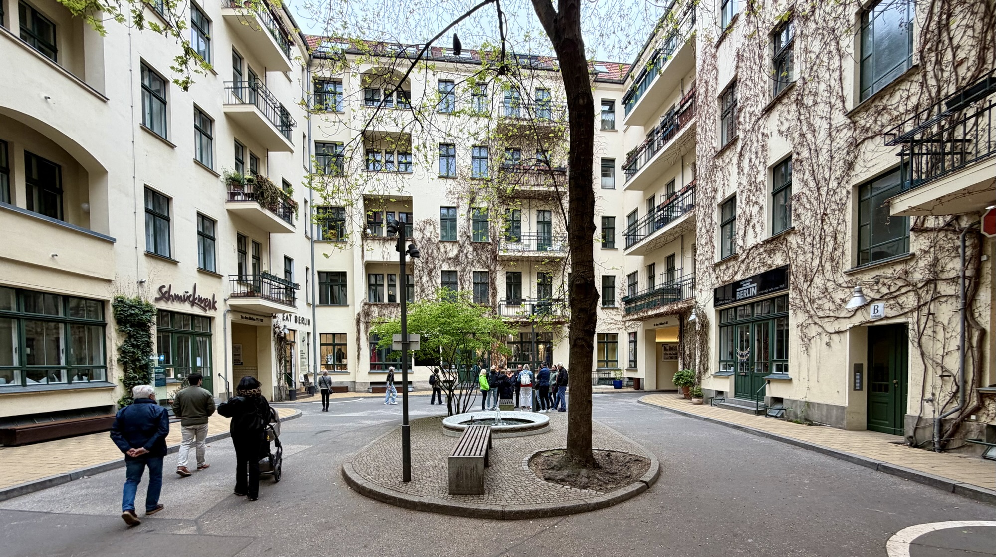
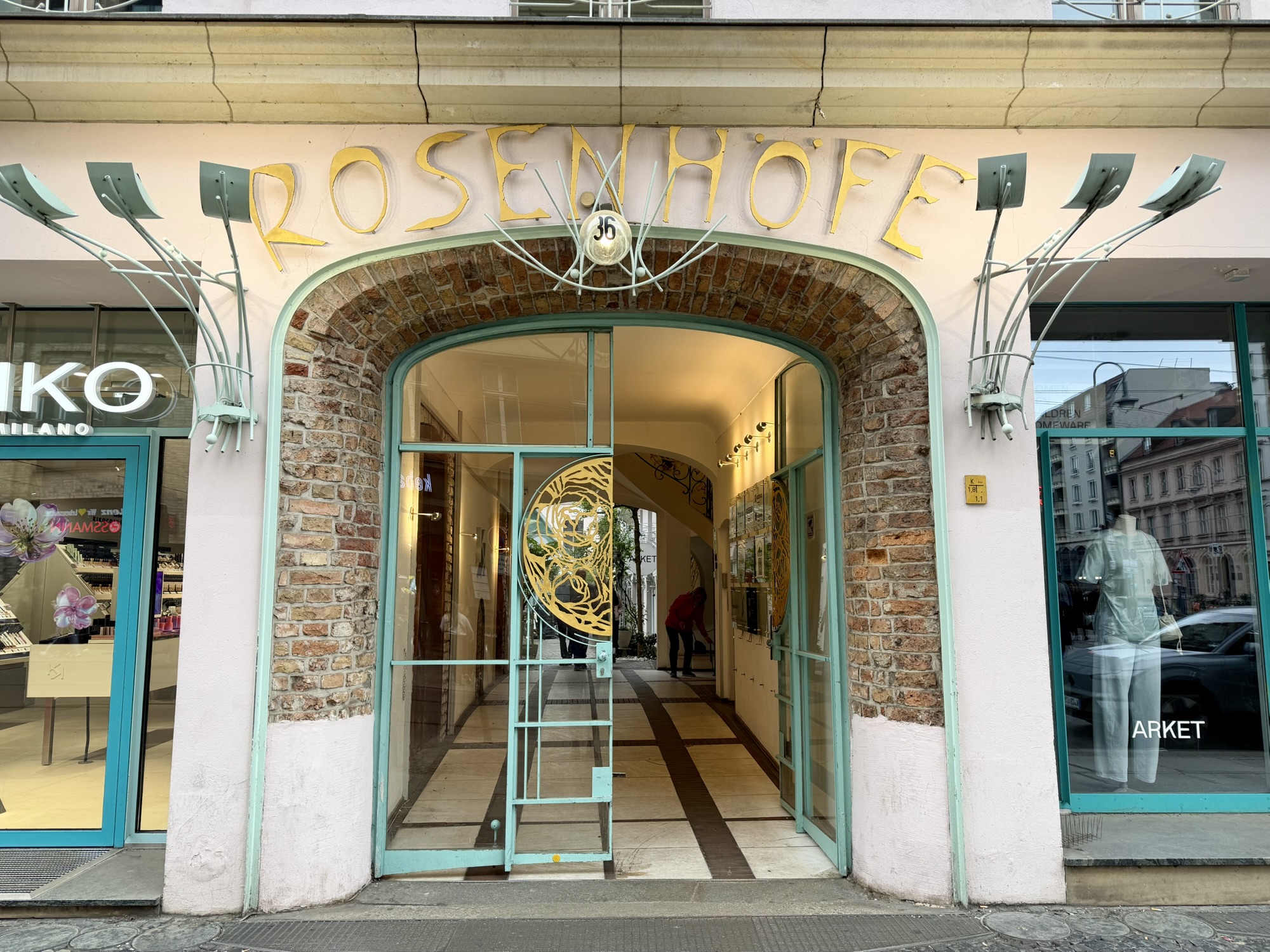
Adjacent to it is a smaller courtyard complex called Rosenhöfe. Both courtyard complexes are quite charming.
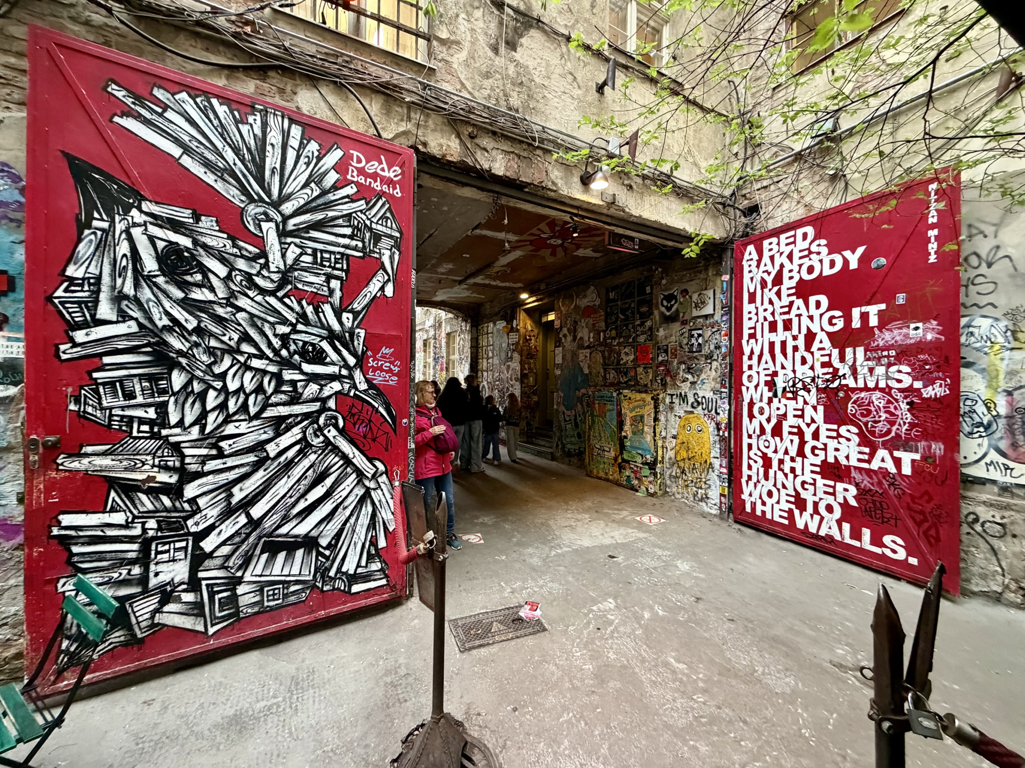
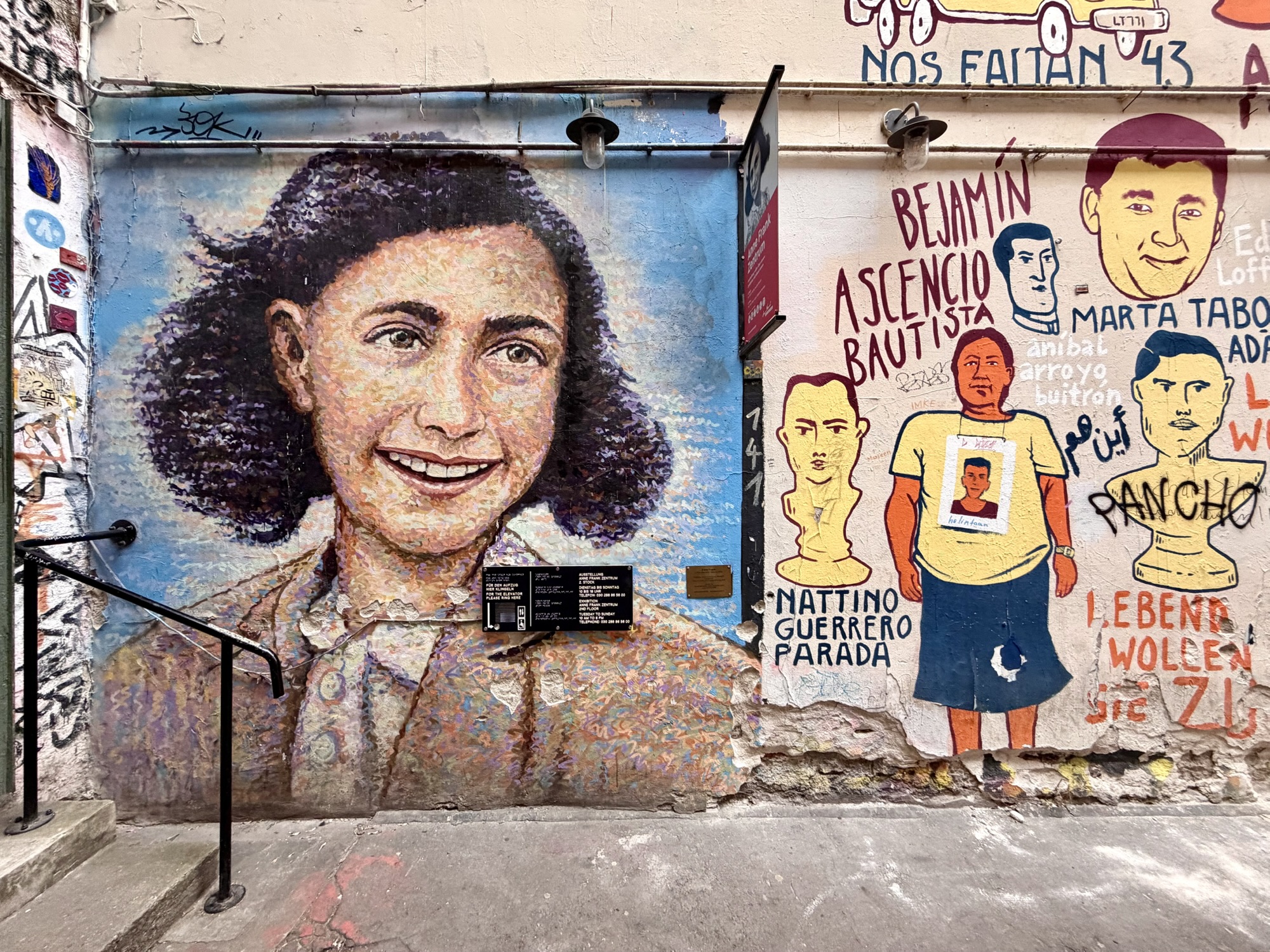
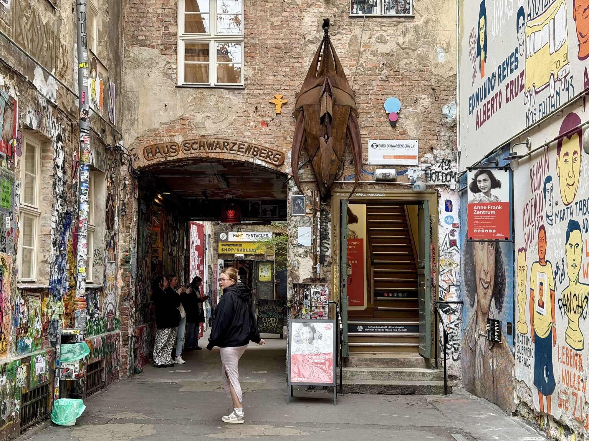
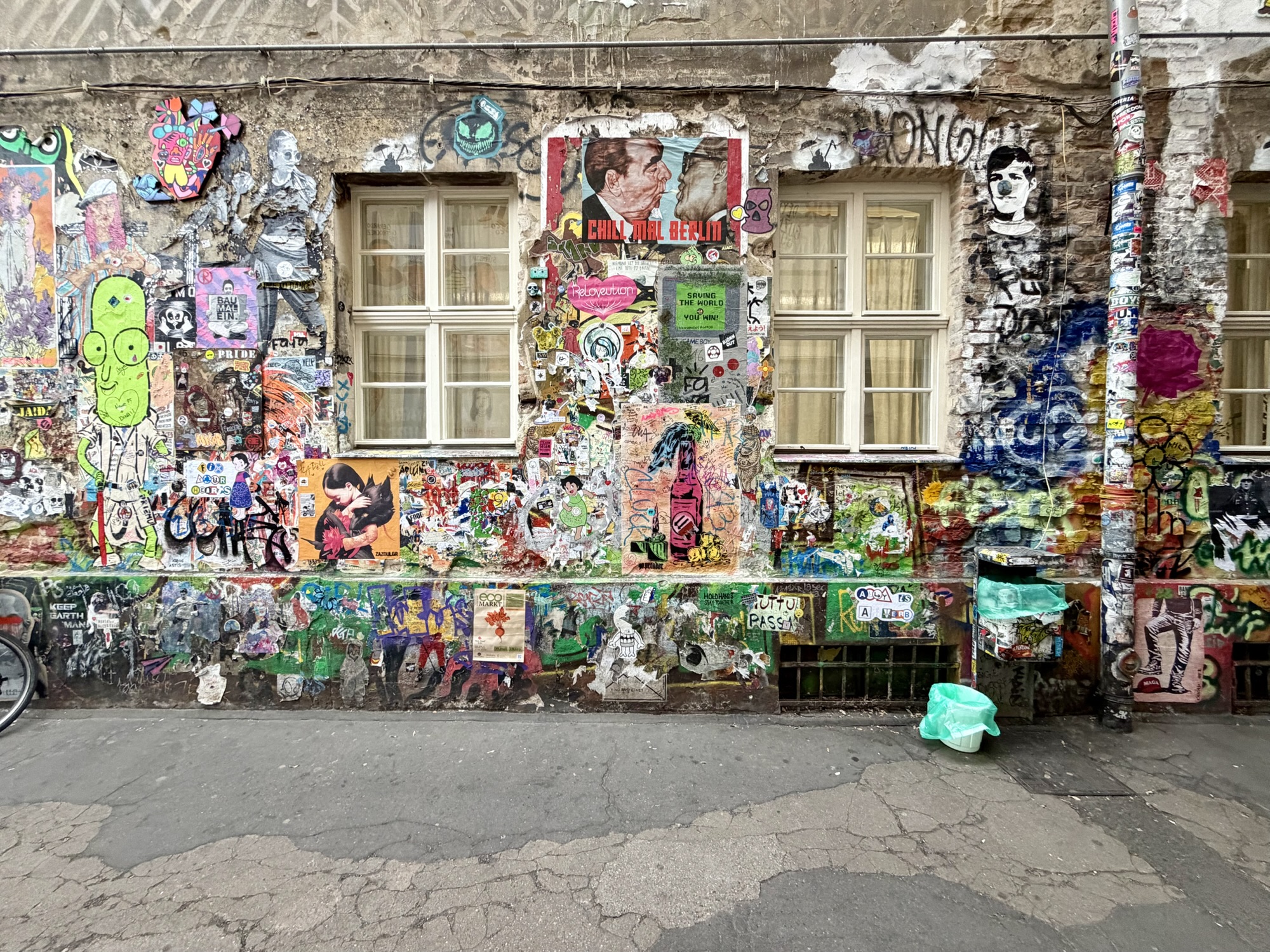
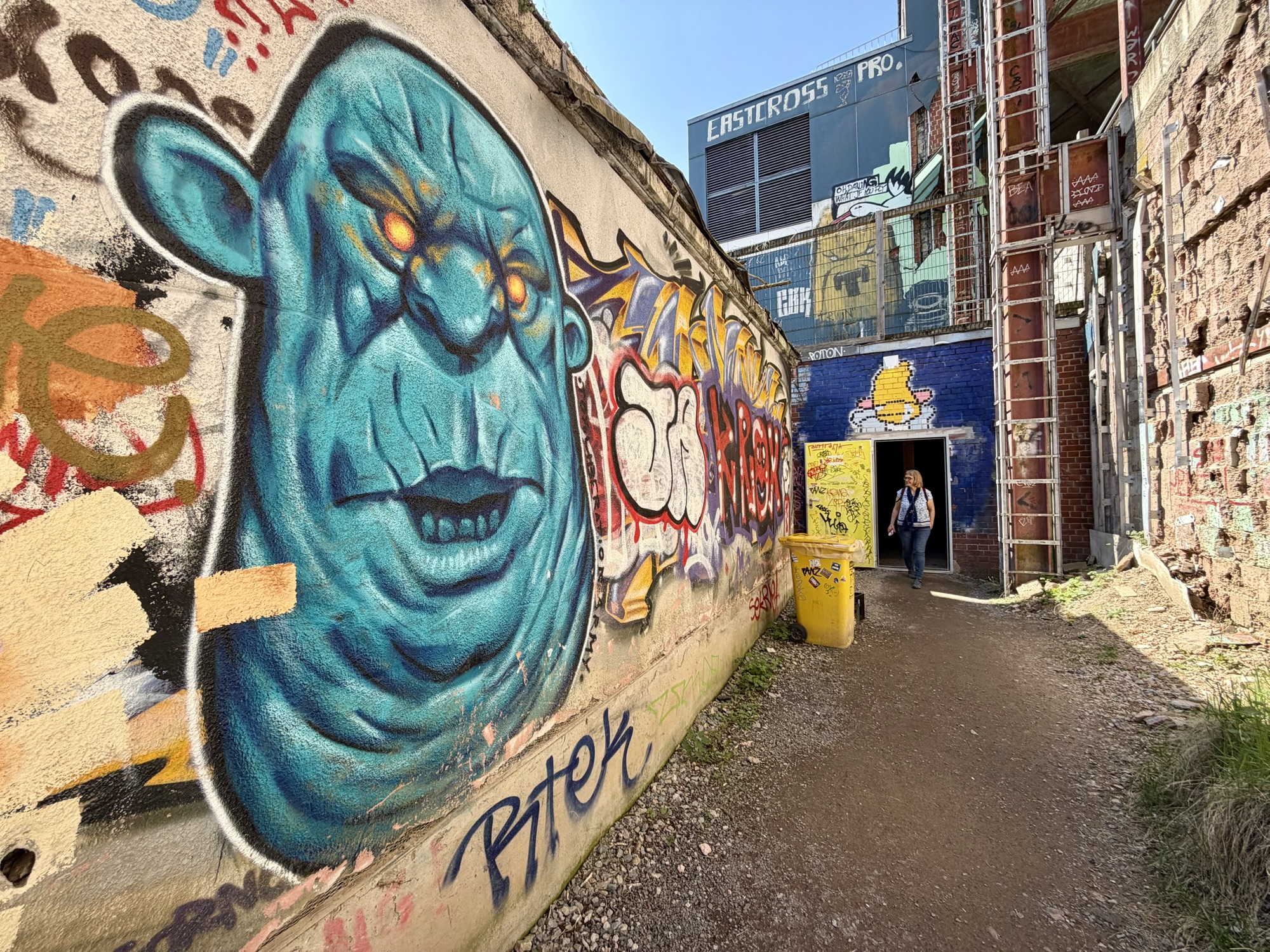
Haus Schwarzenberg is in the same area, but has a very contrasting feel to the boutique shopping in the courtyard areas. It is a historic alternative, cultural courtyard. It function as an independent hub for street art, independent, galleries, offbeat, museums, and underground nightlife. It contains an educational center, which is a partner of the Anne Frank House in Amsterdam.
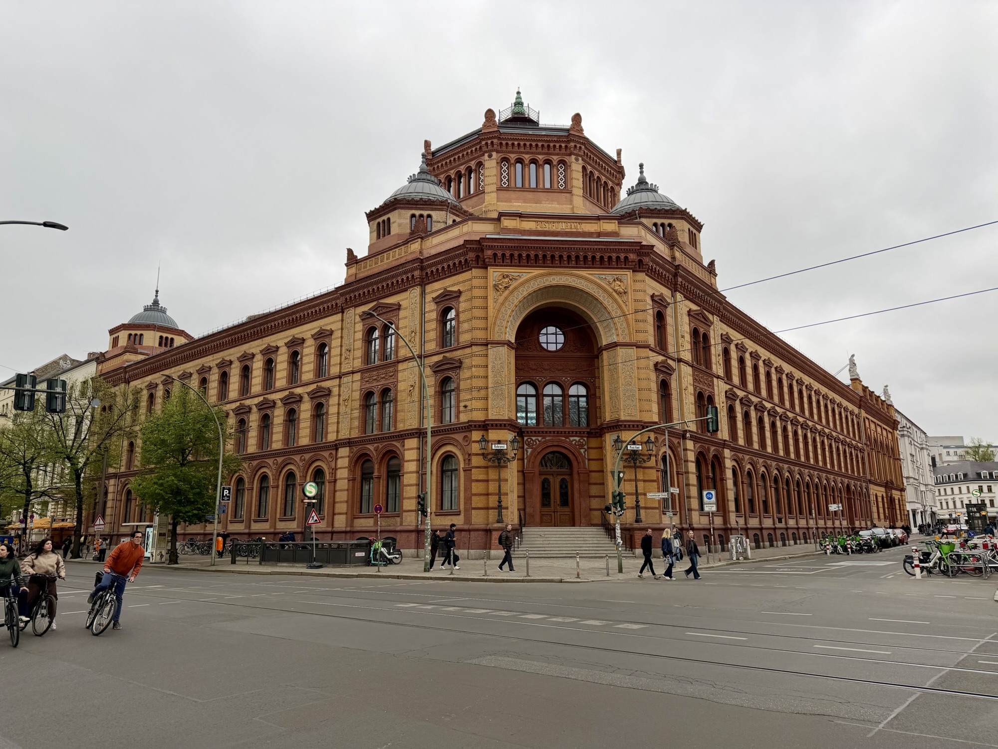
This post office building was built between 1875 and 1881. It was designed in the Italian Renaissance Revival Style. It was used for Postal Service purposes until 1995. It just now used as a conference and education center.
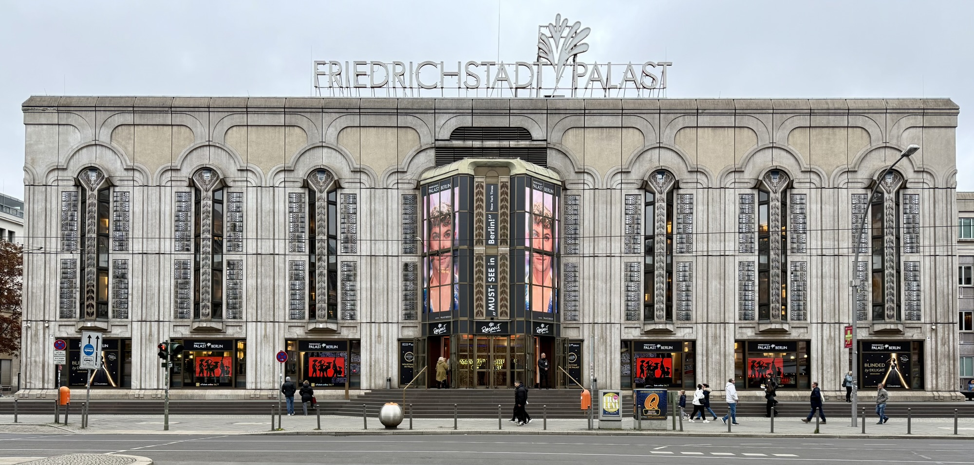
The Friedrichstadt-Palast is a revue theater. It was from 1965 to 1967. It was originally built as a market hall, but over the years has served down a circus arena, and theater. It has a seating capacity of 1895.
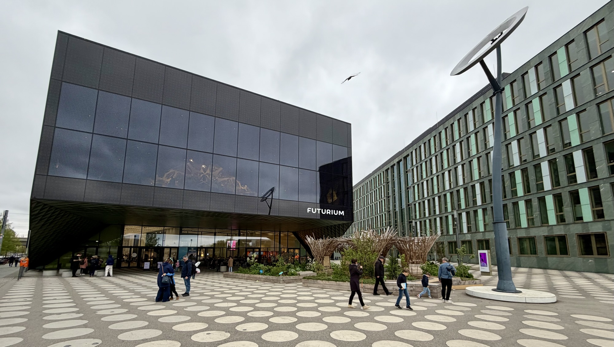
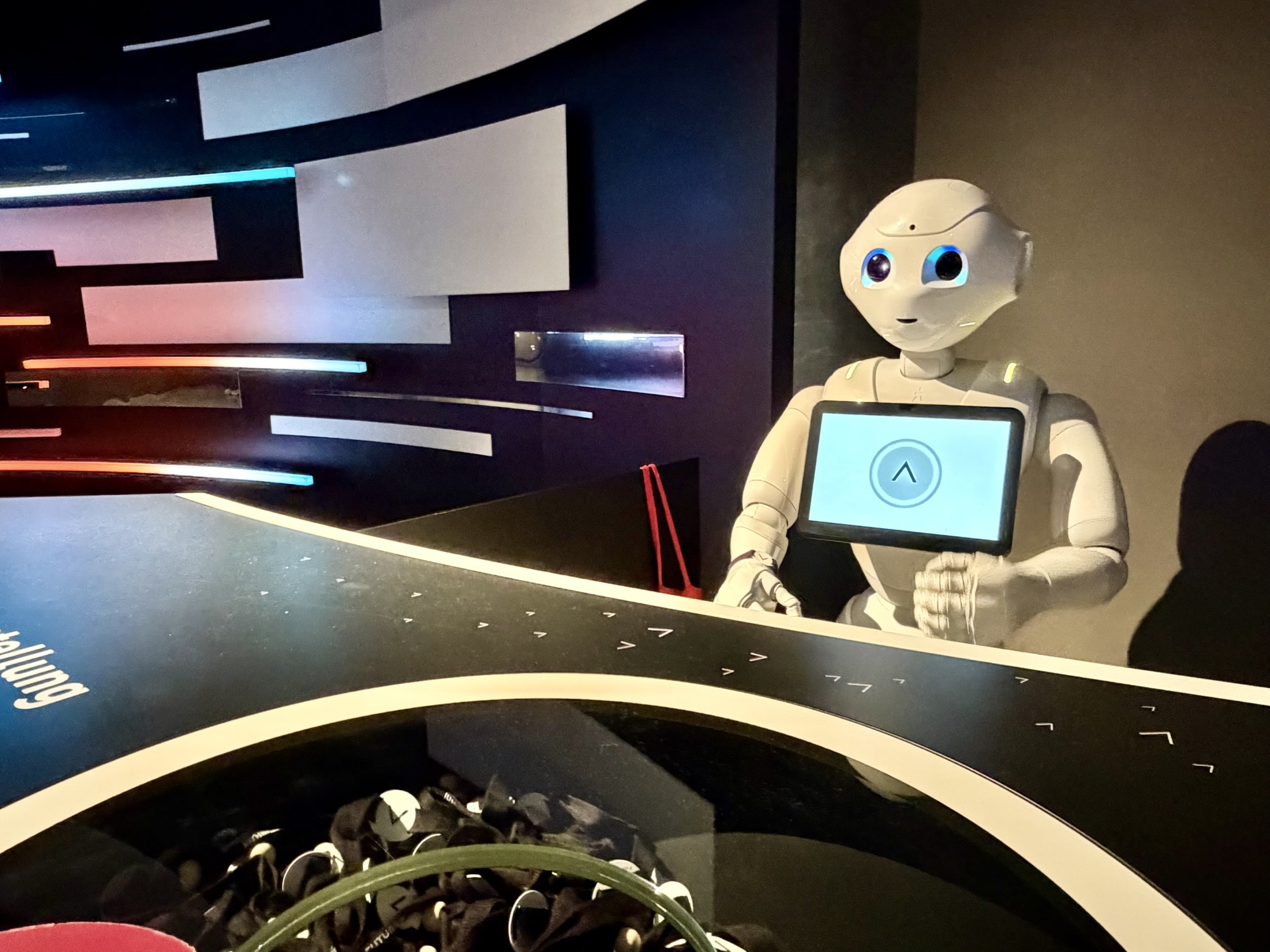
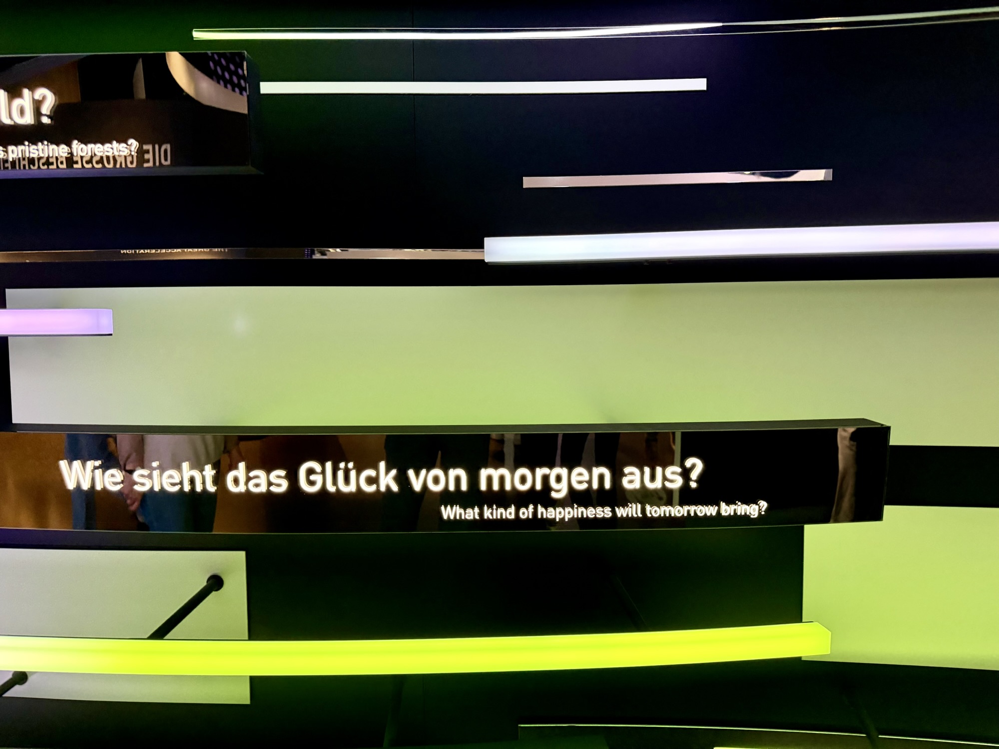
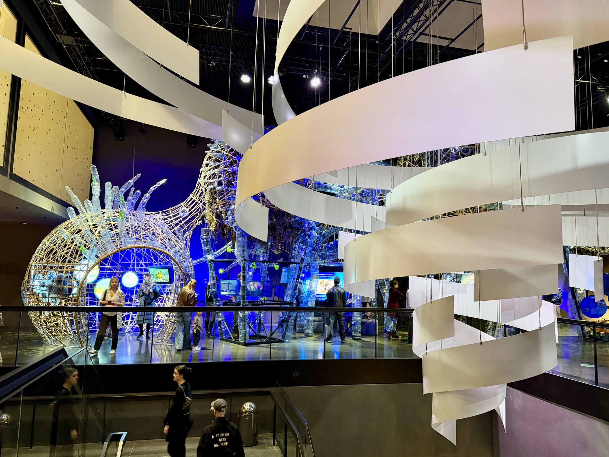
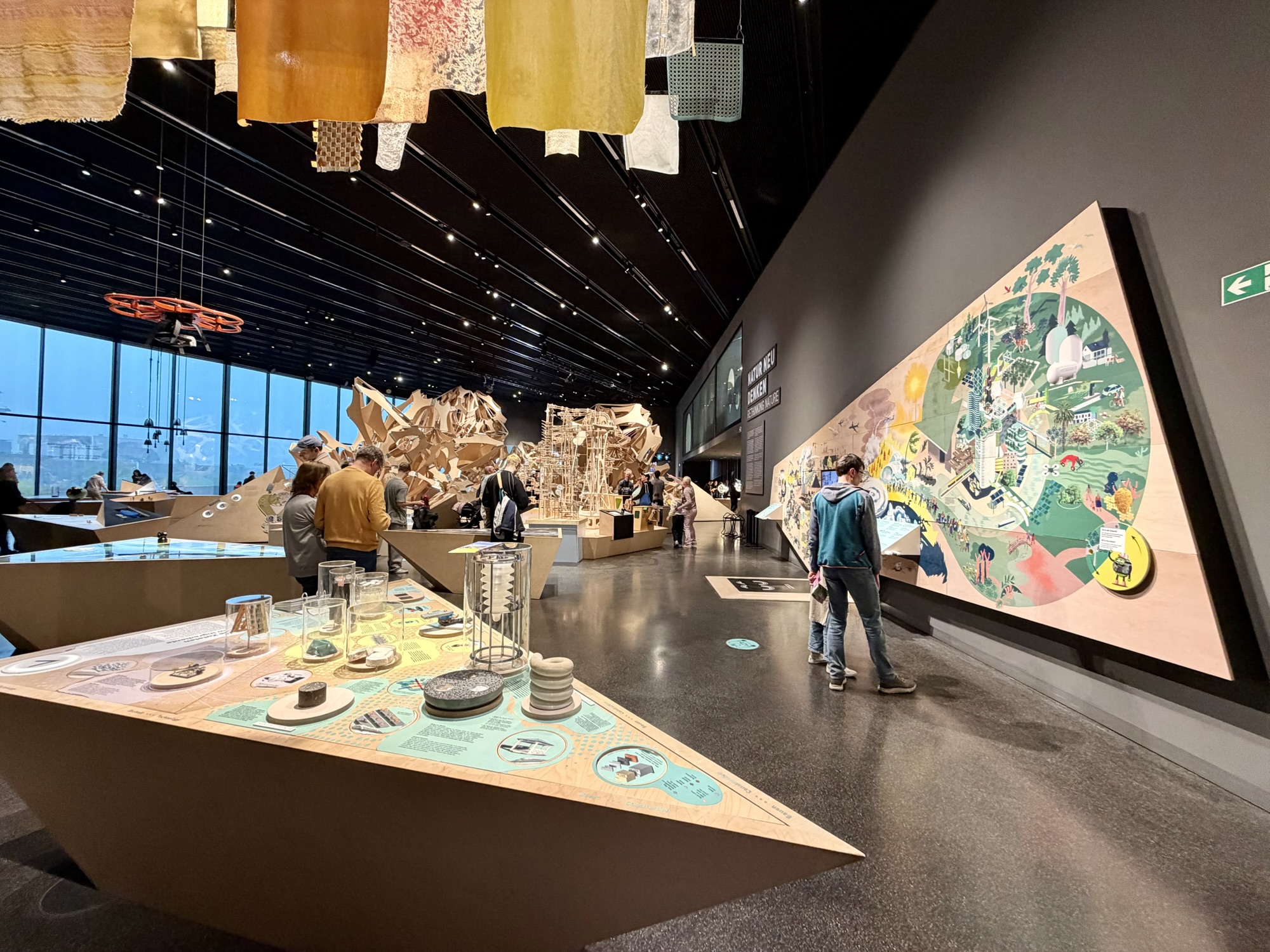
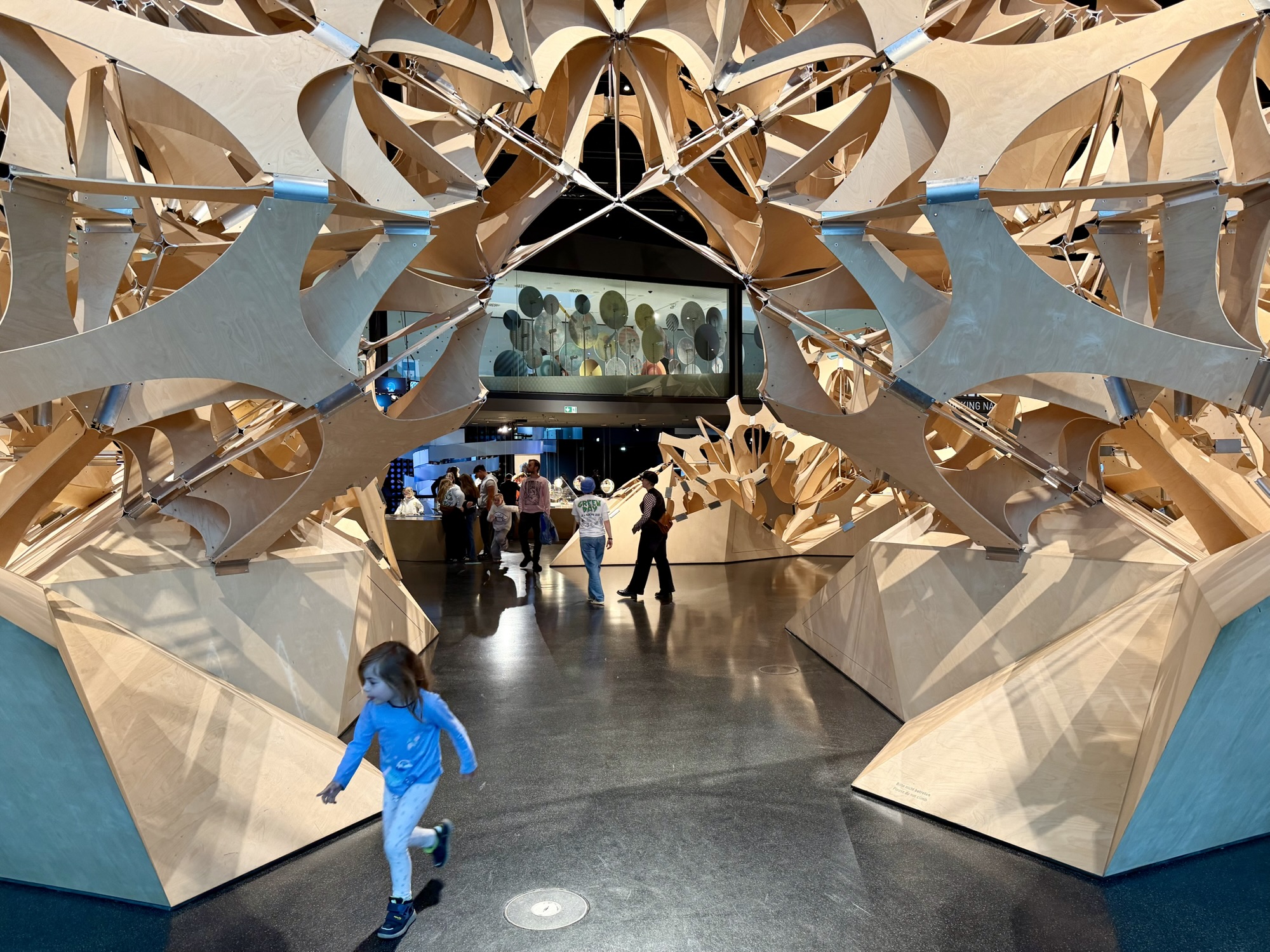
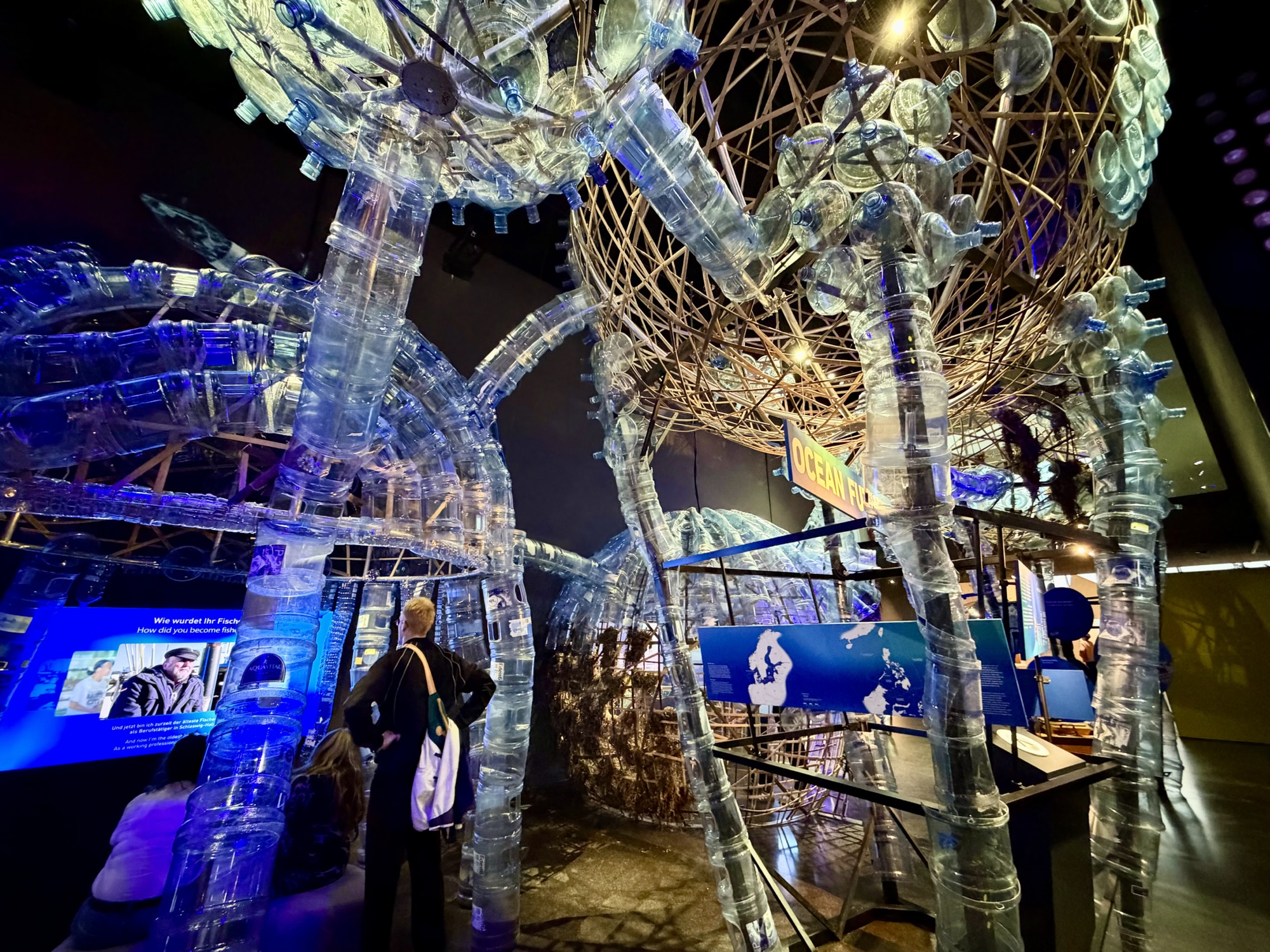
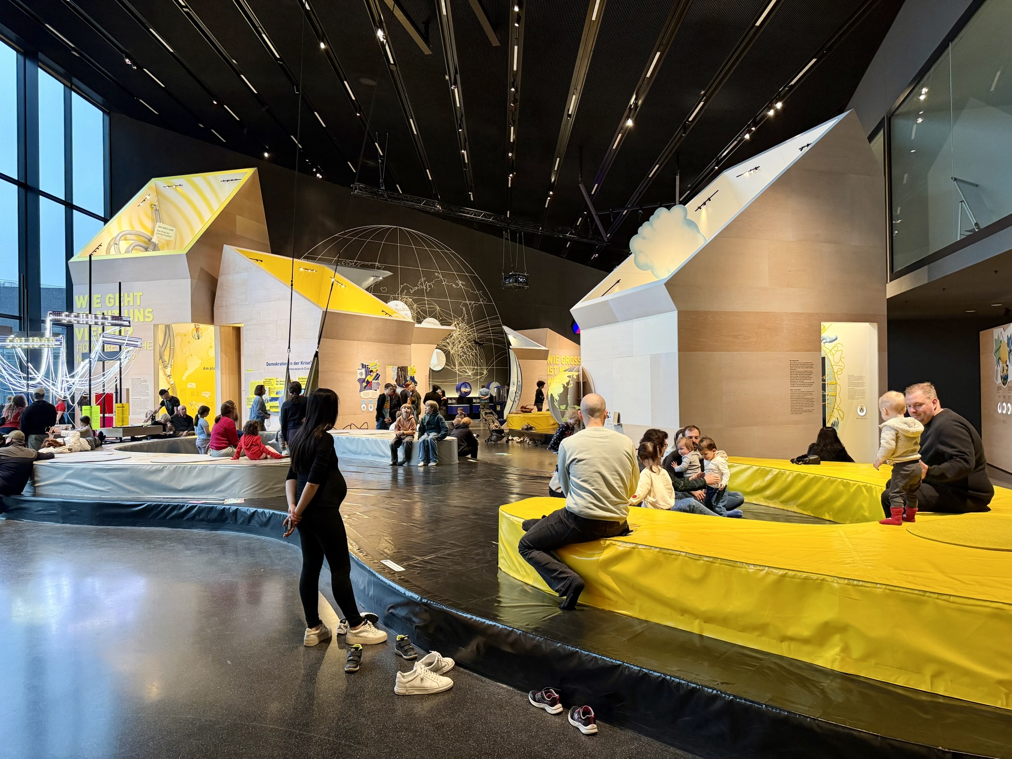
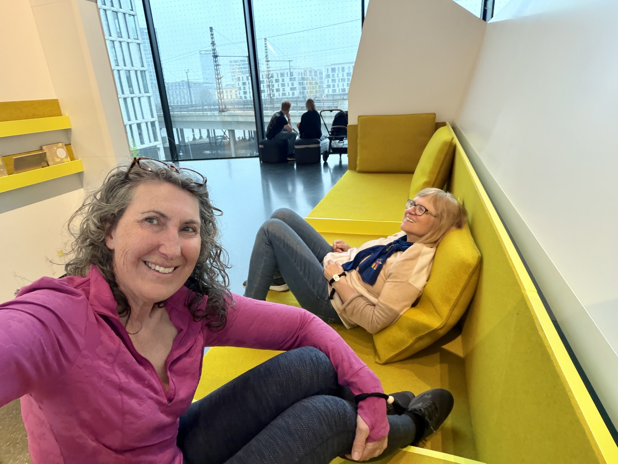
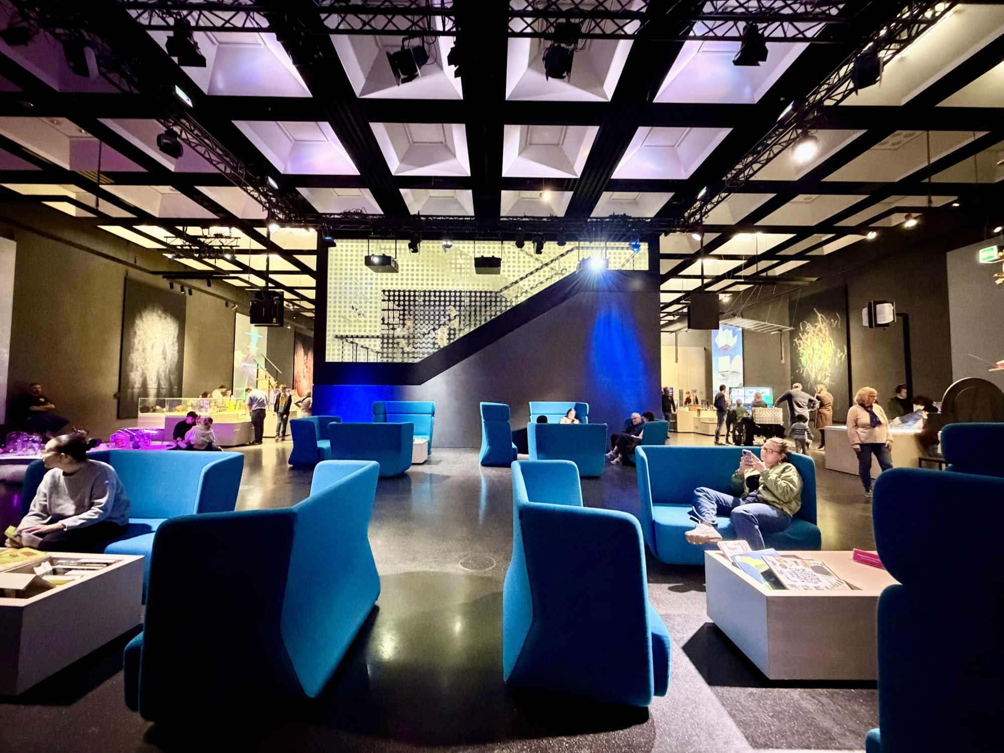
With the forecast rain, threatening shortly we cycled to our final stop for the day The Futurium. From their website: “Here at Futurium, everything revolves around one central question: How do we want to live? In the exhibition, you can explore a range of possible futures; in the Forum, you can participate in open discussions; and in the Futurium Lab, you can experiment with your own ideas.”
The building is located in the government district and highlights the contribution of science, research and technology to shape the future. Entry is free.
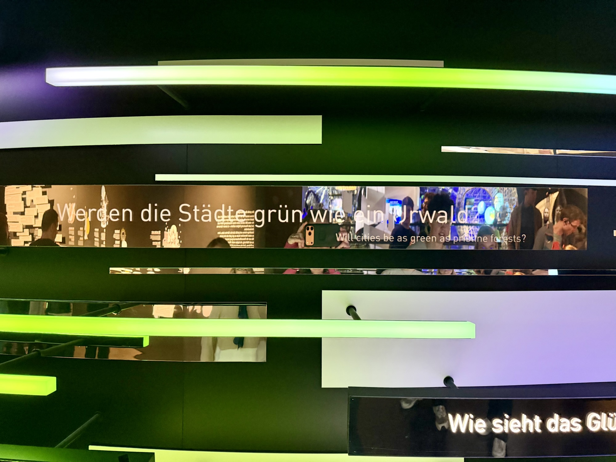
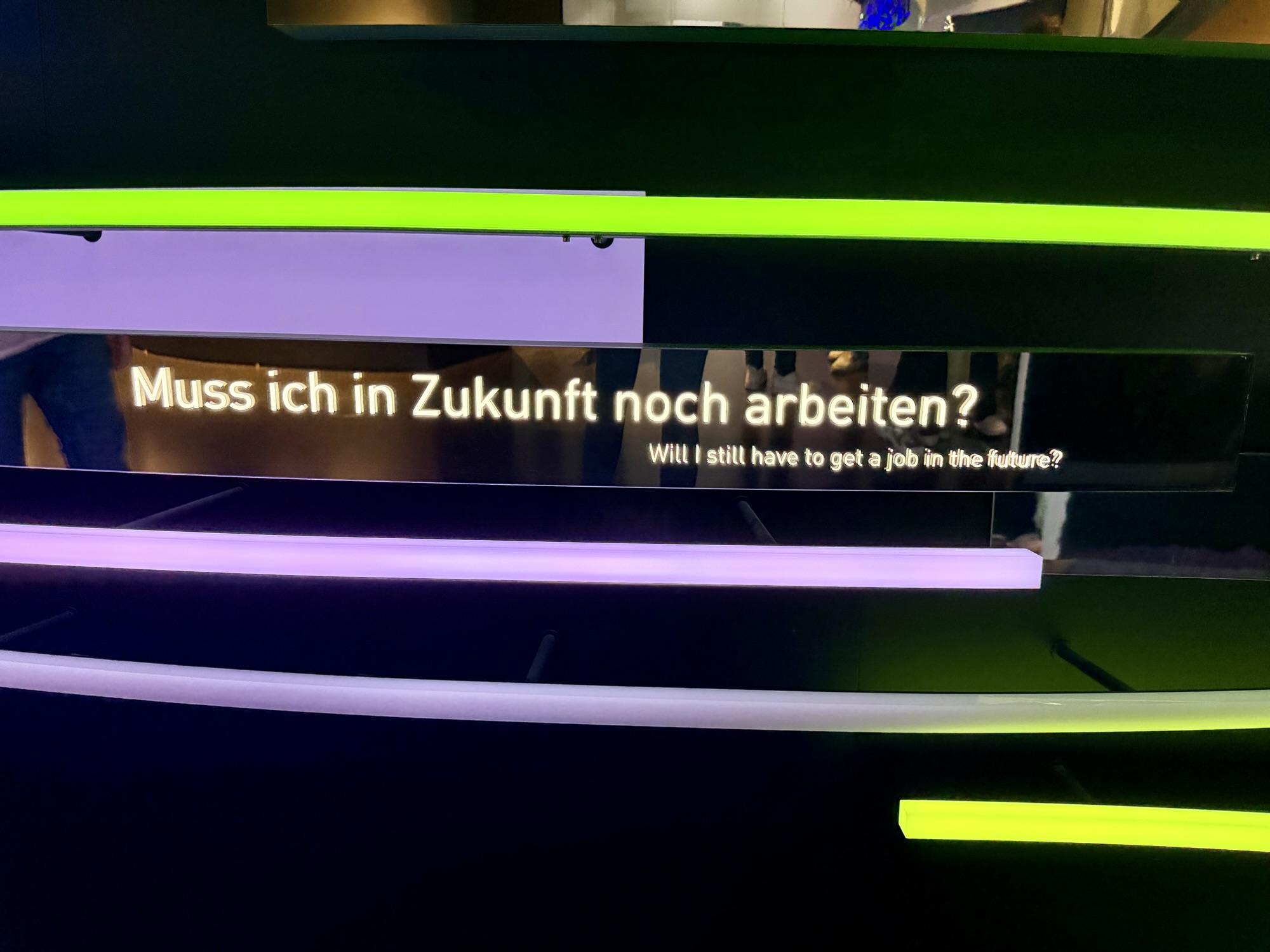
The first exhibit we visited asked questions to inspire thoughts about the future. Will I still have to get a job in the future? What kind of happiness will tomorrow bring? Will cities be as green as pristine forests?
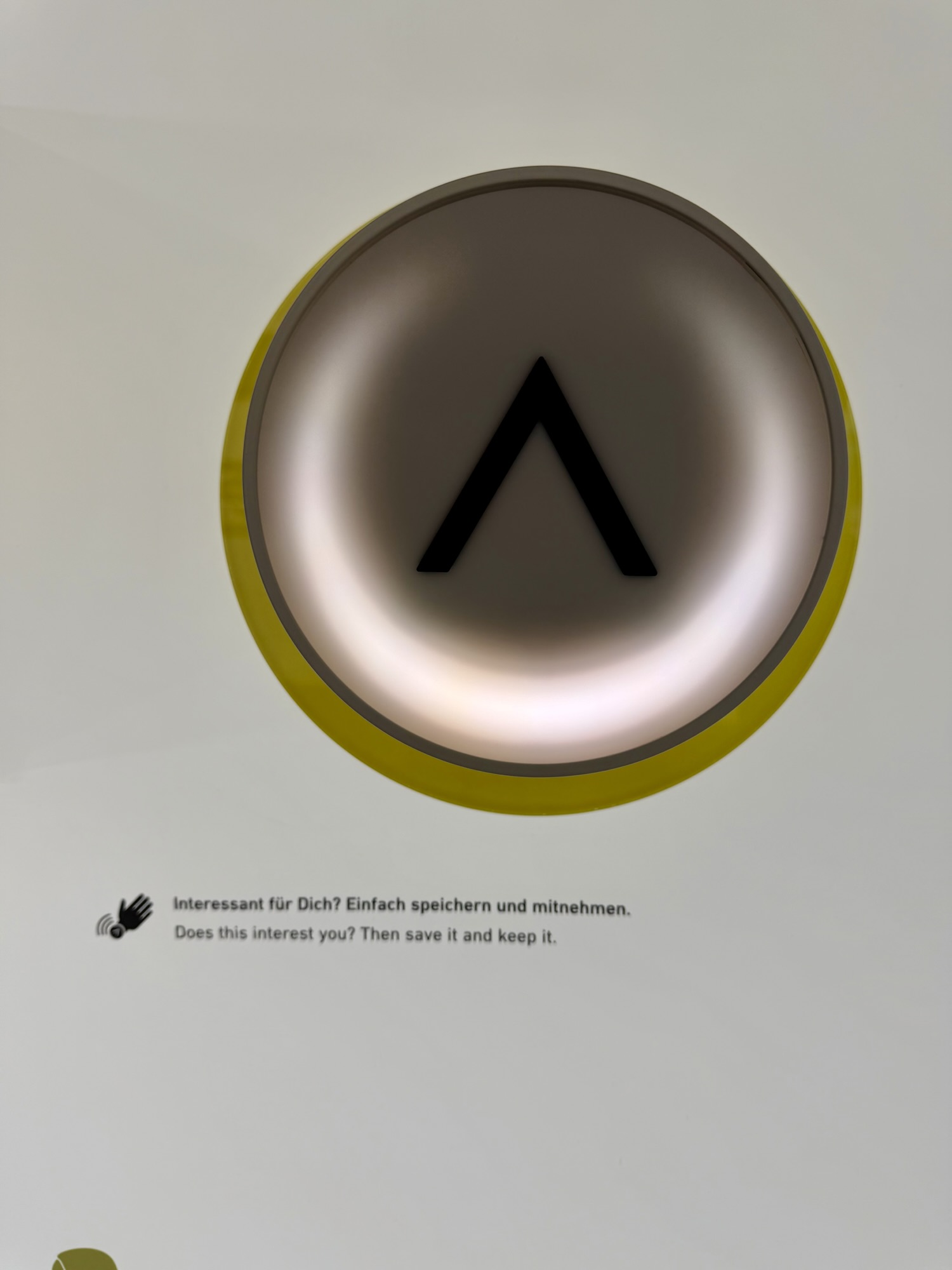
Visitors were invited to take a bracelet and use it to answer questions and to interact with the exhibits. At the end of the visit, visitors could scan their bracelet and get a personal evaluation of how they view the future. If you tapped on buttons like this you would be able to access more information from home on the internet.
One of the exhibits talked about the great acceleration. “Man has always changed the world in an attempt to improve living conditions. This development picked up speed about 200 years ago. Each innovation was followed by newer ones – at ever shorter intervals. As a result of many small steps and big leaps, people are doing better today than ever before: health care has never been better, there has never been such an abundance of food, never have more people had access to education. And never has so much been consumed. But these developments also have a downside: our natural foundations of life are in peril.”
It was very thought-provoking and we could couldn’t really do it just the two hours we spent there.
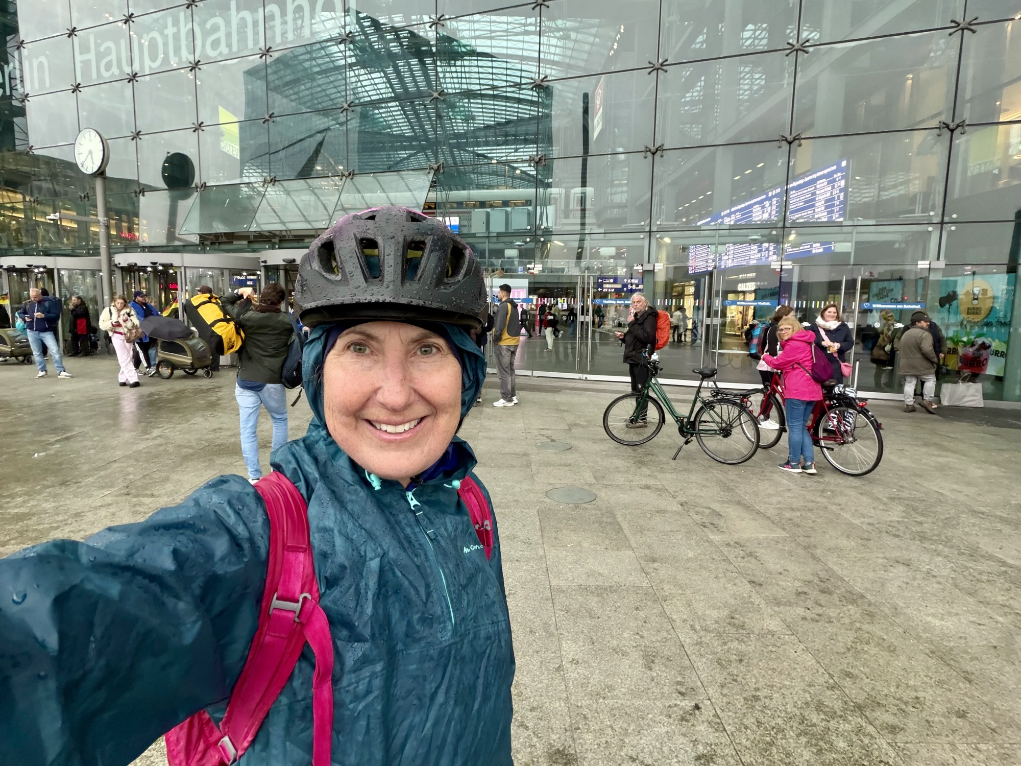
When we emerged the predicted heavy rain had begun. We put on our rain gear and cycled as quickly as we could to the nearby Berlin Hauptbahnhof Station. There were two dean and david restaurants in the station. We enjoyed eating there the previous night so did so again.
We bought tickets for ourselves and our bikes. Bikes are charged at half the rate of a person. And took the u-Bahn back to the station near our guest house.
We had intended to ride the 500 m or so from the station to the bike shop to return the rental bike bikes, before walking back to get our luggage. As we were on the train, I realized that I hadn’t brought my hex keys with me. I needed them to remove my phone holder from the bike bars. We asked a couple cyclists on the train with us if they had hex keys, but they did not. So we cycled back to the guest house to get hex keys, then to the bike store, and then walked 700 m back to the guest house. We were very cold and wet by the time we got back. It was also too early to go to the train station.
So we re-organized our luggage and dried and warmed ourselves. After relaxing for a while, we decided to go to the station, even though it was early. Our tickets were from Berlin Ostbahnhof station in the south-east part of Berlin. Since we hadn’t explored that station yet, we decided to get on there, rather than the nearer Berlin Hauptbahnhof Station.
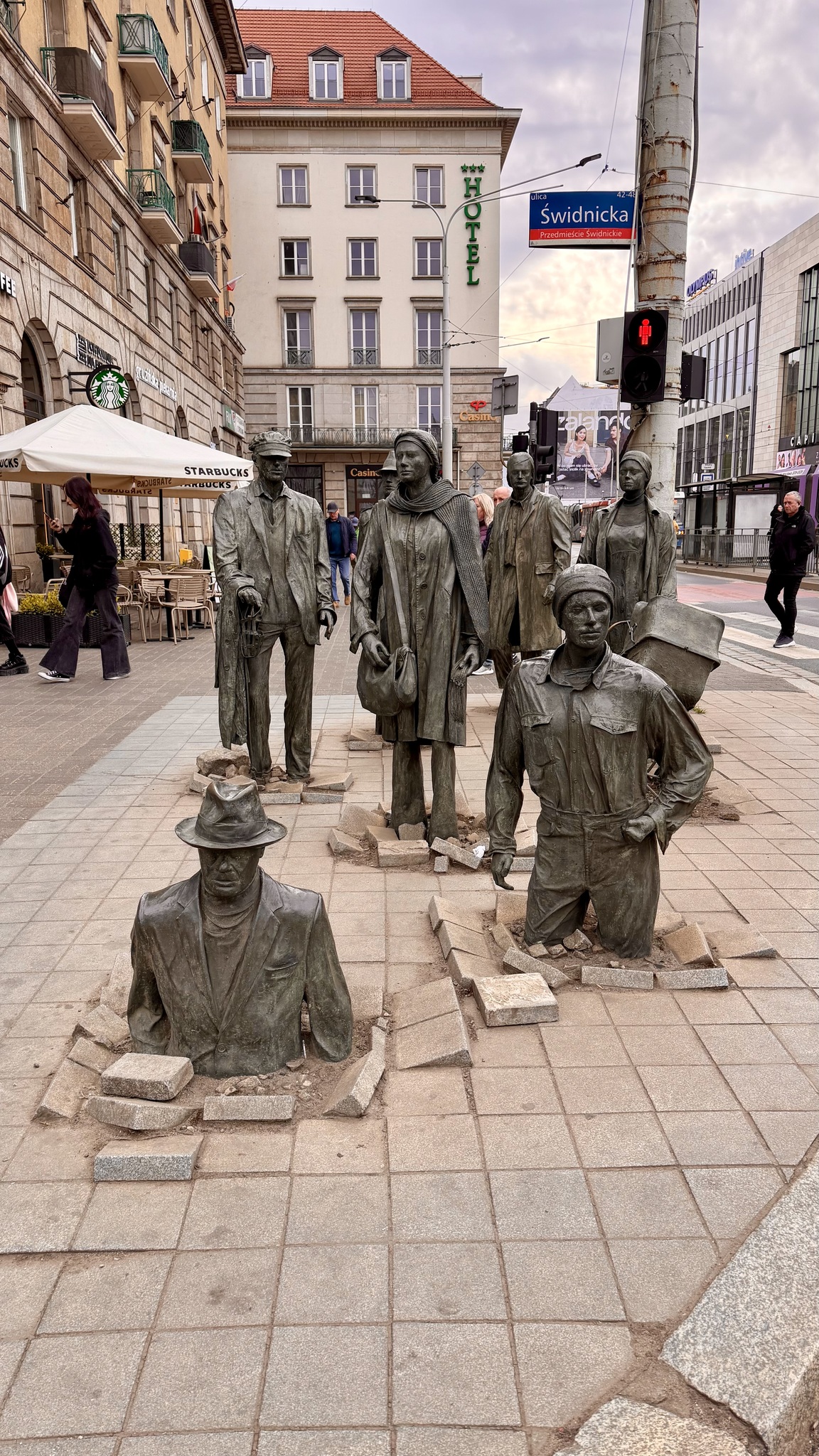
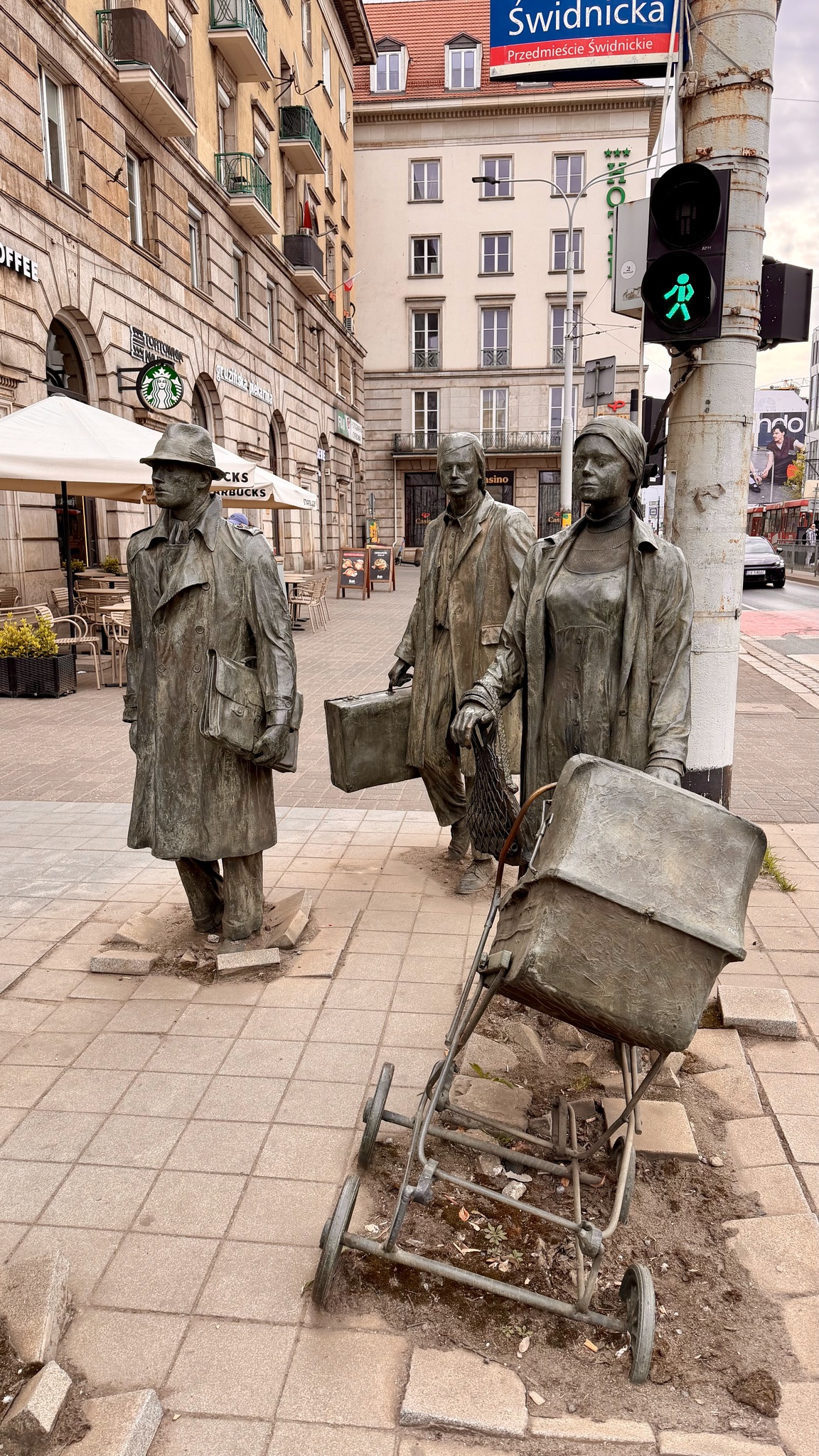
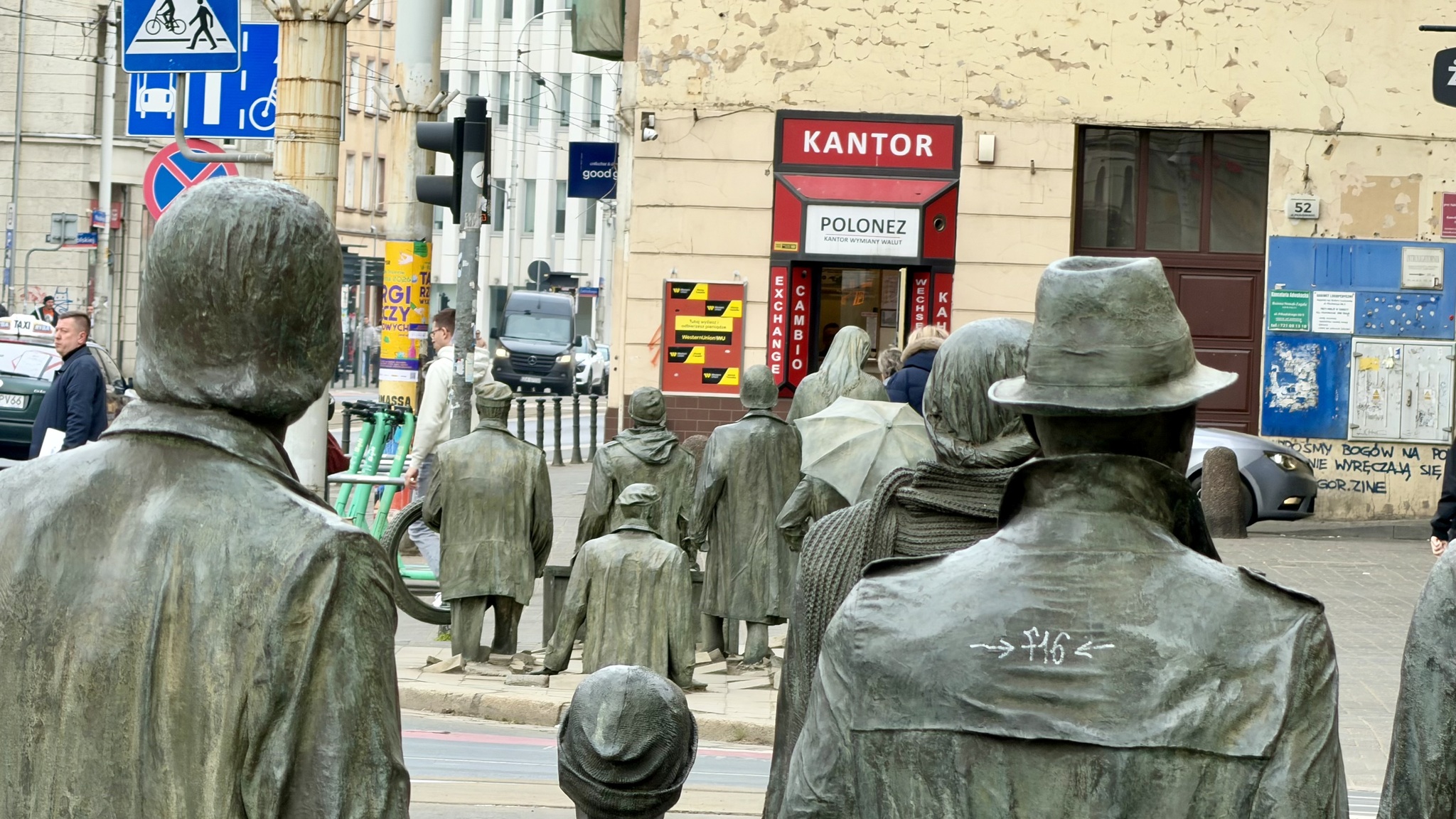
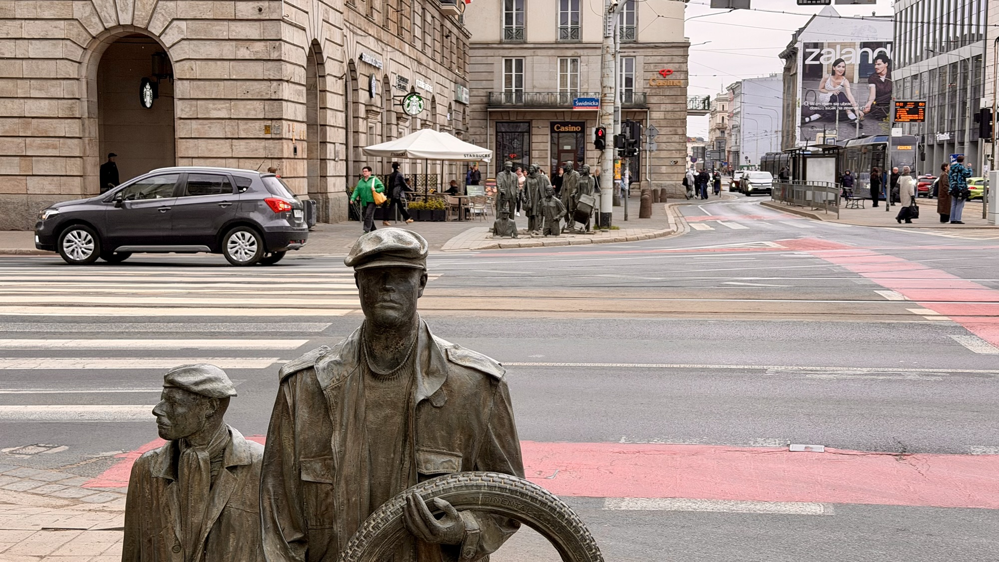
When we arrived at the station, it definitely had behind-the-Berlin-Wall vibes. When we came down from the platform, we encountered unhoused people sheltering in the station. One woman started yelling at me as I took some pictures of the station. The concourse was leaky and smelled of stale urine. We also learned that our train was running late so it would be almost a two hour wait. So, we went back Berlin Hauptbahnhof Station thinking it would be a more comfortable wait.
It was only about 5° outside and still raining heavily. Most of the businesses in Berlin Hauptbahnhof Station were closed, and there was nowhere warm to sit. It also had leaks and unhoused people, which we had not encountered during the day. The concourse is basically open to the outside at the train levels. We put on additional clothes to try to stay warm. By the time the train arrived an hour late we were quite chilled.
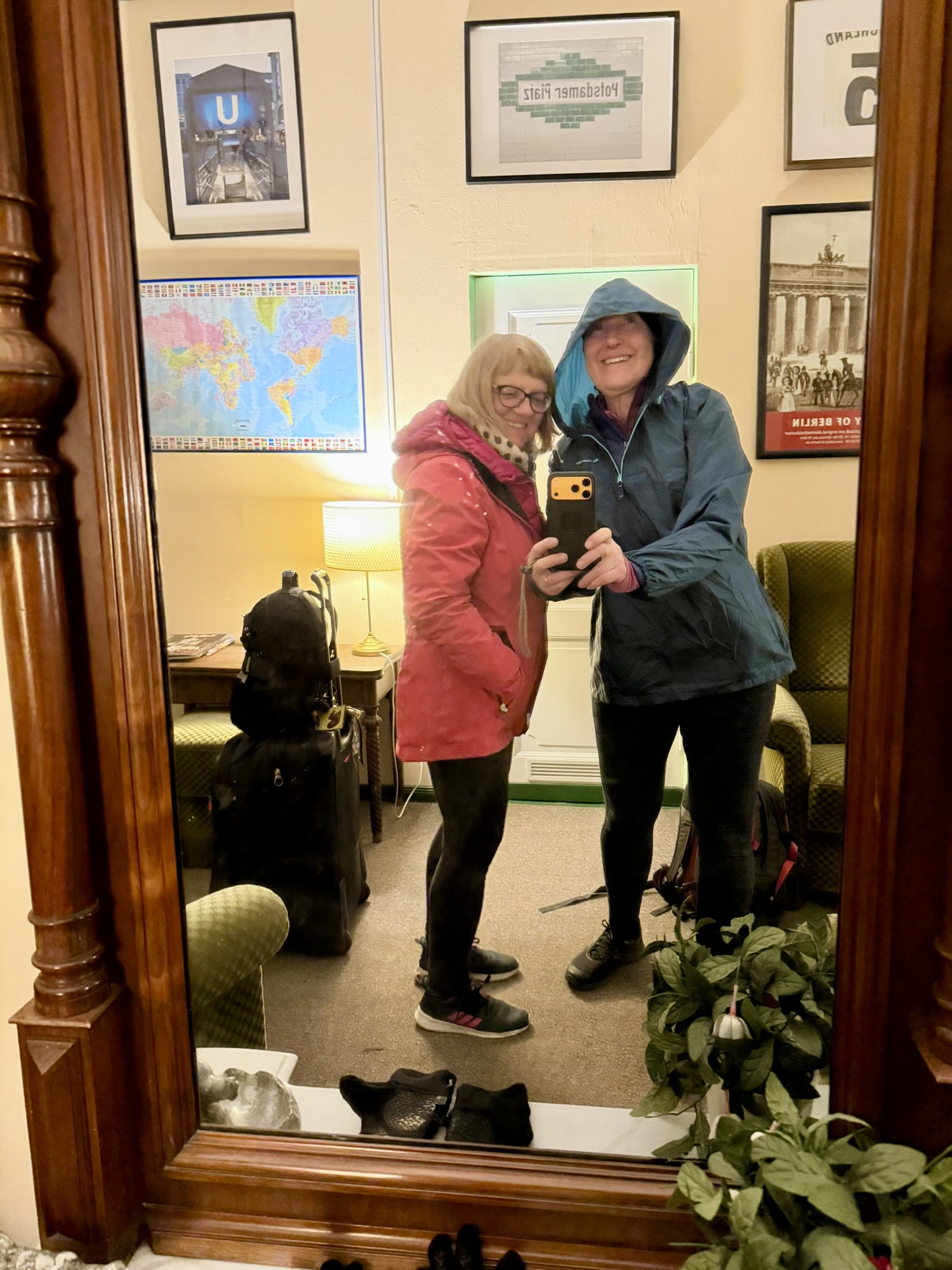
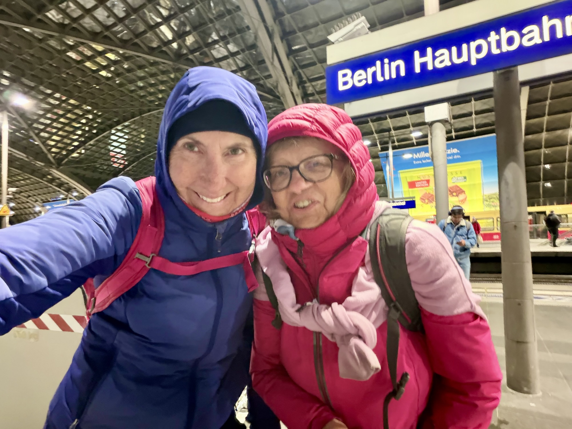
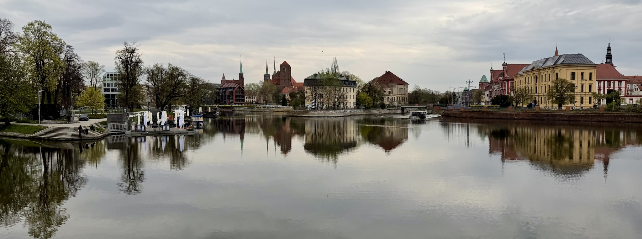
We had booked a basic sleeper compartment with five beds. There was one woman already in the compartment. No one else would be joining us, the conductor stated as she checked our tickets. She also told us that even though the train was more than an hour late we would still arrive in Amsterdam at the scheduled time which meant an hour less sleep than we were expecting. The company is called the European Sleeper. The beds were incredibly narrow as was the space between them. I can’t imagine how tight it would’ve been with five people in there. It was very late, and I was very cold and tired. I knew I would have to be up early to get off the train in Amsterdam. Shockingly, I didn’t take a single picture on the train. As I write this and look at the website, I see that we could have had more comfortable sleeping accommodations, but the next level up would have been more than double the €55 that we each that we paid.
The last time I was on a sleeper train was in 1987.
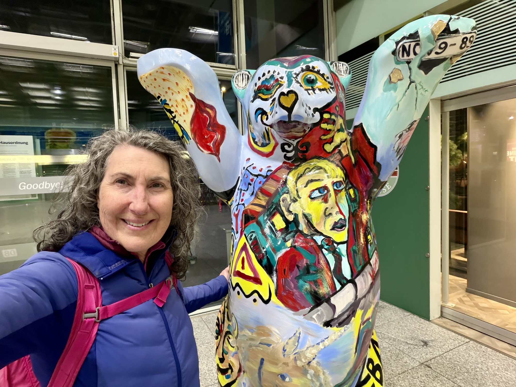
Goodbye Berlin. I look forward to waking in Amsterdam.
Today we visited the Reichstag dome, Brandenburg gate, Bebelplatz, Holzmartk, and the East Side Gallery.
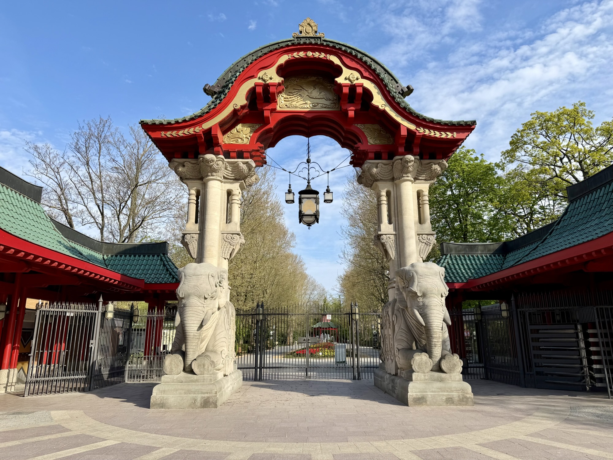
On our way to the Reichstag Dome, we cycled through Olof-Palme-Platz. This small plaza was named after the Swedish Prime Minister assassinated in 1986. It contains a fountain, Ammonitenbrunnen, Ammonite fountain in English, which along with the outer wall forms the shell of a snail.
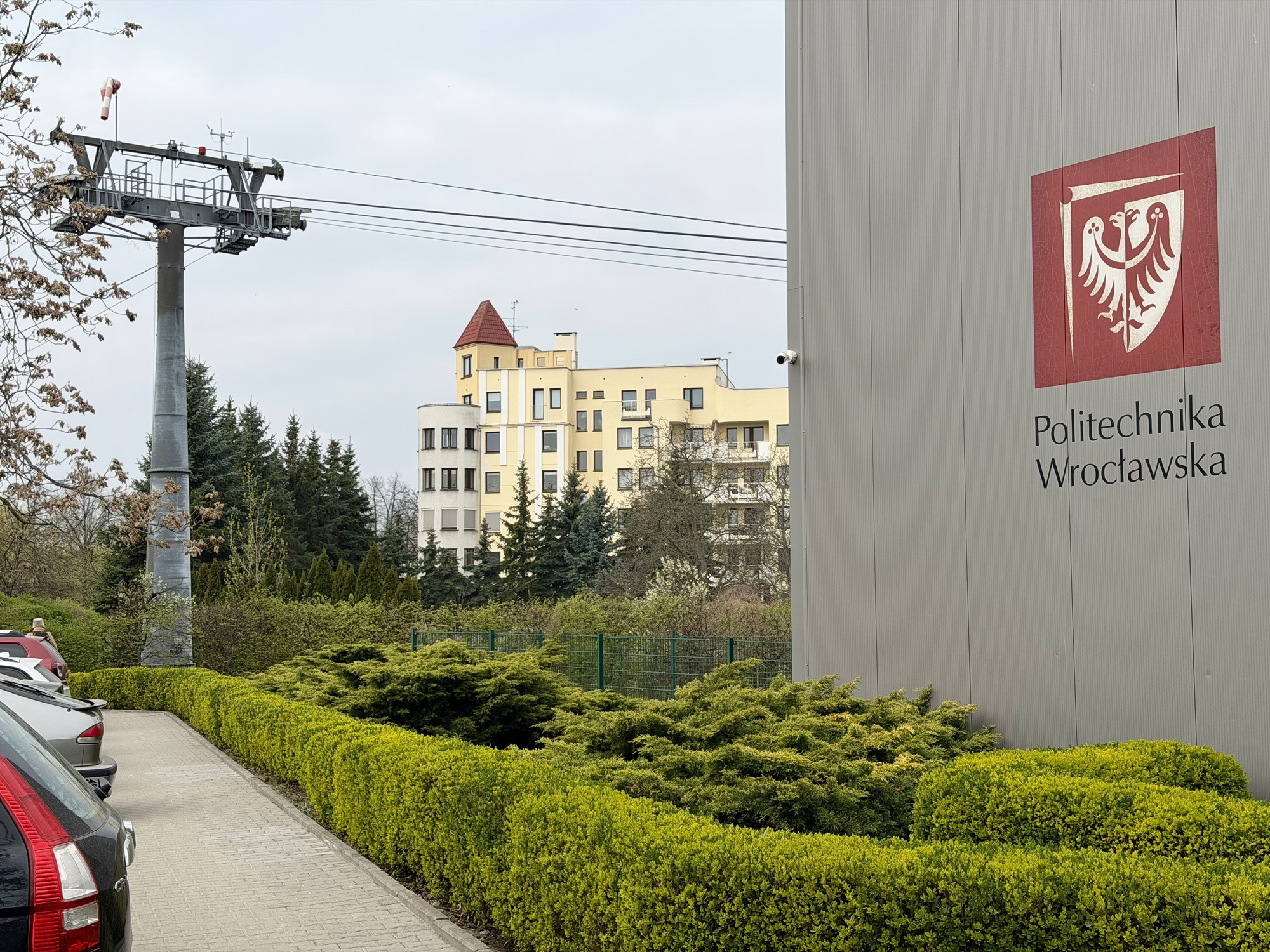
The fountain is in front of Berlin‘s zoological gardens (zoo). I found it interesting that in both Berlin and Wroclaw the zoo was right in the city, unlike in Toronto (other than the small one at High Park).
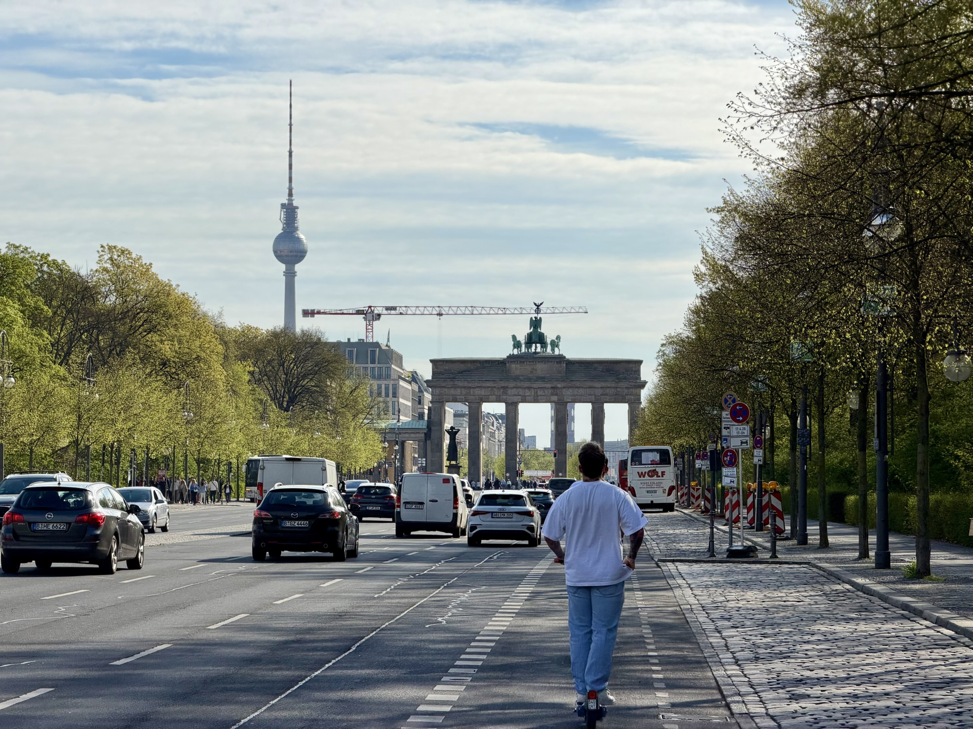
We rode through the Tiergarten again, and then along the road to the Brandenburg gate. The Reichstag is very close by, off to the left.
Entry to the Reichstag dome is free, but you must register for tickets ahead of time and bring government issued photo ID with you. We took our passports. There was a makeshift security area with airport type security levels – checking ID and passing through metal detectors before being allowed into the building.
There was a security sluice, which is a heavily controlled, automated access corridor, similar to an airlock, as we entered the main building. A security sluice uses two interlocking doors that never open at the same time. It prevents tailgating, forced entry, and unauthorized access in high security facilities.
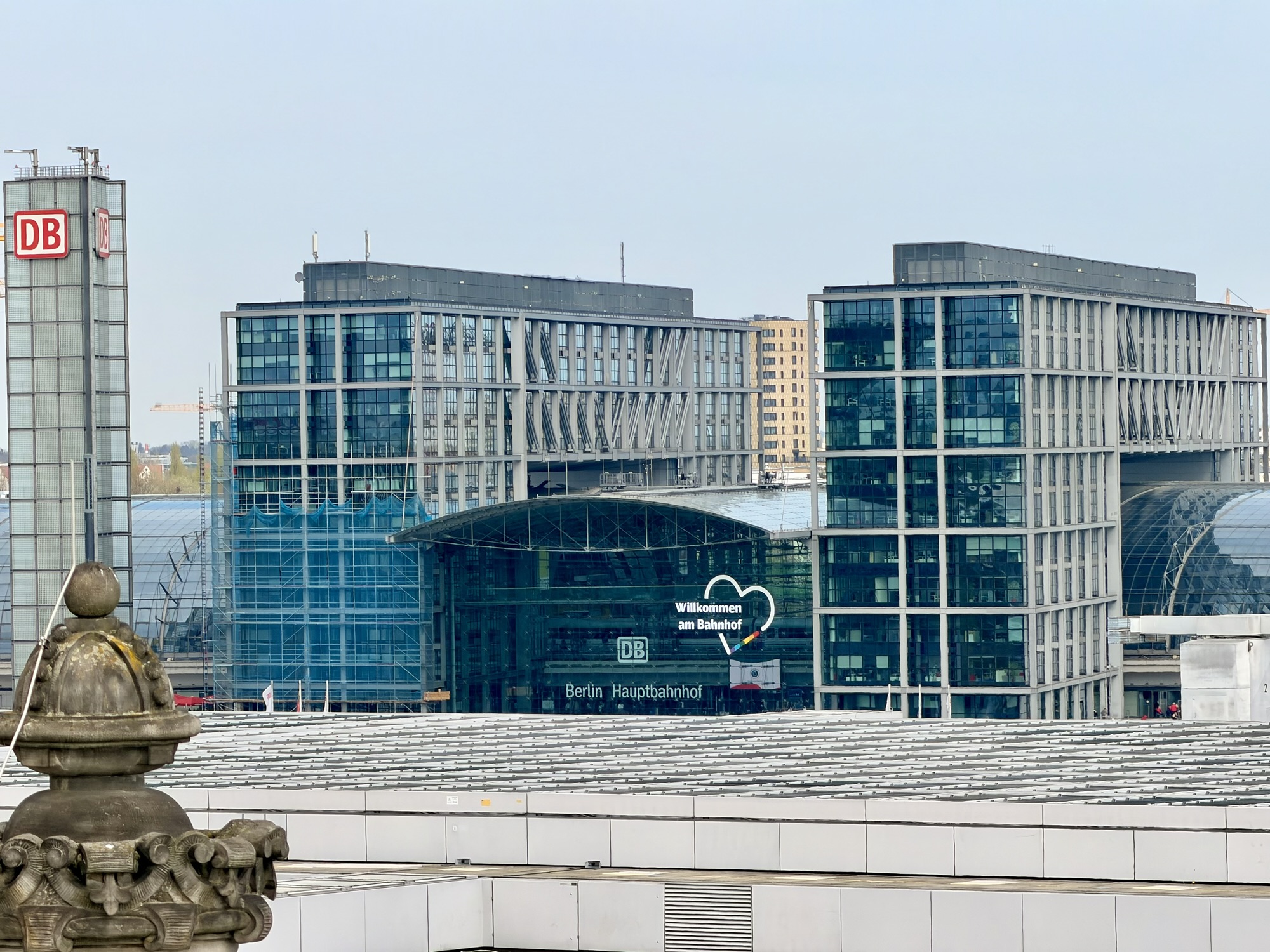
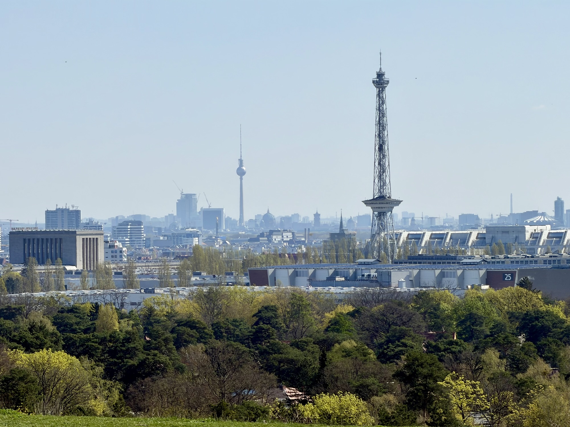
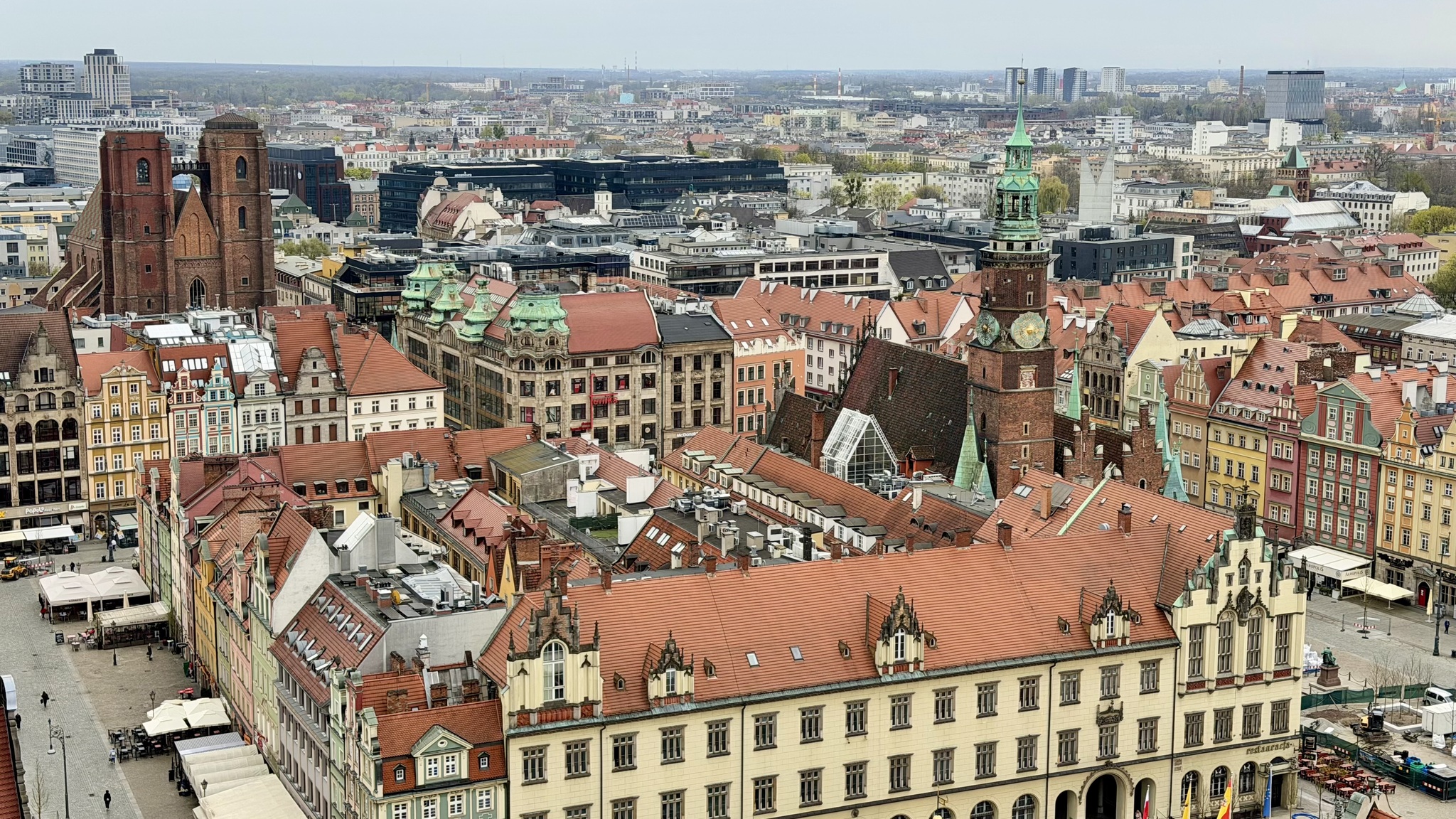
An elevator ride took us to the open rooftop at which point we were allowed to walk around on our own and spend as much time as we wished exploring the views from the rooftop and the dome. There were great views of Berlin Hauptbahnhof, the Central Station.
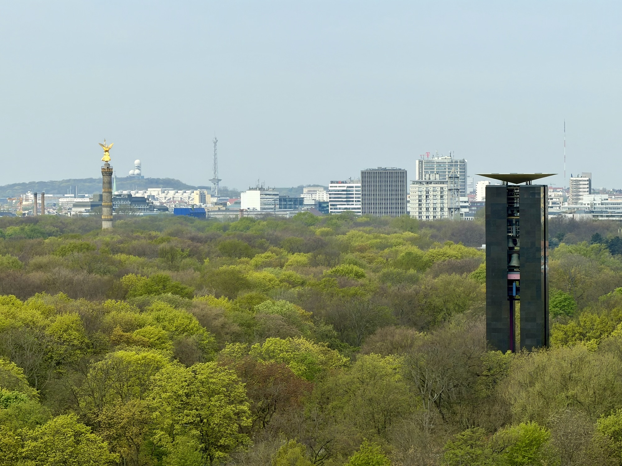
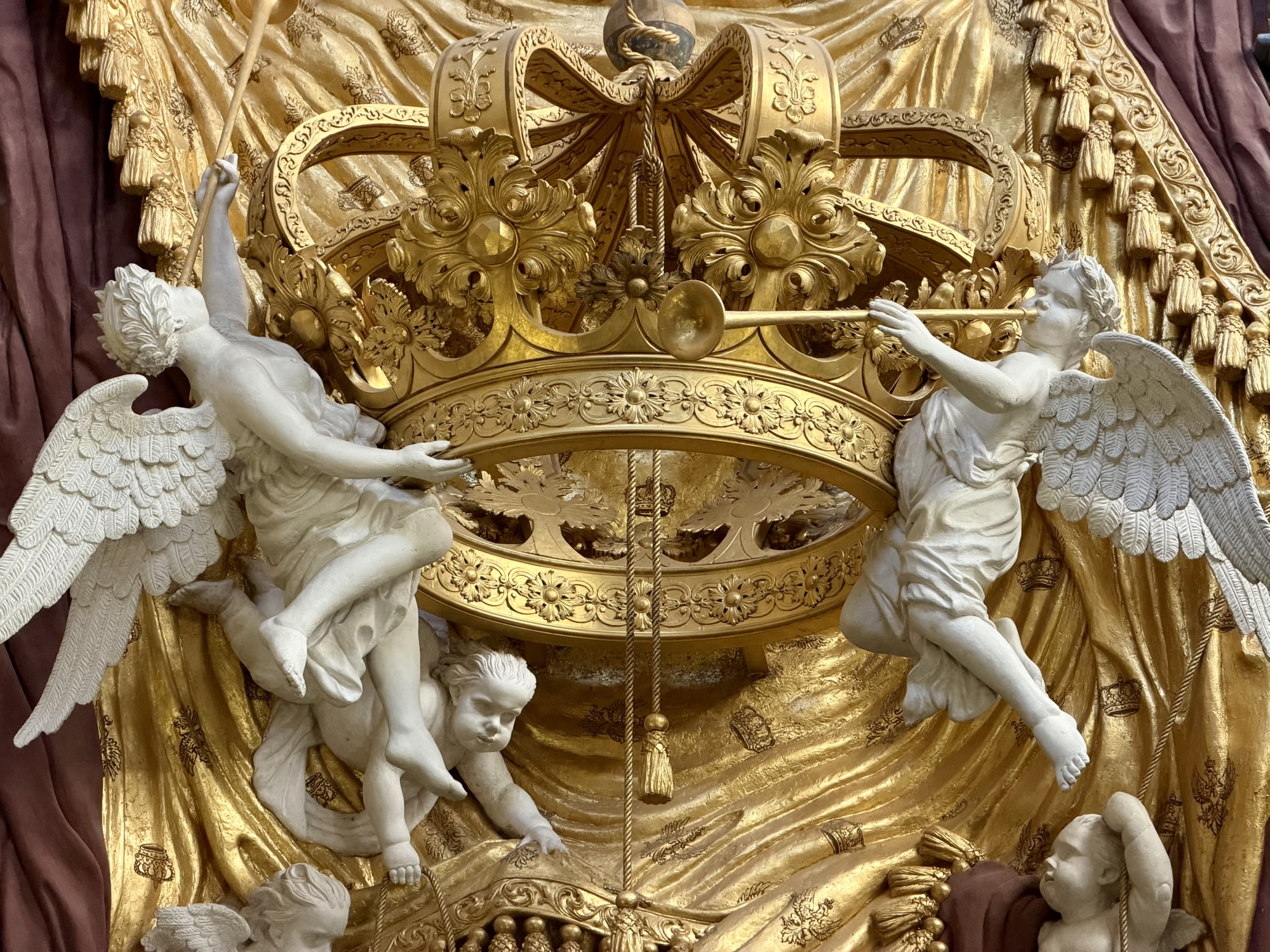
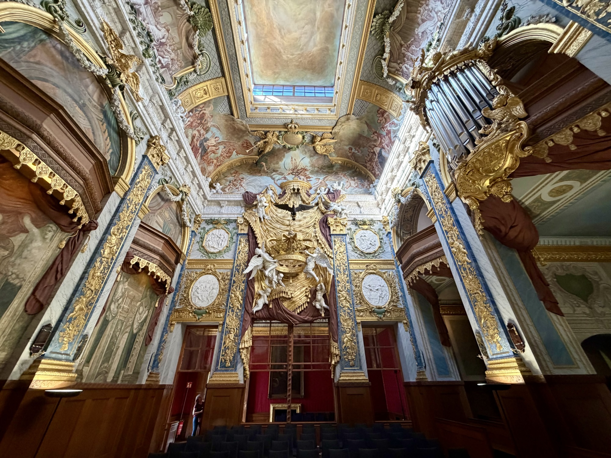
In this view to the west, you can see the size of the Tiergarten. On the left, you can see the Victory Column, Teufelsberg, the Cold War listening station, which we visited yesterday, and a carillon, on the right. The carillon is the fourth largest instrument of its kind in the world. It has a 68 bronze spells and a 42 m tall freestanding tower. It was erected in 1987 to celebrate Berlin 750th anniversary. This is a mechanical carillon. The carilloneur sits in a cabin in the middle of the bells and plays a keyboard using their fists and feet.
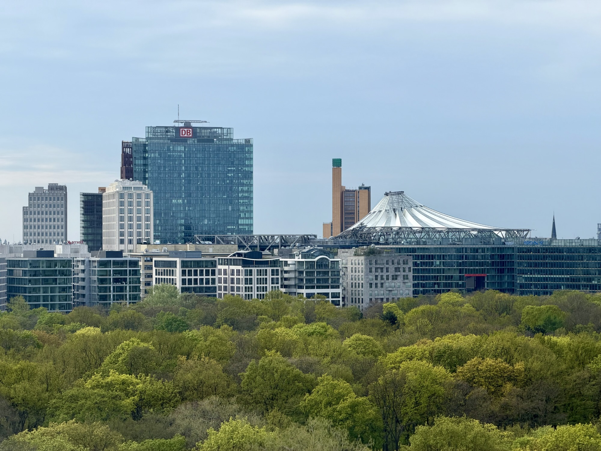
Here you can see the tent like roof of the Centre at Potsdamer Platz.
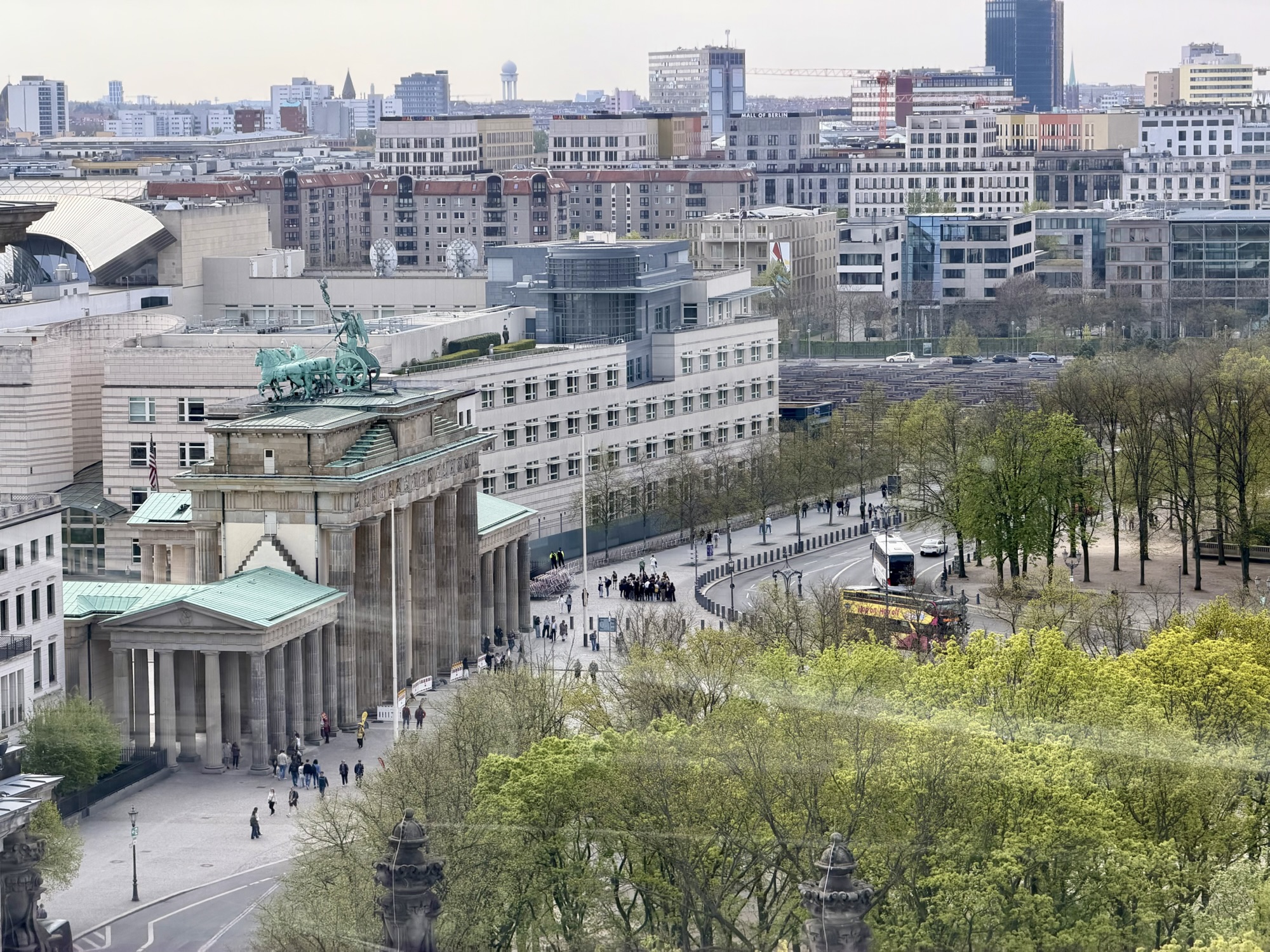
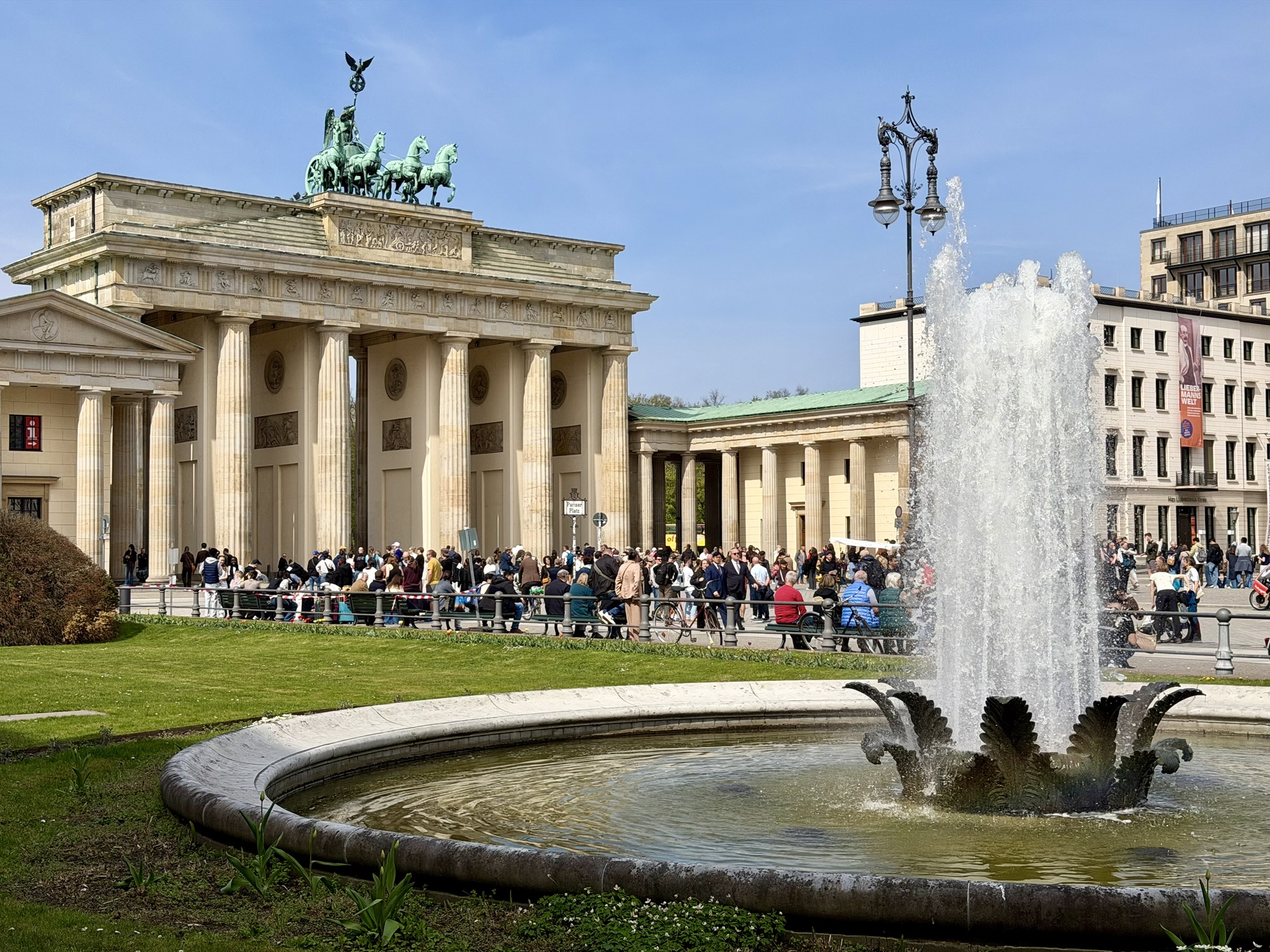
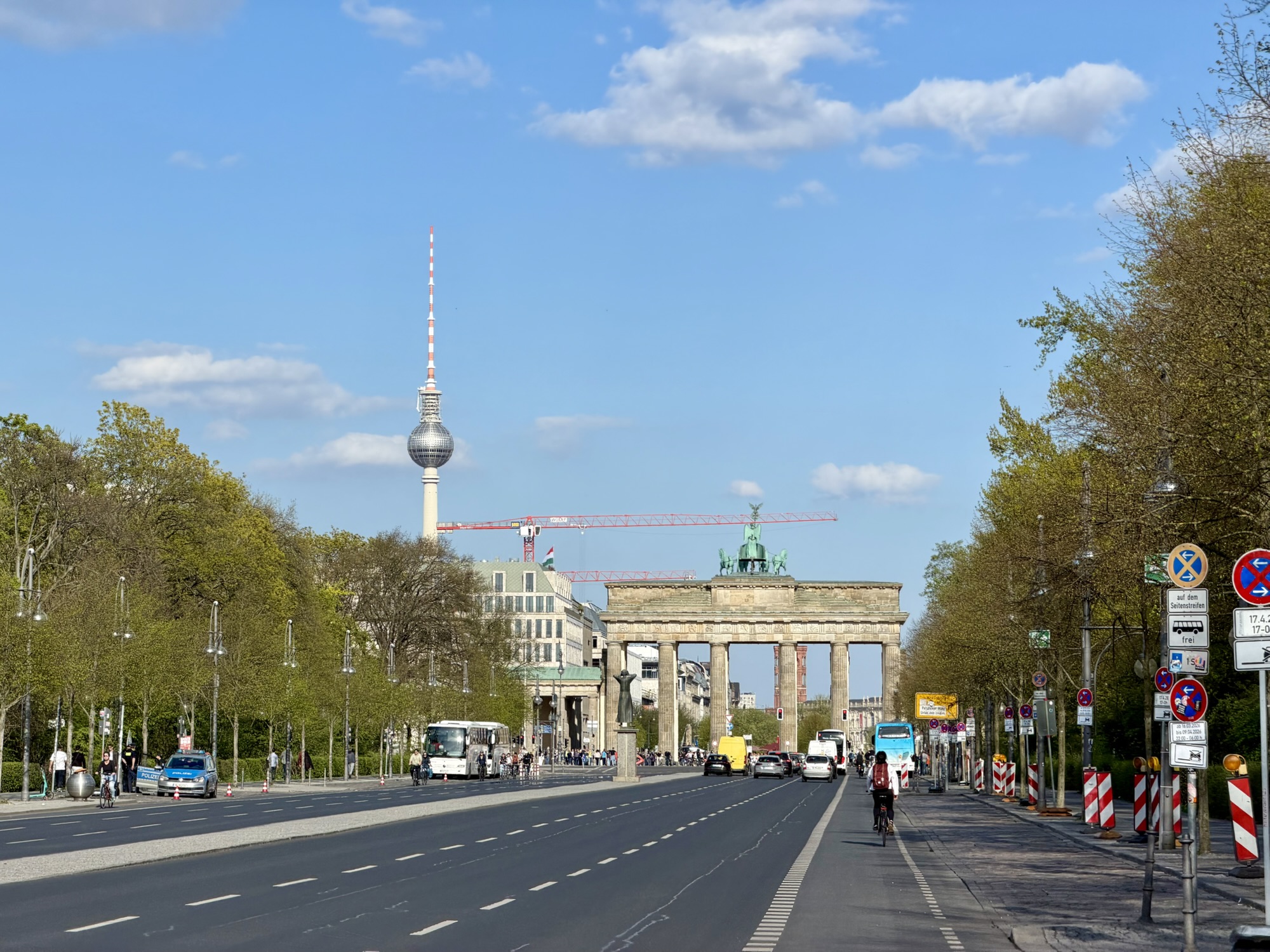
At bottom left, you can see the Brandenburg gate in this image. At centre right is the holocaust memorial.
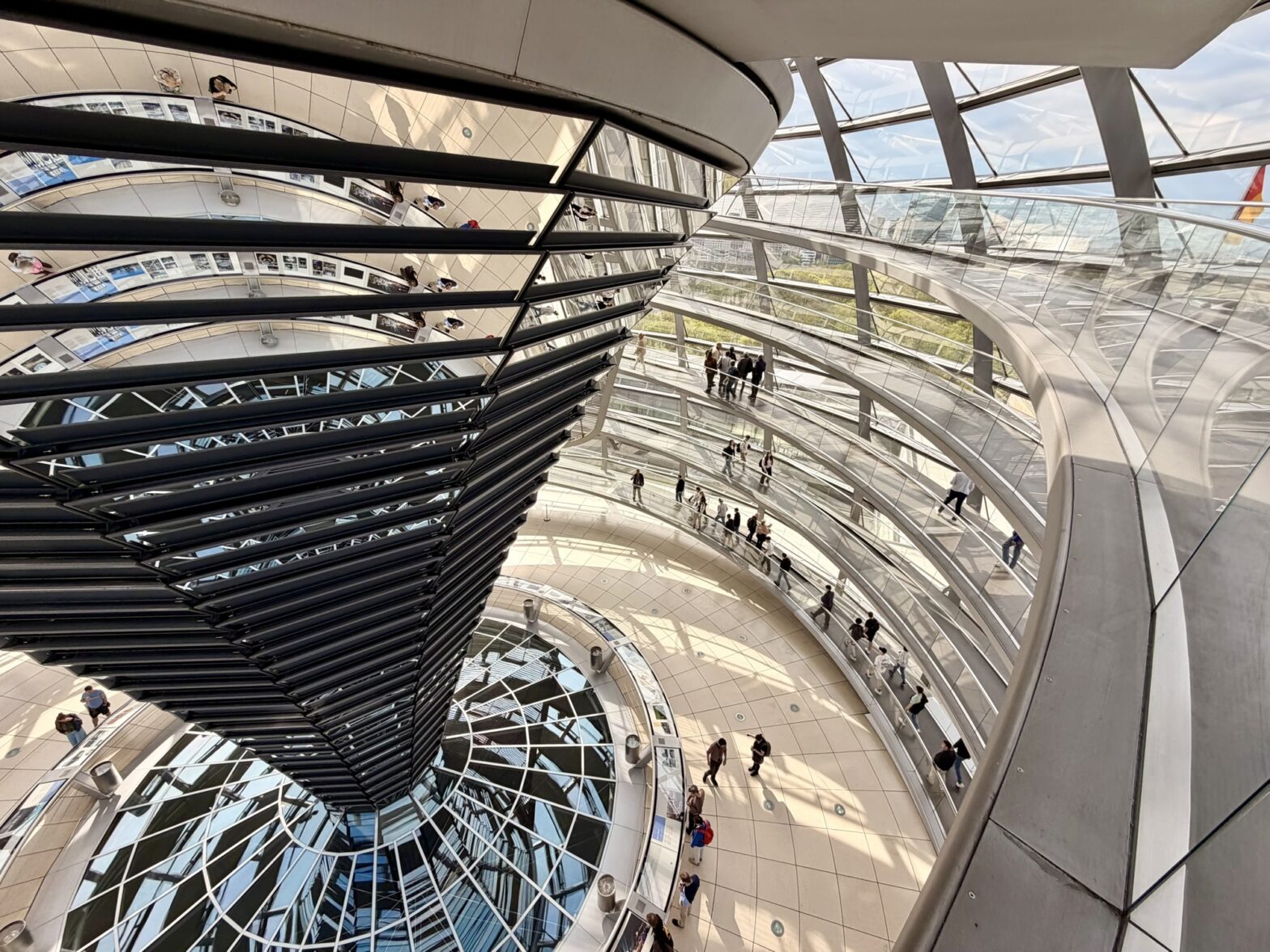
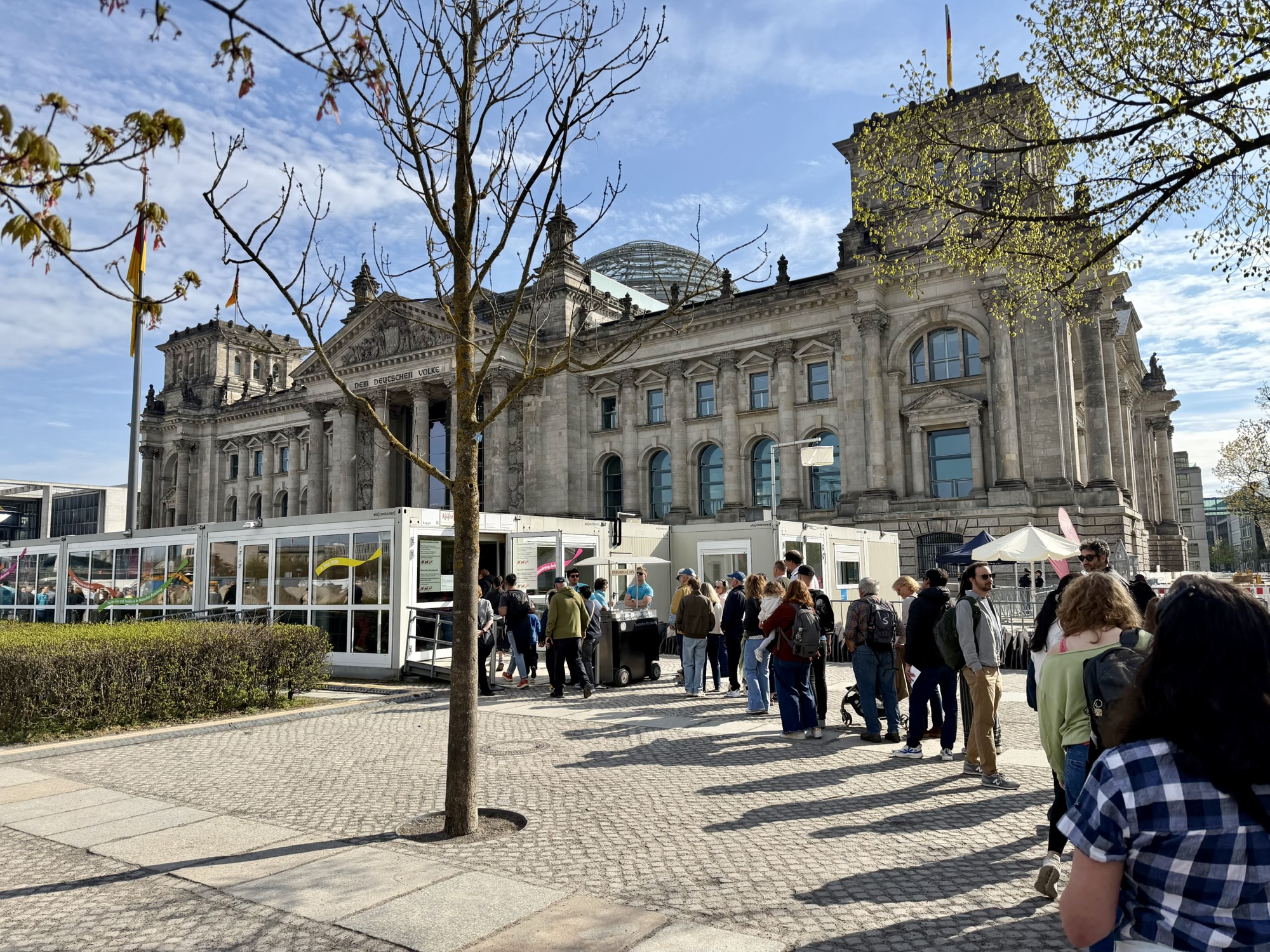
The Reichstag building in Berlin is the seat of the German federal parliament (the Bundestag). It originally opened in 1894. It now features a glass dome, completed in 1998, which has a view of the parliamentary chamber, symbolizing government transparency. It is the most visited Parliament building in the world with more than 3 million visitors annually.
Norman Foster, and partners, were the architects of the dome. The rotating sunshade structure on the left is the computer controlled system of 360 mirrored aluminum panels that track the sun’s path. It prevents glare in the parliament chamber below and redirects natural daylight inward while preventing excessive solar heat gain.
The Reichstag dome uses a sweeping double helix ramp system that allows visitors to walk continuously up to the top and back down. People ascending and descending can enjoy panoramic city views without crossing paths. There were free audio guides available that detected where you were on the ramps and provided descriptions of the views as you passed them.
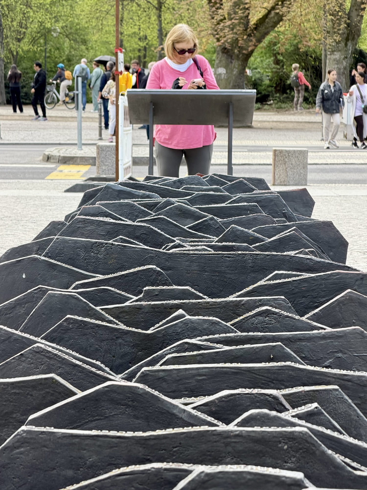
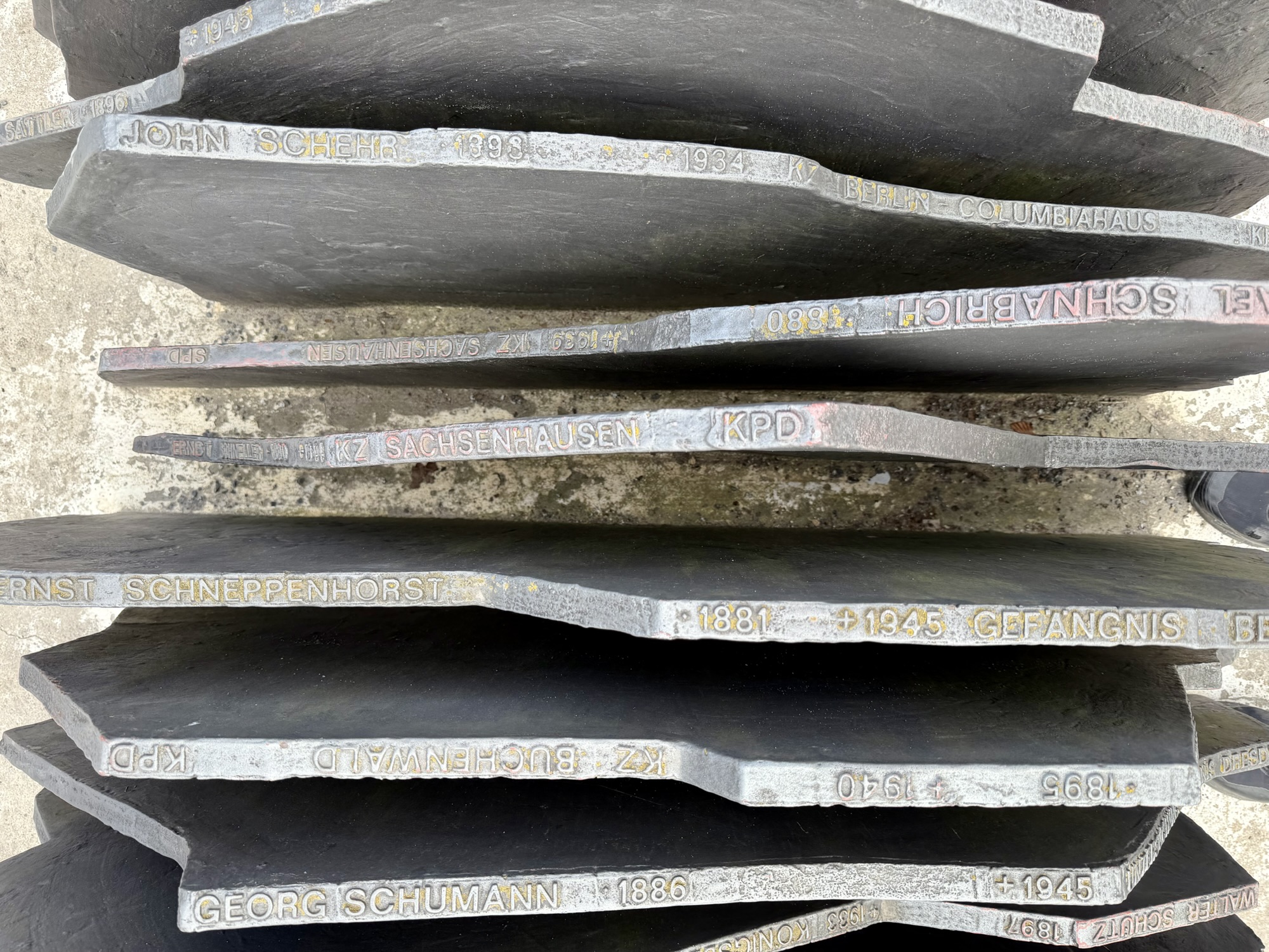
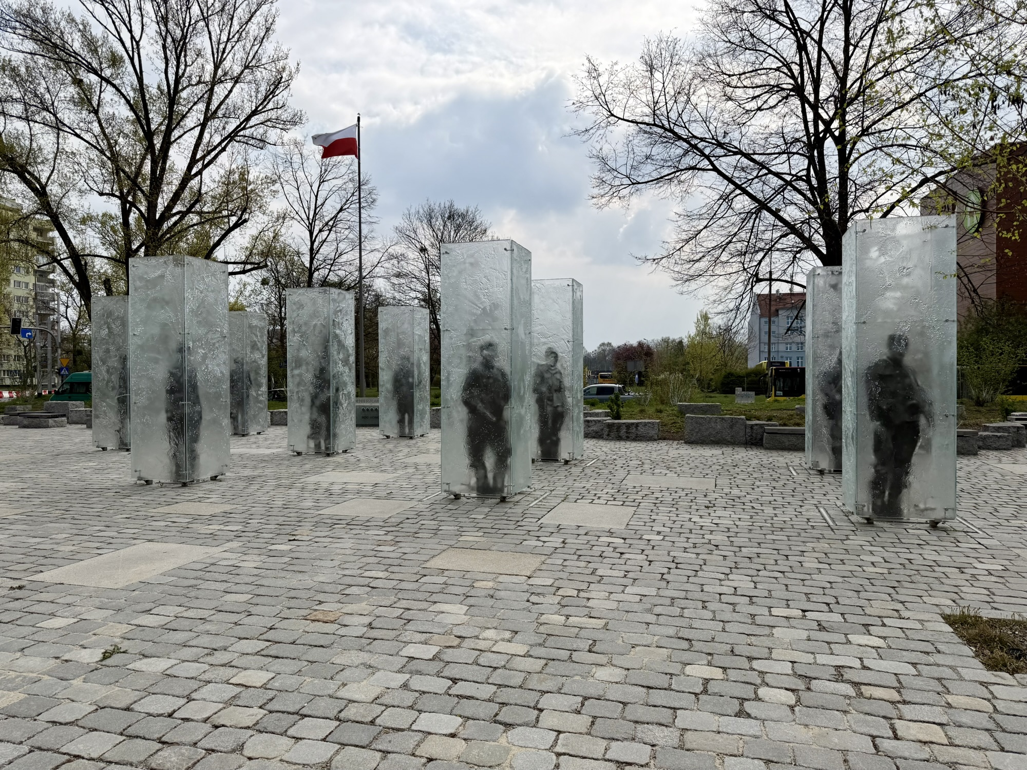
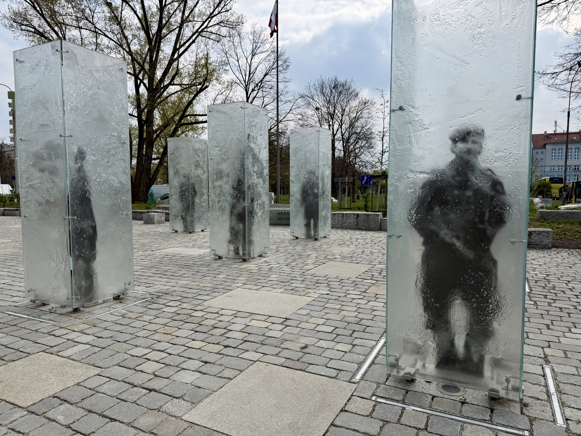
Outside of the Reichstag is the Memorial to the Murdered Members of the Reichstag. It commemorates the 96 members of the parliament who were murdered between 1933 and 1945. The memorial was erected in 1992. It is made up of 96 cast iron plates with the names, birth and death dates and places engraved on the edges.
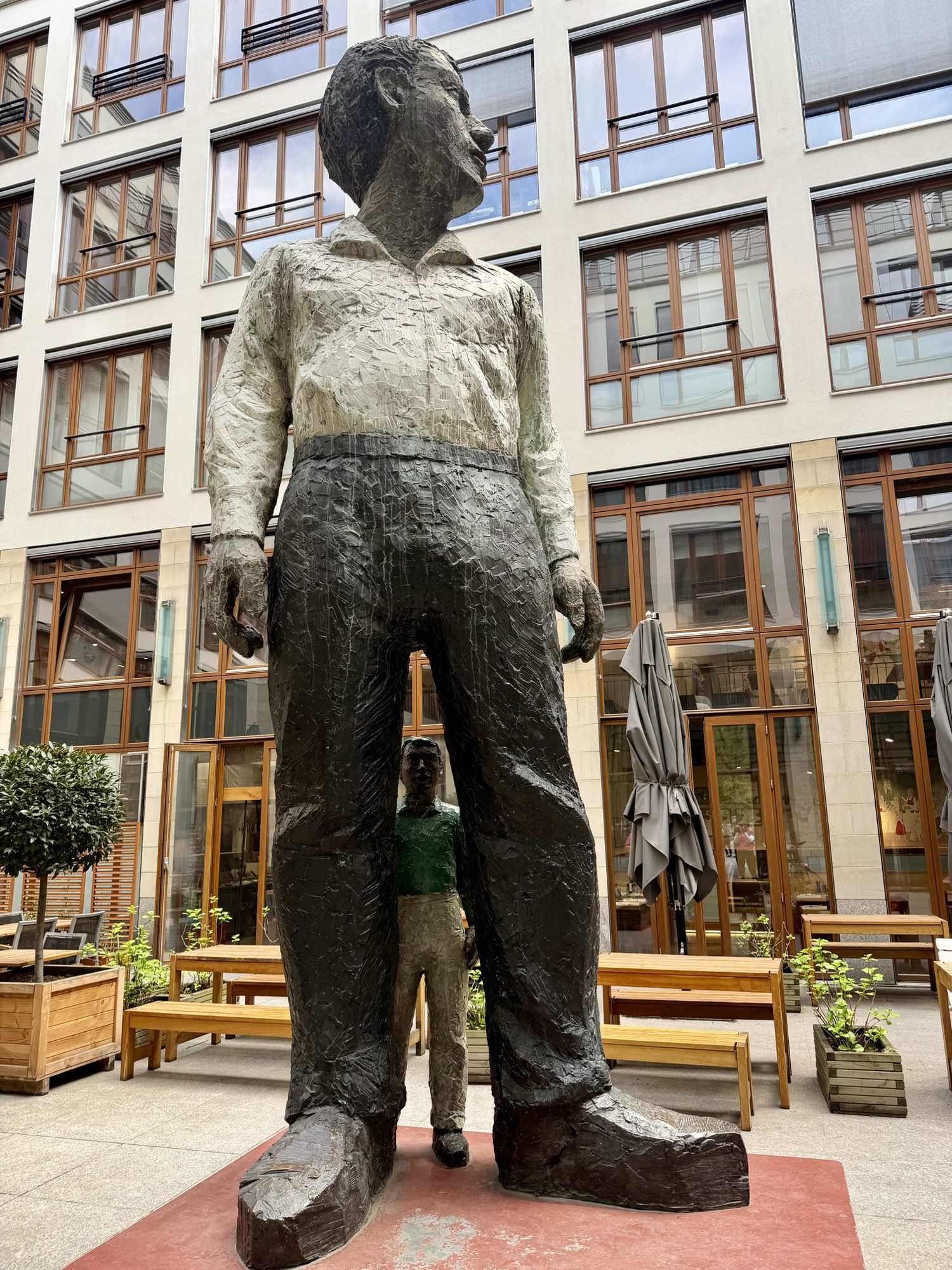
This Stephan Balkenhol sculpture entitled Großer Mann mit kleinem Mann (Big Man with Little Man) features a towering figure gazing toward the Brandenburg gate and a smaller figure looking through his legs towards the street. The big man is a “larger than life figure that symbolizes, the strength and presence of the individual citizen within a Democratic society”. The little man is an “homage to everyday people who opposed state oppression and authoritarianism“.
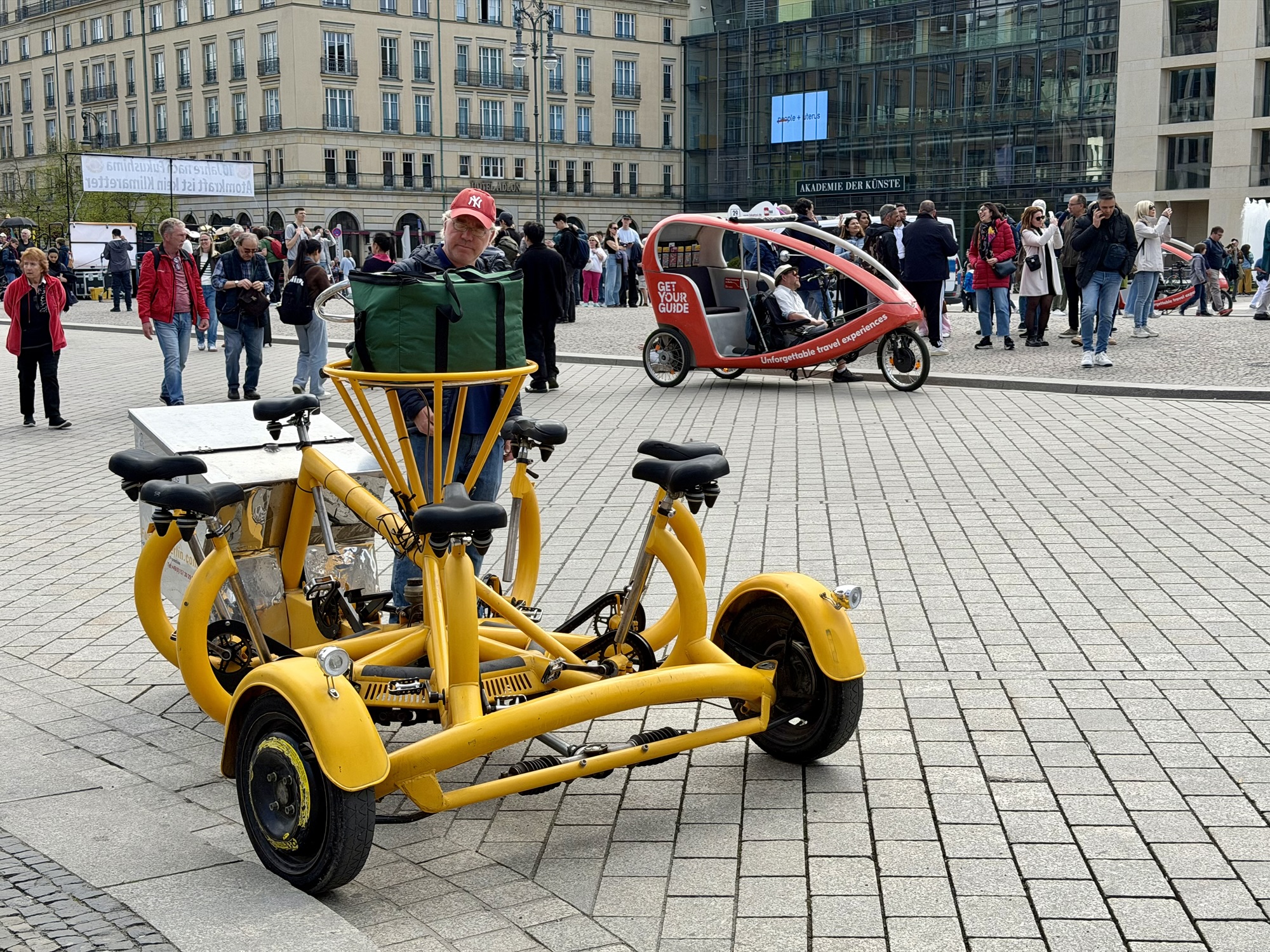
I don’t think I have ever seen an odder bicycle.
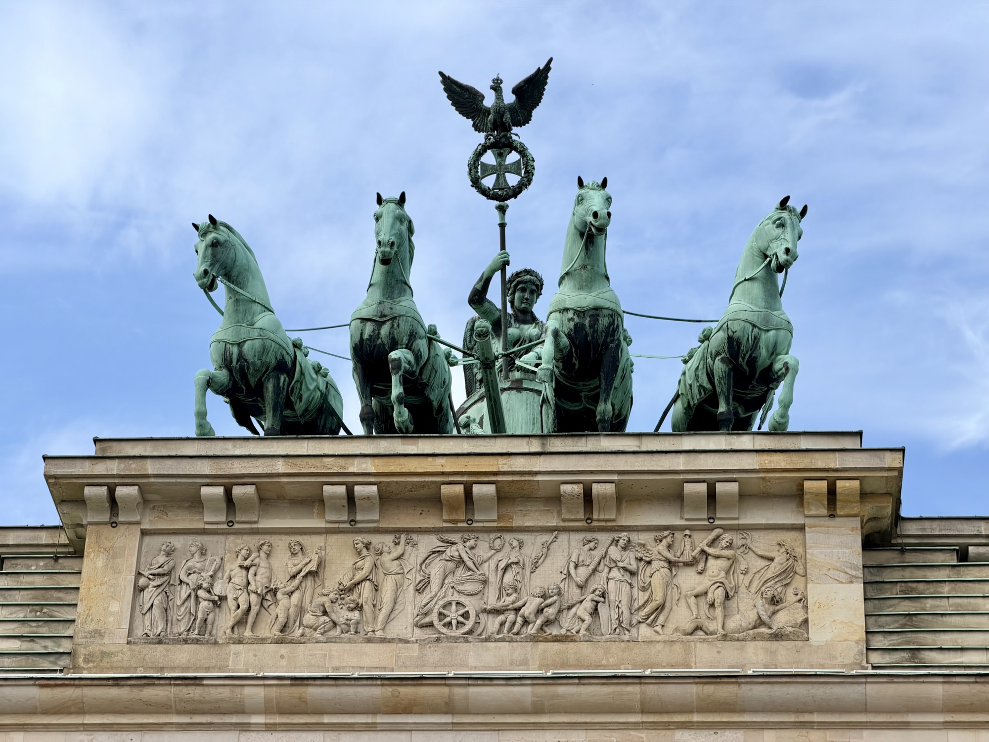
The Brandenburg gate is an iconic 18th century neoclassical monument. It was commissioned by King Frederick Wilhelm II and built between 1788 and 1791. It has served as a symbol of peace, Cold War era division, and modern German reunification.
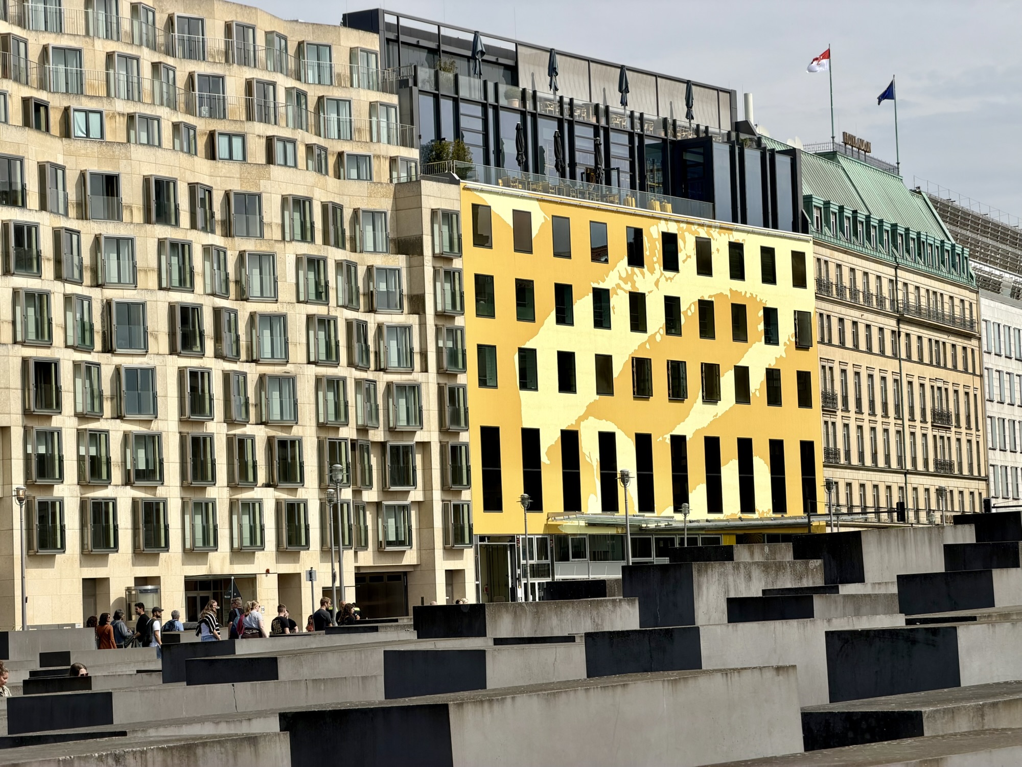
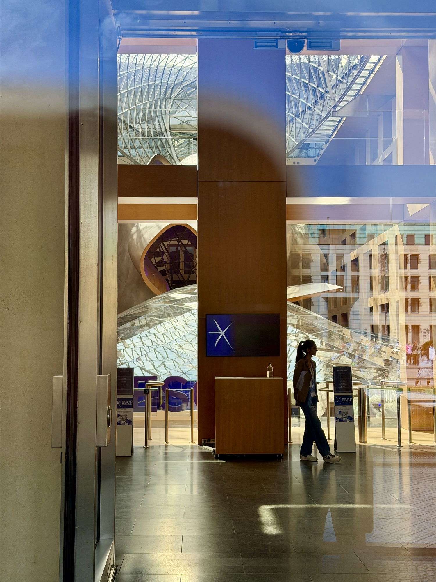
The building on the left across the street from the Holocaust Memorial in the foreground, was designed by Frank Gehry for DZ Bank. It is a somewhat sedate building on the outside, for Frank Gehry, due to a requirement that it that building blend in with the surrounding embassies and historical buildings.
I knew I wanted to go in to see the sculpture in the atrium. However, there was graduation event being held, and security would not allow us to go in. I was only able to get a picture of it through the doors.
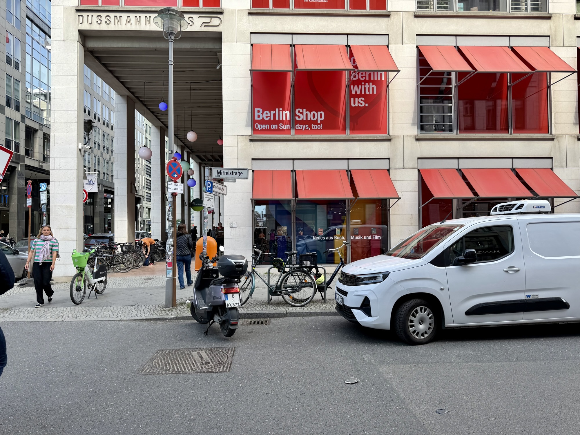
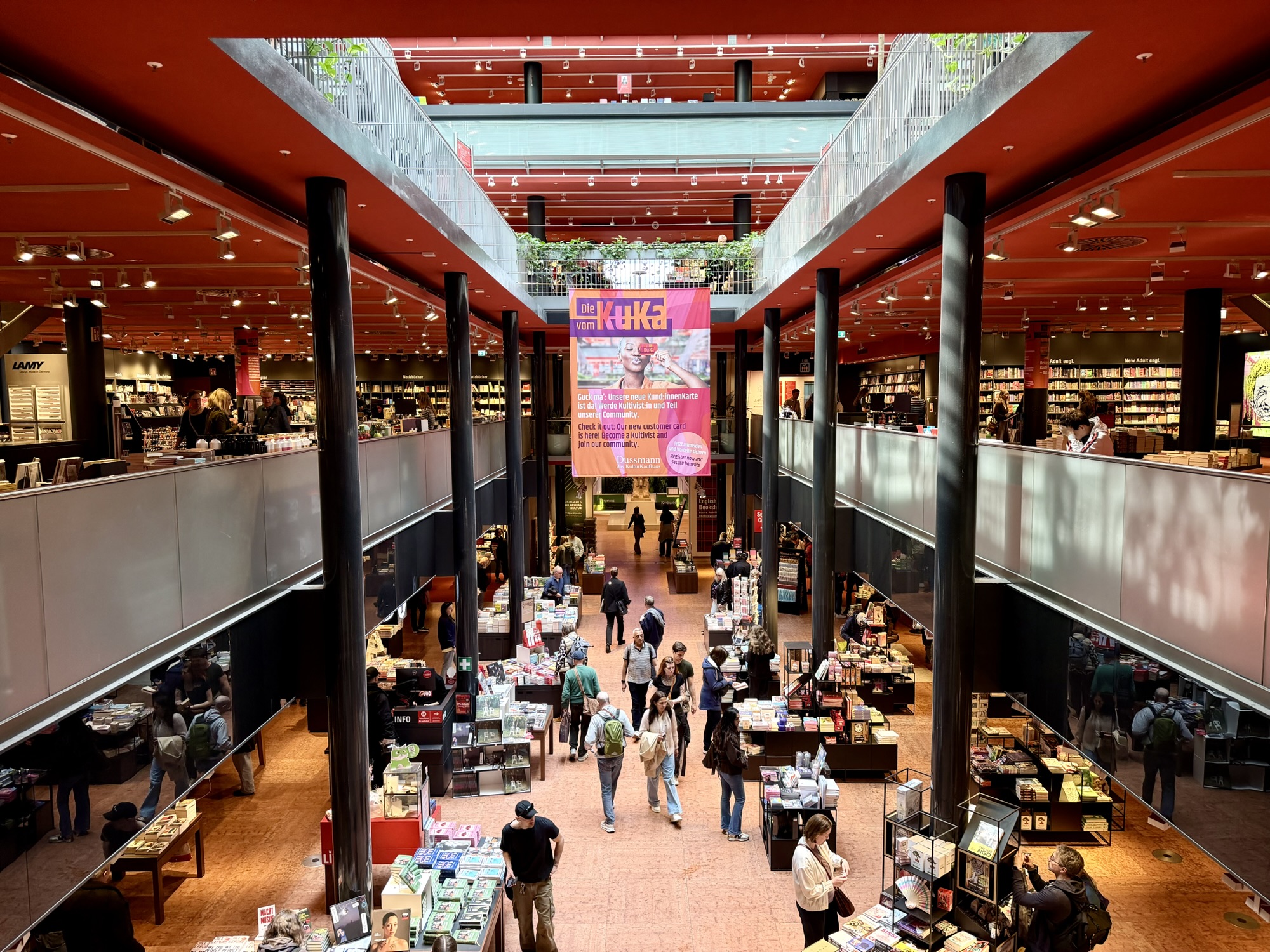
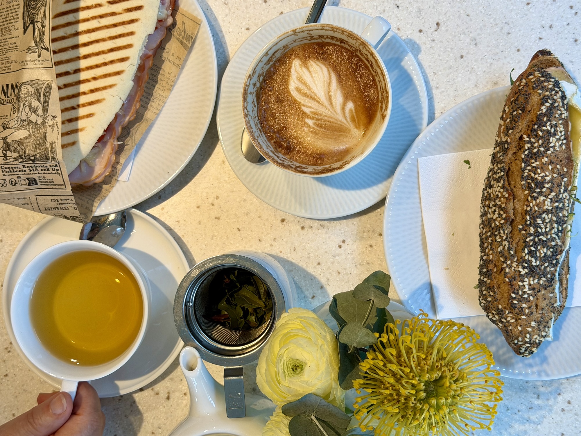
We stopped at the spectacular Dussmann das KulturKaufhaus book store to browse and have lunch in their café. It covers five floors and has over 100,000 books, including a very large English language literature section.
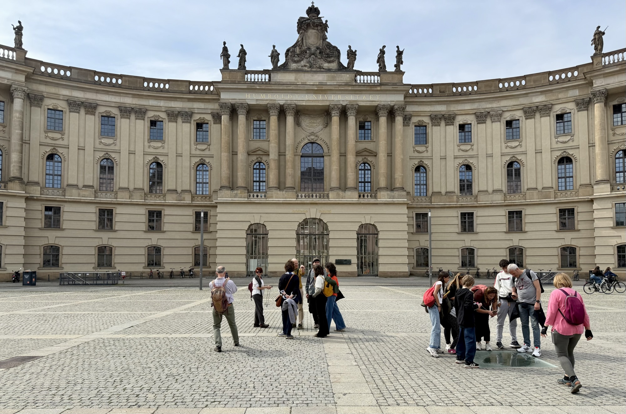
Our next stop was Humboldt University and the square in front of it – Bebelplatz. In the square is a memorial entitled The Empty Library at bottom right in the picture below. It commemorates the infamous Nazi book burnings of May 10, 1933. A plaque set near the memorial translates to:
That was but a prelude;
where they burn books,
they will ultimately burn people as well.

Heinrich Heine 1820
Humboldt University is named after two prominent German brothers: the educational reformer Wilhelm von Humboldt and the naturalist Alexander von Humboldt. Alexander was the first scientist to identify and articulate the concept of anthropogenic (human-caused) climate change. More than 200 years ago, he connected the dots between human activity and ecological shifts, famously warning that mankind’s “mischief” disturbs nature’s order. His insights included deforestation and desertification, the interconnectedness of nature, and the danger of industrial emissions. His observations laid the groundwork for the modern environmental movement.
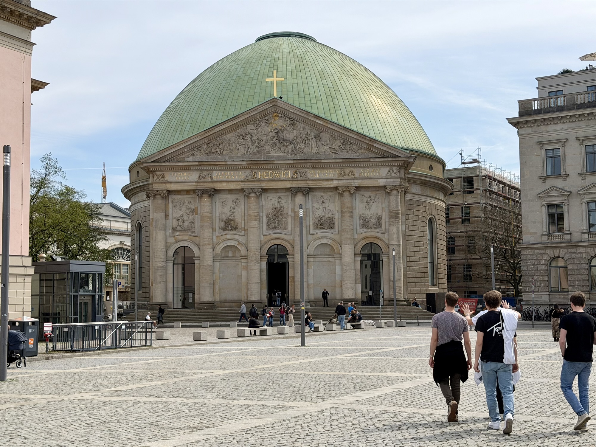
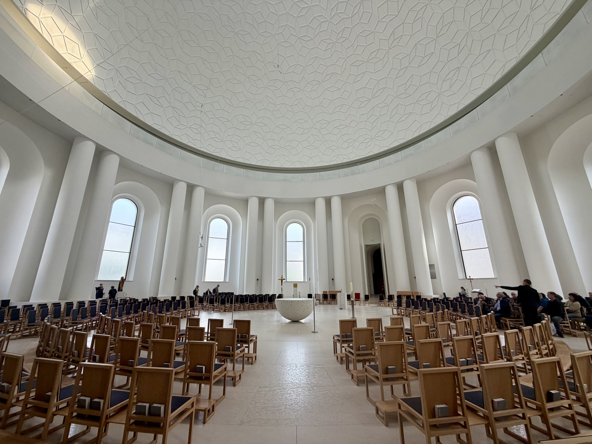
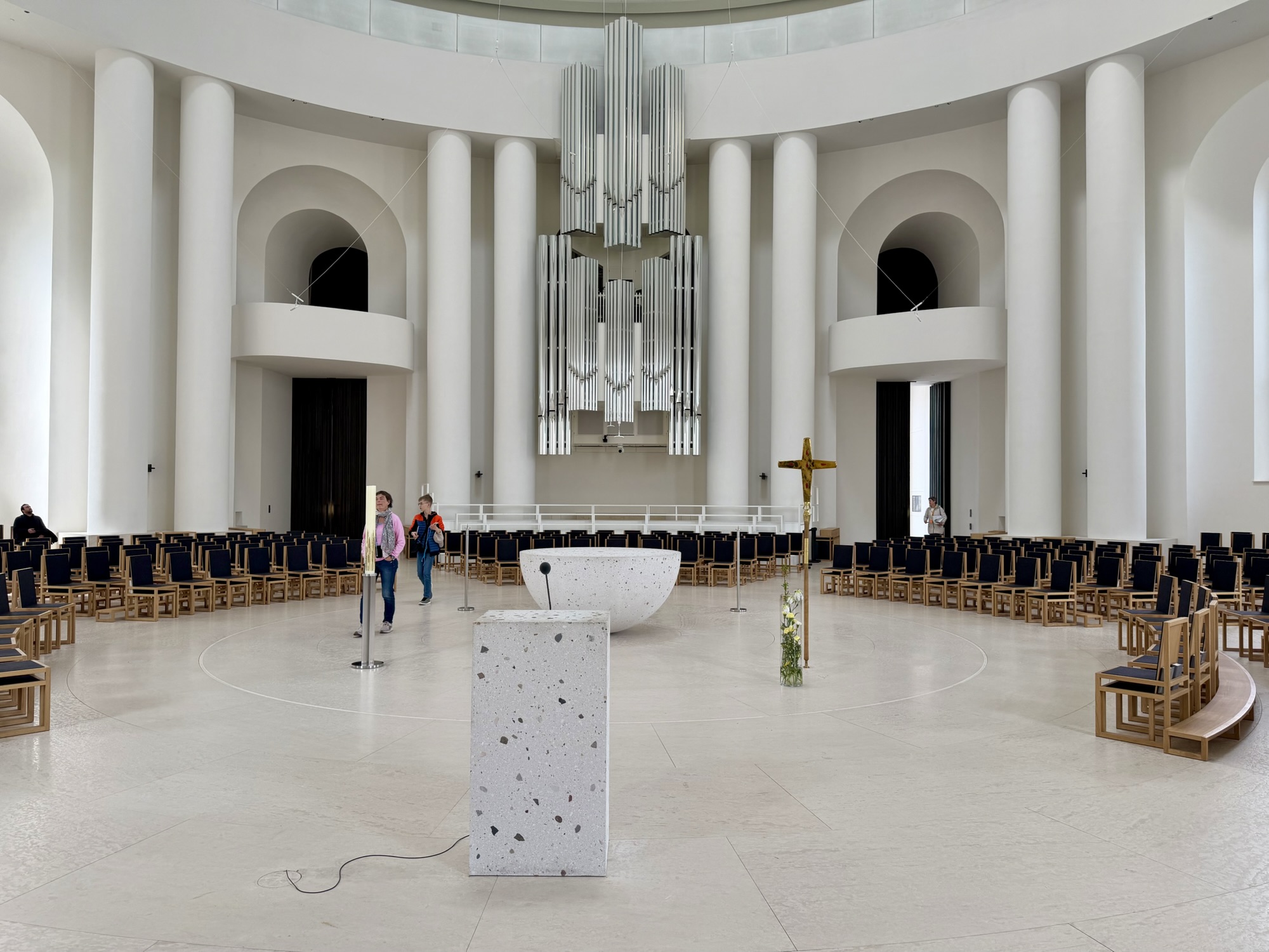
Facing the same square is St Hedwig‘s Cathedral. It is the oldest Catholic Church in Berlin and was inspired by the Roman pantheon. It dates back to 1747. I don’t think I’ve ever seen such a plain Catholic Church. When I looked up information about it to write the blog today, I learned that it looked much different in the past. It was heavily damaged after World War II and rebuilt. Then was renovated again to its current very plain state in 2024.
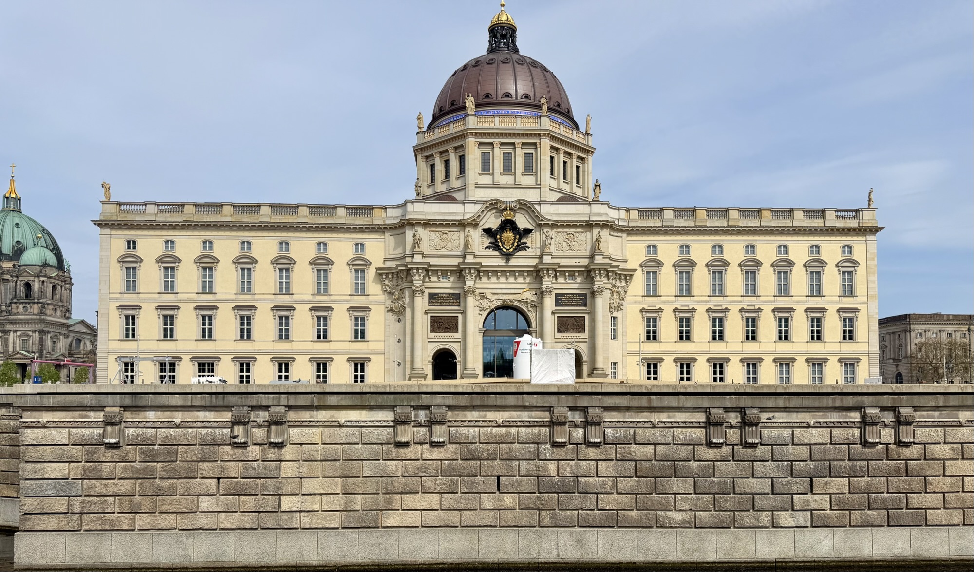
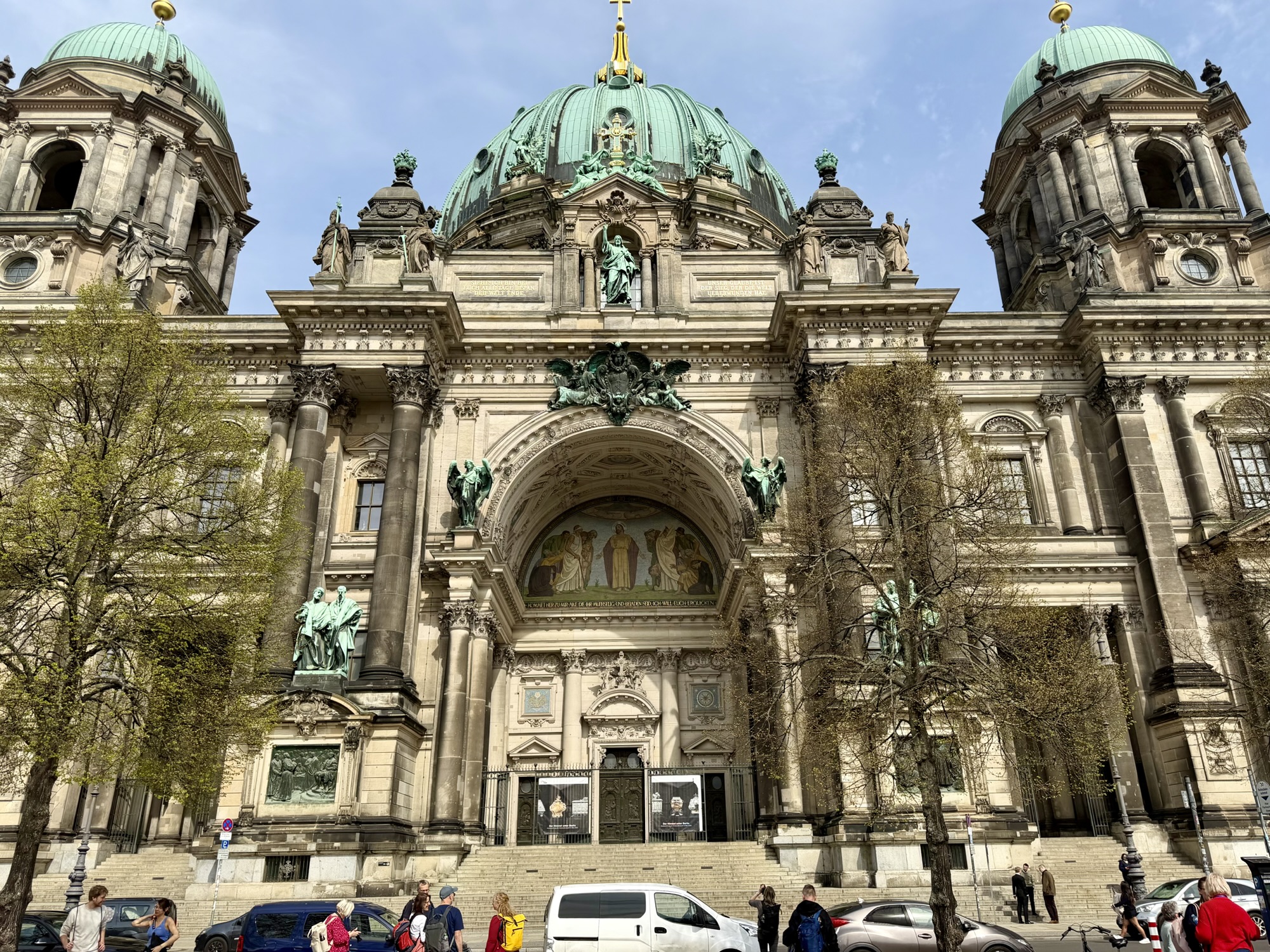
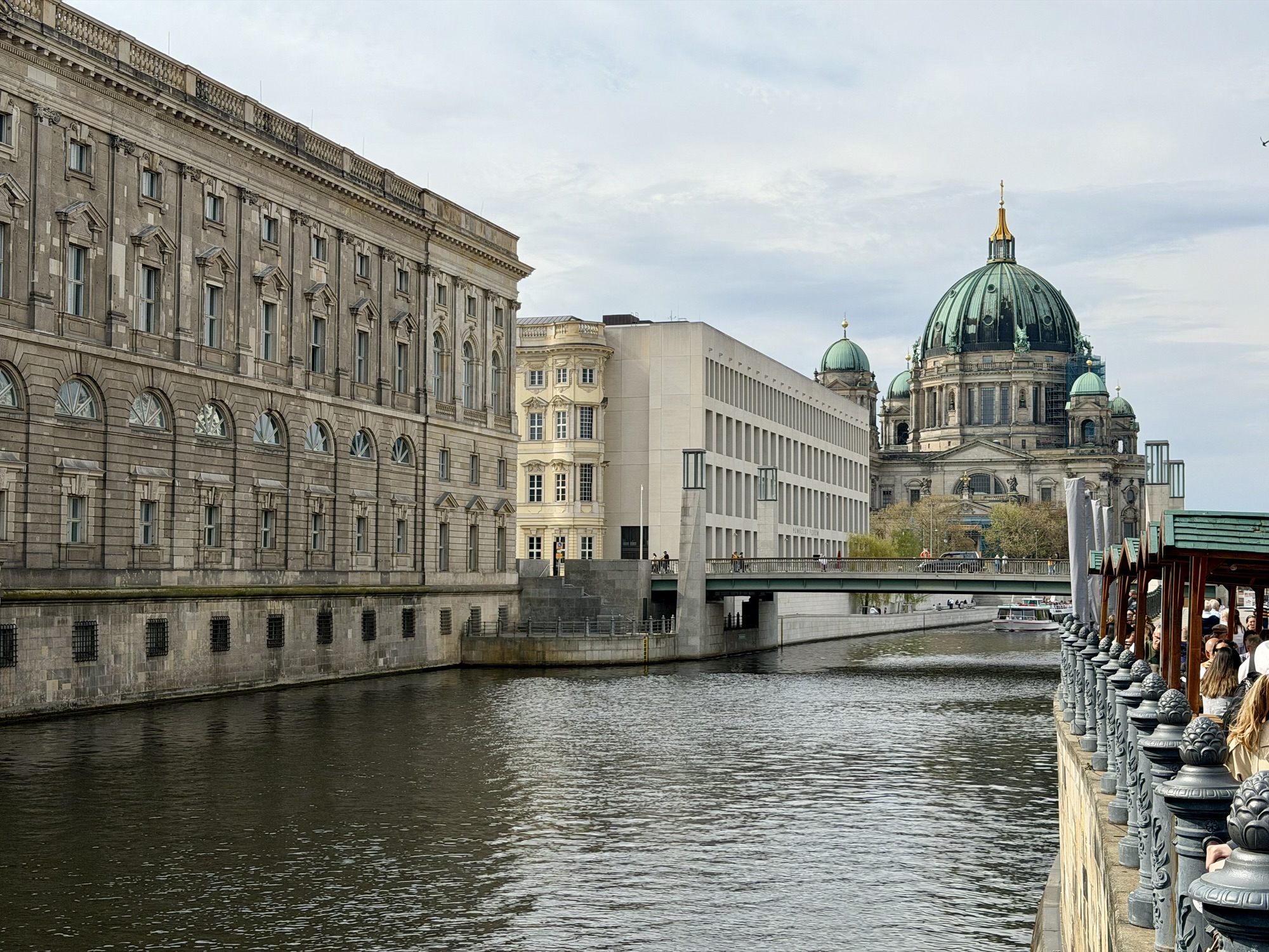
Next, we visited Museum Island, a UNESCO World Heritage site. It houses five world renowned museums, and the Berlin Cathedral.
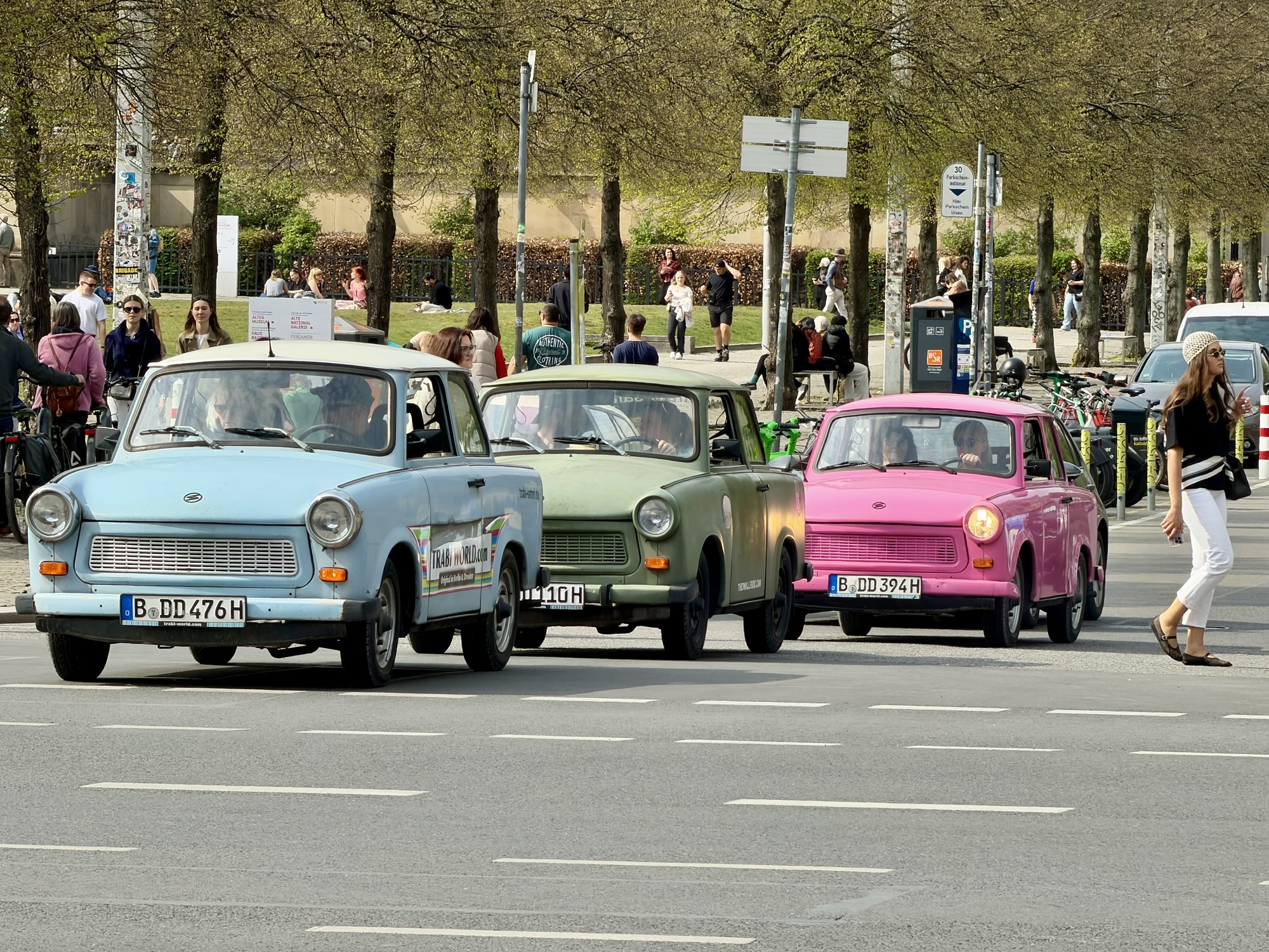
While we were there, we saw these old East German cars – Trabants (or Trabis) which you can rent to drive in a guided tour.
From there we rode to the east side of the Spree River to what was East Berlin. It has a very different feel to it. We encountered some high quality cycling infrastructure there.
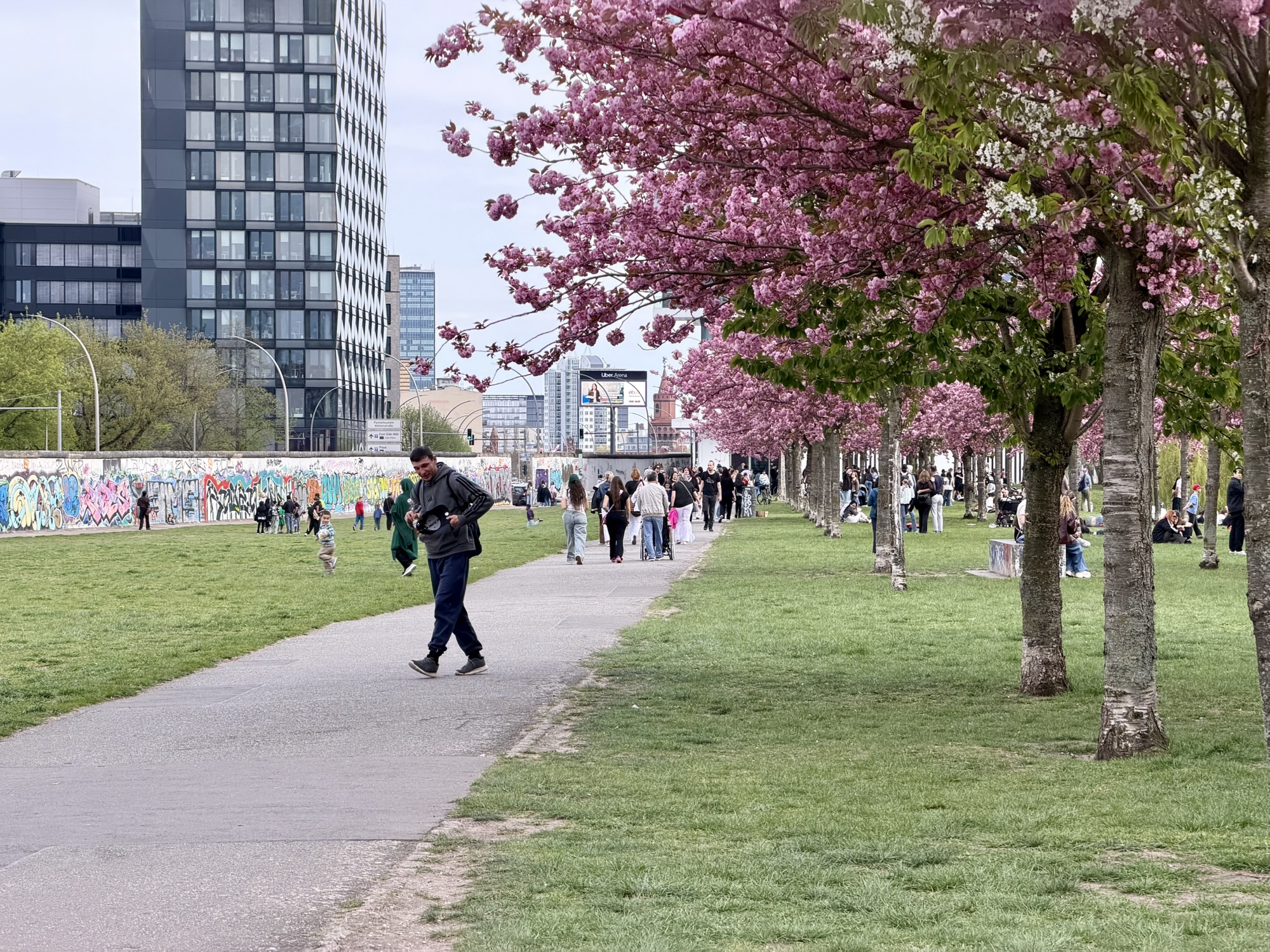
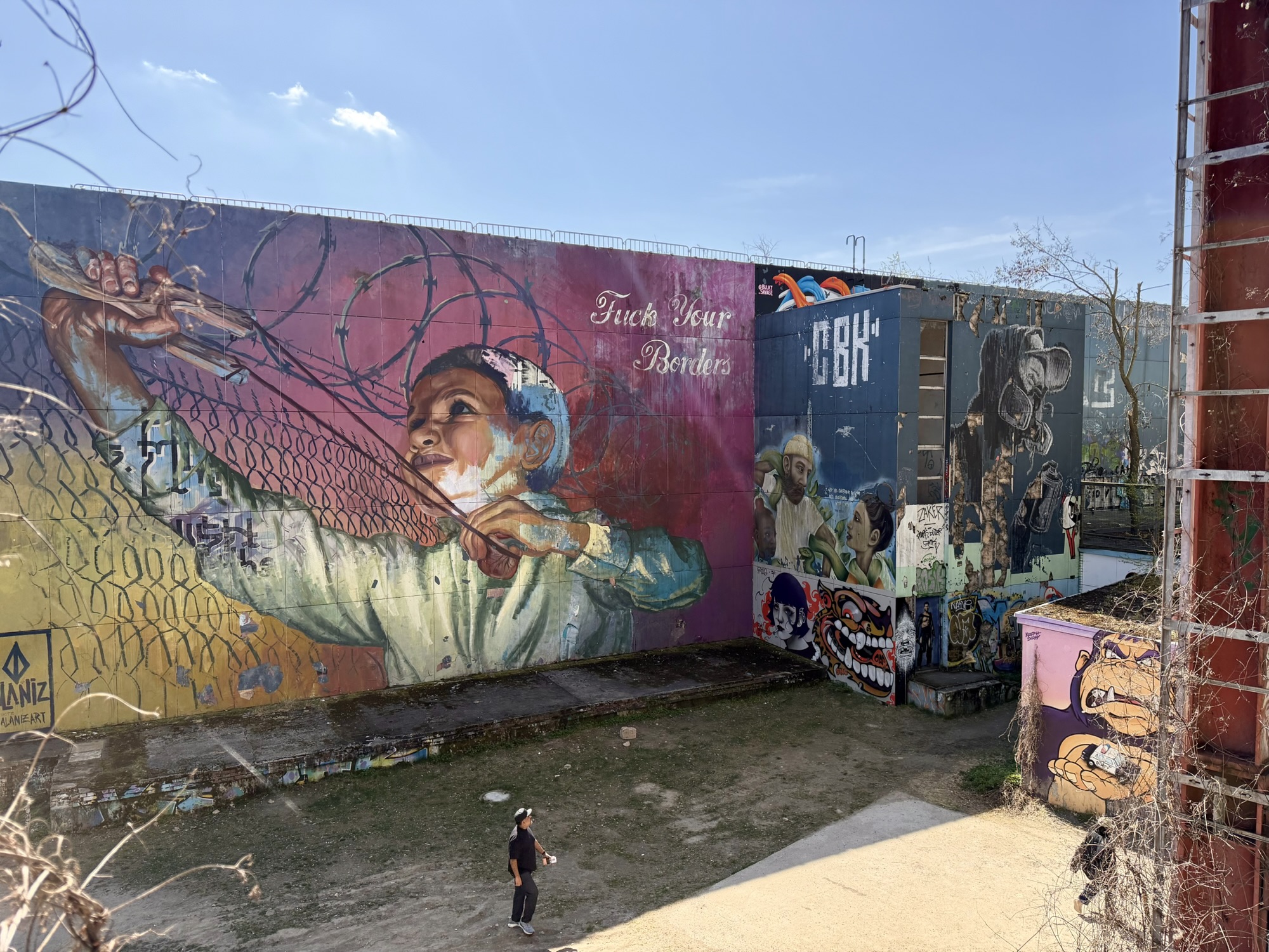
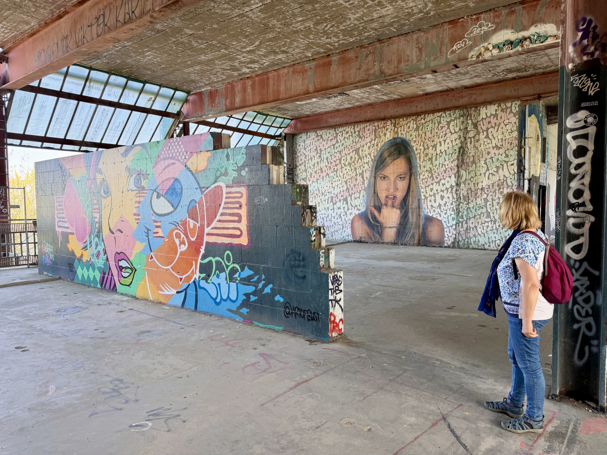
Our next stop was the East Side, Gallery, the longest remaining section of the Berlin Wall covered in street art. The blossoming trees provided a beautiful contrast to the graffiti and street art.
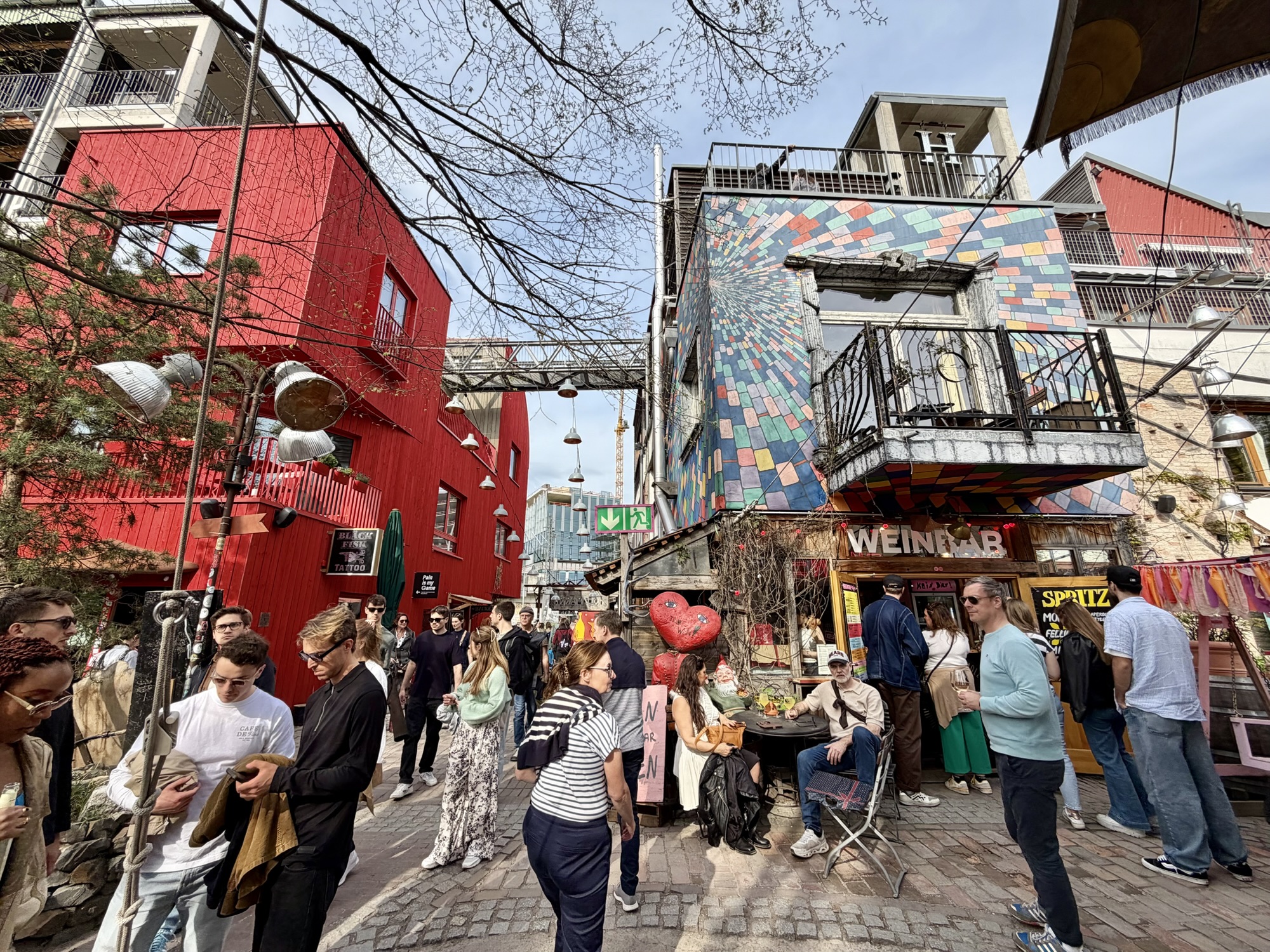
When we passed the Holzmarkt, which neither of us knew about ahead of seeing it we knew we had to stop and check it out. It is a vibrant, cooperative, urban village located on the Spree River. It offers spaces for “concerts, art and culture, gastronomy, original shops and small businesses from the creative sector.”
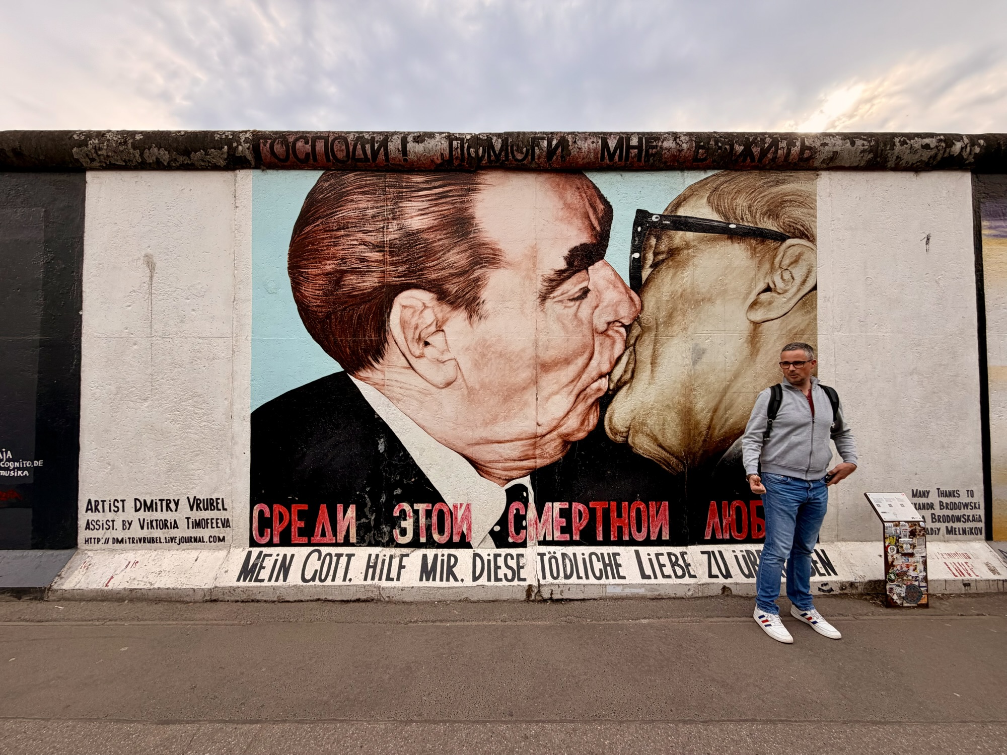
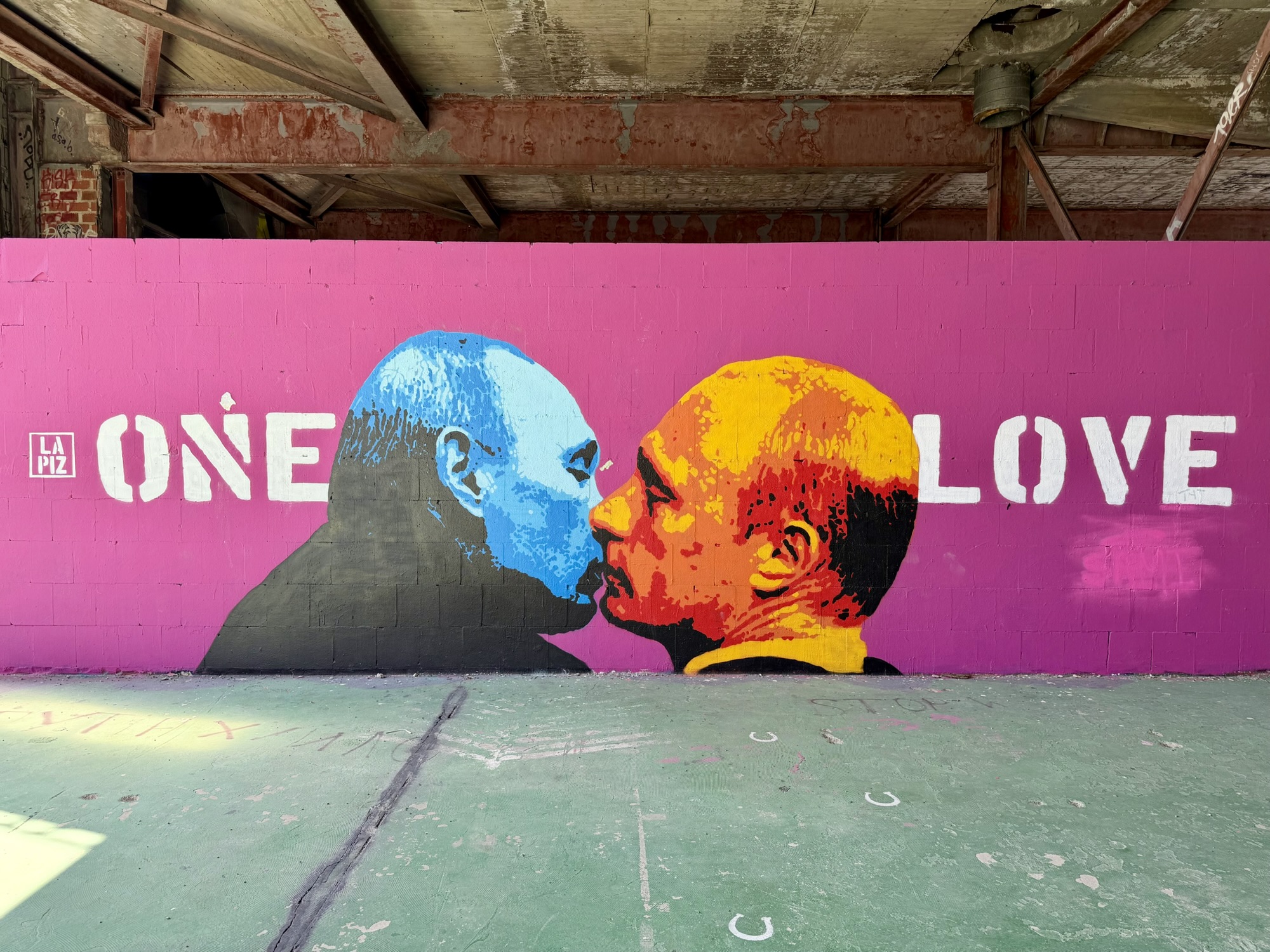
This is the most famous piece of street art on the wall and there was a lineup to take pictures in front of it. It is entitled, “Mein Gott, hilf mir, diese tödliche Liebe zu überleben (My God, help me survive this deadly love)” but more commonly as the Socialist Kiss. It depicts Soviet leader, Leonid Brezhnev, and East German leader Erich Honecker in an impassioned kiss. The “socialist fraternal kiss was a ritualized, high-level greeting between communist leaders meant to symbolize deep solidarity and unbreakable ideological unity. It typically consisted of an embrace and three kisses on the cheeks, but exceptionally close allies sometimes kissed on the mouth”.
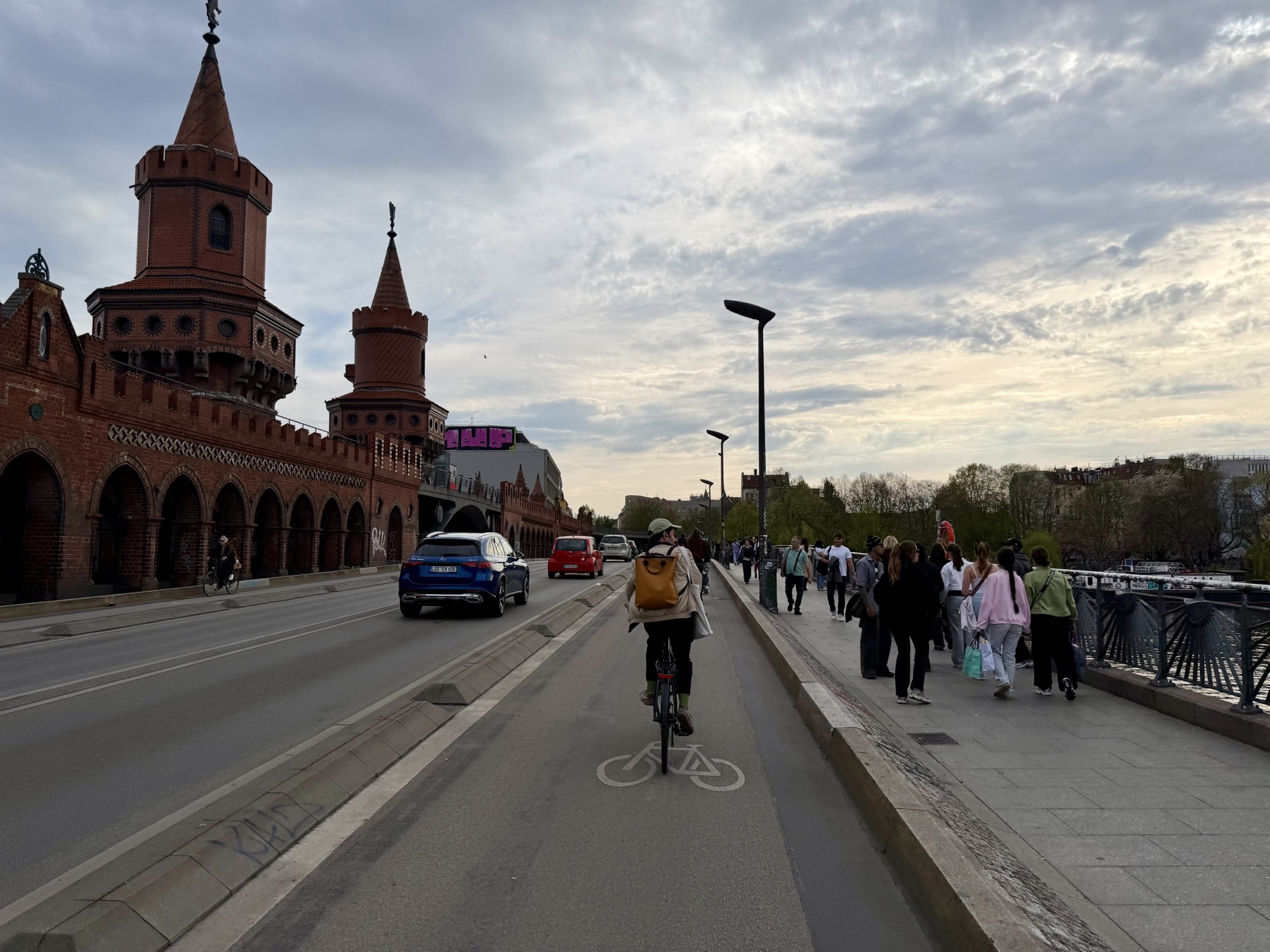
The Oberbaumbrücke is a striking, double-deck Neo-Gothic brick bridge crossing the River Spree. Acting as a major landmark, it connects the vibrant districts of Friedrichshain and Kreuzberg. It carries road traffic on the lower deck and u-Bahn train lines on the upper level. It is considered a symbol of unity because it historically linked the two boroughs separated by the Berlin Wall. During the Cold War, it served as an official pedestrian border crossing between east and West Berlin.
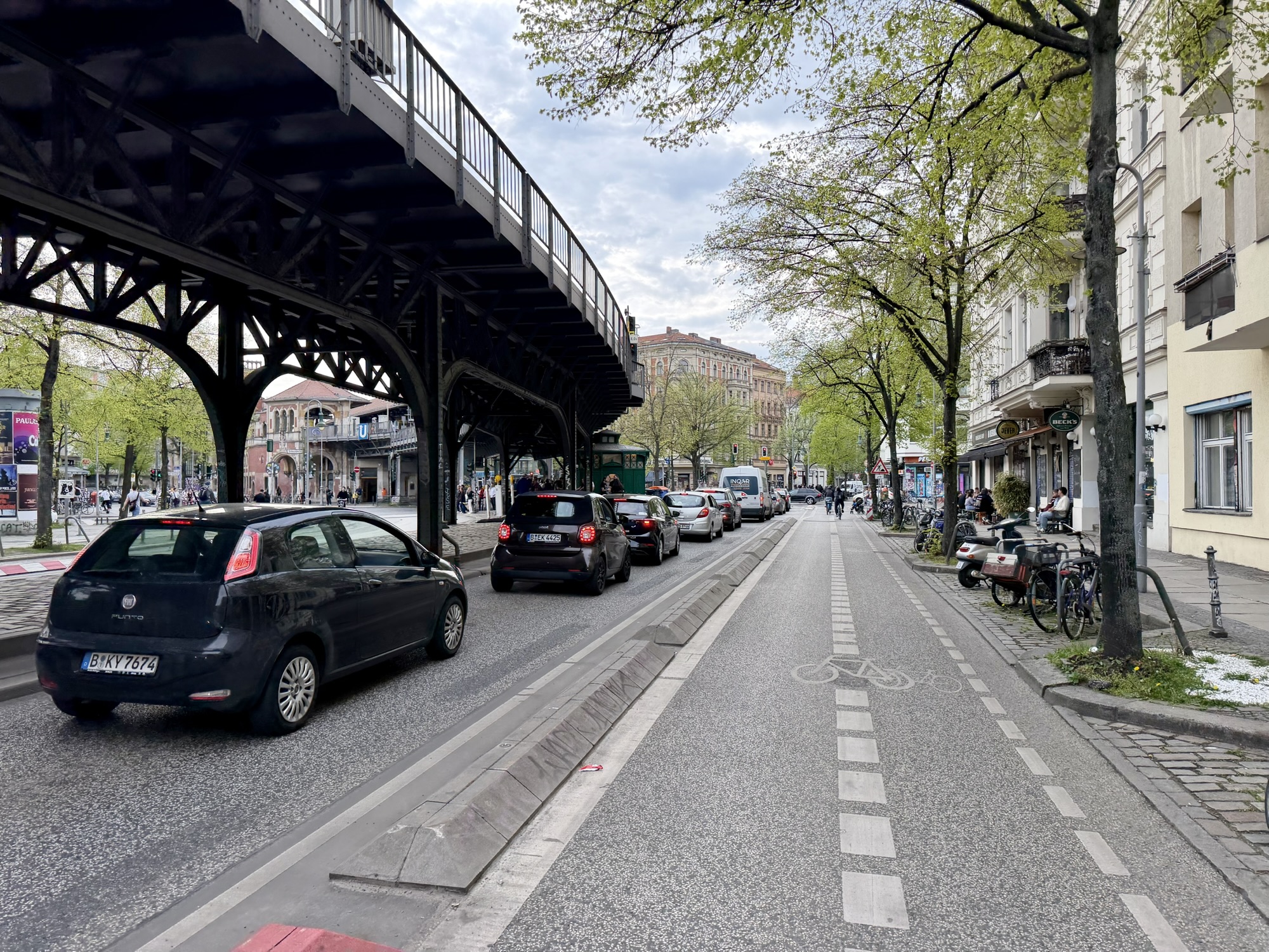
The u-Bahn is elevated through Kreuzberg. Like many areas of Berlin there were many different types of cycling infrastructure, ranging from a curb lanes shared with buses to a small strip beside the sidewalk, to a nice separated cycle track.
When we were in Amsterdam, we went to a restaurant that served Poké bowls for a couple of our dinners. We were craving that so and found a restaurant called Dean and David that served exactly what we were looking for.
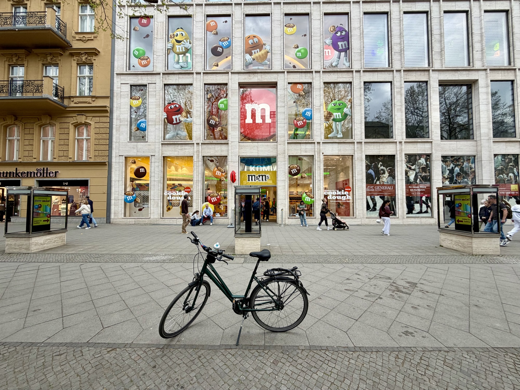
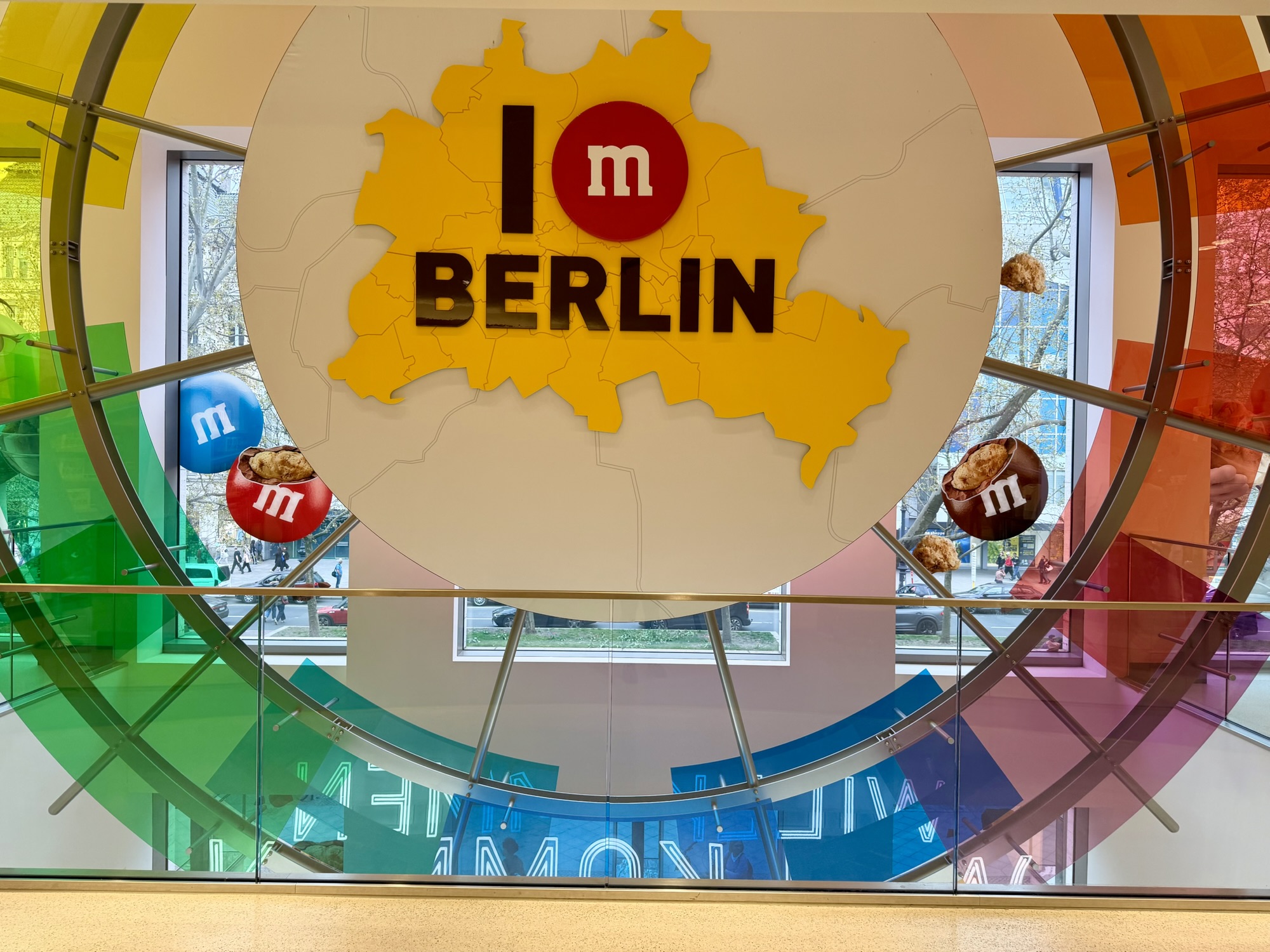
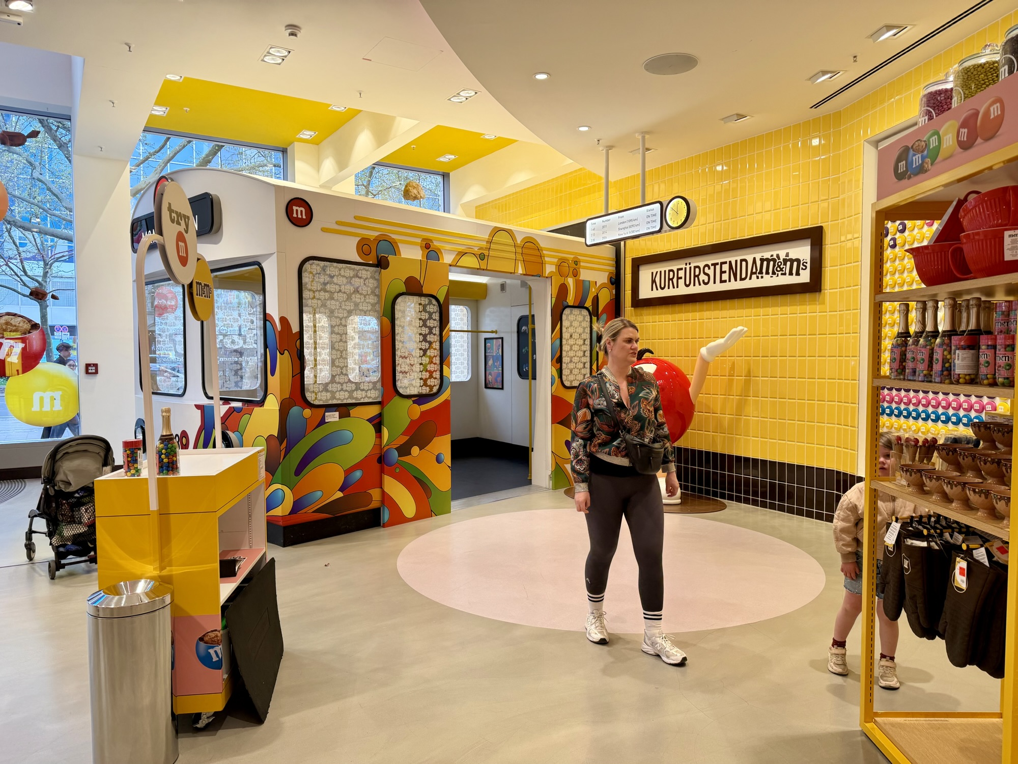
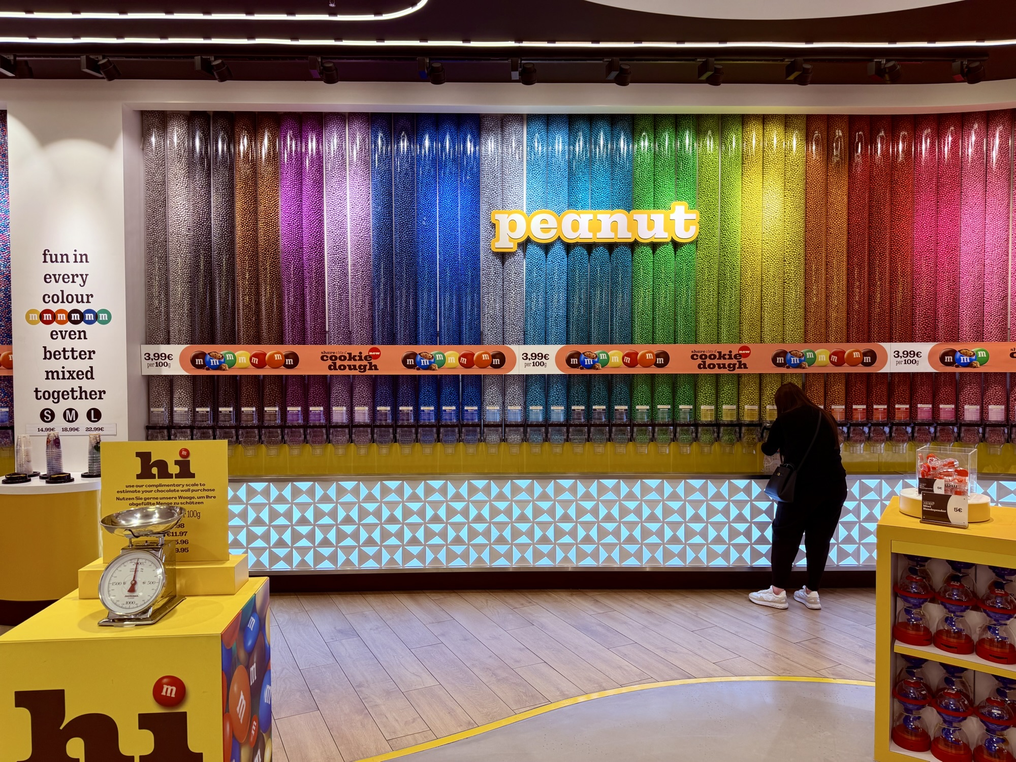
As we were riding back to the guest house, we passed an M&M store. I had to go in. The colours and selection did not disappoint.
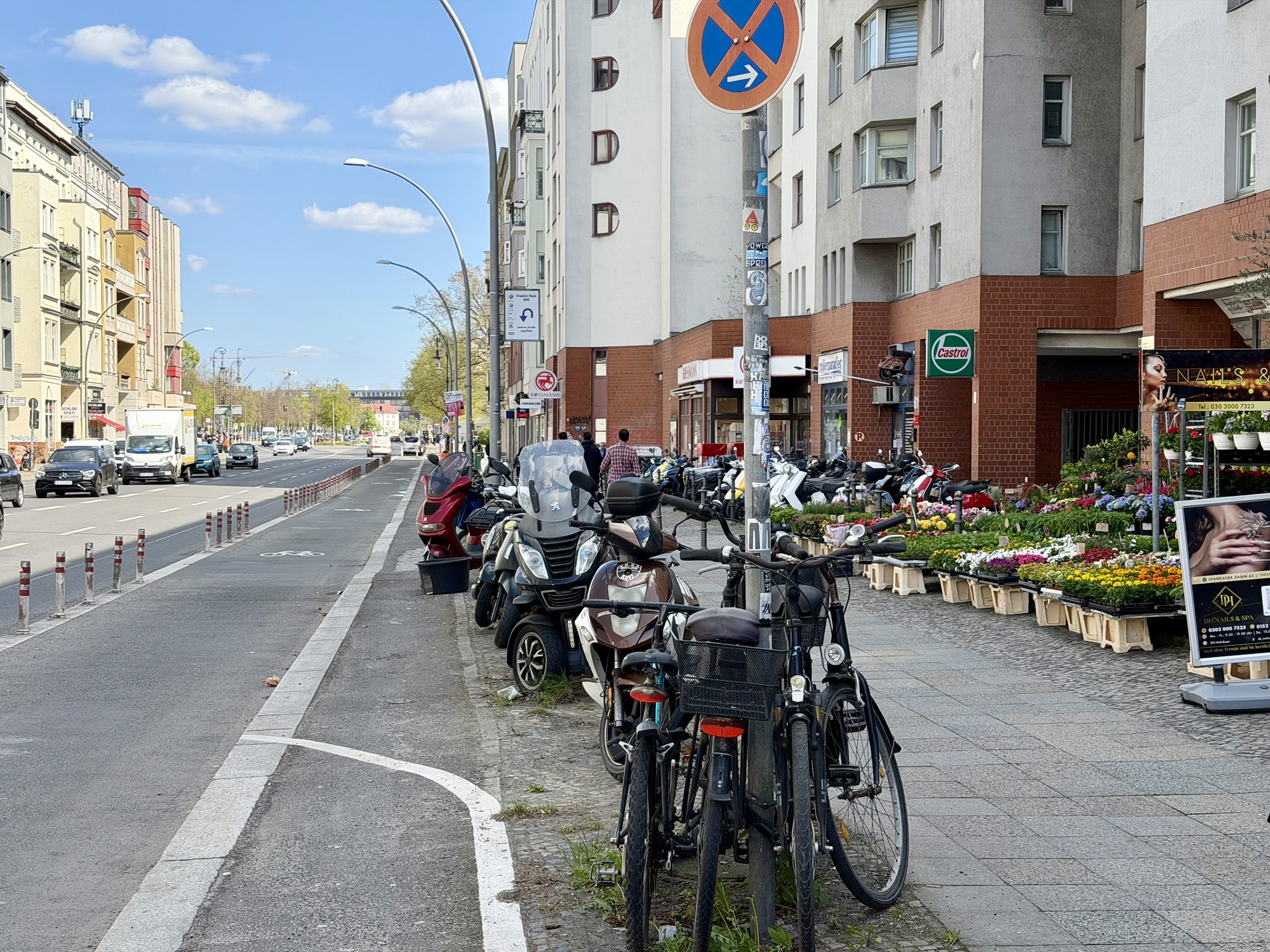
This is a typical road without cycling infrastructure. Lots of parked cars, a nice tree canopy, and not many people driving. When they are driving, the speed limit is 30 kph. It feels very comfortable.
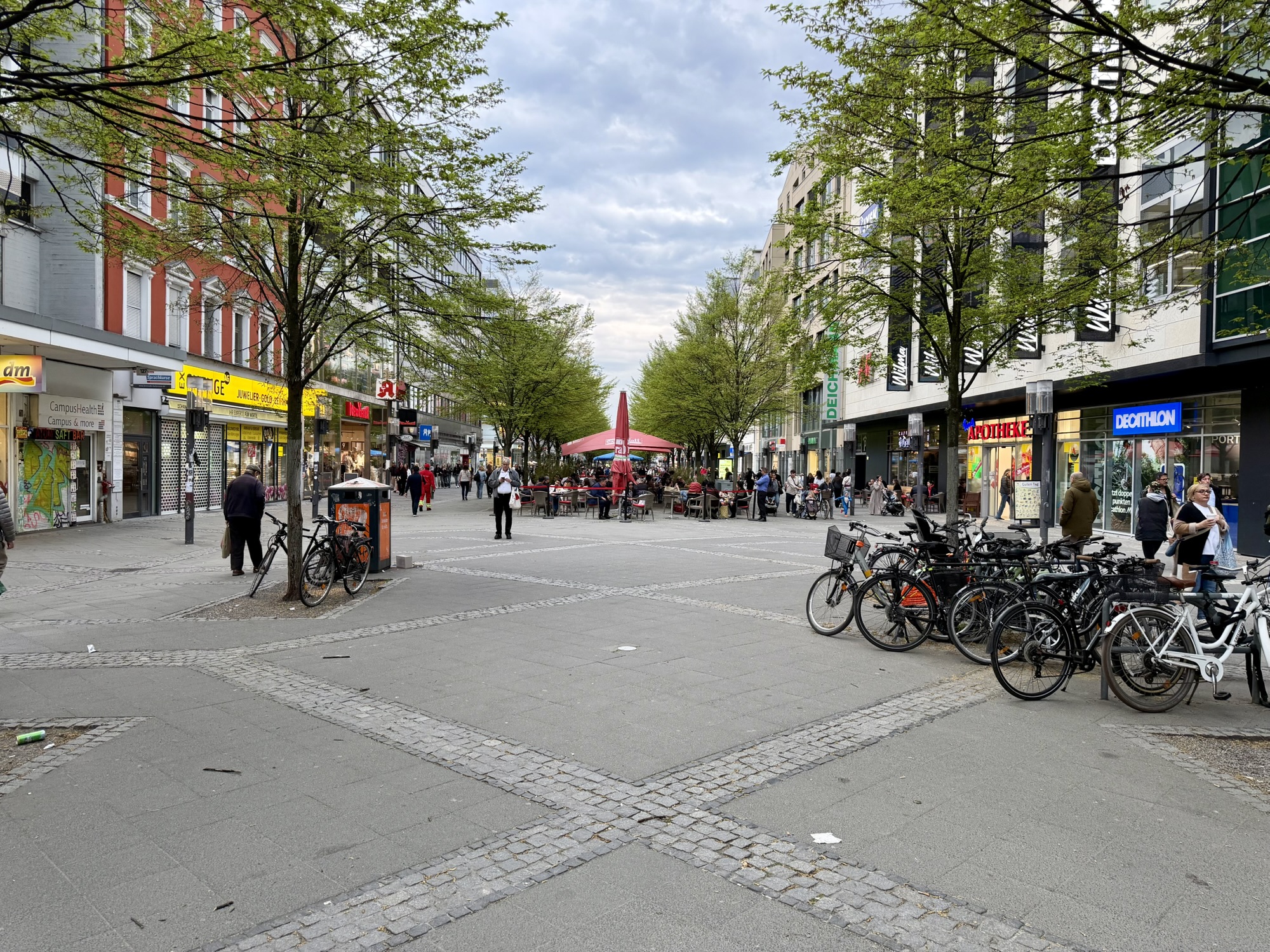
This area in Charlottenburg is pedestrianized and was very busy for a Saturday at 7 PM.
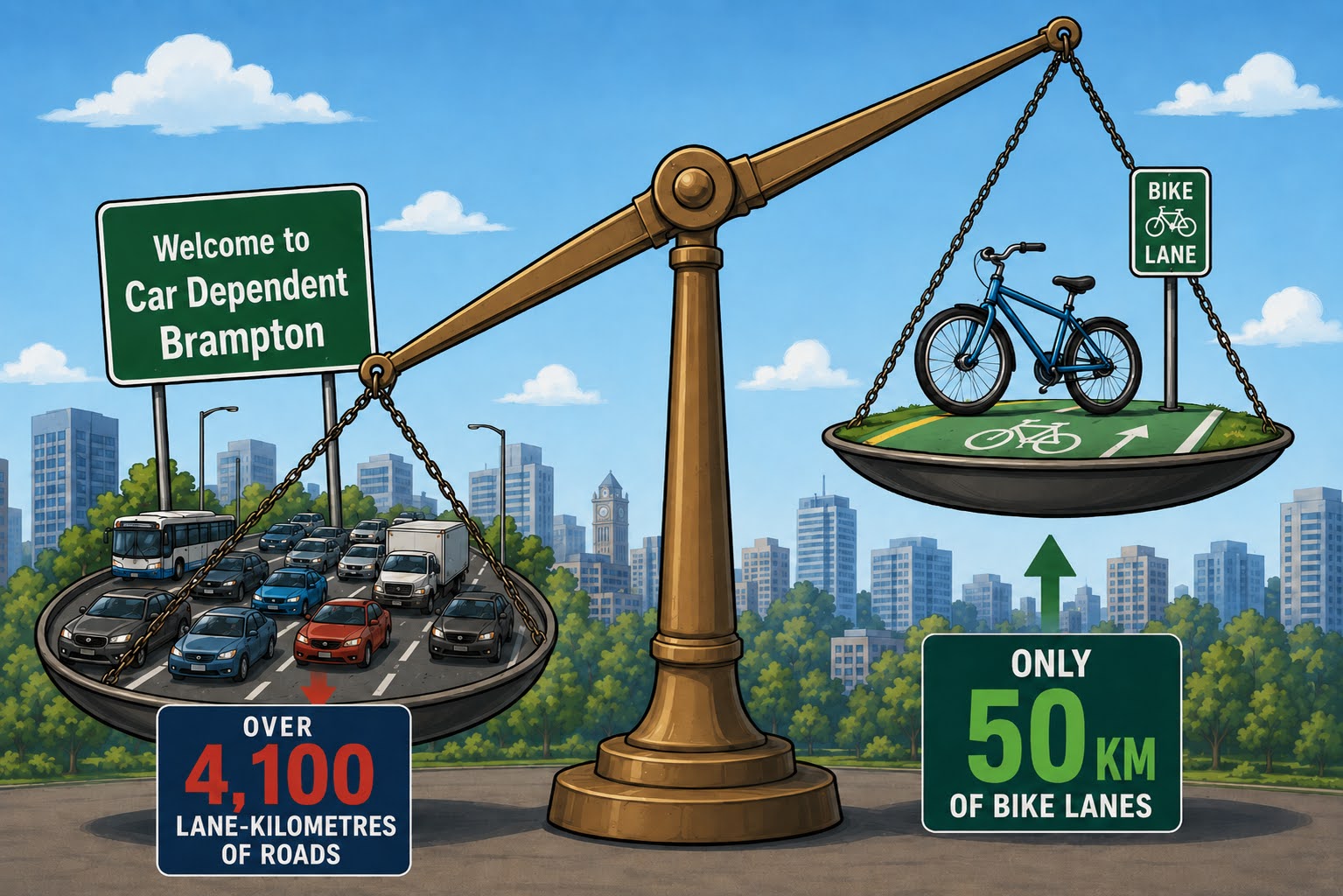
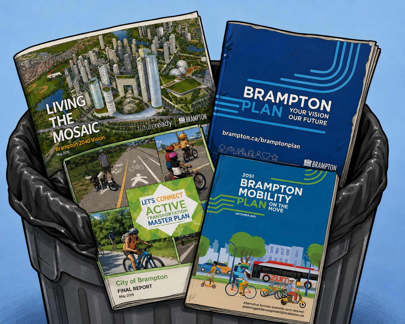
Berlin was my least favorite of the three large cities I visited on this trip. However, as I write this blog, back in Brampton, I am finding I have a growing appreciation for Berlin. It is a good cycling city. It has so many parks, museums, and outdoor culture. It has great public transit. Brampton is the 9th largest city in Canada, yet does not make the Globe and Mail’s 100 Most Livable Cities list. All Brampton’s official plans provide a path for becoming more livable, yet Brampton Council consistently make decisions that go against those plans and lock in the status quo.
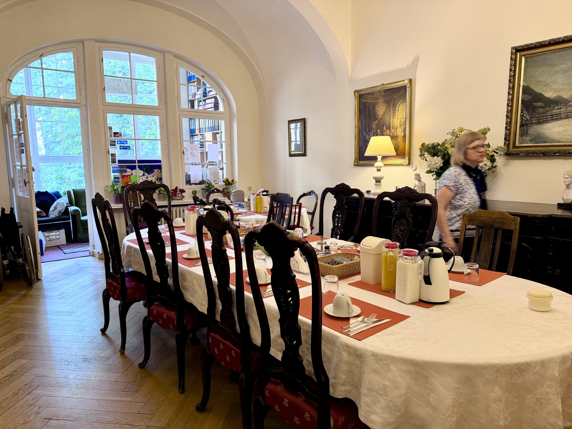
Our small guest house, Hotel-Pension Waizenegger included a good breakfast. It was quite reasonable at $190 each for three nights and three breakfasts. We had a sink and shower in the room. The toilet was in the hallway shared by all the guests.
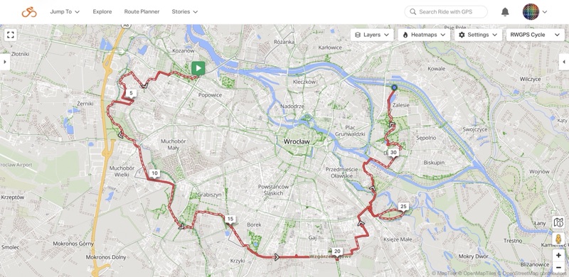
Our destinations for the day included Teufelsberg, Charlottenburg Palace, Tiergarten, and Potsdamer Platz. I created a route Ride with GPS to guide us, entering the places that we wanted to go, but allowing Ride with GPS to determine the route between them.
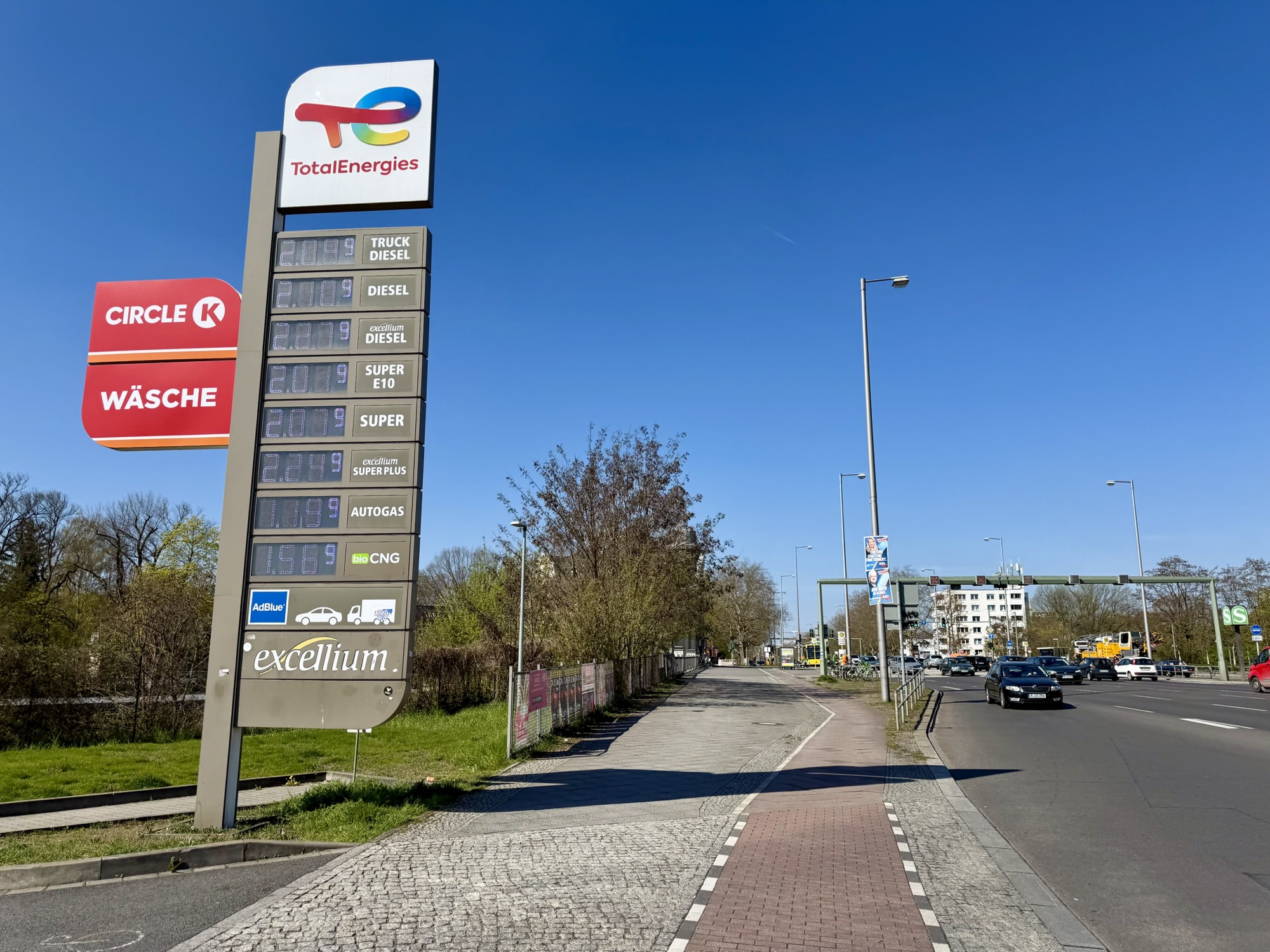
Gas prices were over €2 per liter. The exchange rate is about 1.6 which means that they are paying over double what we pay for gas.
We encountered several other types of cycling infrastructure today. Including curb lanes shared with a bus, a bollard protected lane, raised cycle tracks, a painted lane in the dooring zone, and a parking protected painted bike lane.
Recently a Brampton councillor criticized Brampton cycling infrastructure for not being the same across the city. I explained to him that that was the case even in world class cycling cities. As standards change, infrastructure recommendations change, and newer infrastructure is often different and better than older. However, budget, as well as location constraints, mean that there will always be more than one facility type.
In the slideshow above, there are pictures of six different types of cycling infrastructure we encountered in Berlin in one day. Even though it was only the second day I had ever spent in the city I managed to figure out what to do. Surely drivers could do so as well, if they cared to.
As I was writing the blog, I wondered what the cycling mode share is in Berlin. I was surprised and impressed to learn that it is about 19% of all daily trips in the city despite the fact that in many places, there is no cycling infrastructure. In Brampton, the cycling mode share is at best 1%. It got me thinking what makes a cycling city?
I think there are many of things that make a cycling city and safe cycling infrastructure is only one of those things.
Here’s a list in no particular order.
Cycling infrastructure, preferably protected from motor vehicle traffic
Speed limits. 75% of Berlin roads have a speed limit of 30 kph or less meaning that many people are willing to cycle even when there is no cycling infrastructure
Transitioning road space away from cars to protected bike lanes and away from parking
A good public transit system, which integrates well with cycling
Bike share. These bikes are usually very visible to drivers and help normalize cycling.
Safe places to park bikes
Integrating cycling education into the school system
Cost of gasoline
Carlton Reid wrote a book called Bike Boom in which he argued that cycling infrastructure alone is not sufficient to drive significant cycling mode share in cases where it is easy to drive. He gives the examples of Stevenage, UK, and Columbia, Maryland. In both cases l cycling infrastructure was separated from motor vehicles and formed a network, however, the roads were built to be large enough to make driving easy so most people chose to drive rather than using the separated cycling networks. Many cities in the Netherlands have made driving more difficult as they have built cycling infrastructure, and this has resulted in significant numbers of people choosing cycling over driving. 
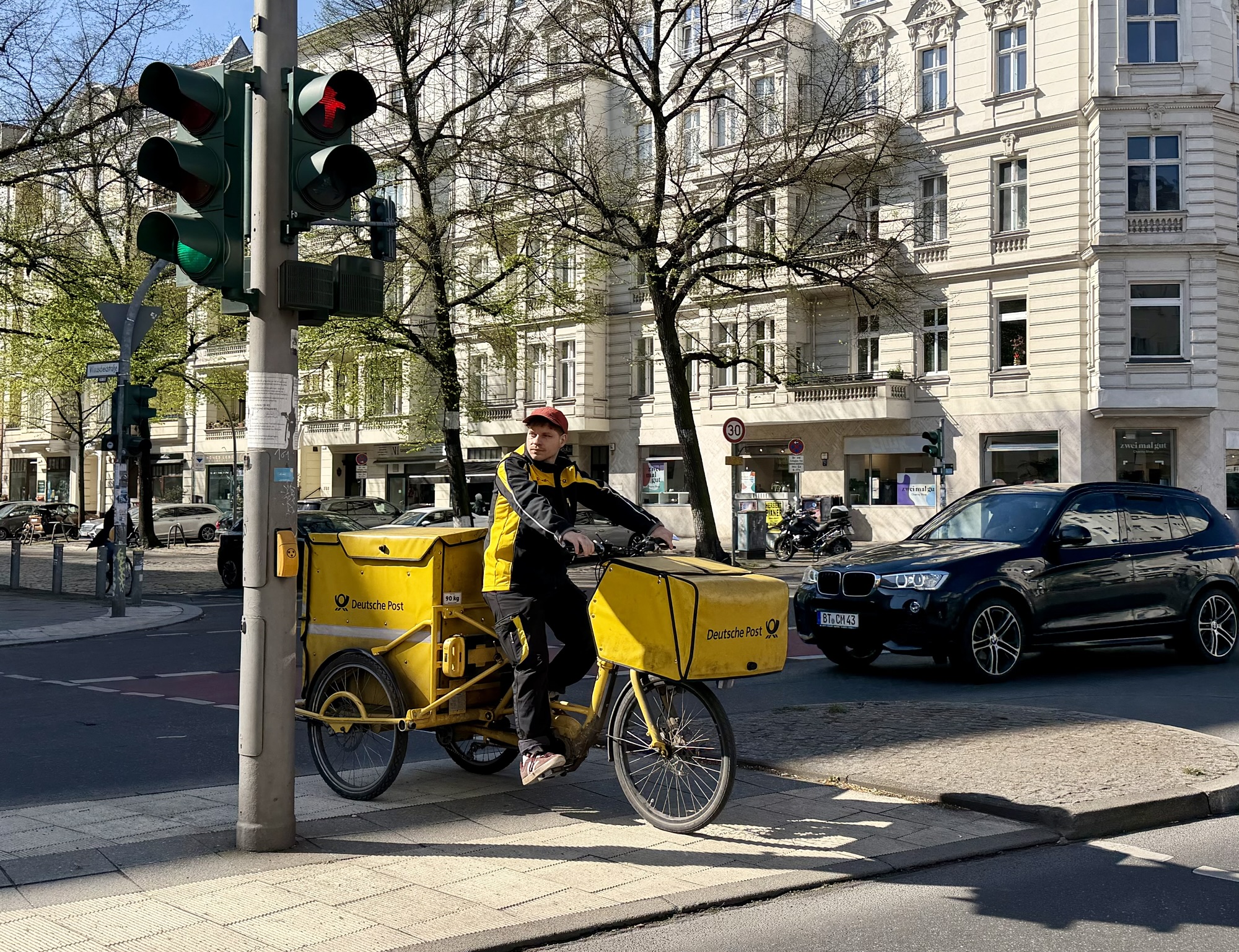
There are bicycle mail delivery vehicles in Berlin as there were in the Netherlands.
I often forget how to spell place names that end in -berg and -burg. As I wrote this blog post today, I googled the difference. Berg means mountain or hill, and burg means fortified castle or town. Thus, Teufelsberg is spelled with an E because it’s on a hill, and Charlottenburg is spelled with a U because it’s a palace.
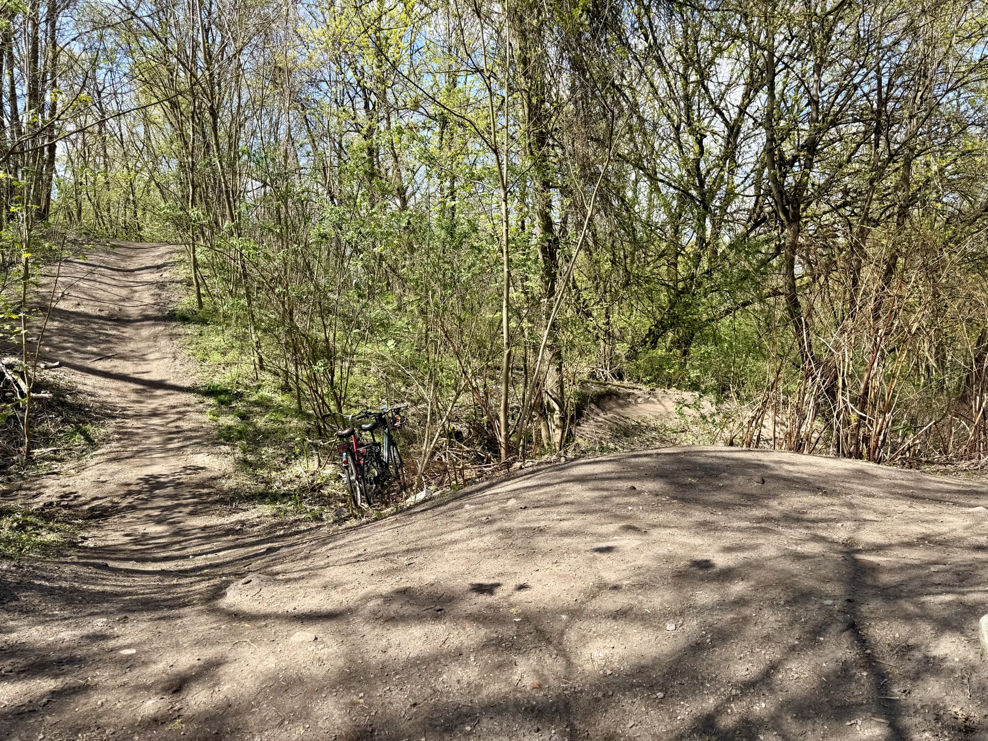
The route was fairly straightforward and we were fairly close to Teufelsberg when it indicated we should turn into a park. Then suddenly we were faced with a hike-a-bike situation. We had to push our bikes through the woods up grades as steep as 17%. I knew that it wasn’t possible to drive a car to Teufelsberg, but this seemed ridiculous.
We emerged from the woods to see our destination. Unfortunately, it was on the next hill over. We stopped to catch our breath, take in the views of Berlin, and consult the map to determine whether or not to continue following the route we were on.
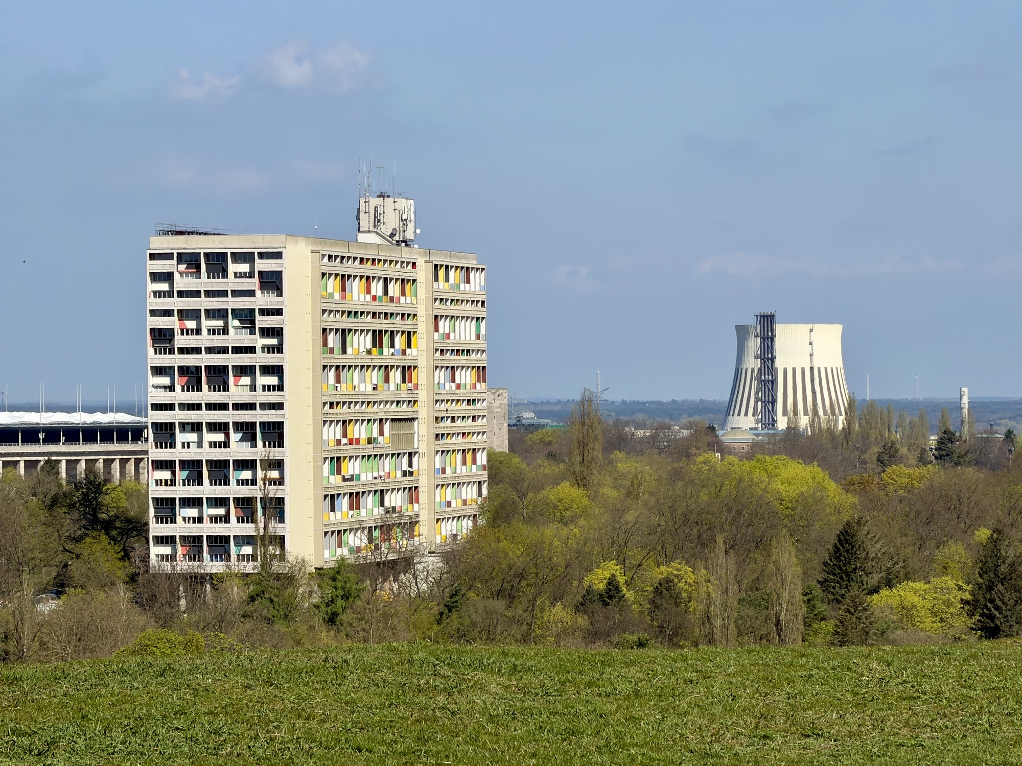
In this picture, the Olympic stadium is on the left, Corbusier’s Unité d’Habitation of Berlin is center left. The architectural style is brutalism. It was built on with on-site prefab cast concrete panels and poured ceiling slabs. A combined heat and power plant is on the right.
We slowly and carefully descended a steep desire line path, that coincided with the Ride with GPS route. Then crossed a small area of flat ground, and were back in woods again. At the next steep incline, we decided to lock up our bikes and walk without them the rest of the way. Can you spot the bikes in the picture below?
Allied bombing raids followed by street by street fighting in the battle of Berlin in 1945 reduced huge areas of the city to rubble. It is estimated that around 75,000,000 m³ of debris filled the streets. Much of the work of clearing fell to the Trümmerfrauen or “rubble women” because so many men were dead or prisoners of war. They salvaged usable bricks, and loaded debris onto carts and makeshift narrow gauge railways, or Trümmerbahnen. Landfills within the city quickly filled up. One of the sites chosen outside the city was the Grunewald Forest. Between 1950 and 1972 an estimated 26,000,000 m³ of rubble were deposited in the forest forming the highest elevation in West Berlin, of approximately 120 m above sea level.
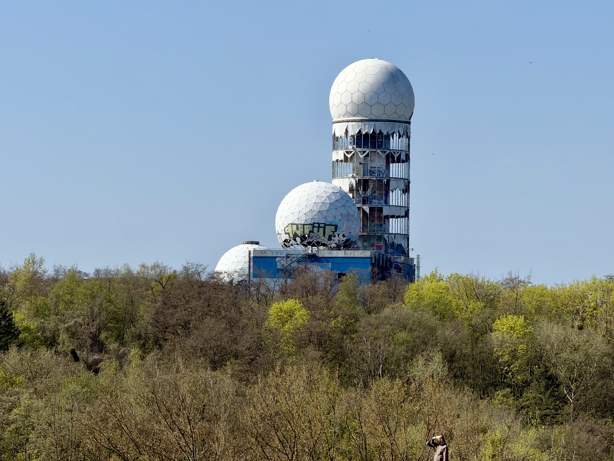
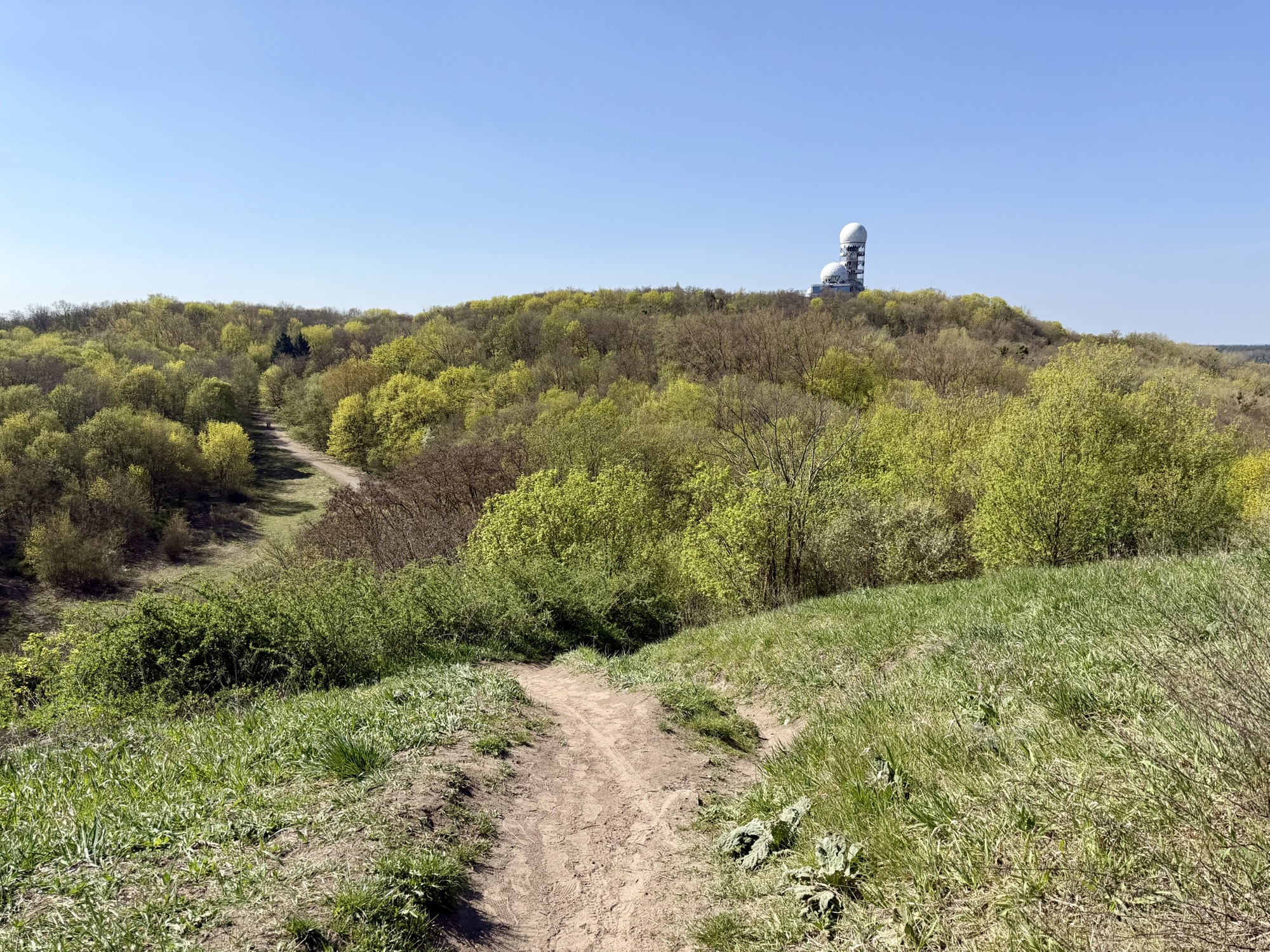
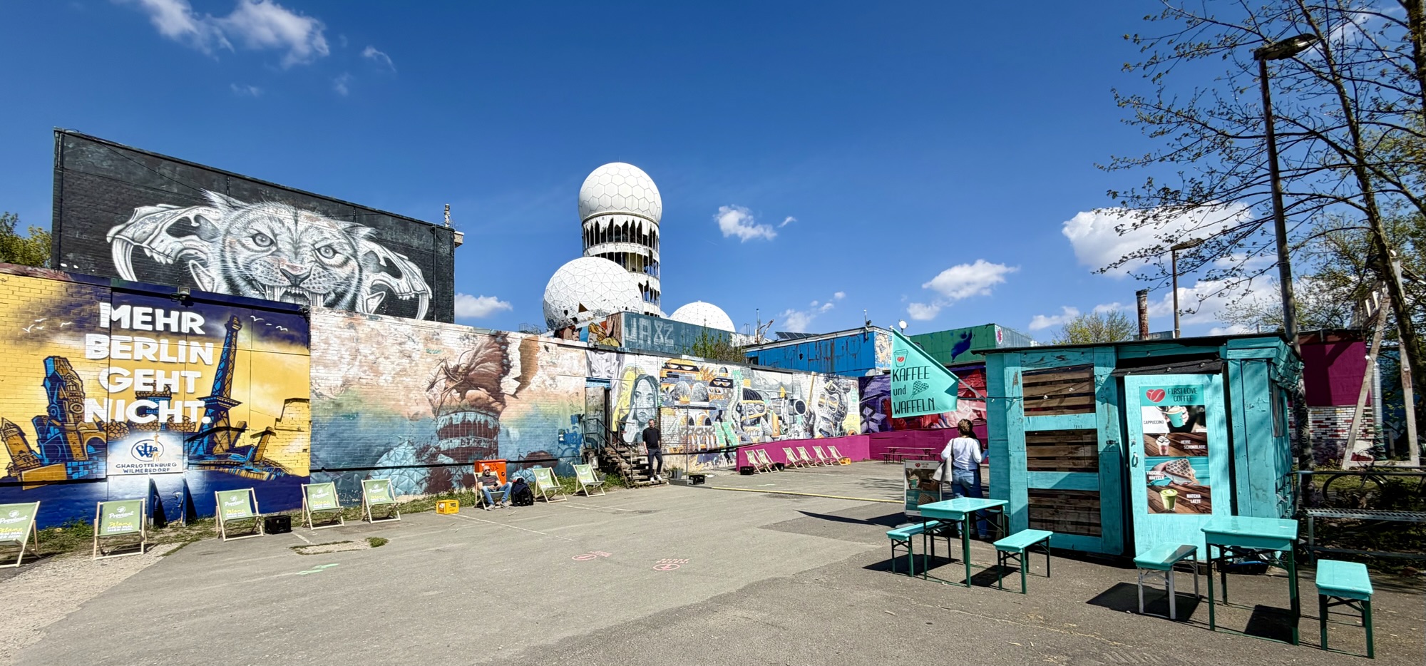
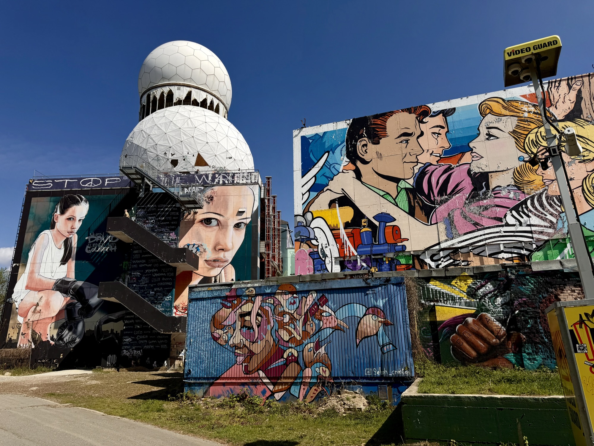
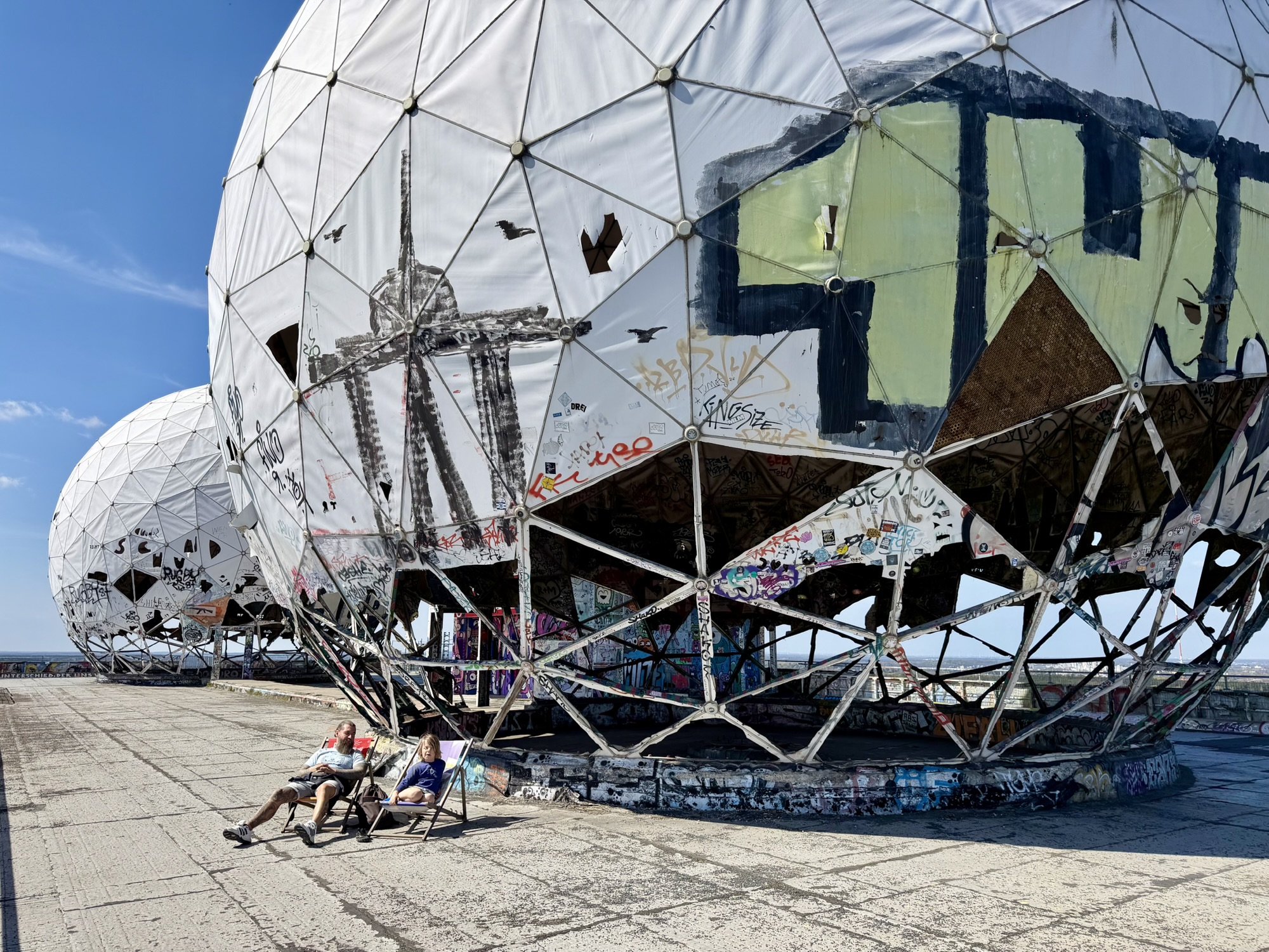
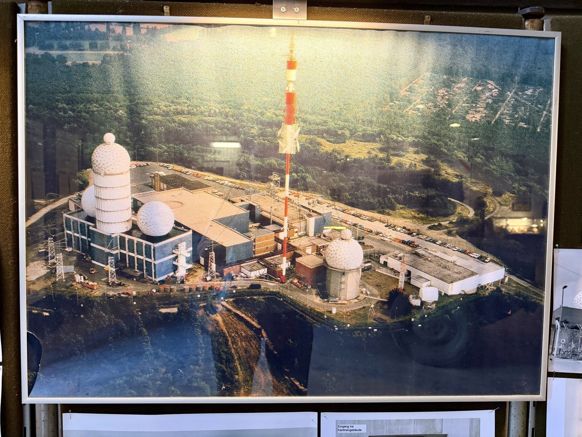
Teufelsberg – the ‘Devil’s Mountain’ – named after nearby Teufelssee, or “ Devil’s Lake“, was a listening post, operated jointly by the Americans and British intelligence agencies. It became one of the west’s most crucial intelligence gathering facilities during the Cold War. A cluster of geodesic domes covered in fiberglass protected the large sensitive dish antennas and other electronic equipment inside from the weather. They also concealed the exact nature and orientation from prying eyes.
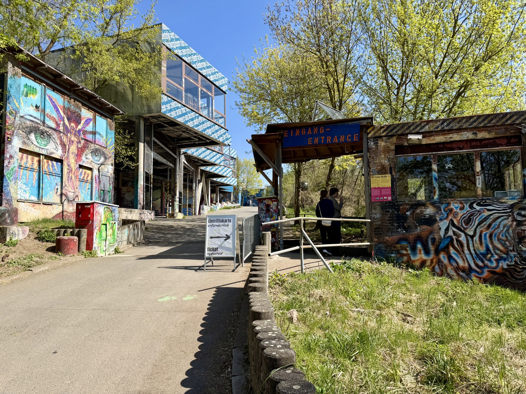
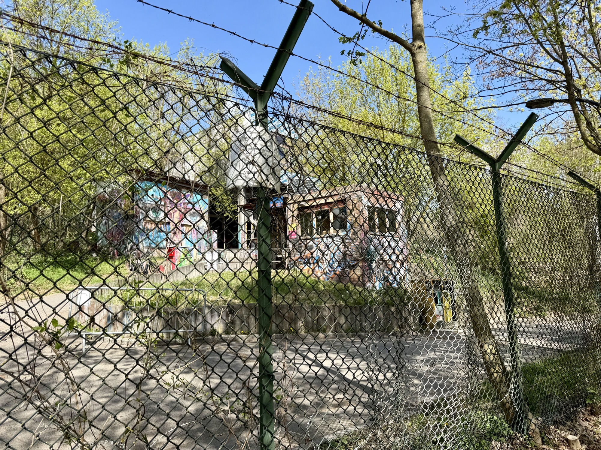
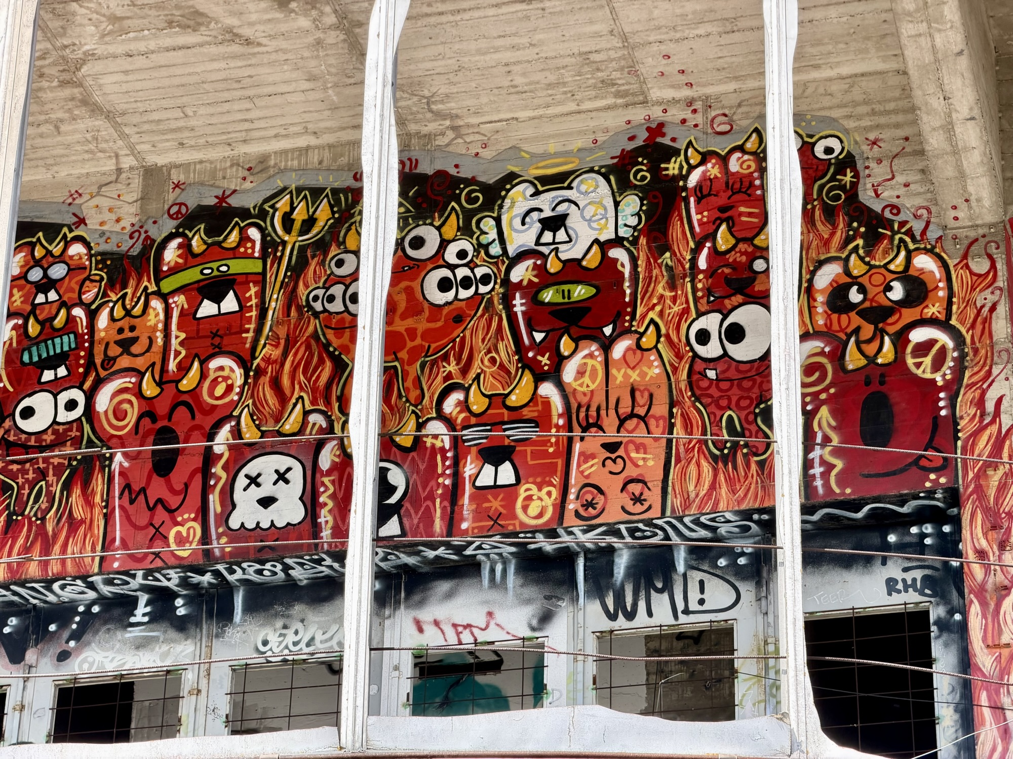
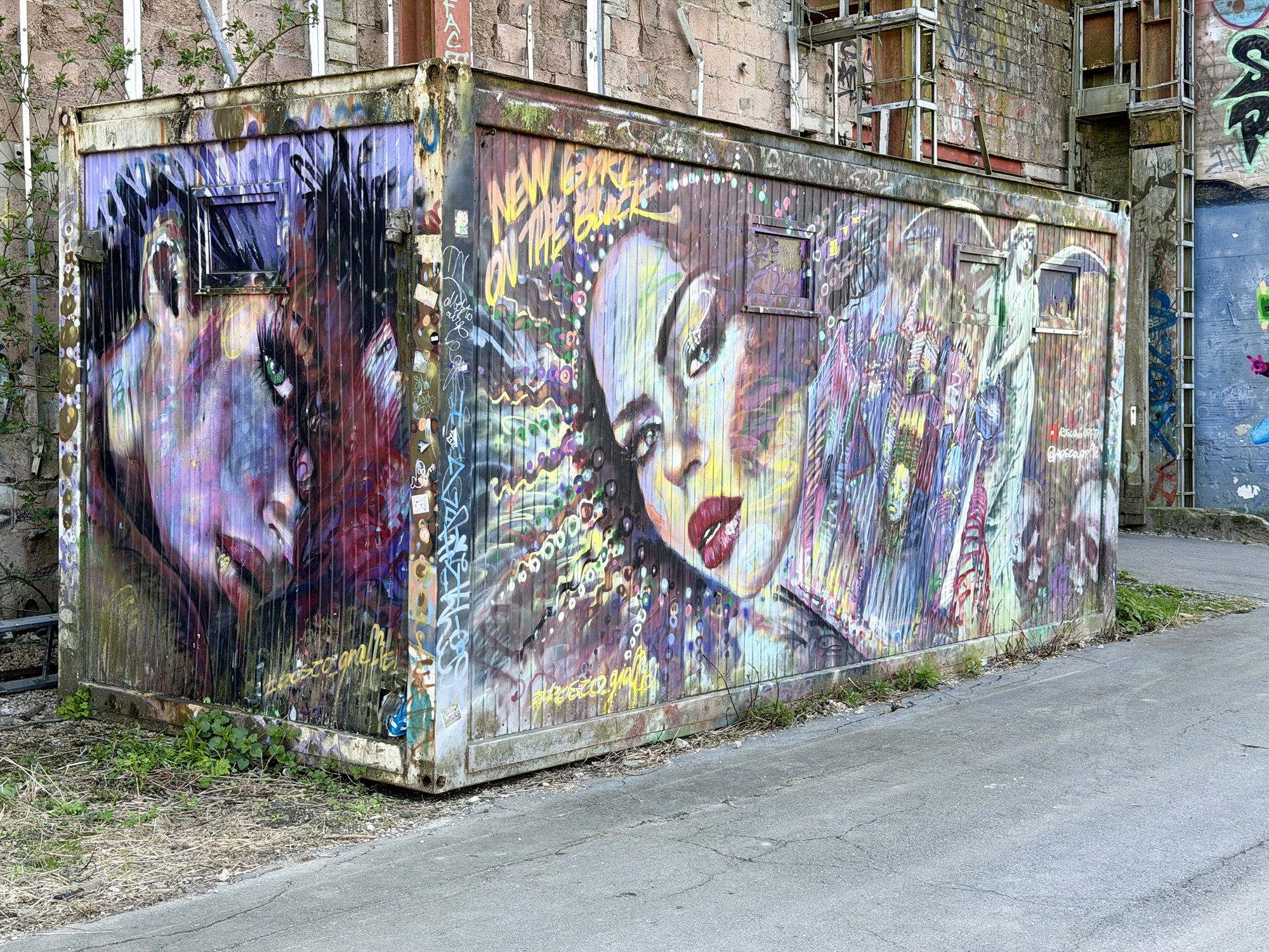
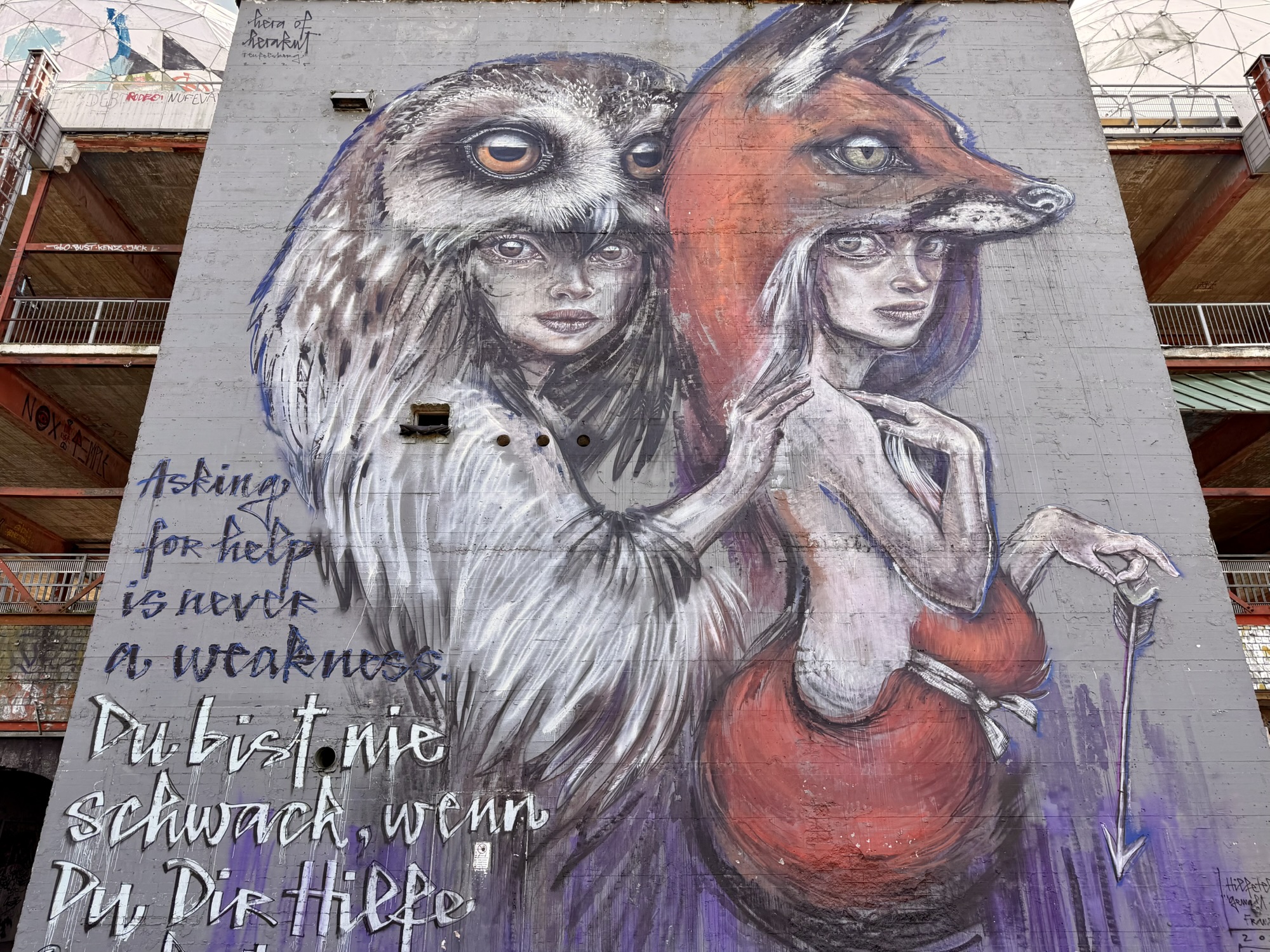
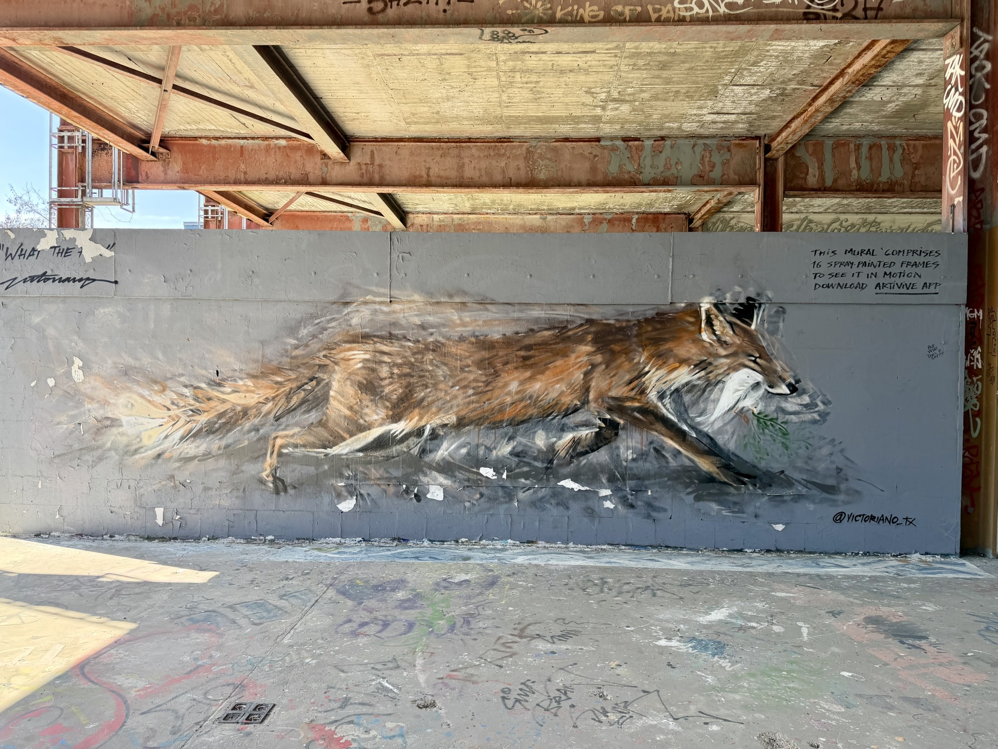
Hundreds of technicians, linguists, and analysts worked around the clock, listening for useful information. After the fall of the Berlin wall in 1989 and reunification of Germany in 1990 the listening operations wound down and equipment was removed or destroyed. By 1992 the site was handed back to German authorities. Over the years, there were suggestions for what to do with the site that included luxury apartments, hotel, conference center, or even a spy museum. None of that happened. The area is now operated as a gallery for street art. It is one of Europe’s largest open air street art galleries. It has over 400 unique works, including massive multistory murals.
This mural was painted in such a way that when viewed through an app downloaded to a phone from a QR code, the fox would run. This is a still image below, and then a screen cap of the fox running on my phone screen.
We spent two hours exploring the murals and climbing up inside the structure supporting the geodesic domes.
This is the view inside one of the geodesic domes.
This is the view from the rooftop supporting the geodesic domes.
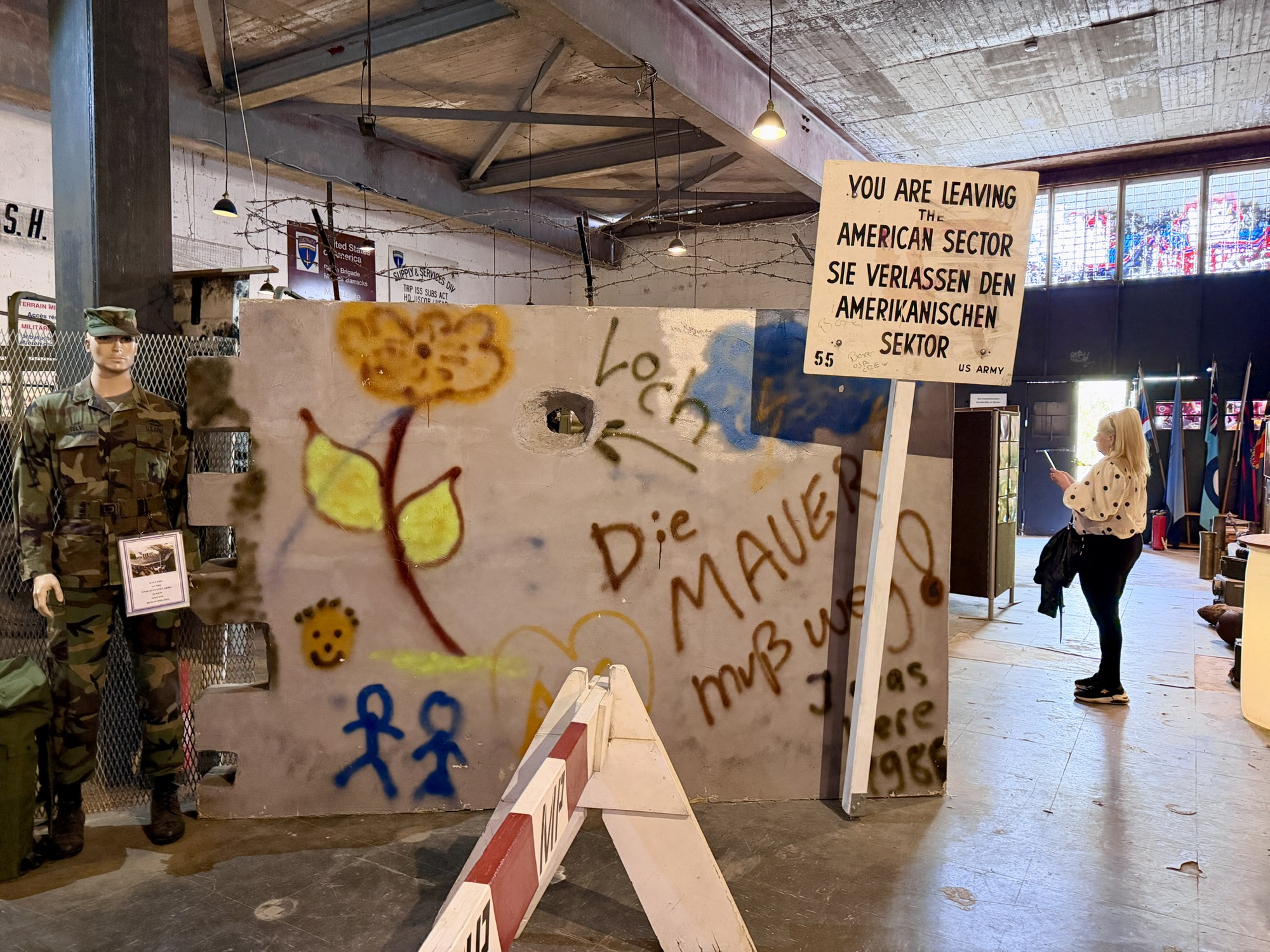
We also explored an exhibit entitled Declassified – The Secret of Teufelsberg which explain the history of the site. And the Museum “Alliierte in Berlin” – Experience History Up Close – which focuses on post World War II occupation from 1945 to 1994.
We had a snack before we left. While having the snack, I studied the map and determined that once we got back to the bikes, we should follow a short desire line which would take us to a road that we could use to descend.
It was a delightful descent, with the steepest section at about 6%. Had we come up this way we would have been able to ride the whole way. I’m not really sure why Ride with GPS recommend going through the forest. Google Maps did, too, as well as videos on the official Instagram account. Lesson learned: check the elevation profile when letting Ride with GPS generate your route. However, it was a fascinating visit, and is all part of the adventure.
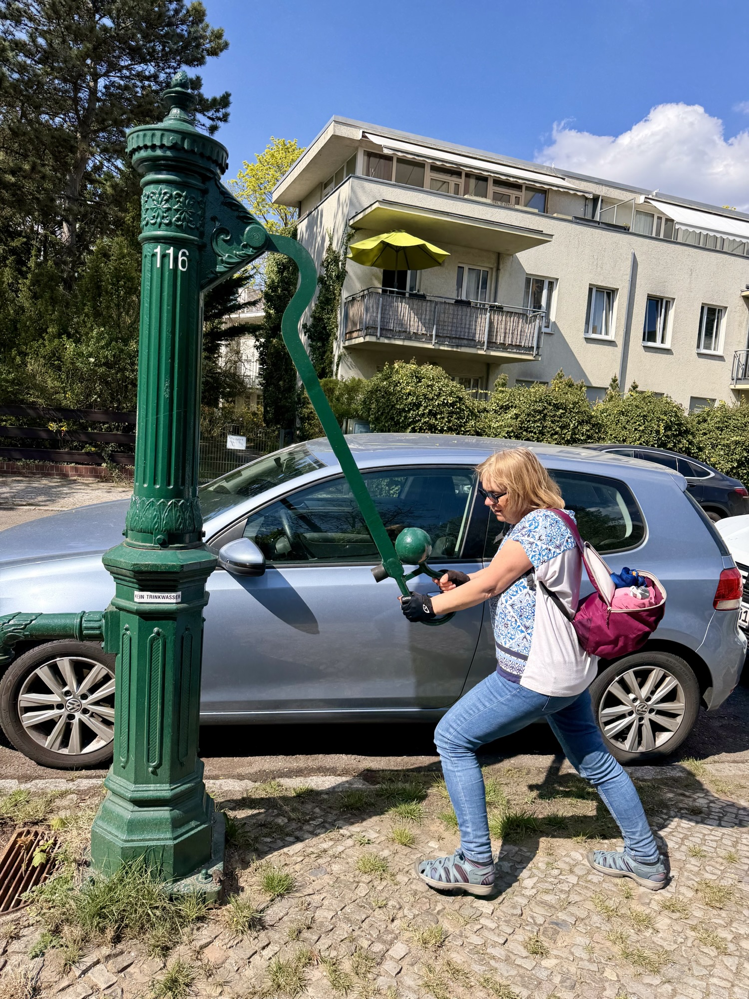
These green cast-iron water pumps are a distinct feature of the city’s streetscape. They were initially installed in the 1800s as watering spots for carriage horses. Today these pumps serve as emergency infrastructure, providing drinkable naturally filtered ground water to the public in the event of a citywide water utility failure. There used to be 6000. The infrastructure was very important after the bombing in the second world war, which damaged the water network. There are still over 2000 in Berlin, of which about 1600 are functional.
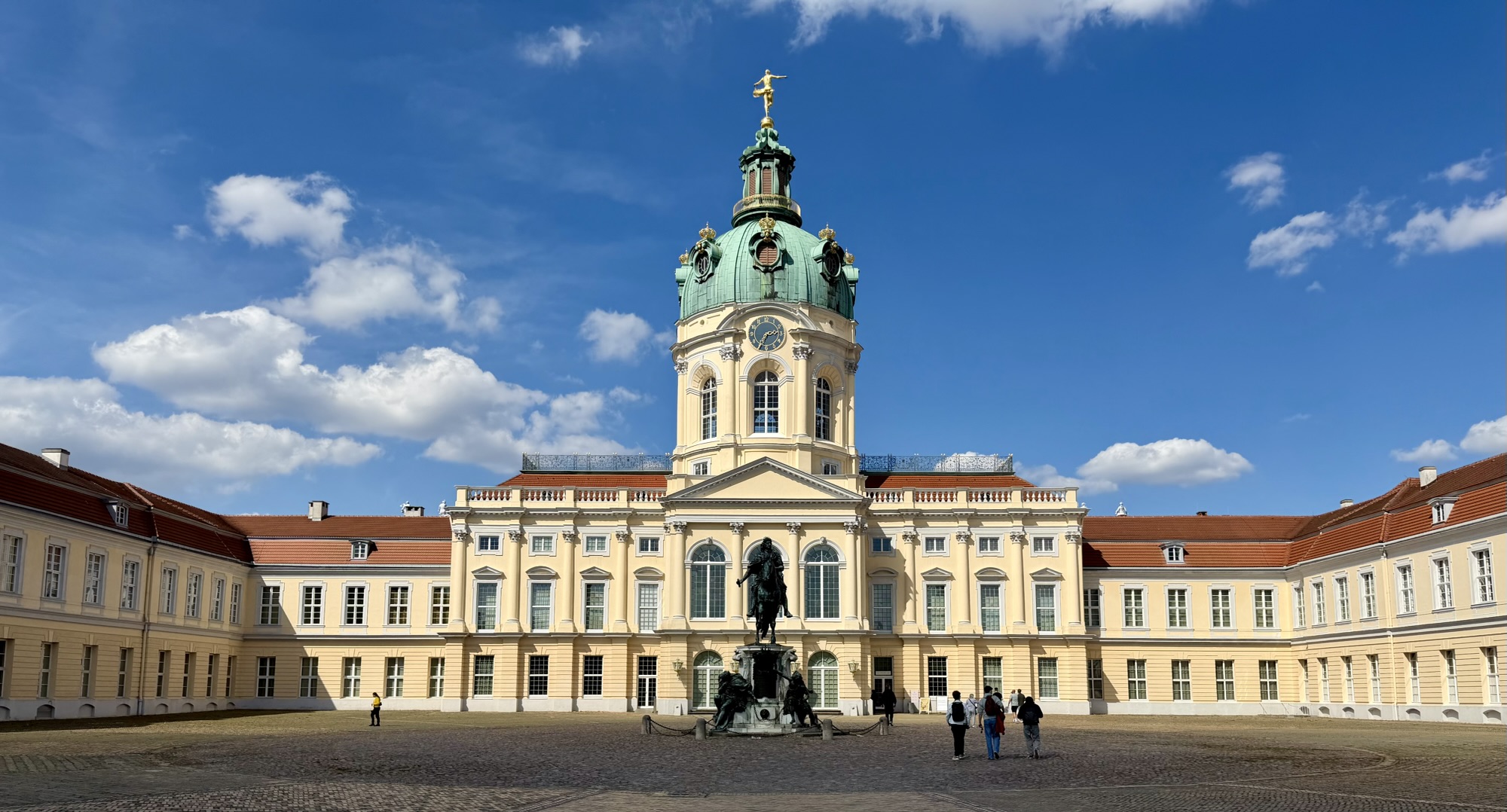
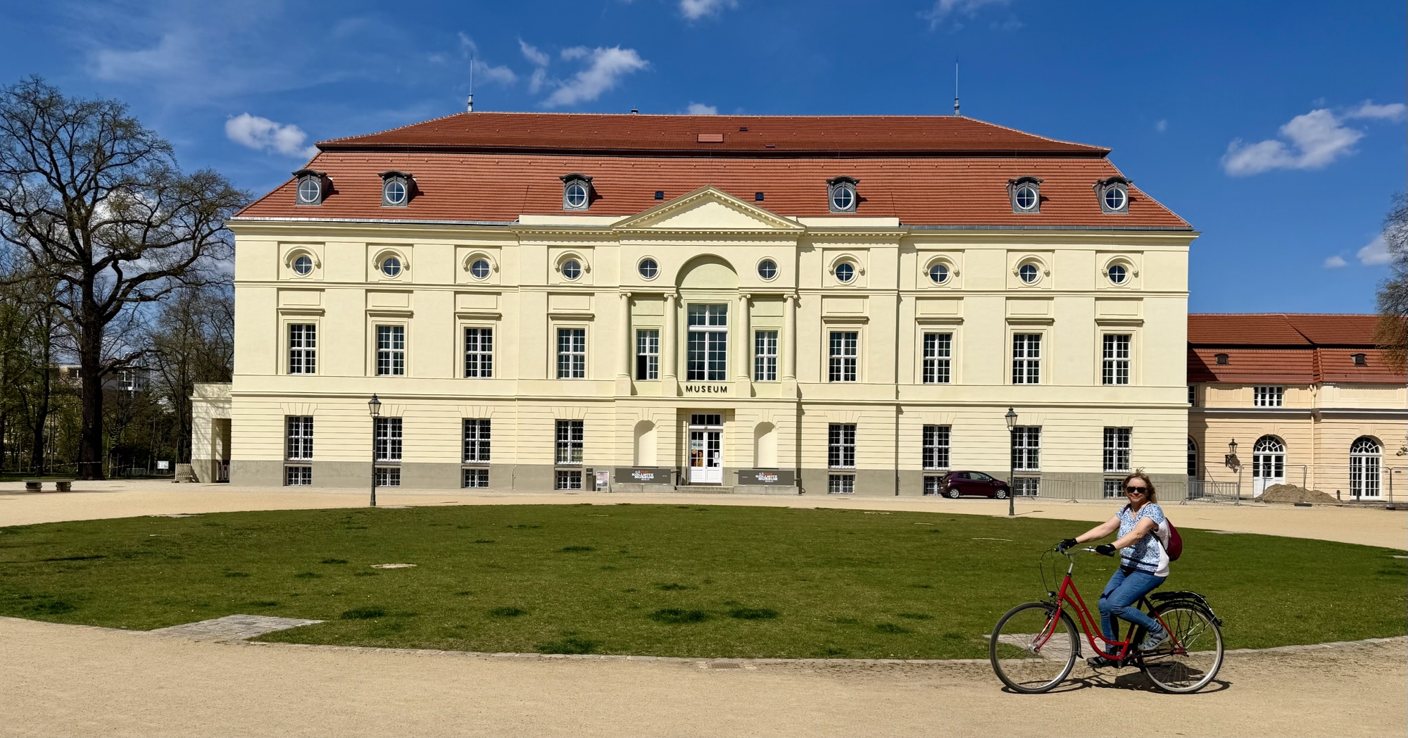
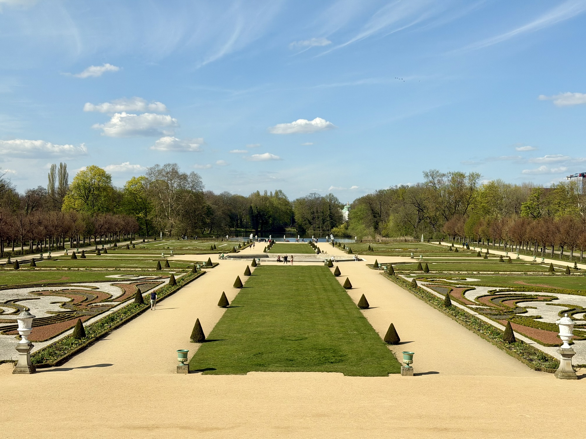
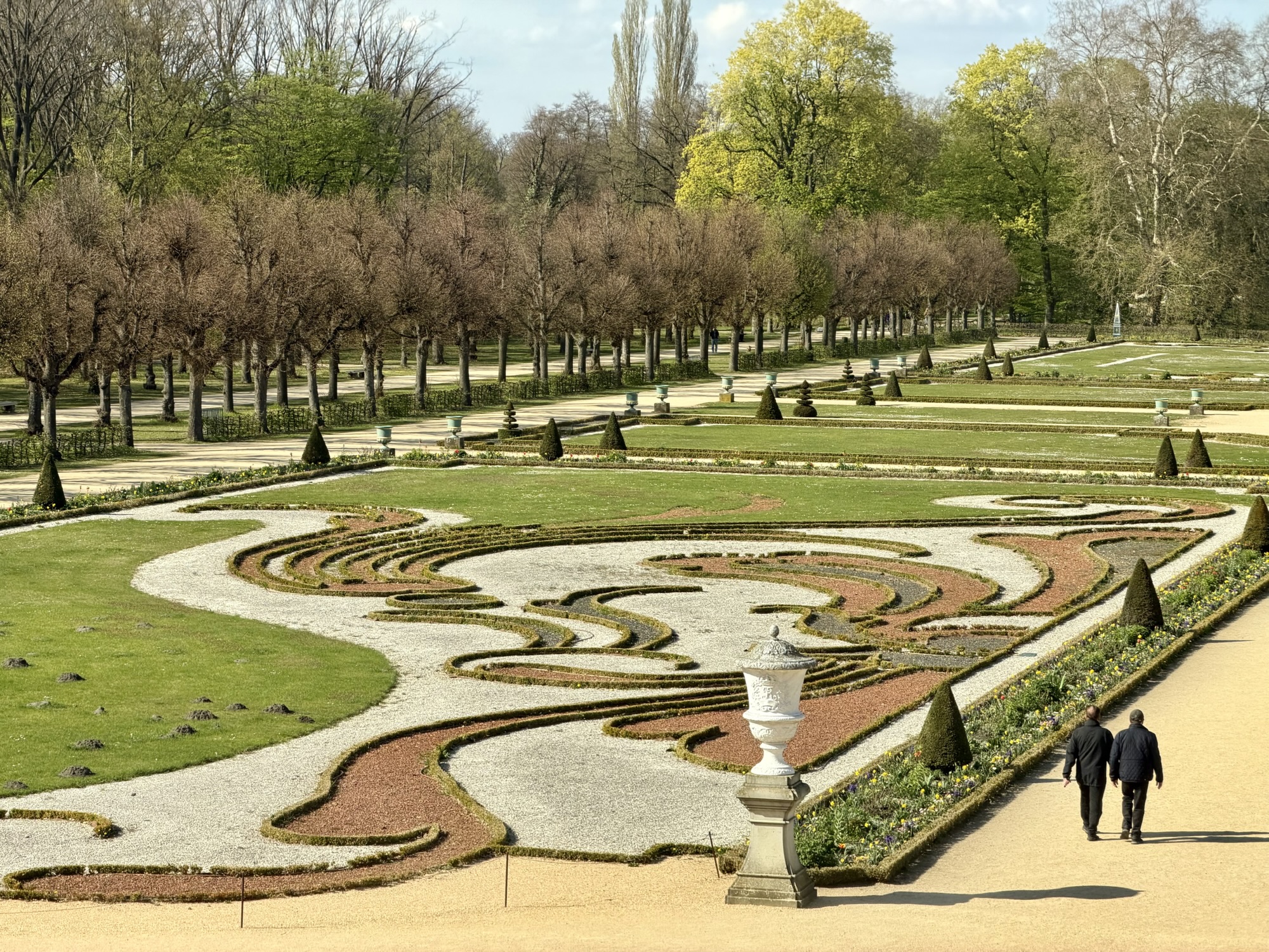
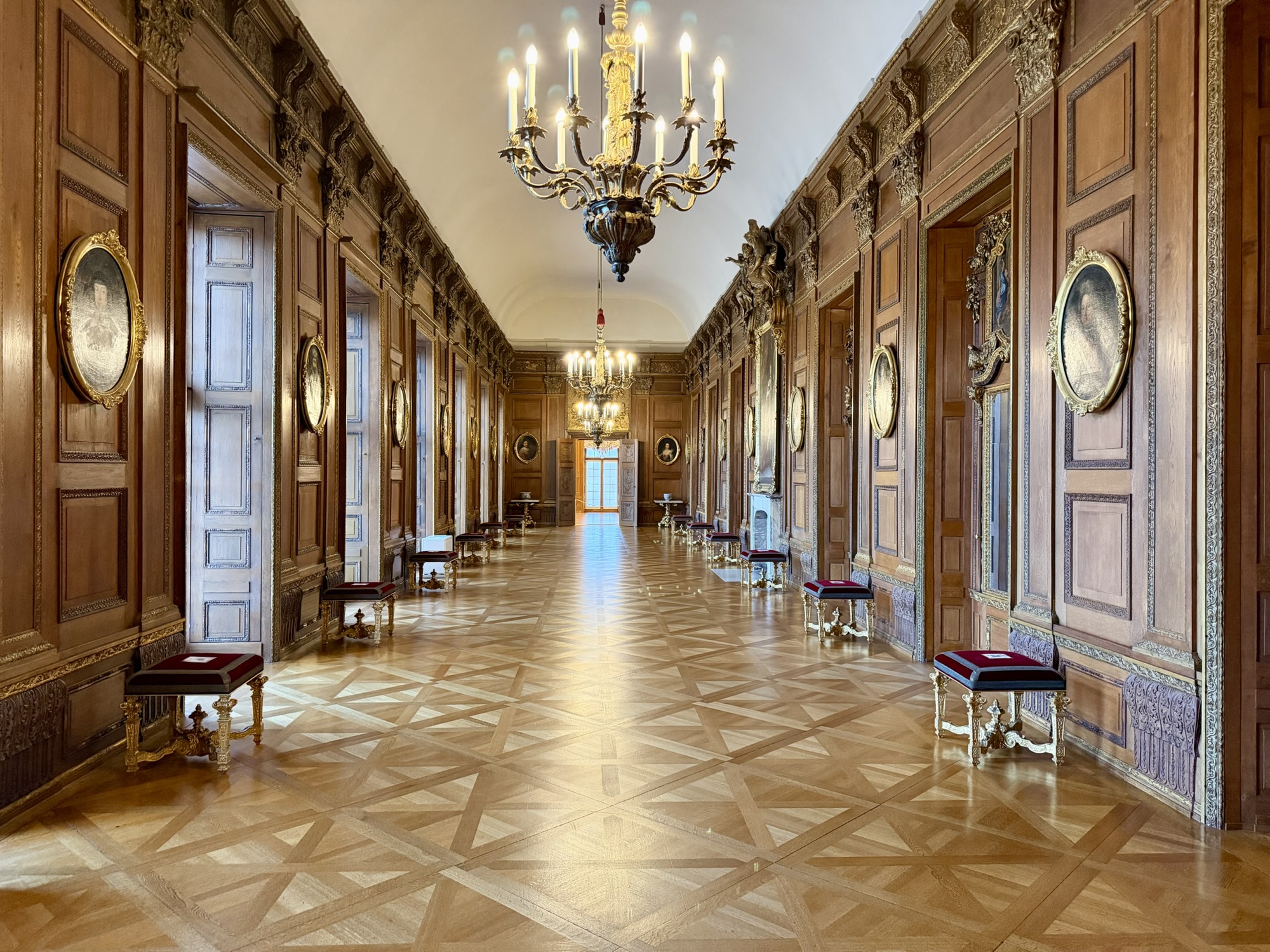
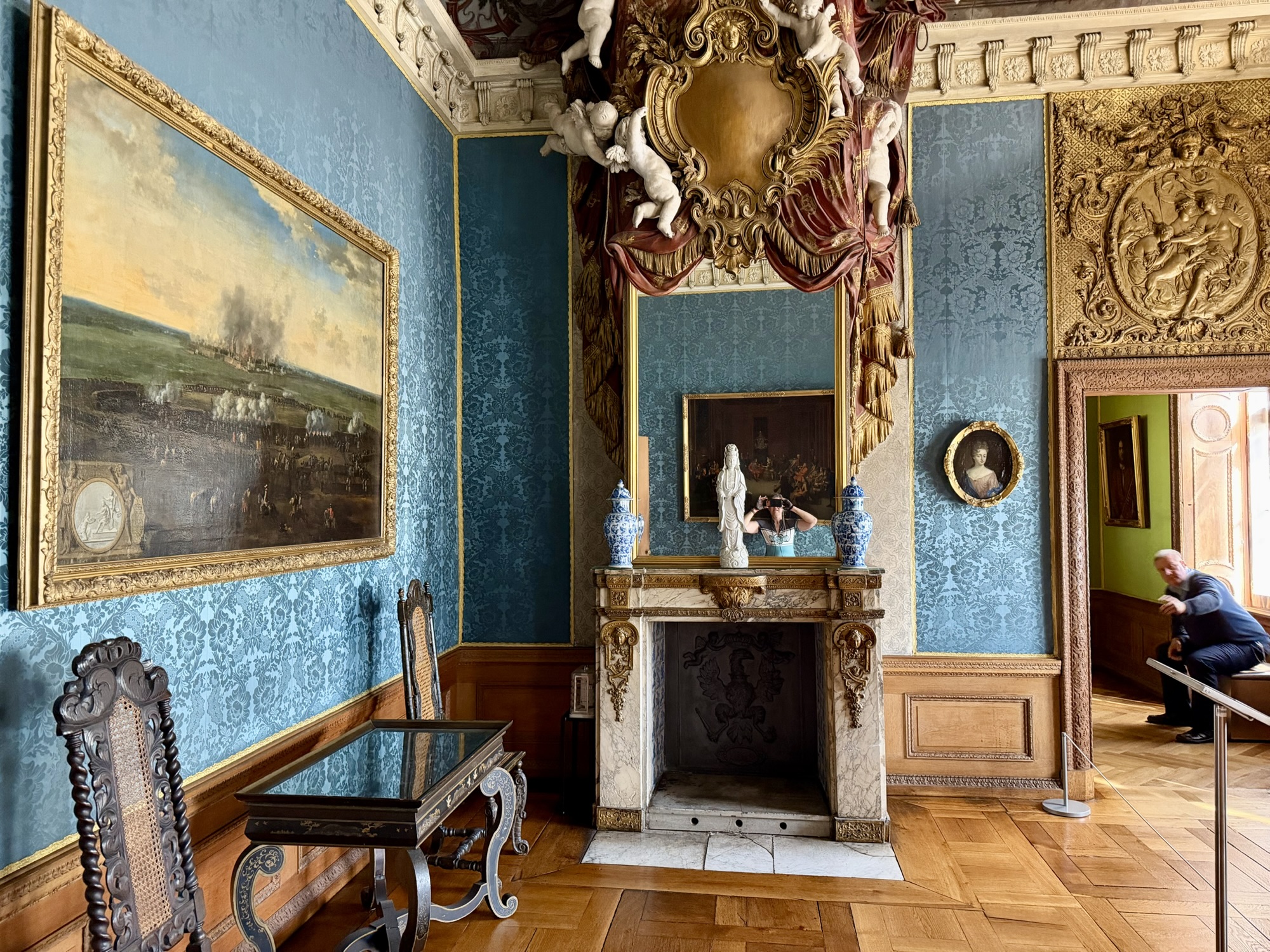
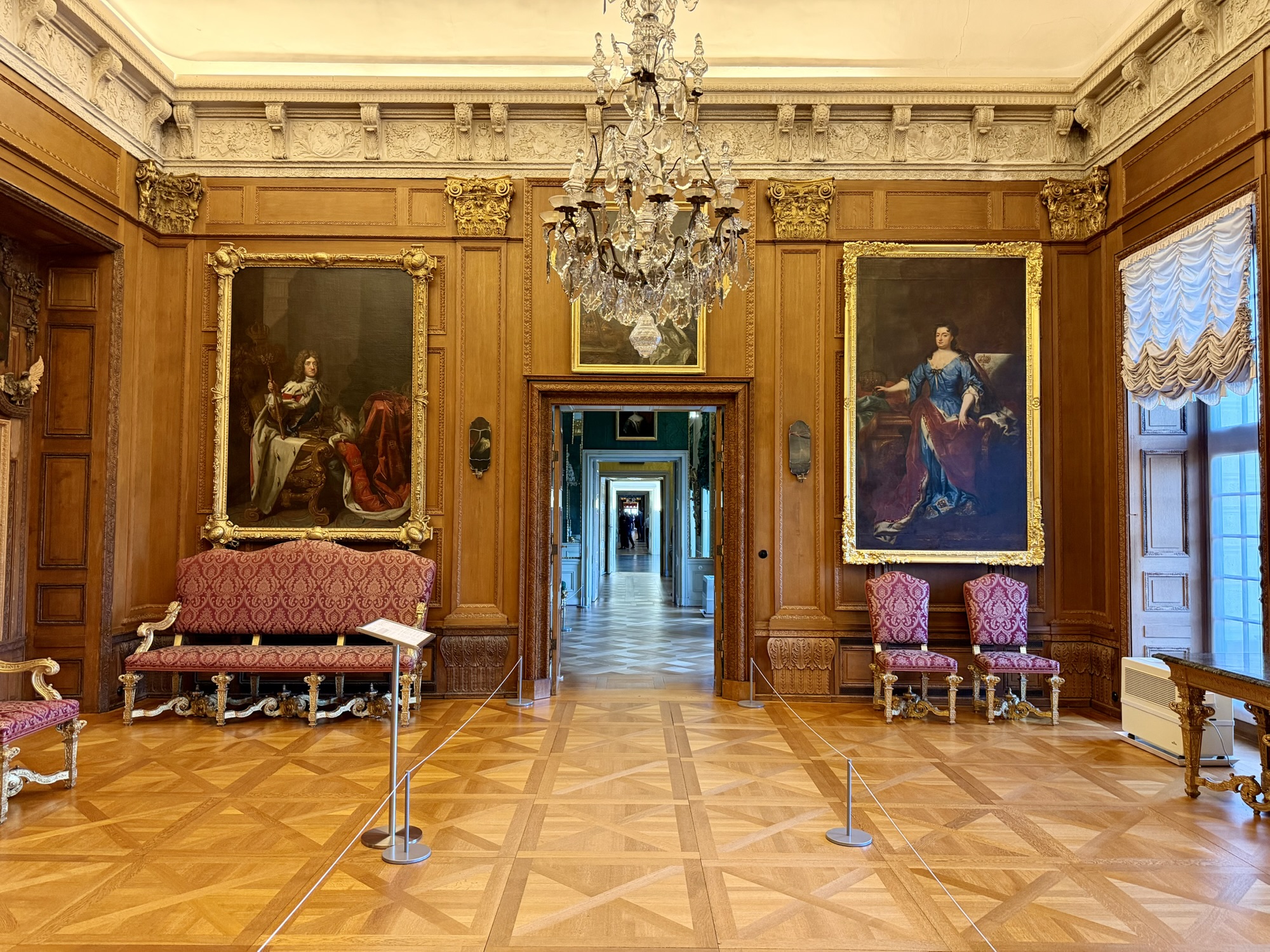
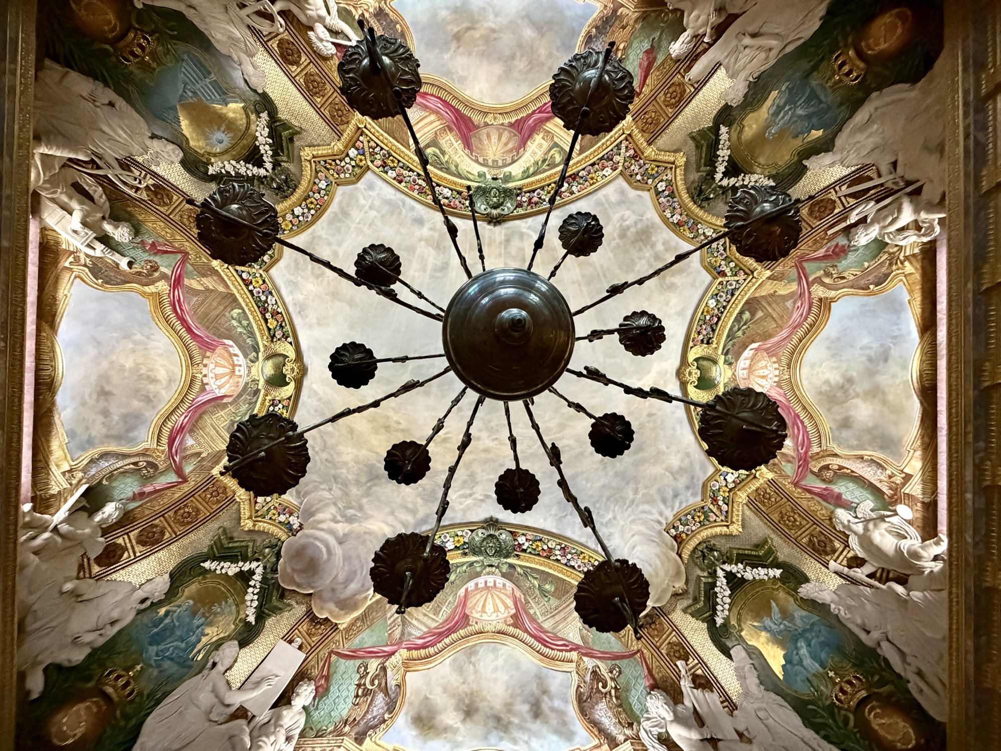
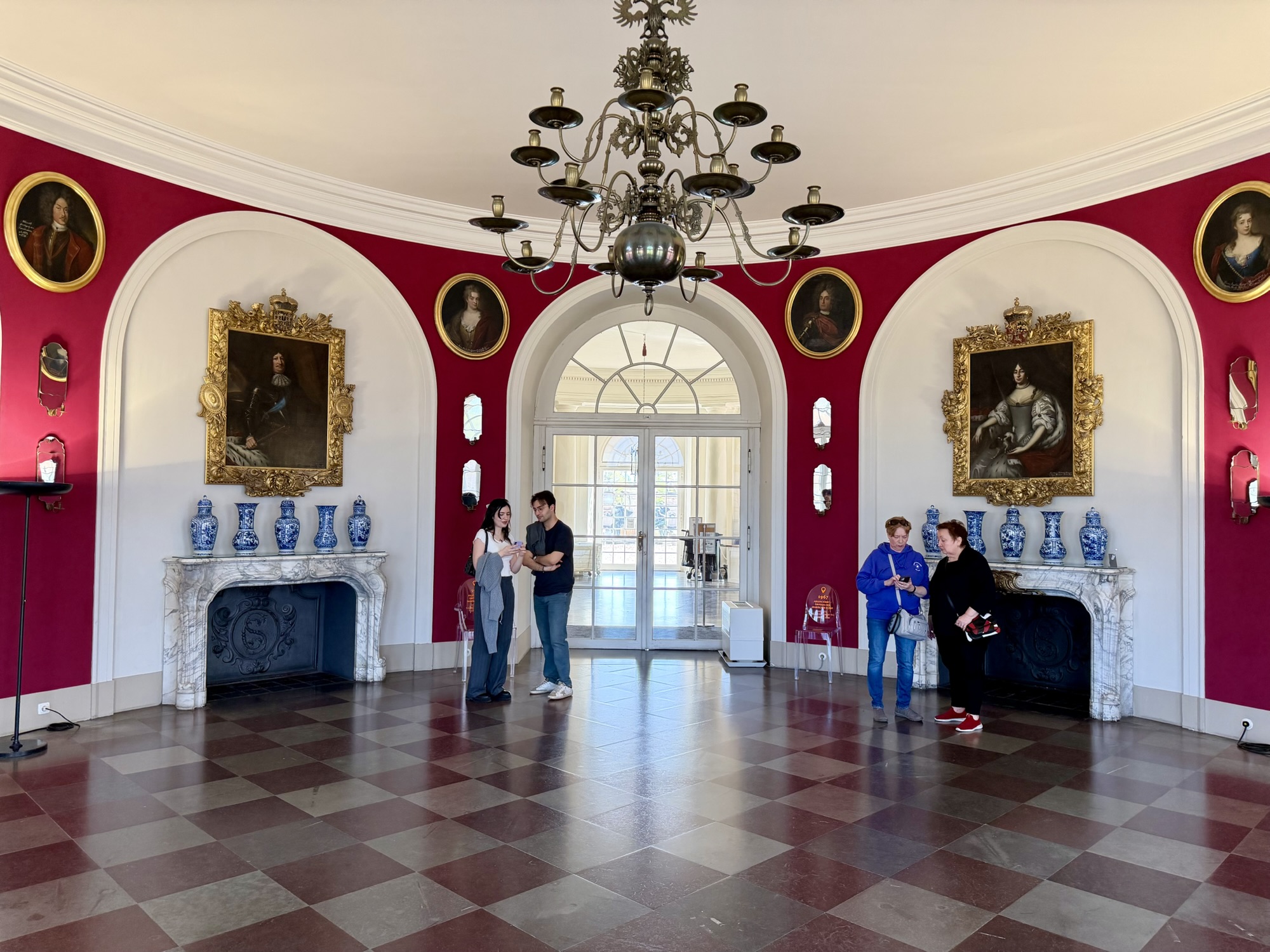
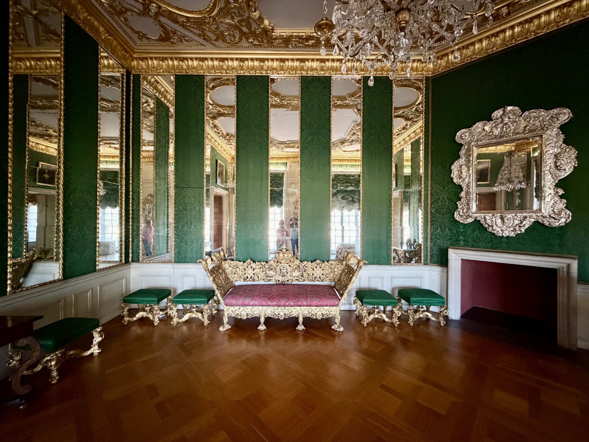
Charlottenburg Palace (Schloss Charlottenburg) is Berlin’s largest royal palace. It was built in the late 17th century as a summer residence for Queen Sophie Charlotte. The architecture is baroque and rococo. It features lavish state apartments, and extensive gardens, and historical art collections.
We toured the old palace, the original core of which was built in 1695. The palace was nearly destroyed by bombing during World War II, but has been meticulously restored to its former glory.
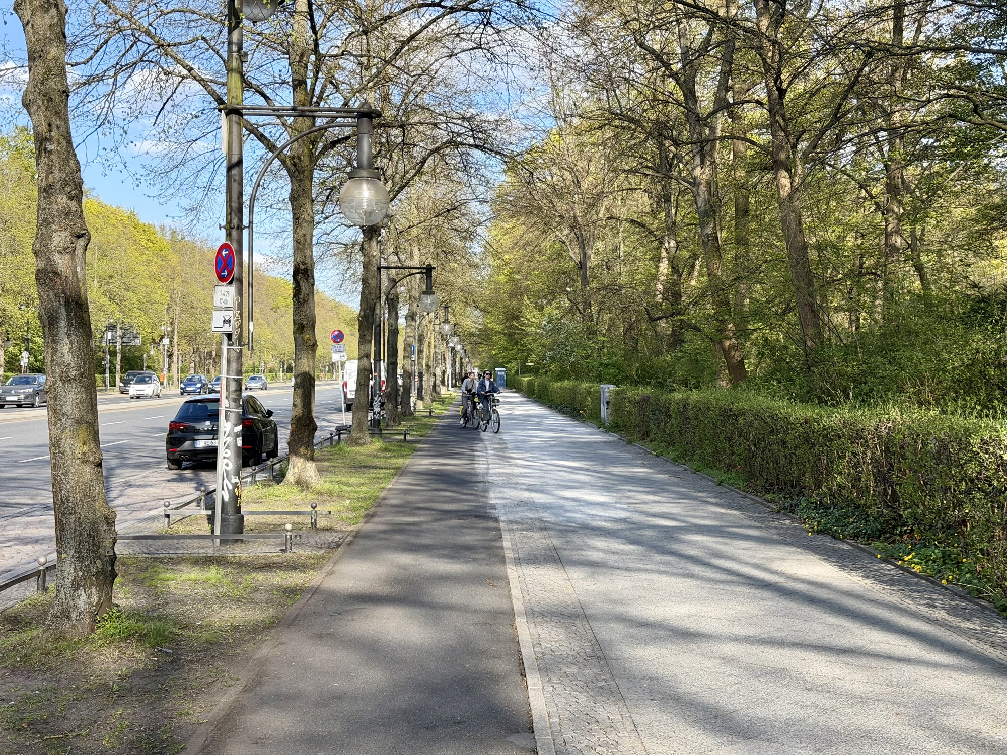
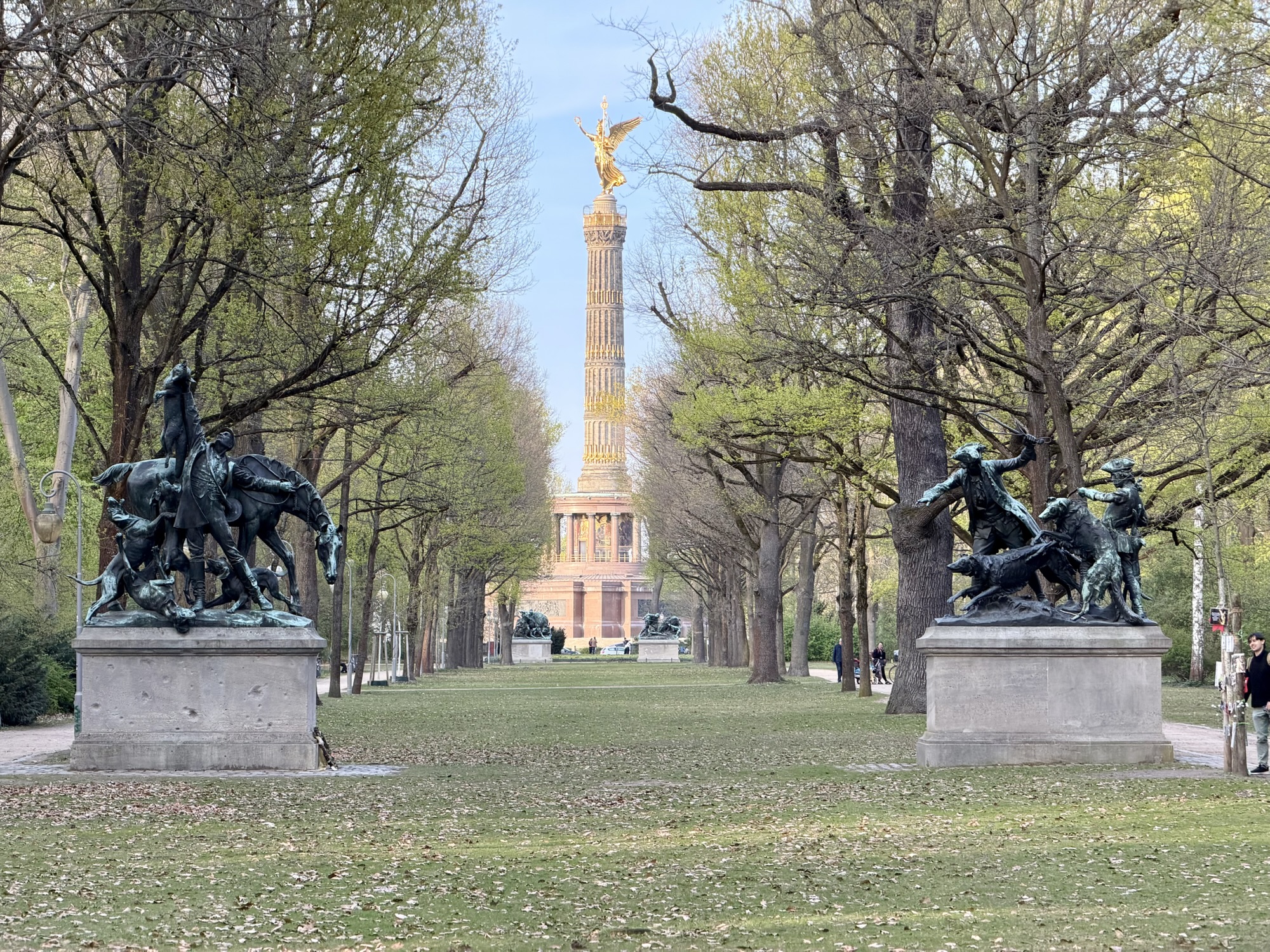
Next, we rode through the Tiergarten. It is Berlin’s largest (519 acres) and most famous inner-city park. It was originally a 16th century royal hunting ground. It now serves as a public recreation area and historic monument.
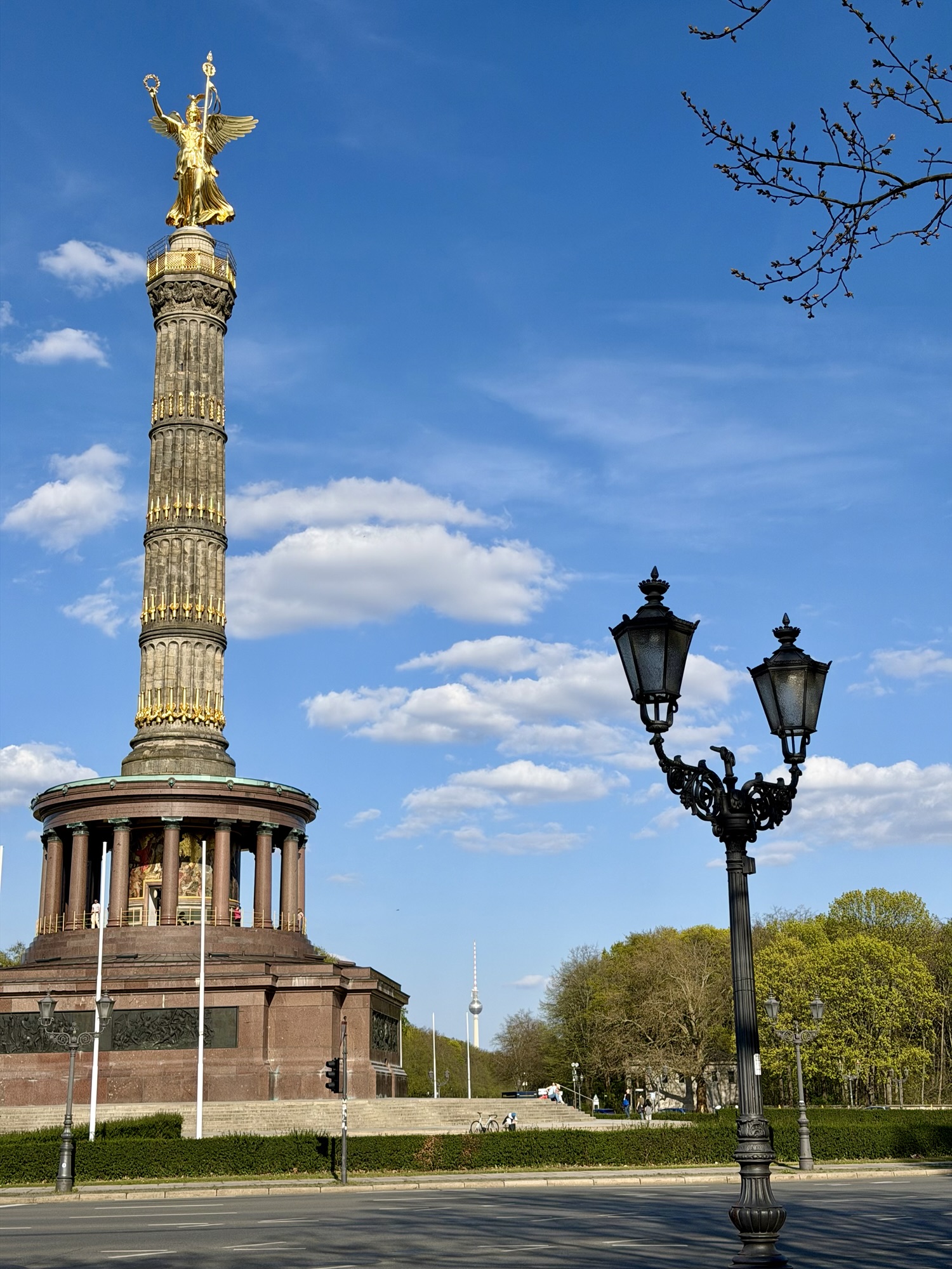
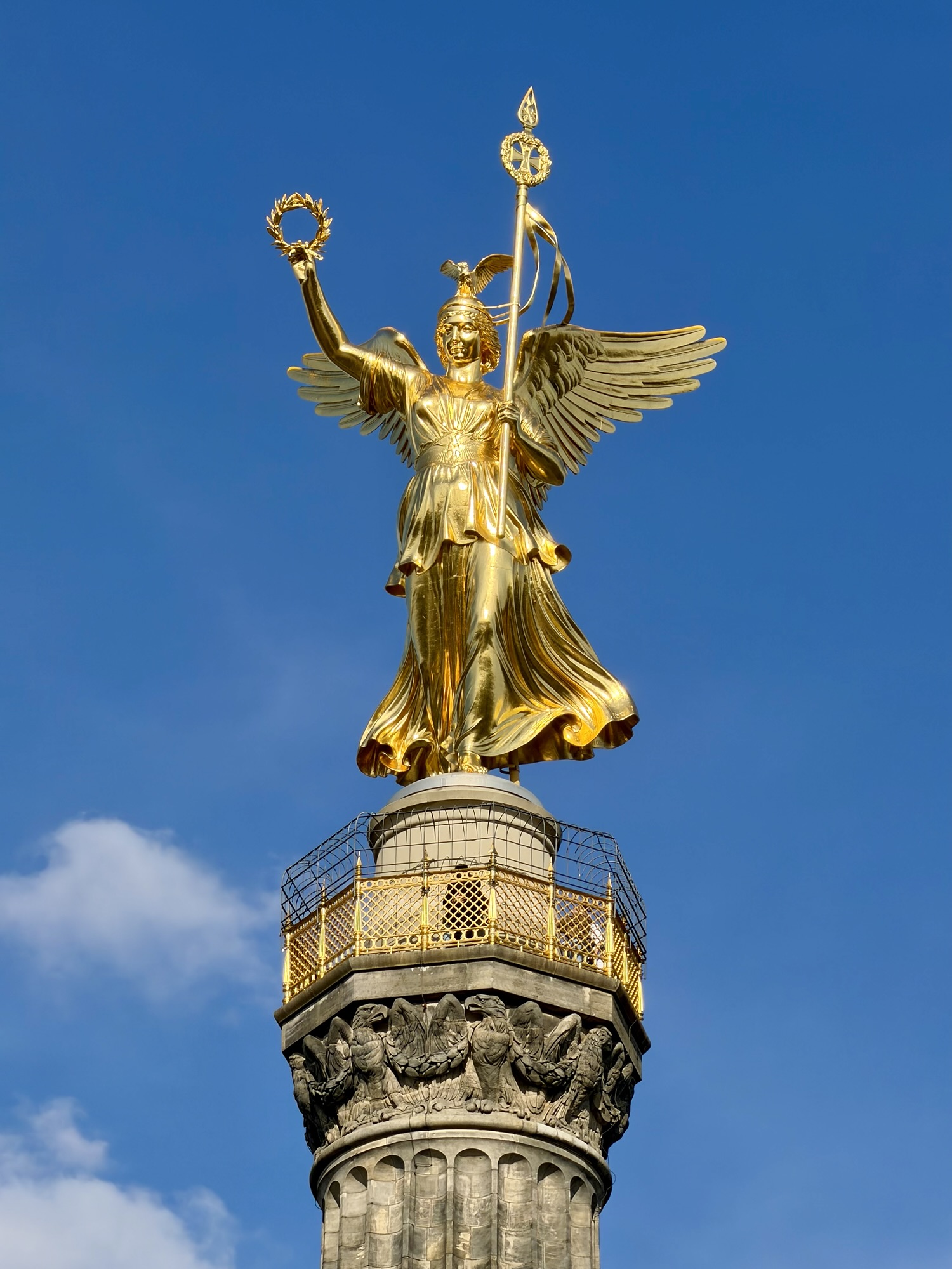
The Berlin victory column (Siegessäule) is a 67 m tall monument in the centre of the Tiergarten Park. It was built between 1864 and celebrates Russia‘s military victories over Denmark, Austria, and France. It is topped by a golden bronze statue of the goddess Victoria. Visitors can climb a winding staircase of 285 steps to reach an open air viewing platform, which features panoramic 360° views of the city. We didn’t take the time to do so as the plan for tomorrow is to visit the nearby Reichstag Dome which also offers open air panoramic views.
In addition to the many recreational trails through the park, there are raised cycle tracks along the streets around the park. Here you can see the Brandonburg Gate and Berlin Tower.
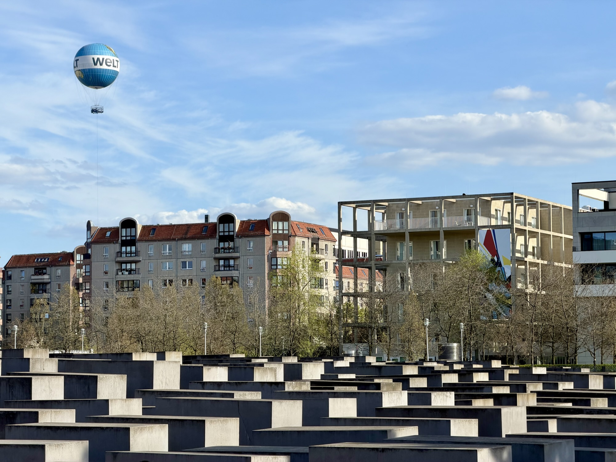
Very close to the park and Brandenburg Gate is the Memorial to the Murdered Jews of Europe, commonly called the Holocaust Memorial. It is a monument commemorating the up to 6 million Jewish victims of the holocaust. It was designed by Peter Eisenman and features a sprawling disoriented maze of 2711 concrete slabs (stelae) varying Heights that cover a 4.7 acre undulating site.
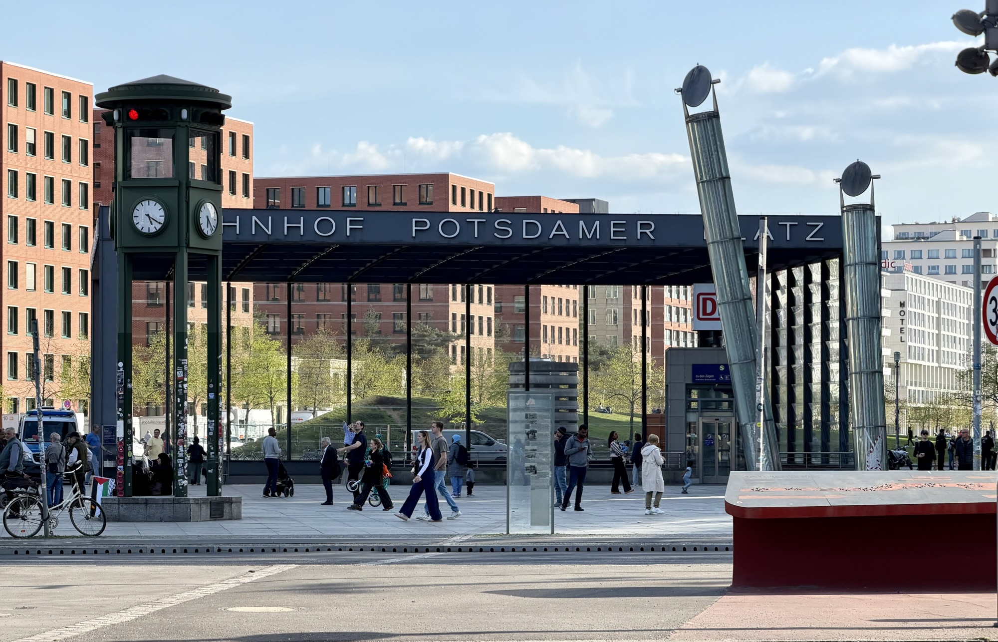
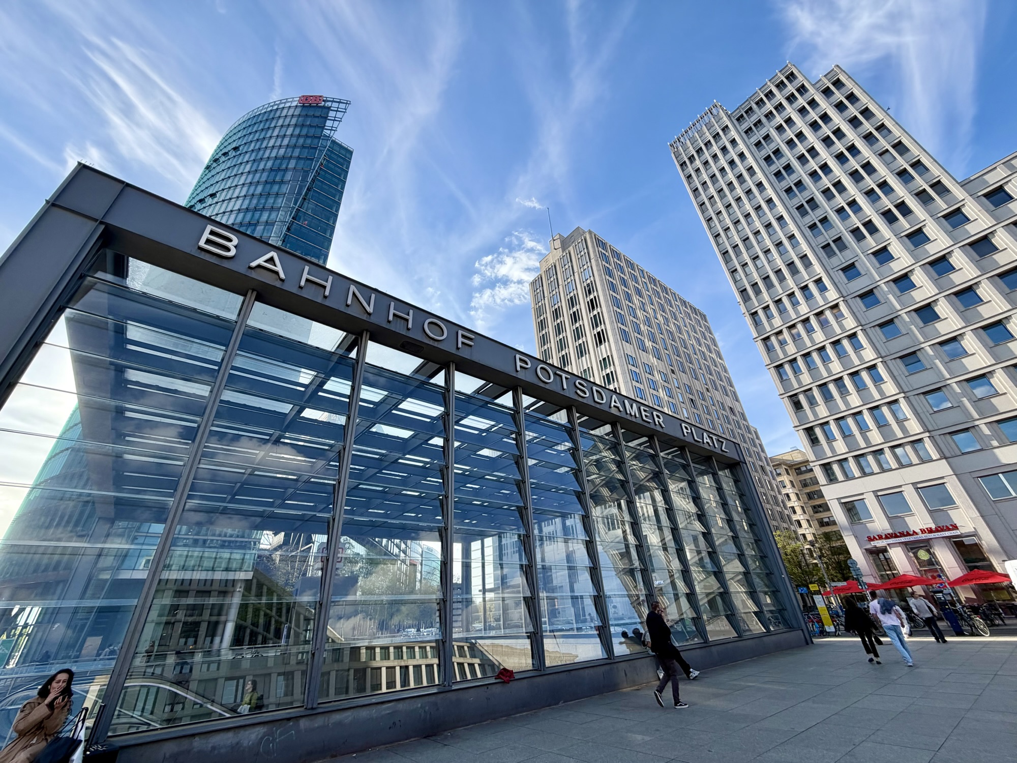
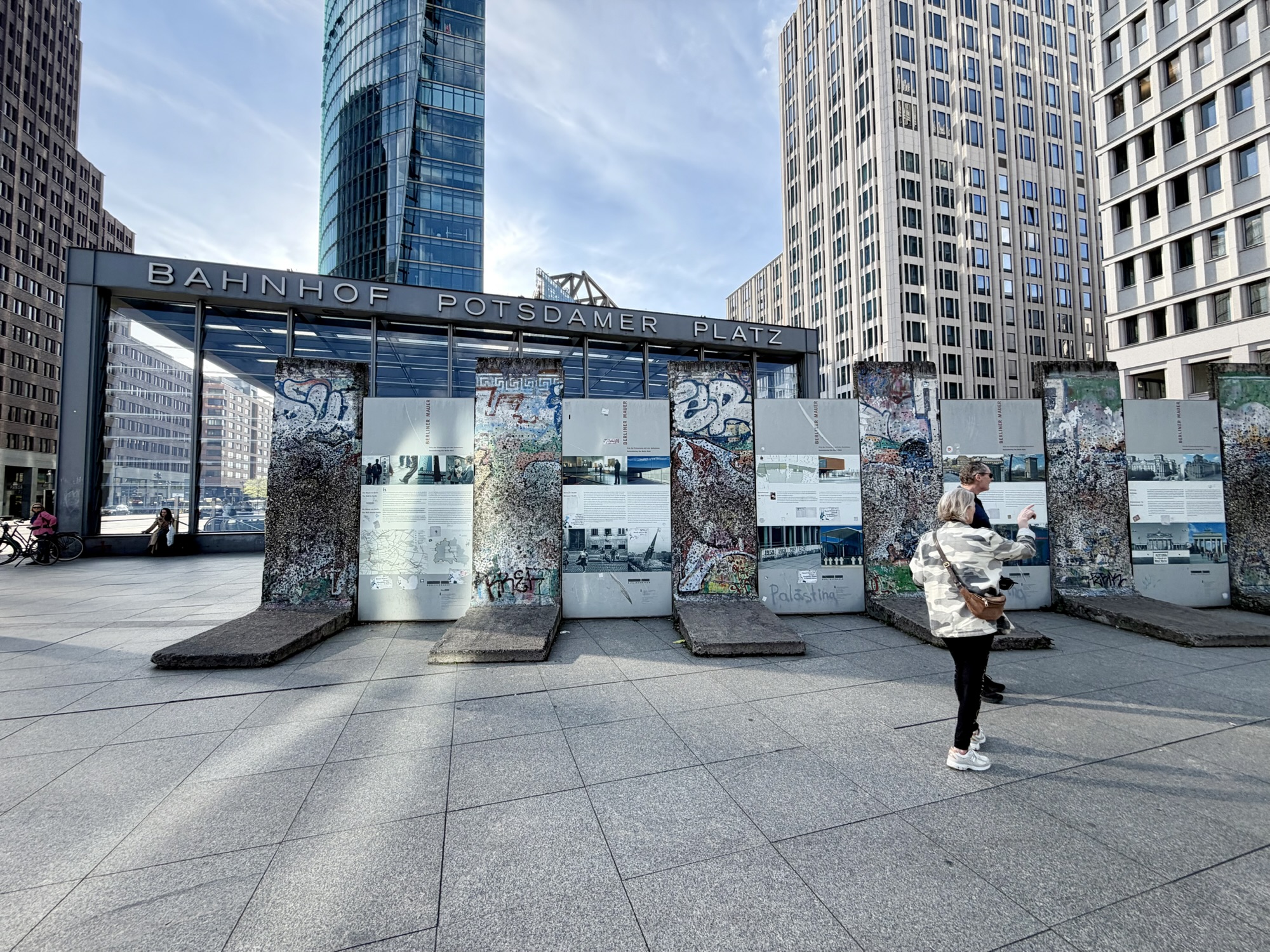
Next, we headed to Potsdamer Platz, which was in East Berlin. Sections of the Berlin Wall have been preserved outside of the modern redeveloped Potsdamer Platz railway and s–Bahn station.
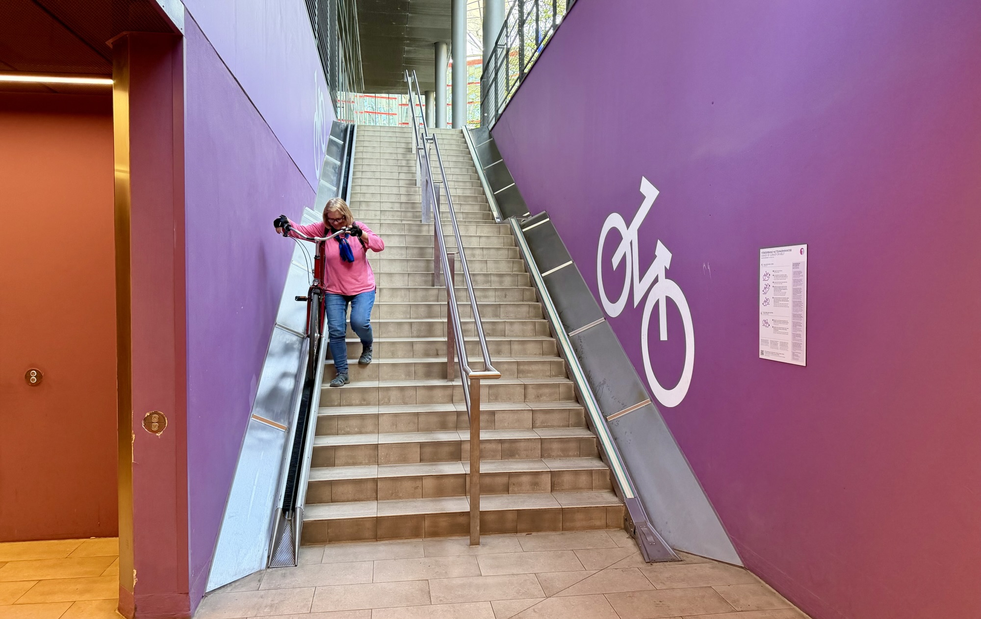
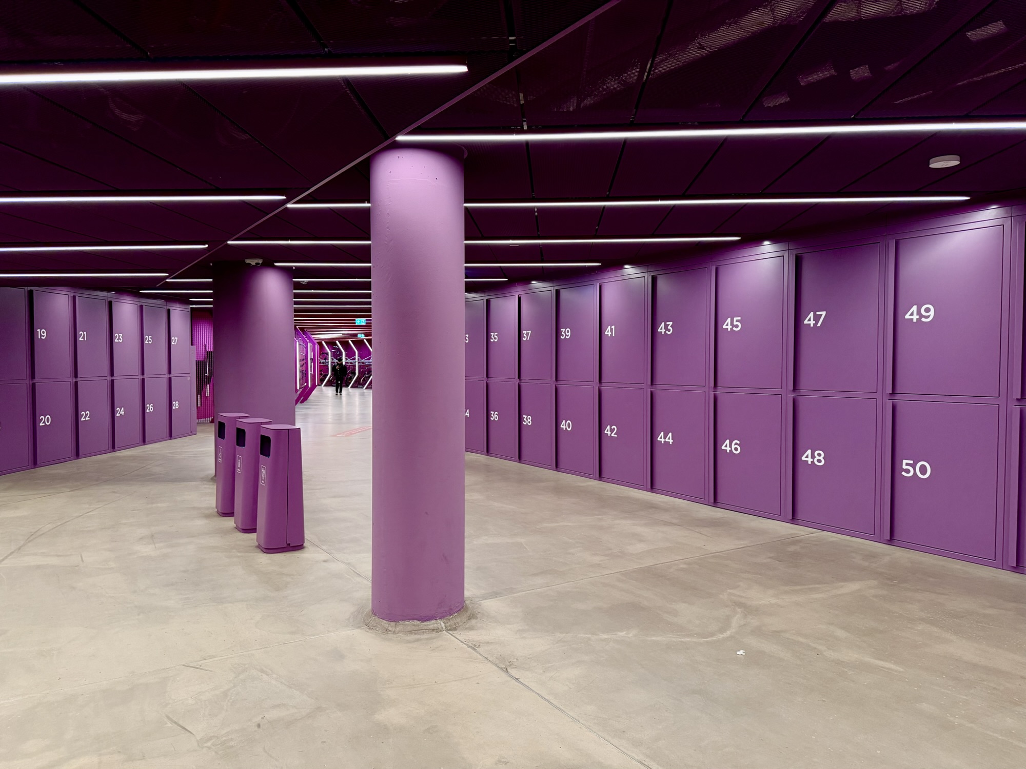
I had recently seen on social media a new underground bike parking station in Berlin, and that’s where we headed next. It is under Potsdamer Platz. The bike trough had bristles that slowed the descent of your bike, and a drain at the bottom to catch water from the tires on wet days.
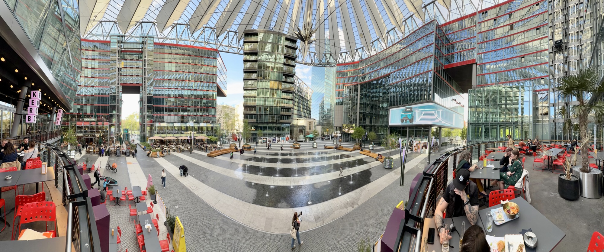
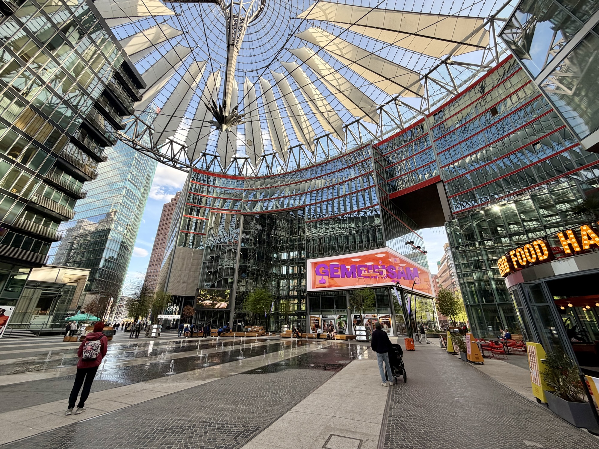
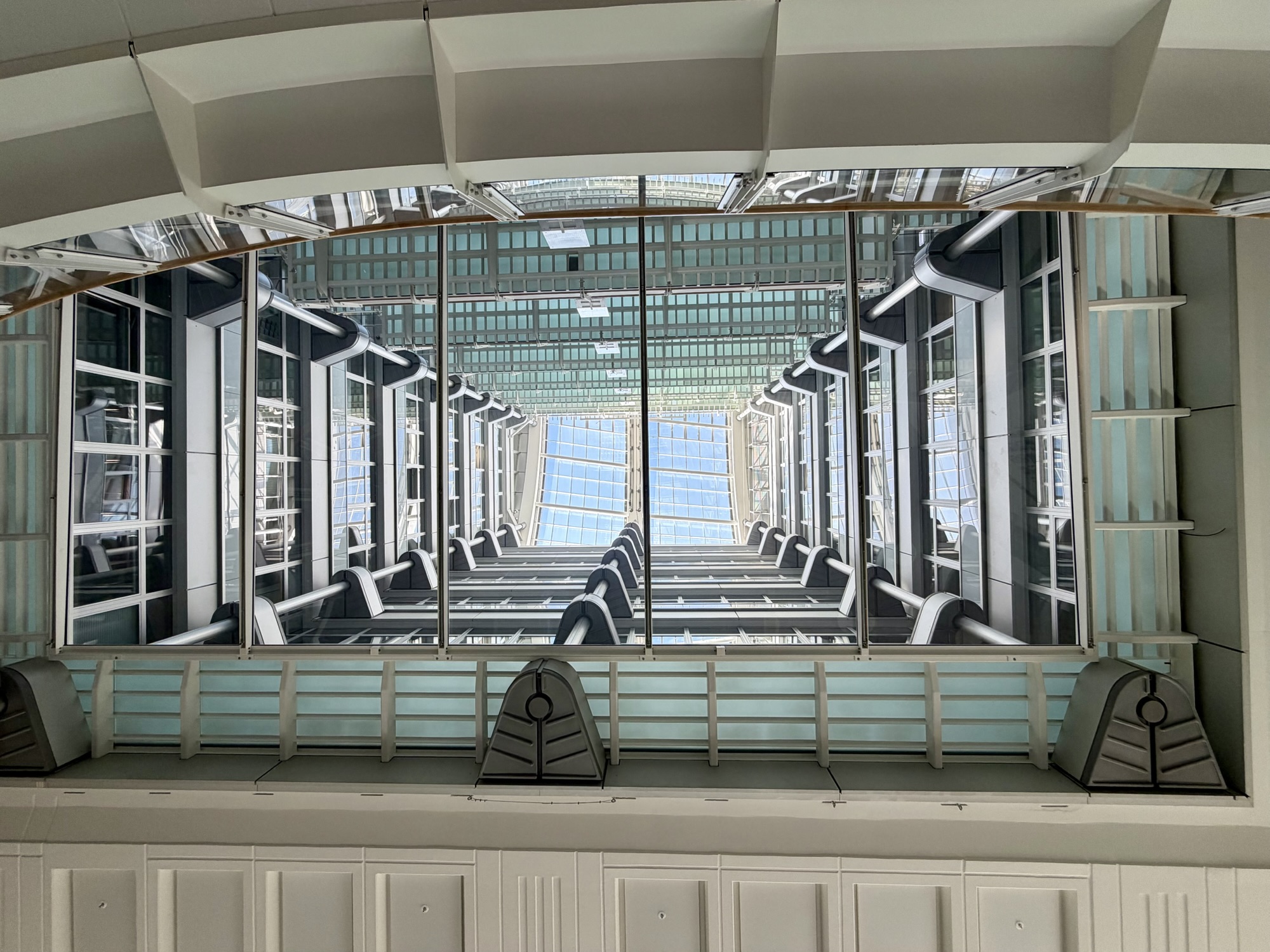
The entryway is in The Centre at Potsdamer Platz, known as the Sony Centre until 2023. It is a glass and steel open air complex with a spectacular tent like roof covering a central plaza filled with restaurants, offices, apartments, and entertainment venues.
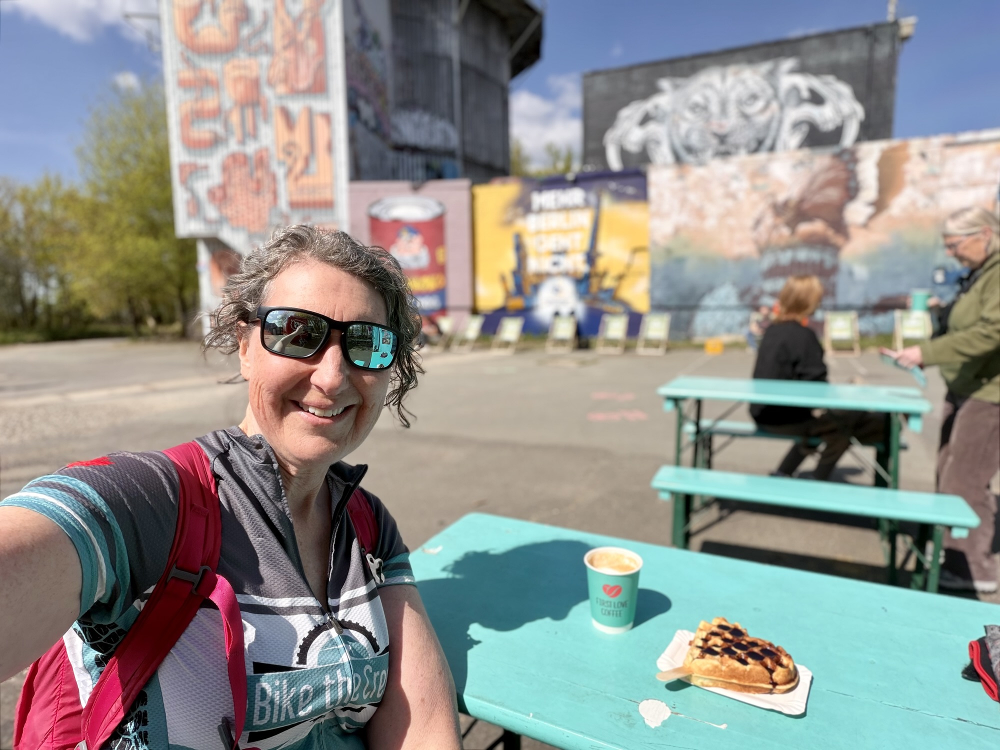
We decided to eat dinner here having not had a proper lunch, but just the coffee and waffle at Tuefelsberg, and some fruit and nuts we had with us before going into Charlottenburg.
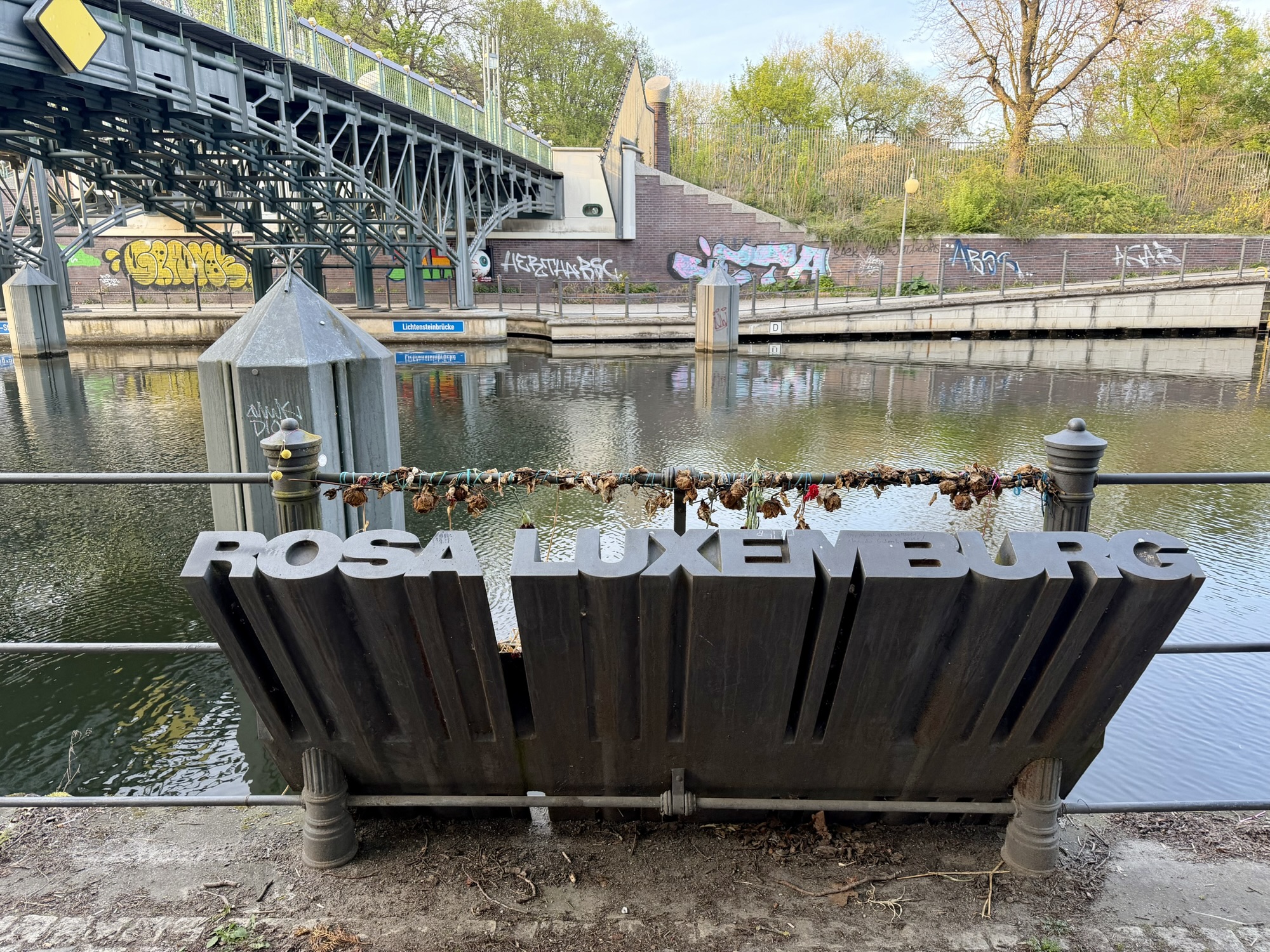
Alina‘s daughter asked her to visit The Rosa Luxembourg (1871 to 1919) memorial. She was “a prominent advocate of democratic socialist thought and action in Europe. She opposed the butchery of the 1914–1918 World War with all her strength. She and Karl Liebknecht were the most important supporters of internationalist and anti-militarist positions within the Social Democratic Party (SPD). She was a passionate and convincing critic of capitalism, and it was from this critique that she drew the strength for revolutionary action. She welcomed the Russian Revolution full of hope, but as a revolutionary democrat remained critical and alert, and had the foresight to condemn the dictatorial policies of the Bolsheviks.”
Rosa was an academic who earned a doctorate at a time when hardly any women attended university. She was also active in politics. “Rosa Luxemburg was a martyr of the German Revolution of November 1918. She was killed by uniformed murderers on 15 January 1919 — members of the same milieu that would later openly support the handover of power to the Nazis.” The memorial has been placed where her body was thrown into the Landwehr Canal.
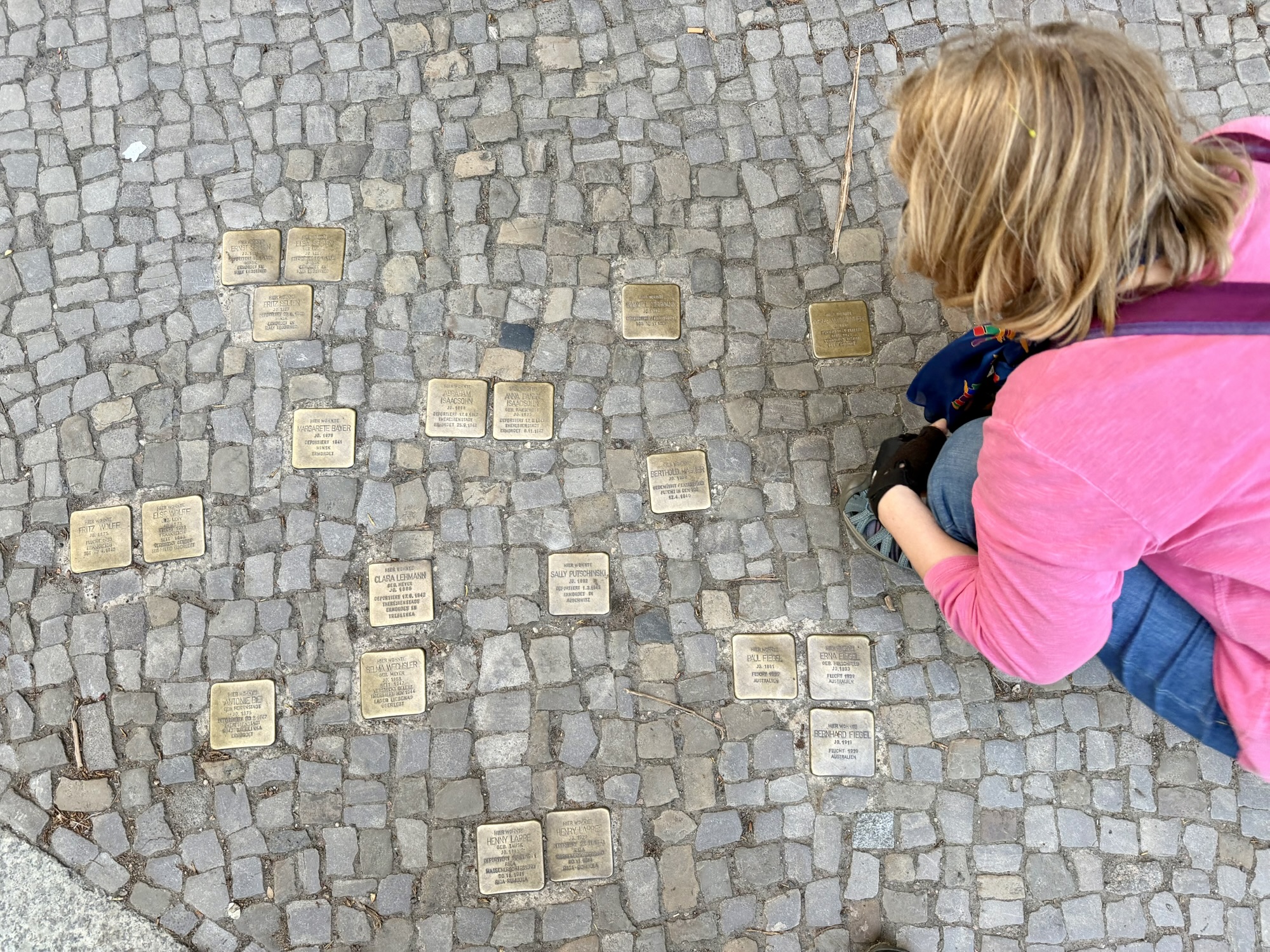
It was starting to get dark as we returned to the guest house. Outside of the building housing the guest house were these small brass capped plaques embedded in the cobblestones. They are known as Stilpersteine (stumbling stones). They were initiated by artist Gunter Demnig, and are placed directly outside the last known freely chosen residence or workplace of someone targeted by the Nazis.
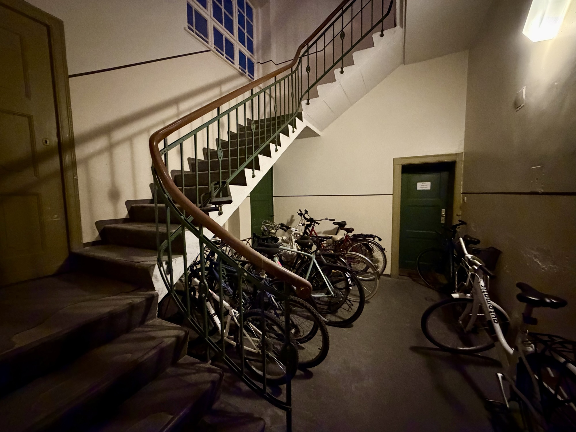
We were locking our bikes up in the courtyard when a resident pointed out that there is a bike room where we should park and that the guest house should have told us this.
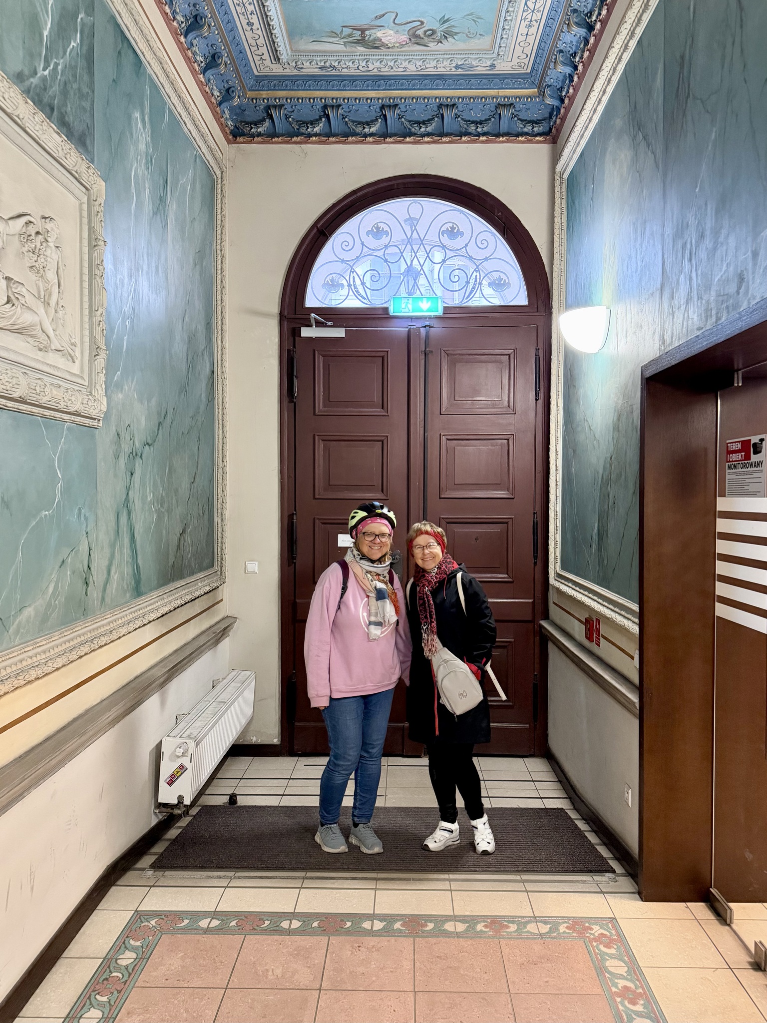
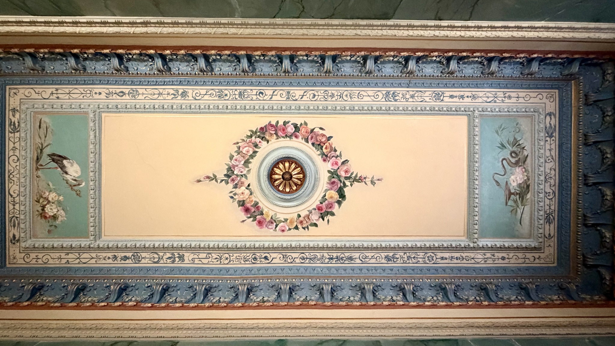
The elevator to our guest house was three steps up from the street level. It was still better than carrying my suitcase up two long flights of stairs, but not very useful for someone using a mobility device.
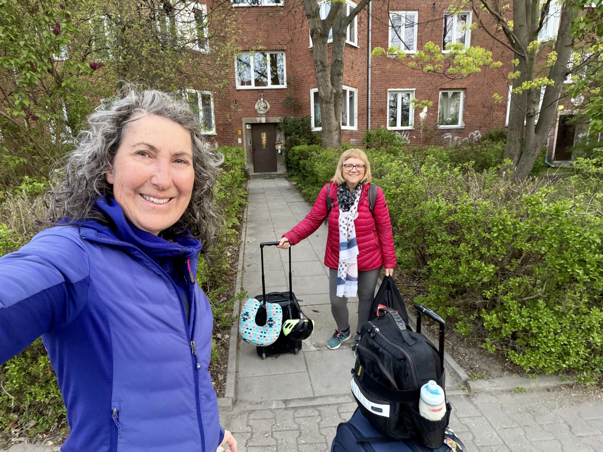
We set our alarms for 5:30 AM and were out of the apartment by 6:15 for our 7 AM train to Berlin. Here we are ready to walk to the bus stop just around the corner.
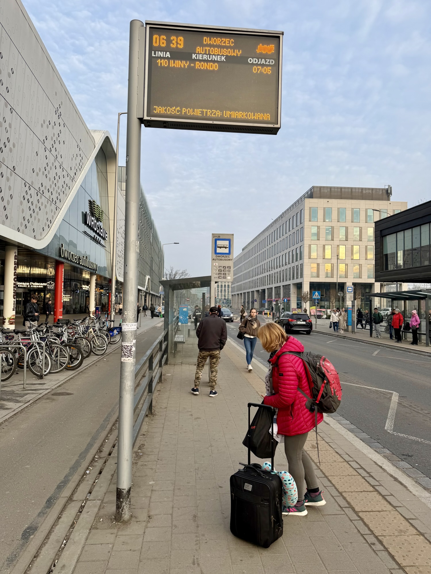
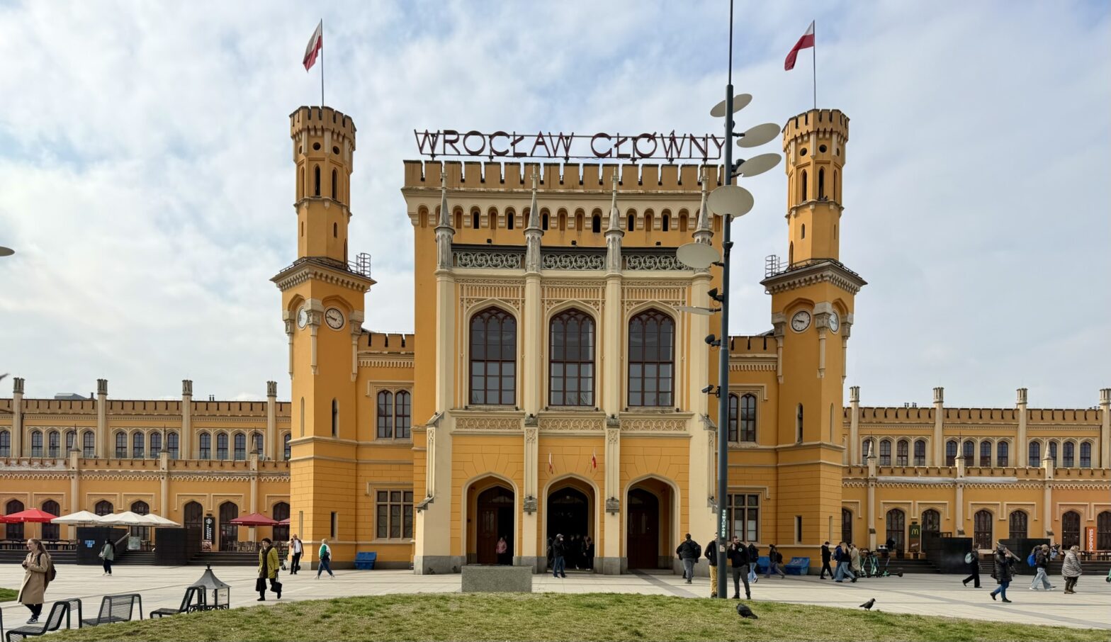
It was a one-bus ride to the main bus station in Wroclavia Mall, which was right across the road from the main train station, Wroclaw Glowny.
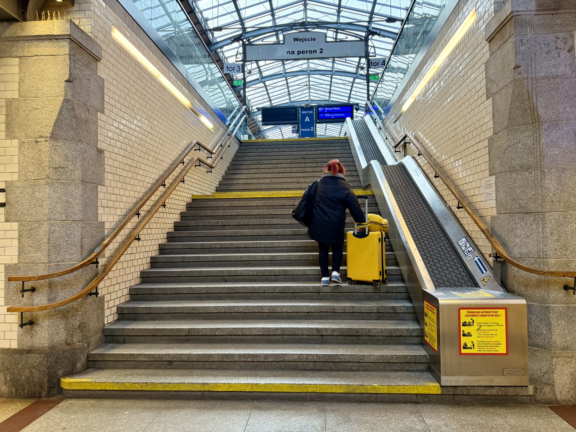
We determined which platform we needed to board the train from, then because we had some extra time, I got a coffee and Alina got some Polish donuts. In addition to having elevators to each platform, they had conveyor belts for you to put your luggage on if you choose to climb the stairs and don’t want to carry your suitcase. I’ve never seen something like this before. Apparently they are unique to Wroclaw Glowny. The train arrived and left on time.
At First German Station, Frankfurt am Oder, there was an announcement we did not understand. People started getting out identification documents.The police boarded and looked at some IDs, but we didn’t have ours out. He looked at us, said something that sounded pleasant, and carried on without checking us. We saw one officer walk by with someone’s passport. Then they left our car and the train started moving. I was surprised to see people getting out identification since both countries are in the Schengen area ( a system of open borders that encompass 29 European countries that have officially abolished border controls at their common borders) and normally no documentation needs to be shown when crossing the internal borders. It appeared that they were looking for someone in particular, rather than generally checking identification.
Alina told a childhood story about the donuts: children would challenge each other to eat them without licking their lips. I found it impossible.
We got into Berlin Ostbahnhof a few minutes ahead of schedule.
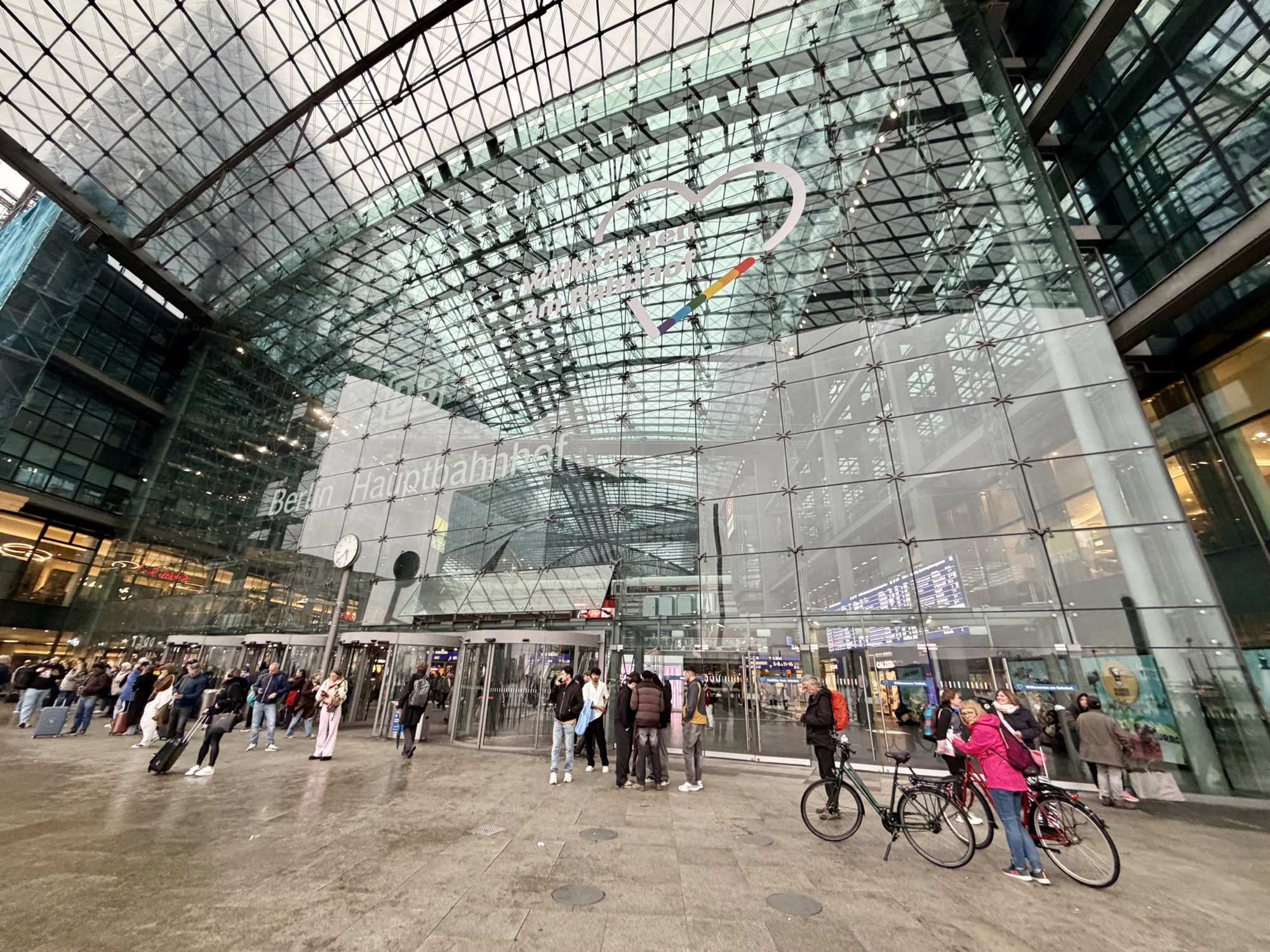
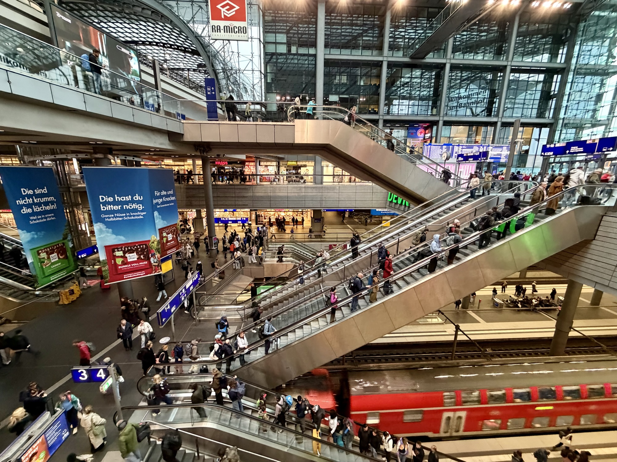
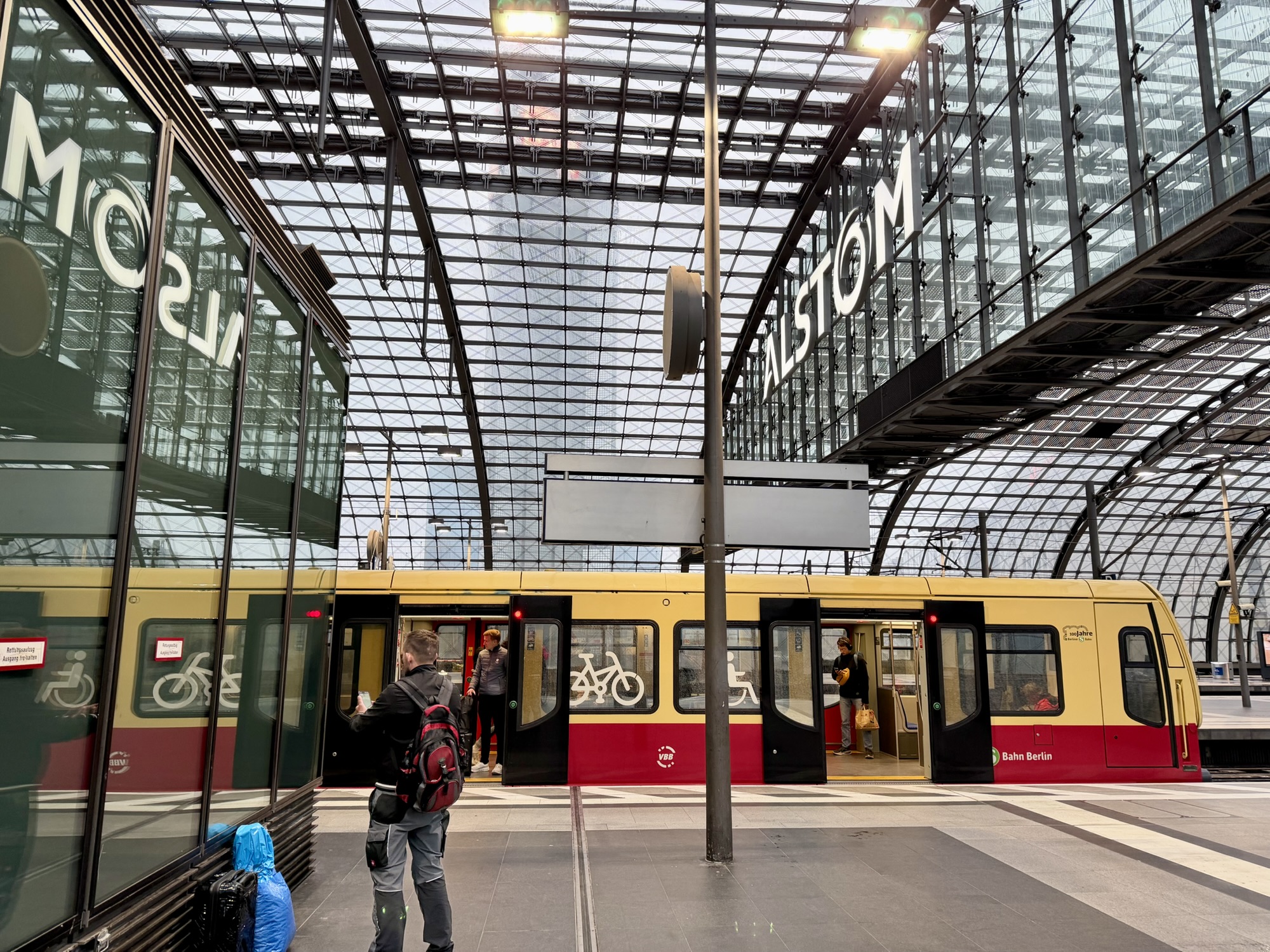
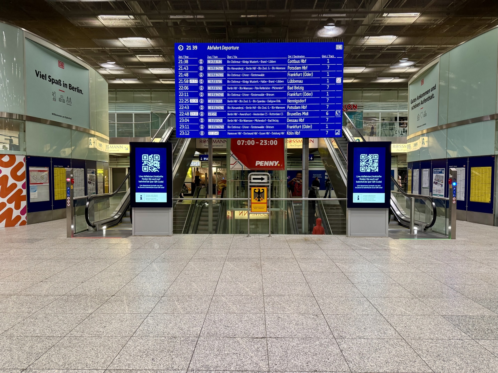
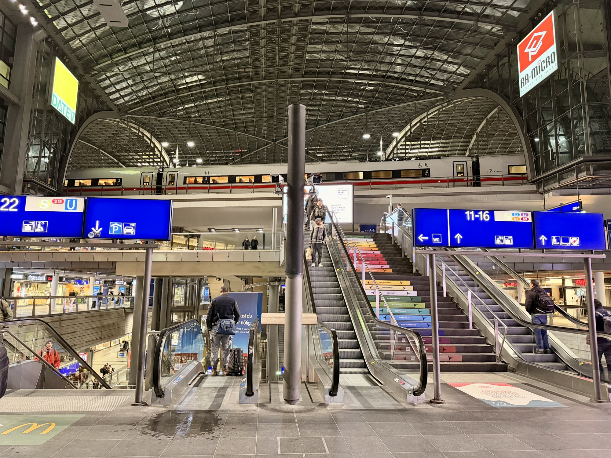
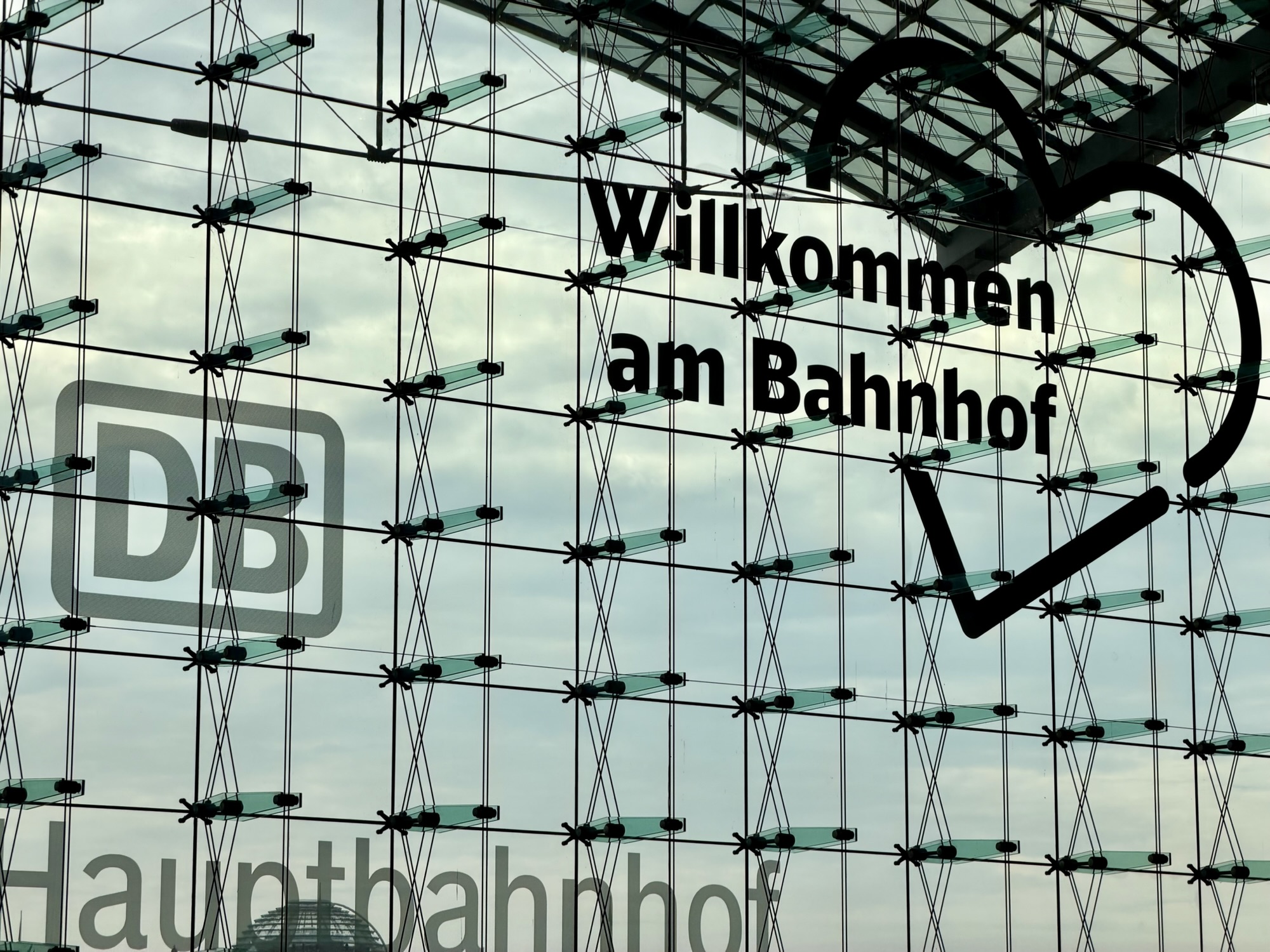
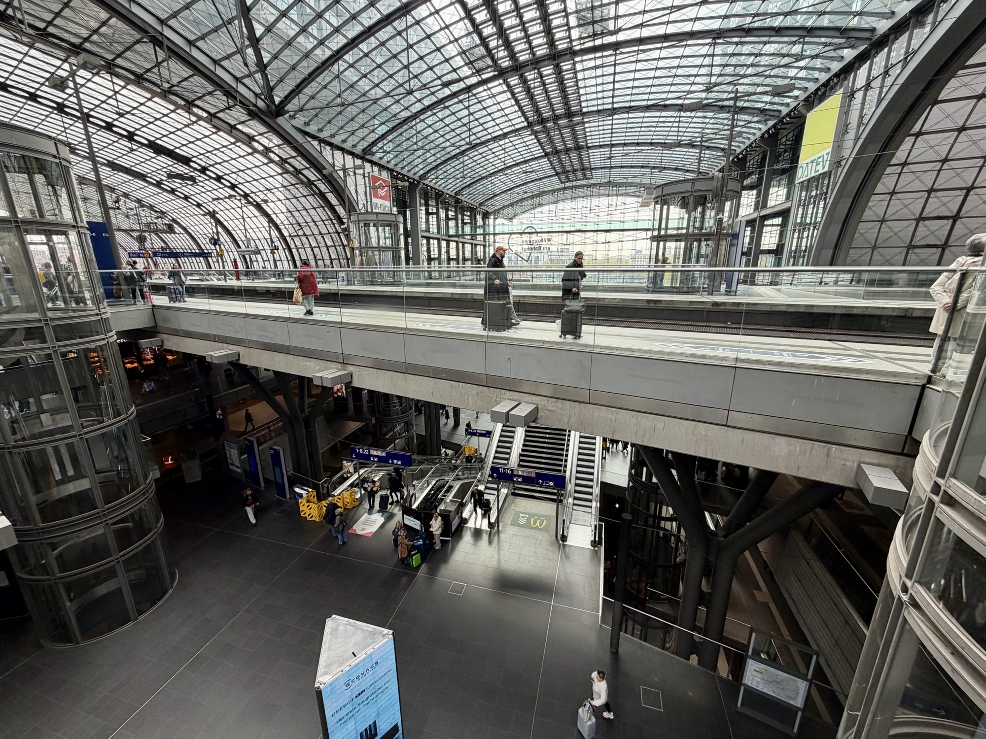
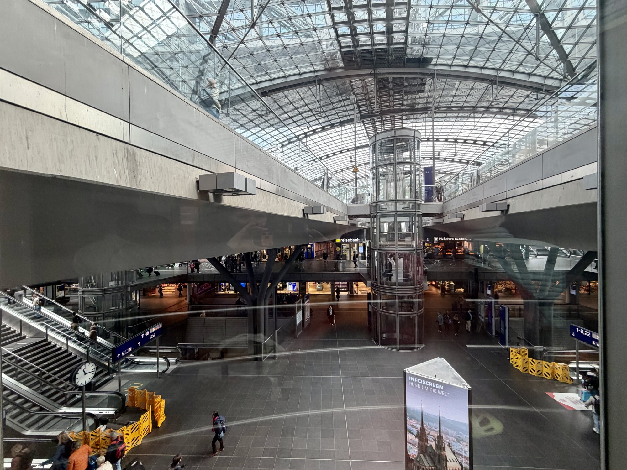
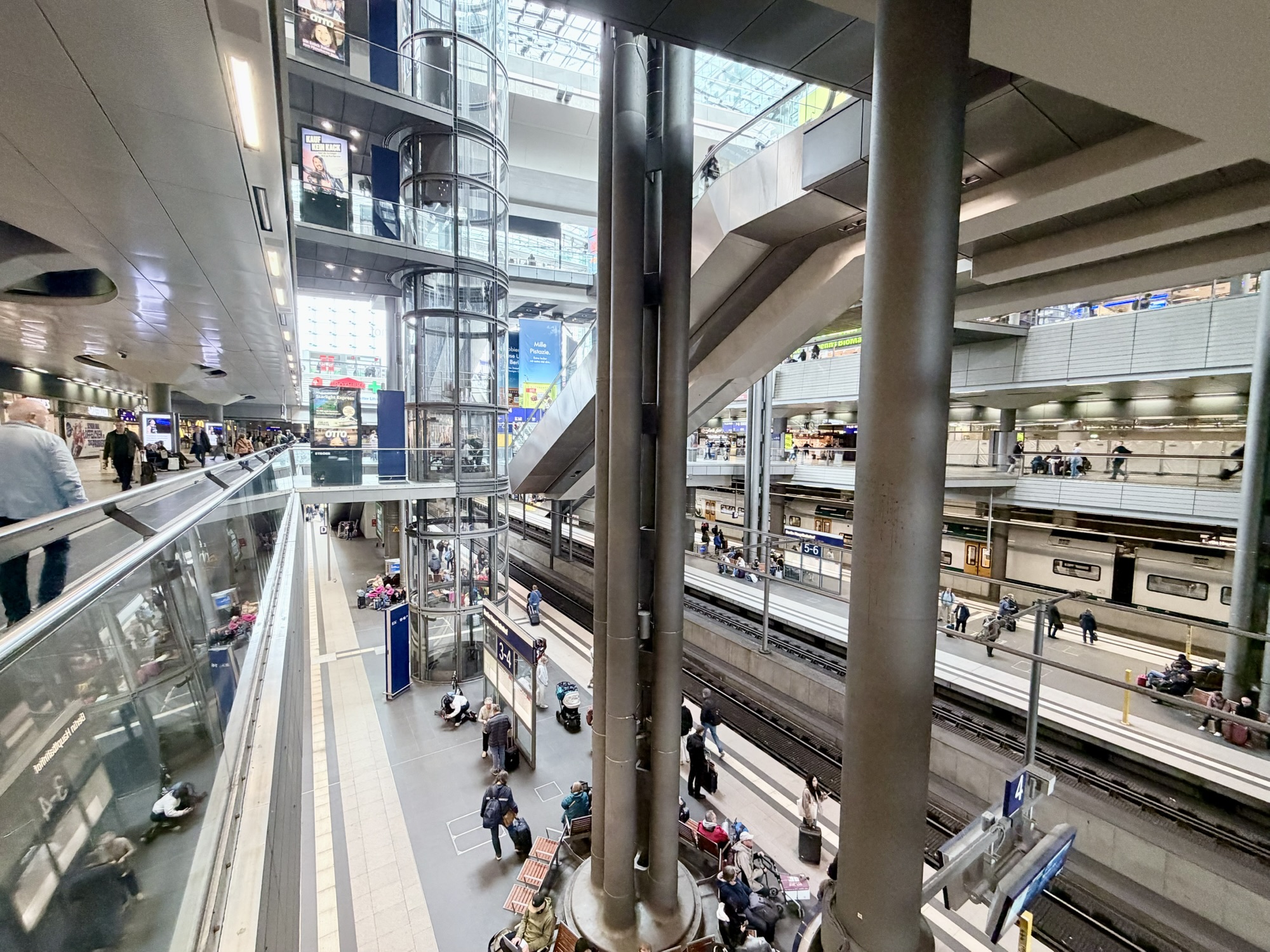
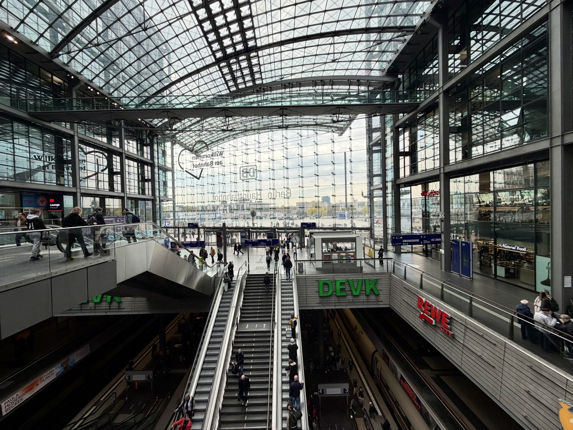
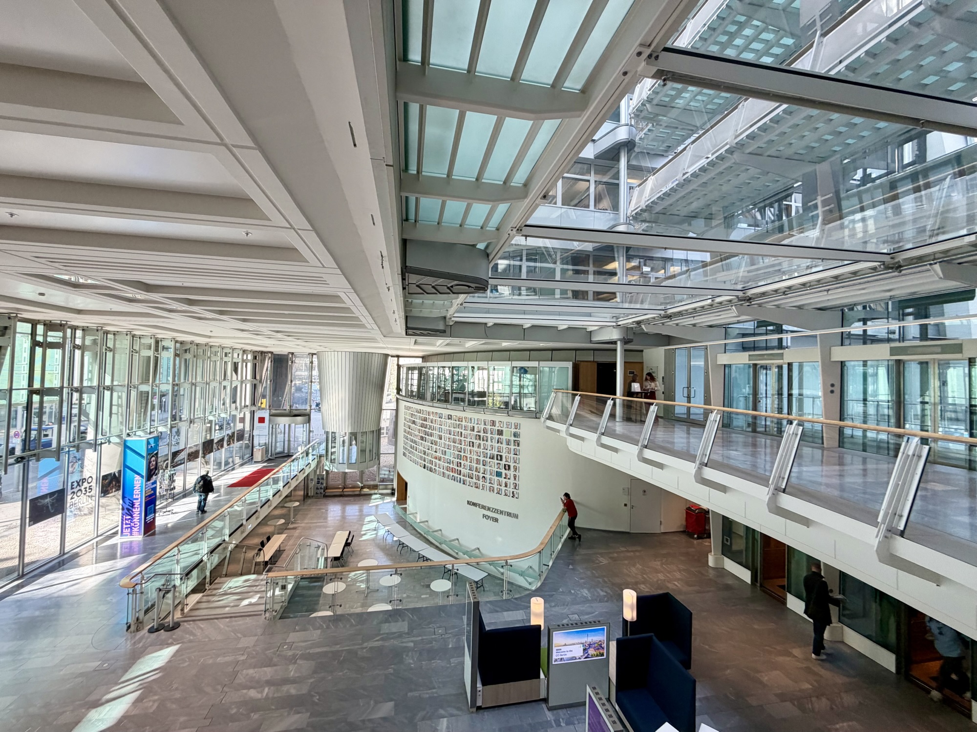
After booking our train tickets, we changed our minds about where to book accommodation. The accommodation we booked was closer to Berlin Hauptbahnhof, the central station, so we decided to stay on board one additional stop.Berlin Hauptbahnhof is the largest and most modern interchange station in Europe. It serves over 300,000 passengers daily. It connects high speed (ICE) trains, regional services, the S-Bahn (somewhat equivalent to Ontario GO Train, but much better) and u-Bahn (the subway) , as well as local trams. It opened in 2006 and has elevated platforms on the top level, underground platforms on the bottom level, and three levels of shopping and restaurants in between. I flipped the first image, taken from inside the station, so the words aren’t viewed from the back, as they actually are from inside the station.
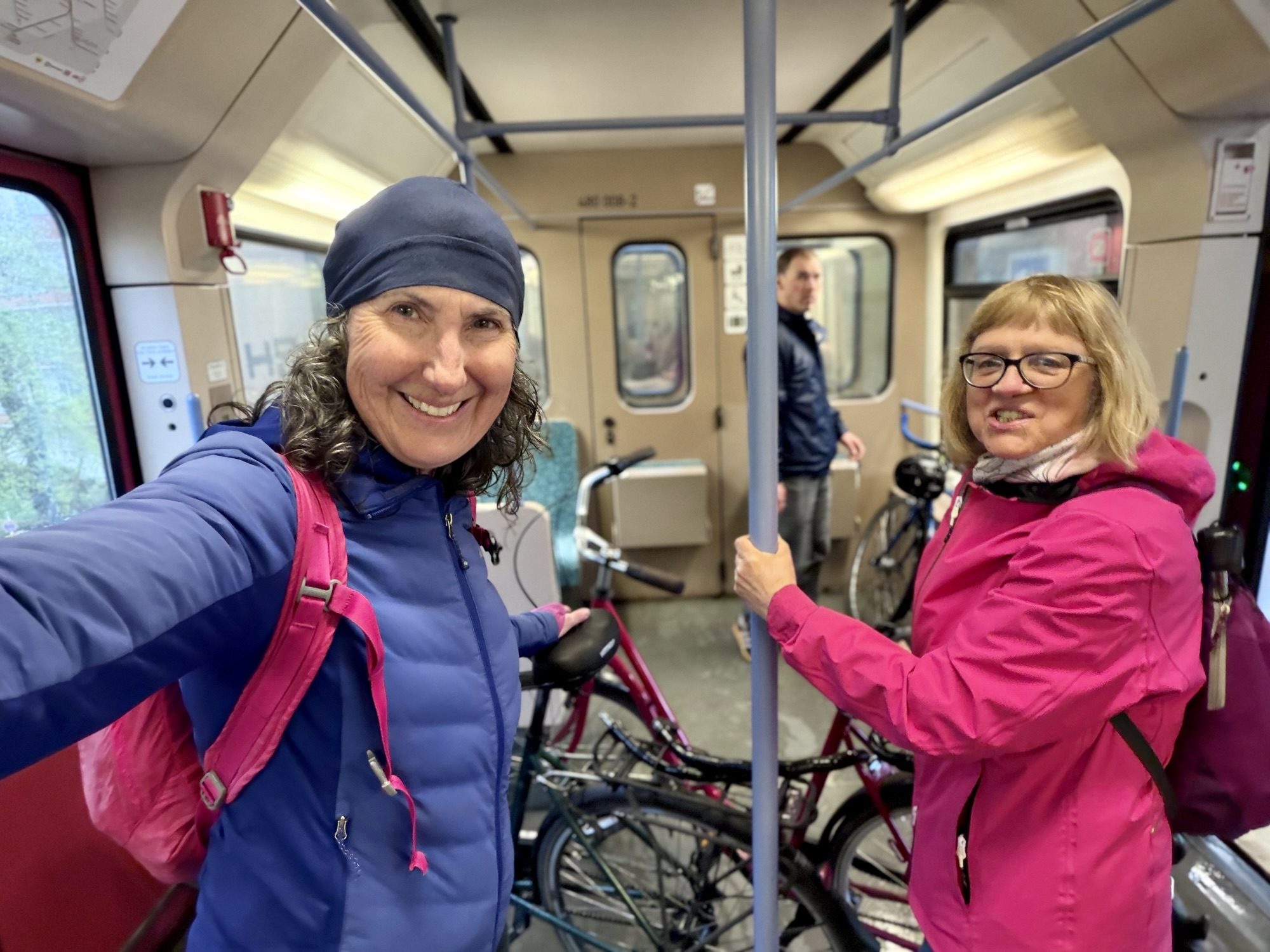
We transferred from the intercity train to s-Bahn and travel a few stops. Then we had a 700 m walk to our accommodation.
We were staying at a small guest house of about a dozen rooms in a larger residential building. Once we settled into the room, I tried to set up an account on one of the city’s bike share apps. I was unable to do so because for some reason unknownst to me, the verification text wouldn’t come to my phone.
When I was in Bratislava three years ago, I had a local SIM card and no access to my phone number tied to my credit card account without swapping the SIM cards, which meant that I was unable to sign up for bike share there. Fortunately, Michael had a phone with dual SIM card slots and had access to both his home and local numbers, so he was able to do it for me.
I thought I wouldn’t have trouble this time, because I had international roaming on my home number. And the bike share app asked me to use a drop-down menu to choose the country code for my phone number, but it wouldn’t work. I tried a second bike share company and app with the same result. So we decided to just do a walk of the things we wanted to visit in the area in which we were staying.
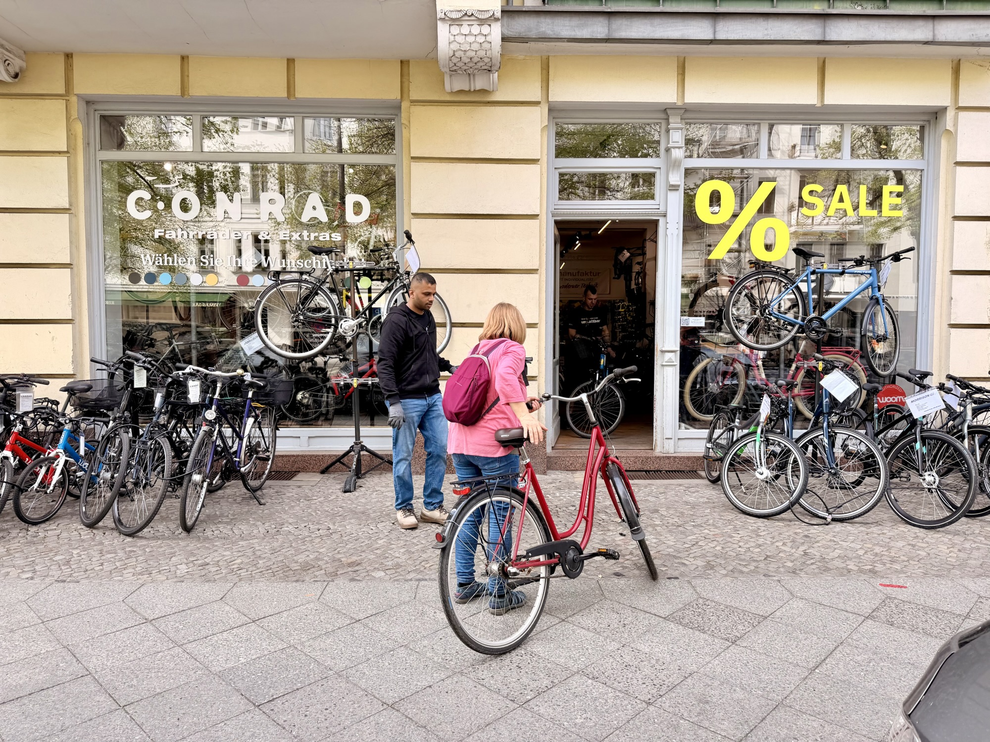
About 700 m from the guest house we came across a bike shop. I suggested we go in and ask if they had rental bikes. They did, and they were willing to rent them to us for three days for €10 a day each. That was quite a deal so that’s what we did. We rode them back to the hotel so that I could get my handlebar phone holder and helmet.
Then it was time to have a coffee.
Our first stop was the home of one of Alina’s high school friends who she saw when we were Wroclaw. This is why we chose to have our accommodation in this area rather than near Berlin Ostbahnhof, but unfortunately she was out of town during our stay. On the other hand, we discovered a couple days later that this area of the city was a more desirable area to stay than where we had originally planned.
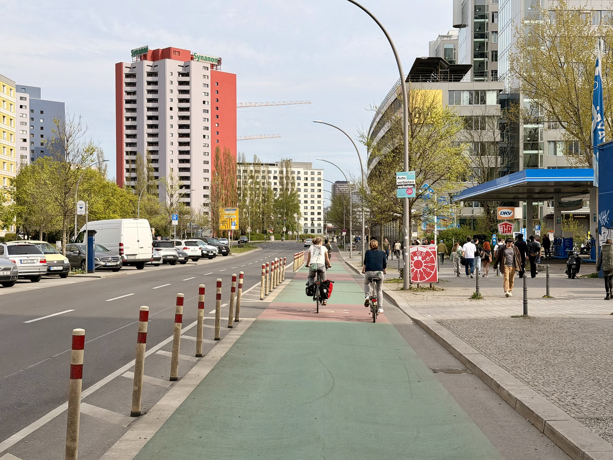
Berlin’s cycling infrastructure was not as good Amsterdam or Wroclaw but there was still quite a bit. A lot of bike claims were like this, painted, but in the door zone of parked cars.
I kept seeing these pipes, in pink or blue around the city and wondered what they are. I googled it when I got back to the guest house and found out that they are temporary drainage systems. They pump ground water away from Active construction sites and channel it to nearby canals and rivers. This is needed because Berlin is built on Marie lounge and sand with a very high water table. Whenever developers dig for new foundations, the trenches immediately flood with groundwater. This means that water must be constantly pumped out to keep building sites dry. The pipes act as temporary above ground. Rerouting of the water away from construction sites.
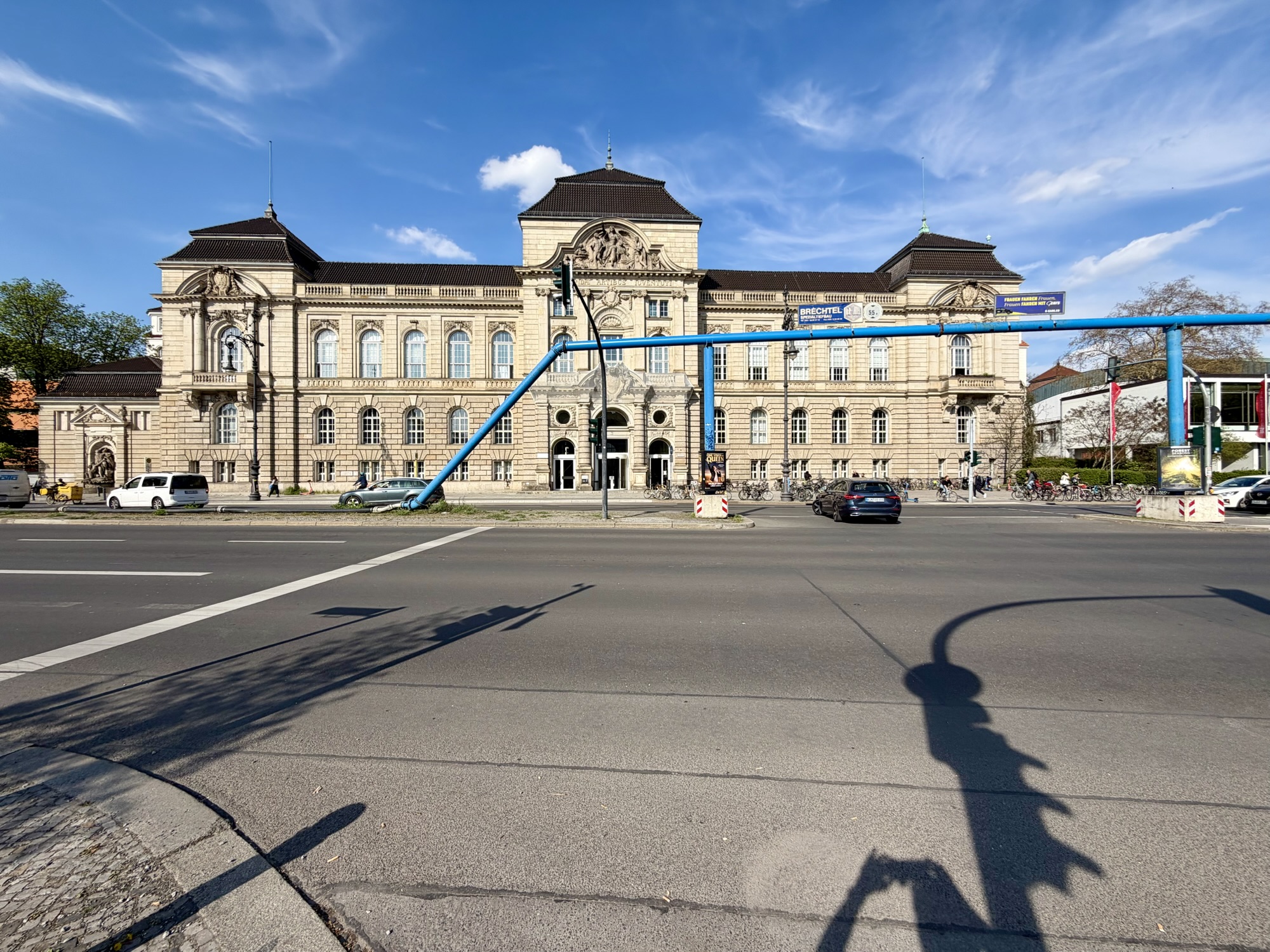
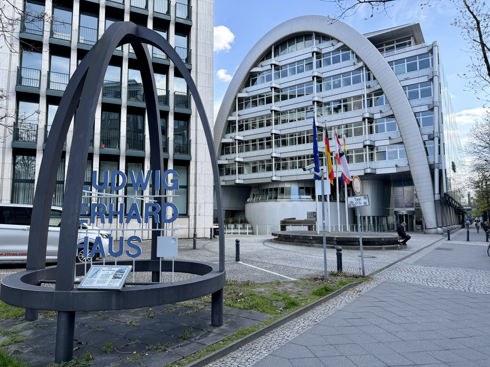
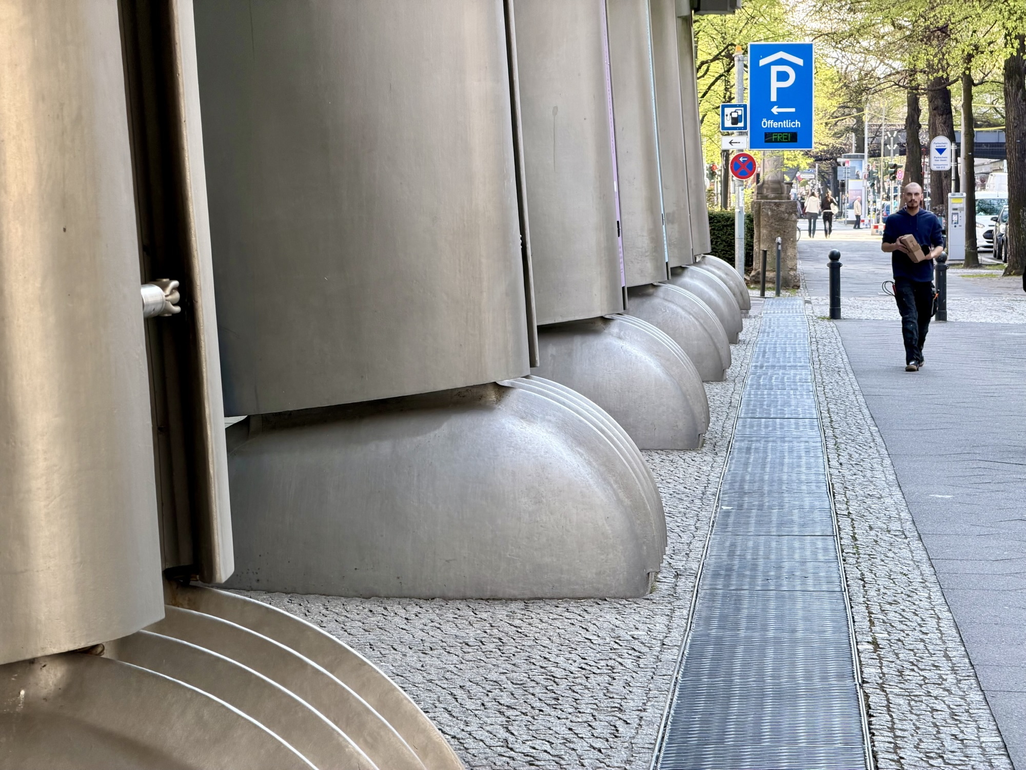
As with the other places I visited on this trip I had a Google Maps list of places that I wanted to visit in Berlin. One of the places was Ludwig Erhard Haus for its interesting architecture. I hadn’t specifically planned to see it today, but I recognized it as we cycled past so we stopped. The steel arches have supports that look like paws – they were cast to look organic and kinetic—acting like the paws or joints of a mechanical beast rooted to the pavement. It is an iconic, futuristic office and conference building built in 1998. Its nickname is the armadillo because of its shape. It was designed by British architect Nicholas Grimshaw.The nine stories of the building are suspended from the steel arches, allowing the first floor to have no supports. Ludwig Erhard was the second chancellor of West Germany, from 1963 to 1966. The building belongs to the Berlin Chamber of Industry and Commerce.
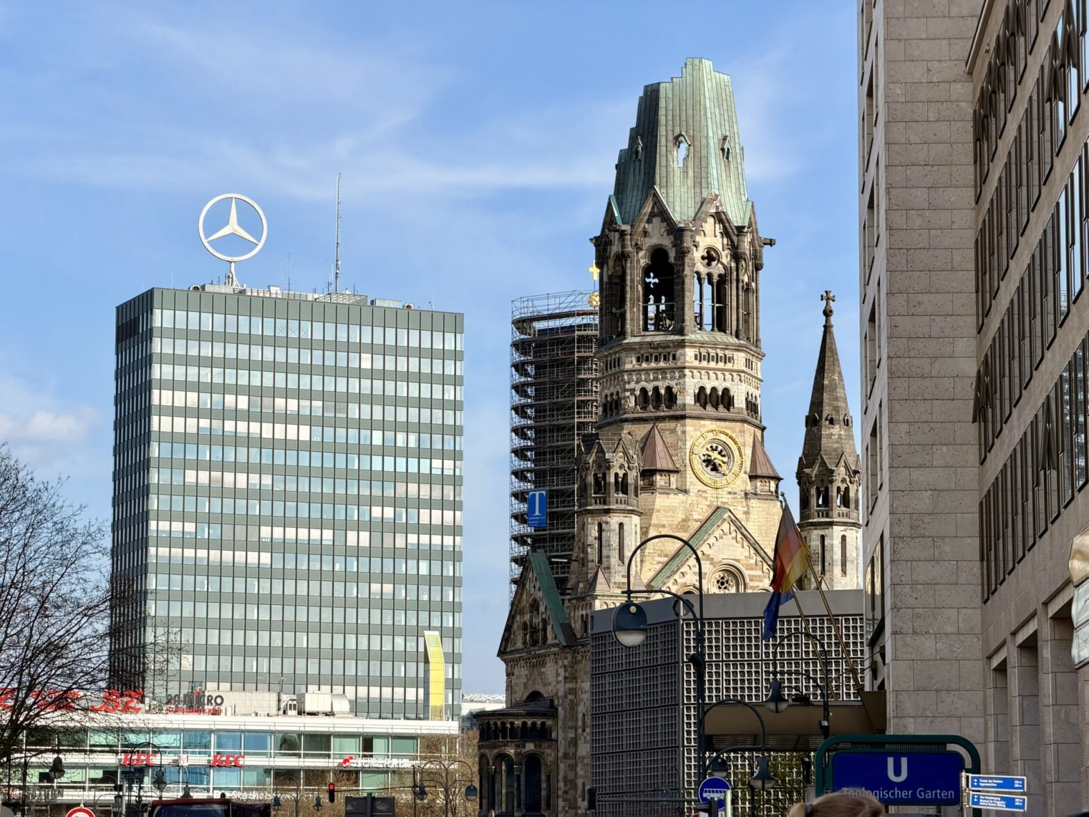
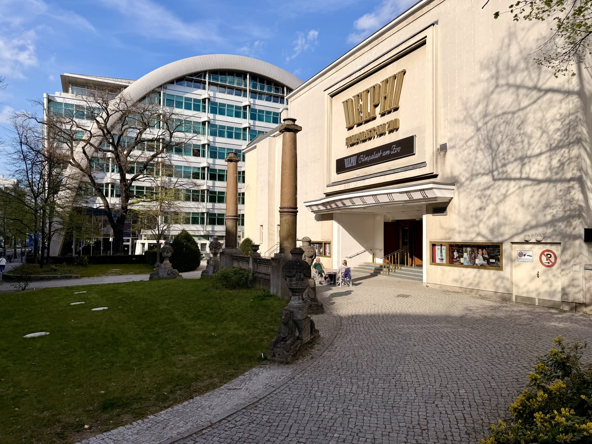
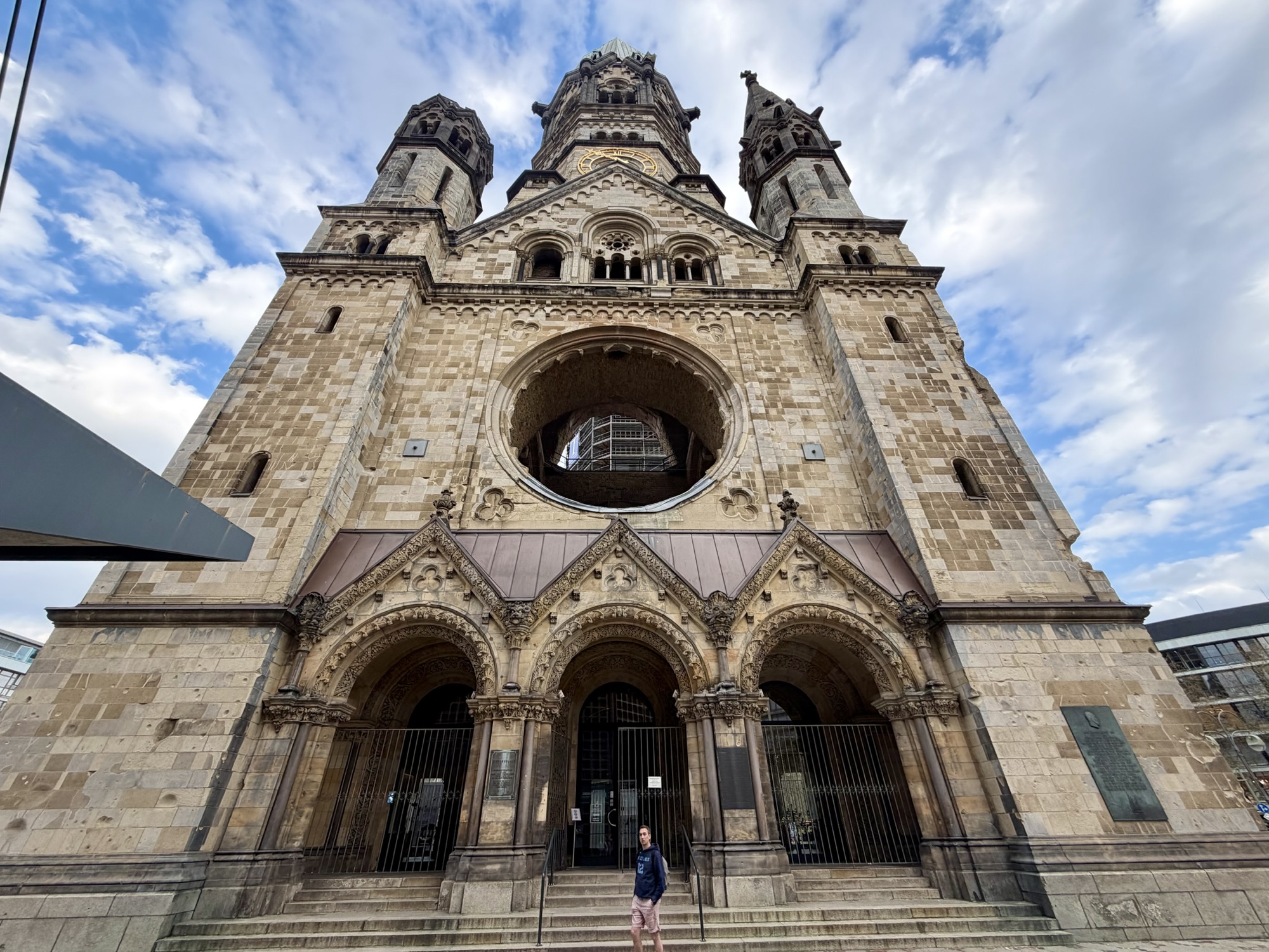
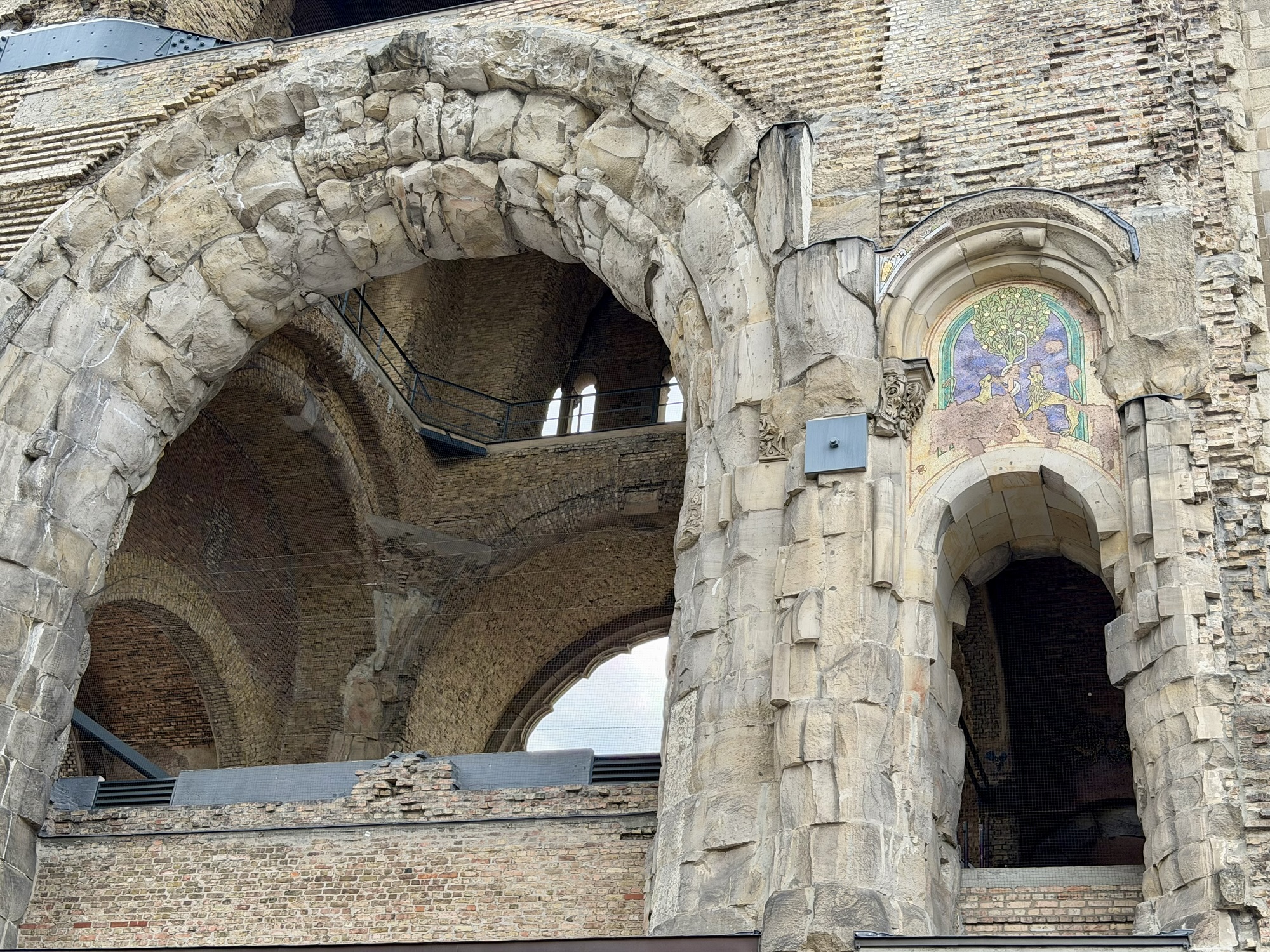
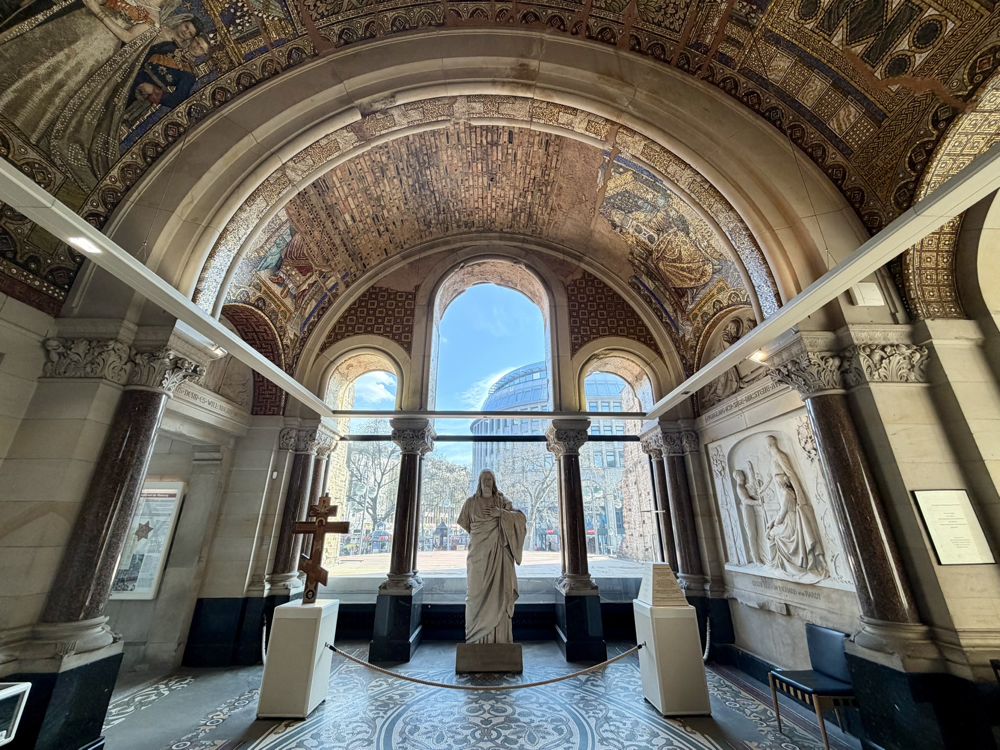
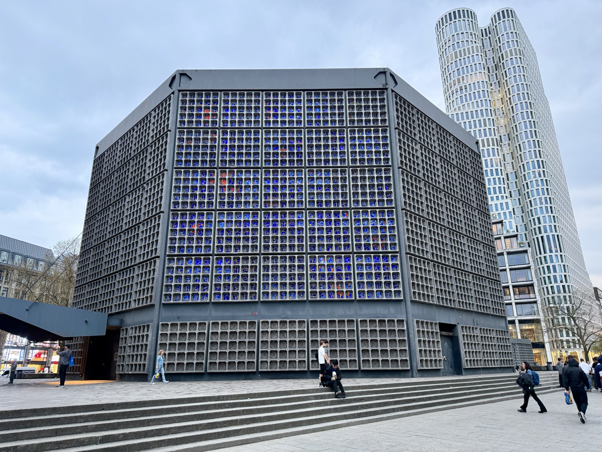
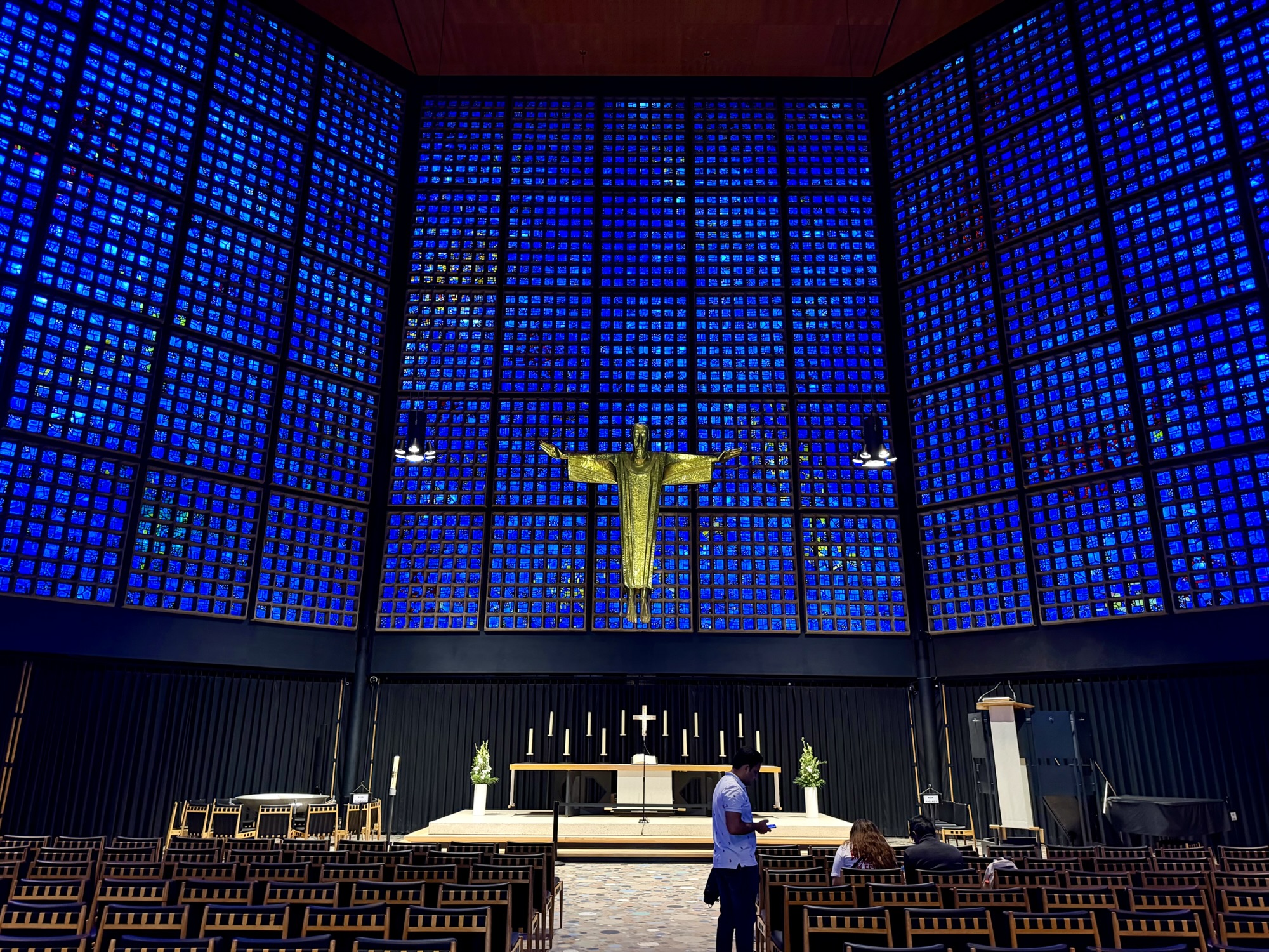
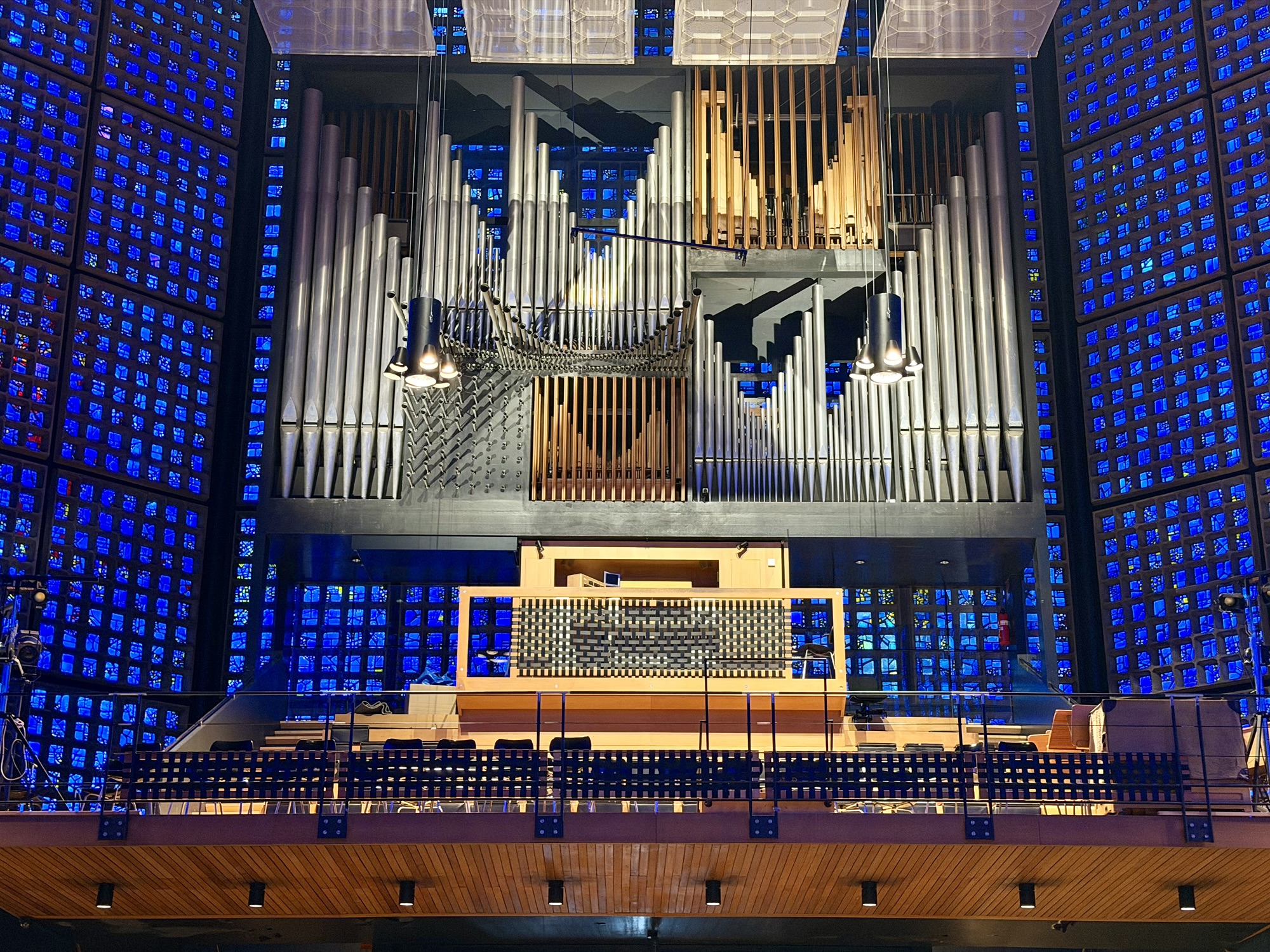
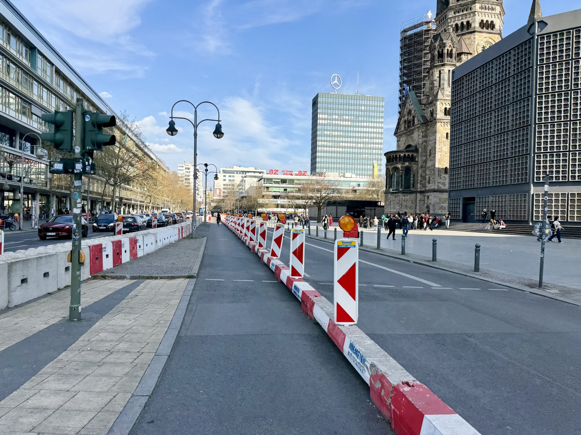
Kaiser Wilhelm Memorial Church has been converted into a war memorial. The original West tower was partially destroyed during bombing by Allied forces in 1943. It was intentionally not completely rebuilt so that its ruin could serve as a memorial against war and destruction.
In 1957, the architect Egon Eiermann, won a competition with his design, which proposed demolishing the old building and building a new one. However, it was decided to preserve the partially destroyed church tower. It was joined by a four part grouping of modern buildings, including an octagonal nave, hexagonal bell tower (which is currently covered in scaffolding), a square chapel, and a foyer.
There is an annual Christmas market that takes place around the church. In December 2016 there was an Islamist terrorist attack which involved driving a tractor trailer into market goers. 11 people died in the attack and another 55 were injured. Today, the streets around the church have ugly, antiterrorist bollards and ramps. In Toronto in 2018 there was a vehicle ramming attack in North York that killed 11 and injured 15. Following that attack Toronto erected Jersey walls around various places where there are lots of pedestrians, including Union Station. I’ve always thought it was “very Toronto” that those Jersey walls haven’t been replaced with something more attractive, that also provide security, but the structure erected for this earlier attack in Berlin is even uglier.
They were quite a few pieces of public art, and a beautiful utility cover in the square near the church. The circular mosaic floors were inside and outside the new building buildings.
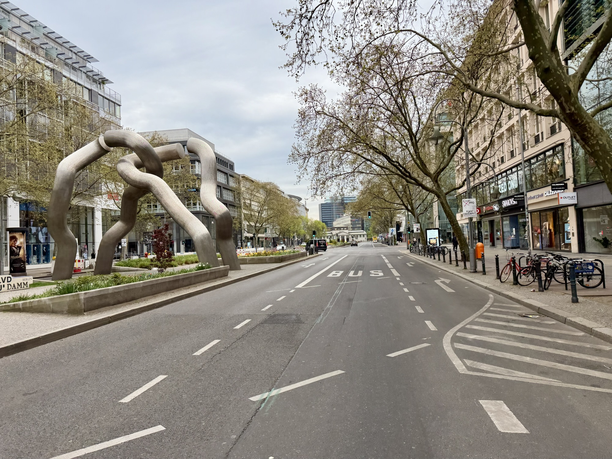
The Kurfürstendamm is a popular promenade and shopping area and features this sculpture simply called Berlin, but known locally as “ Dancing Spaghetti“. The sculpture by Brigitte Matschinsky-Denninghoff and Martin Matschinsky symbolizes the severed physical and emotional connections between east and West Berlin during the Cold War. It was unveiled in 1987.
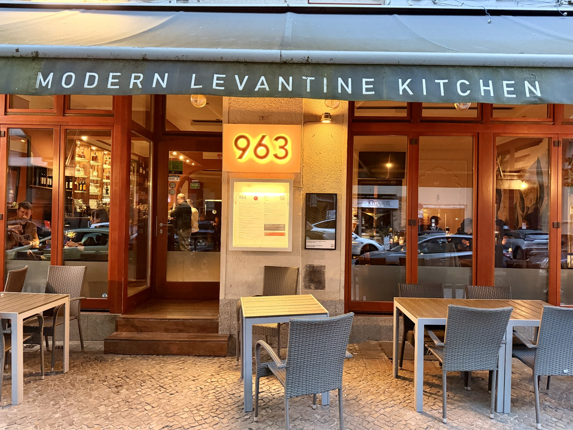
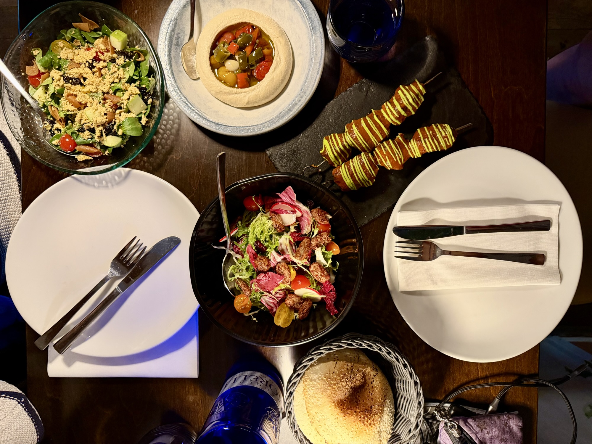
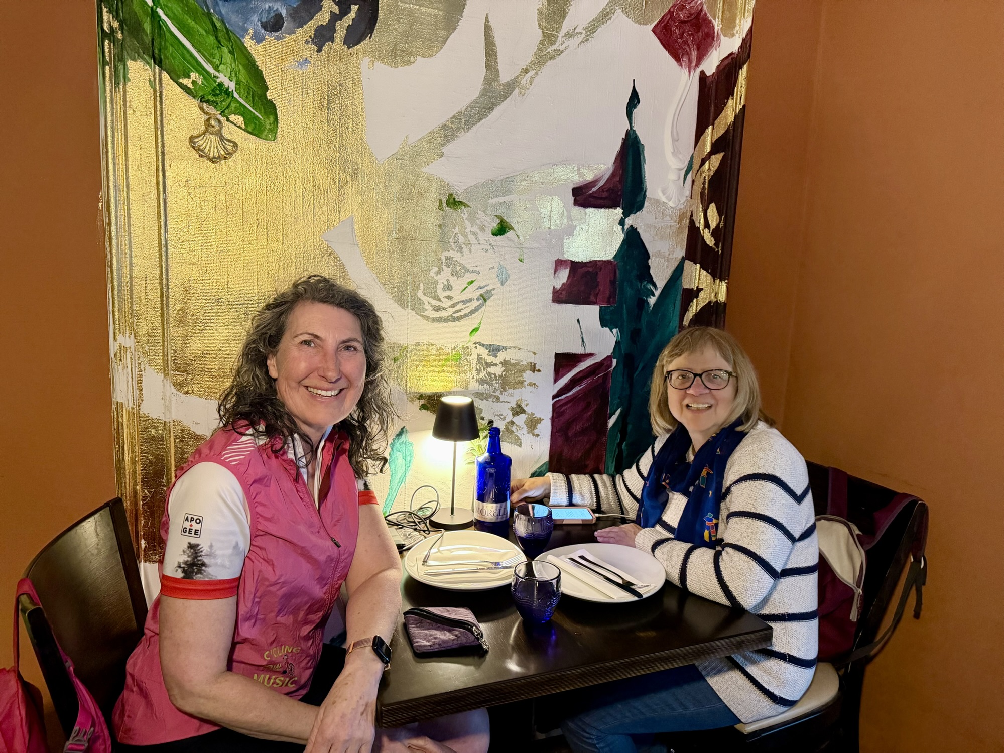
By this time we were starting to get hungry. Our first choice restaurant, a salad place, was closing just as we arrived. We checked the menus at a couple places and chose the Modern Levantine Kitchen. The prices on the menu looked quite a bit better than the other places we considered. However, it turned out the portions were very small. However, the food was delicious.
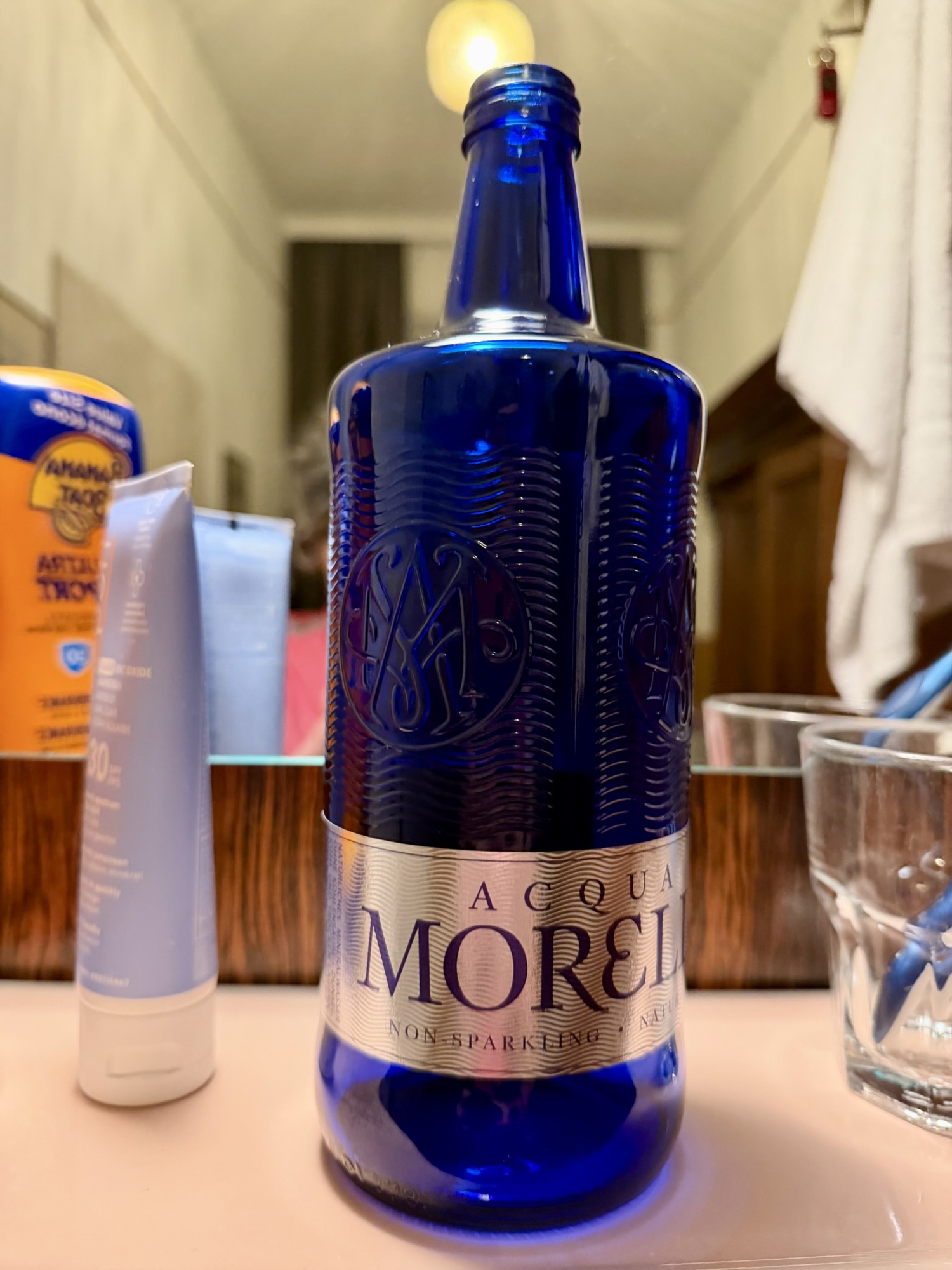
We also accidentally ended up paying for water. Alina asked for water and the waitress asked whether we wanted still or mineral. Alina answered still and the waitress left. I sent to Lina. I think we’re gonna have to pay for that. We should’ve asked for tap water. Alina didn’t think so so we entered into a wager for a euro. In the event, a fancy cobalt blue glass bottle appeared at the table, uncapped, and when the bill was presented, we had been charged €7 for 700 mL of non-sparkling water. I won the wager and we were very careful from then on to order tap water.
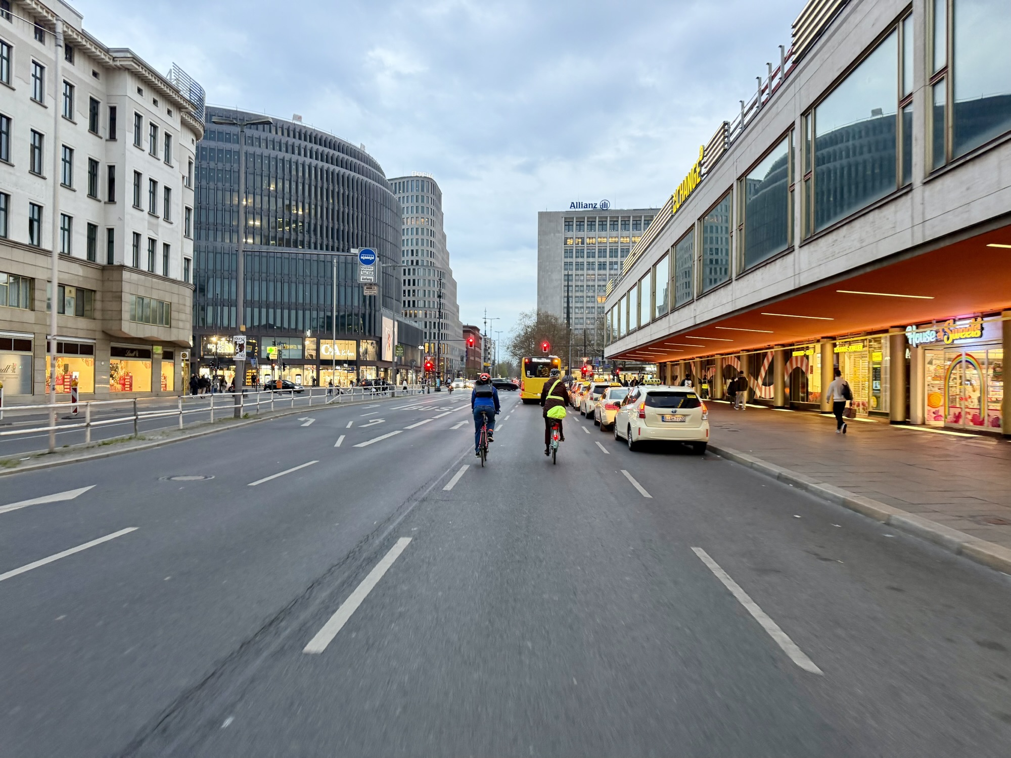
Quite a few arterial streets had no cycling infrastructure at all, but traffic was generally light, and they were still quite a few people riding. On streets with lanes reserved for busses, cyclists shared that lane. However, my observation was that most of those riding were the “Strong and Fearless” type of cyclists. Roger Geller, from the Portland Department of Transportation defined four types of cyclists:
Strong and the Fearless
Enthused and Confident
Interested but concerned
No way, no how
This first page of the report had this quotation: “Riding a bicycle should not require bravery. Yet, all too often, that is the perception among cyclists and non-cyclists alike.” To a great extent it requires bravery to ride a bike in Brampton, and Berlin had a similar feel.
There was a beautiful sunset as we arrived back at our guest house which had a peaceful courtyard where we locked up our bikes for the night.
Since we paid so much for the water, I brought the bottle back with me as a souvenir.
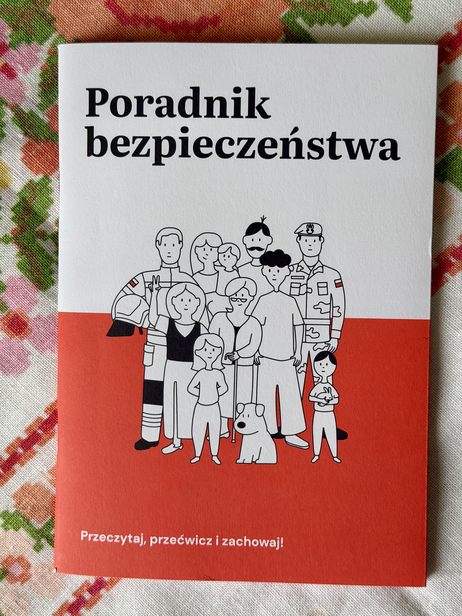
Poland has sent 17 million households a survival guide due to growing concerns over Russian threats and drones. Alina received hers this morning. There is an English version of the Polish survival guide published online. It covers topics such as preparation, evacuation, chemical biological, radiological, and nuclear threats.
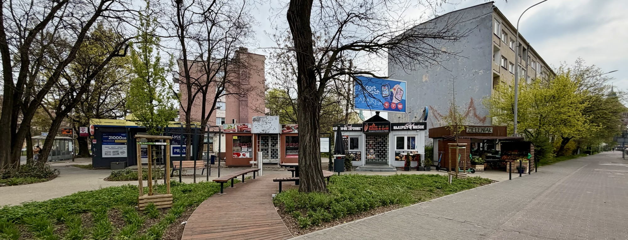
I was sightseeing on my own for the day because unfortunately Alina had to stay home for two different repair people to come to her apartment. Here’s another example of businesses in containers on corners.. This one’s quite nice with seating and gardens.
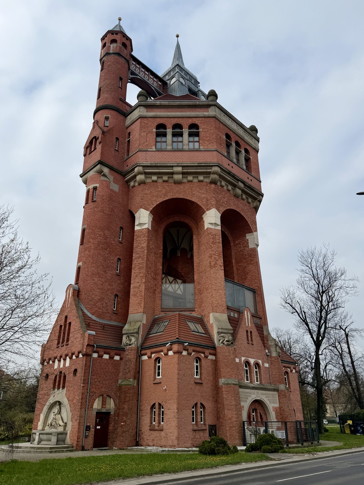
This is a water tower built from 1904 to 1905. It was designed by Karl Klimm. It is 63 m high and has an observation platform, but unfortunately there is currently no public access.
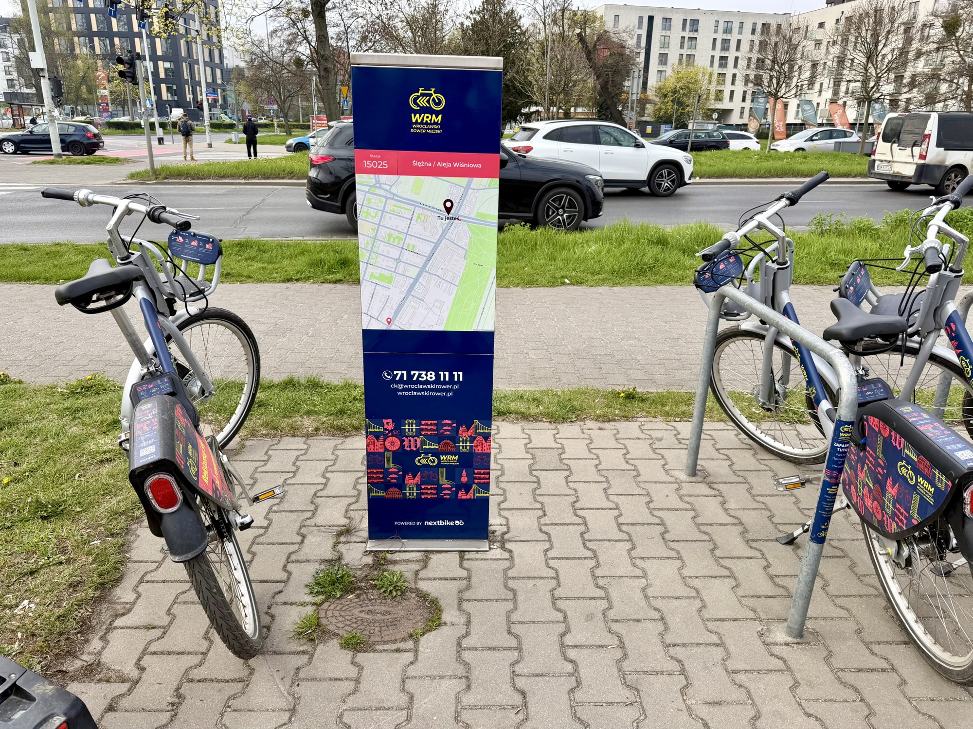
Wroclaw has a bike share system – Wrocławski Rower Miejski. They have standard bikes, E bikes, tandem and cargo bikes, children’s bikes, and hand bikes. The latter two are free to use. It costs 10 Polish zlotys to sign up, which is about four Canadian dollars. The first 20 minutes of each ride is free with increasing amounts for additional time. It is a very economical system.
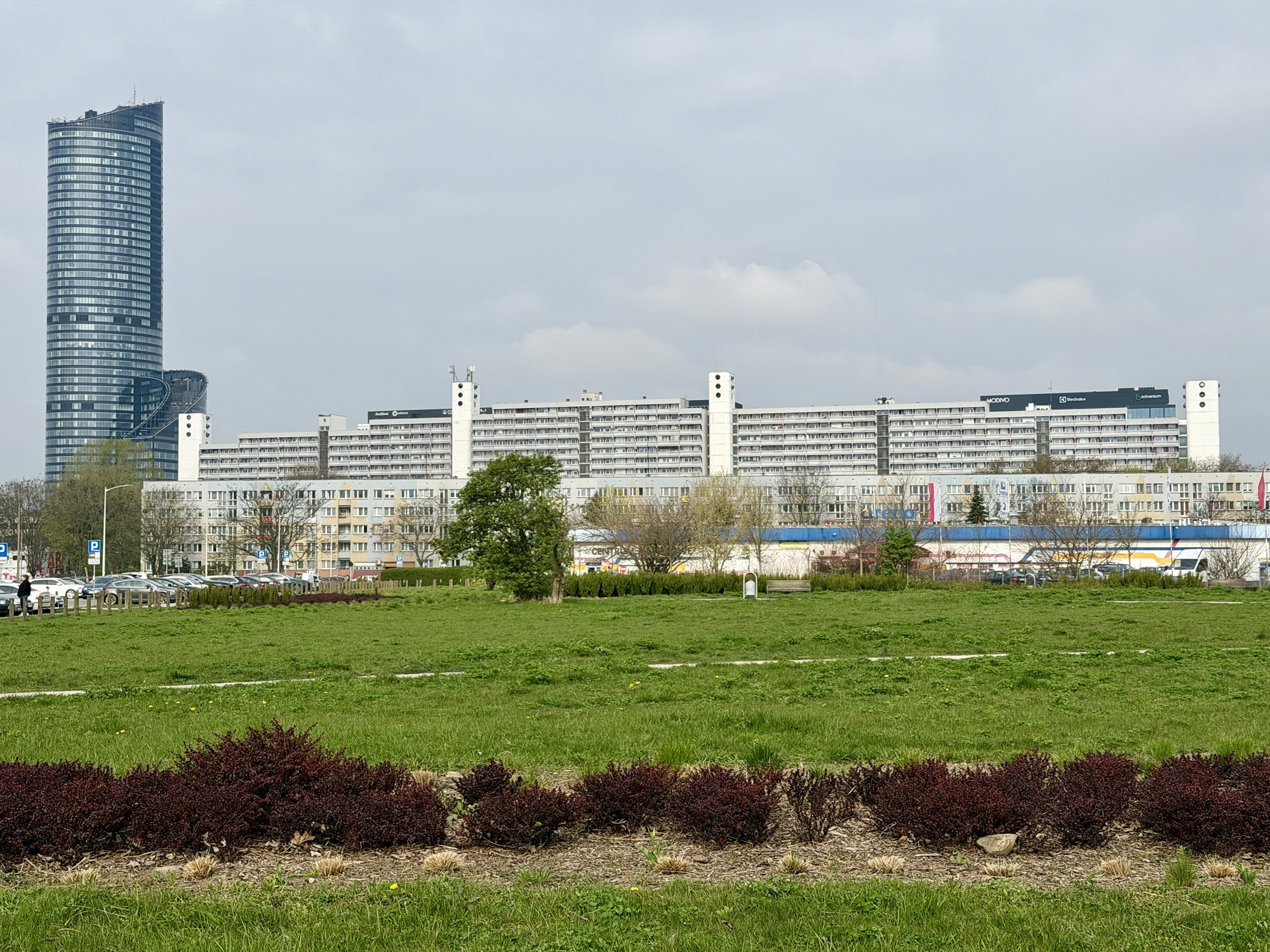
Alina said that when this apartment building was built, it was known as the anthill. The tower on the left side of the image is the tallest tower in Wroclaw, and for a time was the tallest in Poland. It is a residential tower called Sky Tower.
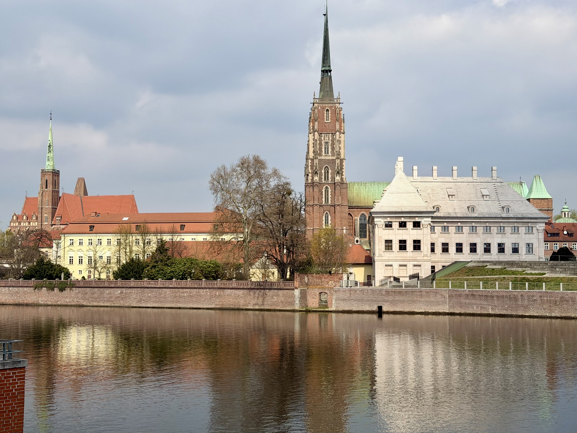
This is the main train station. It was designed by Wilhelm Grapow and constructed from 1855 to 1857.
A lot of the cycling infrastructure is built alongside the trams.
These two buildings, one nicely renovated, and one boarded up, were directly across the street from each other.
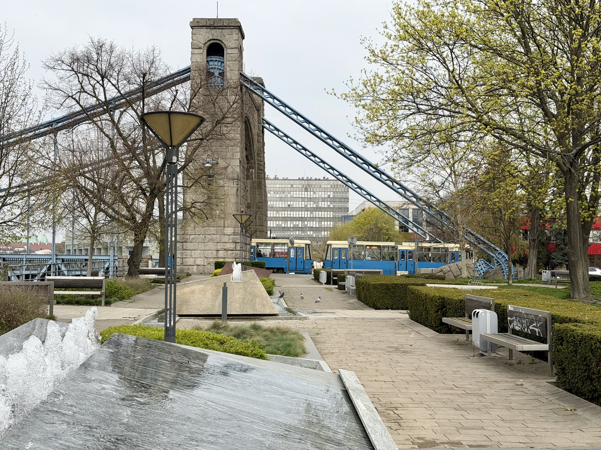
The Wroclaw University of Science and Technology has a cable car – Polinka – launched in 2013, that connects the main university campus with a second campus on the other side of the river Odra. It has just two stations and takes three minutes to cross the river. It replaces a 20 minute walk. Students and staff travel free; others can purchase a ticket. When I saw it, I knew I had to give it a try, so I locked up my bike at the bike rack on the property, and purchased a ticket from the machine. The other place I have been that has a cable car as part of the public transportation system is New York City’s Tramway to Roosevelt Island. I had some trouble purchasing a ticket, accidentally buying bus tickets first, but a student helped me out. I decided to walk back across one of the more than 120 bridges in the city.
Wroclaw is built around the Odra River, which also has several tributaries – Oława River, Ślęza River, Widawa River, Bystrzyca River. This means the city has a lot of bridges.
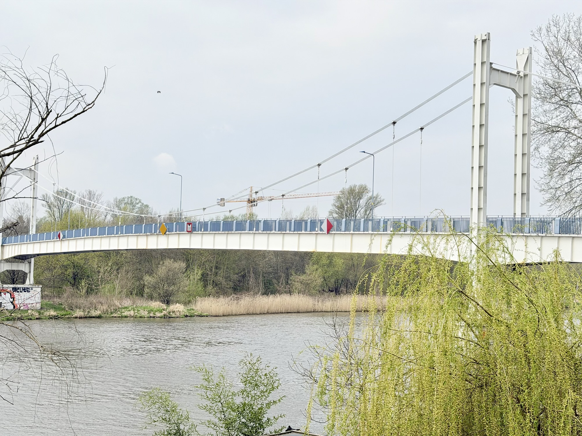
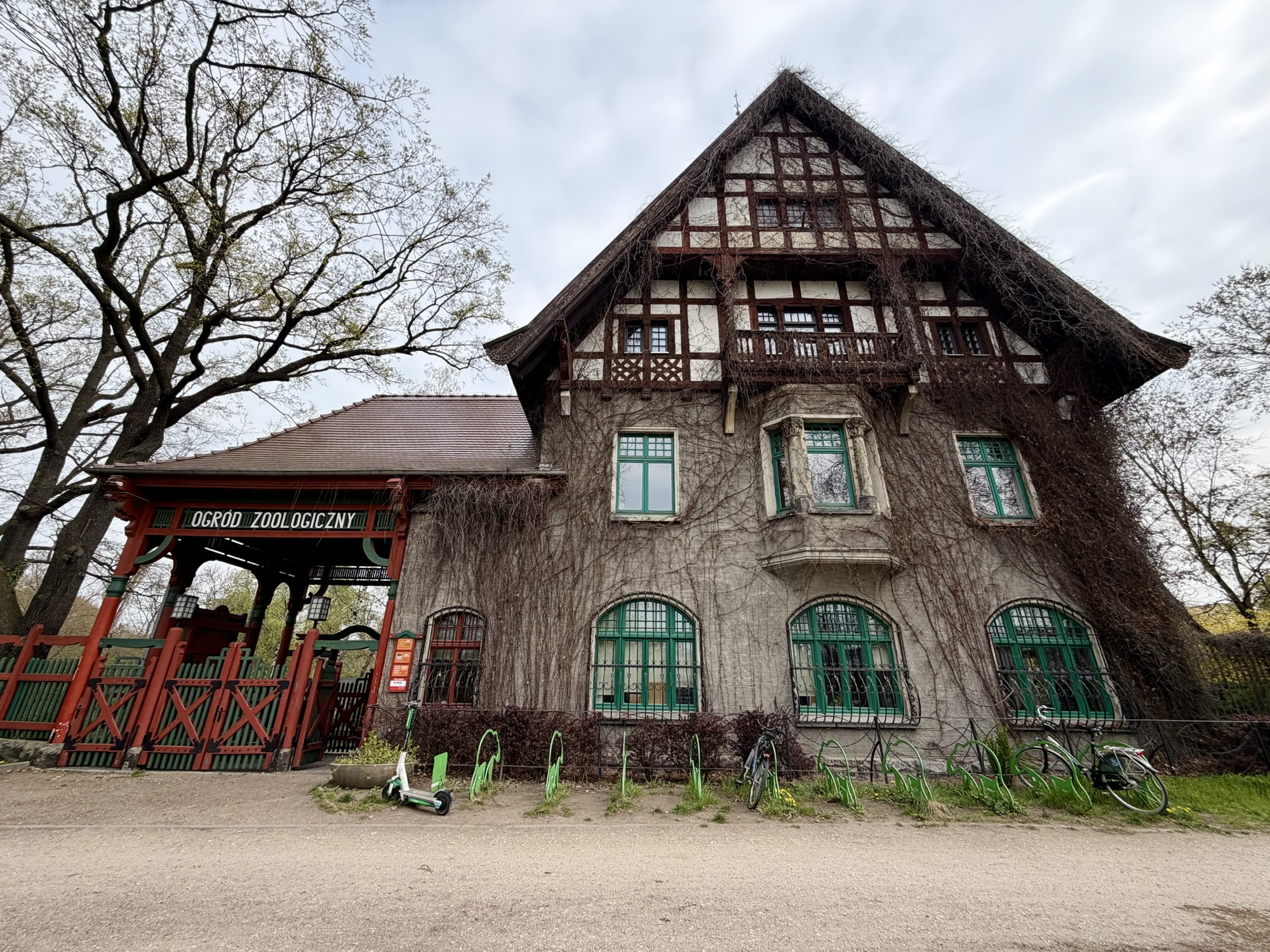
This pedestrian only bridge took me past the zoo.
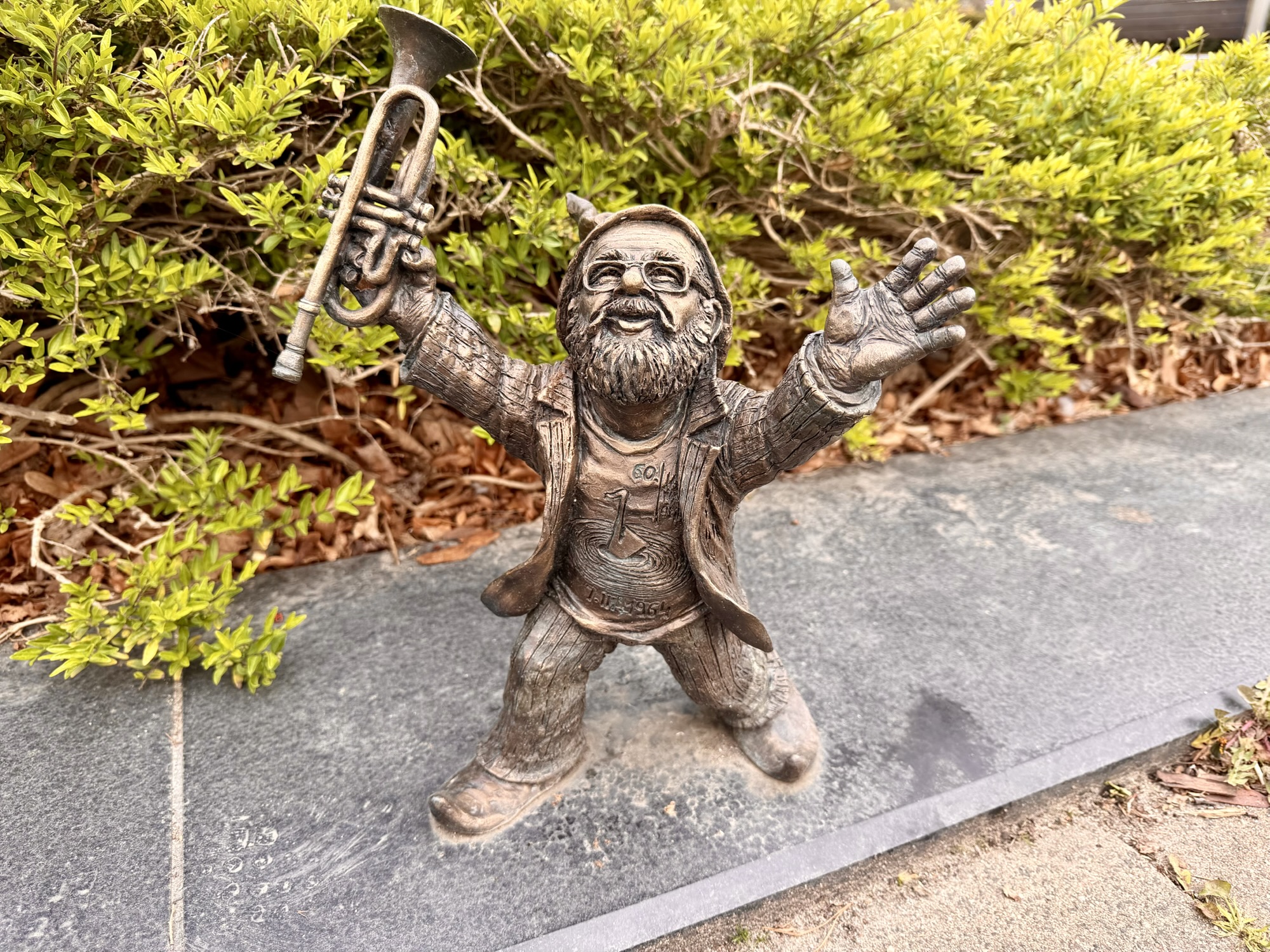
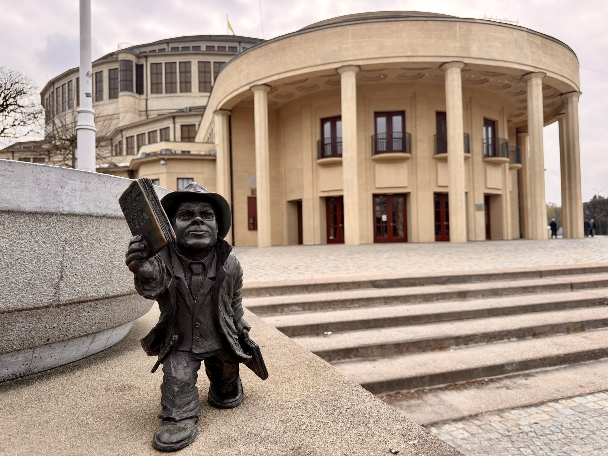
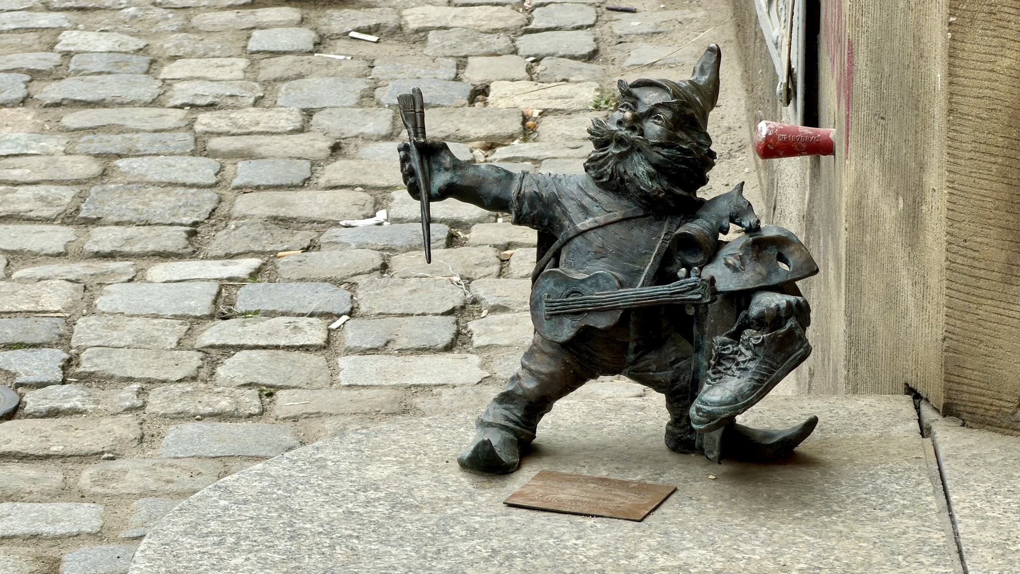
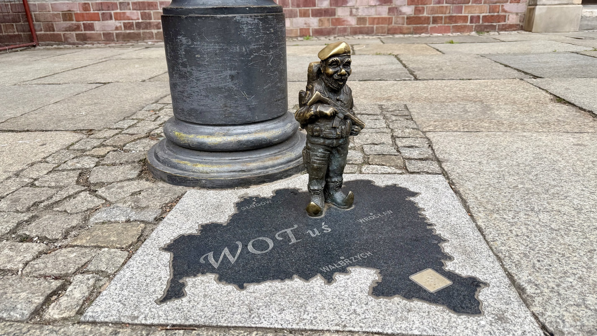
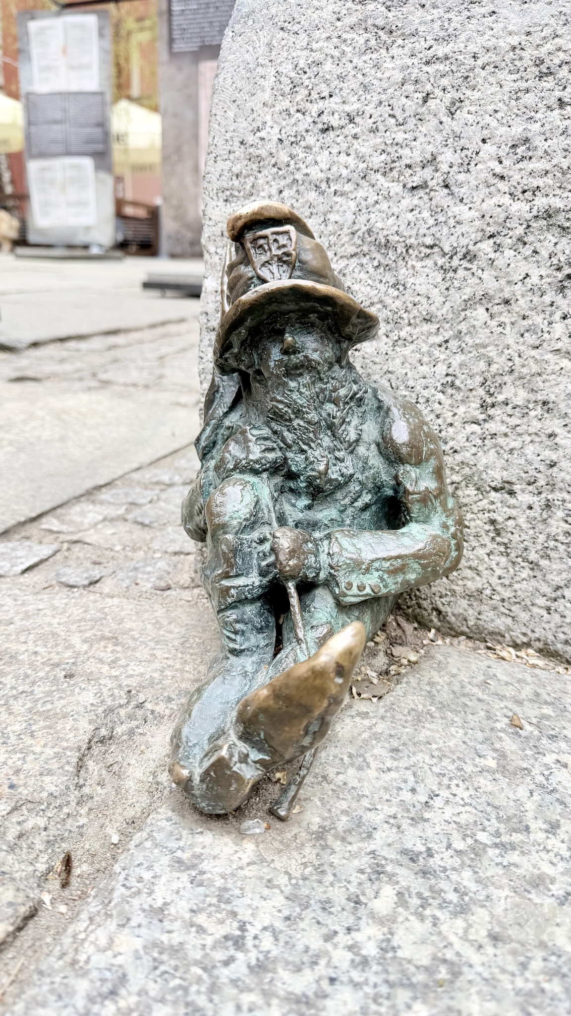
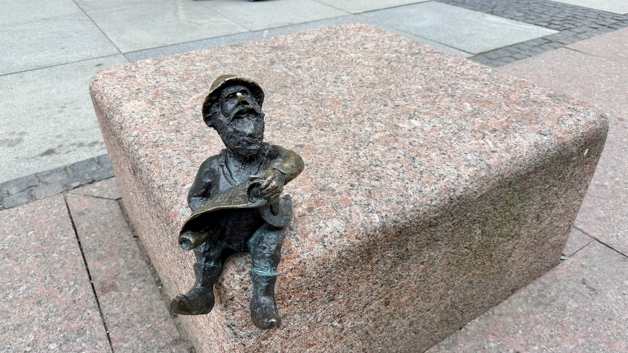
I found a couple more Wroclaw dwarfs.
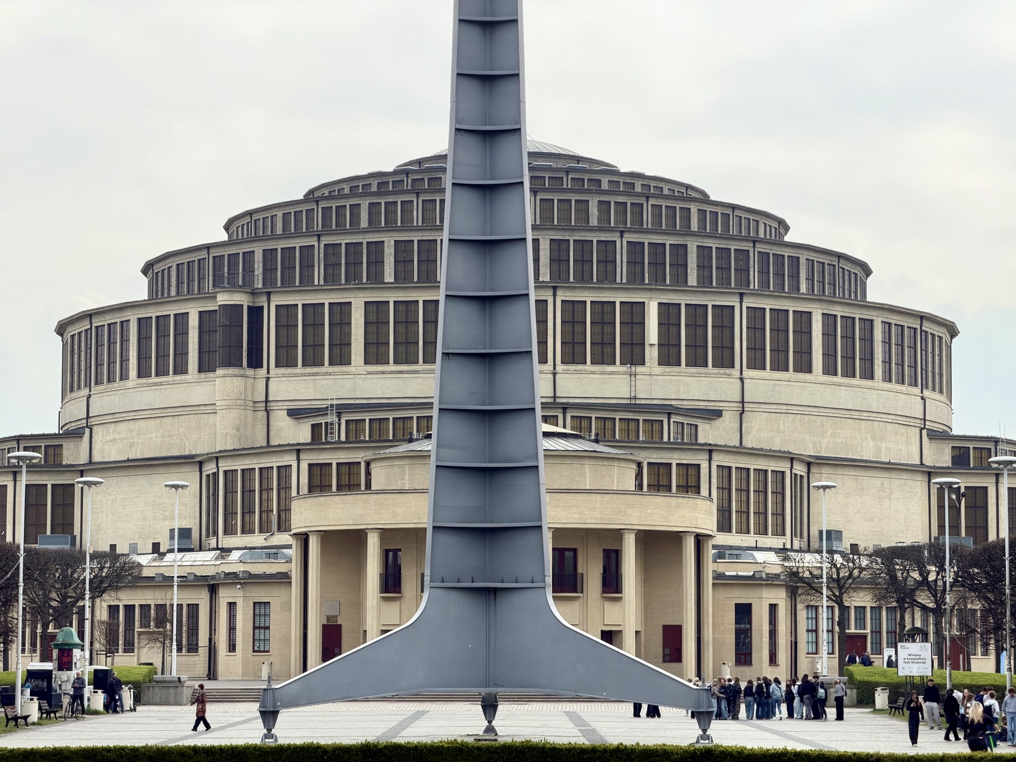
My first planned stop for the day was Centennial Hall (Hala Stulecia). It was built from 1911 to 1913. The architect was Max Berg. At the time it was built it was the world‘s largest reinforced concrete building. It is a UNESCO World Heritage site.
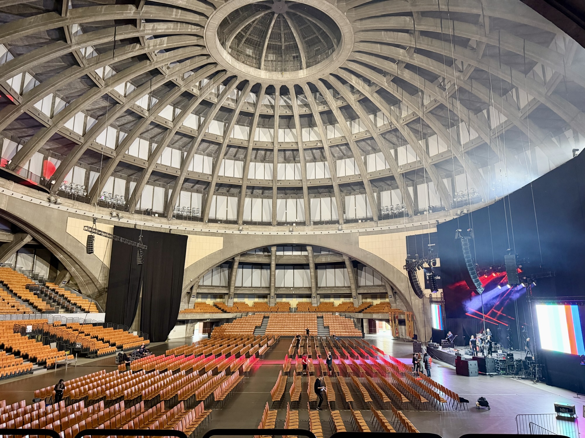
There was an entrance fee to see the hall, which can accommodate 10,000 people. Unfortunately, the blinds were drawn on the ribbons of windows for a concert that evening.
They were preparing for the concert. I used Shazam on my iPhone and it identified the band as HAEVN, a Dutch band, and they were performing a song called Trade it for the Night. The song made a nice background soundtrack to the video I took of the hall.
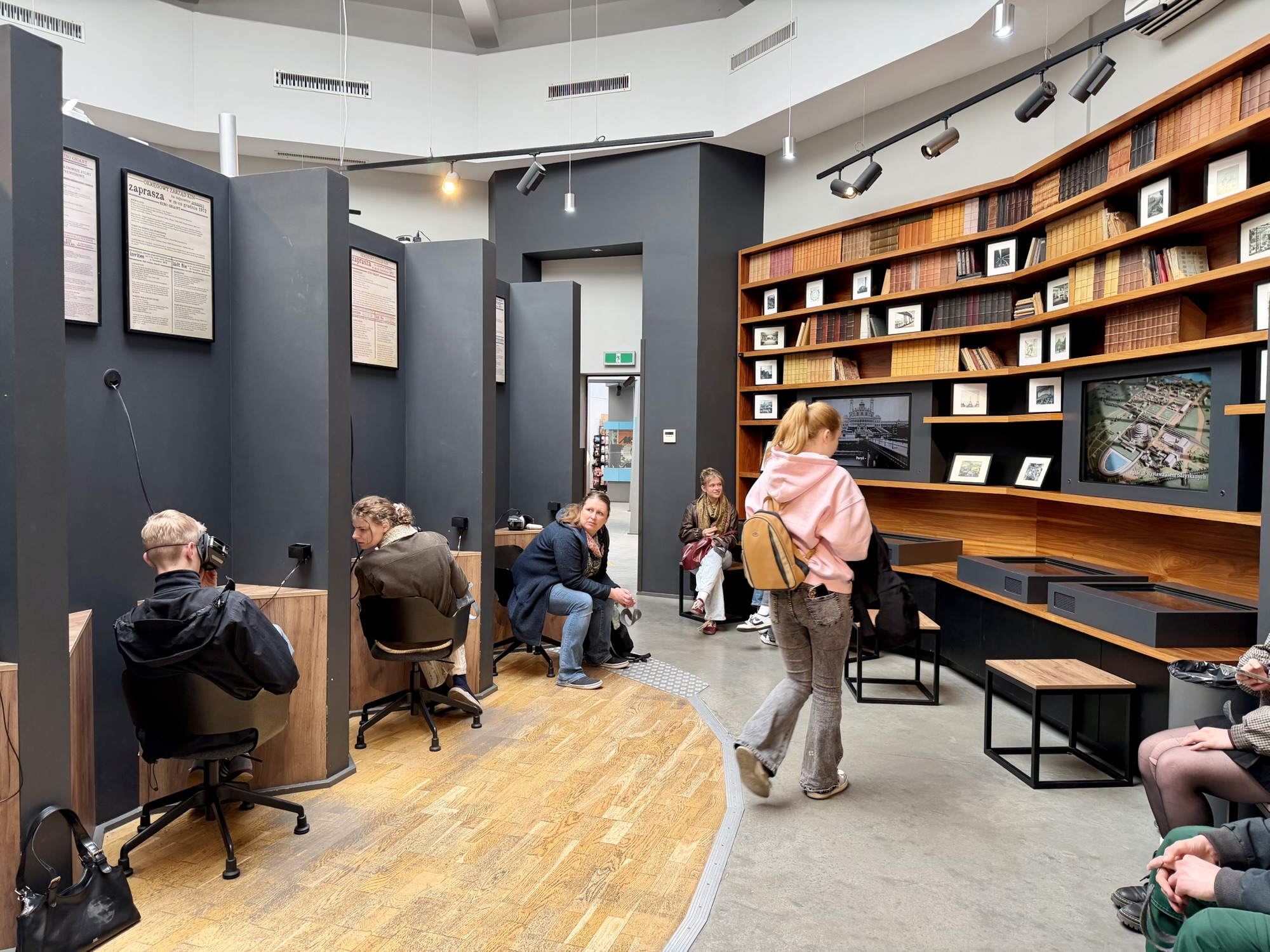
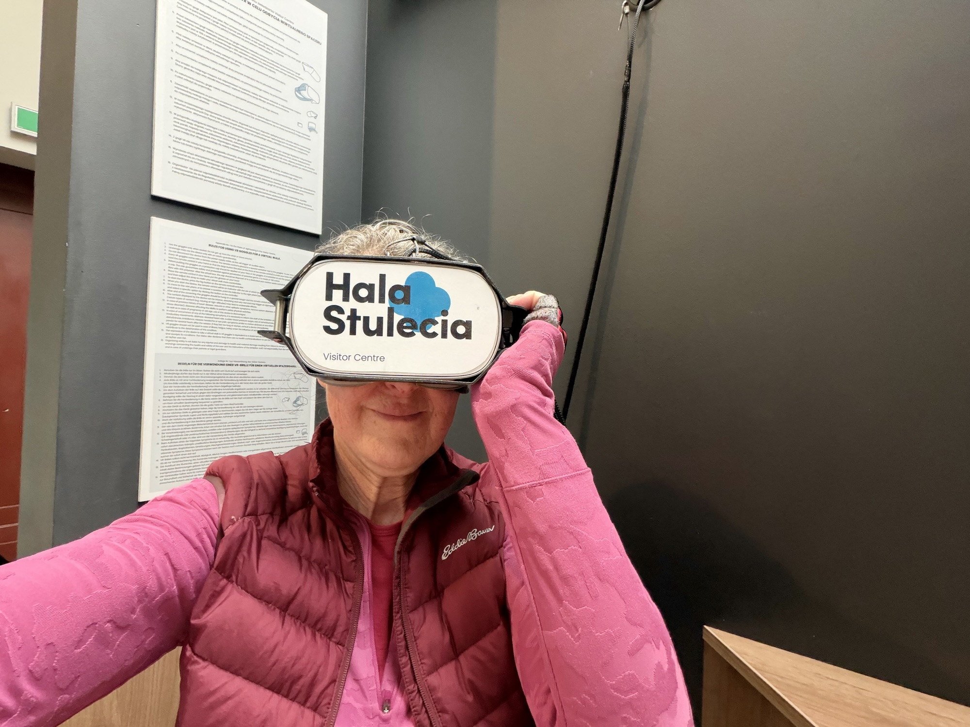
The visitor centre had a virtual reality program which allows one to fly around the complex and look at the hall from a bird’s eye view.
For those of you who enjoy visiting UNESCO World Heritage Sites and and would like to keep track of the ones you visit, there is an UNESCO World Heritage Sites app for that. If you allow it to access your location when you’re using the app, it will show you which sites are close to your location.
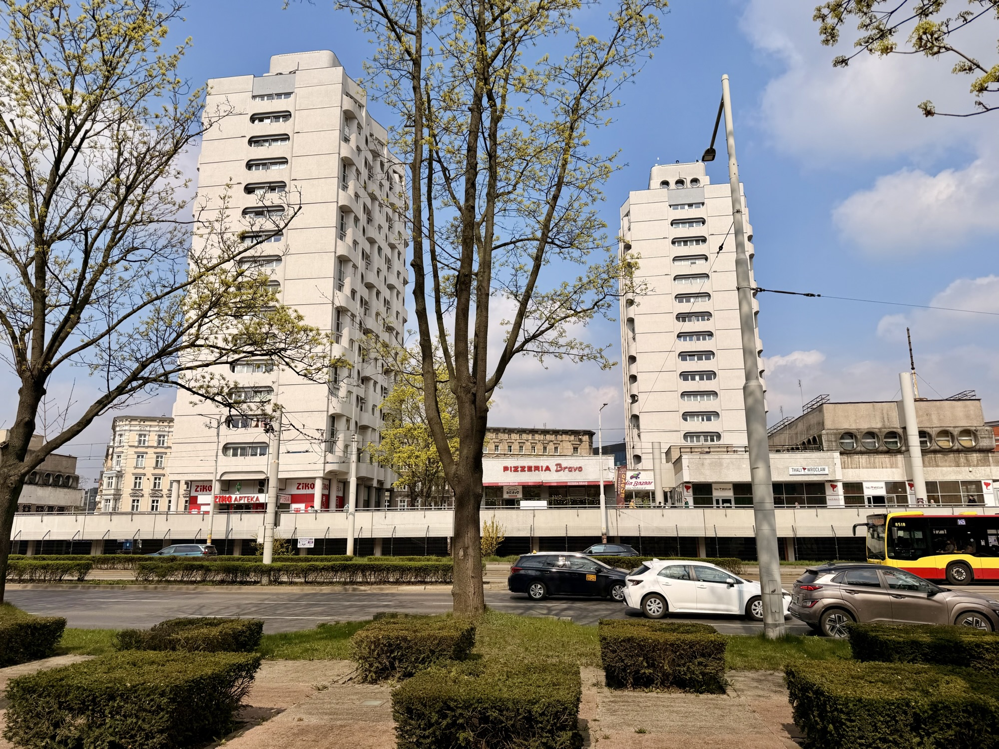
My next stop was the architecture museum. My route took me over another bridge and through an underpass to bypass a busy road past these interesting apartment buildings. There are six of these towers and they are known as Wrocławski Manhattan. They were built between 1967 and 1970. The six towers sit on a podium that contains shops and restaurants.
There were beautiful reflections in the river.
I saw a number of these realistic street art pieces around the city.
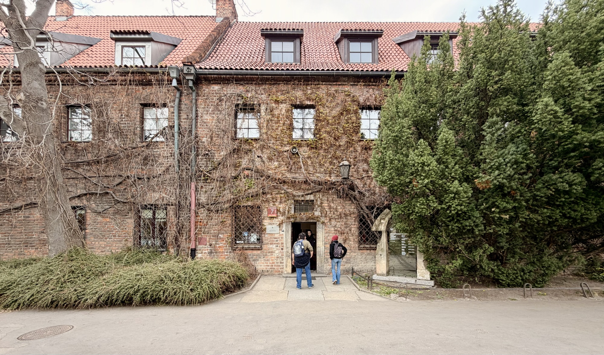
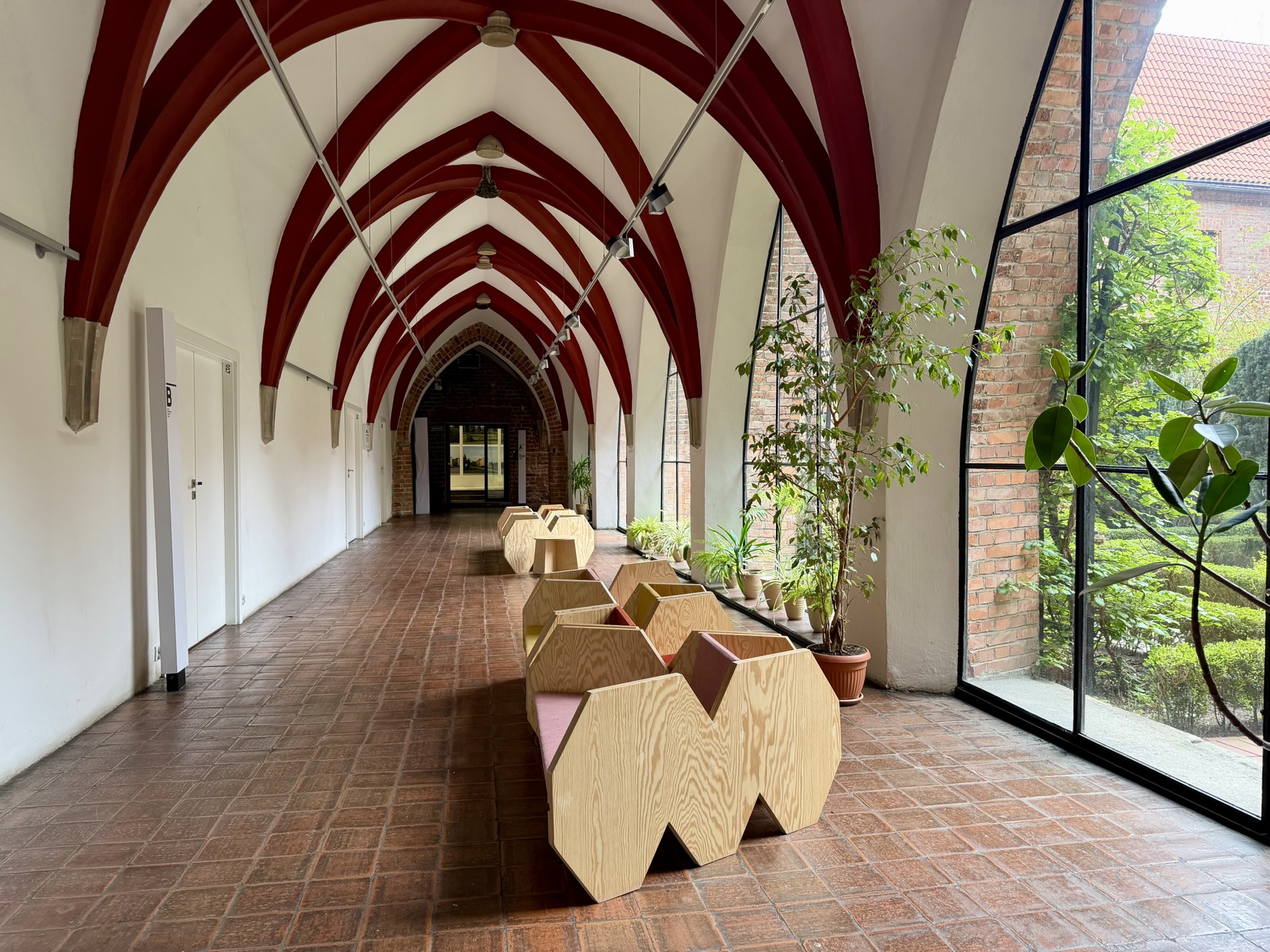
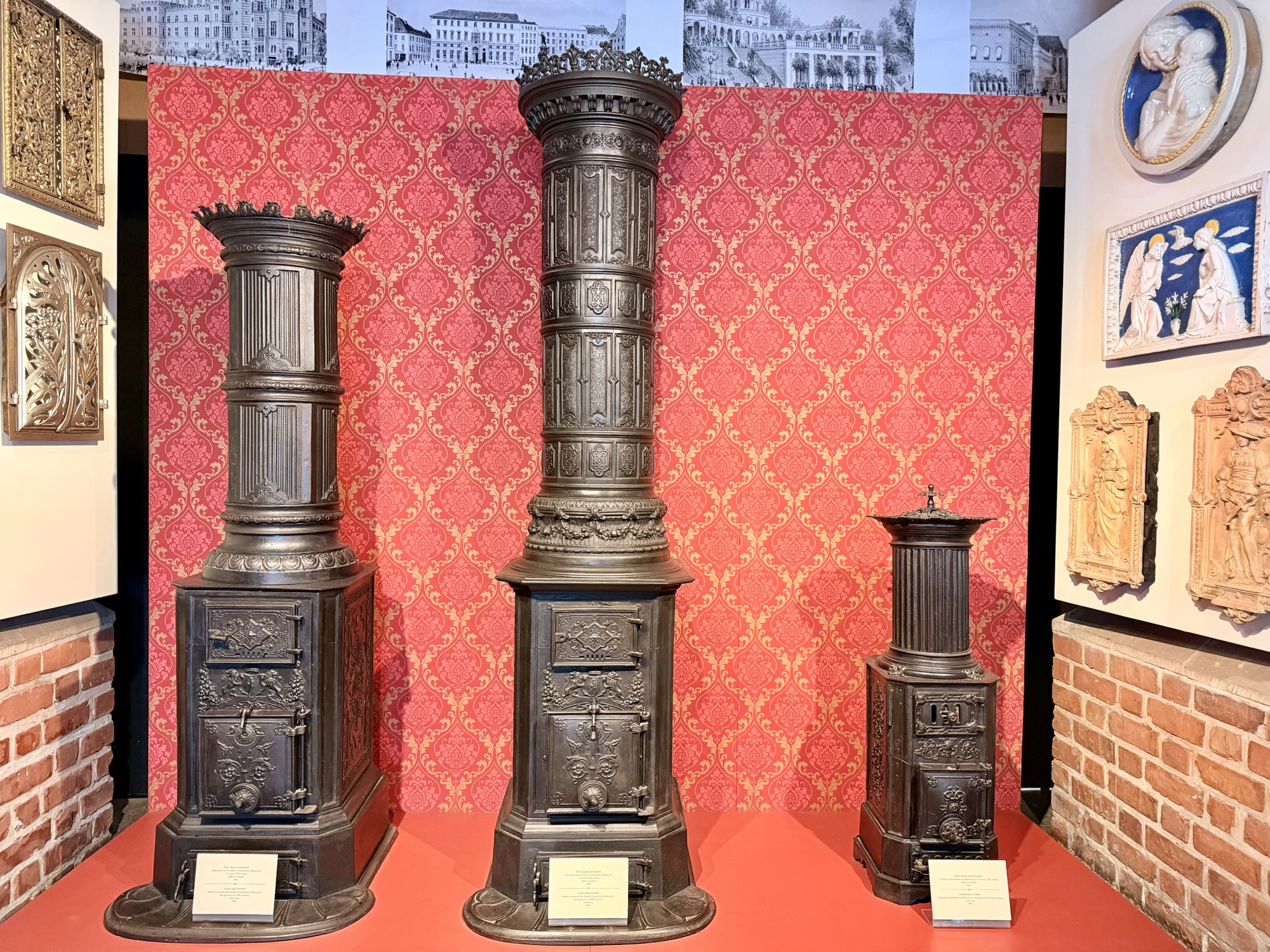
The Architecture Museum, founded in 1965, is housed in the historic building of the Bernardon monastery. There was no entrance fee on the day I was there. It is the only architecture museum in Poland. The building dates back to the 15th century. It contains the largest collection of stained glass in Poland.
The main exhibit on the day I was there was about a Polish couple Maciej Nowicki and Stanislaw Sandecka. The couple withstood the difficult circumstances of World War II. He remained professionally active in secret architectural competitions, taught masonry and worked as a design lecturer in the underground classes of the Warsaw University of Technology, even though teaching architecture to Poles was prohibited by the Nazis. He was involved in rebuilding Warsaw after the war and the couple later moved to the United States.
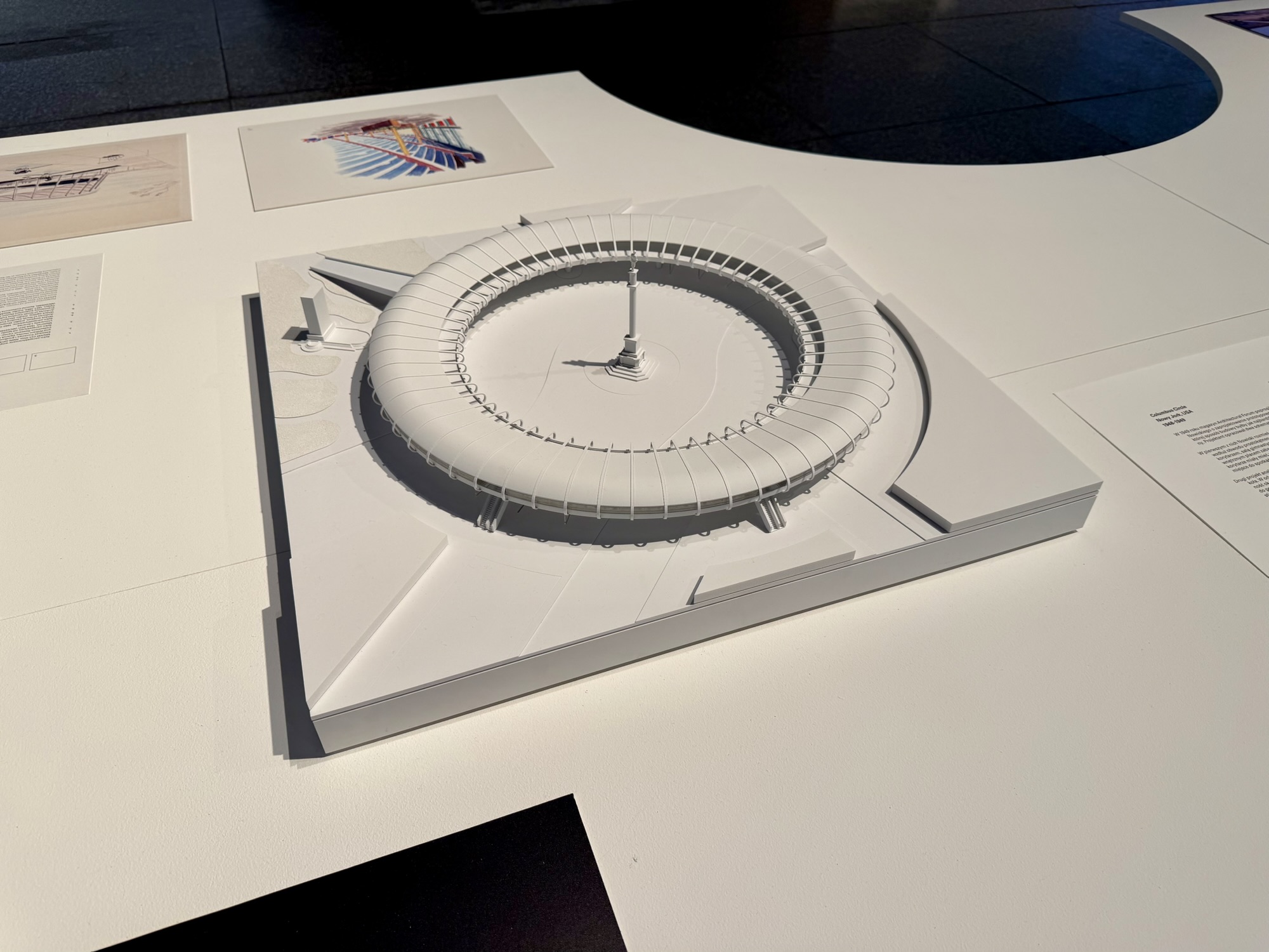
Stanislaw Sandecka was the first woman in US history to receive the title of Professor of Architecture. She also worked as a graphic designer, and some of that work was displayed in the museum. She worked for a year with Le Corbusier. Maciej Nowicki was part of the working group for The United Nations building in New York City. They had models and drawings of some of his unbuilt work such as an elevated pedestrian platform at Columbus Circle in the southwestern corner of Central Park in New York.
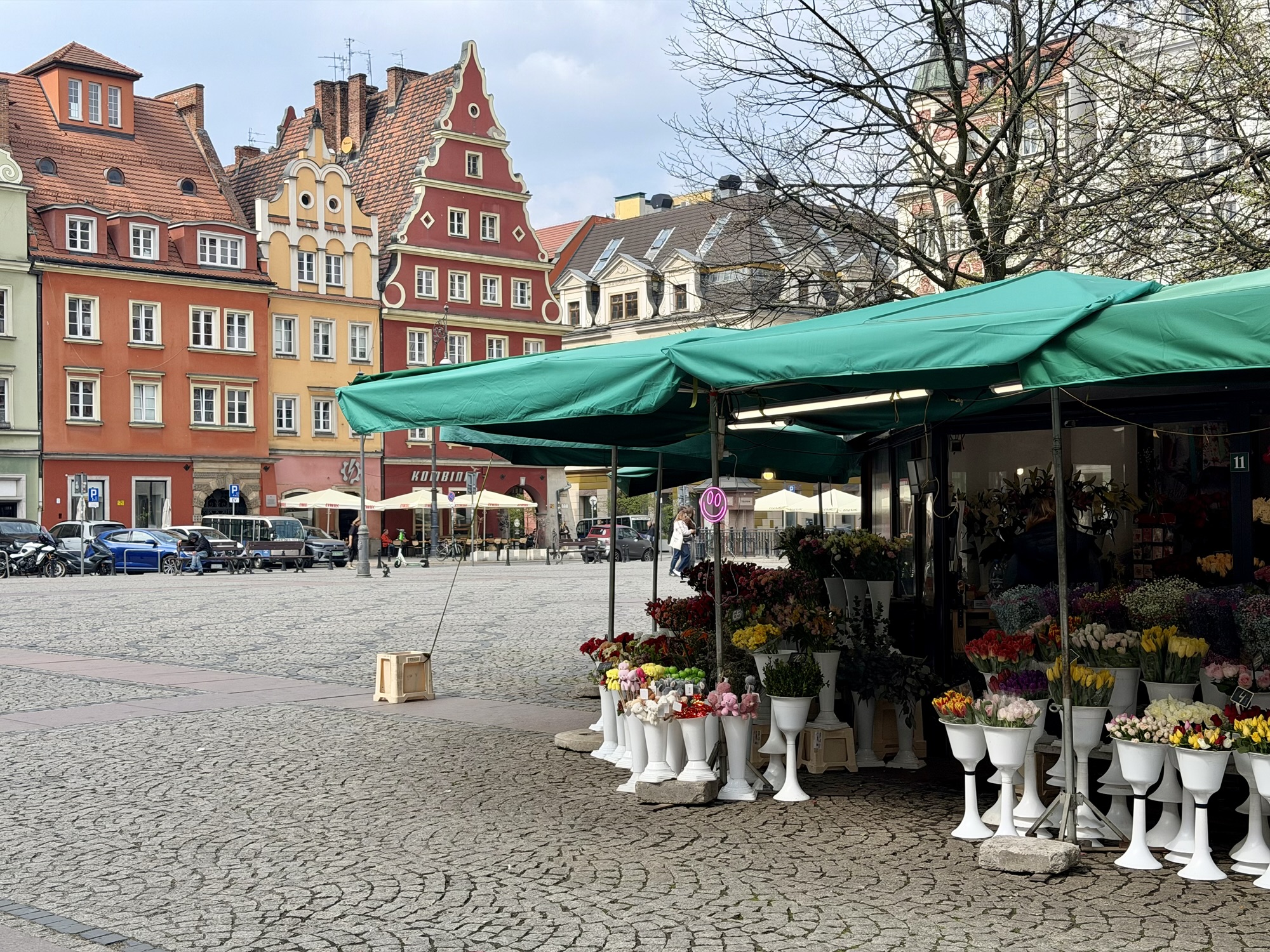
I had lunch at a coffee shop in the small square containing the flower market which is off of the large Market Square (Rynek).
My next stop was something I found out about from Atlas Obscura which would have been better to visit after dark, but was nevertheless still interesting. The Neon Side Gallery is the collection of old neon signs from all over Poland.
Alina encouraged me to return to the apartment via another section of the Wrocław Parkowa bike route that we explored on day 16.
It is across the street from Wroclavia Mall, a large modern shopping mall, built in 2017, which includes a bus station on two underground levels. It is located near the main train station. I visited Bratislava in 2023 and they also have a modern mall, Nivy, with a bus station underneath. I recall looking at the departure board there, and seeing Wroclaw as one of the destinations. There was a bi-directional cycle track on the same street as the mall.
A little further on it turned into a uni-directional cycle track. A Brampton councillor recently complained to me that it’s confusing to have different types of cycling infrastructure. However, every city I have visited, has a variety of types, depending on the immediate situation, and depending on when it was built and what the guidelines were at that point in time. Unless a city is prepared to make a large investment to build a cycling network within a few years, this will always be the case.
Housing tends to be more colourful here.
Most of the streets are very wide here with trams, car lanes, cycle tracks and sidewalks. They are complete streets with separate space for each mode.
At the point where I reached the Parkova route, there was a tile-mosaic-covered, indoor standalone bathroom, but it wasn’t operational. I had to use a porta potty a few metres away.
I passed another interesting water tower.
This street reminded me of many of the narrow streets we saw in Netherlands.
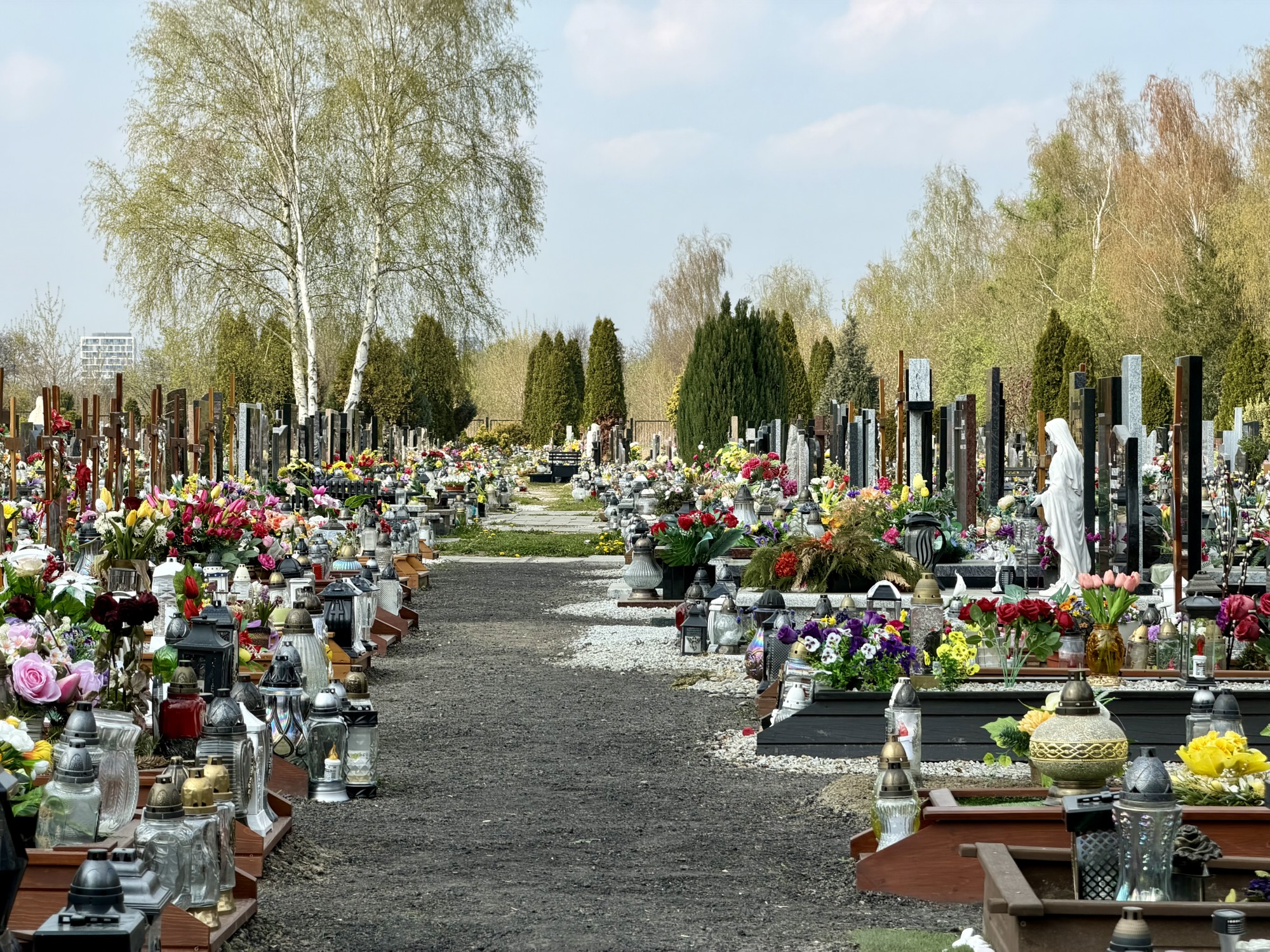
In Poland, visiting and decorating graves at Easter, and other times of year is a very common family tradition. Families clean tombstones, place fresh spring flowers, and lighting on the graves. Most cemeteries have stalls directly outside the gates selling fresh flowers and candles.
The path continued on the other side of a busy road, but there were lights for pedestrians and bikes.
In this area, there was a separate path for cyclist and pedestrians.
Here’s another colourful apartment building I passed.
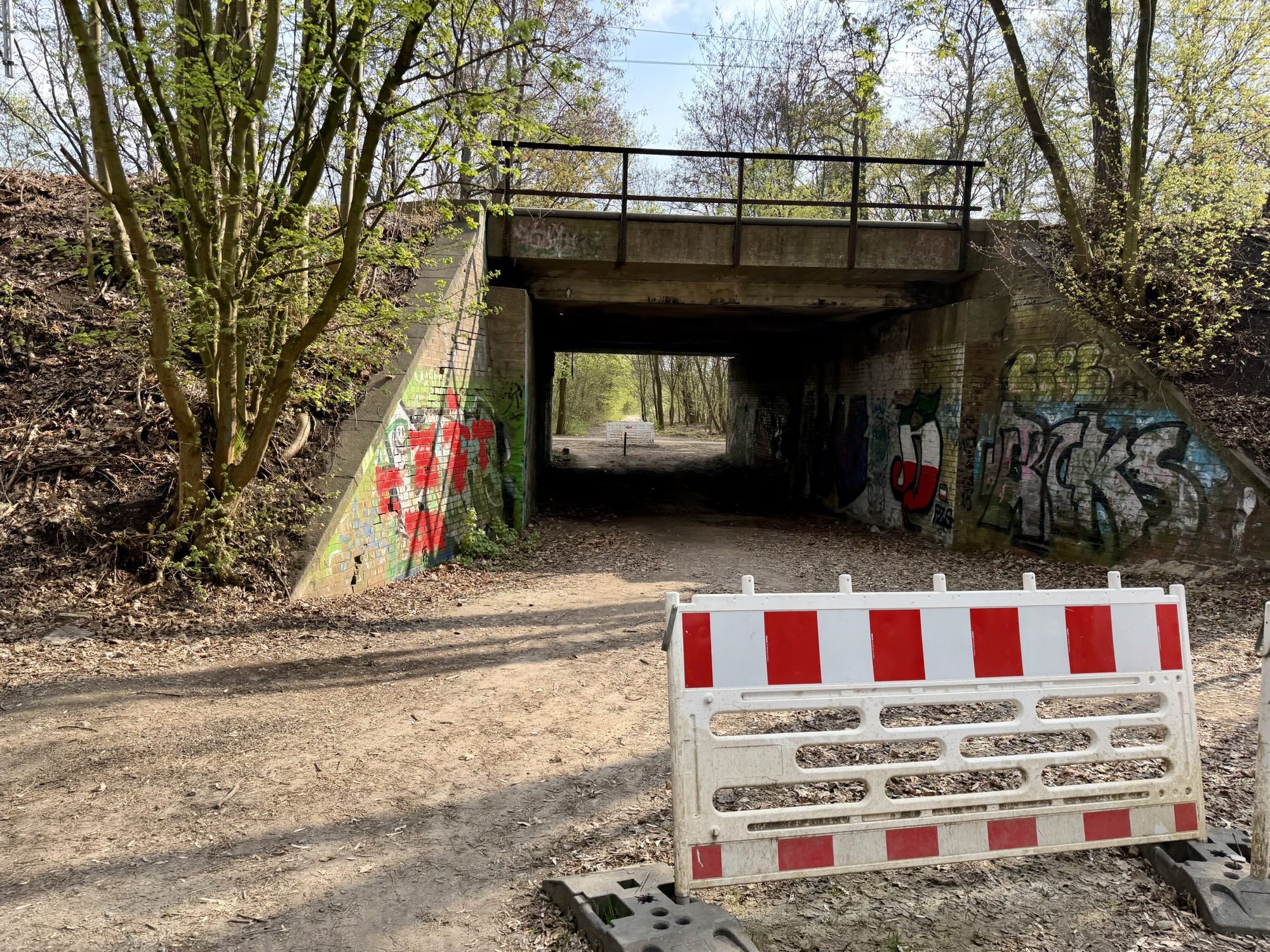
There were regular underpasses under a rail line on a berm.
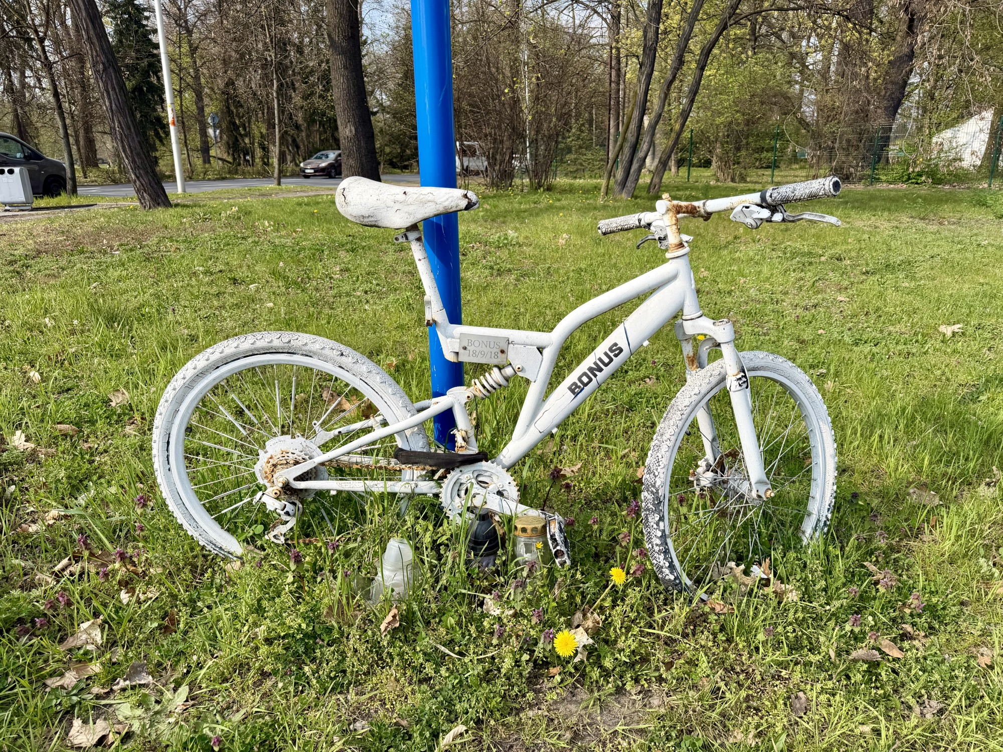
This is the only ghost bike (or duchy roweru in Polish) that I noticed the entire time I was in Europe.
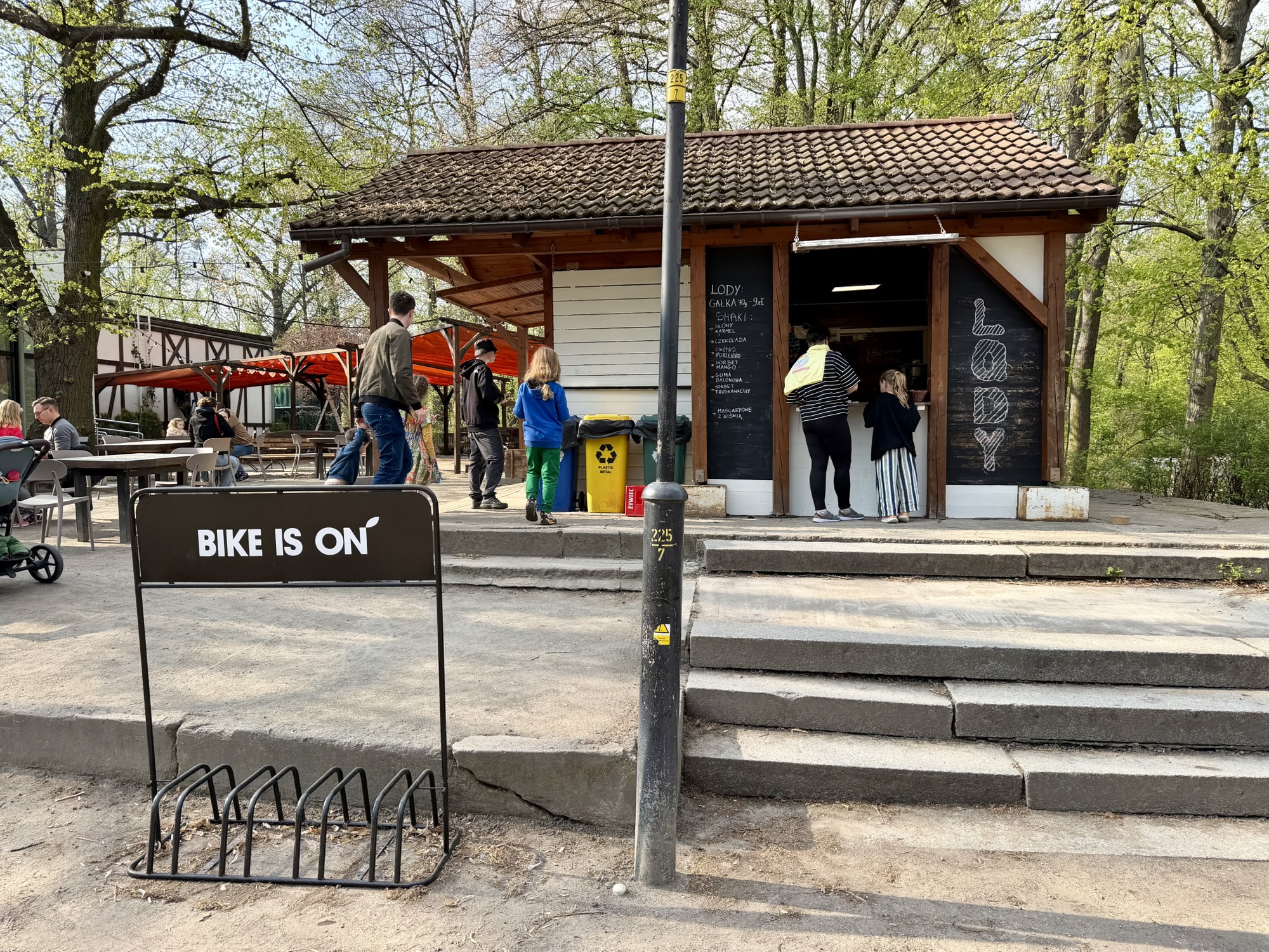
Park Polidniowy had a bike coffee shop and an ice cream shop. I like that restaurants in parks are common in Europe. I wish we had more of that here. Lody is Polish for ice cream.
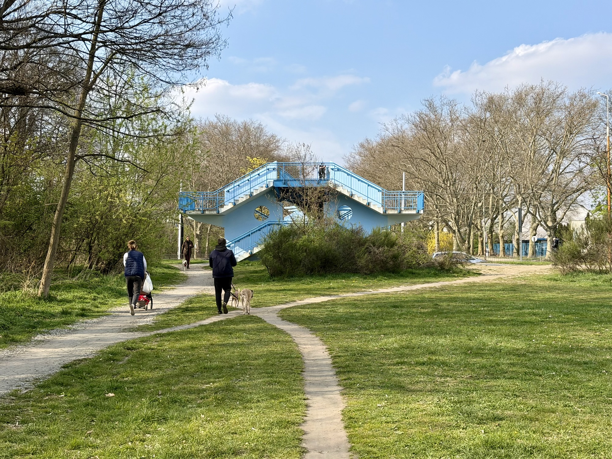
When I spotted this pedestrian overpass, I knew I was close to home.
The second repair person was finishing up as I arrived back. Alina and I rode to a local mall for our last dinner before taking the train to Berlin.
TL;DR stands for “Too Long; Didn’t Read”. It is internet slang used to introduce a quick, digestible summary of a much longer message, article, or document. So if you don’t have time to read this whole post, please read the first few paragraphs and send an email.
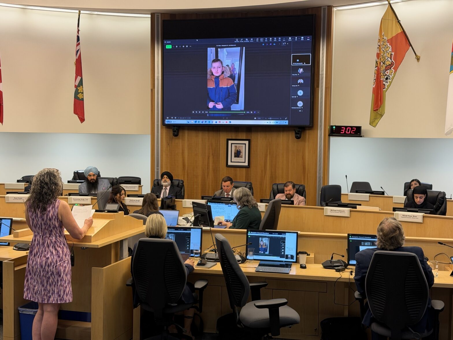
Readers you did an amazing job sending emails before today’s meeting. There were 29 published in the agenda. You can read them here by scrolling down to section 14.2, clicking on the title, then clicking on the letters that pop up on the right side by clicking them one by one.
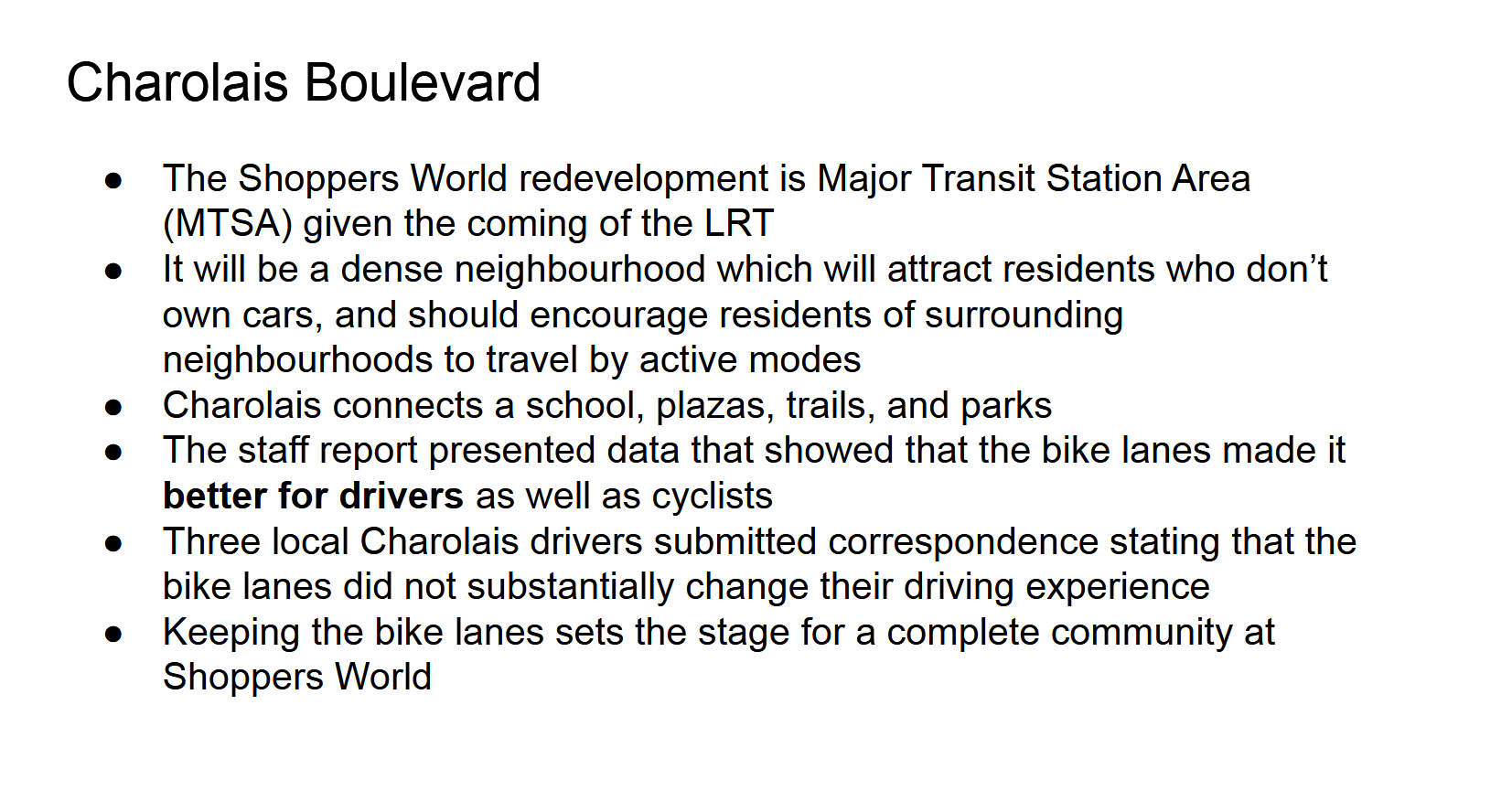
Last week I wrote about finally losing patience with Brampton Council hypocrisy over implementing council approved plans and I delegated a rant which I wrote about here. On Sunday night I was angered and dismayed to discover that Wards 3&4 councillors had put forward a motion for the May 27 Council meeting to remove the bike lanes on Charolais Boulevard, a 3km long east-west collector road that was overbuilt, and connects Shoppers World, a school, parks, plazas and the Etobicoke Creek Trail. So once again I spent days creating and delivering a delegation.
Shoppers World is designated as an MTSA. This stands for Major Transit Station Area. “It is a provincial planning designation that defines zones within an approximately 500 to 800-metre radius (roughly a 10-minute walk) of higher-order transit stations, such as subway, GO rail, Light Rail Transit (LRT), and Bus Rapid Transit stops.” The intension is to focus higher-density residential and employment growth around transit to encourage public transit usage and reduce car dependency. Removing bike lanes from around an MTSA undermines its implementation and potential for success.
Three of us delegated, councillors spoke. During the delegations and the first few speeches from councillors, councillors spoke among themselves and to staff. Many councillors were on the board waiting to speak, when the mayor who was chairing the meeting, shared that he thought a compromise had been reached and suggested the board could be cleared if it was accepted.
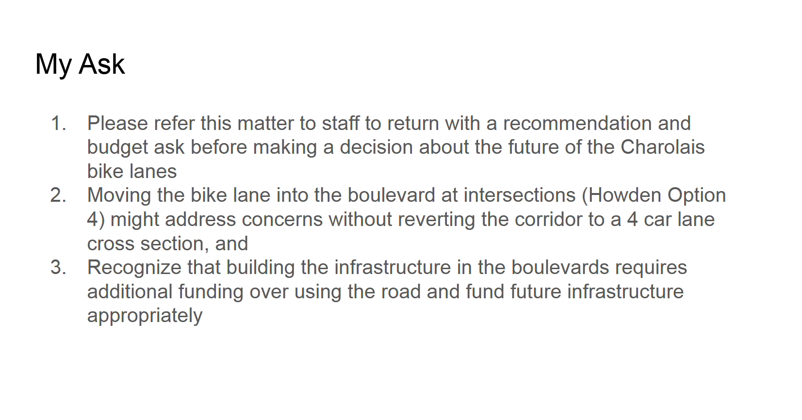
A compromise was reached. We will lose the bike lanes by the end of August, but Council voted unanimously on two friendly amendments to the original motion.
1. That the Mayor be requested to write to the Minister of Transportation to request funding for conversion of the lanes
2. That staff be directed to report back as expeditiously as possible on a budget amendment to accommodate active transportation, specifically the conversion to the boulevard of the two missing links on Howden Boulevard and Charolais Boulevard.
It felt somewhat like a loss, but has the potential to be better for cyclists once implemented so I am cautiously optimistic. Staff is to report back on June 24 with costs, a delivery plan, and an assessment of what this means for our Brampton Mobility Plan targets so we don’t have long to wait to see how this unfolds. We will need to keep the pressure on so that they follow through and do so quickly to minimize the time during we have no cycling infrastructure on Howden and Charolais.
My call to action today is that you write the Minister of Transportation, Hon. Prabmeet Singh Sarkaria, requesting that he provide the requested funding. Copy all of the Brampton councillors, and the clerk, and ask that your correspondence be added to the agenda for June 24. You can copy the emails in the following paragraph into your email client. State that your concerns can be addressed by funding quick implementation of cycle tracks in the boulevards of Charolais and Howden Boulevards, or something to that effect.
Here are some key points you can use in your letter
These areas had automatic speed enforcement cameras. Changing the street back to a four lane cross-section makes it more dangerous for cyclists, necessitating off-road cycling infrastructure.
Brampton council was unanimous in their decision
Cycle tracks in the boulevard on these streets would address your concerns
This is the type of infrastructure will complement the Shoppers World MTSA and encourage multimodal trips
This solution will address driver and cyclist concerns for these corridors
This will be a higher quality safer cycling infrastructure than the painted line on the road that we currently have which will encourage more “all ages and abilities” cyclists.
End of TL;DR
Here is a link to watch my delegation. You will need to use the bar to advance to 1:38:00. There are two delegates after me that are worth your time to hear – Silvia Roberts and Justin Kang. Our delegations complimented each other very well. When the YouTube video becomes available I’ll embed it starting at the correct spot.
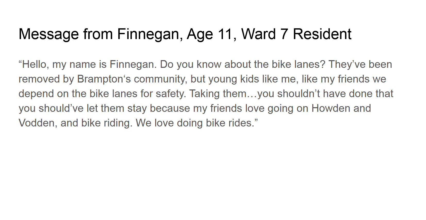
Here are my slides, video of 11 year old Finn, and speakers notes.
Good morning Mayor Brown and Council
Building bike lanes is about bringing balance to the transportation system. There is a “small perceived inconvenience for motorists” on the one side and “streets for people and road safety” on the other. Bike lanes help minimize risk both for drivers and cyclists. People defending the status quo tend to be noisier than those who want to see change. In the agenda there are 24 letters from people who support cycling infrastructure, submitted in the last two days. More letters missed the agenda deadline. Many of these residents asked this Council to implement the Mobility Plan.This is not about cars versus bikes. It is about creating a livable city.
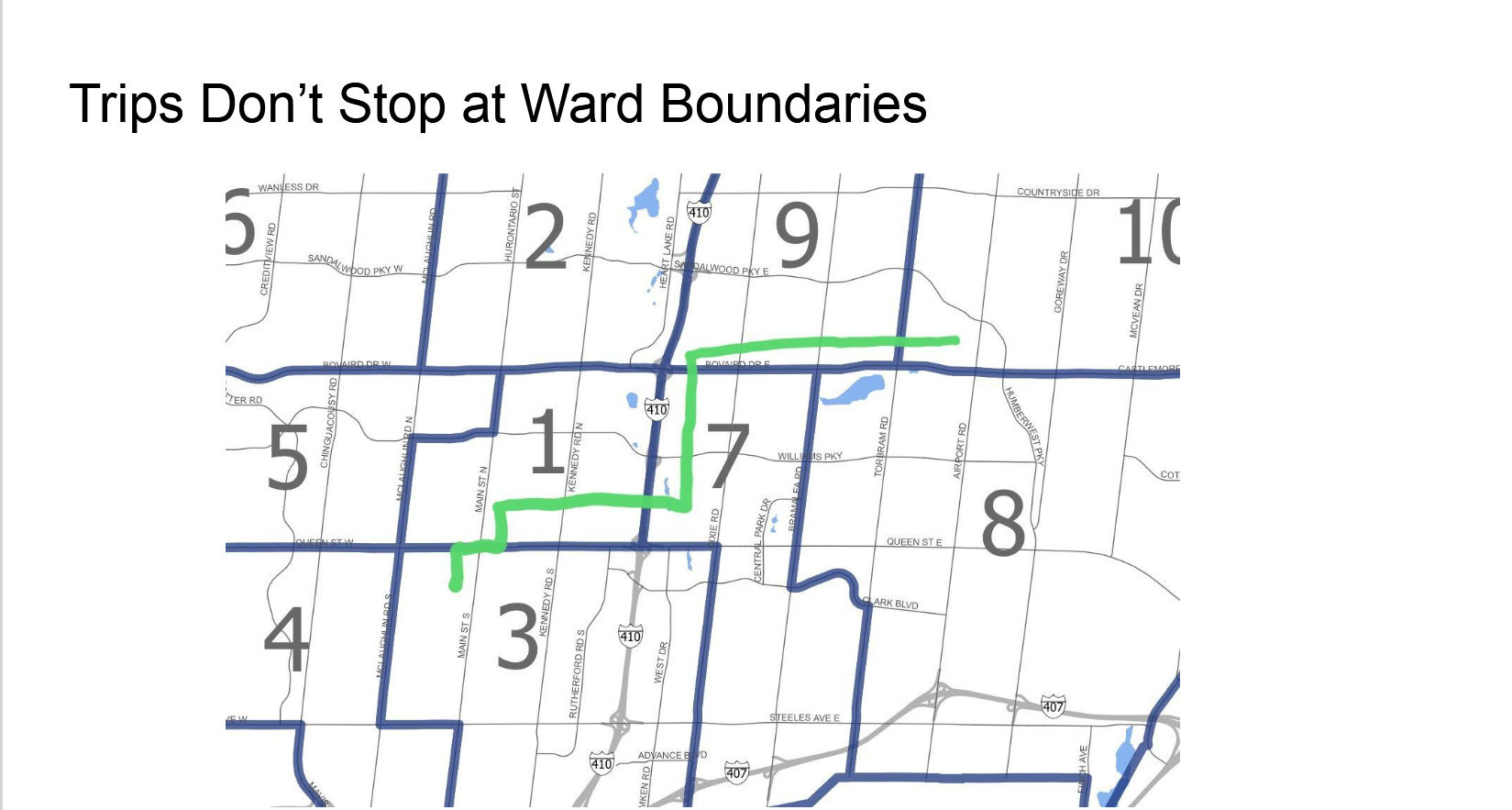
I am a resident who chooses a bike for transportation. I want convenience, comfort and safety. My route to City Hall takes me on low-volume streets, and streets with bike lanes, and avoids the arterials, riding through wards 10, 9, 7, 1 and 3. Cycling trips do not stop at ward boundaries.This is not a local issue. Eventually all the bike lanes will form a citywide network. Removing pieces for parking or more car lanes prevents that from happening.
I am asking that the network be maintained and expanded for residents like Finn.
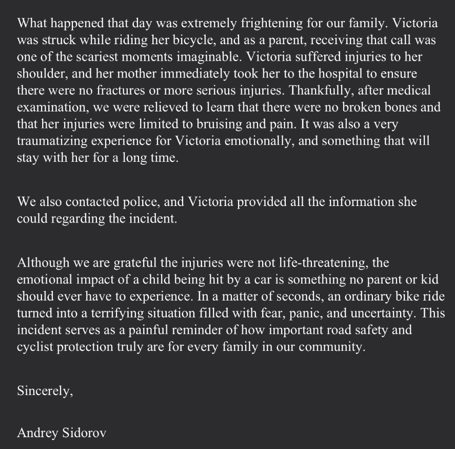
Last Wednesday I read Victoria’s request that councillors make decisions to protect vulnerable road users.
This is Victoria. On her way home from school last Wednesday she was hit by a car. She was hit by a car while riding her bike on the day she asked this Council to make Brampton a safer place for cyclists like herself. The driver fled the scene.
This is a message for Council from Victoria’s father.
“Streets are for people”, not just for cars. If you only build for cars all you get is cars. Providing safe space for cyclists in this city can literally be a matter of life and death.
Councillor Rowena Santos wrote a positive piece on the outcome this morning. She writes, “A budget amendment will fund protected, boulevard-level cycling infrastructure on both Charolais and Howden, replacing painted lines with separated, dedicated paths that are demonstrably safer for cyclists, e-scooter users, and people using mobility devices.” This makes it sound like a done deal, but after years of begging for twigs*, I’m going to hold my celebration for when I can actually ride on the new infrastructure.
* “Instead of celebrating piecemeal infrastructure, local advocates are tired of what the Toronto community famously calls ‘begging for twigs’ – a phrase coined by cycling advocate @wardFORpeople to describe pleading for painted lines when we need concrete barriers. Organizations like Cycle Toronto are pushing past these crumbs to demand comprehensive, protected networks.”
Someone just asked me what TL;DR means. It stands for “Too Long; Didn’t Read”. It is internet slang used to introduce a quick, digestible summary of a much longer message, article, or document. So if you don’t have time to read this whole post, please read the first four paragraphs and send an email.
Off the top of my head these are the bike infrastructure removals over this term of council. Royal West Drive. Elbern Merkel Drive. Howden Boulevard protected bike lanes. Protected intersection at Dixie/Guru Nanak/Peter Robertson. Inspire Boulevard.
The removals are accelerating. It’s going to get worse if people who ride bikes do not start telling Council that it is unacceptable to remove bike infrastructure and that it is unacceptable to pause the implementation of Active Transportation Master Plan.
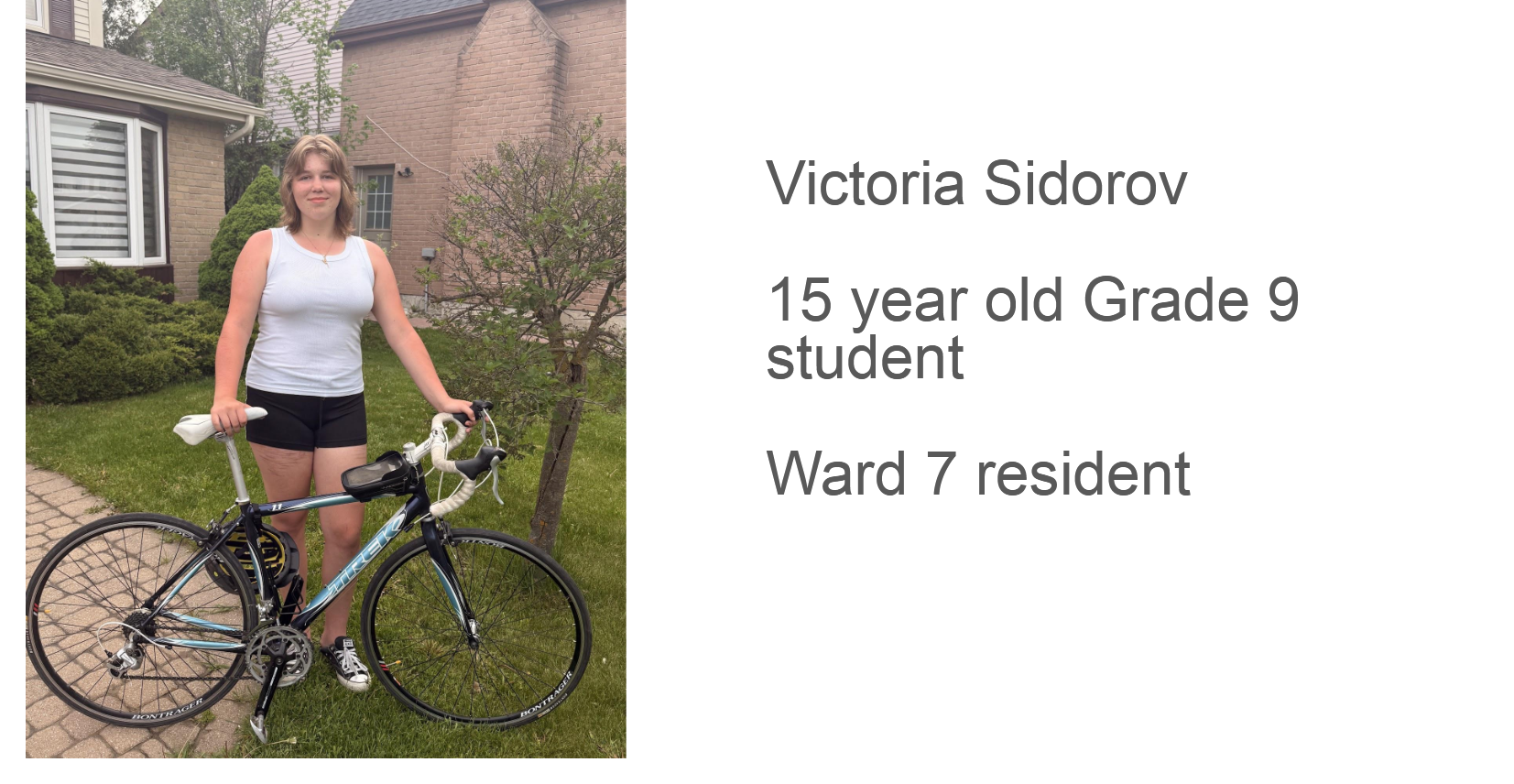
My voice isn’t enough. My call to action is that everyone reading this who uses Brampton cycling infrastructure email council. I’m going to make it easy. Copy paste the next paragraph which has the emails for all the councillors, the City Clerk and BikeBrampton. The email doesn’t need to be long or complicated. Just state that you use the infrastructure and that you are supportive of building more and how you feel about the removals. If 15 year-old Victoria (more about Victoria at the end of the blog) can do it so can you.
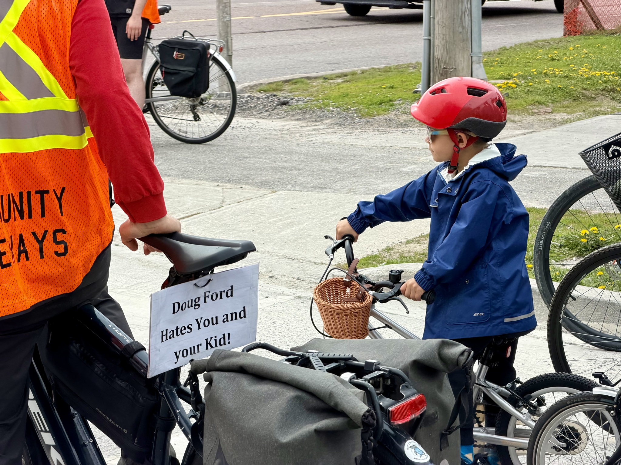
This morning, once again, Brampton Council voted to remove a bike lane. I have delegated many times to Council in an educational, “Let’s work together” tone, and it rarely works. And the environment has worsened significantly since Doug Ford passed Bill 212.
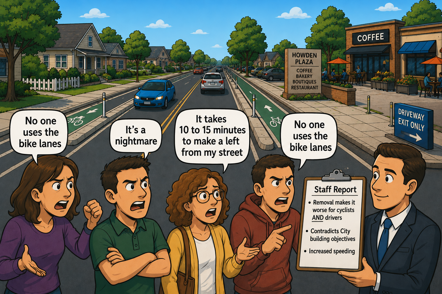
In January Brampton Council voted to take out a key section in our east-west cycling corridor, Howden Boulevard, and one of only three streets in Brampton where we had a protected cycling lane. They did it against staff advice, after having staff waste months developing four alternatives, running public consultations, running a survey, and writing staff reports. They didn’t allow one of the alternatives to be do nothing. All of the alternatives had some level of bike infrastructure remaining.
When it came back to Council, they rejected all the alternatives and voted to revert the road to a four lane cross-section. Somehow, in a city where construction is almost always delayed, they managed to tender the contract, higher a contractor, and have them finish work a few weeks ago. Staff advice was that this would make it worse, not just for cyclists, but also for drivers. Traffic volume do not warrant four lanes – this is a collector road, not an arterial – which means that the removal will encourage speeding and aggressive driving.
So for today’s delegation I decided, no more playing it nice. I decided to tell them how I really feel. Here is my slide deck.
My delegation (embedded below at the correct time in the video) slightly exceeded the five minutes allowed. I was expecting that Council would not want to linger on the topic and for the delegation to be accepted without any questions or comments. However, I think I struck a nerve. There were 35 minutes of defensive statements and questions from Councillors and answers from me when I could get a word in edgewise.
Ultimately, it made no difference.
Here are my speaker’s notes.
Good morning, Mayor Brown and councillors. I am Lisa Stokes. I am here today because this council is dismantling the active transportation network one street at a time.
Brampton’s environment is widely recognized as highly obesogenic, characterized by heavy car dependency. Prioritizing safe, active transportation directly dismantles the structural foundations of an obesogenic environment.
Motornormativity is an unconscious cognitive bias leading people to assume that car ownership and driving are necessary
Because it is an unconscious bias I can understand your constituents asking for special treatment for their cars. What I cannot understand is why this Council, who know better because you have easy access to the information needed to counteract this bias, chose to lean into it instead
The effects of motornormativy are many. They include:
Death and serious injuries for all road users, expensive car insurance, huge demands on police resources and budget, Obesity, diabetes and heart disease and Pollution contributing to climate crisis
At the meeting during which Council voted 10-1 to remove the bike lanes on Howden the Mayor told us that residents were livid.
Well I am a resident and I am livid.
I am livid because a couple years ago the Mayor told Council he didn’t want to see gaps in the Active transportation network. Yet here you are about to remove another bike lane.
I am livid because BikeBrampton delegates are treated as a niche group rather than as an organization who speaks for those who lack the time or knowledge to do so
I am livid because Council makes decisions based on hyperbolic lies rather than expert staff advice. A one block conversion of Clockwork minimizes the network damage, but still breaks the network creating a disincentive to the “ interested but concerned”
I am livid because asking people to drive carefully doesn’t keep children safe. Do you know what keeps children on bikes safe? Protected cycling lanes like the ones just removed from Howden Boulevard.
Three years ago ward 3&4 councillors were getting complaints about Charolais. Cllr Medeiros stated….He is right. And credit where credit is due, the Charolais bike lane is still intact. Yet they voted to remove the bike lanes from Howden.
I am livid because Council endorses plans that describe a city where the private motor car is de-prioritized, yet when it is time to implement change, Council panders to parochial car-brained demands, following the mob rather than leading by implementing previously endorsed plans which have had significant public consultation.
I am livid because Council and the public talk about balance when the scales tip overwhelmingly towards cars and roads.
I am livid because Active transportation infrastructure is funded in a way that ensures it goes in piecemeal, by only building when roads need resurfacing rather than in a cohesive networked fashion. Then councillors criticize bike lanes for being disconnected.
I am livid because Council and staff have spent considerable resources developing a Rental Licensing Program, but instead of ensuring that the 65% of homes between Thornbush and Brisdale that have ADUs have provided adequate parking, you ask staff to break the network.
Would you think it reasonable of me to demand that the city provide a bedroom free of charge for my visitors?
If your answer is no, why concern yourself with providing free car storage in front of people’s homes?
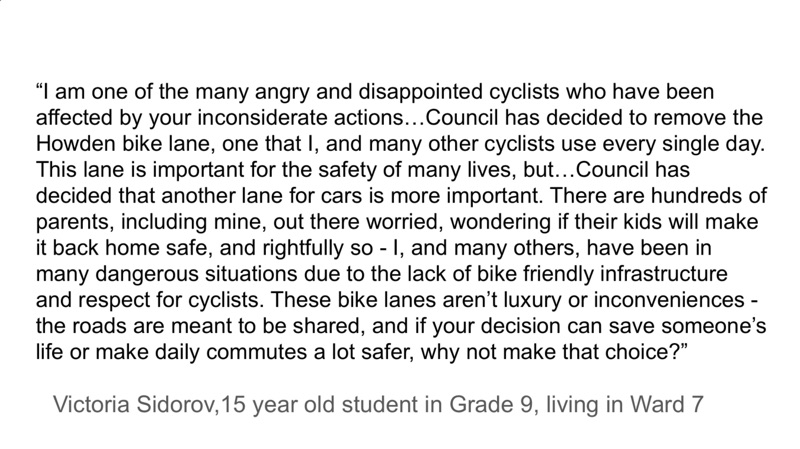
I am going to give the last word to the awesome 15 year old Grade 9 Ward 7 resident Victoria who writes:
“I am one of the many angry and disappointed cyclists who have been affected by your inconsiderate actions…Council has decided to remove the Howden bike lane, one that I, and many other cyclists use every single day. This lane is important for the safety of many lives, but…Council has decided that another lane for cars is more important. There are hundreds of parents, including mine, out there worried, wondering if their kids will make it back home safe, and rightfully so – I, and many others, have been in many dangerous situations due to the lack of bike friendly infrastructure and respect for cyclists. These bike lanes aren’t luxury or inconveniences – the roads are meant to be shared, and if your decision can save someone’s life or make daily commutes a lot safer, why not make that choice?”
Ironically, this council’s decision to remove the Howden protected bike lane signals they are comfortable with a 15 year old riding with no cycling infrastructure on a four lane cross section road, yet Victoria is not old enough to have her correspondence published in the agenda without her parent’s consent.
If you’ve gotten this far, I’ll remind you that my call to action is for you, the reader, to write your councillor in support of cycling infrastructure. They constantly claim to hear from enraged drivers, and only the same old handful of cyclists. If you don’t know what ward you live in or your counselor‘s email you can use this link to the advocacy page on my blog to find out.
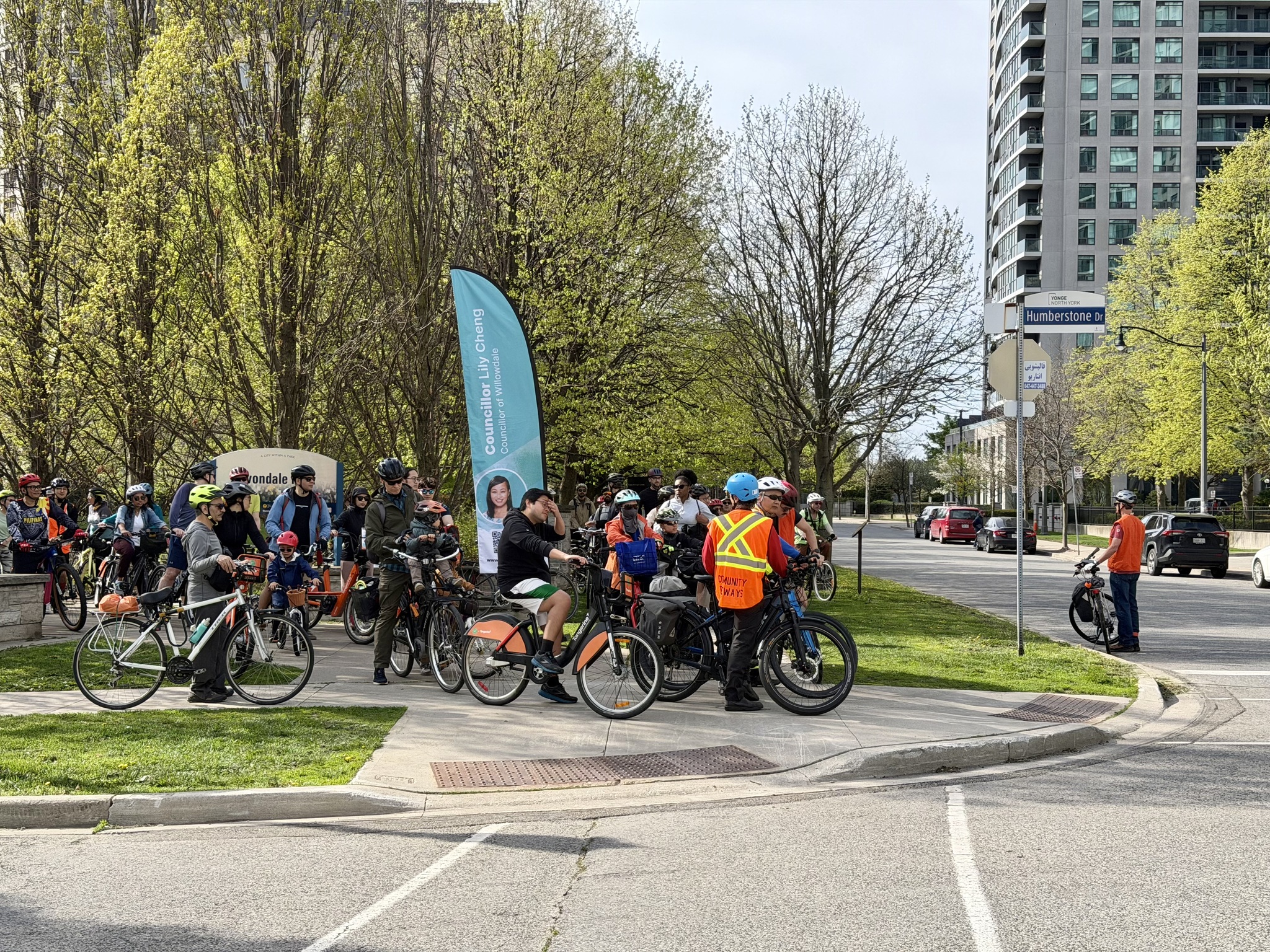
The purpose of the ride is to encourage Willowdale residents to try biking, and Bike Share. Bike Share bikes were provided free of charge to anyone who didn’t have a bike or wanted to try Bike Share. The ride began at Avondale Park, near Yonge and the 401. The route wound its way through quiet Willowdale residential neighbourhoods to the Don Mills Trail, and the Don Trail, with a brief stop at Evergreen Brickworks, and a planned finish at Biisaadage Park, a relatively new park in Toronto’s Port Lands.
I invited my fellow Brampton cycling advocate Cindy, to join me. We considered riding to the beginning of the ride, but would have had to have left Brampton about 6:30 in the morning so we decided to carpool.
I enjoyed a short visit with Jason Thorne, Toronto’s Chief Planner. I first met Jason a few years ago when he invited people to join him on a ride around Hamilton when he was their chief planner. Hamilton was, and Toronto is, fortunate to have him.
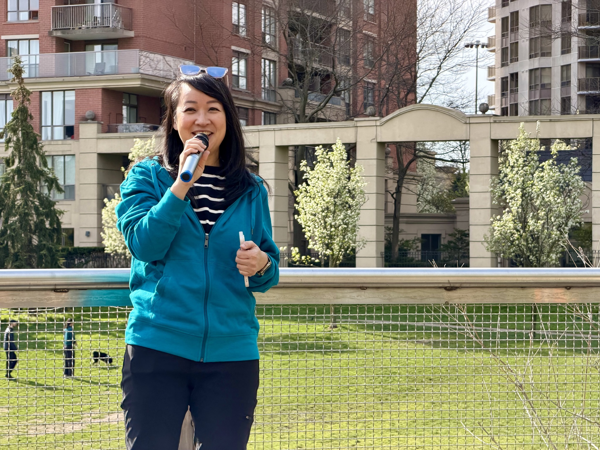
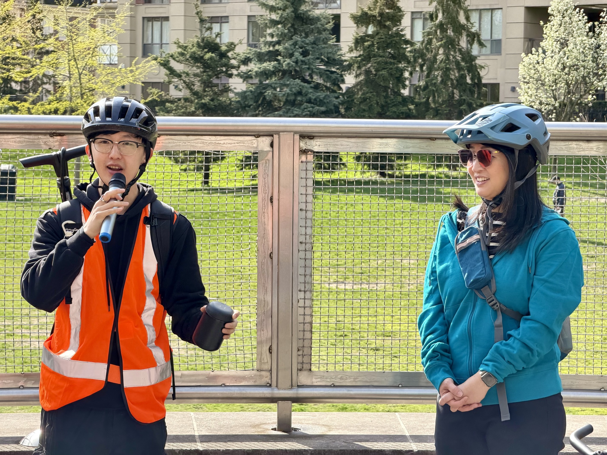
Lily gave a brief welcome to the group.
Albert Koehl, is an environmental lawyer, Toronto cycling advocate, and author of Wheeling through Toronto: A History of the Bicycle and Its Riders. He gave the safety briefing.
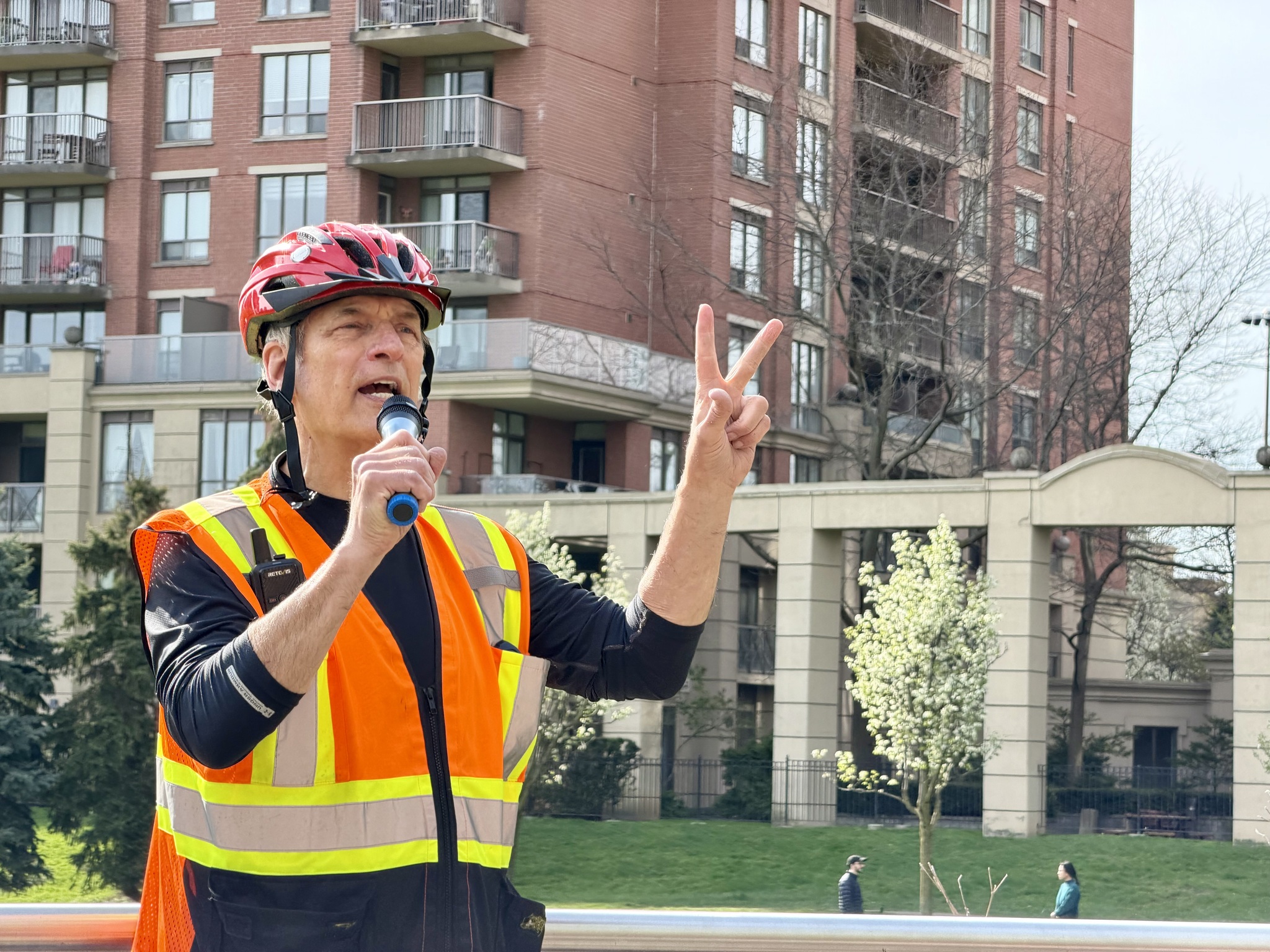
Peter Low, is instrumental in organizing the ride and led it.
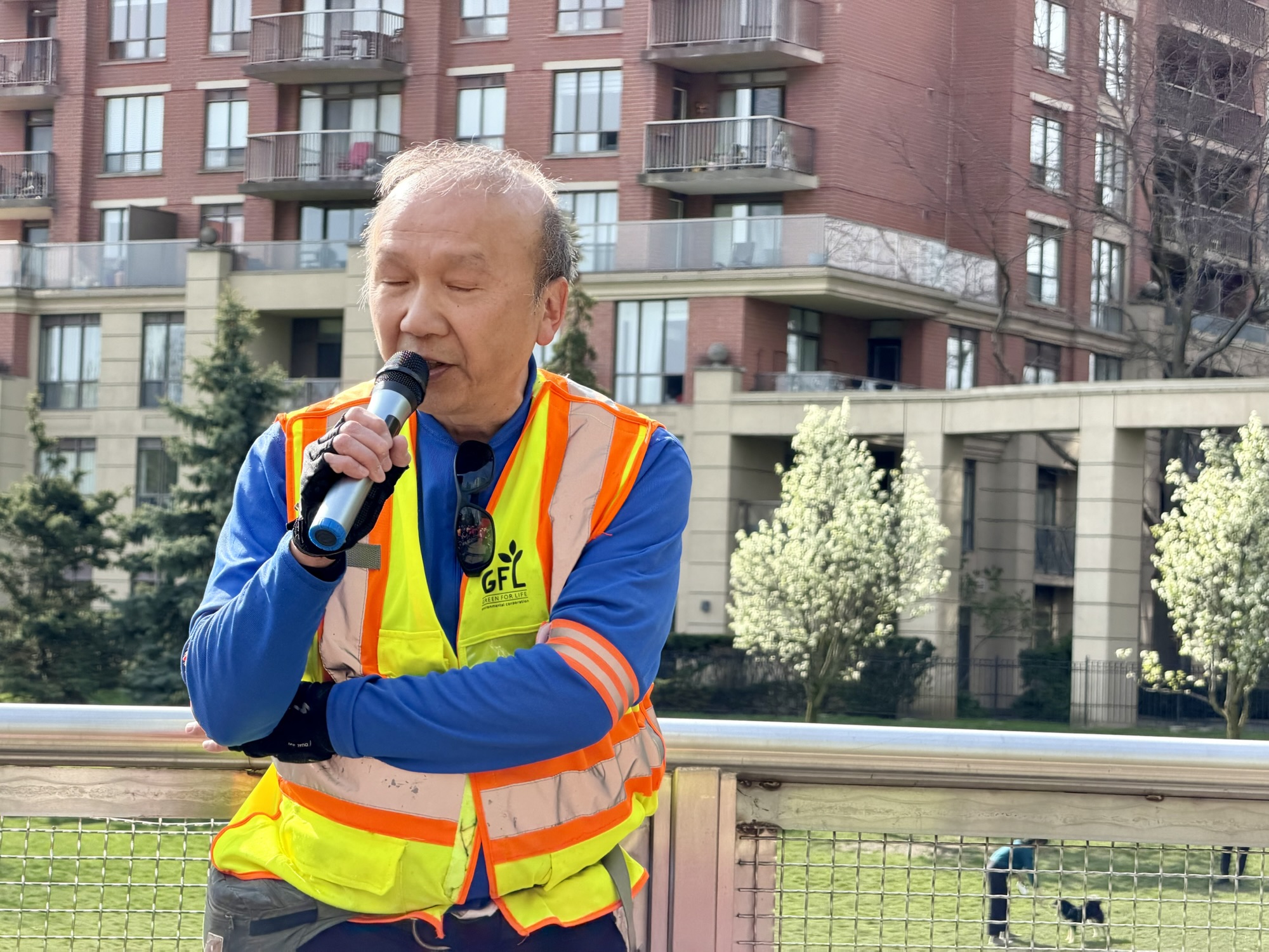
Jesse spoke about North York Cycles. They are a community group started in 2025 for people who want to ride together. They also deliver bike tuneup events and advocate for road safety. Check out their website for the 2026 Ride program.
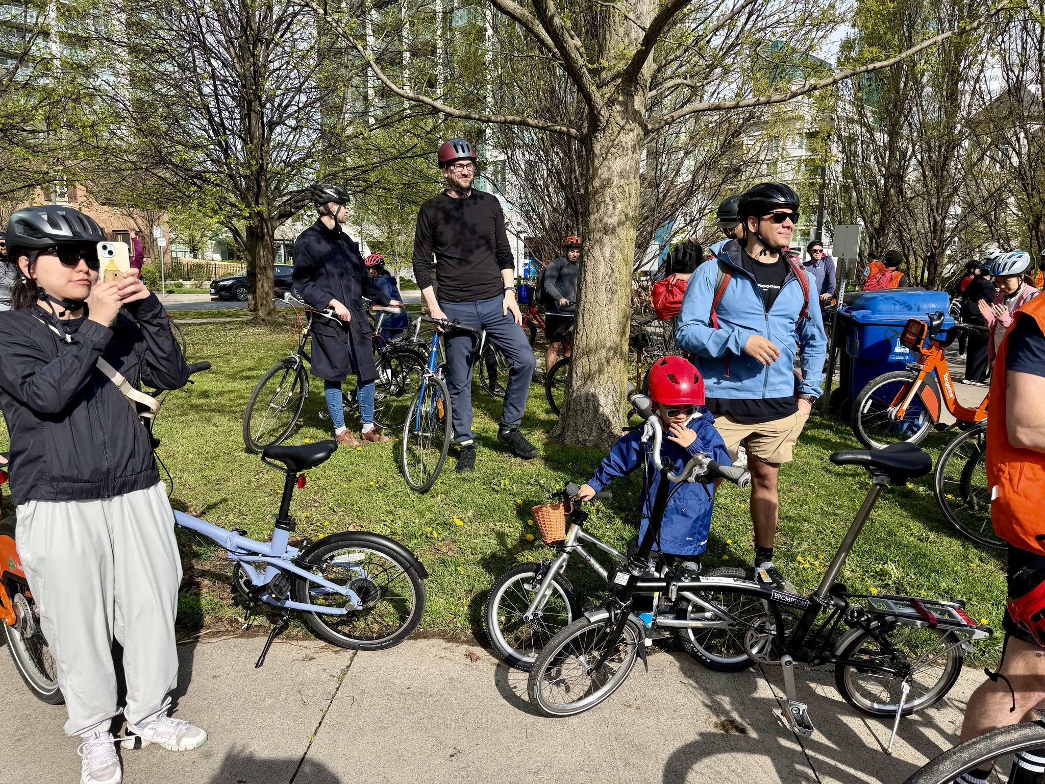
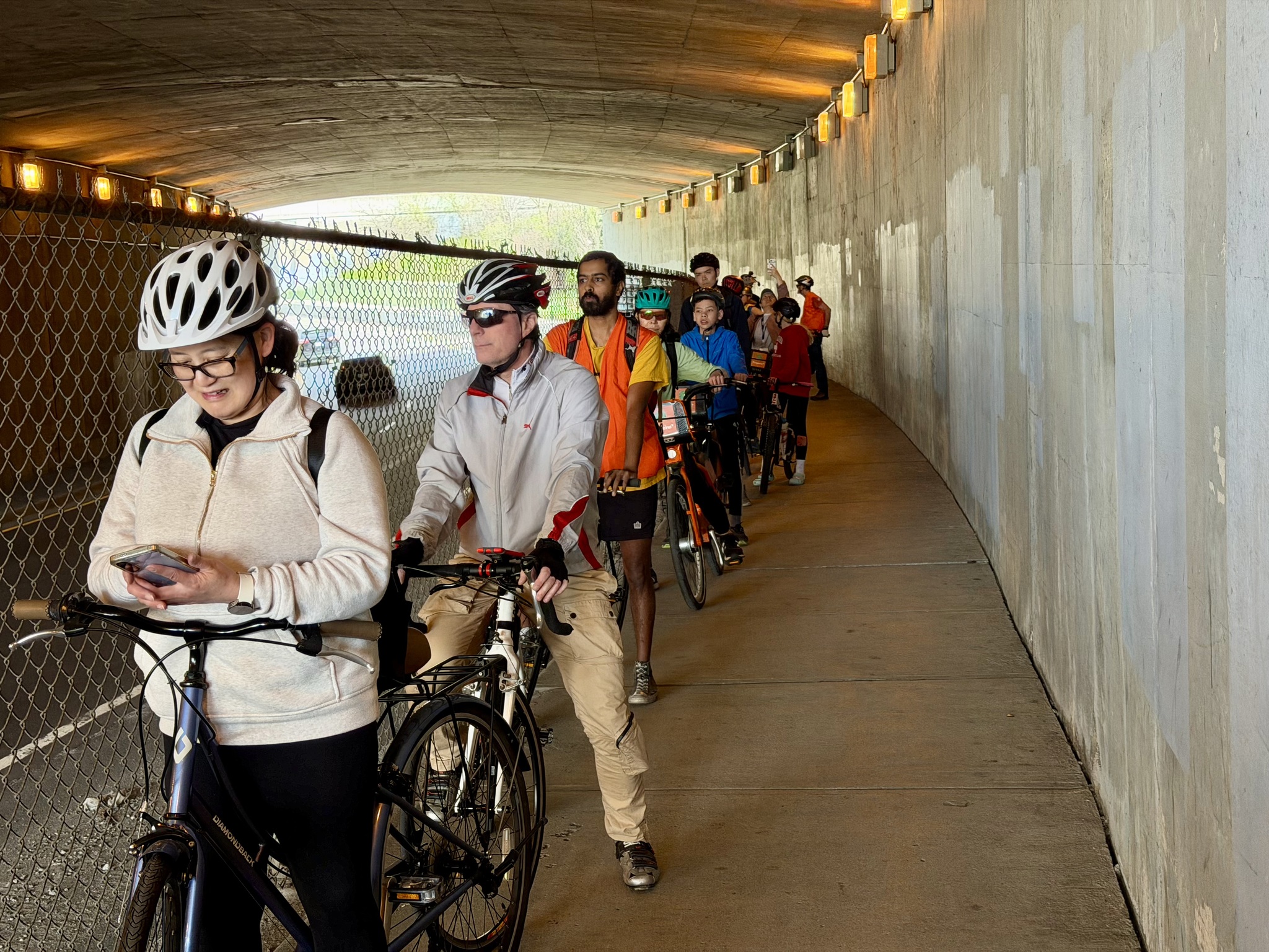
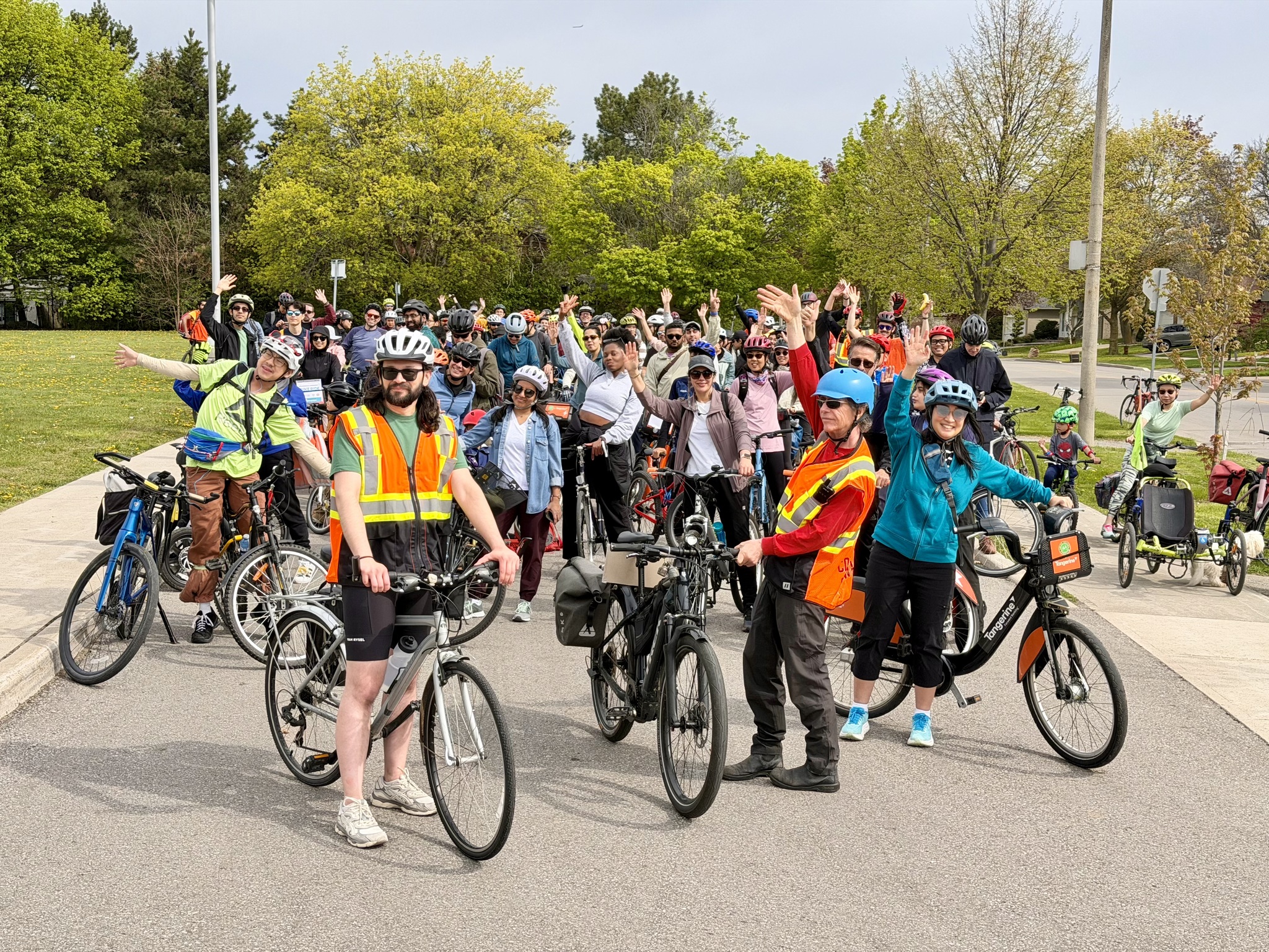
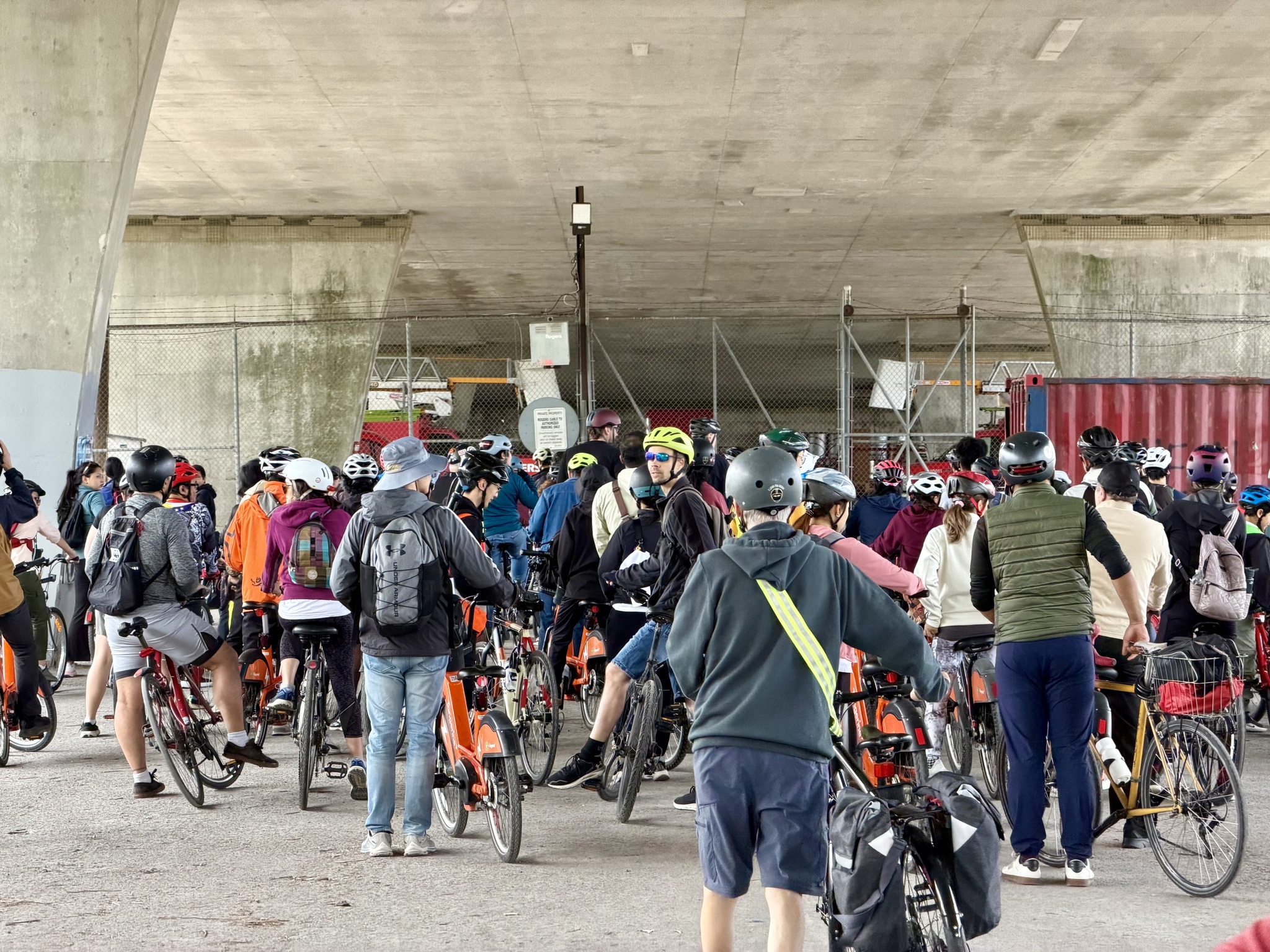
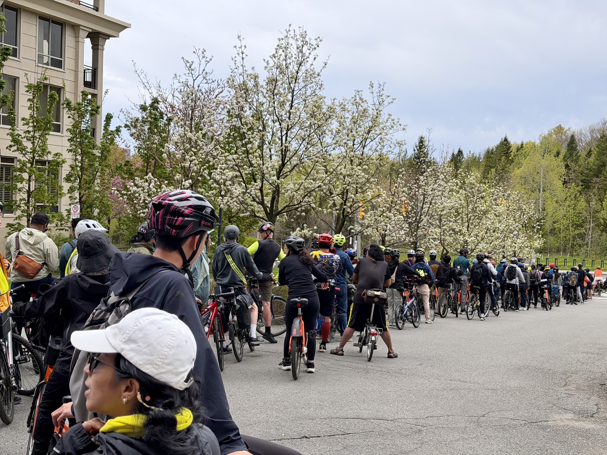
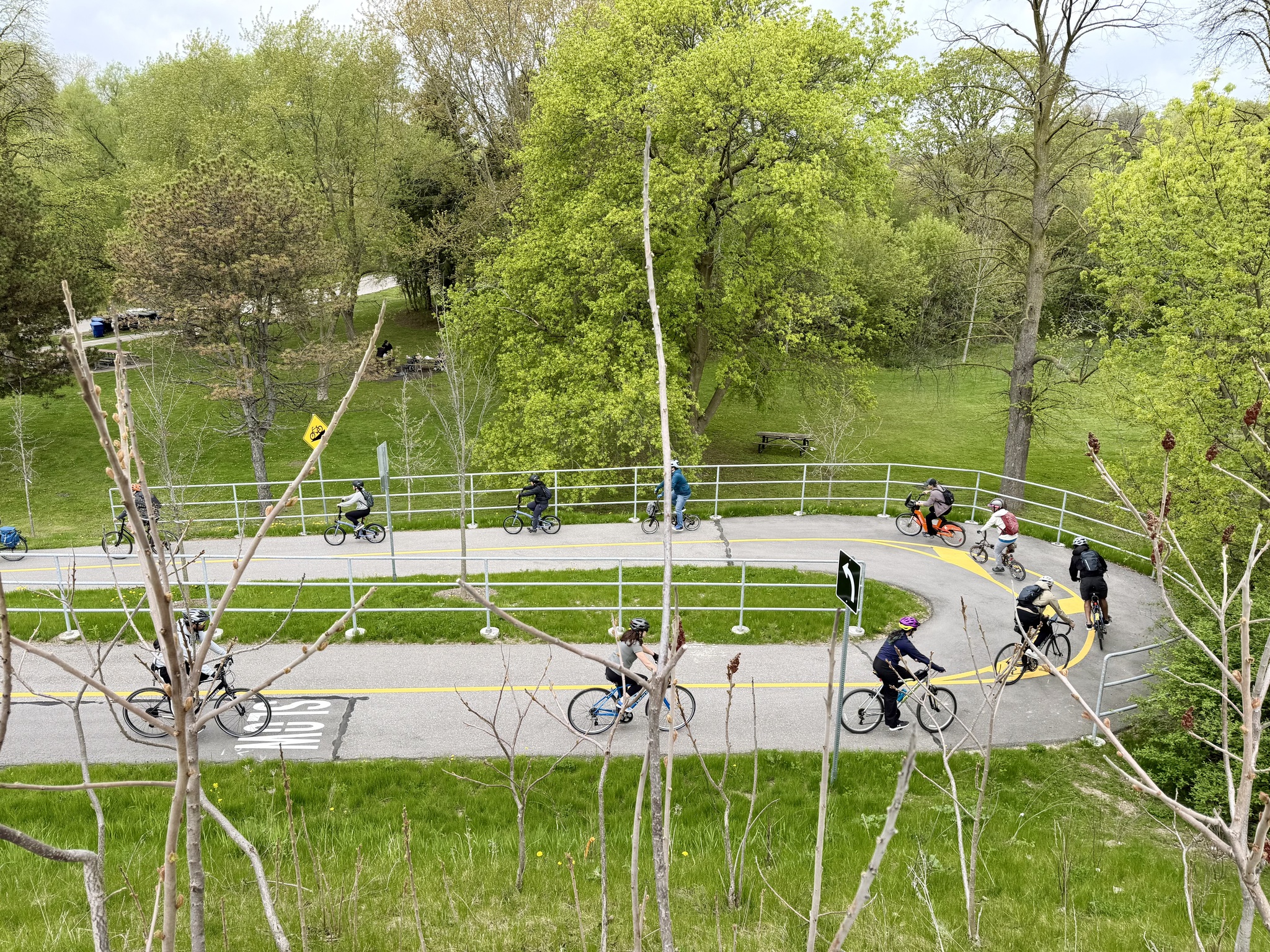
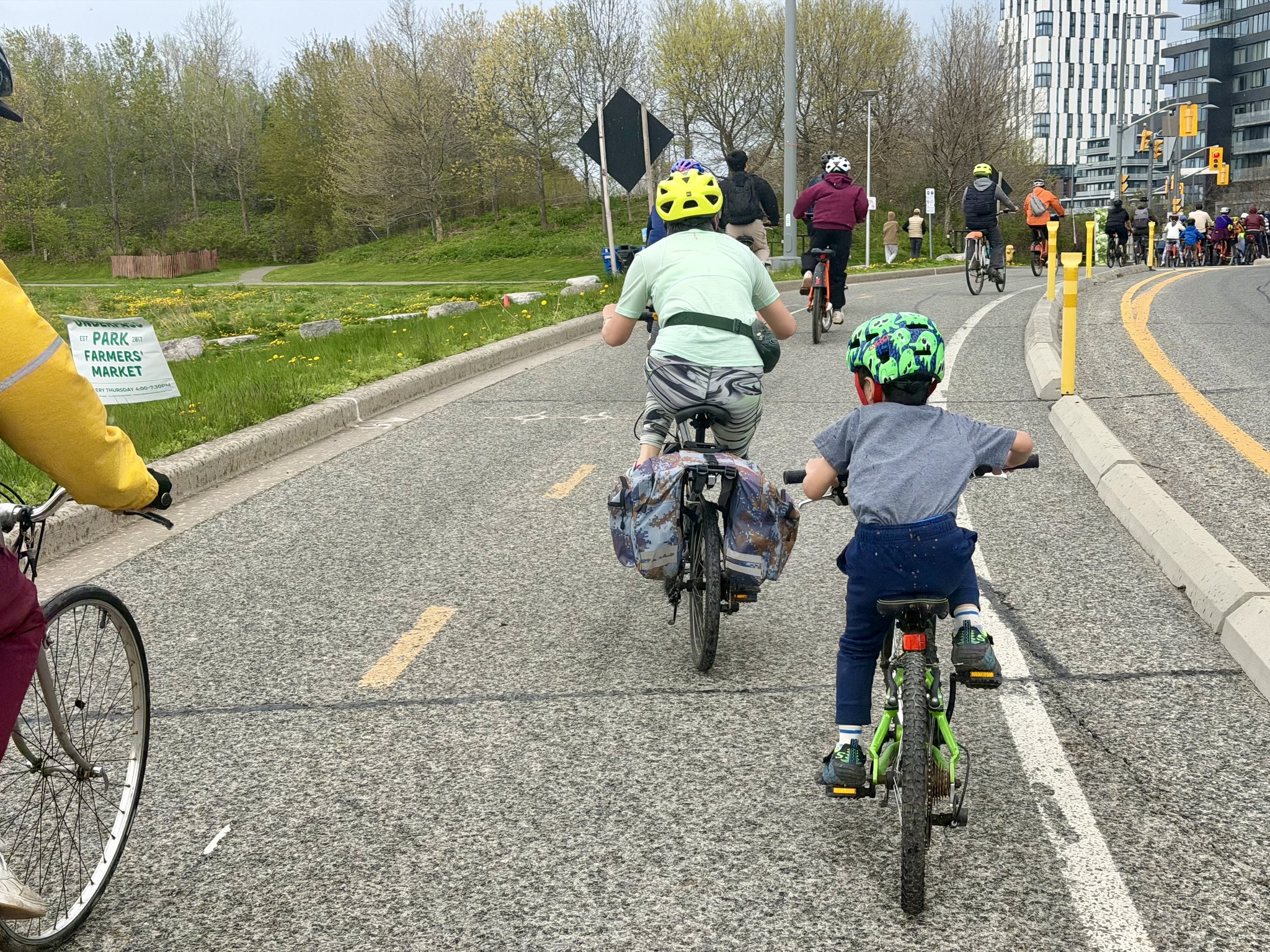
The group is ready to leave.
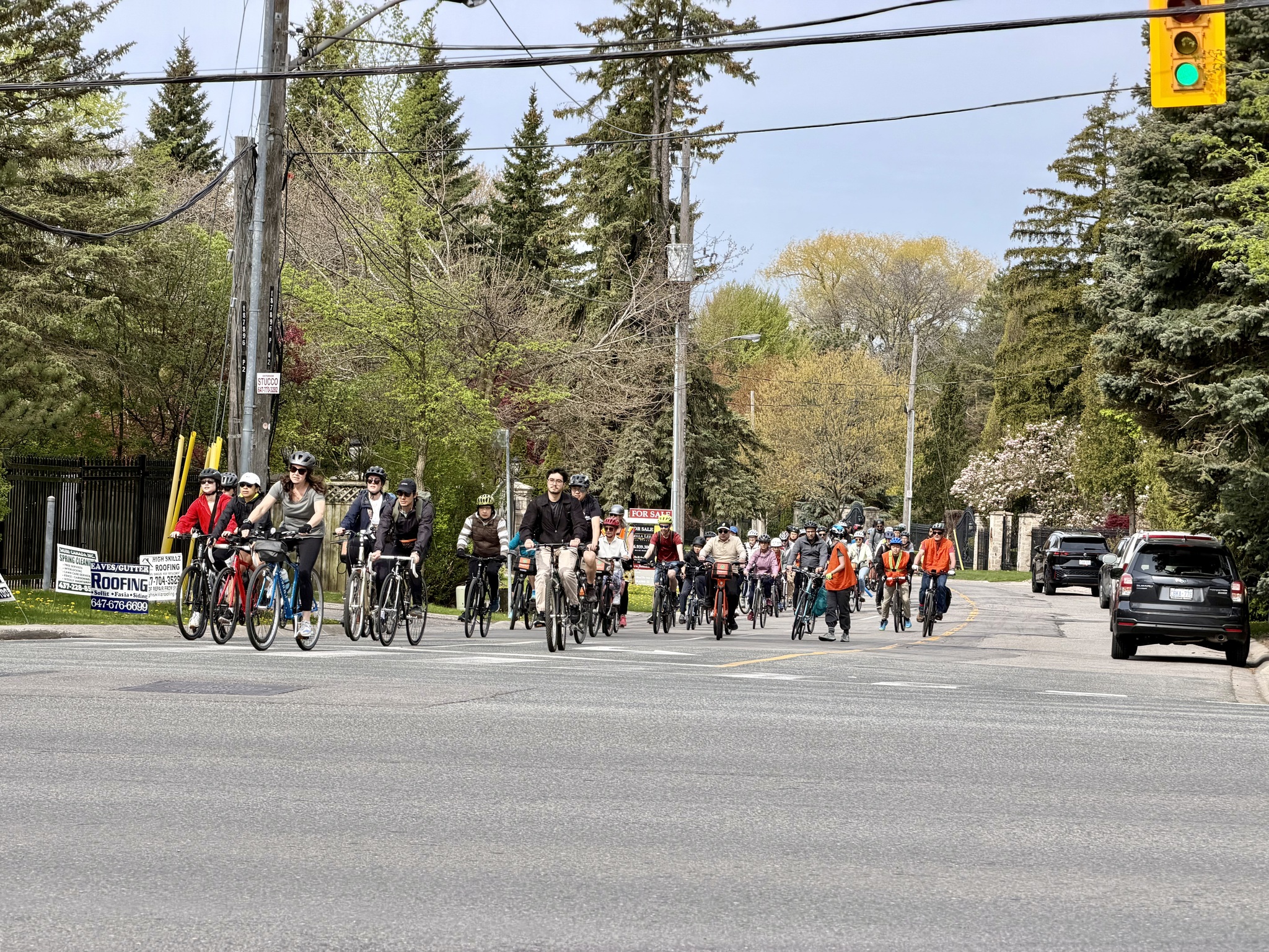
Here’s a video of the group leaving Avondale Park. I counted 120 people and three dogs.
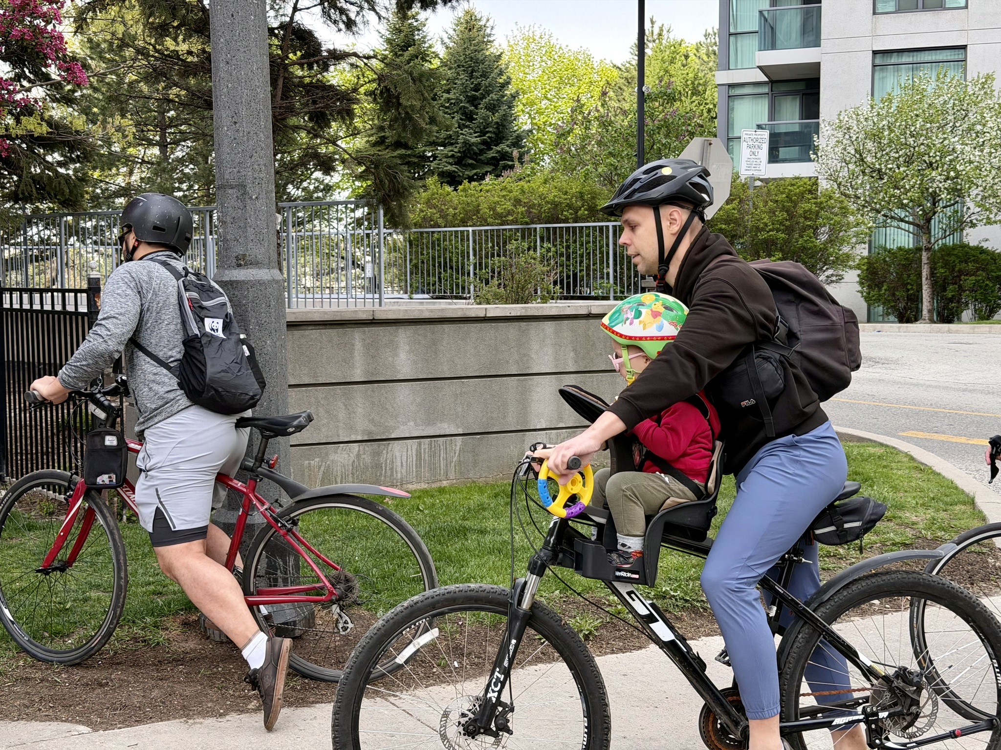
This is one of the youngest participants.
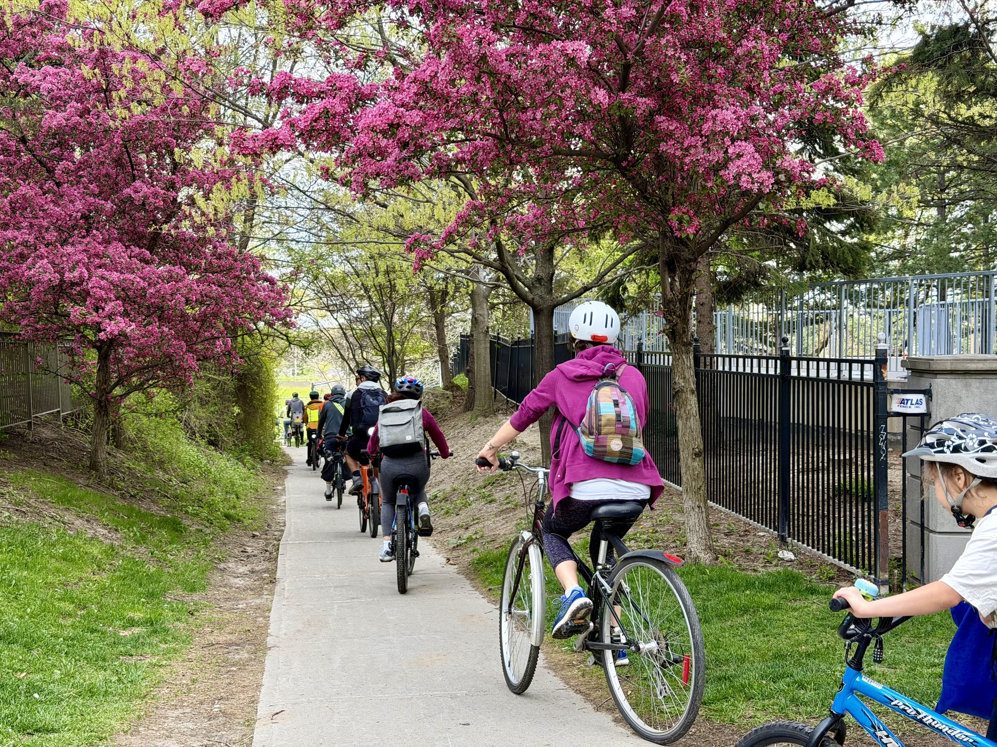
The many crabapple trees we encountered were gorgeous.
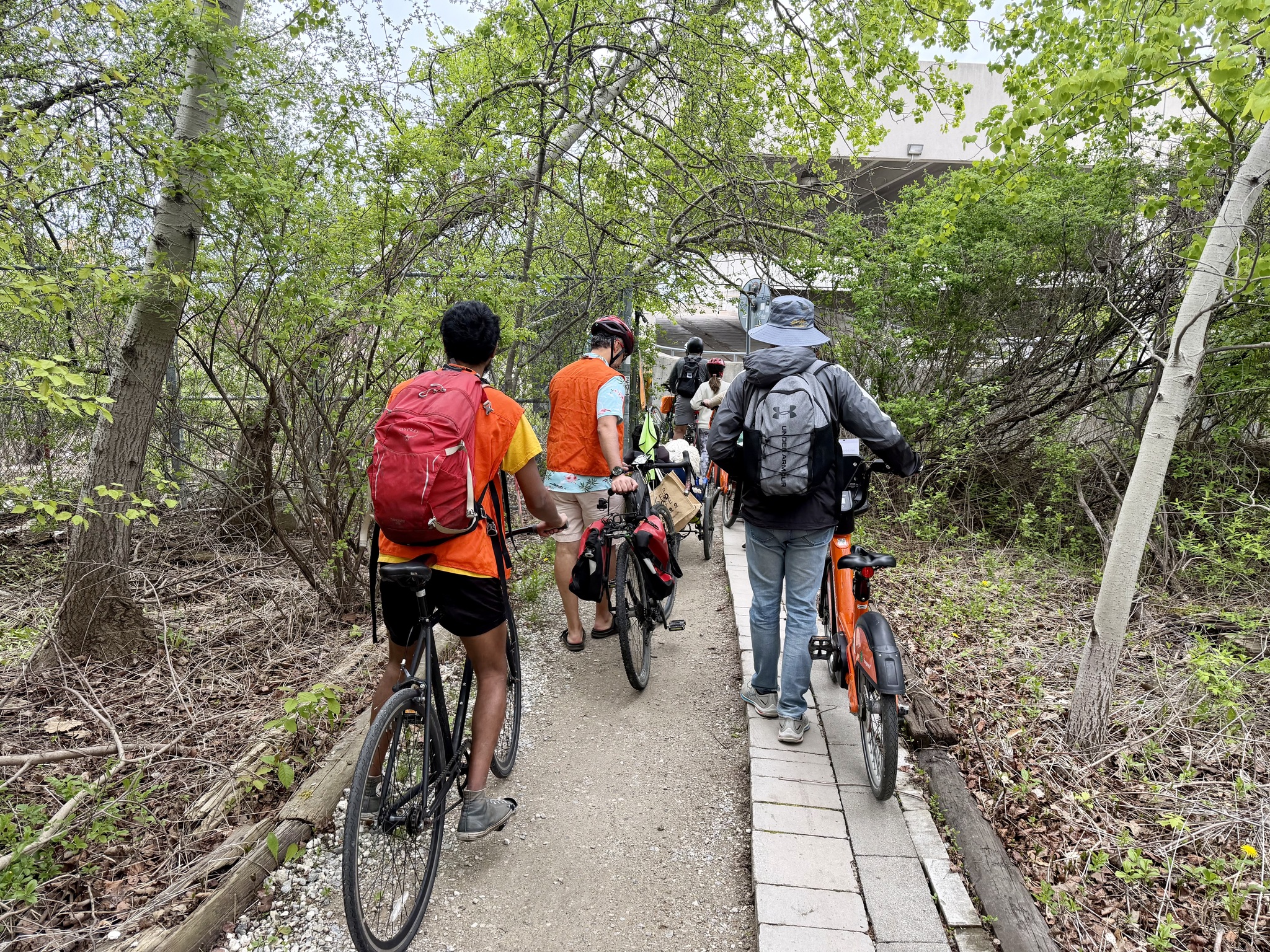
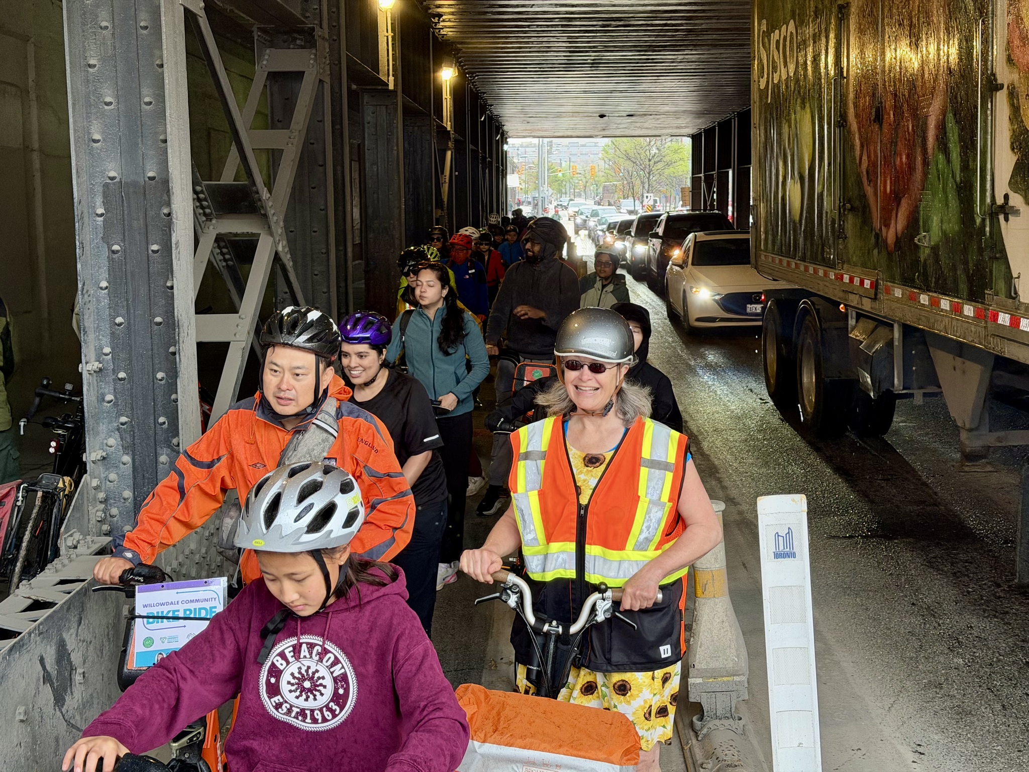
We took the sidewalk under the 401. There is no safe Active Transportation crossing of the 401 anywhere near Willowdale. The nearest would be on the Betty Sutherland Trail on the east side of Leslie, but it has been closed for construction on the 401 for a few years, and will remain so for a while yet.
Then we had to wait quite a while before we could stop the traffic on the highway 401 ramp to get into the calm neighbourhood on the other side.
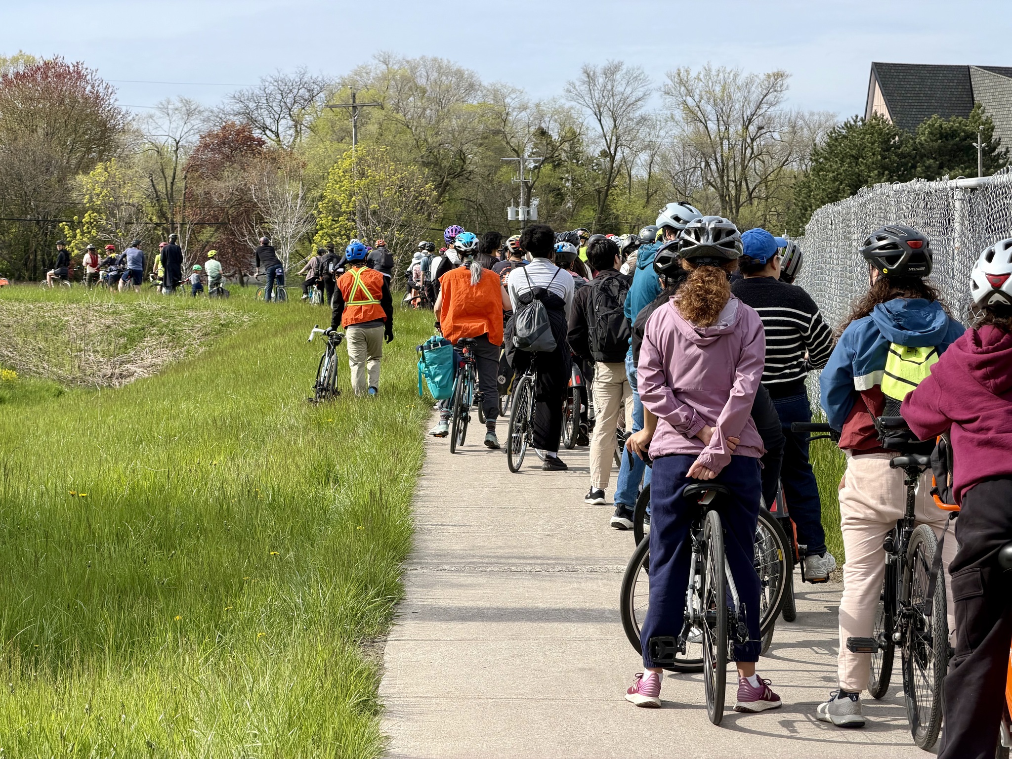
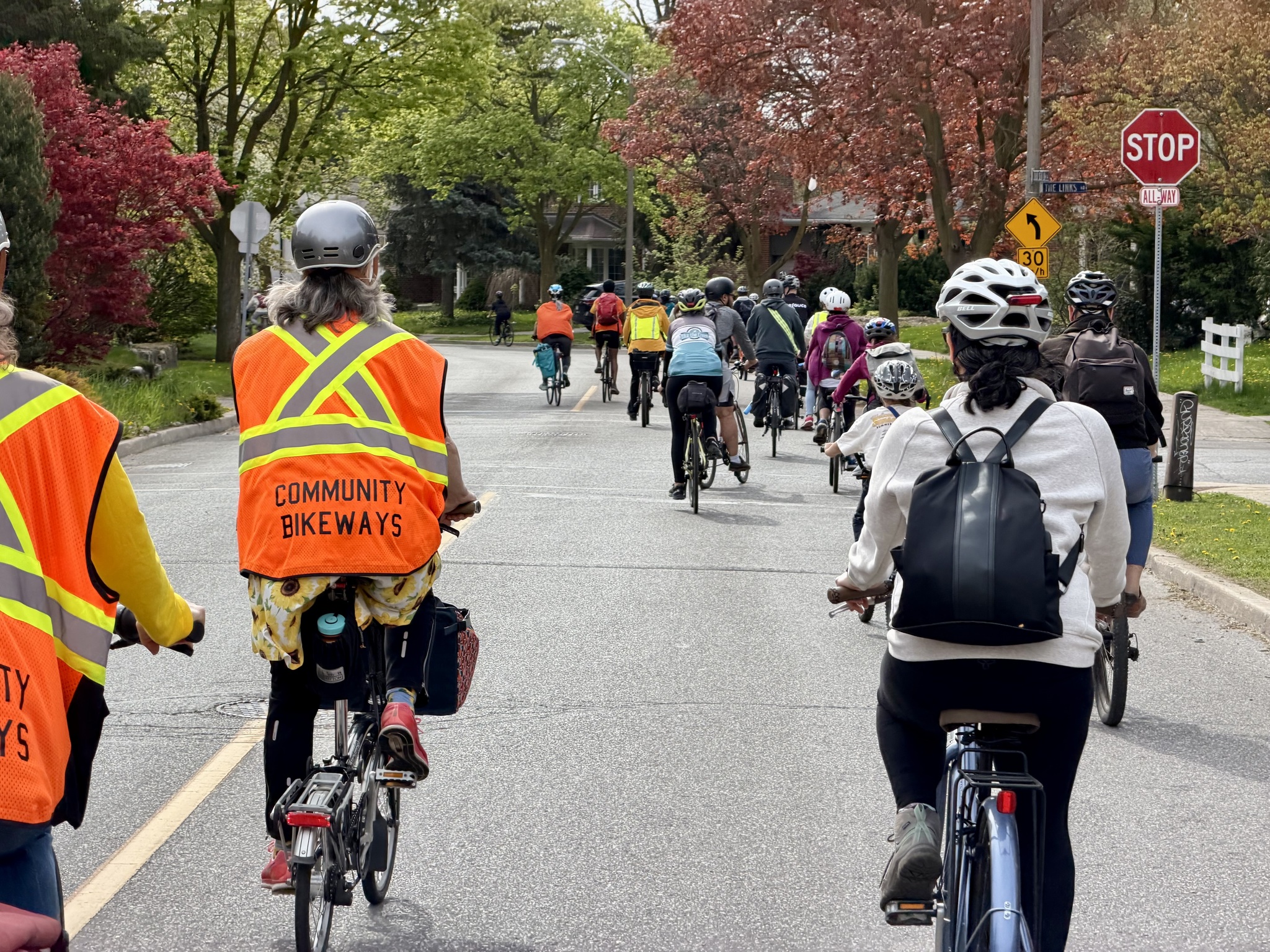
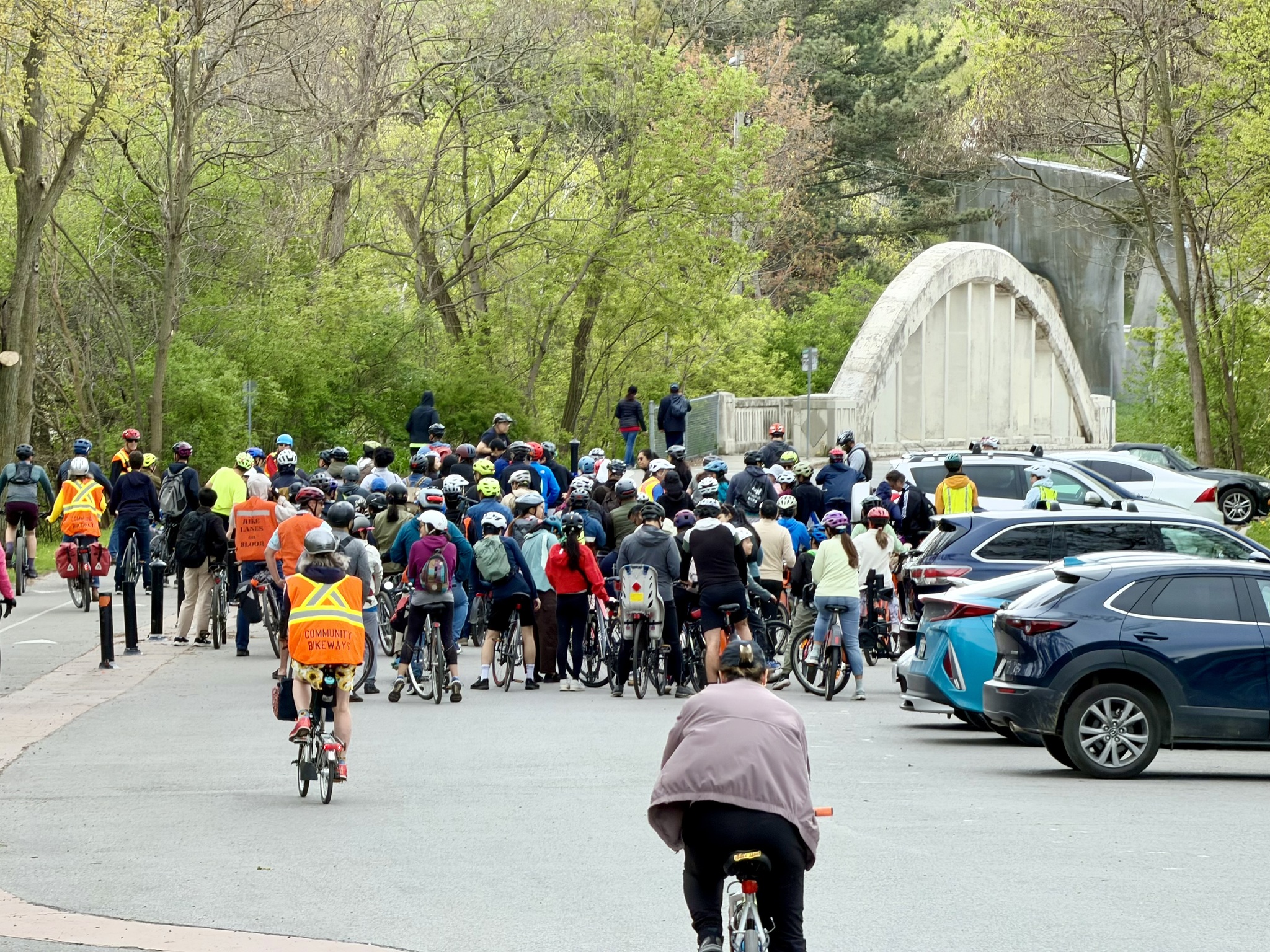
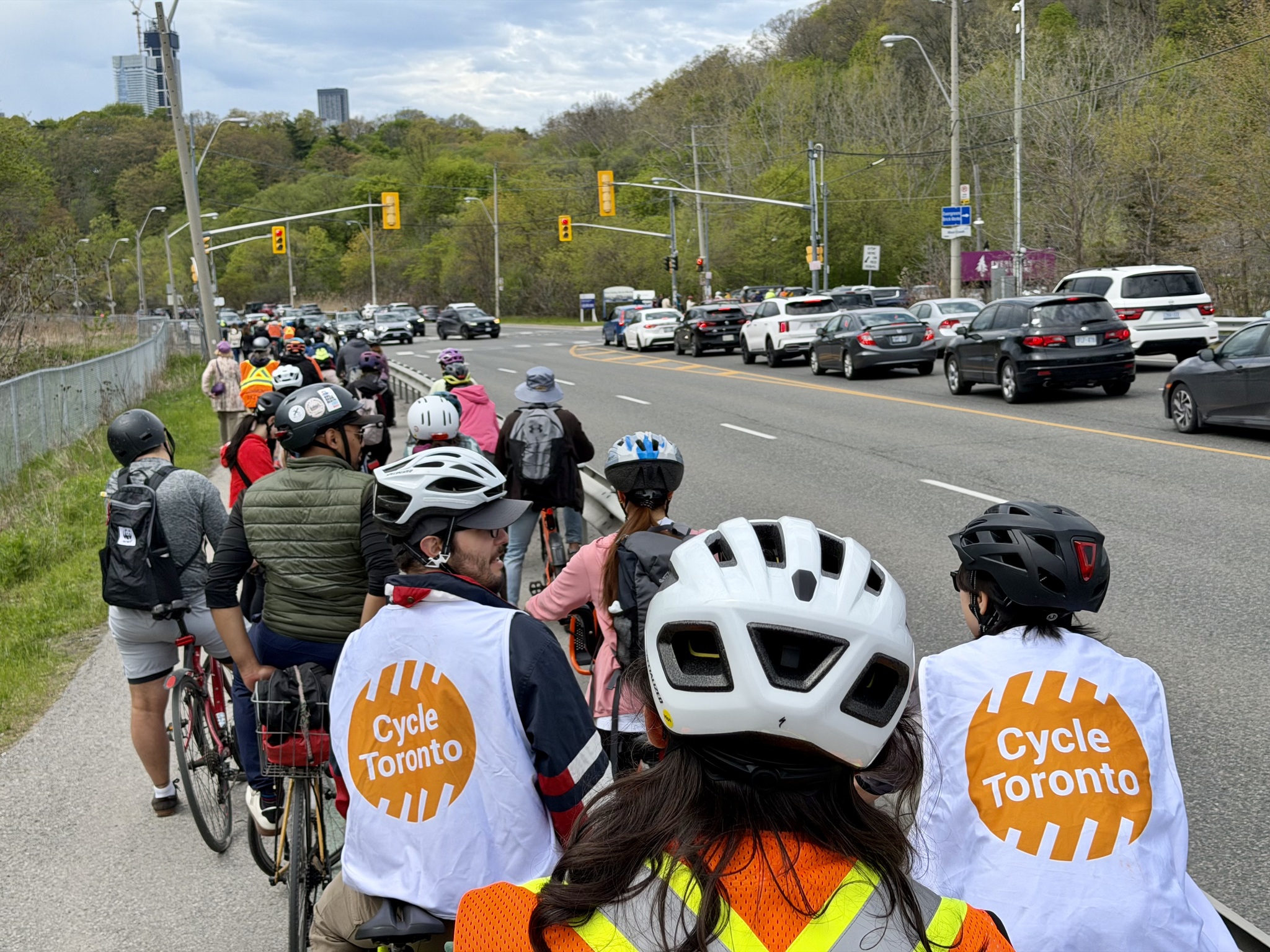
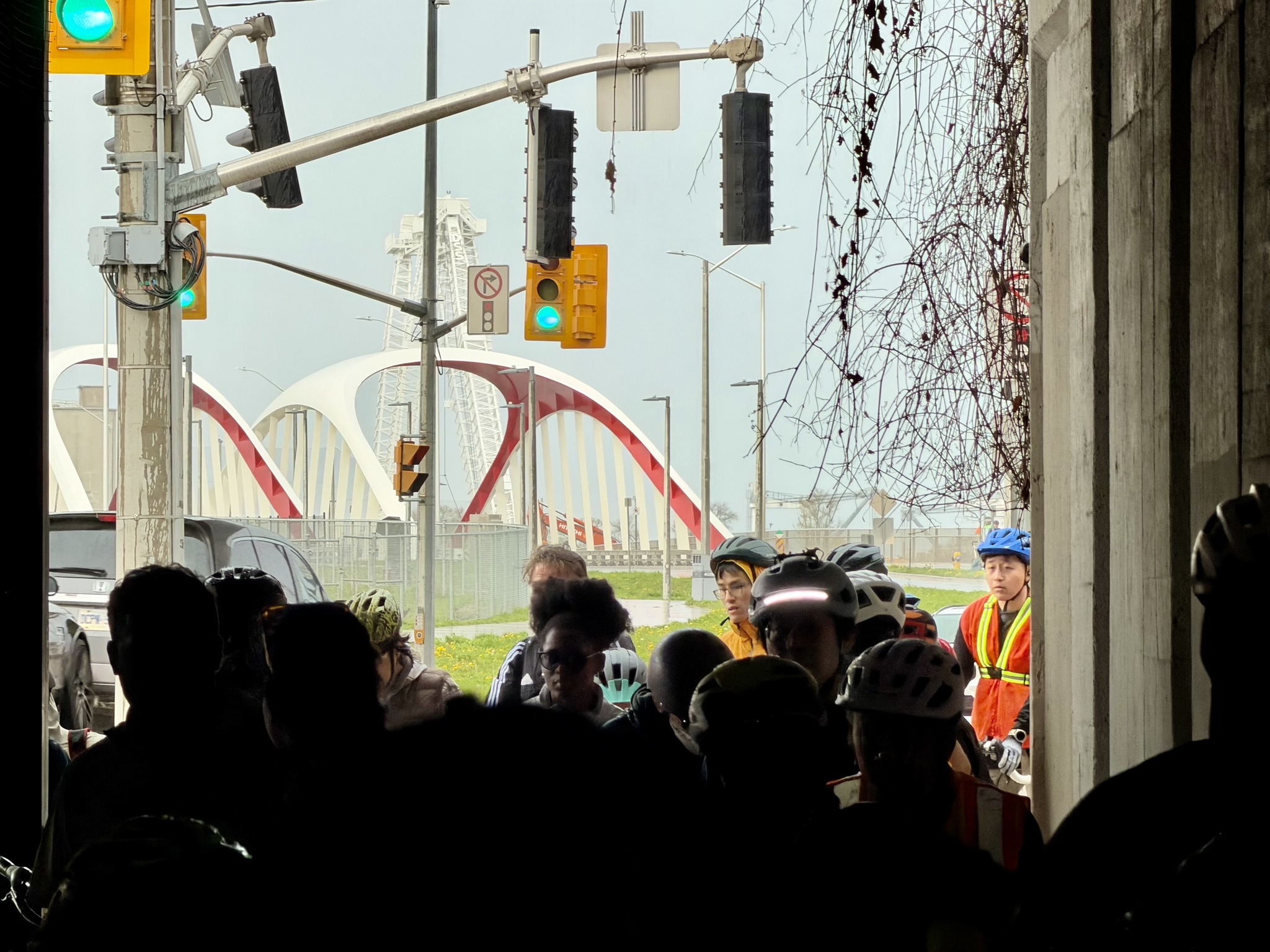
Community Bikeways provided marshals for the ride. They did a great job of stopping traffic so our large group could stay together.
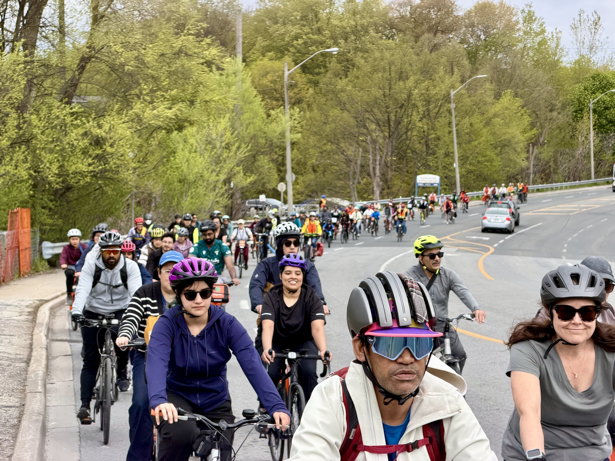
Here the group is crossing Bayview Avenue.
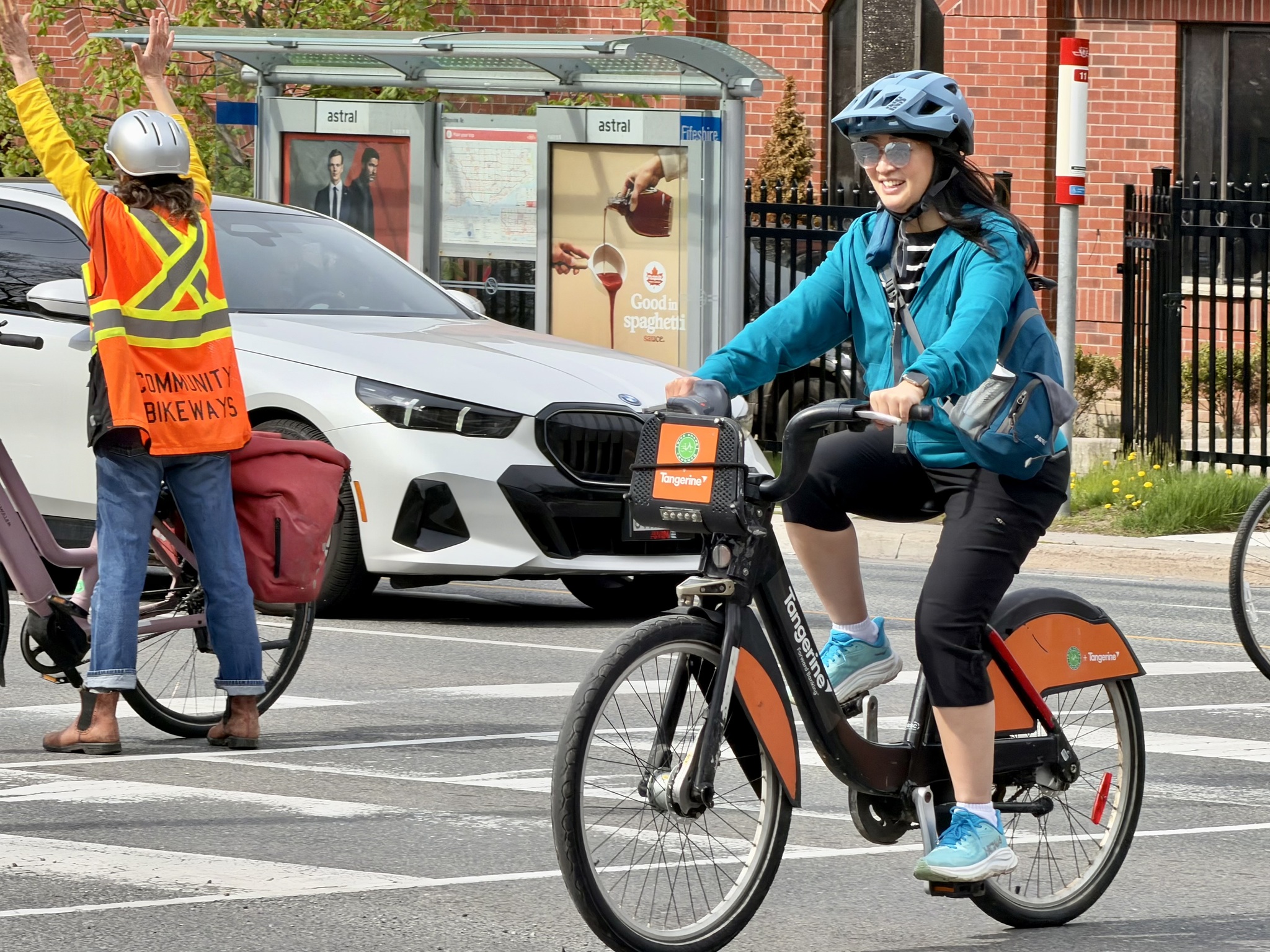
And here is Councillor Lily Cheng on a Bike Share bike.
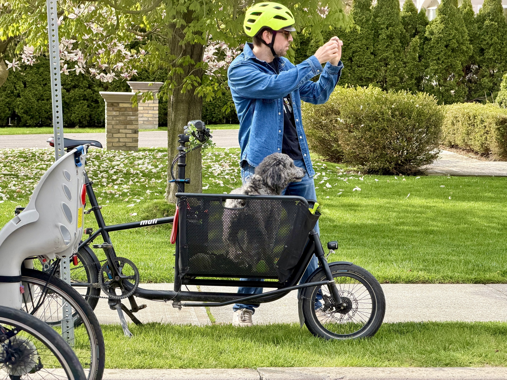
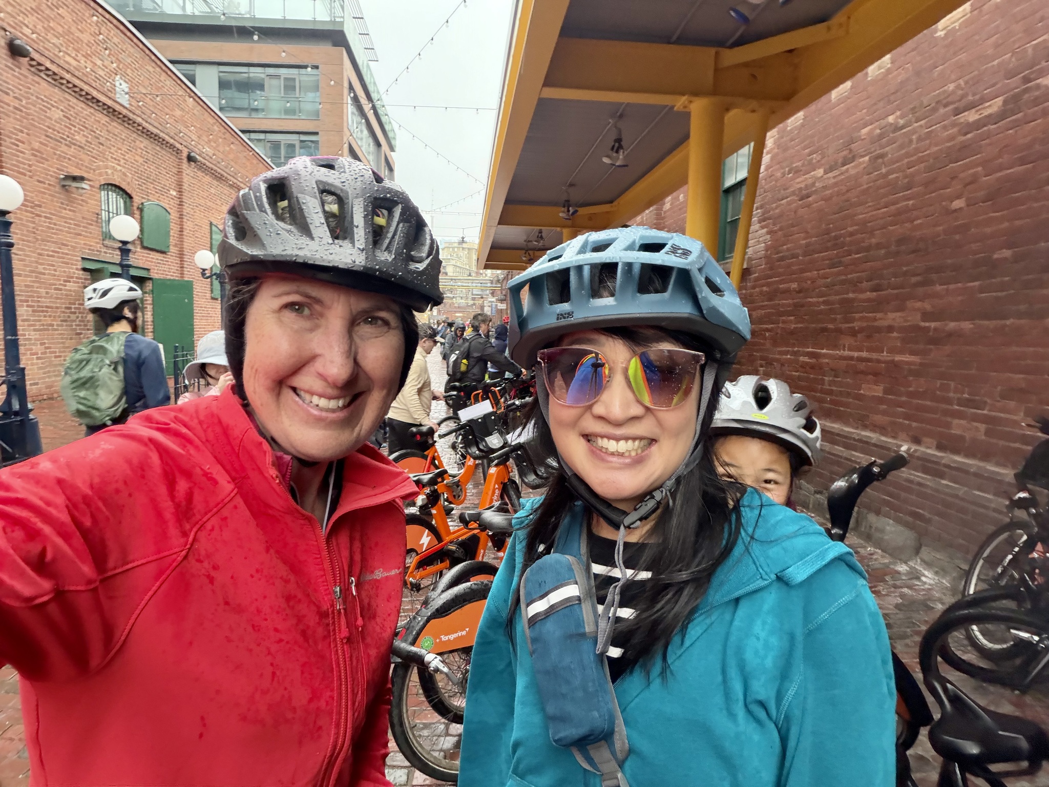
Robert Zaichkowski is a Toronto cycling, advocate, and fellow blogger. He was riding his cargo bike today so he could bring along his sweet dog Mozzie.
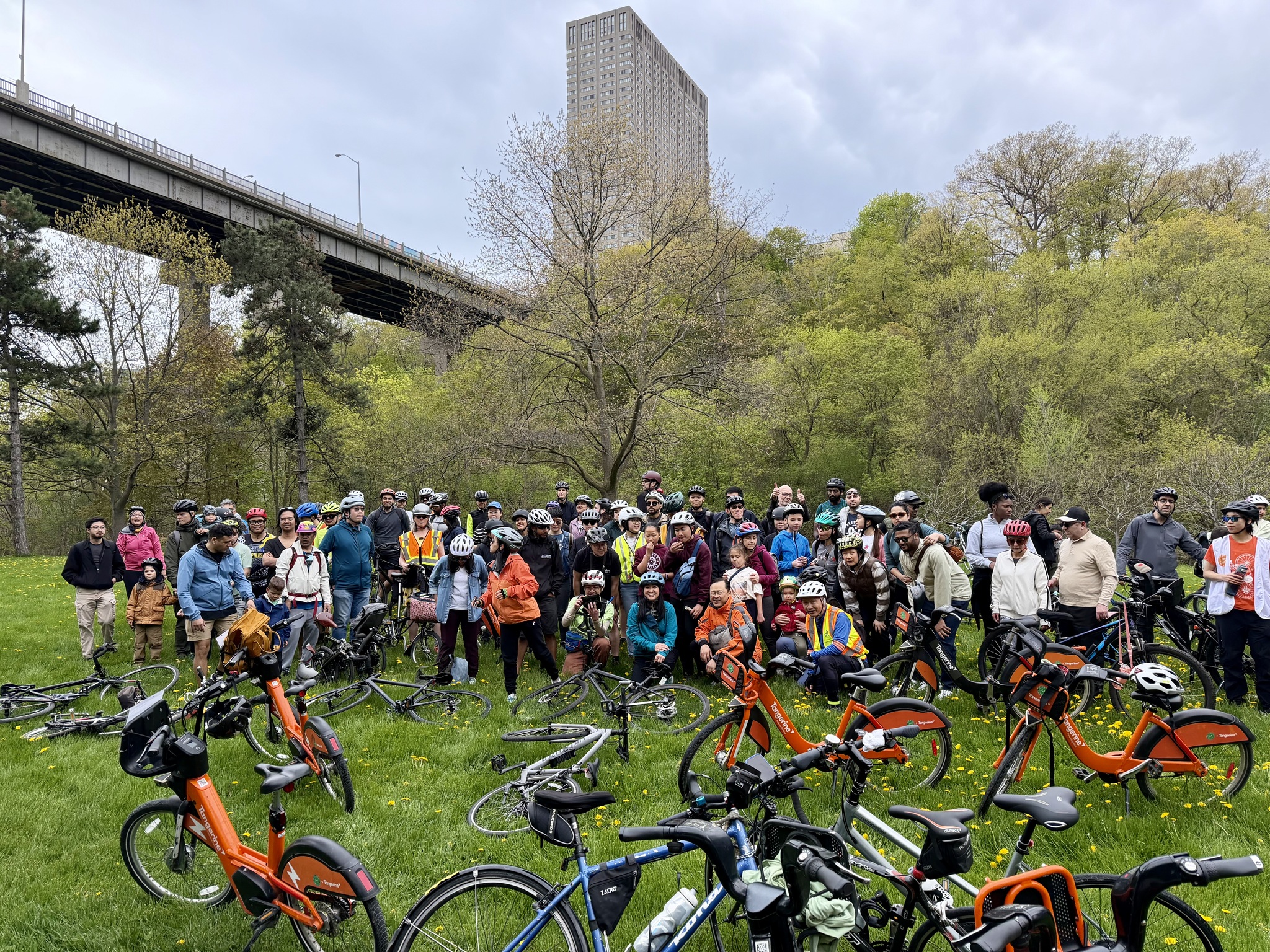
We had a short stop in a school driveway for a group picture.
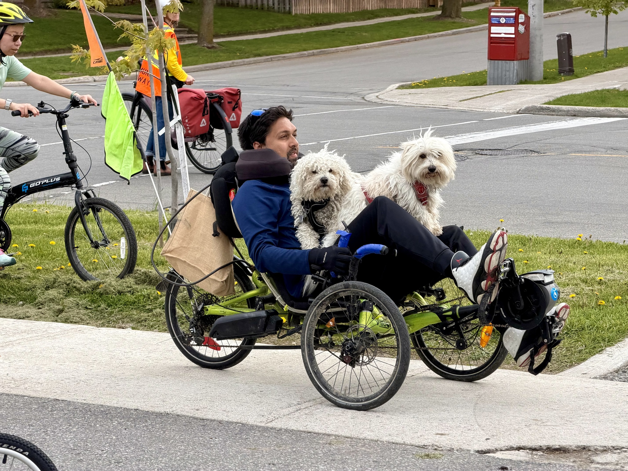
These are the other two dogs that were on the ride along with their owner on his recumbent electric tricycle.
I endorse this message.
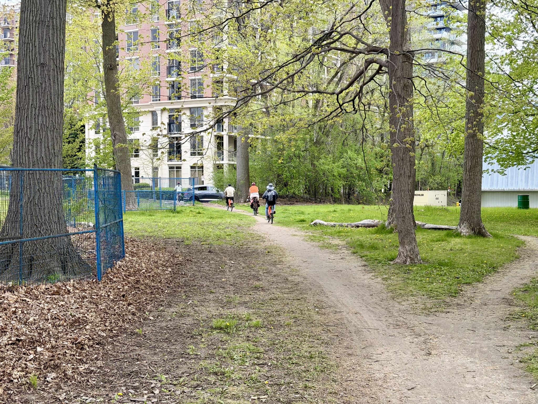
We were routed through a plaza to get to the north end of the Don Mills Trail at York Mills Boulevard. We gathered under York Mills until everybody was ready to continue.
Unfortunately, the Don Mills Trail ends just north of The Inn on the Park at Eglinton. One has to use this sketchy trail through a break in the fence. When I was here two years ago, we rode down the sidewalk to get to a traffic light to cross Leslie Street. This time we rode this desire line through to some new condos.
The driveway of the condos is where the traffic light is.
At this point, we had a short ride on Leslie Street. Three years ago, we turned into the driveway for Wilket Creek Park.
Today we turned onto the multiuse path on the north side of Eglinton.
This led to a an excellent new access point to the park. It was lengthy with a switch back, making the grade quite accessible. It’s unfortunate that the Don Mills Trail and this beautiful new ramp don’t connect safely.
Here’s a video of the group using the access ramp.
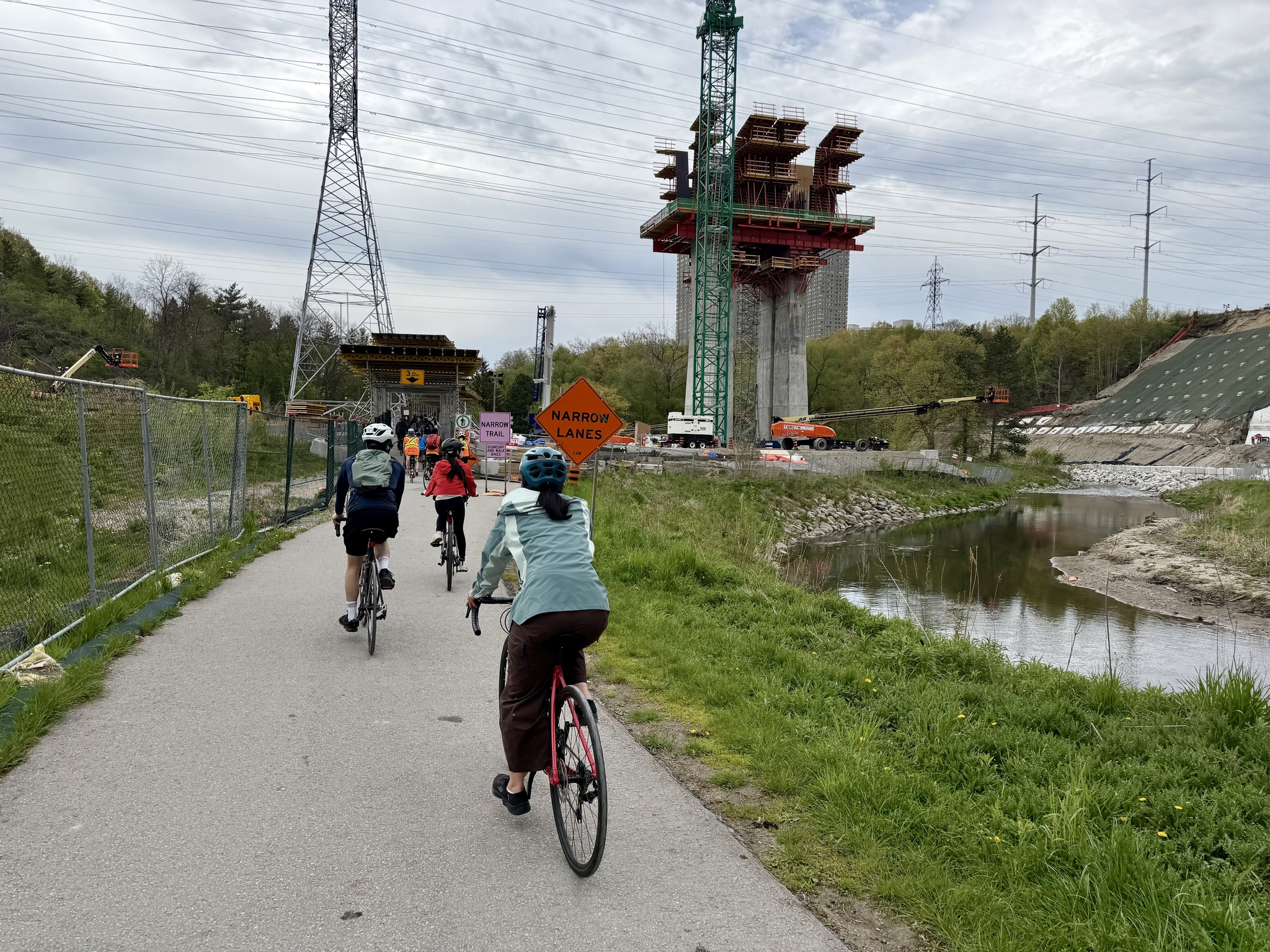
This is the new Ontario Line, a 15.6 km rapid transit line which will run from Exhibition Place to the former site of the Ontario Science Center. It will cross the Don Valley via two major bridges. This is the first, a 500 m bridge rising up to 38 m above the valley floor. Here’s a video about it that I was served as I was uploading my videos to YouTube today.
We had a short stop just before going under Overlea Boulevard. There were washrooms and water fountain.
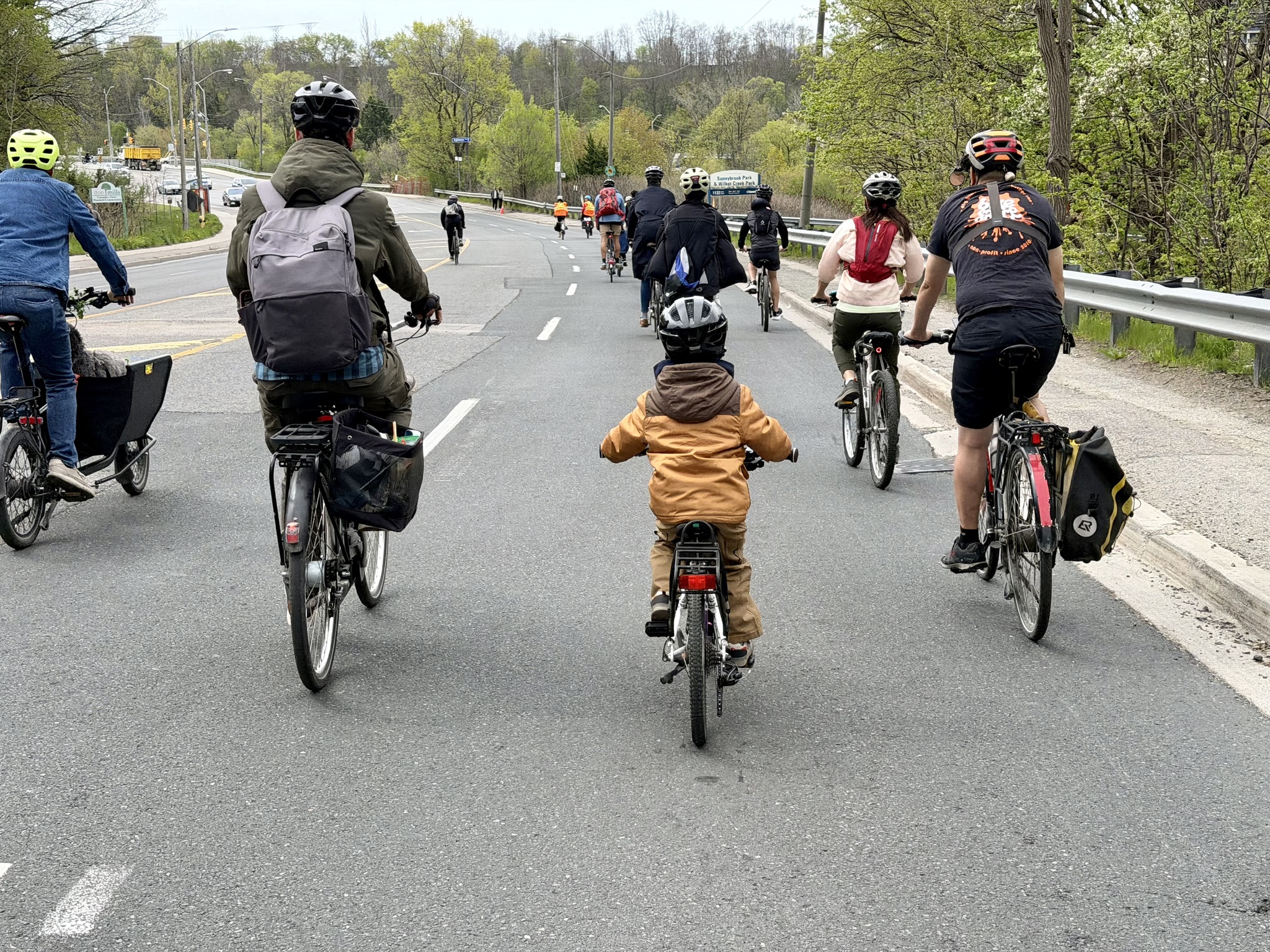
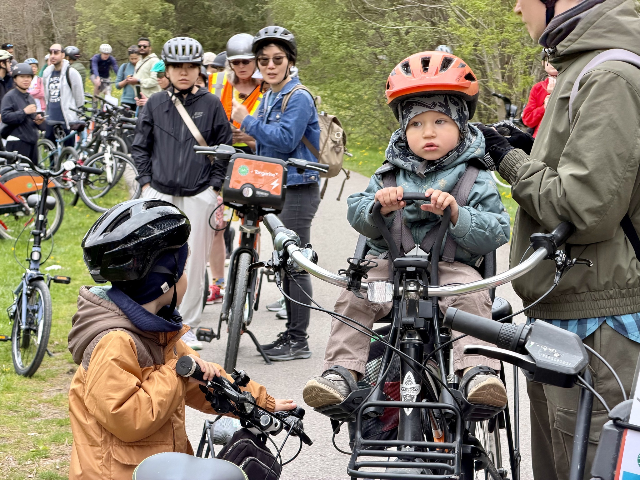
Here is the another very young participant, along with his brother, who rode the whole 25km.
Imagine if all these people had driven cars to the park.
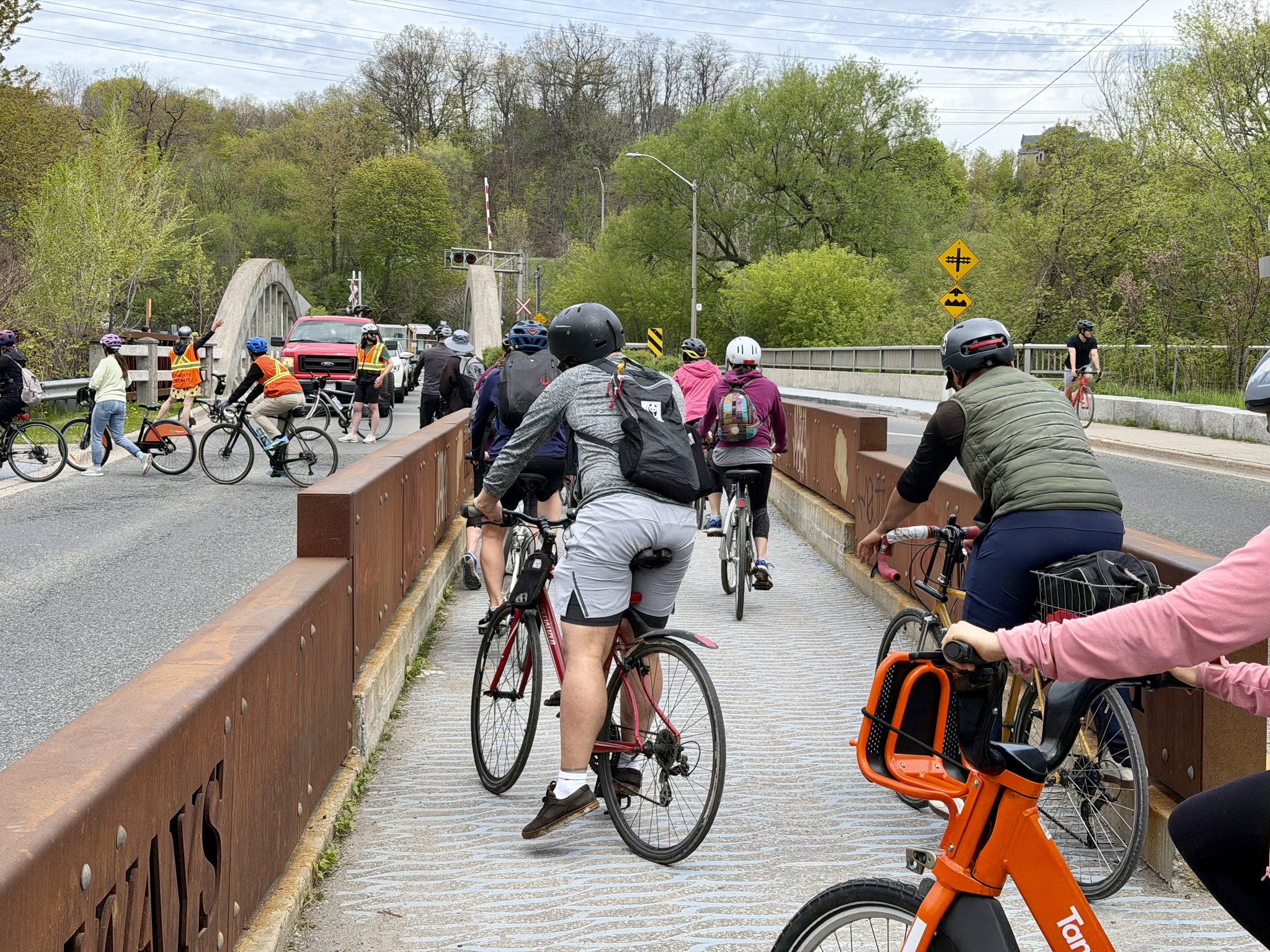
Here we are on a refuge island crossing Pottery Road. You can see the marshals stopping traffic so the whole group can cross safely and stay together.
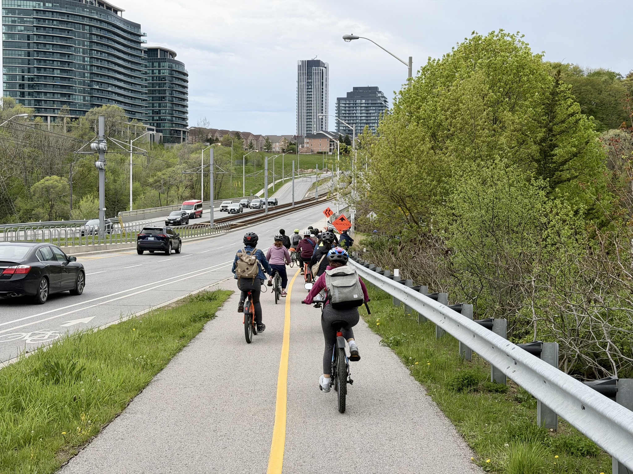
We filled the protected multi use pathway along Bayview Avenue.
We had a half hour break at the Evergreen Brickworks. I enjoy attending these events in Toronto because it often gives me an opportunity to meet in person people that I have interacted with online. Here I am with Cindy, Brian, who I was meeting in person for the first time, and Janet.
This little guy powered up this hill after riding about 23 km so far, without complaint.
It was an odd day, weatherwise. It was warm when we left Willowdale, but we lost the sun and it felt cool as we rode south. As we got towards the bottom of Bayview Avenue and came along Mill Street the wind increased suddenly and it started raining quite heavily. We sheltered under the Gardner Expressway and the marshals conferred with each other.
We could see one of the Portland bridges, and we’re only about 1 km from our destination Biisaadage Park. However, there’s very little shelter in Bissdaasage Park, so the decision was made to do a U-turn and go into the Distillery District.
Despite the wind and the rain, everyone was still happy. Here I am with Lily.
Lily thanked everyone for attending and gave instructions for either returning the Bike Share bikes or continuing on to Union Station for transit home.
Cindy and I had planned to ride all the way back, but given the weather, we decided to get coffee instead, and invited Janet to join us.
While we had coffee the weather changed again.
Cindy needed to be back in Brampton about 4 PM so we decided to ride to Union Station and take the subway back. Janet led us down Lower Sherburne where they have raised cycle tracks.
Sugar Beach was very busy with people lounging and taking in a food festival.
And here I am in Union Station. It was only my second time taking my bike on the subway. The last time was for the Bill 212 rally.
We got off at the Sheppard stop, and it was only a short ride back to the car.
Thanks to Lily, Peter, and Community Bikeways, for organizing such a fun event and keeping us safe. I look forward to next year.
Here is a better picture than the one yesterday of Alina at the bar for cyclists. You can put your foot on the lower bar and hold onto the top bar with your hand.
I was in a rush a few days ago when I took pictures of The Passage, so we stopped, and I took a few more today. The people on one side of Swidnicka Street are descending into the ground. The ones on the other side are emerging. It is said to represent the period of martial law in Communist Poland in the 1980s.
Alina treated me to breakfast at Dinette. It is reviewed in the Michelin restaurant guide.
From the guide: “Operating as both a coffee shop and restaurant, this is one of those appealing something-for-everyone places. Occupying part of a former 1930s department store, its modern bistro feel is infused with subtle Art Deco touches that tie in with the building’s history. Brunch is served in the day, before the dinner à la carte kicks in with its clean, fresh, and seasonal dishes taking inspiration from around Europe. Pastries from the café are sometimes available for dessert.”The food was delicious and beautifully presented.
Nearby was a meteorological station. It showed temperature and air pressure. Distances to the international dateline to the east (8521 km), the North Pole (4388 km), the international dateline to the west (9822 km), and to the South Pole (15,699 km) were carved into the pavers. The world is a big place.
Our next stop was the Wrocławskie Centrum Spa. It is a recreational facility built between 1895 and 1897. It has a swimming pool, saunas, steam baths, rehab, and sports facilities. When Alina was a young child, she and her mother used to come to the public baths here. At the turn of the 20th century, many residents lived in tenement housing that lacked proper bathrooms.
This is a statue of Nicholas Copernicus. Wroclaw’s airport is named for him. However, he probably never visited the city, despite holding a formal administrative connection as a Church Canon of the Holy Cross Collegiate Church. He might have studied under or was influenced by astronomers connected to Wroclaw.
Across the street is Bastion Sakwowy (Saddlebag Bastion). It is a fragment of the former city fortifications and an elevated pavilion. It was built in 1867.
This is the Wroclaw Planetarium. It offers educational shows and is very close to the Nicholas Copernicus monument.
Wroclaw had defensible walls and a moat system in the 13th century. It was developed to protect the old town and is now a scenic green pedestrian belt known as the old town promenade.
There are many beautiful buildings along the moat.
There is a small model of the fortified city at a pedestrian and cycling underpass, Brama Olawska. The remnants of the medieval gates were uncovered during the construction of the underpass.
Next, we met a high school friend of Alina’s, Krystyna, on the University Bridge. Krystyna is a city tour guide. The statue is Stanisław Wysocki’s tribute to the thousands of anonymous heroes who sprang to Wrocław’s rescue during the great flood of 1997. Erected in 1998, the three-metre statue depicts a nameless woman wading out of the water carrying books, mimicking scenes that took place in 1997 when local students joined efforts to save the priceless artefacts in the University Library.
This widening of the Oder River has several islands connected by footbridges.
These are university buildings.
We stopped for ice cream at Lody Roma. It was started in 1946 by two friends – a Polish pilot and mechanic, and an Italian pastry chef. The British newspaper, the Guardian, recognized it. It is one of the 20 best ice cream parlours in Europe.
Krystyna showed us the beautifully restored interior of one of the buildings in the area.
Plac Świętego Macieja, St. Matthias Square, has a pisuar that was a little bit more private than the “Pee curls” we saw in Amsterdam. The park dates back to 1876.
Buildings that have suffered years of neglect are slowly being renovated. Here you can see one that’s been renovated on the right, but not yet on the left.
Krystyna was very surprised to see a traditionally dressed chimney sweep riding by on his bike.
Midrise apartments surround Plac Świętego Macieja.
Placed “among street traffic, it was to make an impression of something abandoned”. He explained in an interview that: This artistic condition existed not in the chair, not in the form, but in the surroundings. The existence of this chair caused all of the surroundings to become artistic. Despite promises, the design wasn’t realized at the time. Lech Stangret wrote what follows: The organizers of the symposium found themselves in a difficult position. They promised the designs would be realized, but Kantor’s idea caused not only technical but also ideological problems – this idea was seen as a mockery of the socialist monuments which were being raised all over Poland.
In 2011, after his death, a concrete chair was created according to his design and erected in Wroclaw.
This is Alina’s high school.
It is across the street from St. Elizabeth’s Church (Bazylika św. Elżbiety). This is the same St. Elisabeth that I wrote about when I visited The Blue Church in Bratislava. The structures date back to the 14th century. However, it was gutted by fire in 1976, destroying the organ. The church and tower were reconstructed.
It’s hard to get a picture of the exterior and I realize as I write this that I did t even do a good job of trying. This is my best which has buildings in front of it, but shows the tower that we climbed.
A new pipe organ was built by a consortium of three organ workshops. As the original instrument, the pipe organ is mechanical and has 54 ranks. It is 16.5 m high, 10 m wide in a straight line (12.7 of curve width). Its weight exceeds 30 tonnes. The pipe organ is composed of almost a million elements, including nearly 3.5 thousand pipes of sizes between 6 mm and 12 m. It was inaugurated in 2022.
A 1:10 scale model was made as a first step to the reconstruction and is displayed in the church.
St. Elizabeth’s has a 91m tower open for climbing, which gives spectacular views over the market square. It felt more difficult to climb than the taller tower of the new church in Delft because the steps were of varying heights.
Outside the church was a small model.
Wroclaw is known for its small bronze dwarves scattered throughout the old town. From Wroclawguide:
It started with a political protest in the 1980s – the “Orange Alternative“ to express dissatisfaction with the communist regime. It was dangerous to express an opinion that differed from the official line. Anti-communist graffiti was regularly painted over. Starting in 1982, members of the movement began painting pictures of dwarfs over the painted-over graffiti. Over time, the colour, orange, crystallized as a response to communist, red, and protest events. Participants began to wear orange headgear, reminiscent of dwarf caps. Thus, the “Dwarf Uprising of Wroclaw” became a silent, but obvious form of protest.
The first bronze statue dates to 2001. Various sources claim that there are anywhere from 200 to 700 bronze dwarfs around the city. Here’s a slideshow of some of the ones that I encountered. This website has pictures of hundreds of dwarfs.
We then headed back to the apartment so Alina could continue to try to find technicians to come to the apartment tomorrow for her maintenance issues. The market area is largely car-free.
We then had active transportation infrastructure all the way back to the apartment.