Dixie Road Cycling Facilities North of Bovaird Drive


This is the first of three blog posts I will make about cycling in, or near, the Dixie Road corridor, and the various cycling facilities, or lack thereof.

  1. Dixie Road Cycling Facilities North of Bovaird Drive
  2. Bramalea GO Station to Clark Boulevard (Bramalea City Centre) along Dixie Road
  3. Clark Boulevard to Bovaird (Chinguacousy Trail)

Last Fall I took a ride along the Chinguacousy trail  from south of Bovaird to Countryside Drive and took pictures.

Overall, north of Peter Robertson, it is a trail with good bones that, with some tweaks, could be an excellent trail for recreation or commuting.

IMG_1679&80 editsmall

The Chinguacousy Trail comes from the south to the southeast corner and continues diagonally opposite on the northwest corner.  There is no signage on the southeast to indicate how one should continue. This is a simple fix and the city has some signage on McVean at Ebenezer, where the trail crosses to the opposite side of the road, which could be used here.

One could also choose to travel east or west along the Bovaird Trail, on the south  side of Bovaird, rather than continuing north parallel to Dixie Road. The Dixie and Bovaird intersection was recently reconstructed for the new Zum route on Bovaird and the Chinguacousy Trail connects to the eastbound Bovaird Trail with a ribbon of asphalt inside the sidewalk to keep pedestrians and cyclists separate. Initially there was only the narrow sidewalk, but I pointed out that it was a poor design for a potentially busy spot and an opportunity to connect two major trails.  The Region listened and added the asphalt ribbon.

IMG_20160421_134240editsmall

They also relocated a badly placed fire hydrant.


Ching Trail vs Dixie Road

 The reason I specify that the trail has good bones from Peter Robertson, but not between Bovaird and Peter Robertson is because it is so indirect between those two streets.  There is construction for a short way north of Bovaird due to the intersection improvements and as far as I can tell, there is no intention to have a multi-use path adjacent to the road, which means that instead of traveling along the red line for 600 metres, a cyclist would have to travel a hilly route along the yellow line for 1100 metres.
 IMG_1688 editsmall
One has to cross both north and west and then travel along sidewalk to the trail that begins just before the bus shelter, then meander through the storm management pond park before emerging at Peter Robertson, where there is a centre median, which means there are four curbs to navigate, or a run down the sidewalk to the light at Dixie, to continue north.
 IMG_1690 editsmall
IMG_1701 editsmallIMG_1702 editsmall
Beginning at Peter Robertson, the path is wide, relatively straight and nicely isolated from Dixie Road with vegetation on both sides.
 IMG_1706 editsmall
At the driveway to the soccer centre, once again there are curbs.
 IMG_1709 editsmall
At Sandalwood the path runs straight into a bus shelter.  Sandalwood also has a centre median meaning four curbs to negotiate or a run down the sidewalk to the light at Dixie.
IMG_1710 editsmall
 The path north of Sandalwood is older, but the asphalt is still in reasonable shape.  The path runs a little closer to Dixie, but is still nicely separated and relatively straight.  As the path approaches Naperton, it is a newer path again and it becomes a more typical in-boulevard trail, rather than being in a narrow park.
 IMG_1713 editsmallIMG_1715 editsmall
The treatment at bus stops is good.
 IMG_1716 editsmall

While the trail is wide and smooth, the intersection treatments concern me.  They always put concrete sidewalks at the corners and generally put a depression leading only onto the ladder crosswalk where it continues to be illegal to cycle.

IMG_1719 editsmall


The trail ends at Countryside, however Dixie has not been reconstructed north of there yet, so I assume the intention would be to continue in the same fashion to Mayfield.

Poor Sign Placement – Castlemore Road

I am relating this story here on my blog as I wish to provide more information to the city insurance claims adjuster but am unable to successfully send image rich emails to the city without them being bounced for being to large.

There is an approximately 2.4 metre multi-use path adjacent to Castlemore Road on the south side running from Airport Road to Highway 50.  This is a continuation of the Bovaird Trail that runs west from Airport Road, with a few breaks, to the Mount Pleasant area. Between the curb and the multi-use path is an approximately 1.0 metre maintenance strip that allows for roadside storage of snow in the winter.  Unfortunately, in most places the maintenance strip and multi-use path are both made of asphalt so that there is no delineation between the two, although occasionally the maintenance strip is made of a coloured, pressed concrete.  To the casual observer, unversed in road construction practices, it appears that there is a single 3.4 metre wide multi-use path.

Between Airport Road and Goreway Drive road traffic signs are placed 1.0 metre in from the curb, ostensibly between the maintenance strip and the multi-use path as in the following images.

The pathway is bidirectional with cyclists generally staying right as is customary in this country.  When eastbound (as in the images) the signs would not pose a problem.  However, when travelling westbound these signs can and do pose a hazard.

In May 2015, at night, my daughter was riding her bike westbound along this section of the pathway.  She was keeping to the right side of the path, approaching Bayridge Drive, when she was startled by an aggressively driven car in the eastbound curb lane, and caught the edge of her handle bar on a sign that was placed in the path, rather than at the edge of the path as is usually the case, and she went down hard on her left side.  She also cracked her phone screen which she was carrying in a cross body bag on her left side.  She was crying and confused when she phoned us for help.  We took her home, cleaned her up and watched her closely for the next few hours.  Fortunately, we determined she did not need a doctor.

Had the sign been placed where the asphalt and grass intersect, as is usually the case, the accident would not have happened.

I wrote to the city and requested that the signs be relocated and that my daughter be reimbursed for her broken phone.  I was informed by their insurance claims adjuster that the signs were placed “no more than 2 metres from the roadway edge” as required by  “provincial guidelines contained in the Ontario Traffic Manual Book” and “it would therefore not be possible as you suggest moving the sign to the outer side of the multi-use pathway as this would place it at too great a distance from the roadway to comply with provincial guidelines”.

The letter continued, “For these reasons we believe that the City of Brampton had maintained this location in a reasonably safe condition and in compliance of provincial regulations.  The City of Brampton can therefore not be held liable in this case.  Although we very much regret your daughter’s unfortunate injury and loss, we must respectfully decline any claims”.

I believe that the adjuster is incorrect because while 5 signs are placed in this fashion between Airport Road and Goreway Road (a distance of 1.4km), a further 27 signs between Goreway Drive and Highway 50 (a distance of 4.9km) are placed exactly where I have suggested they should be placed, between the multi-use path and the grass, significantly more than 2.0 metres from the roadway edge. Furthermore, the signs along the Bovaird section of the pathway, while adjacent to a regional rather than city road, also place the signs more than 2.0 metres from the roadway edge.

According to Ontario Traffic Manual Book 1B, Section 12, “standardization of sign position is important so that drivers can quickly find signs in expected locations”. Thus on a single road all of the signs should be similarly placed in relation to the roadway edge.

Section 12 continues, “Standardization of position, however, cannot always be attained in practice, since signs must be placed in the most advantageous position and must be adapted to the road design and alignment.”  Castlemore Road’s design includes a multiuse pathway which necessitates the signs be placed so as not to obstruct the safe flow of pedestrians and cyclists on the pathway, that is between the pathway and the grass.

Furthermore, whilst maximum horizontal distance from the roadway edge is defined for many types of signs in Book 1B Section 12, there is no maximum horizontal distance from the roadway edge defined for the types of signs posted on Castlemore Road and illustrated in my photographs.

The city cannot have it both ways: the five signs should be moved as I requested.

Since my daughter was travelling from east to west that evening and had safely passed 27  consecutive signs over a distance of 5km that were placed outside of the asphalt maintenance strip and multi-use path, she had a reasonable expectation that the signs over the next 1.4km of pathway would be similarly placed outside of the asphalt maintenance strip and multi-use path .

Here are the other 27 signs.


May 25 UPDATE to this post – I have been informed “these signs were installed in accordance with the applicable city standards and provincial guidelines. However, given the details of this incident, staff will consider relocating the sign(s) in question. ”

I am unsatisfied with this response, however, if the signs are actually moved I will consider it a small victory.


Exploring Hamilton Mountain Staircases

My daughter began attending Mohawk College in the upper city on the mountain in Hamilton in January.  Shortly after she began I discovered that there are several sets of steps from the lower city to the upper city.  As someone who has climbed the CN Tower for the past nine years I was intrigued.  Also, after driving up James, Claremont and Becket accesses and hearing about a cyclist killed on the Claremont access, and knowing that Hamilton is making an effort to be more bicycle friendly, I  was curious as to whether or not there was a safe, and not crazy difficult, way to cycle up the mountain.

I was picking up Megan for the weekend in the mid-afternoon, and had nothing planned for the morning, so I headed out three hours early with my bike in the back of the van with plans to find staircases and climb them, find a bike friendly way to get up the mountain (for a future trip) and explore a new bike path I discovered on Google maps at the east end of the upper city on Mountain Brow Boulevard.

Studying Google maps before I left home I came up with a plan to find the James Staircase to begin, then drive up the Jolly Cut, where I could see on Streetview that there was a narrow painted bike lane and then head to Mountown Brow.

I parked on Freeman Place and walked to the end of John Street South and followed the gray path in the red box on the map below.

Hamilton - Jolly cut - marked


I discovered a wide dirt path through the trees, not the stairs I was expecting.  I decided to follow it anyway.

IMG_20160401_113451 smallIMG_20160401_113705 small

It went up behind some lovely old homes, one of which had a great treehouse in the backyard, with views of downtown and the harbour through the trees.

IMG_20160401_114127 smallIMG_20160401_113724 small

I eventually came to some steps and when I climbed them, found myself at the edge of the Claremont Access and on the Bruce Trail.

I continued to walk along the edge of the Access and eventually came to the sidewalk, which led me to the top of the stairs and Southam Park, after crossing the ramp to West 5th Street.

It was a useful diversion from finding the stairs immediately, as it would be a fairly easy, short route to push a bike up this pathway. I outlined the staircase in blue on the map above.

Interestingly, on a Jane’s walk today, Shawn Micallef said he liked exploring somewhat randomly and then returning home and researching what he had seen on the internet.  Tonight when I was making the map above, I discovered that there is a sidewalk, a small staircase and pathway around the east end of the Jolly Cut that one could follow on foot or if one had a light enough bike to carry on the stairs.  That is outlined in yellow on the map above.  I will have to check that out on my next trip.

After descending the staircase I went back to my van and drove up the Jolly Cut (outlined in green) and over to Mountain Brow.

What a fabulous job Hamilton has done on the bike path along Mountain Brow Boulevard. The path is 4m wide, lighted with solar powered lights and well marked.  There is a small parking lot near the east end of the street between Nova and Ellsworth Drives and several bumpouts for on street parking of about 8-10 cars every so often along the length of the path which is about 2.5km. I got out my bike to explore. This residential road with houses on one side and the escarpment on the other used to be two lanes in each direction.  It is now a much nicer single lane in each direction with the wide bike path along the escarpment making for a much more desirable, and useful for all, streetscape.

Part way down the mountain the is a flat area with a paved rail trail (Hamilton Brantford) which I will definitely be exploring on another day.

The views were terrific even on this overcast day.

In short order I discovered Uli’s stairs (marked in green – above the Rail Trail and yellow, below),  built by hand by a retired local resident in 2005. The city discourages their use and has installed a metal staircase (Kimberly stairs) 300 metres west (marked in red – above the Rail Trail and blue, below).

Mountain Brow map - marked

I cycled the length of the trail and then returned to my car, moved it to one of the bumpouts for on street parking and climbed down the Kimberly Stairs to the rail trail. I walked west to the lower set of Uli’s stairs and then back east to climb the upper set of Uli’s stairs.  I didn’t discover the location of the lower Kimberly stairs until I returned home and studied the map further. I will climb those another day.

Uli’s Stairs:

Kimberly Stairs:

The city has even put in a water fountain at the top of the Kimberly stairs, something rarely seen outside any more. The stairs have bike rails, but there is a ramp access to the rail trail at the east end of  Mountain Brow Boulevard and Mohawk Road East.

I then returned to my van, drove to McDonald’s for a latte and picked up Megan. Megan then showed me the top of the Dundurn stairs (red box below) which she has recently started using and together we discovered the top of the Chedoke stairs (blue box below), but by this time I was starving so we left those for another day.

Chedoke and Dundurn Stairs - marked

This is the top of the Chedoke stairs, the stairs and the view to McMaster.   These stairs also have a bike rail. The drive to McMaster from Megan’s house near Mohawk on the mountain is 6.7km, but the walk, via the Dundurn stairs is 5.2km.


Brampton Cannot Afford A Tunnel

According to Brampton’s 2016-2018 Capital Budget Overview (on page 69) the City of Brampton has approximately $4.7 billion of assets in operation, excluding land.  As assets are used and age, their useful life declines, which leads to the need for replacement. This decline is known as depreciation expense and is considered to be the minimum amount of funding that should be set aside each year to ensure that the assets can be repaired  and/or replaced in the future.

Any gap between depreciation and the amount set aside for repair and replacement is called the annual infrastructure gap.  Additionally, there is an accumulated infrastructure gap that is the sum of all the prior annual infrastructure gaps.

Take a look at this chart that was included (on page 56) of the 2015 Budget.

2015 Infrastructure gap


According to the preamble to this chart, on page 55, Brampton has an accumulated infrastructure gap of $1.2 billion, yes, BILLION.

To address this gap, council has passed an infrastructure levy of 2% on property taxes which is represented by the orange on the chart.

Even with this infrastructure levy, they are not beginning to address the accumulated debt, nor are they even eliminating future annual gaps, they are only reducing future annual gaps to the point, in 2024, when they will put aside 93% of that year’s replacement cost. By 2024, they predict they will have added another $322M to the infrastructure debt for a total of $1.5B.

But it gets worse!

Fast forward to the 2016-2018 Budget document with an updated infrastructure gap projection.

2016 Infrastructure gap


The accumulated infrastructure gap is now $1.3B according to the preamble.  Now compare 2024 in the first chart (last column) to 2024 in the second chart (second column from the right), prepared one year later.

They are now projecting that the gap will only close to 79% by 2024 vs the 93% predicted last year.  That is a huge difference.  And now the projected annual additions to the infrastructure debt over the next 10 years  are $504M vs the $322M predicted last year. If the City was actually closing the infrastructure gap with the 2% levy, with each passing year, the projected annual additions should be falling, not rising.

Clearly something terrible is going on.  How do the predictions change that much in one year?  Perhaps one might argue it is difficult to project out 10 years.  Well, let’s look at the gap predicted for 2016 in the 2015 document versus the 2016 document. 66% versus 53%.  How could they have gotten it so wrong when projecting only one year out?

No wonder squirrels are falling from the roof of the Balmoral Recreation Centre and the pool is closed at Howden.

Yet, despite all the foregoing, six of our councillors thought it was a good idea to turn down a fully funded surface LRT route on Main Street and gamble on the provincial and federal levels of government providing additional funding in the future for a more expensive alternative.

They asked staff to come up with a recommendation for three alternative routes.  Staff have now come back with two alternatives, both options detail a tunnel under Main Street.  The only difference is the number of stops.  The price tag is $570M, not including contingency, for the tunnel piece only, which would begin at Elgin Street.  There would also be the cost from Steeles Avenue to Elgin.

The province has been clear that there will be no funding for any route other than the surface route that was extensively studied and planned, but ultimately rejected.

Brampton cannot afford to build a tunnel given the infrastructure debt we already have; a tunnel that would itself become an asset that would depreciate and have to be maintained in future, adding to the annual infrastructure gap.  On top of that there is the opportunity cost of building an expensive tunnel where a surface route would suffice.

Opportunity Cost is defined as “the loss of potential gain from other alternatives when one alternative is chosen.”

Money spent on a tunnel is money not spent on  repairing all those deteriorating assets we already own.  Money spent on a tunnel is money not spent on assets Brampton lacks that other cities, many much smaller than Brampton, already have.

For $570M we could have:

  • A third hospital (a priority for many who opposed the surface LRT), or
  • A central library (Brampton doesn’t have one and ranks 40/41 when compared to cities across Canada for library infrastructure), or
  • An indoor, year round, Farmers’ Market, or
  • A national level art gallery, or
  • No additional annual infrastructure gap, in other words, fix what we have

Even if, and its a huge if, funding could be secured from the provincial and federal levels of government, there is only so much they will invest in Brampton. If they invest in a tunnel, will they be willing to invest in Riverwalk, which would flood proof downtown Brampton, and allow for future development and protection of our heritage buildings? Will they invest in a hospital, or art gallery?  I think not.

Brampton should not build an LRT tunnel.  The opportunity cost is too high.


Riding UP

Metrolinx, the provincial agency responsible for regional transit in the Greater Toronto Hamilton Area, opened the Union Pearson Express (UP Express) last July amid much criticism based on the price of the service ($27.50 cash/$19  with Presto Card, one way) and skepticism over the ridership projections of 5000 people per day.  The train travels from Terminal One at Pearson Airport on a 6km long dedicated spur before joining up with the tracks used by the Kitchener GO train.  It stops at Weston Station and Bloor Station before arriving at its own special station on the Skywalk just west of Union Station 23 minutes later.

Unfortunately, the skepticism proved to be well founded as UP struggled to attract only about half the projected riders.  While it provides a more reliable trip time than a taxi, at the current cost it is really only attractive to the single traveller.

In order to showcase the train to a wider audience, Metrolinx decided to offer free travel over the Family Day long weekend.  It would not make sense for my family to use the train as we live in the suburbs north of the airport.  However, having become interested in public transit since being involved in the Hurontario-Main LRT debacle, I was interested in trying out UP. We have also never used the continuous loop cableway train (LINK) from the long term parking at the airport to the terminals.

IMG_3609 editsmall

I decided to have a family day out.  With Megan home from college for the weekend all six of us were able to go.

We drove to the long term parking, parked in the surface lot and walked a couple minutes to the LINK station.  Next time I would park in the multistory lot with a bridge connecting to the station.

IMG_3611 editsmall

The station was bright and clean with glass walls separating the waiting area from the track. Once the train entered the station, it lined up its doors with sliding glass doors in the glass wall and both sets of doors opened to allow boarding.

IMG_3383 editsmallIMG_3382 editsmall

When the train arrived and we entered it I was surprised to see how small each car is with a bench seat at each end and standing/luggage room in the middle.

IMG_3392 editsmall

LINK stops at Terminal 3 first, then continues on to Terminal 1 where the UP station is located. It only took a few minutes and let us out right in front of the entrance for UP.

IMG_3398 editsmallIMG_3399 editsmall

The UP station also has glass walls separating the platform from the tracks. There was no lineup to board and within a few minutes we were seated in comfortable seats with seat back trays, “in-flight” magazines and free wifi.  There was staff on the train to greet us and people cleaning the train.  Michael commented that he has never seen anyone cleaning on a GO train.  It was spotless.

IMG_20160214_105355 edit

Here we are looking down on the LINK track from UP.

IMG_3402 editsmall

The train was quieter and faster than the GO train and 23 minutes later we arrived at Union Station. However, we had left home at 10:10, so the door to door trip took 70 minutes, at least 20 minutes longer than it would have taken us to drive downtown on a Sunday morning.

The station was relatively quiet when we disembarked.  There was a backdrop inviting us to take a picture and tweet with the hashtag #ImOnUP for a chance to win a prize. And guess what? I won a prize – a $50 Balzac Coffee gift box.

We planned to have lunch at Marche in Brookfield Place, but it was still early so we explored Union Station and the PATH system first.

I love this view from the bridge over York Street.

As we walked under this sign, Michael quipped, “It’s telling us to go via the subway”.

IMG_3439 editsmall

The Great Hall is being renovated.

IMG_3441 editsmall

A relatively new addition to the PATH system, a bridge over Simcoe Street.

IMG_3455 editsmallBack onto the Skywalk looking east toward the UP station.

IMG_3467 editsmallThere was one little gap where we had to go outside to get from Union Station to the Royal Bank tower entrance. I read about an outdoor area being glassed over in the future.  I’m not sure if this is the area.

IMG_3472 editsmallIMG_3514 editsmall

I love the Allan Lambert Galleria in Brookfield Place. As you climb the stairs from the underground PATH system this is what you see.

IMG_3509 editsmall

Just as we were starting to get hungry we arrived at Marche.

IMG_3484 editsmallAs usual, the food was good.  It was the first time Megan and Owen had eaten at the Marche.

We managed to get our favourite table, way in back, where it isn’t too noisy.

After lunch we retraced our steps and were shocked to find a huge line-up for UP which continued to grow for the 40 minutes we waited for a train.

IMG_3528 editsmallMichael, Megan, Alun and Trystan elected to stand in line, while Owen and I walked about. I entertained myself taking pictures, introducing myself to Anne Marie Aikins, the spokesperson for Metrolinx, and tweeting the pictures I was taking.

Metrolinx employees were ensuring that anyone travelling to the airport for a flight were boarded first.  They were able to come up the left side of the ramp in the picture above. The trains were not filled  when leaving Union so that travellers waiting at Bloor or Weston would be able to board.

After another quiet and quick journey we arrived to crowds of hundreds waiting to board at Pearson.  Thankfully we had set out early enough not to encounter delays at both ends.

If I lived in a place where it made sense to use UP, I probably would.  Given that I do not, and we have no weekend or evening GO trains from Brampton, I hope that Metrolinx will consider lowering fares and offering a family rate so I can ride UP again.

Metrolinx offered the free fares for the weekend in the hope that it would bring out many people who would try it for free and pay in the future.  They were certainly successful in getting people to try it for free.  More than 10000 people rode on each of the three free days.  Whether or not that translates into future fare-paying customers remains to be seen.

Father Tobin Road Traffic Calming Endangers Cyclists

Father Tobin Road in northeast Brampton runs 3.5 km west-east from Dixie Road to Mountainash Road.  It has houses, parks, two elementary schools, a middle school and two high schools.  Unfortunately, as a 3.5km long, straight, overly wide road, it encourages drivers to use it to avoid busier arterial roads and to exceed the speed limit. One quarter of vehicles was deemed to be “cut-through” traffic in a vehicle study of this road.

Last summer Brampton decided to do traffic calming on the 1.4km section between Bramalea and Dixie where there are three schools.  The speed limit over the 3.5km varies from 40-50kph.  East of Fernforest, near the middle school, the speed limit is 40kph, with average measured speeds at 45.5kph, which might not seem too bad at first glance, however, the 85th percentile – the speed at which 85% of vehicles travel at or below – is 55.8kph, which means that 15% of vehicles are travelling at higher than 55.8kph in a 40kph school zone.

img_3281

Newton’s laws dictate that a doubling in vehicle speed results in a stopping distance four times as long and four times as much kinetic energy absorbed during an impact. Driver response times further increase stopping distances. As a result, a small increase in roadway traffic speeds results in a disproportionately large increase in pedestrian fatalities.


Source: https://www.sciencedirect.com/science/article/pii/S0386111214000235

Pedestrians or cyclists hit at speeds above 40kph are dramatically more likely to sustain severe injuries or die. Clearly, given this street has only homes and schools on it, the traffic situation was dangerous.

Brampton is embarking on traffic calming on Fernforest Drive this year, so I cycled along Father Tobin Road and Fernforest Drive this afternoon to see what was done last year so I can provide feedback at the Public Information Centre (PIC) for the Fernforest Drive traffic calming next week.
Options presented at the PIC for traffic calming on Father Tobin Road included a parking lane on one side or bicycle lanes on both sides.  Neither option was actually constructed.  The image below shows the evaluation criteria which includes lowering the 85th percentile to 45kph, which means that 15% of vehicles would still be travelling above 45kph.
img_3282
I began my ride at the east end where Father Tobin Road begins at Mountainash Road.  This is Shaw Public Elementary School and the road is far too wide along the entire length of Father Tobin Road, so I am curious why the traffic calming applied only to the western 1.4km.
IMG_20160108_141500 editsmall
This is an intimidating expanse of asphalt to cross at Torbram Road.
IMG_20160108_141730 editsmall
It is quite unusual to see a bridge built so wide in Brampton.  There is plenty of room for bike lanes here.
IMG_20160108_141842 editsmall
Another huge intersection at Sunny Meadow Boulevard.
IMG_20160108_142049 editsmall
Here is where the traffic calming begins, on the west side of Bramalea, in front of a high school.  Urban shoulders, on alternating sides, and some medians, using a brick surface in places, is what was actually implemented.  Parking is allowed on urban shoulders.  Cyclists may ride on the shoulder, but need to come out into the motor vehicle traffic to get around parked cars.  And in this implementation, with the urban shoulder alternating from side to side, the cyclist needs to regularly merge with traffic when the shoulder disappears.
IMG_20160108_142408 editsmall
Here the lane disappears
IMG_20160108_142539 editsmall
Here’s another section on the north side where the shoulder has appeared again.
IMG_20160108_142743 editsmall
This is a terrible implementation for cyclists.  The likelihood of a crash between a car and a cyclist has likely increased due to the increased numbers of merges.  Most cyclists in Brampton are inexperienced at riding confidently on the road and will likely ride on the shoulder until it just runs out rather than merging into the travel lane before the shoulder narrows.  This increased risk might be somewhat offset by the fact that cars should be travelling at a lower speed.
Next I headed to the north end of Fernforest Drive which runs from Countryside Drive in the north to Bovaird Drive at the south end.  However, the road continues south of Bovaird with a name change to MacKay Street and will continue north of Countryside with a name change to Russell Creek Drive.  Ferforest has no road markings except at intersections where sometimes there are right and left turn lanes.  MacKay Street has four lanes painted from Bovaird to Williams Parkway, where it ends at a middle school.
The traffic calming for Fernforest is for Bovaird to Sandalwood Parkway only.  There are only homes and schools on Fernforest, right up to Countryside, and on MacKay, so I would like to know why the traffic calming is limited to such a small section, just as it was on Father Tobin.
This is the north end of Fernforest.  There is a multiuse path on the boulevard on Countryside on the south side to which bike lanes on Fernforest could connect.
IMG_20160108_144028 editsmall
This is a section that is not going to be traffic calmed.  It is crazy wide.

IMG_20160108_145402 editsmall

As I passed this school the traffic was heavy with people picking up children in cars.  No children, up to and including a Grade 6 student, would be expected to walk more than 2km.  It was a windless, sunny, dry, not too cold, winter day.  No reason not to walk.  This behavior drives me crazy.IMG_20160108_145546 editsmall

Finally, here is MacKay, south of Bovaird.  A residential street, far too wide for local traffic, but not part of the upcoming traffic calming.
IMG_20160108_150353 editsmall
To summarize:
1.  I would like to know why these traffic calming projects are being carried out on only a portion of these streets
2.  The alternating-side urban shoulder potentially makes the traffic calmed street more dangerous for cyclists than the original design.
3.  I hope a better implementation will be constructed on Fernforest, for the entire length, and include MacKay Street.

Buffalo and Frank Lloyd Wright

Breakfast was included in our stay at the Hilton Garden Inn in a nice space on the second floor overlooking the LRT and Lafayette Square.  I wrote about our first day in Buffalo, here.

After breakfast we packed up and asked for the car to be retrieved.  While waiting I had a look down Main Street where we walked the previous evening.

IMG_2826 editsmallIMG_2825 editsmall

In the light of day, the area didn’t feel quite as welcoming, possibly due to the fact that it was almost completely deserted.

I took a few other pictures as we waited. It was a beautiful sunny, but cool, November morning.

There is a civil war monument in Lafayette Square and when you stand with your back to the monument you look straight down Court Street to City Hall.

The car arrived and I entered Rotary into the GPS, the address where the Fontana Boathouse  is situated.  As we headed off, I said to Alun that it felt like we were going in the wrong direction, but as I had never been to Buffalo before, and did not have a paper map on which I could get an overview of the route, we followed the directions.

We saw the Electric Tower, once the tallest building in Buffalo, as we drove in the previous evening, and walked by the M&T Bank building with the gold dome which faces the LRT.

IMG_2834 editsmall

IMG_2835 editsmall

We ended up at the University of Buffalo on Rotary Road, not on Rotary Row (which wasn’t in the GPS, but was the correct street name) which was, as I had felt, in the opposite direction of where we wanted to be.  I had to stop at a McDonalds to use the wifi to find Rotary Row.  I don’t mind getting lost as it affords an opportunity to see things I might not have otherwise seen like these beautiful windows and reflections on the campus.

Once we left the area of the hotel, we did see the more rundown, abandoned side of Buffalo.  We saw very few chain stores and restaurants (although there was a Timmies kitty-corner to the hotel) and later discovered Buffalo doesn’t even have a Walmart, which must be a fairly uncommon situation for a city of a quarter million people.

Eventually we found the Fontana Boathouse.  It was originally designed by Frank Lloyd Wright in 1905 for the University of Wisconsin, but was never built until its construction in 2007, in Buffalo, along the shore of the Black Rock Channel.  Unfortunately, it was locked up on a November Sunday morning so we were only able to view it from the outside where it was already showing some signs of neglect.

Next we headed to the Darwin Martin Complex and the reason for our visit.  I booked a two hour tour starting at noon.  The house is considered by leading Frank Lloyd Wright scholars as one of Wright’s finest achievements of the Prairie period and, indeed, of his entire career. The complex consists of the Barton House, built for Martin’s sister, The Main House, pergola, conservatory, stables and carriage house and gardener’s cottage.

IMG_2869 editsmall

Darwin Martin had a difficult childhood, with the death of his mother when he was six, and left home at age twelve and managed to obtain a job selling soap in New York City.  He moved to Buffalo a year later and was hired by the Larkin Company as an office clerk and eventually rose to become Corporate Secretary. In 1902 he needed to find an architect to build a new administrative building for Larkin.  His brother, living in Chicago at the time, recommended Frank Lloyd Wright, an architect he used on his own home, the William E. Martin house in Oak Park.

Martin had become quite wealthy by this time so in addition to hiring Wright to build the Larkin building (which no longer stands) he also asked Wright to design and build a home for him.  Wright found an acre lot in a Victorian neighbourhood.  Martin commissioned him to build a home for his sister, Delta Barton, on one corner of the property to audition the architect.  It is clearly a Frank Lloyd Wright home, but the details pale in comparison to the main, 15000 square foot home that Martin commissioned.  The Barton House was completed in 1903 on schedule and Martin was impressed enough to hire Wright despite the fact that it came in three times over budget.

IMG_2845 editsmall

Unfortunately pictures are not allowed inside.  We started in the Eleanor and Wilson Greatbatch Pavilion (Visitor’s Centre) designed by Toshiko Mori (former Chair of Architecture, Harvard),  and built in 2009.  It is a glass pavillion designed to be unobtrusive on the property and offer great views of the house and grounds.  It in inspired from design elements from Wright’s work. We were shown a slideshow about Darwin Martin.

IMG_2862 editsmallIMG_2864 editsmall

Next we moved on to the gardener’s cottage, built in 1909, which had even fewer details than the Barton House, and is a stucco finish on a wood frame, but is a home I could happily retire to. It has an addition on the back which had beautiful Wright-inspired doors.

IMG_2859 editsmallIMG_2860 editsmall

Finally, we came to Martin’s home.  The size and the details were overwhelming.  It was amazing to see in person the genius which I had only seen in books or on the internet in the past.  Martin designed every aspect, from floor plan, to window design to furniture design and layout. In order to have perfectly level eaves-troughs, Wright designed an eaves-trough in an eaves-trough with the inner one sloped to drain properly.  The mortar between the bricks was indented an inch parallel to the long side of the brick, but flush on the short side to accentuate the long low feel of the house and its connection to the earth.  The house used curtain wall construction, with the structural support coming from huge brick piers which were used to disguise duct work, separated large rooms into functional areas and contained built in shelving.  This allowed for “ribbons” of windows which were unusual at the time.  This is one of the best documented of Wright’s homes as the architect and client communicated by letter on all the details, often daily.  Wright also had a professional photographer capture the home when it was finished.  Wright’s famous “Tree of Life” window design is used extensively throughout the house.  Each window has 300-400 pieces of glass and was handmade.

The family moved into the house in 1907.  In 1926, Martin hired Wright to build a summer home, Graycliff, south of Buffalo.  We didn’t have enough time to visit Graycliff this weekend, but we will definitely return.

Martin was financially devastated by the depression and died of a brain hemorrhage in 1935.  His wife, Isabelle, was unable to sell the house and abandoned it in 1937.   Then began the “Period of Abandonment” which lasted 17 years.

Architect Sebastian J. Tauriello purchased the Martin House in 1954 (it had reverted to the city for back taxes in 1946).  The pergola, conservatory and carriage house were demolished and an apartment building was built.  The money this earned was used to rescue the main house.  In 1967, it was purchased by the State University of New York at Buffalo, for use as its president’s residence.

In 1992, the Martin House Restoration Corporation (MHRC) was established.  $42M US has been spent restoring the house to its 1907 “Year of Significance”, rebuilding the pergola, conservatory and carriage house, acquiring the Barton house and gardener’s cottage and building the visitors’ centre.  Only about half of the complex’s almost 400 windows survived the “Period of Abandonment”.  Each restored window costs $27K US.

Restoration is about 85% complete.  Next spring the MHRC will embark on a project to restore the grounds to Wright’s design which included one million plants.

We will definitely be returning to see the house completed, to see the gardens and to visit Graycliff.


November 21, 2015 – Buffalo and The LRT

I have long admired Frank Lloyd Wright and am familiar with his work from books.  Alun, my sixteen year old, is interested in architecture, so I suggested to him that we visit The Martin House in Buffalo.

We left just after lunch and had an uneventful drive, with less than ten minutes spent at the border crossing into the U.S.

Our first stop was The Fashion Outlets of Niagara Falls in Niagara Falls, New York.  We were there with Megan back in September when I took the two of them for their first cross border shopping trip.  I don’t really enjoy shopping, but I thought it would be a fun excuse to get away before Megan moved to London for college.

IMG_1731 editsmall

Alun found a couple cardigans to add to the two he purchased the last time we were there.

We then drove the rest of the way to Buffalo, where I had booked a room at the Hilton Garden Inn, as recommended by The Martin House website.  It was a nice hotel, right downtown, and by booking through The Martin House link we got a reduced rate.

It was after dark when we arrived, unloaded, arranged for the valet to park the van in a nearby garage and checked in.  We went up to our room on the ninth floor to find unmade beds.  I called the front desk and they arrived in short order with a new key for a made-up room down the hall.

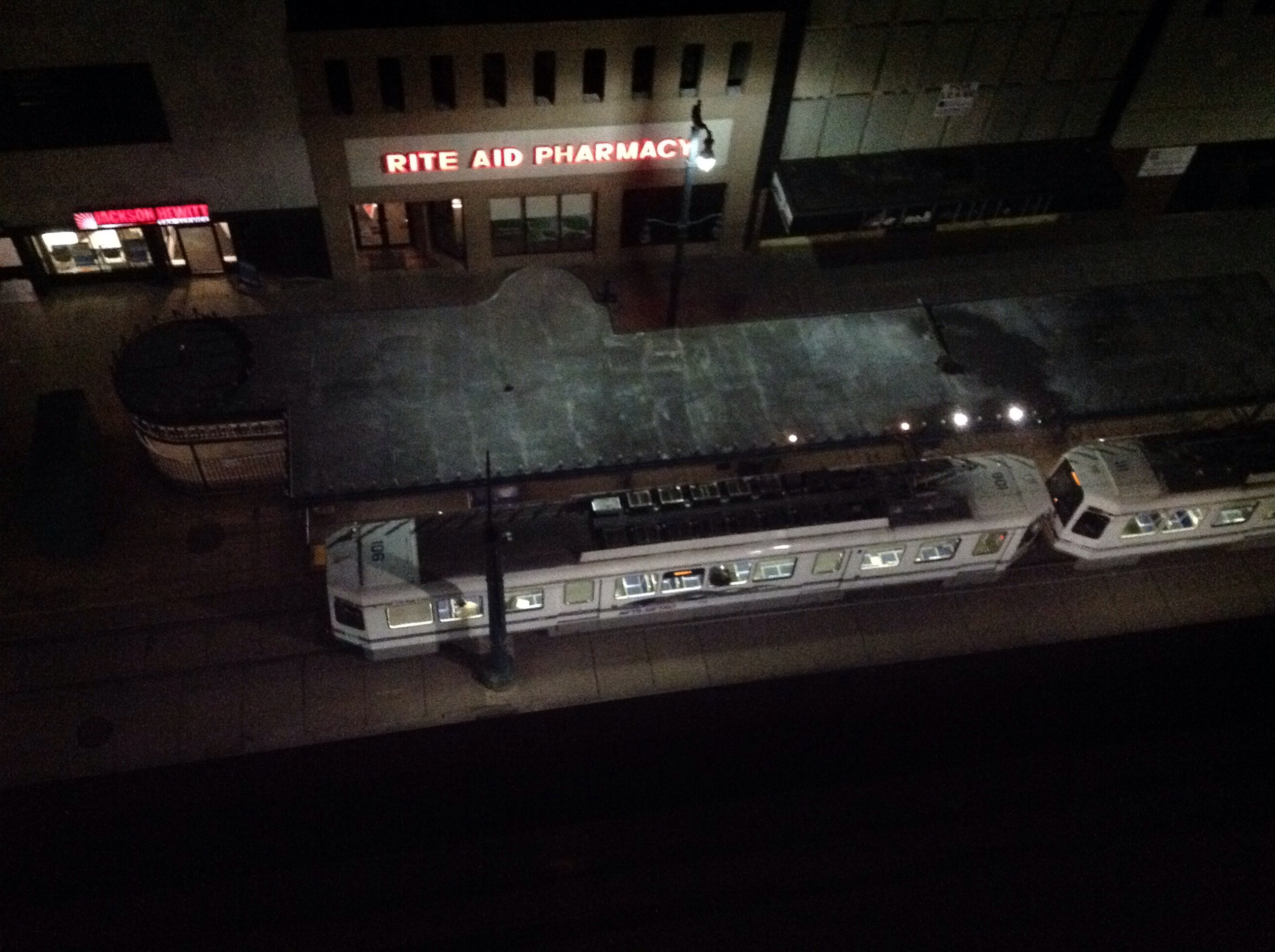
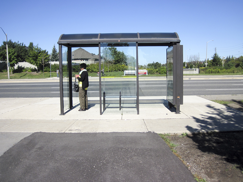
We carried in our luggage and I flung open the curtain and looked out to discover an LRT in a transit plaza adjacent to the hotel.  “Oh my God, Buffalo has an LRT!”, I shouted.  “We must ride it!”.


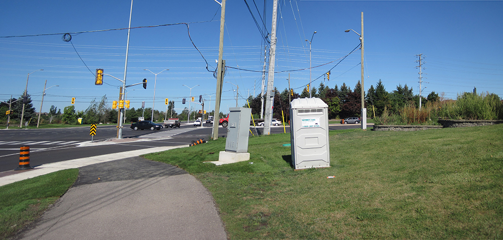
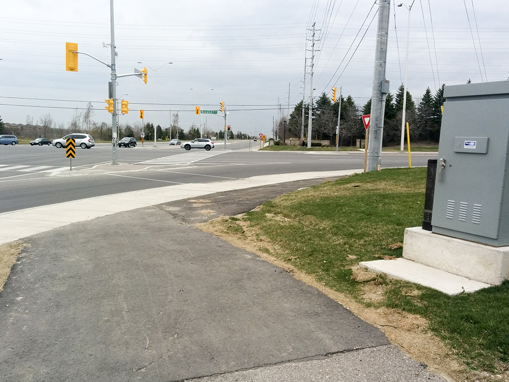
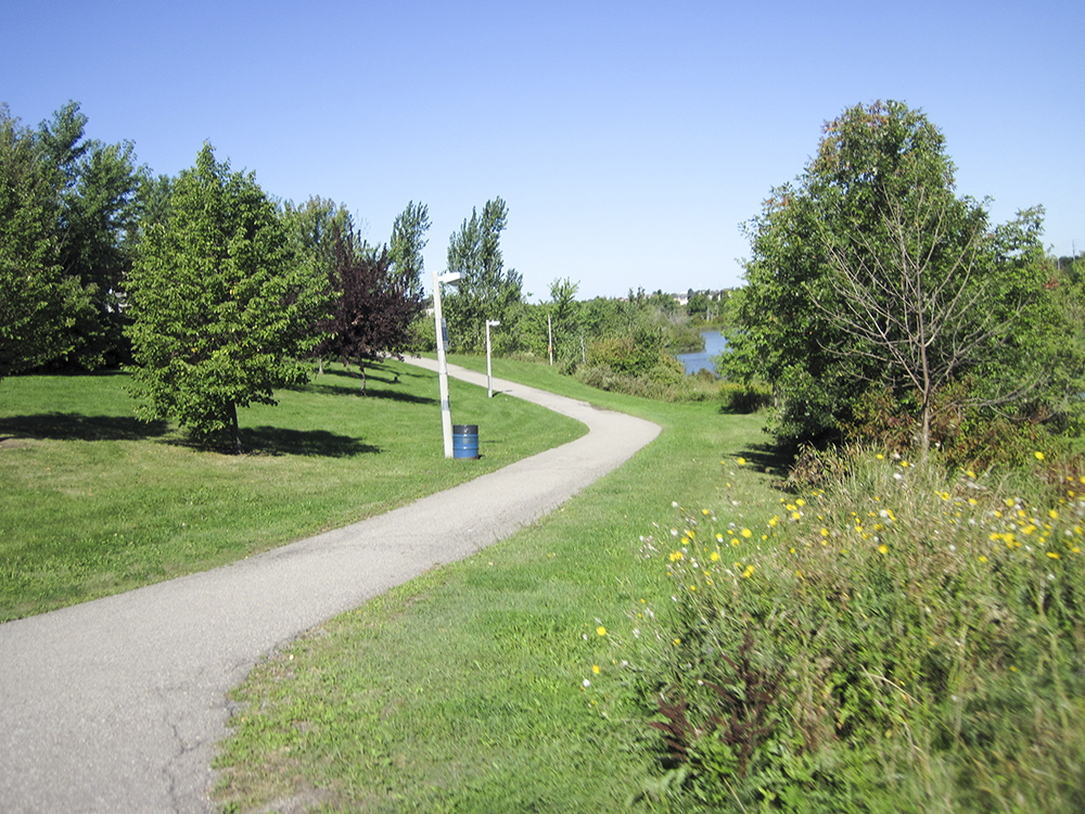
Perhaps a little background is needed to explain my excitement.  In 2010, Brampton started running light Bus Rapid Transit on Main Street.  The Transportation Master Plan called for it to be converted to Light Rail Transit when ridership and funding warranted. In the intervening years, the Hurontario-Main LRT (HMLRT) was extensively planned, had public consultation and ample opportunity for City Council to have input on the route.

Having completed the planning phase, Metrolinx, a provincial agency responsible for The Big Move, building transportation infrastructure for the Great Toronto Hamilton Area, looked to Mississauga and Brampton Councils to approve the plan so they could move forward with contracting and construction (2018-2021) of the HMLRT.  Mississauga Council approved the plan, but Brampton Council rejected it 10-1 in September of 2014 due to concerns they had failed to address through all the years of planning.

In October, a new Council was elected with a new mayor, six new councillors and four returning councillors.  In April of this year, the Provincial budget provided full capital funding of $1.6B for HMLRT.  With a substantially new council and full funding rather than the usual split of one third funding provided by each level of government this was a game changer.  The Mayor indicated she supported the route as planned and that the decision would be brought back to Council.  It soon became clear that the old divisions still existed and that it would be a tough job to get Council approval.

I wrote a letter to the Brampton Guardian urging acceptance of the plan.  I made a deliberate decision in 2013 to get involved in cycling advocacy and started communicating with staff and my councillor and I joined the advocacy group BikeBrampton. I have also been appointed to the Brampton Cycling Advisory Committee of Council.  I wrote the letter regarding the LRT because it just made sense to me , but I didn’t expect to get involved in transit advocacy.  Shortly thereafter I was contacted by Fight Gridlock, an advocacy group that had been encouraging acceptance of HMLRT for over a year, and asked to send my letter to my councillor and to delegate the Planning & Infrastructure Committee when they debated whether or not to approve the HMLRT.

Thereafter followed an extensive correspondence with my councillor, who was against the LRT, and preparation to delegate.  You can see my delegation starting at 2:37:07.  There was one delegate against and seven for the LRT.  At the meeting of the previous council the opposite was the case: with Fight Gridlock for and seven others against.The committee decided to defer making a decision to a Special Council meeting held on the evening on July 8, so I spent the next three weeks working with other advocates and preparing to delegate again.
On July 8 the council chamber overflowed and additional seating was provided in the atrium. There were about 80 delegates with three quarters of them for the HMLRT.  You can see my presentation at 1:01:03. The meeting went until almost 2am and ended with a motion to defer for six weeks to allow for a facilitator to be hired to help Council reach a concerns us.  It was very disappointing. Councillors were entrenched in their opinions and seemed impervious to evidence.

Six weeks turned to twelve and my time continued to be taken up with the fight.  We advocated our councillors and fellow citizens through the media, email, videos, Facebook and Twitter.  The Minister of Transportation and head of Metrolinx held a townhall, a facilitator was hired at great expense and accomplished nothing.

On October 27 another Special Council meeting was held, this time at The Rose Theatre to accommodate the expected crush of delegates and observers.  No issue had ever captivated the population of Brampton the way this one did. There were about 60 delegates, again with three quarters in favour, that included the CEO of Coca Cola, the president of the Board of Trade, an MP and many others, all urging Council to vote in favour of the plan.  You can see my delegation  at 37:10.

It was all to no avail. At the end, in the wee hours of the morning, Council voted 6-5 to reject the plan. Through all this I had never seen or travelled on an LRT. I was also unaware that there was one in Buffalo, thus my excitement.

We ate at the Pan-American Grill & Brewery in The Hotel Lafayette.


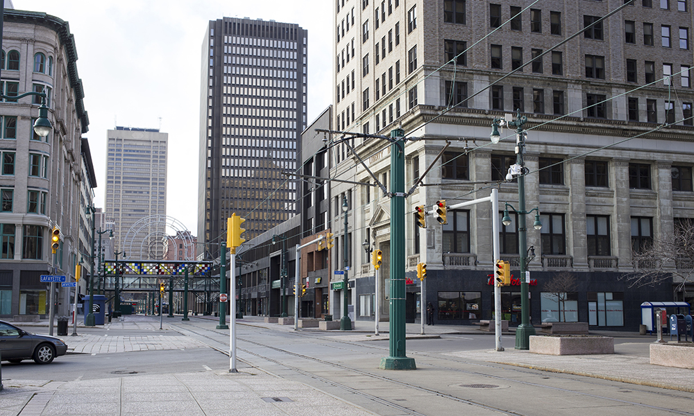
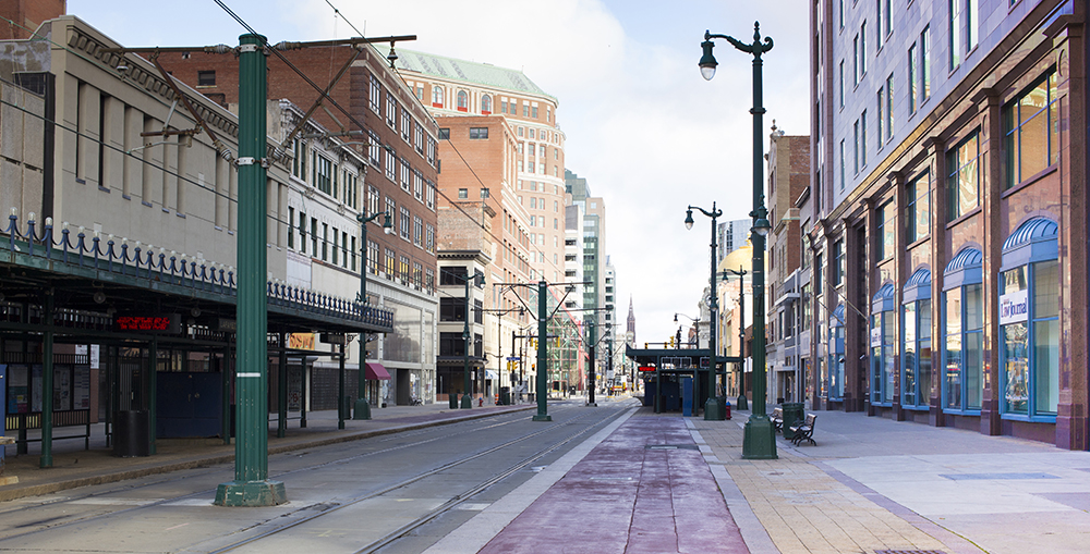
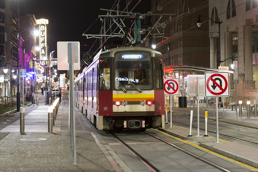
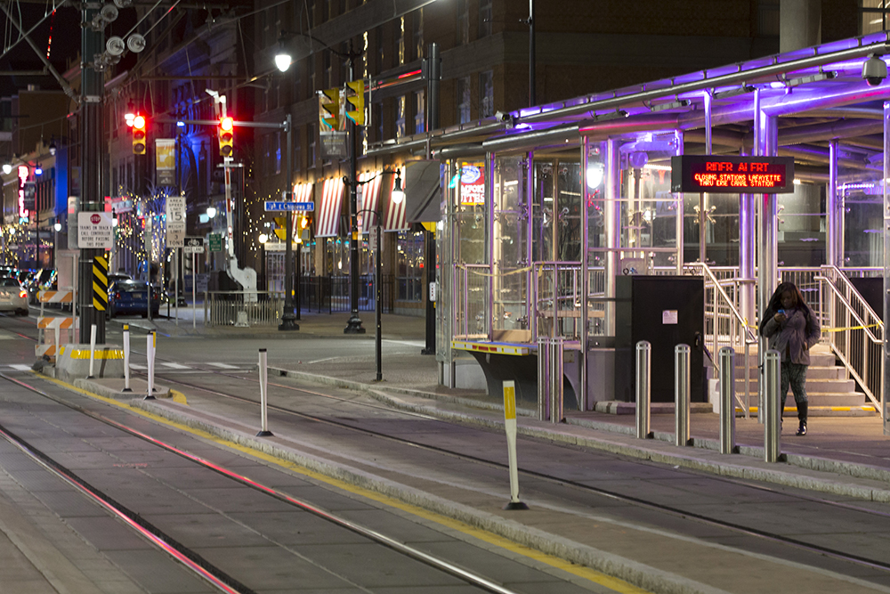
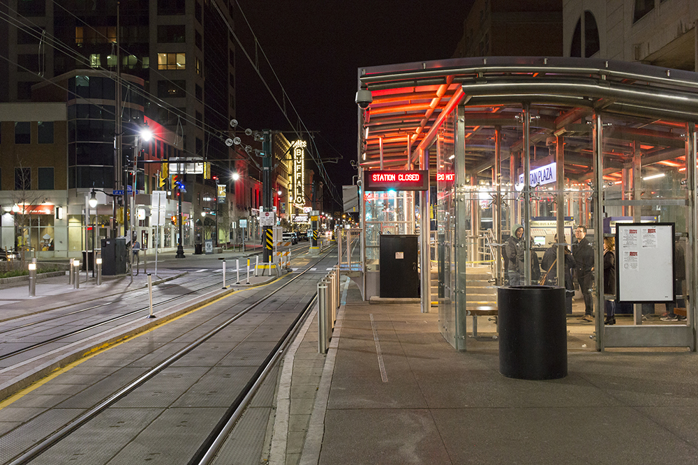
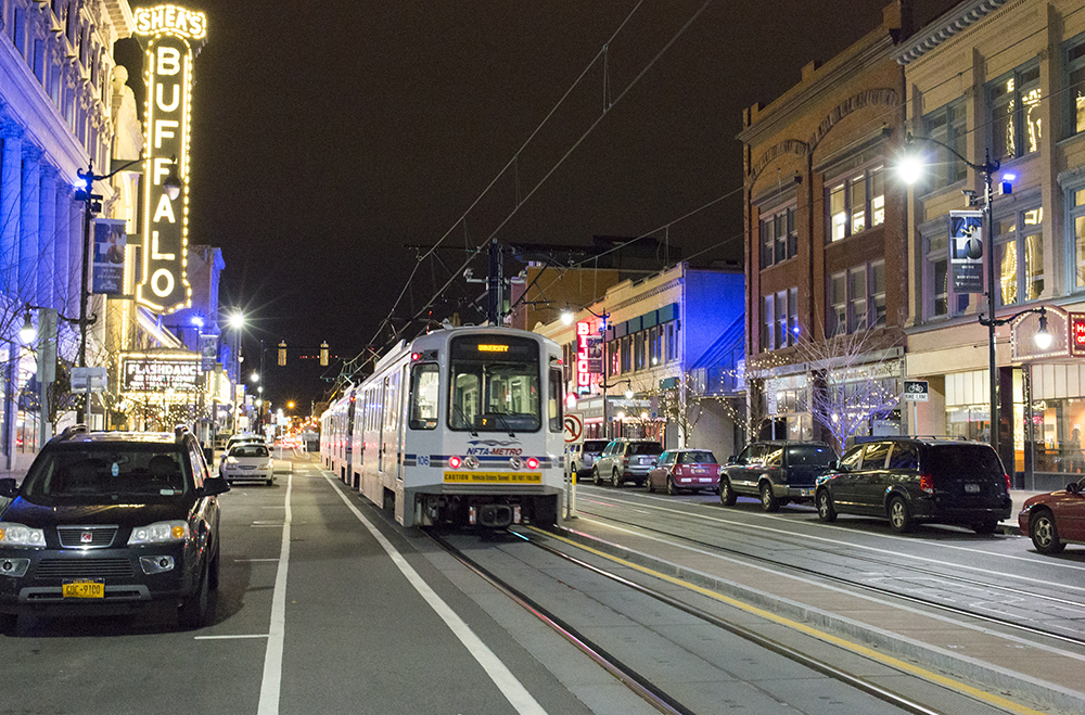
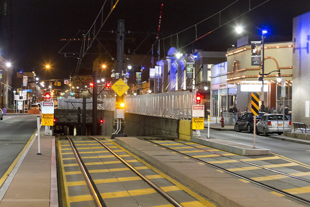
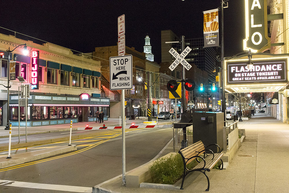
Then we took a ride on the LRT.  About a third of the length is above ground with the remainder underground.  Unfortunately, most of the above ground stations were closed for the weekend.  The above ground section is a free fare zone, so we rode between two open stations and got off just before the tunnel.  It was the above ground section that interested me most, anyway.  Then we walked back. It was quite interesting because in a very short distance we were able to see three different street treatments.  The first section was a transit plaza with wide sidewalks, cycling and LRT with no private vehicles.

IMG_2715 editsmall

This section also had colourfully lit stations.

IMG_2716 editsmallIMG_2756 editsmall

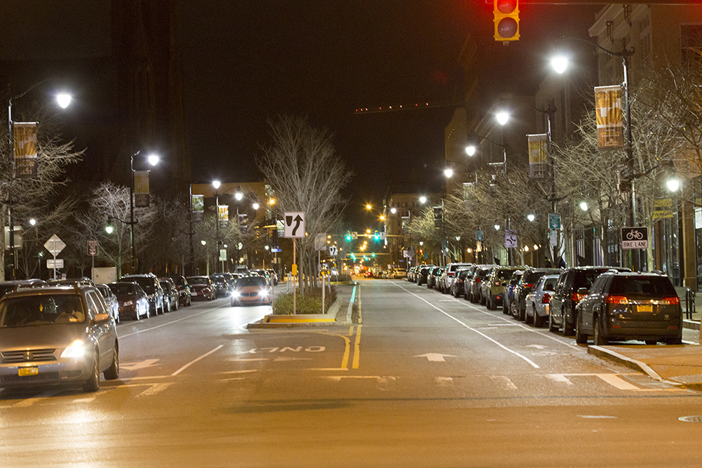
A second section had narrower sidewalks, on street parking and shared right of way with a narrow painted Bike lanes.

IMG_2750 editsmallIMG_2746 editsmall

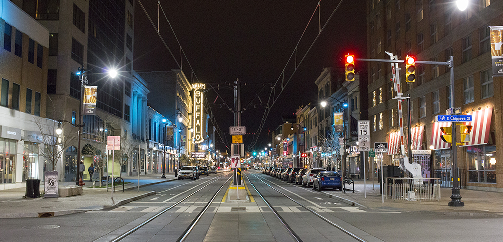
And finally, a quite ugly, tunnel entrance and then just a regular wide urban street with painted bike lanes and on-street parking on both sides.

IMG_2728 editsmallIMG_2733 editsmall

The first section was definitely the most inviting for pedestrians and the part of the street where I would be most likely to linger to shop or stop for a coffee or meal.

Although there seemed to be a fairly high vacancy rate, just like in Brampton’s downtown, the buildings were all in good repair (unlike Brampton) and changeable coloured lights were used on the buildings for the length of the street to give the area a unified inviting feel.

IMG_2726 editsmallIMG_2744 editsmall

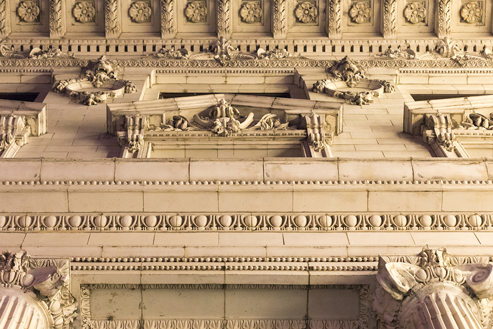
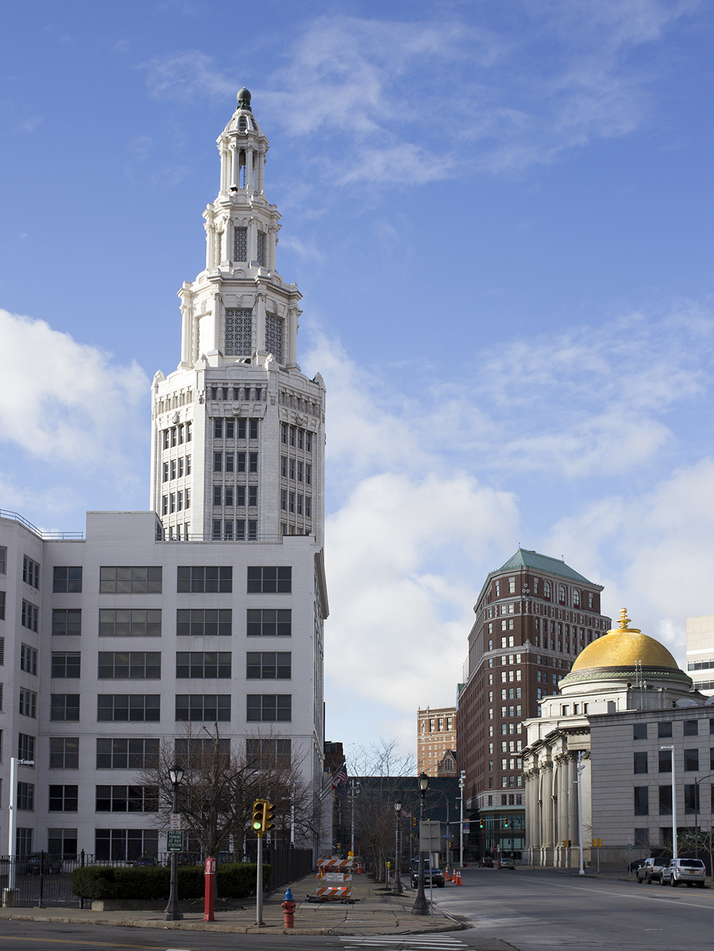
As we ventured away from the LRT we encountered many beautiful old buildings, but fewer pedestrians.  Buffalo has a massive old City Hall and county buildings and courthouses all clustered around a roundabout with a monument to President Mc Kinley , who was assassinated in Buffalo, in the centre.


The City Court was built in the Brutalist architectural style and stood in stark contrast to City Hall and a newer glass courthouse.

I was surprised at the the size of the downtown and its buildings.  I recall, when I was a child, watching after-school shows on channels from Buffalo, which were often interrupted by breathless reports from Irv Weinstein about fires raging in Buffalo and Tonawanda. That and reports of tremendous snowfalls was about all I knew of Buffalo.

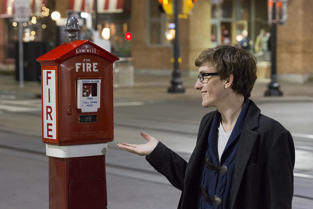
To our amusement we discovered they have fire alarms on the street corners downtown.

IMG_2719 editsmall

Upon returning to the hotel I learned that Buffalo had once been considered one of America’s leading cities and owed its prosperity to shipping.  However, upon the opening of the St. Lawrence Seaway, its fortunes declined and from the 1960s to the present it lost half of its population.  The population decline was well on its way by the time the LRT was built and continued thereafter.   It is also odd in that it runs on the surface downtown and in a tunnel in the suburbs. The tunnelling caused significant construction cost and time overruns.  Having said all that it still carries over 6M riders annually on its 10km run.

IMG_2808 editsmall

In the GTA there are constant complaints of congestion, but it is somewhat disconcerting walking around a city built for over half a million people that now contains only half of that. We kept joking that it felt like the zombie apocalypse had happened.

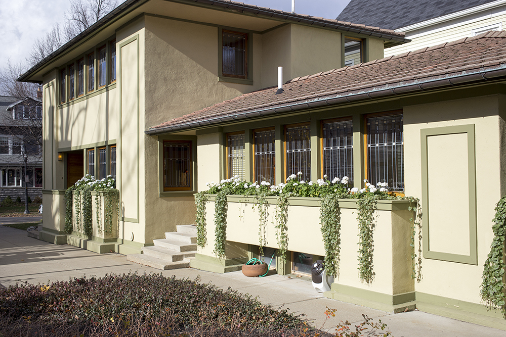
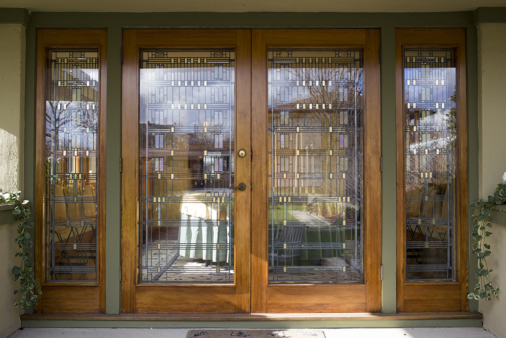
In my next post I will write about our second day, driving around Buffalo in the daylight and visiting the Darwin Martin complex.

November 8, 2015 – University of Guelph and the My Kitty Cafe

Owen discovered the existence of Cat Cafes a couple years ago while browsing on the internet.  He asked me if I would take him to one, however, at the time, the only ones I could find were in Montreal and New York city.  I told him we would go to one when there was one closer to home.  Since then there were one or two crowdfunding campaigns to open one in Toronto, but they were unsuccessful.

Last month, in my Facebook newsfeed, an article about a new cafe opening in Guelph popped up.  Guelph is just an hour away by car so we planned an outing for a couple weeks after the grand opening.  The cafe is called My Kitty Cafe and is located in the back of a variety and pet supply store on Wyndham Street North.  Just this weekend TOT, The Cat Cafe, opened in Toronto.  Owen and I will be heading out for another cat inspired adventure soon.

It was a beautiful autumn day so I planned a walk around the University of Guelph campus before heading to the cafe so we could get some fresh air and exercise.  Earlier this year I cycled in the Tour de Guelph, which started at the University, however, I didn’t really get a sense of how large it is until this visit.  I had also visited the Arboretum five years ago to enjoy the fall colours.  It is a huge campus with over 22K students.  It was Fall Preview Day for high school students so the campus was busy for a Saturday.

IMG_2652 editsmall

Guelph seems to be further along in encouraging cycling than Brampton is and the campus was a mecca for cyclists with wide walkways and sparsely travelled roads.  The bike racks and repairs stations were terrific.

IMG_2630 editsmall IMG_2633 editsmall

The university has a nice mix of old and new buildings.

IMG_2629 editsmall IMG_2632 editsmall IMG_2641 editsmall IMG_2644 editsmall

Most of the trees were bare, but there was still some nice colour around the conservatory.

IMG_2648 editsmall IMG_2647 editsmall

The campus is quite large.  We set out in one direction from the car, walked almost an hour out and back, and did not reach the far edge of the campus, past the barns and fields where the Veterinary Science classes are held.

After our campus tour we drove about five to ten minutes to downtown.  Guelph, with a population of 120K, has an extensive and thriving downtown, especially compared to Brampton’s downtown even though Brampton has a population of 560K.  The potential for flooding by the Etobicoke Creek has stunted downtown Brampton’s growth. Guelph has a much more significant river, The Speed River running through it, but apparently dams were built upriver that have helped to eliminate flooding.  They have a lot of nice parkland along the river and have located their stadium, the Sleeman Centre, right downtown.

IMG_1025 editsmall IMG_2686 editsmall

Here is a view looking toward the Church of our Lady Immaculate at the end of Macdonnel Street.

IMG_2653 editsmall

And here is a nice looking indoor mall on Wyndham Street North near the cafe.

IMG_2655 editsmall

Here is Owen arriving at the My Kitty Cafe.

IMG_2657 editsmall

The cafe is in the back of a variety and pet supply store.  You can order food and drink at the front and when it is ready you can eat it in the back with the cats.

IMG_2659 editsmall

Ready to go meet the cats.

IMG_2661 editsmall

There were four cats living in the cafe when we visited, although we only saw three. They were very friendly.

IMG_2668 editsmall

One might have been hiding out in the private area for the cats at the back.

IMG_2673 editsmall

Apparently 26 cats have been adopted through the cafe in the few weeks it has been open.  Two of the cats we saw were kittens and looked like siblings.

IMG_2669 editsmall IMG_2671 editsmall

There was a lot of upholstered furniture and a small bar at the back where one could eat if you preferred.  When I started eating while sitting in one of the upholstered chairs, one of the kittens was up on my lap in a flash trying to help herself.  There were lots of toys, tunnels, climbers and cat books available.  I had a chicken wrap and a coffee, Owen had packaged sushi and a hot chocolate.  We had a cookie and a cat themed cupcake for dessert. The food was reasonably priced, with a small selection.  However, it wasn’t a problem, because it was the cats that were the main attraction.

IMG_2677 editsmall

Owen saying goodbye to one of the cats.

IMG_2679 editsmall

I noticed that there is an art gallery nearby and I would have like to have explored downtown Guelph more, however, we had to get home to pick up Alun from a DECA competition so our stay was short.

We will definitely be heading back on another day.

Bike To School Week – May 26-29, 2015

I worked with Walk+Roll Peel and the principal at my children’s school in northeast Brampton to encourage participation in Bike Week.  The school has an enrollment of 760 students.  Bike Week was promoted to families in the school newsletter, advertised on the notice board outside the school on the Friday before Bike Week began and added to the morning announcements at the school.
IMG_0283 editsmall
Historically, 10-15 children have cycled to school in the spring with the most bikes I had ever counted in the bike racks being 27 on one particularly beautiful spring morning.

We began on Tuesday because I was busy on Monday at Bike to Work day leading a group downtown from northeast Brampton.

IMG_0285 editsmall
I had 60 bells from Walk+Roll Peel and screwdrivers.  I decided to actually install the bells on the bikes because often giveaways like these end up on dusty shelves in garages.  It also gave me a way to determine repeat versus new riders as we progressed through the week.   I thought 60 bells would be sufficient as that was more than double the most bikes I had ever seen at the school.  I was overwhelmed when 45 children arrived on bikes and had to enlist the help of a couple Grade 8 students to get all the bells installed.

IMG_0284 editsmall
I tweeted congratulations and pictures to the school and challenged them to do better on Wednesday.  I also acquired additional bells.  Each day I followed the same pattern and the children were amazing.  Each day more children rode their bikes to school.  By Friday, the racks were overflowing as there is comfortably room for about 55 bikes.

Tuesday 45 cyclists
Wednesday 53
Thursday 65
Friday 77

IMG_1378 editsmall IMG_0341 edit blog
Total individual cyclists over the week was 121 from a school population of 760.  It was much more successful than my most optimistic projections.

IMG_0345 banner blog
I continued to check the bike racks every few days and amazingly, the little bit of encouragement made a lasting change. Daily thereafter, until the end of the school year, there were 50-60 children riding.

When school started again this fall 30 -40 students rode their bikes each day without any additional encouragement as was provided during Bike to School week.  The number has slowly dwindled as the weather has become cooler, wetter and windier.  By this point in prior years there would have been no cyclists at all.  However, as of this morning, November 16, twelve students are still riding.
IMG_2687 editsmall
Imagine the change we can make if this type of effort is made at every school every year.