#OttawaBramptonOdysseyCycle – Meeting and Tour Day – Ottawa

What a busy day we had today.

We started the day with the great breakfast in the common room on the 17th floor of the residence at the University of Ottawa where we are staying. Jim went shopping this morning and then set up a breakfast buffet in his and John’s room for us. We were treated to various brands, cereals,  yoghurts,  juice and milk, and fresh fruit. The view of downtown Ottawa from the common room was amazing. We couldn’t have picked a better place to have our breakfast and start our day in Ottawa. I don’t have a picture to share tonight but I’ll make sure to get one tomorrow. John, Nelson, Rani and I went off in search of coffee after breakfast and walked over to the Byward market. We then returned to the residence to meet up with the rest of the group and head out for our day of meetings.


We were told to bring photo identification and allow plenty of time for each meeting to get through security. I decided to go light in terms of what to carry today, leaving my wallet back in the room and carrying only my credit card, forgetting about the need for photo ID. Fortunately at every point at which we had to go through security they were understanding and allowed me to use my credit card as identification. We started off the schedule at Ontario Office of the Minister for Small Business and Tourism, moved on to Road Safety Programs, then to speak with a policy advisor in Minister Sohi’s office.


From there we rushed over, in the rain, to the Centre Block, for a tour.

It’s been a long time since I’ve had a tour of the centre block so it was great to be able to do so. We were only able to look through the windows at the House of Commons which is having some work done on it over the summer break.


I love the ceilings at the centre hall.


The symmetry is beautiful.


The library is incredible and houses 600,000 books if I recall correctly.

We were able to enter the senate.


I would have liked to have gone up in the belltower, however we had a meeting that we needed to move onto with by a policy advisor in Minister McKenna’s office.


By the time we finished, we were all famished and headed to Bridgehead on Spark Street for lunch at about 3pm.

After fueling and relaxing we walked back to the residence, changed into cycling gear, unloaded our bikes from the trailer, put the pedals back on and headed to the Hartwell Lock, a 6km ride, to meet Heather from BikeOttawa for a tour of Ottawa’s cycling infrastructure.


Heather spent hours telling us about their advocacy wins and challenges and showing us the bike sights. I took over 200 pictures, far too many to share or even absorb at the moment.  We finished up at Mill Street for a great meal.


Heather left us with a couple final treats – an inviting, colourful tunnel and a bike counter showing the number of cyclists passing that spot today. Apparently, the number was low, due to rain this afternoon, and often climbs over 3000. I will publish a second part to this day at a later time with a selection of infrastructure examples.


After bidding Heather goodbye, the ride back to the residence was so exhilarating due to the wonderful day we had had, the incredible infrastructure we were riding on, and the beautiful weather we were experiencing, that we rode a little further than we had to and got an ice cream before heading to bed.

#OttawaBramptonOdysseyCycle – Train Travel Day to Ottawa

I had a relaxing morning since the the bike and suitcase were packed yesterday and dropped off last night. I just had to pack my day pack and catch the 13:20 train from Union Station to Ottawa. It was my first time traveling by VIA Rail and it was so civilized – no security, quick boarding, lots of leg room and a timely departure.

Michael drove to David and Dayle’s then dropped the three of us at Rani’s house. Rani then drove us to Toronto. We had plenty of time until we arrived at the traffic jam for the Spadina ramp on the Gardner. The Yonge, York, Bay ramp is being rebuilt and there was a Blue Jays game on.20170709_120711blog

It took about the same time to drive from Brampton to this point as it did to get the rest of the way to Union Station. Rani’s brother was waiting for us right in front of Union Station to take the car when we arrived.

20170709_123747blog
After stopping to have the Information Booth attendant take our picture, Rani bought lunch – the rest of us brown-baggged it – and we joined the line to board the train. A few minutes later the line started moving. A couple pictures on the platform, a couple at our seats and the train was off, precisely on time.

20170709_131107blog20170709_131039blog20170709_130528blog
At a few places in Toronto, Pickering and Bowmanville, David and I were able to recognize places that we will be cycling on the return trip. We each spent time putting the routes in RidewithGPS, which helps us to learn the routes and, along with Google Streetview, get an idea of road size and surface. I have paid the subscription price, of $6US for the month, so that I can get turn by turn verbal navigation of the route, without using data. I tried it on the last couple Brampton Community Rides that I led and it worked well. John and Jim did an amazing job scouting the route and providing us with paper maps: fold-out overview maps and detailed ones in a 3-ring binder, which were an excellent basis for creating the routes RidewithGPS, but I find it much easier to use my phone than the paper maps. The paper maps with their highlighted routes actually take me back to my childhood when my dad would write off to the oil companies for free maps and create his own personal TripTik. Of course, this was long before GPS and Google maps.

At times we traveled as fast as 153kph as measured by MapMyRide!

We arrived in Ottawa right on time, walked out of the station, and, a few minutes later, boarded Ottawa Transit for a 15 minute ride to the University of Ottawa where we are staying.
6E95228B-F85B-46E7-A9B5-94C4FFAFA5B8blog20170709_175801blog
As we walked across the campus and through the parking lot in front of the residence building there was the rest of our group, along with the trailer, having just arrived themselves. It took them much longer driving, than it took us on the train, due to heavy traffic through Kingston and the fact that they did a little bit more route scouting.

20170709_182023blog
We unpacked a few things, checked in and headed out for dinner.

Here’s the view from my room.

20170709_183603blog
We had dinner in the Byward Market at Zak’s Diner. It was reasonably good and served quickly.

20170709_195128blog20170709_194950blog
Byward Market is lovely in the evening.

10555E64-AE6E-4471-B0DA-22F1C97FD120blog
Then we walked past a couple fun signs and a maple leaf painted on steps leading up behind the Chauteau Laurier.
3B1C201B-F3D8-48EE-9CA8-51458F8DC128blog9470681F-2615-42D8-8368-6C1D18D7A83Bblog
Crossing the street to take our picture on the steps with a maple leaf painted on them I spotted bike traffic lights.

C148A743-3555-4630-8D89-8D86071E0743blog2ECD4F6E-006F-4065-9D3E-AADE80237ABEblog
Lock One of the Rideau Canal and the Chateau Laurier.

99794DB2-7A62-4E53-9514-2F7B915464D2blog
Then we walked over to the Parliament Building to discover a bike gears light show displayed on the front!

421E582C-DF42-4865-9A7E-9B9740AB9B34 edit-1blog
We walked down Metcalfe Street to Spark Street then down the west side of the canal to capture some twilit buildings with reflections before heading back to the residence. It was a wonderful day.

E84F92F3-7512-4147-BF95-CDFB07D6D94FblogB1A93A21-0B96-4E70-8171-AD32255D3C35blog51619ECF-6A98-4695-B47C-EE97656409E5blog73FA36B8-AEA4-441F-977D-F8BBFFB82605blog
Tomorrow we have meetings and a bike tour of local cycling infrastructure.

#OttawaBramptonOdysseyCycle – Packing Day

Last fall, as members of Brampton Cycling Advisory Committee and BikeBrampton chatted in the parking garage under City Hall after a committee meeting, I overheard John and David talking about planning a cycling trip from Ottawa to Brampton for Canada’s 150th birthday. Their inspiration came from Budi Tahir, a Brampton senior who circumnavigated Lake Ontario on his bike in 2013.  My ears perked up. I have long dreamed of cycling across Canada since meeting a cross-Canada cyclist on our family trip trip driving through the Rocky Mountains in 1983, but for one reason or another I have never managed to do a trip by bike. I asked them for details and they asked me if I would be interested. I replied that I would.

Fast forward eight months and we are about to set off on our adventure. The cyclists include David and his wife Dayle, John, Rani, Nelson and me. John’s friend Jim will be driving his van pulling a trailer with all our bikes and luggage. Nelson is Brampton’s Active Transportation Manager and the rest of us are cycling advocates who are passionate about cycling. John will travel to Ottawa with Jim and Nelson, and the rest of us will travel on VIA Rail. John and Jim have made two trips in a car scouting the route and had the great idea of collecting bike boxes to keep our bikes safe in the trailer on the drive to Ottawa.

We dropped off our bikes and luggage at John’s house this evening.
Here’s a picture of David and Dayle removing the pedals from my bike so that it will fit in the bike box. We had a small hiccough when it seemed that one of my pedals wouldn’t come off, but a rubber mallet came to the rescue.

20170708_192636blog
This is my bike getting boxed up.

20170708_194054blog

This is the inside of the trailer with everything loaded, except for Nelson’s bike and suitcase, which will arrive with Nelson tomorrow morning.

20170708_194949blog

Finally, a picture of the gang, absent Nelson, who doesn’t live in Brampton, and Rani, who had already dropped her things off and left. From left to right – Jim, Lisa, Dayle, David and John.

20170708_195726blog

Here’s Rani dropping off her bike.

IMG_4117blog
We will spend Sunday traveling. On Monday David has arranged a number of meetings with government officials to learn about the national cycling strategy and to make sure that key people in Ottawa are aware of the fact that there are advocates and staff in Brampton working hard to improve cycling in the city. We will also be getting a tour of Ottawa cycling infrastructure. Tuesday is a free day in Ottawa. We can see the sights, pick up anything we realize that we have forgotten and rest for the trip home. On Wednesday we start riding.

Wednesday – Ottawa to Merrickville ~ 75km

Thursday –  Merrickville to Kingston via at the Thousand Islands Parkway ~ 125km

Friday – Kingston to Belleville ~ 87

Saturday – Belleville to Port Hope ~ 79

Sunday – Port Hope to Ajax ~ 83-88km depending on route

Monday – Ajax to Brampton ~ 68-94km depending on route

I realized after riding over 3700 km last year, including one ride of 120 km, that I needed to do some work to strengthen my neck and shoulders over the winter. I worked on it on my own for a few months but felt I wasn’t coming along as quickly as I wanted, so I consulted my physiotherapist who told me that I had a “head forward” position which I needed to correct with stretching, strengthening and better posture. Under his guidance I have made significant strides but don’t feel I am quite as far as I would like to be for this ride, so while I am very excited for this trip, I do have some trepidation about my ability to ride this significant number of kilometres for six days straight, but I’m going to give it my best shot.

The most I have ever done before is 200 km in two days or 390 km in one week. However I have done over 2500 km in the last four months including over 800 km in May and over 1100 km in June. I have done my best to prepare.

Wish me luck. I will try to write a blog post about our adventures each evening. I hope you enjoyed following along.

2016 Cycling Goals Achieved

This year I had four cycling goals.

  1. Ride the 120 km route in the Tour de Mississauga
  2.  Ride 100km each day for two consecutive days
  3.  Ride 3000 km
  4.  Ride further than my friend Kevin

The first three were the same as last year and I achieved numbers 1 and 3.  I thought it would be funny to add the fourth goal since Kevin beat me by only 14km last year. On Strava, when you look at your friends profile you see a side by side comparison of your achievements.

I have now achieved the first three goals and will likely achieve the last but can’t say for sure until the end of the year.

Here is a chart of my annual distances.

annual-cycling

I really didn’t think I was going to achieve the second goal, but I challenged my friend Rani to join me and she was up to the task.  I also spread the word of the plan to my BikeBrampton friends (who might, along with me, cycle from Ottawa to Brampton next summer) and five others joined us.

20161029_083549-edit
Leo, Leslie, David, Rani, Peter, Lisa, Stewart

It was a beautiful day for a ride – overcast, but dry, and warm for the last weekend in October.

I planned two routes, starting at my house, each 100km.  On Saturday, we cycled to Dineen, a coffee shop on Yonge Street in Toronto, recommended by Rani, via the Humber Trail (also know as the PanAm Path after the 2015 Toronto PamAm games) and The Waterfront Trail. On Sunday, the plan was to stick closer to home in Brampton and Caledon in case we couldn’t complete the 100km.

We left half an hour late at 8:30 on Saturday. One section of the Humber Trail, just north of a large train trestle and the Old Mill was in glorious autumn colours.

20161029_102335-edit

On the Waterfront, we found an unlocked public washroom, having passed two or three that were locked and this nearby public art commemorating the 60th anniversary of the  1956 Hungarian Revolution.

20161029_110236-edit

We cycled on on-street cycling infrastructure for a few kilometres after leaving the waterfront and arrived hungry and happy at our destination.  We decided we needed more than coffee so grabbed lunch and followed up with the promised amazing cappuccino and cookies. It was warm enough to sit outside for our coffee.

20161029_120457-edit

I always enjoy crossing the Humber Bay bridge which is only for non-motorized use.

20161029_131906-edit

The great bike racks using the PanAm games symbol appeared regularly along the trail.

20161029_141620-edit

Nearing the end of the trail we realized we had left David behind. We stopped and waited about 15 minutes, but everyone was getting cold and stiff, so when he didn’t show up we reluctantly cycled on.

We had a stiff headwind once we left the trail and we were shocked to find David ahead of at Castlemore.  Turns out he took a shortcut, but still managed the longest distance of the day since he cycled from home to my house while others drove their cars. People scattered, without committing to a second day riding, other than Rani, and I retired to a cold bath for tired legs with milk and peanut butter raisin toast.

20161029_170333-edit

The weather dawned cold and wet on Sunday morning.  I really wanted to stay in bed and so did Rani, but we were each to proud and stubborn to call off the ride. Rani drove to my house again and the two of us set off.  While it wasn’t raining when we left, it soon was, and the temperature was in the single digits. We met David and Dayle 20 kilometres into the ride.  David came out to tell us he wasn’t going to be able to ride a second day, but Dayle joined us for 30km.

We took our first break at Starbucks where Dave joined us.  Dave came out to Brampton Critical Mass on Friday night (I usually attend, but decided to save my legs for the rest of the weekend) and heard about the planned rides.  Unfortunately, he was given the wrong start time and missed us by over an hour.  He was a trooper and still cycled some of the route, but we didn’t see him on Saturday.

When he saw we were at Starbucks, near his house, he jumped on his bike and joined us for 13km before heading home.

Dayle left us at the same place as Dave and Rani and I carried on to Bolton where we had lunch at McDonalds.  It stopped raining, but was cold and very windy.  We had a section after lunch of 7km north into a headwind of 40-50kph.  It was one of the hardest sections I have ever done.  Thanks to Rani for taking the lead and letting me draft the whole way.  You were amazing.

We arrived home, exhausted, but exhilarated and still smiling.  We actually made better time on our second day and had a slightly higher average speed.  I was too cold to endure a cold bath, but sat in a hot one for over an hour.

20161030_155925-edit

As of this writing on Tuesday night I have pretty much recovered and looked forward to our next group ride to Schomberg on Sunday.

Ride statistics:

  • Saturday
  • Length:  100.3 km
  • Ascents: 218 m
  • Riding Time: 5:33:16
  • Elapsed Time: 7:40:49
  • Average Speed: 18.1 kph
  • Top Speed: 59.8 kph
  • Sunday
  • Length:  101.3 km
  • Ascents: 244 m
  • Riding Time 5:19:54
  • Elapsed Time: 8:07:019
  • Average Speed: 19.0 kph
  • Top Speed: 55.1 kph

Exploring Hamilton by Bike

It’s been a while since I have made a blog post, but I had such an amazing day today, I want to write about it to cement the memory.

The day started cool and misty with a walk with Owen and Bailey. It was a perfect autumn day with a few of the leaves changing colour.

The boys all have the day off school today, which I forgot, when I planned to spend the day cycling in Hamilton with my friend Rani, before picking up Megan for Thanksgiving and Reading Week.

They don’t really mind when I leave them since it means they can do their own thing without me bugging them about spending too much time in front of screens.

Years ago, I used to spend a lot of time cleaning the house and resent it when Michael and the kids made messes.  Michael told me I should lower my standards since no one else cared how messy the house was.  Over the years I have managed to do so.  Apparently, I have been so successful that today, Alun, my 17 year old, vacuumed, dusted and washed the stairs and mopped the kitchen and hallway tiles because the mess was offending him.

I met Rani at Princess Point at 10am.  Here is a link to the route I planned. In June, another friend, Erica, and I spent the day cycling in Hamilton.  That day I planned for us to use the bike trough on the Kenilworth stairs to get our bikes up the mountain, but we missed Kenilworth by a few kilometres, looked at the map and decide to follow the Red Hill trail to Albion Falls, our destination.  It was a beautiful, but tough ride, on a dirt or crushed gravel path with steep hills up and down.  After leaving the falls we returned to the lower city on the Hamilton-Brantford rail trail. It was a lovely gradual decline through the trees along the face of the escarpment and I wanted to try riding up it, which is what we did today.

The mist was lifting just as I arrive at Princess Point where Rani had arrived and was taking pictures.  We unloaded our bikes and set off to discover that Rani, while trying to pump up her tires last night, pretty much completely emptied them.  Neither one of us had a pump so we loaded up the bikes and drove to the Bike Repair station on Locke St.  Unfortunately, the pump only had a Schrader end, not Presta, which is what Rani needed.  So we drove to Pierik’s Bike Shop, nearer to Princess Point than the Bike Repair station on Locke, where a friendly, helpful staff member pumped up Rani’s tires.  Back at Princess Point, we unloaded the bikes again and set off.

We cycled around the bay and then up James Street in search of an independent coffee shop. Last week I found a list of 15 in Hamilton and am determined to try them all.  I couldn’t think of a single one in Brampton.  Sigh.

We stopped at the Mulberry Street Coffee House and had some awesome cappuccino and baked goods to fuel up. I’ve now been to three on the list of 15.

We continued on our way and we very pleasantly surprised at how easy it was to climb the mountain on the rail trail.  It was about 100 metres ascent over 8km.  Much easier than riding up any of the street accesses or the Red Hill Trail that Erica and I took.

We briefly used the great Cannon Street cycletrack which has little bicycle shaped insets in the lights for bikes.  We also came across this great new crossing on Limeridge Road East where there are no curbs and pedestrians have the right of way when they are present, but otherwise drivers do not need to stop here.

We’ve just finished the climb and Rani is still smiling.

img_20161007_124226-editsm

Here are a couple more pictures of the rail trail.  Much of it was covered by trees and so pleasant to cycle through, but I didn’t take any pictures in that part.

img_20161007_131044-editsm

Here we are at Albion Falls.  It was a bit difficult climbing down with the cleats on the bottom of my sandals.

We then cycled along Mountain Brow Boulevard, a street that went on a road diet and became a complete street a couple years ago.  It is residential on one side and a narrow linear park overlooking the lower city on the other.  It used to be a four lane cross section, but is now two, with some parking and a wonderful wide multi-use path.

The views were awesome.  When we couldn’t see over some low bushes Rani climbed up on this wall.  I soon followed.  My family, and my friend Patti, with whom I have been cycling and exploring since Grade 7, usually discourage this type of “risky” behavior.  It was fun having someone else lead the way.

Here’s the view from the top.

img_20161007_132233-editsm

Back in April, I did some cycling and exploring of the escarpment staircases which I wrote about here. I talked about Uli, who single-handedly build an escarpment staircase.  We met him tending it today.  What a modest fellow.

img_20161007_132929-editsm

We found a great place for lunch.

Then continued along to the Chedoke Radial Trail, which I hadn’t explored before.  What a wonderful ride down the mountain it provided. It started under an hydro tower and passed several waterfalls.  It is part of the Bruce Trail.

We looked down over the highway and crossed a bridge.


There was a lovely canopy of trees all the way down.

img_20161007_152137-editsm

By following the route clockwise we had gentle inclines going up and fun, steeper rides going down.

It was a perfect autumn day, enhanced by a lovely visit with my daughter on the way back home.

Morning mist banished by sunshine.
Autumn colours.
Cycling in a city that gets it.
New friend with the same passion.
It doesn’t get any better!


Peel School Board Bussing Policy

I have just written to my Peel Board Trustee, Chair and the Minister of Education about Peel’s bussing policy and am reproducing the letter here.

Eligibility for bussing is as follows and was recently revised downward.

Busing eligibilty

The distance a child must walk to the bus stop is even less.

Walk to bus stop

Trustee Singh, Chair McDougald and Minister Hunter,

On the final day of Bike To School Week at Robert J. Lee Public School, the mother of a kindergarten student was locking his bike to the rack as I was counting the bikes. The bell had already rung.  She told me that they had been running late and she told her son they would drive the car to school.  “No Mum”, he told her, “I have to ride my bike and exercise my brain”. I was thrilled.  The message being given at RJ Lee is working and children, even very young ones, can influence their car dependent parents’ behavior.

Unfortunately, the Peel Board of Education, unlike this kindergarten student, does not recognize in its transportation policy,  the importance of building exercise into the lives of children, and continues to enact policies which lead to obesity, behavioral issues and lower test scores.

Brain on exercise

The Peel Board should be taking a leadership role in teaching the next generation that the habits of theirs parents have led to a health crisis, and congestion and injuries on our roads.  Teaching children healthy habits takes more than talking at them in classrooms, it takes leadership and modelling. It requires board wide encouragement of Active Transportation and minimizing the wholesale bussing of children.

The recent policy change to reduce eligibility distances for bussing is a travesty, and not only are the eligibility distances too short, the maximum distance a child must walk to a bus stop is at least as bad.  If children who are bused were required to walk up to the same minimum distance to their bus stop as children who do not receive bussing are required to walk to school, there would be benefits.

  • Children would get more exercise on the way to and from the bus stop
  • Fewer bus stops would be required leading to the potential for
    • Shorter travel times
    • Cost savings

My four children aged 12-19 have attended or are attending Peel Board schools.  They have walked to school, or when attending high school programs outside our catchment area, walked to and from public transit.

The first year my eldest attended middle school she qualified for bussing. She chose to ride the bus, not because the distance was too far for her to travel, but because the bus was available.  She rode it because her friends did.  This behavior occurred in a child who regularly walked much longer distances and was raised in family that engaged in, and promoted, active transportation. Such widespread availability of unnecessary motorized transportation for children is a serious disincentive to exercise.

I encourage you to read the Brampton Kids on Bikes report which makes very plain the destruction caused by a car dependent society.

I also encourage you to read about the success I have had, in partnership with Johnna Varriano, principal of Robert J Lee Public School, in encouraging cycling to school and reducing road congestion.

I encourage you to be leaders.  Leadership is leading people somewhere they wouldn’t otherwise go. Reducing bussing eligibility distances won’t be popular, but it is the right thing to do.  Do the right thing.  Re-visit this policy.

Bike To School Week – Year 2 – Robert J. Lee

On the final day of Bike To School Week, the mother of a kindergarten student was locking his bike to the rack as I was counting the bikes. The bell had already rung.  She told me that they had been running late and she told her son they would drive the car to school.  “No Mum”, he told her, “I have to ride my bike and exercise my brain”. I was thrilled.  The message is working and children, even very young ones, can influence their car dependent parents’ behavior.

For the second year in a row I worked with Walk+Roll Peel and the principal at my children’s school in northeast Brampton to encourage participation in Bike Week.  In 2015, it was due to my encouragement that the school decided to enroll.  You can read about that week here.  This year, the principal assigned a teacher to work on Bike To School Week and asked me to help.  I was pleased that, not only did they want to participate again, but that they also took the lead this time.

Bike To School sign 2016

The school has an enrollment of 770 students.  On our final day of the week we had a 17% cycling modal share! Bike Week was promoted to families in the school newsletter, advertised on the notice board outside the school before Bike Week began and added to the morning announcements at the school each day, during the week leading up to Bike  Week, and during Bike Week, with a student reading bike related tips.

Additionally, at the Character Assembly in the week prior to Bike Week, I gave a presentation on cycling to school, which you can see here.  This image, from the presentation, is what stuck in the kindergarten student’s mind.

Brain on exercise


The week was wildly successful with bike racks full to overflowing.

IMG_20160603_081949editsmall

We had to direct children to lock their bikes up again the kindergarten fence.

IMG_20160601_082615editsmall

We didn’t have enough stickers for the Bike To School Week counting chart.

IMG_20160603_082813editsmall

Prior to running Bike Week for the first time there were about 10-15 cyclists daily.  Up to 77 students cycled during the first Bike Week, with 50-60 students cycling daily during the rest of the month.

Bike Week bar graph

Bike Week Year 2 saw 90-130 students cycle each day, with 75-85 students cycling daily in the weeks since.

I will end with a conversation I had last week with the teacher who has for years directed traffic in the Kiss ‘n Ride as her morning duty. Last week she gestured to a driveway that had only a few cars and no line of cars on the street waiting to turn into the school causing a traffic jam.  She told me, “My job has gone from being the hardest one to the easiest one”.

I advocate to make Brampton a better place for cycling for everyone and to change the behavior of the next generation.  It’s working.


Dixie Road Cycling Facilities South of Clark Boulevard

This is the second of three blog posts I will make about cycling in, or near, the Dixie Road corridor, and the various cycling facilities, or lack thereof.

  1. Dixie Road Cycling Facilities North of Bovaird Drive
  2. Bramalea GO Station to Clark Boulevard (Bramalea City Centre) along Dixie Road
  3. Clark Boulevard to Bovaird (Chinguacousy Trail)

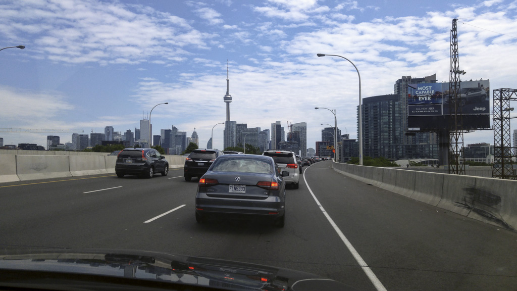
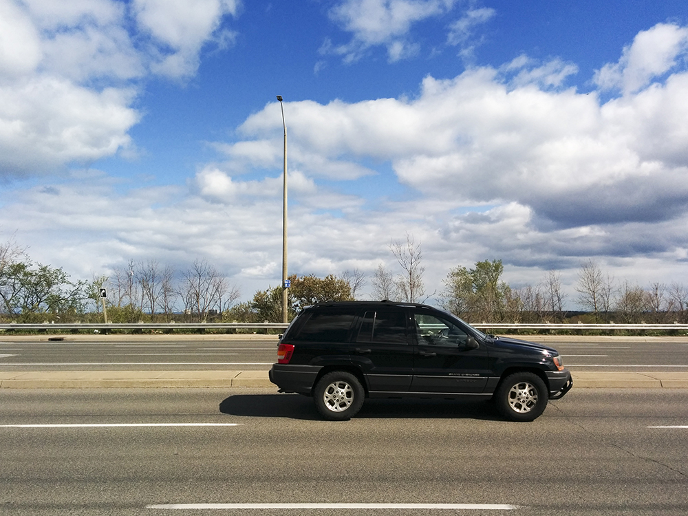
Dixie Road is a regional road.  The planning and construction is done by Peel Region, rather than by the City of Brampton.  Brampton is responsible for maintenance once construction is complete, for both the road and the sidewalks and multi-use paths.

The Region of Peel is currently engaged in widening Dixie Road to three lanes in each direction.  At the same time they are replacing the sidewalk on the west side, from Clark Boulevard to 400 metres north of Steeles.

The intersections where Dixie Road crosses Steeles Avenue and Bovaird Drive were reconstructed prior to a general road widening to allow for Brampton Transit’s Zum buses to travel in a reserved queue jump lane through intersections. At that time no multi-use path was installed .

I had a conversation with staff at the Region of Peel about the pointlessness of infrastructure that just ends 400 metres north of a major intersection, especially on a road with the volumes of car and especially, truck traffic, that is carried on Dixie.  They agreed to look into the feasibility of continuing the path south to Steeles while construction crews were still on site and I am pleased to report that I have been told that is exactly what will happen.

Victory for advocacy. Thanks to Regional staff for listening and acting.

In April, I attended my first Ontario Bike Summit, courtesy of the City of Brampton.  It was educational to hear what other cities are doing.  One item that was of particular interest to me was that Metrolinx provided funding for the Spur Line trail in Waterloo in order to improve Active Transportation infrastructure leading to GO and Via Trains.

In a board meeting presentation last year Metrolinx explained:

  • Designs for station facilities will be guided by both the way travel modes are used today and policies intended reduce dependency on single-occupancy vehicles and towards more sustainable modes.
  • While investments will be made across all travel modes, those needed to achieve the shift towards more sustainable modes will be prioritized.

Currently only 1% of riders cycle to GO rail service and I suspect the percentage that cycle to Bramalea GO Station is far lower than that, despite the fact that they have covered bike parking at both the north and south lots. Metrolinx states that, “Incentives to encourage and significantly increase cycling are needed (e.g. improved cycling routes and environment, secure bike parking, bike share, etc.)”.

Watching the Region improve cycling infrastructure along Dixie Road, hearing about Waterloo receiving $1.2M for their Spur Line Trail and knowing the proximity of of Bramalea GO station to the Dixie multi-use trail and one of Brampton’s few legal on-street bike lanes (Birchbank Road) led me to explore how all these elements could be connected. I hope that by writing this blog I can inspire the City of Brampton, the Region of Peel and Metrolinx to work together to create an active transportation connection to Bramalea GO, a station on a very busy road in the middle of industrial lands, but not too far from some residential areas and existing AT infrastructure.

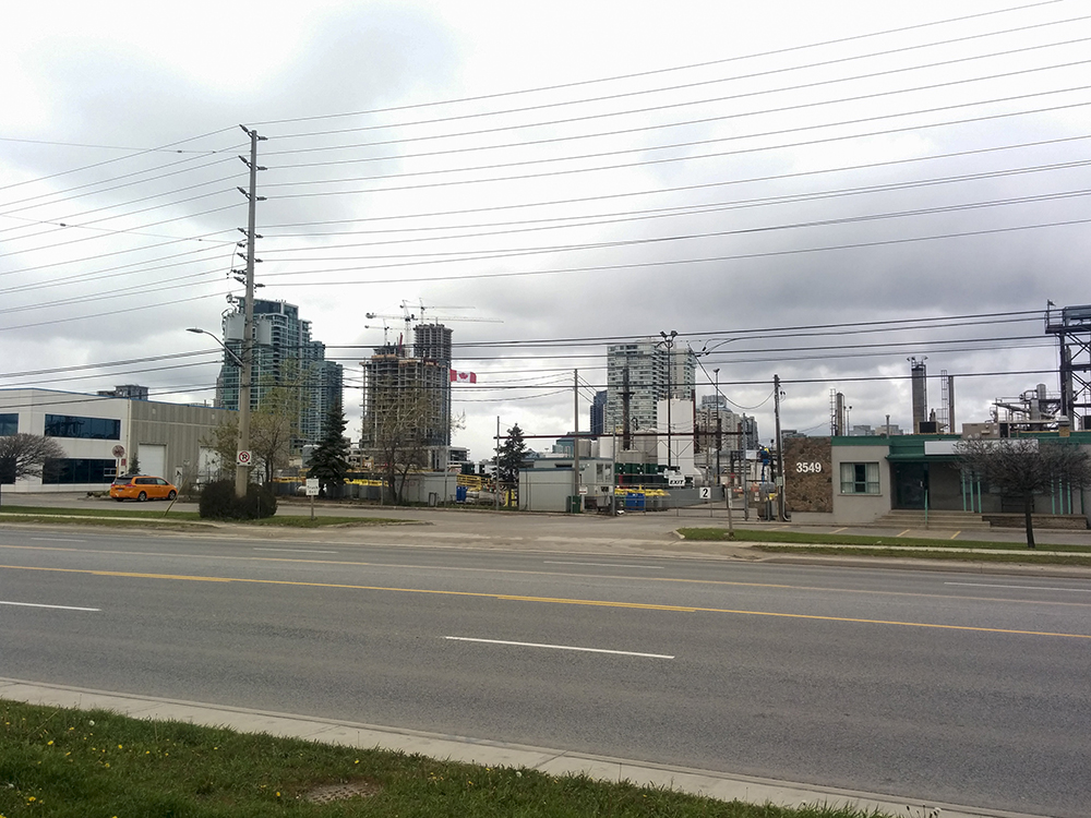
Let’s explore Dixie Road moving south from Clark Boulevard.

IMG_20160421_090615editsmall

Here, the sidewalk has been preserved and a multi-use path added between the curb and sidewalk.  The pole in the foreground is a temporary one, but it is not clear whether or not the multi-use path will continue north to Clark.

IMG_20160421_090517editsmall

Continuing south, you can see the sidewalk has been removed and a wide multi-use path installed from curb to property line.

IMG_20160421_090359editsmall

I prefer the treatment in this section where the “salt strip” or snow storage area is constructed of a different material. I have not been able to get an answer as to why this is done is some places but not others, even along the same path, although it does tend to be at intersections, but sometimes extends quite far from the intersection.

IMG_20160421_090253editsmall

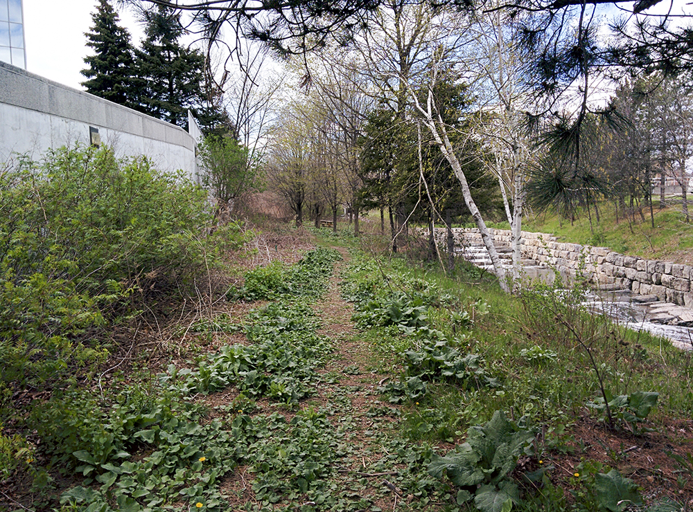
As you can see this section does not use pressed concrete for the salt strip, but expects users to somehow magically understand that the metre adjacent to the curb is not considered part of the multi-use path. In this picture I am standing at the northern end of the Rogers campus at the entrance to the south end of the Esker Lake Trail which is shown in the next image.

IMG_20160421_090250editsmall

This is a nice connection here, and the Esker Lake trail will be getting Brampton’s first Active Transportation-only crossing of Highway 410, when the Franceschini Bridge, between Williams Parkway and Bovaird, which used to be used to access a gravel quarry, is opened later this year.  Unfortunately, the Esker Lake trail leaves much to be desired, but I will address that in another post.

IMG_20160421_090055editsmall

This section differentiates salt strip and path.

IMG_20160421_085928editsmall

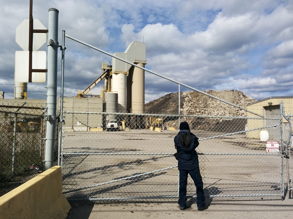
I am not sure how this bus stop will be handled.  In the first picture in this blog, you can see that a concrete bus pad was laid on which a shelter could be erected. Something else to note is that about 100 metres south of here is a Tim Hortons/Wendy’s. I hope that signage is installed to indicate that drivers should expect cyclists and not to stop on the path.  When I approached from the south, a driver was stopped on the path and looking north for a gap to turn right into, with never a glance to the south to see if anyone on the path was approaching.  Had I not stopped and waited I am fairly certain I would have been in front of him and crashed into when he turned.  This will be a common occurrence here, as drivers will not be permitted to turn left, and will therefore not look to their right before pulling out.

IMG_20160421_085742editsmall

This image is looking back north towards Orenda Road on the left and Birchbank Road on the right.  There is a legal bike lane on Birchbank.

IMG_20160421_085714editsmall

Continuing south from Orenda toward the Chrysler dealership.

IMG_20160421_083202editsmall

The road was widened enough under the rail bridge for the path to continue and it dips less than the road making it easier to traverse.  A sign should be installed where the material changes to concrete and the width narrows to indicate bikes welcome, but caution needed.  I saw this sign on Castlemore Road.

Narrow Single Lane

IMG_20160421_083259editsmall

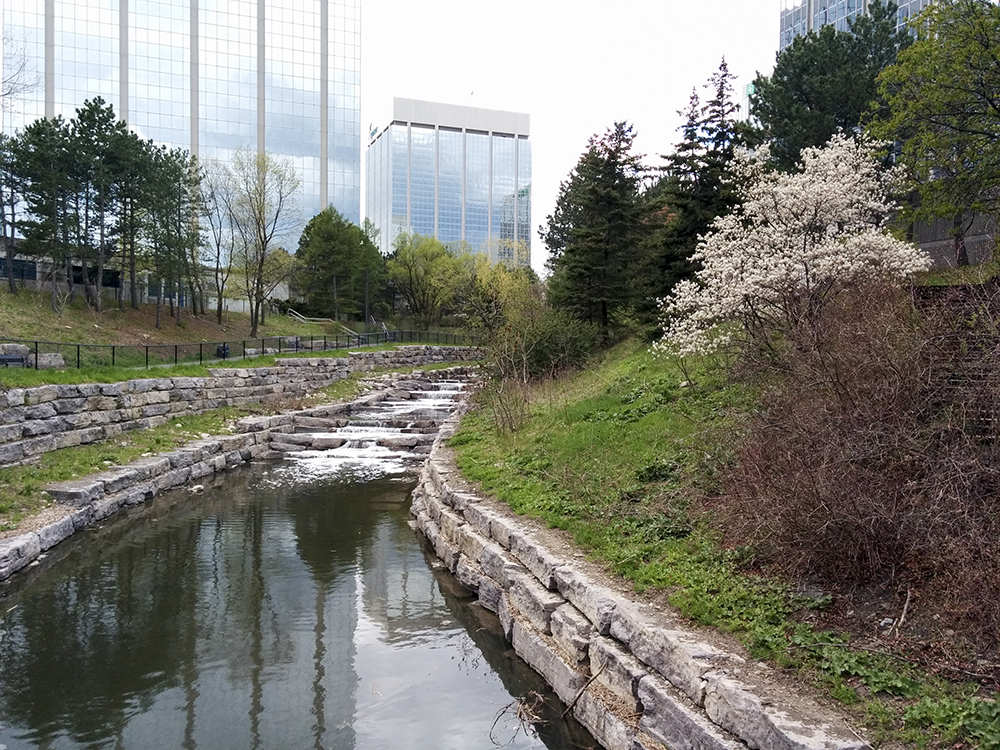
As one emerges from underneath the bridge the path comes to an end about 400 metres north of Steeles.

IMG_20160421_083434editsmall

This is where, I have been told by Regional staff, they have determined that it is feasible to extend the path to Steeles Avenue.

Now let’s address getting to Bramalea GO Station.

Map around Bramalea GO crop

The red line on the map shows the trail gap which the region needs to complete to Steeles.

The blue line shows the route to the south lot bike parking at Bramalea GO. This route is 2km from the Steeles/Dixie intersection (north route).

The green line shows the route to the north lot bike parking at Bramalea GO and runs along Steeles. It is 1.2km from the Steeles/Dixie intersection (south route).

IMG_20160421_083545editsmall

Steeles and Dixie is a very large intersection, with six through lanes of traffic on each road plus left and right turn lanes.

So, there are two options for getting to the GO station. While the route to the north lot along Steeles is shorter, it requires a trip up and over the rail bridge, which which be challenging for some cyclists. The space available for a multi-use path is also more constrained, particularly over the crest of the bridge.  I didn’t take pictures along here, but when I go back to check out the 400m gap north of Steeles I will do so and provide an update.

My preference, and the one I have pictured below, is the route to the south lot via Dixie,  Advance and Alfred Kuehne, which, while longer, is flat and once off Dixie, the road allowances are wide and traffic relatively light.

IMG_20160421_083846editsmall

This is looking north from Advance Boulevard.  If the sidewalk were removed as it has been north of Steeles, a multi-use path could be installed.

IMG_20160421_084023editsmall

In this image I am facing east looking across Dixie at Advance.

IMG_20160421_084154editsmall

On Advance there is a sidewalk  on the north side of the road and nothing on the south.  By observing where the fire hydrant is you can see there is plenty of room for a multi-use path adjacent to the road.  The other possibility here is a bike lane if the curb-to-curb allowance would accommodate it.

IMG_20160421_084359editsmall

Alfred Kuehne also has a sidewalk  on the north side of the road and nothing on the south, with plenty of room for a multi-use path adjacent to the road.

IMG_20160421_084452editsmall

This is the only potential pinch point, but the bridge rails are probably high enough to allow bikes to travel over the sidewalk here with a warning to yield to pedestrians.  If not, they could be replaced.

IMG_20160421_084529editsmall

The driveway to the south GO parking lot is wide and could probably accommodate a bike lane.

IMG_20160421_084800editsmall

And, there is already a nice covered bike shelter awaiting cyclists.

The City of Brampton is currently undertaking an exercise to create an Active Transportation Master Plan and will not want to make any significant investments in the 18 months it will take to complete.  However, I would argue that this is a project that could be undertaken in the meantime and that by partnering with Peel Region and Metrolinx the cost could be shared and manageable.


The Dross Walk

Last week I wrote that I drove to Mississauga to attend Stephen Caulfield’s Dross Walk, but that I got the date wrong so did my own little Jane’s Walk around the Absolute Towers and Cooksville Creek.

Today was the Brampton Cycling Advisory Committee’s first community bike ride and the day dawned cold and wet.  We had many fewer attendees than actually registered, but I really can’t blame them – I would have stayed home had I not been volunteering to sweep the 15km ride.  We still had 16 people come out to brave the elements and enjoy ice cream afterward.  Do sign up for our future rides – there are nine more – I am sure the weather can only improve.

If you haven’t read the description of the Dross Walk you really must follow the link and read it all, it is very entertaining.  Here is a small excerpt.

“Walk the Dross. We’ll be thinking about the future and how this aesthetic nightmare would make a great set for a zombie movie (or home for actual zombies). This is not for babies or wusses. Please visit Malton before Dross Walk in order to build skills required for coping with hallucinatory landscapes.”

As we drove down the 410 it was overcast with sleet and gusty winds: perfect for the Dross Walk.  I realized I had forgotten my umbrella.  Oh well, too late.

We arrived a few minutes before the appointed time and spotted Stephen standing “in front of the shut down Goodwill in the plaza beside the payday lender”. We were a few minutes early so I ran over to McDonalds for coffee to brace myself for the promised headache.

Coffee in hand, we set off, down a set of crooked stairs, our first stop under a sign for Gardin bicycles, to hear about Joe Gardin who had the Italian passion for cycling, and set up part of his factory in Mississauga for bicycle manufacturing.

Across the street was Metal Works (not pictured), a recording studio owned by a member of Triumph and Mississauga’s downtown peeking over this industrial wasteland.

IMG_20160515_151952editsmall

We stopped to talk by this sign.

IMG_20160515_152001editsmall

At Central Parkway and Mavis Road we found this small plastic bouquet of flowers, a reminder of how dangerous Mississauga’s streets can be for cyclists.  Despite having a Cycling Advisory Committee for ten years, in places like this, nothing changes much for cyclists.  A female cyclist was killed here in 2007 and an elderly male cyclist killed in the same spot in 2014.  A ghost bike placed here by Advocacy for Respect for Cyclists in September 2015 has been removed by the city.

IMG_20160515_152431editsmall


Here, Stephen tells us, is a business that buys scrap metal from the garbage scavengers that we often see after garbage is put at the curb, before the region comes to pick it up.

IMG_20160515_153643editsmall

Next we saw the site of the Mississauga train derailment on November 10, 1979, which led to the largest peacetime evacuation in North America, with over 200,000 people evacuated. That record stood until the New Orleans evacuation following Hurricane Katrina.  The train was carrying explosive and poisonous chemicals.  I lived in Mississauga a few kilometres from the explosion and we decamped to my aunt’s home in Peel Village in Brampton.  I have fond memories of missing school, going shopping, bowling and to the movies.  The accident could have been much worse, explained, Stephen, if not for the brave actions of the train’s brakeman, Larry Krupa, which allowed the un-derailed part of the train to be moved away from danger, preventing those cars from becoming involved in the fire. The city was re-opened on November 16. Stephen, who works at a car dealership adjacent to the tracks recently unearthed a piece of track and a railway spike from the explosion.

The mascot for the walk was the kildeer and it was like a treasure hunt finding the photocopies he had posted along the walk.  We also encountered two real kildeers in the Rogers Cable parking lot.

Having finished my coffee I began looking for a garbage can, but had to walk more than a kilometre before finding one in front of a Canadian Tire at Mavis and Dundas.  Despite the unpleasant landscape and many coffee cups blowing around I couldn’t bring myself to drop mine.

At Dundas Street we found the edge of Lake Iroquois, a prehistoric, proglacial lake that existed at the end of the last ice age 13,ooo years ago.  It was an enlargement of Lake Ontario that formed due to an ice sheet blocking the St. Lawrence River which caused water levels to be about 30m higher than present day.  Casa Loma sits on the Lake Iroquois shoreline as do the Scarborough Bluffs.

IMG_20160515_161853editsmall

There was some beauty in the Dross Land – crabapple trees were in blossom, but the view was blighted by wires.

IMG_20160515_161913editsmall

If you look closely through the brush you can see Wolfedale Creek, tamed by concrete and polluted by nearby industries.

IMG_20160515_162035editsmall

Many properties where there used to be manufacturing are now warehouses or service industries.

IMG_20160515_163107editsmall

We saw an ash tree completely stripped of its bark, having been infected by the emerald ash borer.  Earlier in the walk we saw a city works yard full of mulched ash trees with more arriving daily according to Stephen.  “It’s like an urban logging operation”.

We saw a mountain of asphalt awaiting recycling from both Mavis Road as we walked south, and Wolfedale Road, as we walked north. It’s hard to get a sense of the scale here, but there were roads leading up the pile for trucks to dump their load.

IMG_20160515_165300editsmall

A battered truck parked in a corner parking lot was full of iPod Nano arm bands, wet and rusting.

IMG_20160515_165757editsmall


As we approached the end of the walk, again, we could see Mississauga’s towers rising in the background behind this industrial wasteland.

IMG_20160515_170225editsmall

I have driven these roads before, but never walked the sidewalks.  It wasn’t a place I ever thought to walk and probably won’t walk again.  However, the company and the information shared, made for a pleasant afternoon in the Dross Land.


Dross Walk Delayed

I started my day with breakfast in bed served by Owen, aged 11. About 11am I headed out for a 35km cycle, the last 15km of which were in the rain and wind which began shortly after I left Starbucks having refreshed myself with a cappuccino and a chocolate chip cookie.

When I got home the last thing I wanted to do was go for a walk in the rain, but the forecast promised clearing so I had a quick, warming shower and we headed out enticed by Stephen Caulfield‘s humourous description for the Jane’s Walk entitled The Dross Walk that he is leading.  We drove down the 410 to Mississauga under gray skies entirely appropriate for the subject walk.

“Okay, enough with the suburban revisionism and the relentless positivity. Time to walk the dross. People, we’re gonna get you in touch with rage and depression, boredom and awe as we pass extractive industries, a species graveyard and a wingless aeroplane… Bring Tylenol. Get a tetanus shot.”

As we crossed into Mississauga, Highway 410 slowed to a crawl.  The concrete barriers had been moved closer to the centre to reveal and a new lane, and, apparently the change was enough to slow traffic.  Either that or induced demand is already at work.

IMG_20160508_143518editsmall

I snapped a picture (from the passenger seat) and tweeted that we were on a new bit of Hwy 410 on our way to The Dross Walk. A few minutes later a Twitter contact pointed out that the walk is next Sunday, not today.  Oops.

So we decided create our own personal Jane’s Walk starting with a walk around Kariya Gardens, south of Square One, since we were there and no longer had anything to do. Unfortunately, the cherry trees are not out yet and the garden was rather barren.  Just north of the garden was an area long vacant with dross-like qualities.

We parked on the top of a multi-storey lot at Square One where the weather continued to threaten wet and windy conditions.  Down the stairs, across City Centre Drive and this great view of Absolute Towers juxtaposed interestingly with the Mississauga Manneken Pis.

IMG_20160508_153213editsmall

We headed down this desire line, the most efficient way to a light-controlled intersection where we could cross to the Absolute Towers.

IMG_20160508_153437editsmall

I can never get enough of these towers.  I always admire them from near and afar.

After exploring the little grocery store at the base of the towers we headed east towards a fabulous piece of active transportation infrastructure, over Cookville Creek, on the Burnhamthorpe Trail. Before this bridge was installed the trail was interupted where the road bridge was too narrow to carry it across along with the traffic lanes and a skimpy sidewalk.  Well done Mississauga.

We turned onto Robert Speck Parkway and discovered this great picnic table at the entrance to a park that led to Cooksville Creek.

IMG_20160508_155744editsmall

Even though this area is getting very built up there is some nice green space. We followed the path along the edge of a parking garage on one side and some low rise office buildings on the other.

IMG_20160508_155821editsmall

As we approached the turn in the path we could hear water and came upon this great view.

IMG_20160508_160109editsmall

The glass office buildings almost disappeared into the sky, reflecting the conditions around them and made an interesting backdrop to the water and vegetation. I do wish the fence was not placed along the edge of the path.  One can go around the fence at the beginning or end of the path, so it seems rather pointless and creates a visual barrier.

Some attempt was made to create a pleasing space under the Robert Speck Parkway bridge crossing the creek.

At the end of the path, where one is expected to climb up to Robert Speck Parkway, we found another desire line leading to a couple picnic tables where we sat for awhile.

IMG_20160508_161141editsmall

We ended our walk inside Walmart and took a trip up the “rampolator”, the only one I can recall ever encountering, left over from when Woolco was in the space.

IMG_20160508_163623editsmall

I arrive home to a lovely bouquet of flowers from Trystan for Mother’s Day. Megan and Alun gave me Cadbury Dairy Milk chocolate bars and a huge bag of M&M Peanuts.  I will need to do a lot more walking and cycling to work them off.

IMG_20160508_171435editsmall